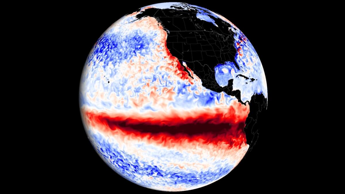
Updated June 26, 2026 — Atmospheric and oceanic data from across the globe have converged on a singular, high-stakes conclusion: the tropical Pacific is rapidly transitioning into a "Super El Niño" event. As of late June, NASA satellite telemetry and international meteorological forecasts confirm that this climate phenomenon is not only emerging but gaining strength at a pace that suggests a historic impact for the remainder of 2026 and well into 2027.
For residents of North America and Europe, this shift represents more than a mere oceanographic anomaly. It signals a fundamental restructuring of the jet stream, which is already beginning to alter seasonal precipitation and temperature trends. With climate models now consistently projecting peak intensity levels that rival the legendary 1877-1878 event, meteorologists are bracing for a period of extreme, global-scale weather volatility.
The Mechanics of a Global Shift: Understanding the "Super" Status
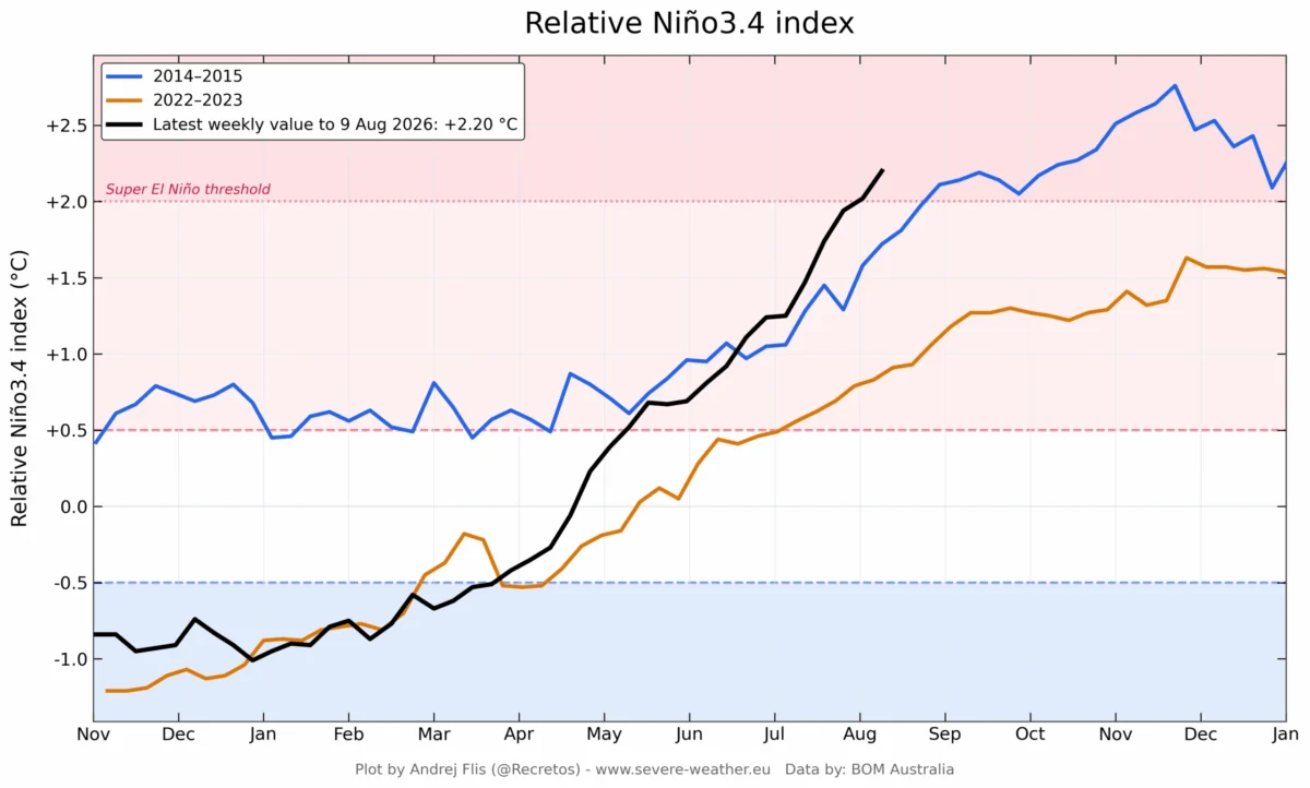
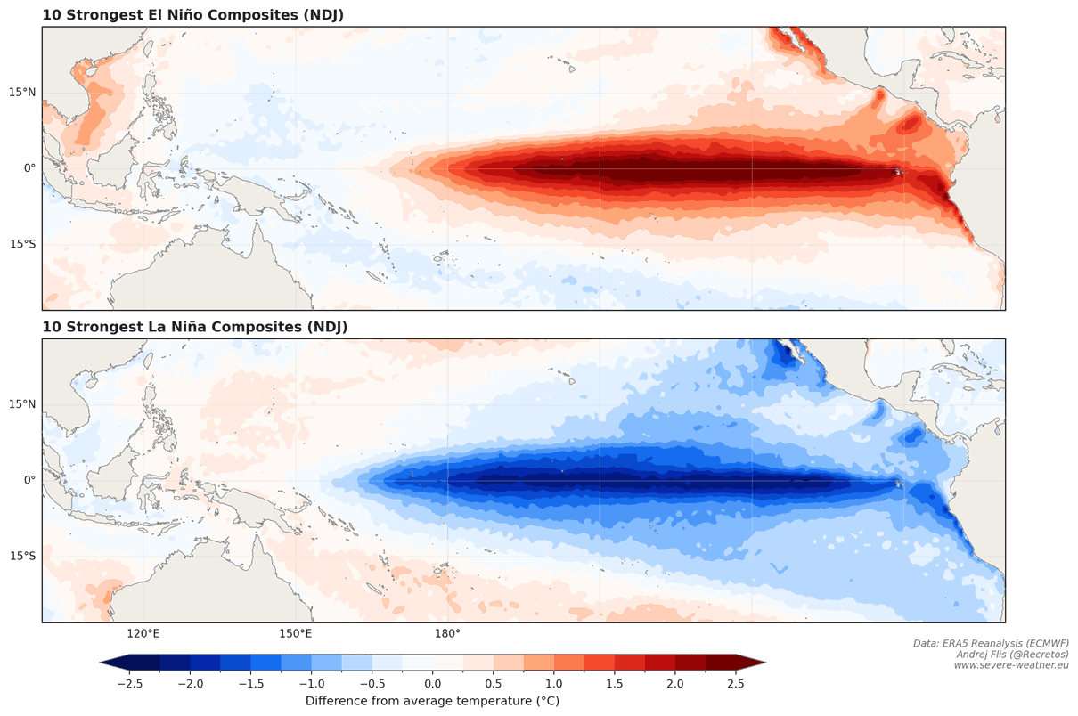
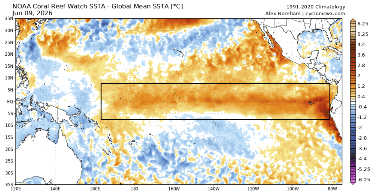
At the heart of this event is the El Niño-Southern Oscillation (ENSO), a recurring climate pattern involving changes in the temperature of waters in the central and eastern tropical Pacific. When temperatures in the Niño 3.4 region exceed the long-term average by 2.0°C or more, the event is classified as a "Super El Niño."
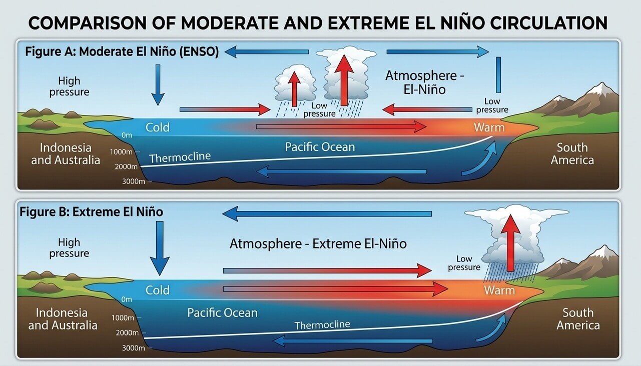
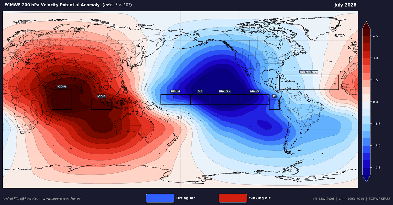
These events act as massive "pressure release valves" for the planet, redistributing the enormous amount of thermal energy stored in the deep Pacific. Unlike standard El Niño cycles, which occur every few years, a Super El Niño is a rare, decadal-scale event that fundamentally alters the Walker Circulation—the atmospheric loop of rising and sinking air that dictates weather across the tropics and mid-latitudes.
Chronology of the 2026 Surge
The current transition began in earnest following the dissipation of a weak La Niña last winter. The timeline of this year’s development is particularly striking:
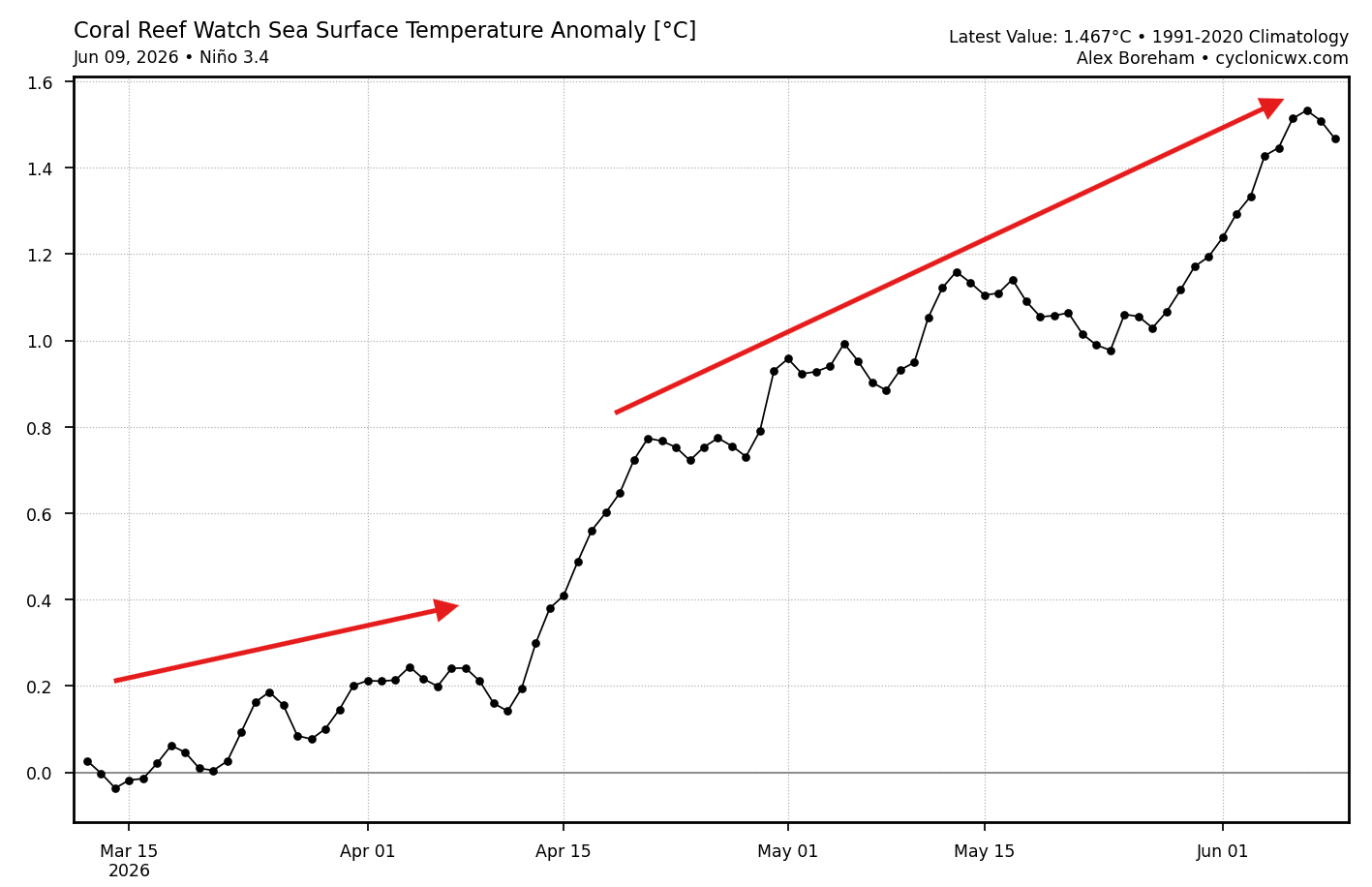
- March 2026: Initial temperature anomalies began to materialize in the central Pacific, crossing the crucial 0.5°C threshold required for an official El Niño designation.
- Mid-April 2026: The rate of warming accelerated, driven by a series of powerful Kelvin Waves—massive pulses of warm, subsurface water moving eastward along the equator.
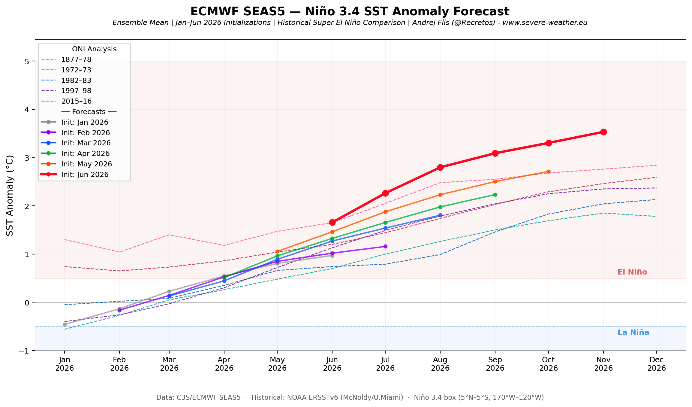
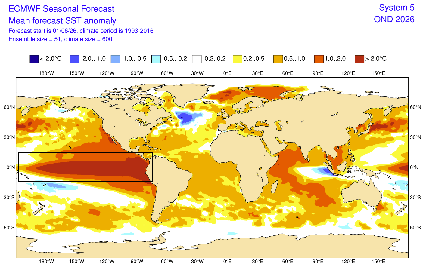
- June 2026: Satellite analysis confirmed that the "Super" threshold is not only reachable but currently being tracked by nearly all long-range forecast models, including those from the European Centre for Medium-Range Weather Forecasts (ECMWF).
Supporting Data: NASA’s Sea Level Warning
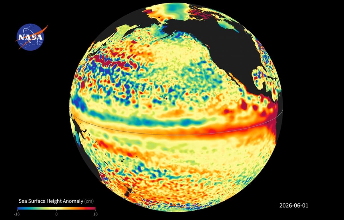
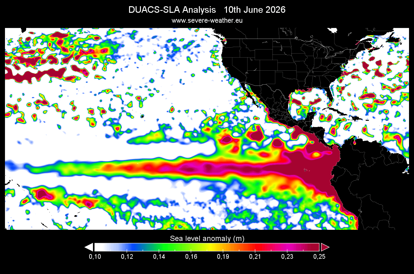
One of the most compelling pieces of evidence for the strength of this event comes from NASA’s Sentinel-6 satellite missions. As warm water expands, it occupies more volume, leading to a measurable rise in sea levels.
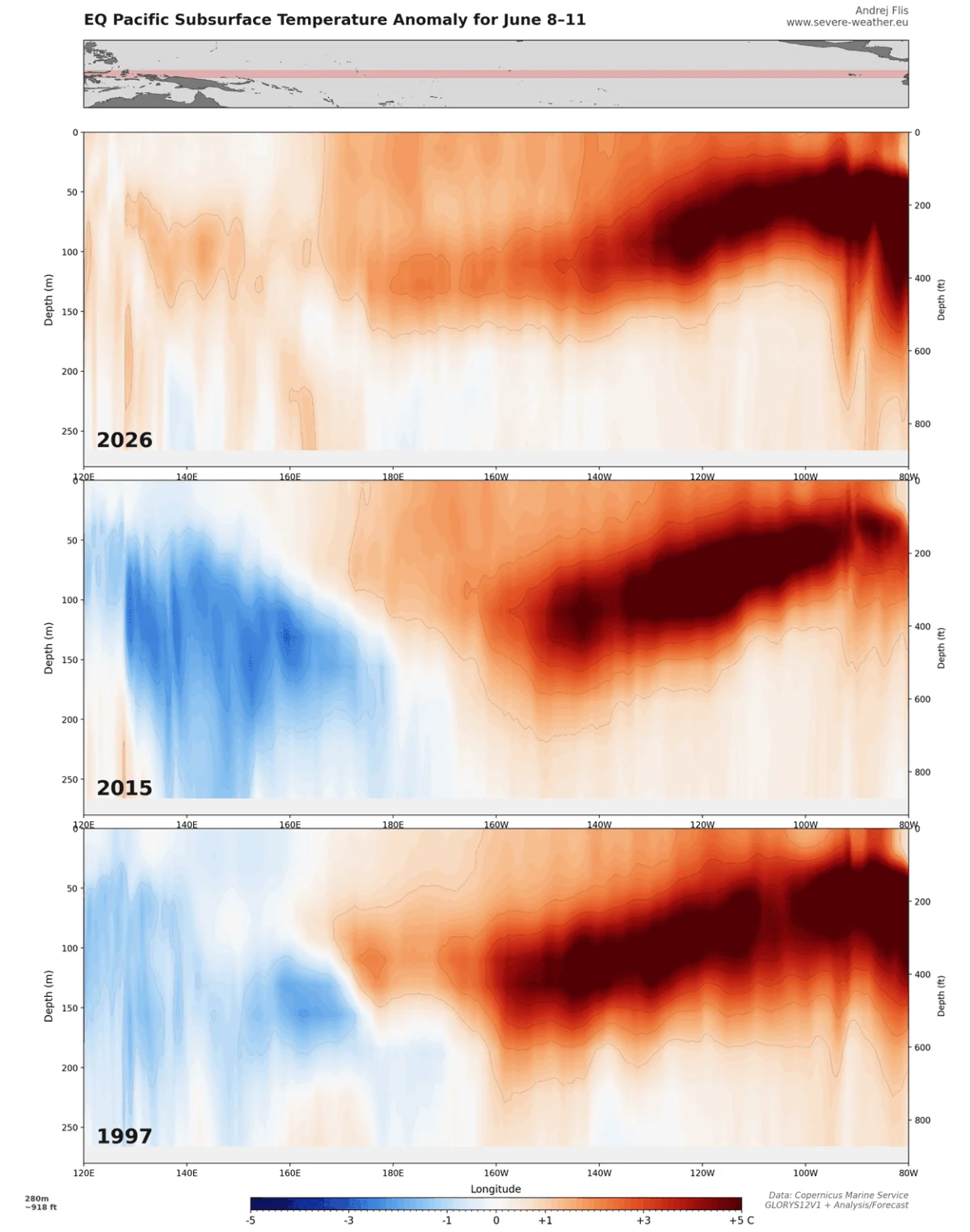
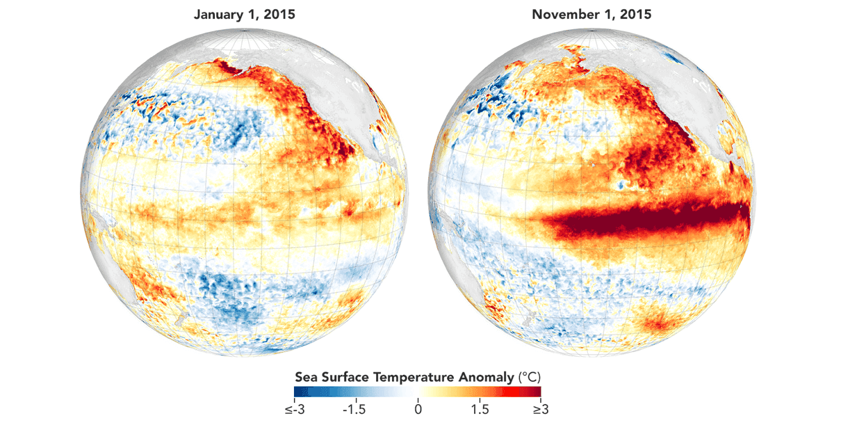
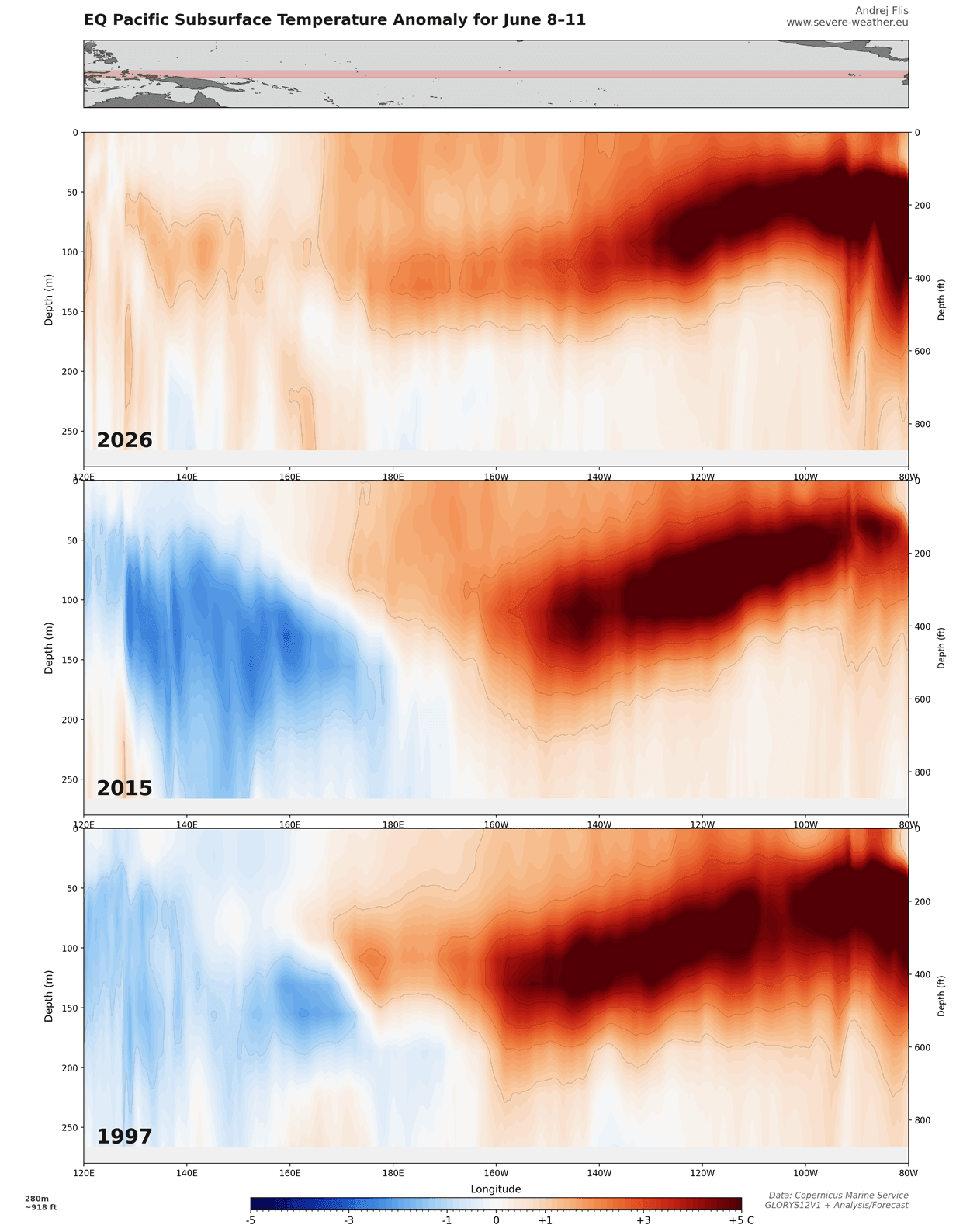
Current altimeter data reveals a significant sea level anomaly exceeding 25 centimeters (approximately 10 inches) above normal across a broad swath of the equatorial Pacific. This is a direct physical manifestation of the massive heat content currently migrating eastward. When compared to the subsurface temperature profiles of the 2015 Super El Niño, current 2026 data indicates that the subsurface heat supply is arguably more robust, suggesting that the event has significant "fuel" to continue its intensification through the autumn months.
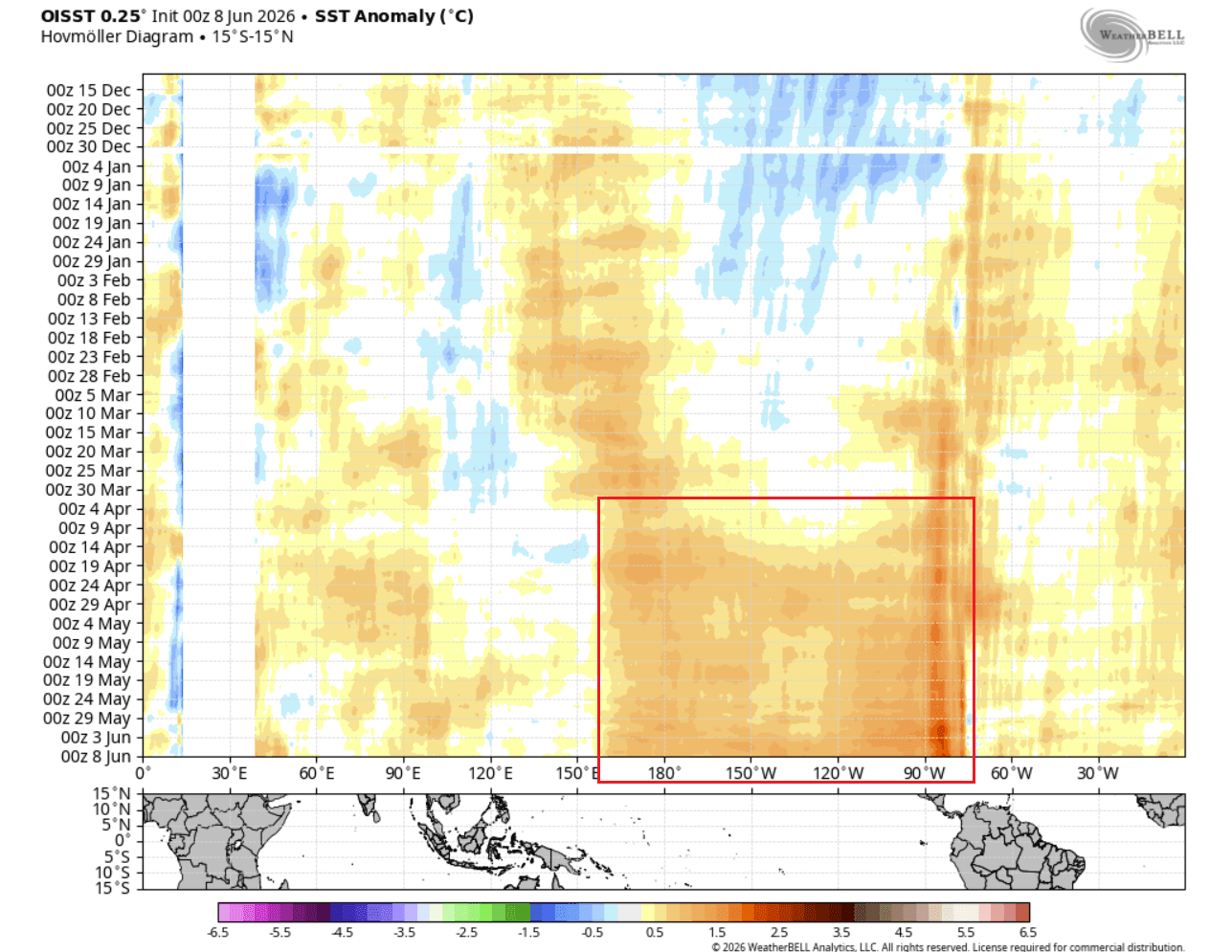
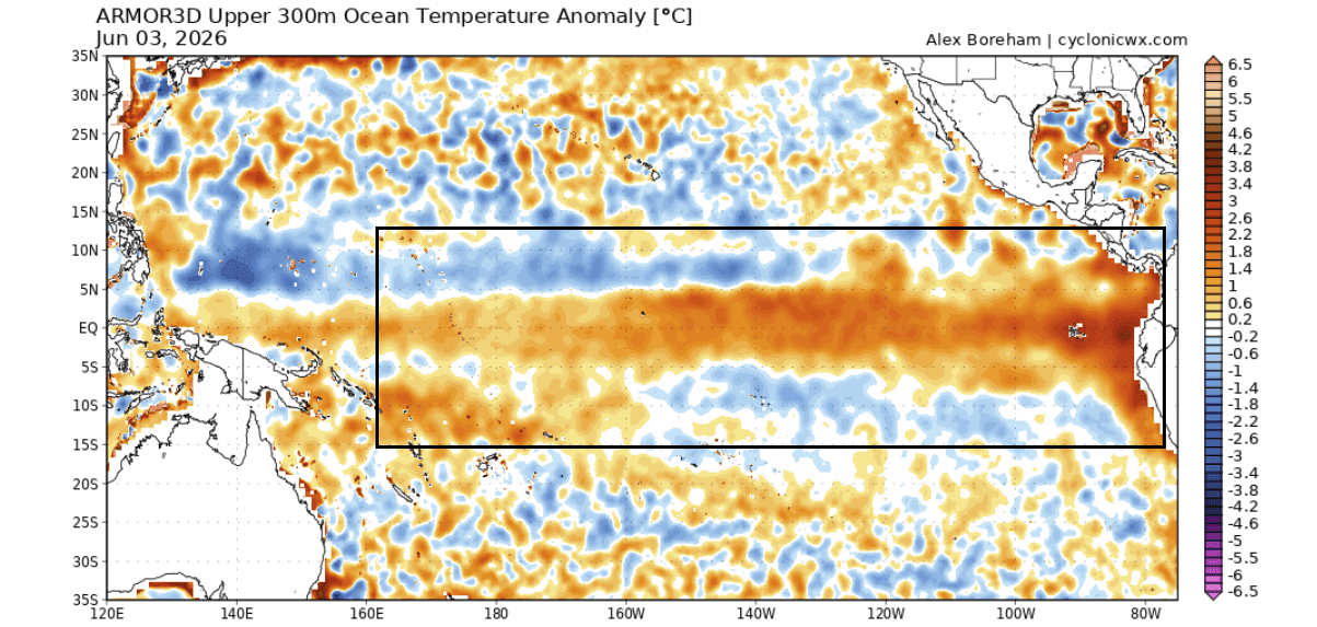
Furthermore, high-resolution ocean heat content maps confirm that this isn’t just a surface-level fluctuation. The warmth is penetrating down to 300 meters, creating a deep-seated energy reserve that will likely influence global atmospheric circulation for the next twelve to eighteen months.
Official Forecasts: What to Expect in Late 2026
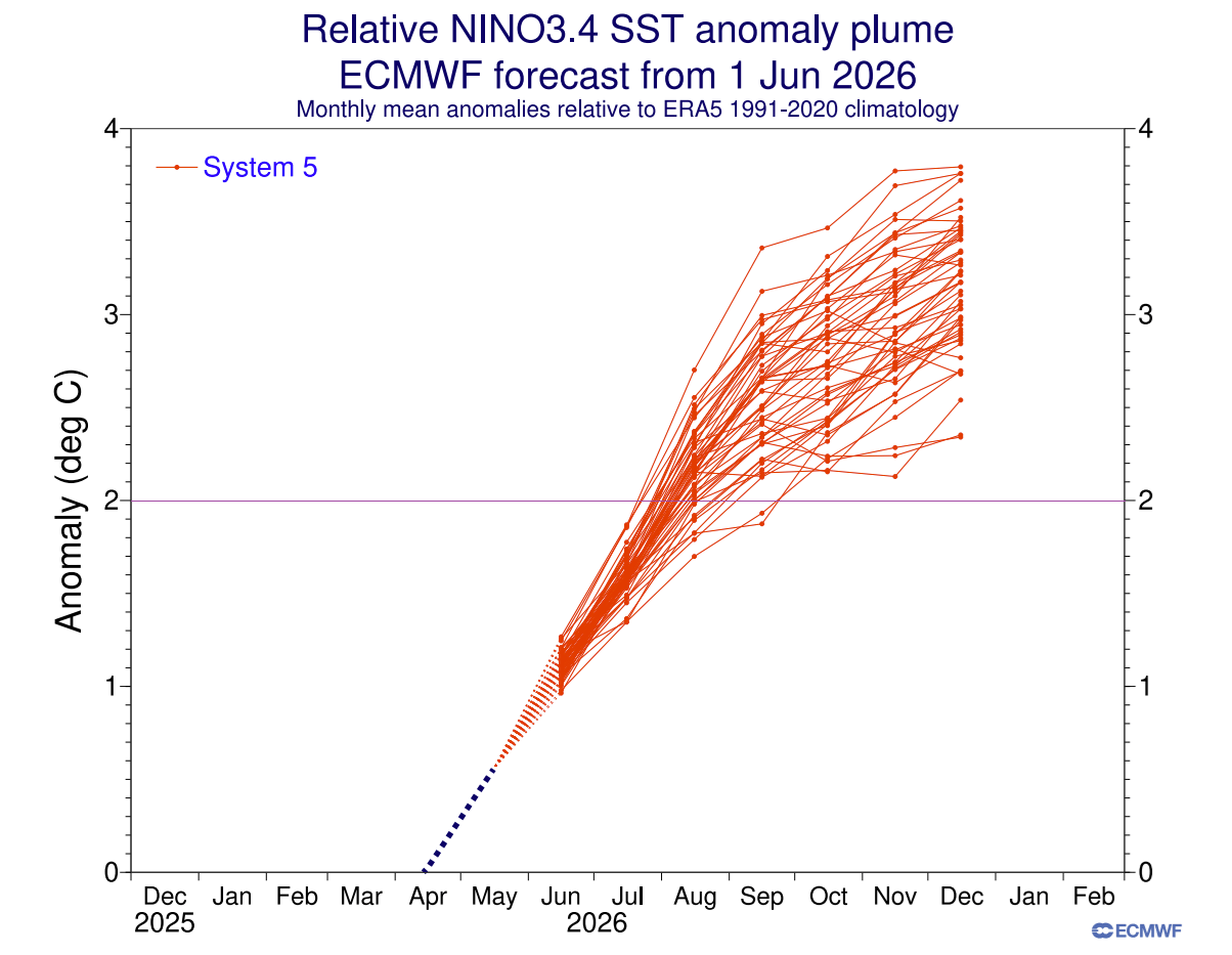
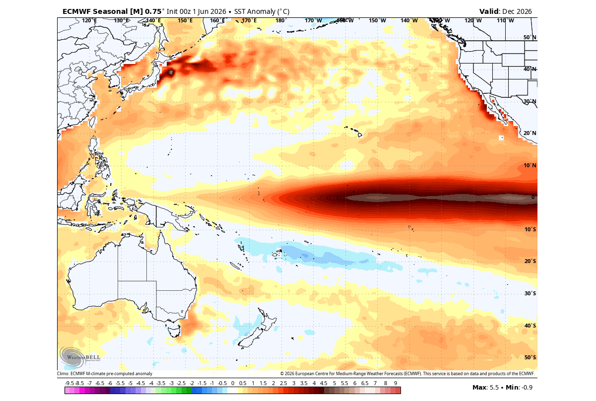
The ECMWF long-range forecasts have become increasingly aggressive. The latest ensembles show that by December 2026, sea surface temperature anomalies in the central Pacific could peak at +5.0°C. If verified, this would place the 2026-2027 event in the upper echelons of recorded history.
The North American Outlook
For the United States and Canada, the emerging pattern is becoming clear. We are seeing the development of a persistent low-pressure system in the North Pacific, which traditionally forces the polar jet stream further north. This shift is expected to produce:
- Warmer-than-average winters for northern sections of the U.S. and Western Canada.
- Increased moisture and storm activity across the southern United States and the Gulf Coast, as the subtropical jet stream becomes amplified.
- Heightened precipitation risk for the northeastern United States and southeastern Canada as the jet stream dips, creating a "storm track" that funnels moisture across the continent.
The European Outlook
While the influence of El Niño on Europe is more complex due to the interference of the North Atlantic Oscillation (NAO), current models suggest a distinct signature. A persistent low-pressure system is expected to reside over the northwestern Atlantic, which could usher in a series of wet, mild, and windy patterns for Western and Central Europe throughout the coming fall and winter months.
Implications: The High Cost of Volatility
The implications of a Super El Niño extend far beyond mere temperature charts. These events are historically correlated with significant humanitarian and economic disruptions.
Agricultural and Economic Risks
The shift in rainfall patterns is the most immediate concern. Regions that typically rely on steady rainfall may face severe, prolonged droughts, while others—particularly in the southern U.S. and parts of South America—may experience extreme flooding. Agricultural markets are already monitoring these shifts, as the potential for disrupted harvests in major breadbasket regions could lead to global commodity price volatility.
Infrastructure and Emergency Preparedness
With the forecast calling for increased storm activity, municipalities in vulnerable regions are being urged to accelerate their winter preparedness. The "Super" designation implies that standard climate models may underestimate the intensity of storms, leading to potential challenges for local energy grids and flood-management infrastructure.
The "New Normal" Discussion
Scientists remain cautious about how much the current warming is amplified by long-term anthropogenic climate change. While El Niño is a natural cycle, the background level of global ocean heat is higher today than it was during the 1997 or 2015 Super El Niño events. This suggests that the 2026 event may act as a force multiplier, pushing global temperatures to record-breaking levels and accelerating the melting of cryospheric regions during the winter.
Conclusion: A Window of Opportunity
We are entering a period where the global climate system will be dominated by a single, powerful driver. While the unpredictability of weather remains a constant, the current data provides a rare, high-confidence "early warning" for the coming seasons.
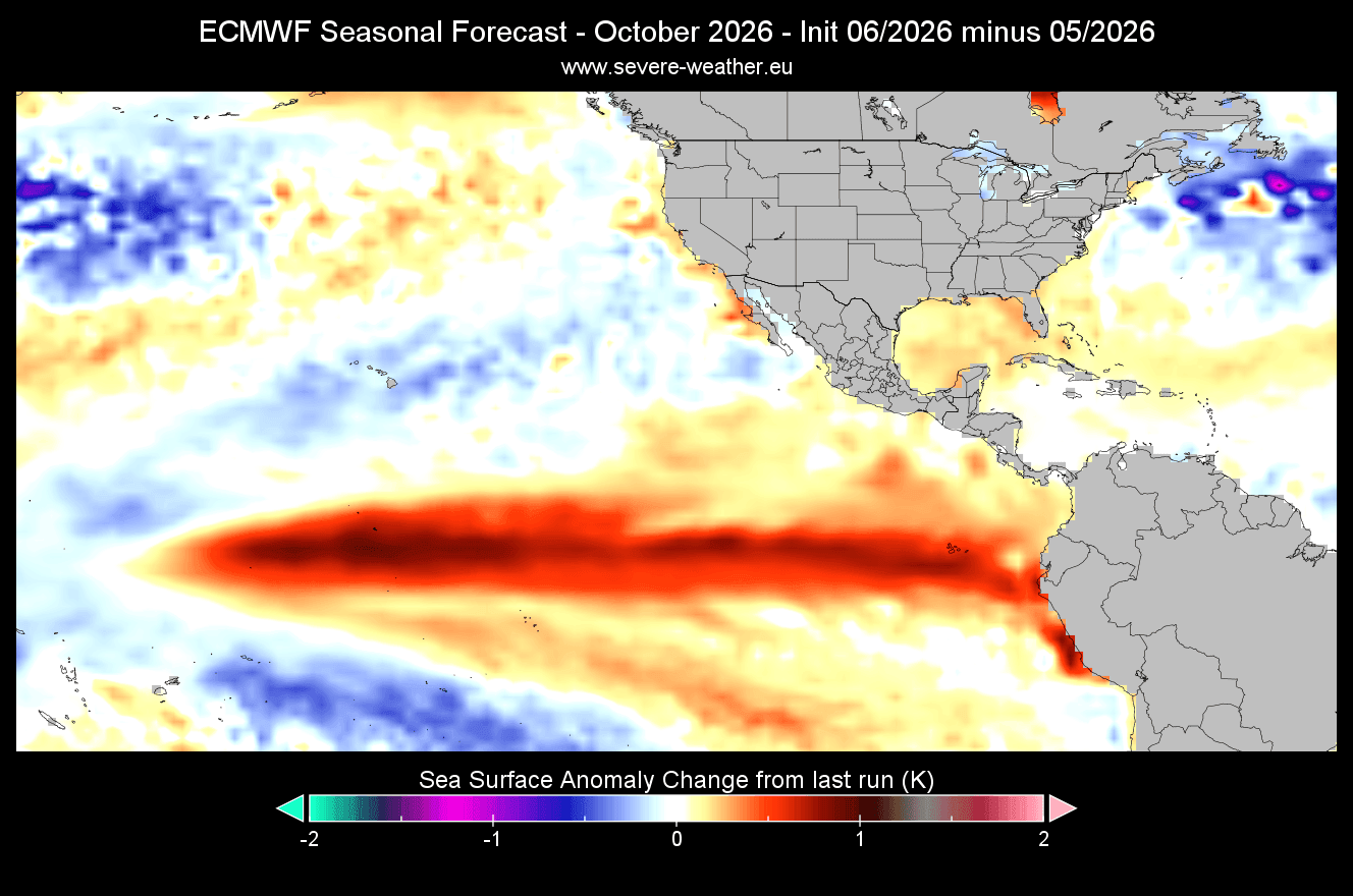
As we move deeper into the summer, monitoring the speed of the Kelvin Wave’s final ascent to the surface will be critical. The transition from the "emerging" phase to the "locked-in" phase is nearly complete. For policymakers, industry leaders, and the public, the message is clear: the atmospheric and oceanic "pressure valve" has been opened, and the global weather patterns of 2026-2027 will be defined by this rare and formidable Super El Niño.
This report utilizes data from the ECMWF, NASA JPL, and Copernicus EU. For continuous updates on this evolving climate situation, ensure you are tracking the latest seasonal outlooks as they are released in the coming months.