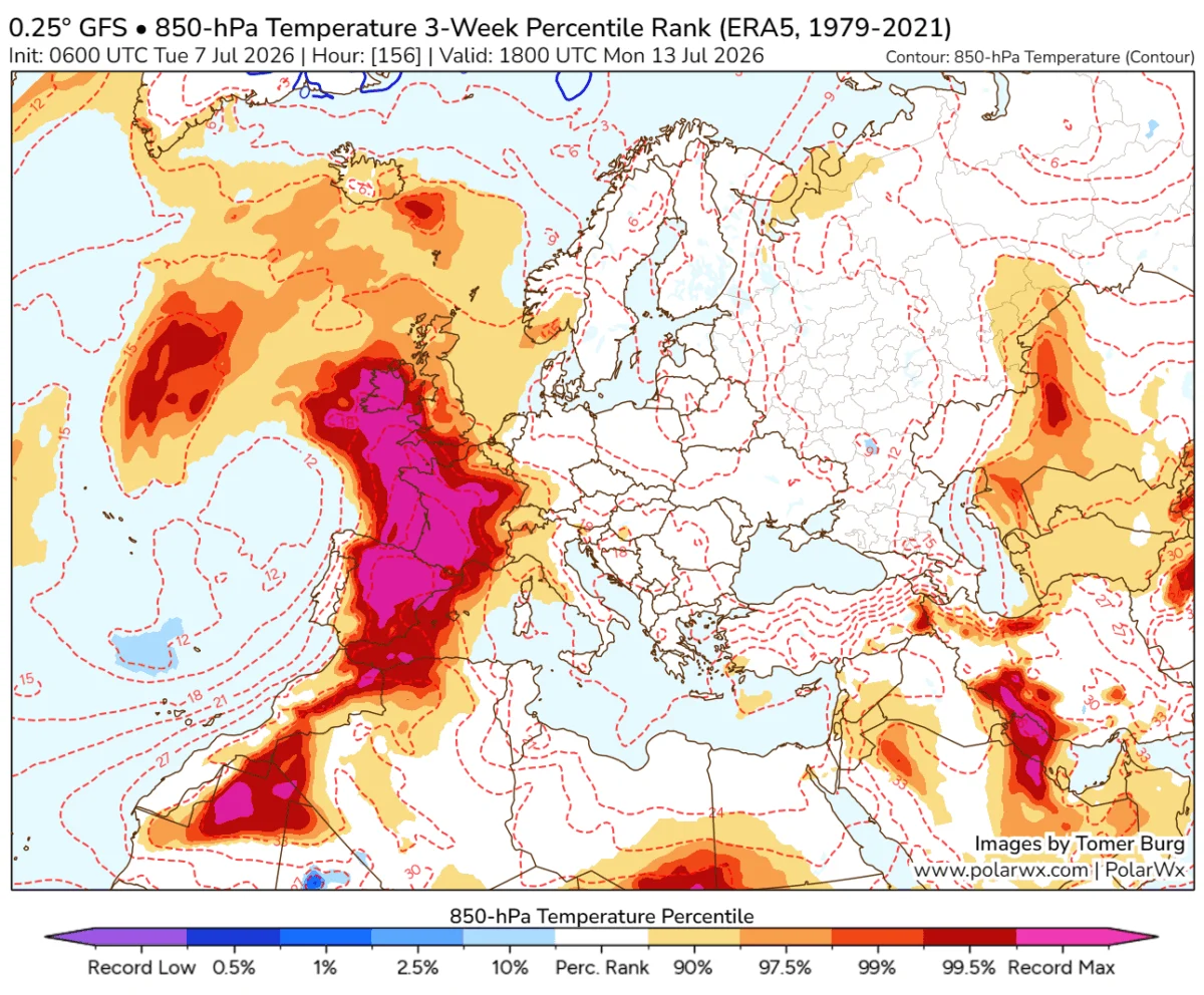
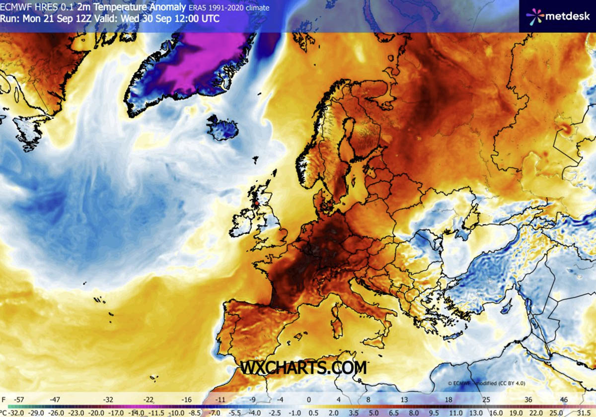
As September draws to a close, a meteorological anomaly is set to defy the seasonal transition. A massive, persistent Heat Dome is making a dramatic return across the European continent, setting the stage for an unseasonably warm spell that will stretch well into the first week of October. Driven by a powerful upper-level ridge building north from the Mediterranean and North Africa, this thermal event is expected to push temperatures 8 to 12°C above long-term seasonal averages across vast portions of Western, Central, and Northern Europe.
The Synoptic Setup: An Atmospheric Dipole
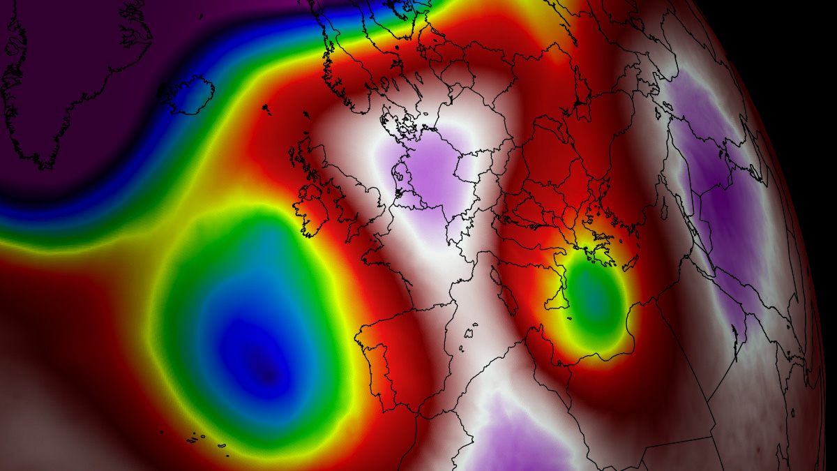
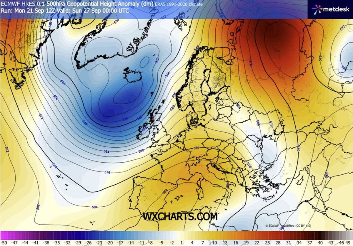
The primary engine behind this late-autumn thermal surge is a classic atmospheric dipole pattern. A deep, high-amplitude upper-level trough has established itself over the North Atlantic, acting as a catalyst that forces an intense southerly jet stream plume to advect warm, tropical air deep into the heart of the European continent.
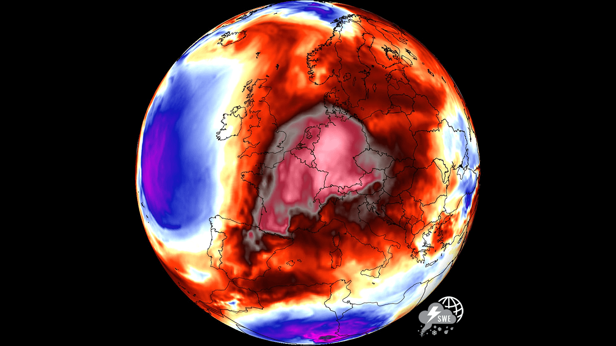
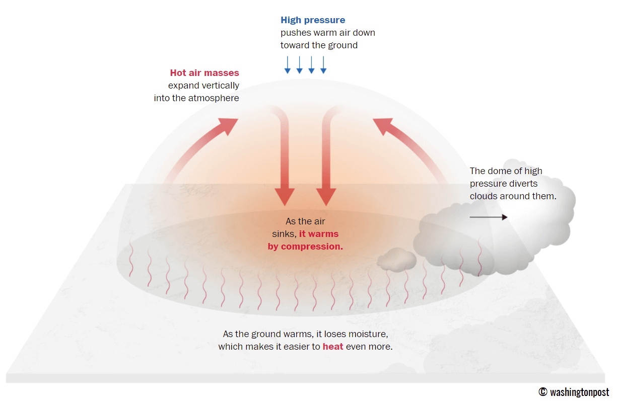
Beneath the core of this expansive blocking ridge, strong atmospheric subsidence is at work. As air sinks, it compresses and warms, effectively stripping away cloud cover and creating a "lid" that traps heat near the surface. In many regions, this will result in afternoon temperatures climbing well into the upper 20s, with localized peaks reaching into the low 30s. For late September and early October, these are not merely warm days—they are historical outliers.
Chronology of the Heatwave
The progression of this heat dome follows a distinct geographical trajectory:
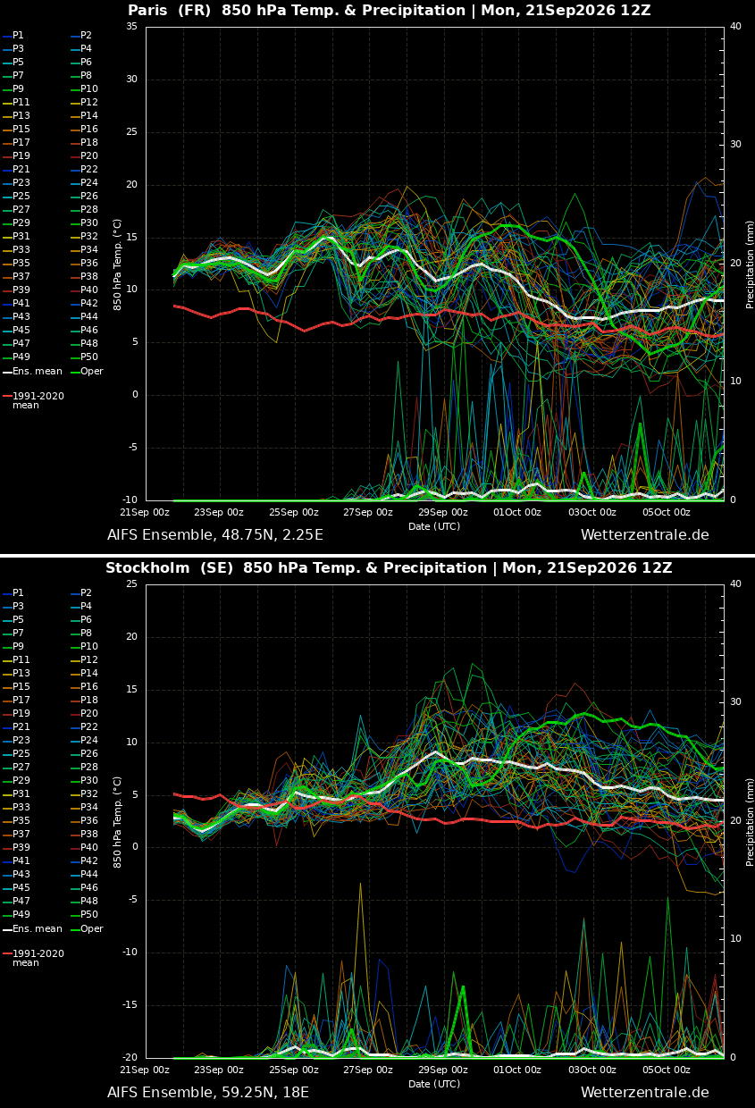
- Late September (The Build-up): The initial wave of heat is currently intensifying over the Iberian Peninsula, with extreme temperatures impacting Spain and Portugal. By mid-week, this warm plume will surge northward into France.
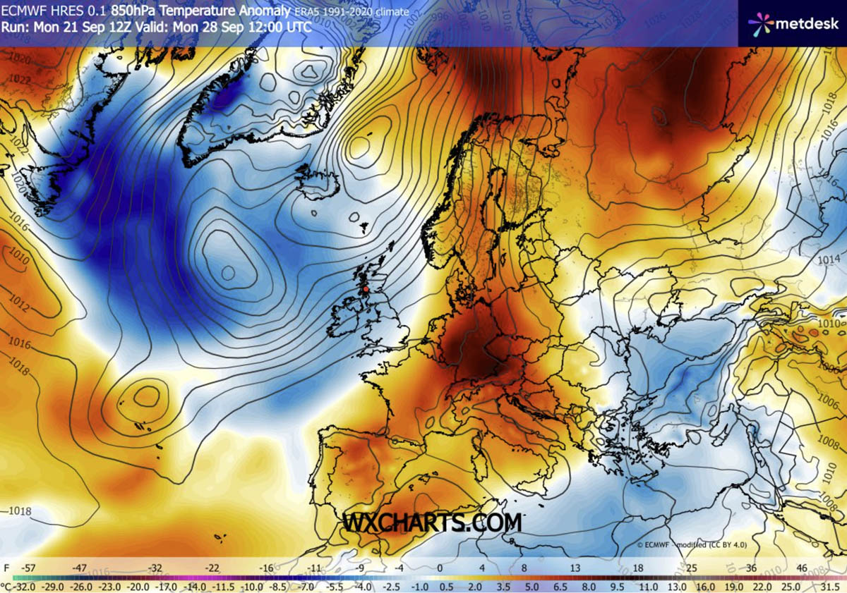
- The Weekend Shift: As the blocking ridge strengthens and pivots, the heat will expand its reach. While the British Isles will experience a brief, moderated increase in temperatures, the brunt of the heat will shift toward the Benelux region and Germany.
- Early October (Northern Expansion): By the start of the new month, the atmospheric block will effectively seal off the continent from Atlantic weather systems. This will allow the high-pressure core to drift toward Scandinavia and the Baltic region, bringing anomalous warmth to latitudes that typically begin their rapid descent into autumnal cooling by this time of year.
Understanding the "Heat Dome" Mechanism
To understand the severity of this event, one must look at the mechanics of the heat dome itself. Much like a lid on a boiling pot, a high-pressure ridge prevents heat from escaping. As air at higher altitudes sinks toward the ground, it undergoes adiabatic compression—a process that significantly raises the temperature of the air mass at lower elevations.
Because the system is "blocked," it remains stationary for days or even weeks. This leads to a compounding effect: the ground dries out, vegetation loses its cooling moisture, and the surface becomes increasingly efficient at absorbing solar radiation, creating a feedback loop of rising temperatures.
Implications for Public Health and Infrastructure
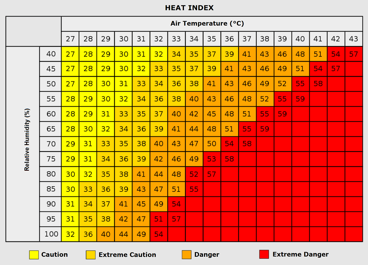
The persistence of this weather pattern presents significant challenges, particularly regarding the phenomenon of "tropical nights." When nocturnal temperatures refuse to drop below 24°C, the human body is denied its vital physiological window to recover from daytime heat stress.
Health Risks and Vulnerability
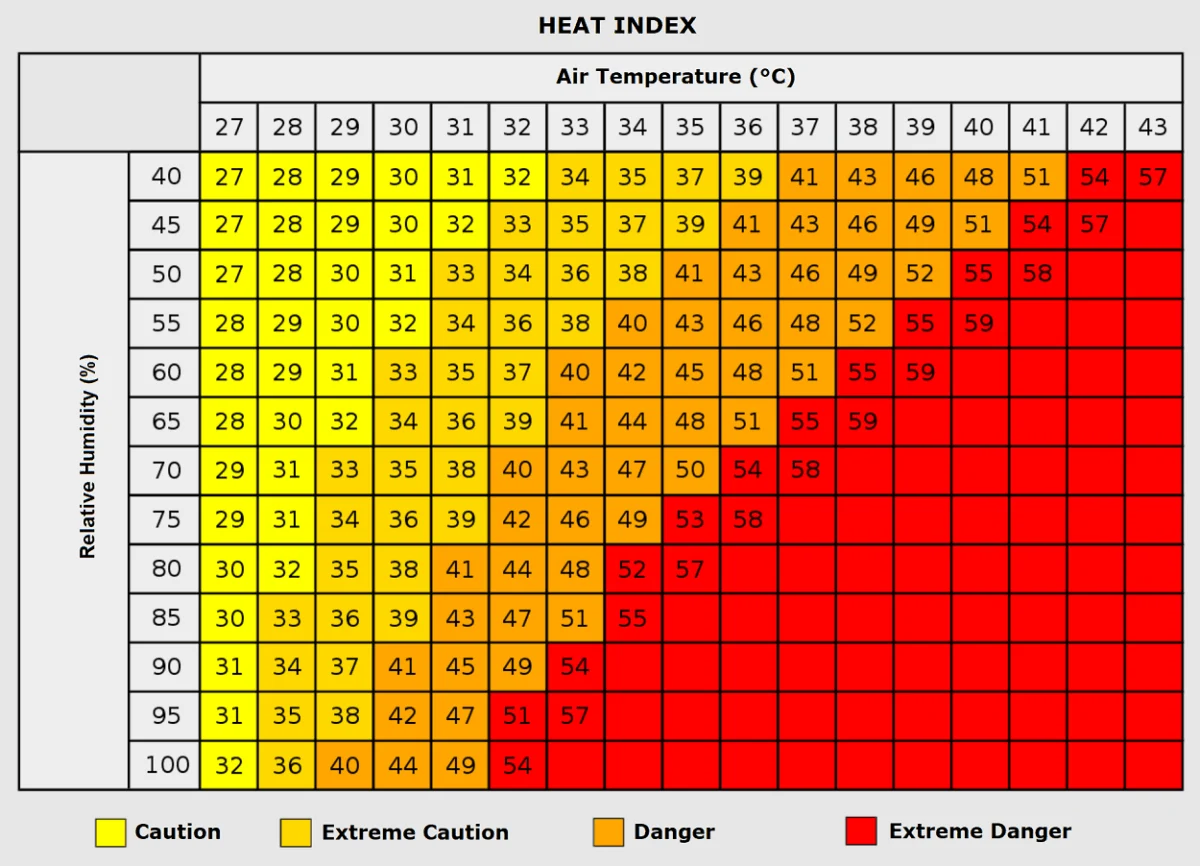
Prolonged exposure to these temperatures—even those considered moderate by summer standards—is taxing. Vulnerable populations, including the elderly, those with cardiovascular or respiratory conditions, and children, are at heightened risk. Furthermore, the "urban heat island" effect exacerbates these conditions; cities constructed of heat-trapping concrete and asphalt retain warmth long after the sun has set, turning urban centers into thermal reservoirs.
Construction workers, agricultural laborers, and outdoor personnel must remain vigilant. Heat exhaustion, characterized by dehydration, dizziness, and fatigue, is a precursor to the more lethal condition of heat stroke. Public health officials are already flagging the need for hydration and shade, particularly as the public may be less prepared for heat-related precautions during a time of year when they expect cooler weather.
Grid and Economic Impacts
Energy grids will likely experience increased strain as cooling systems remain in use far longer than the seasonal average. In the agricultural sector, the heat poses a complex problem. While the warmth may extend the growing season for certain crops, the lack of precipitation under the high-pressure block, combined with high evaporation rates, could exacerbate soil moisture deficits in regions already grappling with water management concerns.
Regional Breakdown: Where the Heat Will Hit Hardest
Southwestern Europe: The Epicenter
The Iberian Peninsula remains the focal point of the heatwave. Through the weekend, temperatures in south-central Spain and Portugal are forecasted to range between 34°C and 38°C. In some pockets, the mercury could flirt with the 40°C mark, a staggering figure for late September.
Western Europe: France and the Benelux
Southern and central France will see the heat intensify as the dome drifts north. Interior regions are expected to reach the mid-30s. As the air mass moves into the Benelux region, residents should prepare for a weekend where temperatures hover in the low 30s, significantly higher than the regional norm.
The United Kingdom and Ireland
The UK will experience a "shorter" version of this event. While not as extreme as the continent, south-central England will see daytime highs in the mid-20s through Sunday. Interestingly, the sharp boundary between the high-pressure ridge and the deep Atlantic low will create a stark contrast: while the south stays dry and warm, the western British Isles, Ireland, and Scotland will face an "atmospheric river" of moisture, resulting in heavy, orographic rainfall that could exceed 150 mm in some areas.
Central and Northern Europe
By early next week, Germany, Poland, and the Baltic states will see the heat anomaly move in. Temperatures are expected to reach the high 20s and near 30°C. Perhaps most notably, models show significant thermal anomalies extending into Sweden and Finland, where the warmth will be felt acutely as the region enters its darker, autumnal phase.
Scientific Consensus and Long-Range Outlook
Data provided by the GFS (Global Forecast System) and ECMWF (European Centre for Medium-Range Weather Forecasts) ensembles indicate that this blocking pattern is remarkably stable. The atmospheric "dipole"—the pairing of the deep Atlantic low and the continental high-pressure ridge—is expected to persist through the first days of October.
Meteorologists emphasize that while the current forecast suggests this specific heat event will eventually break down as the pattern becomes more "dynamic" later in October, the occurrence of such high-amplitude blocking events is a critical area of study. The ability of the atmosphere to hold these patterns in place for extended periods is a hallmark of shifting climate dynamics.
Conclusion: A Season in Transition
As Europe moves toward the end of September, the contrast between the saturated, cool Atlantic and the dry, sweltering continent is a reminder of the volatility inherent in current weather patterns. Citizens are advised to monitor local meteorological alerts, particularly as the combination of heat and drought can heighten fire risks in parched vegetation.
While the "heat dome" will eventually dissipate, its arrival at the end of September serves as a poignant indicator of how seasonal boundaries are becoming increasingly blurred. For now, the continent must prepare for an autumnal heatwave that forces a re-evaluation of late-season expectations. Stay tuned for further updates as the meteorological models refine their outlook for the first week of October.