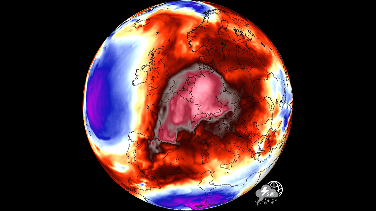
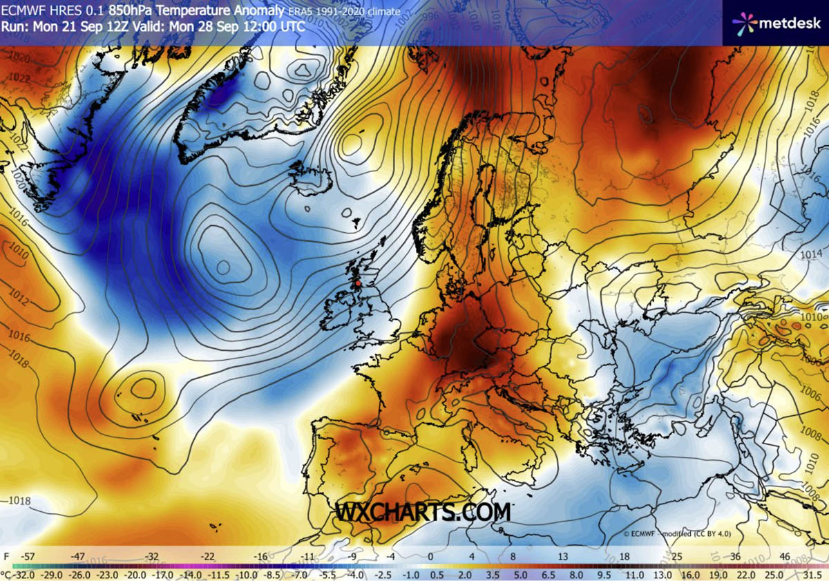
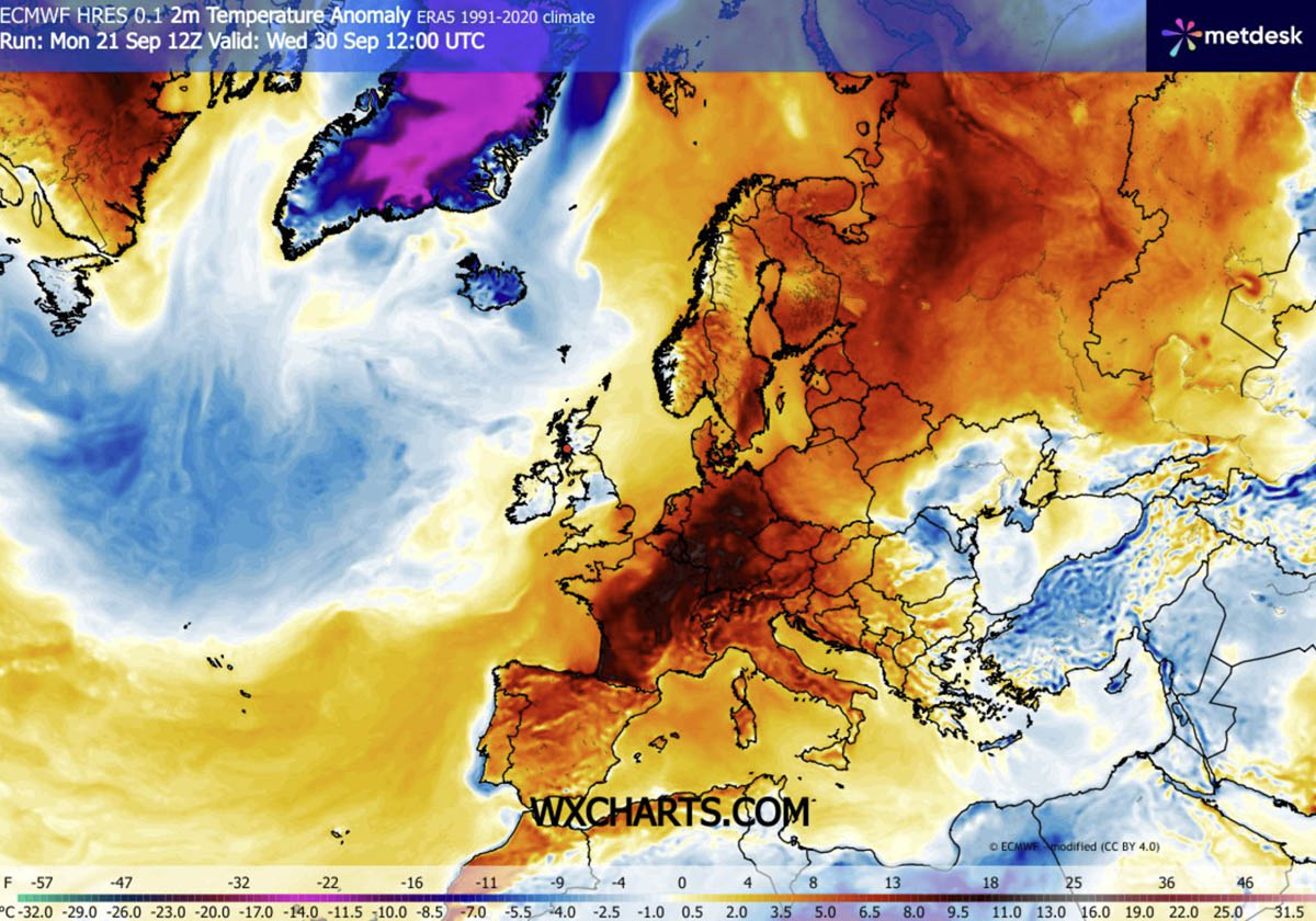
As the calendar turns from September to October, Europe is preparing for an anomalous and intense weather event. A massive, high-pressure "Heat Dome" is currently establishing its grip over the continent, poised to deliver a stretch of unseasonably warm weather that defies traditional autumnal cooling. This atmospheric phenomenon, driven by a powerful upper-level ridge building from the Mediterranean and North Africa, is set to push temperatures 8 to 12°C above long-term averages across vast swathes of Western, Central, and Northern Europe.
The Science of the Dome: Atmospheric Dynamics at Play
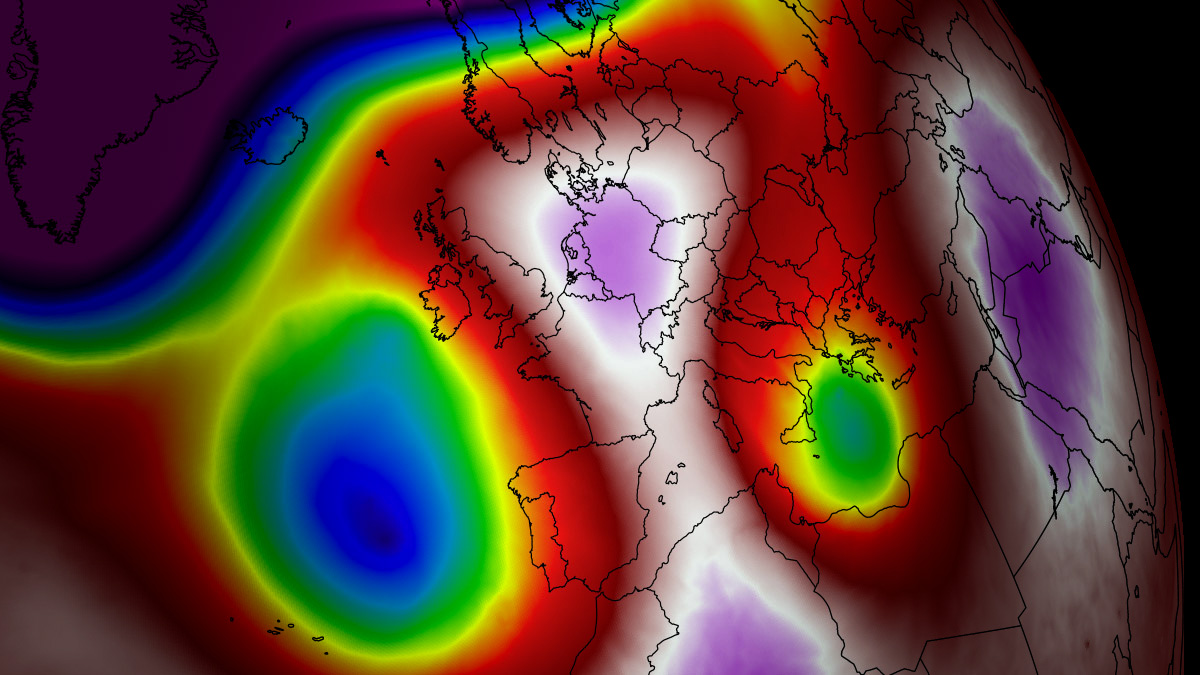
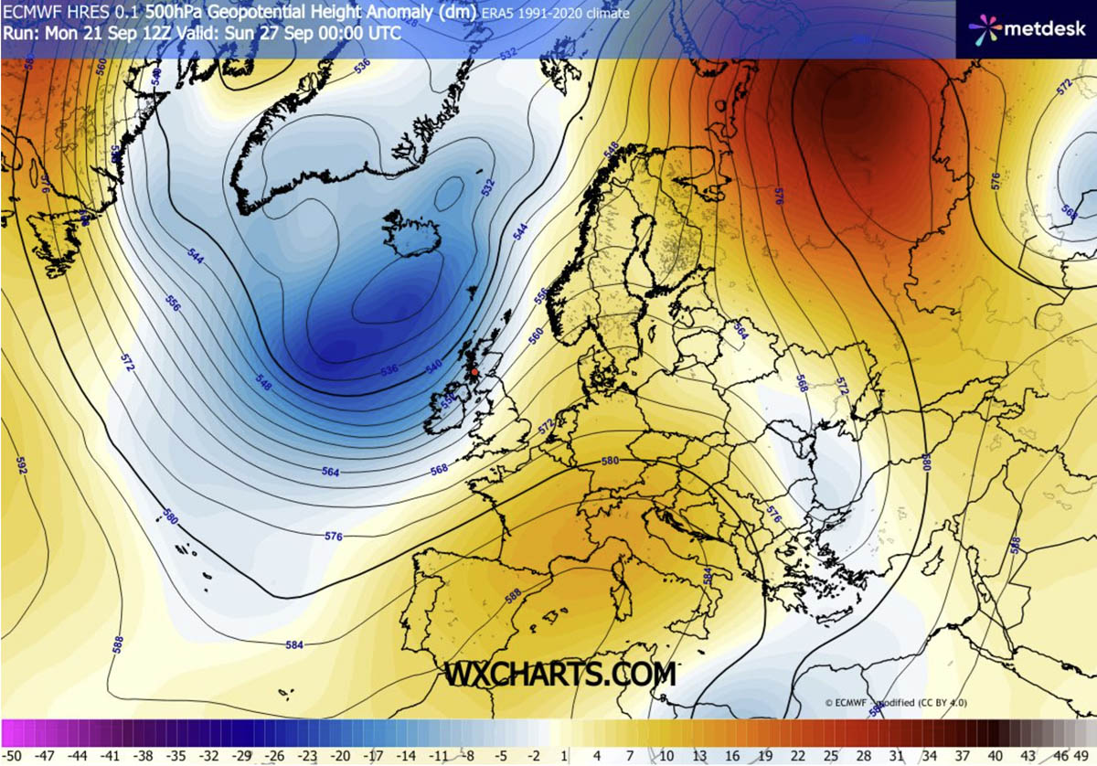
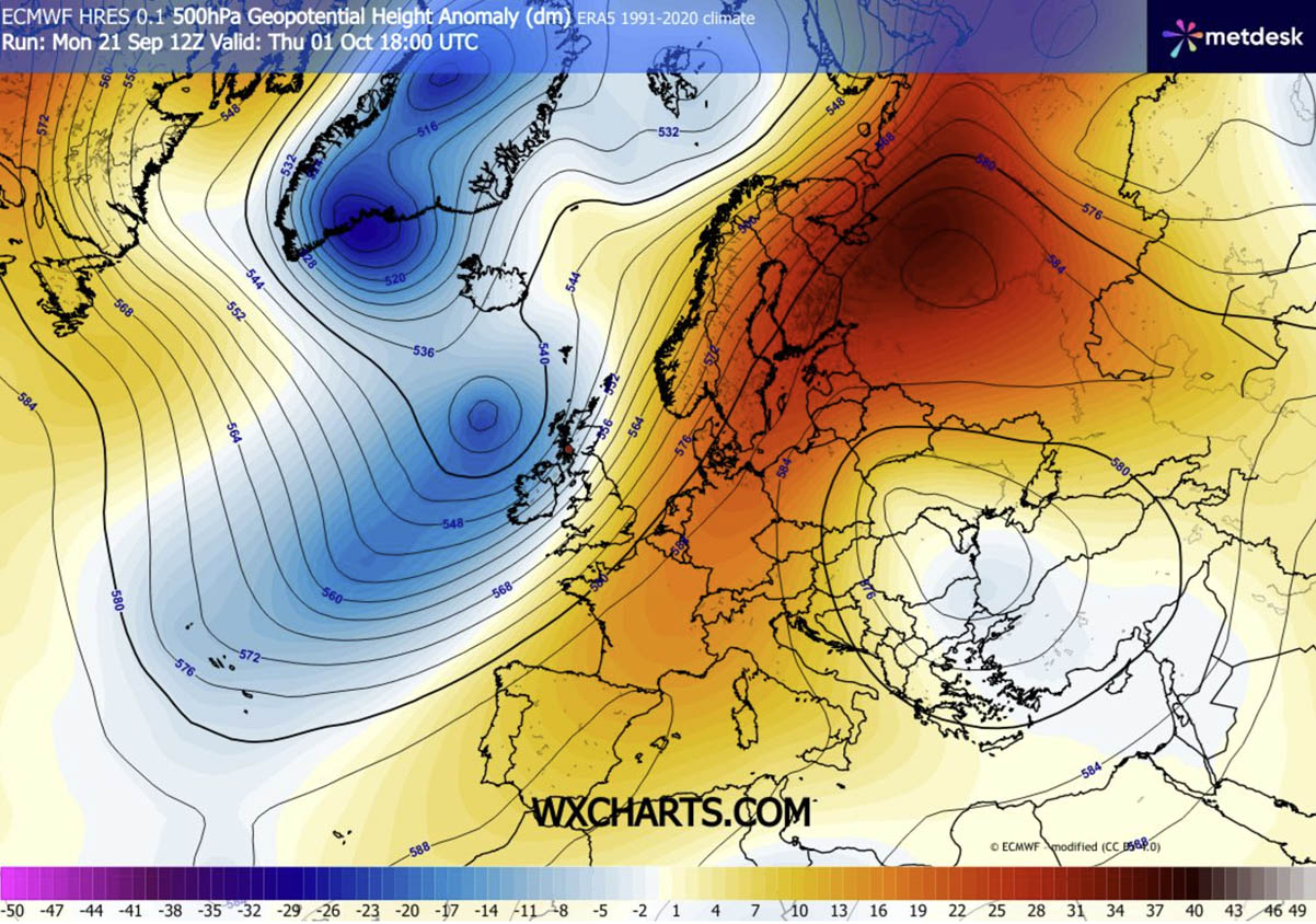
To understand the severity of this late-season surge, one must look at the "atmospheric dipole" currently governing the European sky. A deep, high-amplitude trough has anchored itself over the North Atlantic, acting as a massive engine that is forcing an intense southerly jet stream plume. This stream is effectively pumping tropical, North African air deep into the heart of the European continent.
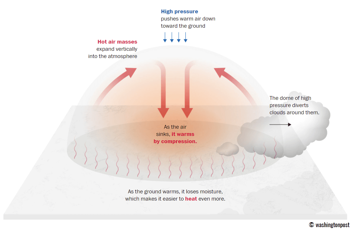
The "Heat Dome" itself functions as a meteorological lid. Within the core of this expansive, blocking high-pressure system, strong atmospheric subsidence—the sinking of air—is compressing and warming the lower atmosphere. This process suppresses cloud formation, allowing for direct, intense solar radiation to drive surface temperatures well into the high 20s and, in southern regions, the low 30s. This is an extraordinary thermal anomaly for late September and early October, a time when the continent typically transitions into crisp, cooling autumn weather.
Chronology of the Thermal Surge
The progression of this event is expected to be steady and pervasive. While the Atlantic coast will remain locked in a battle between the incoming warmth and the persistent trough, continental Europe is set to experience the full force of the heat through the weekend and into the first days of October.
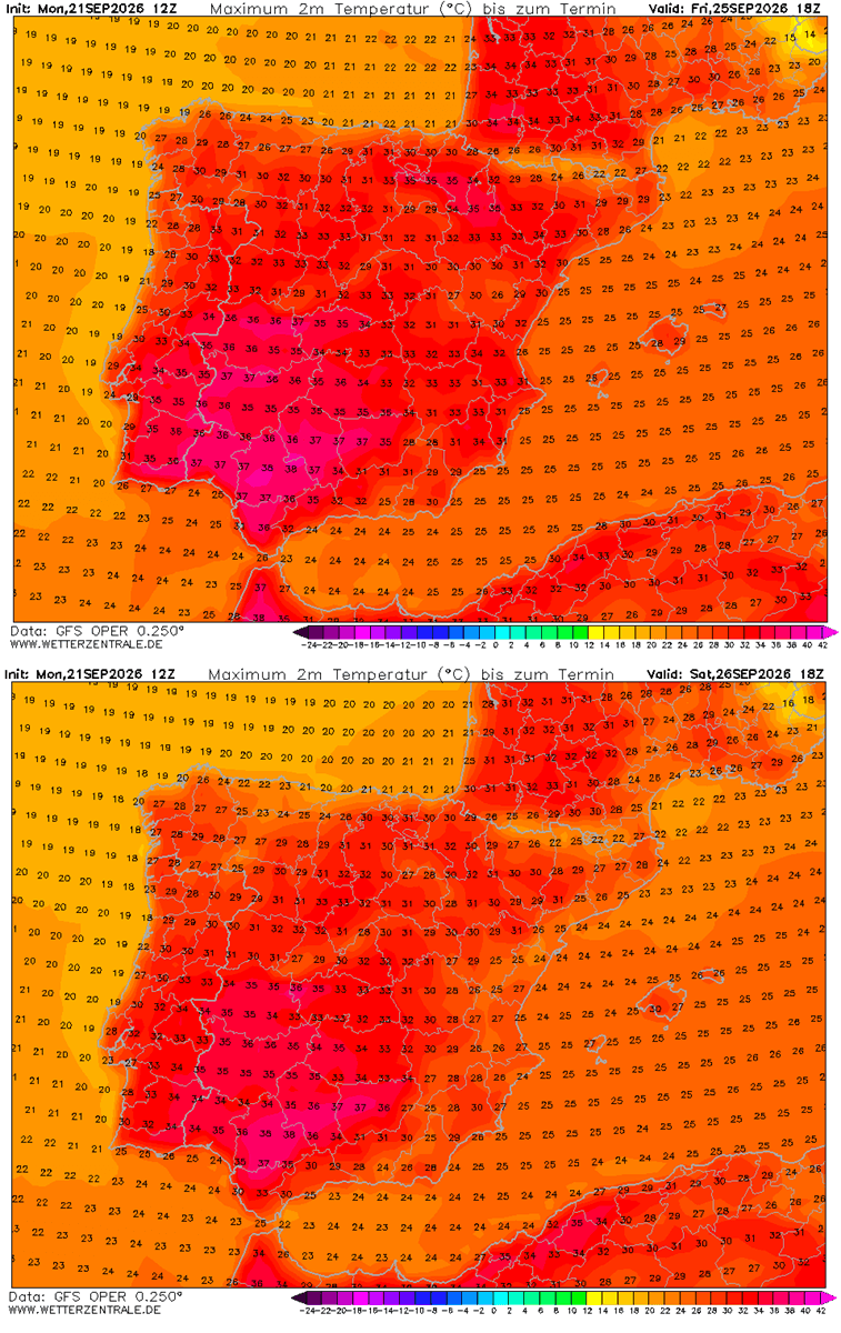
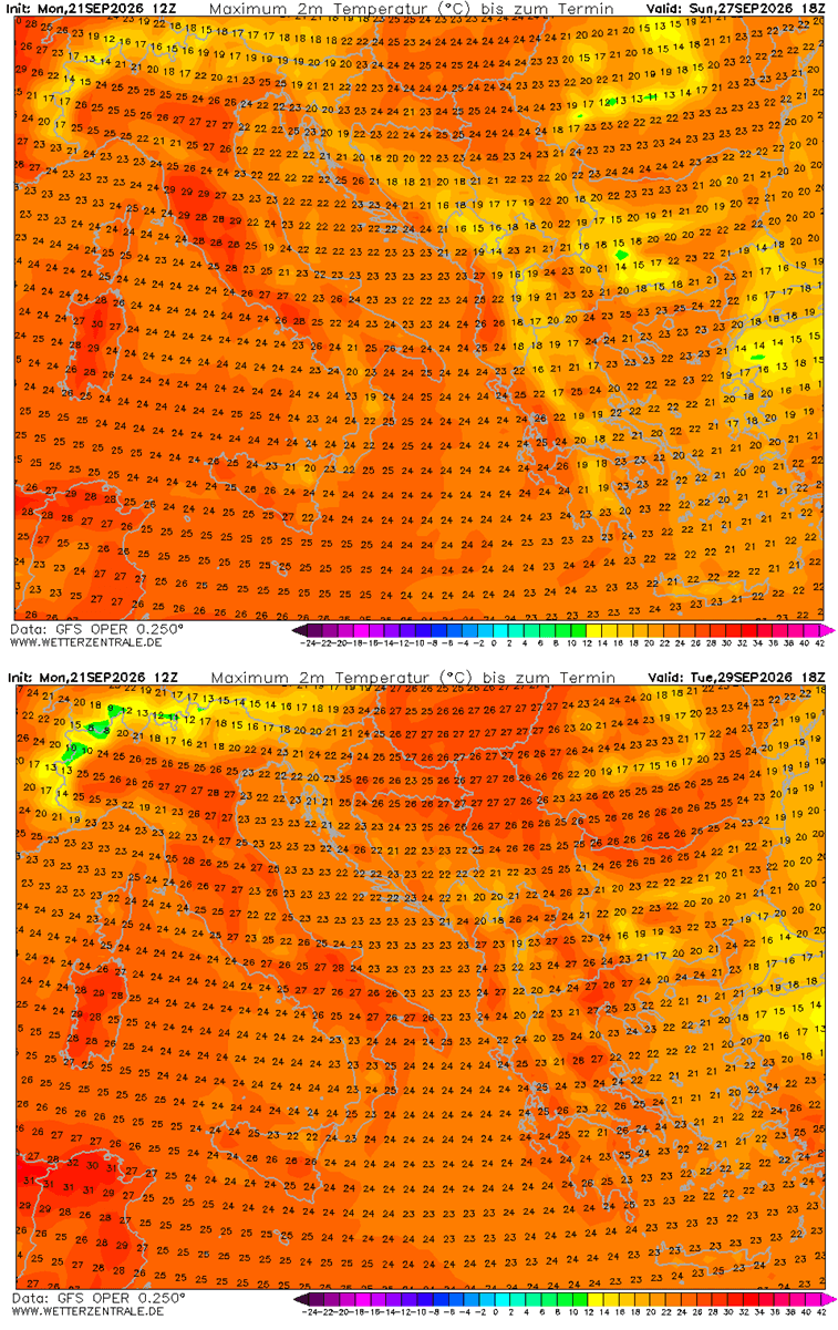
- Late September: The heat dome tightens its grip. Southwestern Europe, particularly the Iberian Peninsula, will bear the brunt of the initial surge. Temperatures in Spain and Portugal are projected to climb to 35–38°C, with potential peaks hitting the 40°C mark in localized interior regions.
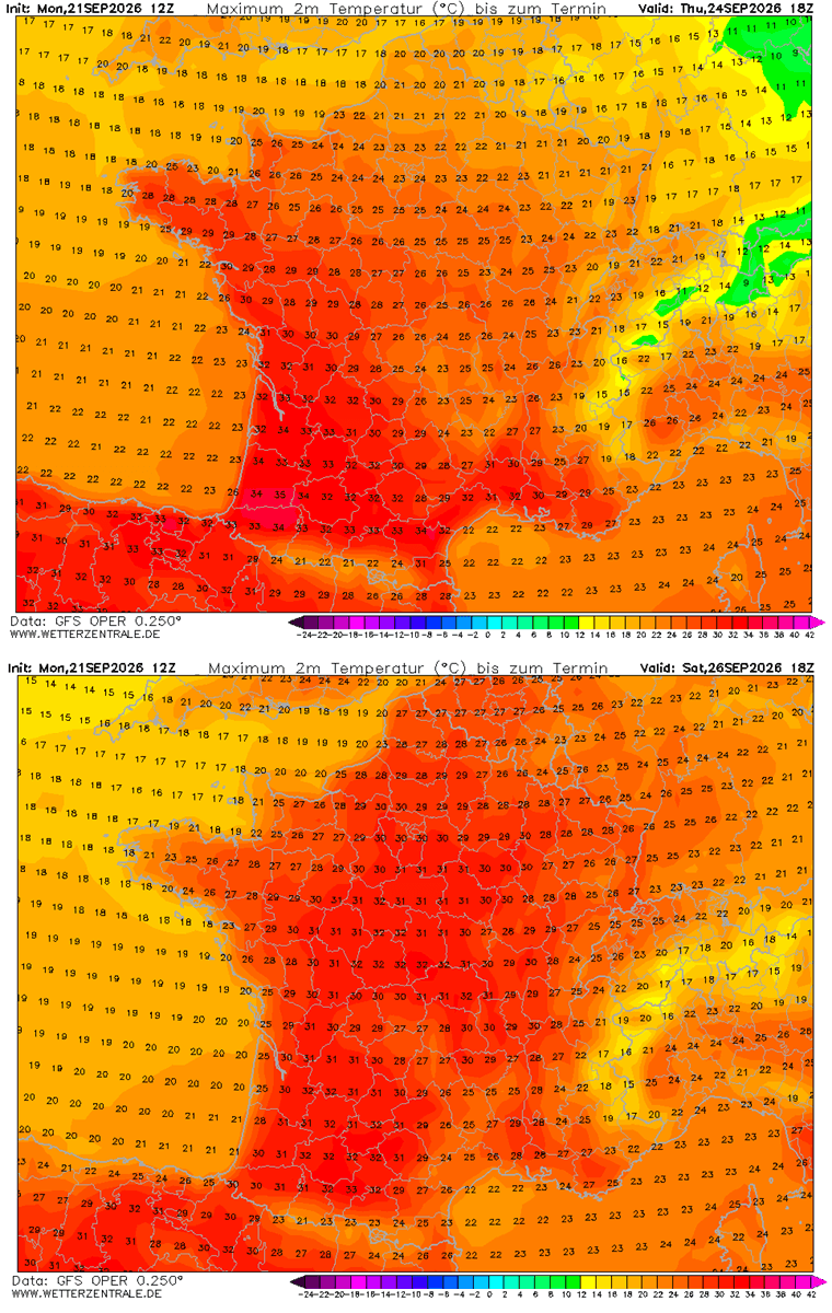
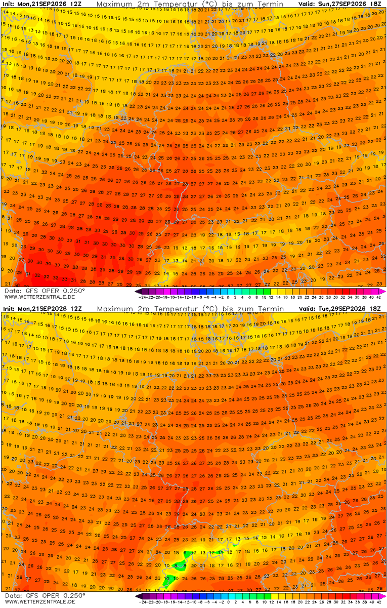
- The Weekend Transition: By Saturday, the heat plume will shift its focus. Central and Southern France will see temperatures push toward 36°C. Simultaneously, the warmth will begin to migrate toward the Benelux region and Germany, where residents can expect highs in the upper 20s.
- Early October: The pattern is expected to persist into the first week of October. The ridge will expand further, reaching into Scandinavia and the Baltic states. Forecast models suggest that regions such as Sweden and Finland, usually accustomed to brisk autumnal air, will face record-breaking warmth for this time of year.
Regional Breakdown: Where the Heat Will Strike
The impact of this heatwave is not uniform; it follows the trajectory of the atmospheric ridge as it pushes northeast.
The Iberian Peninsula and Southwestern Europe
Spain and Portugal are currently under the most extreme conditions. With an exceptionally dry air mass in place, the region is bracing for a sustained period of heat that is more characteristic of mid-July than the cusp of October. Projections indicate that the intense solar heating will maintain daytime highs exceeding 35°C for several consecutive days.
France and the UK
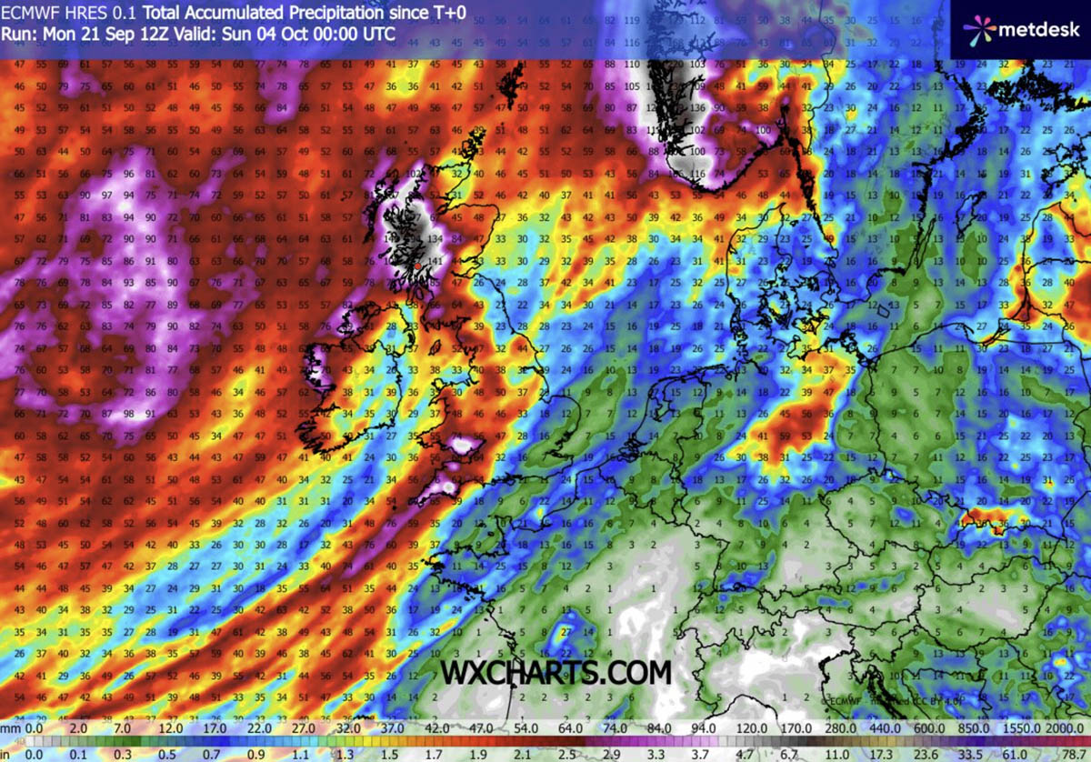
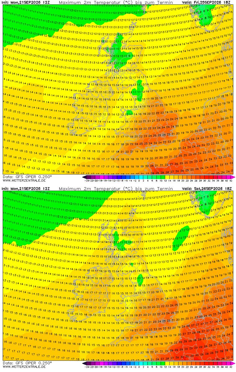
France is set to experience a significant thermal spike, particularly in the south and center. While the UK is largely shielded from the most extreme temperatures due to its proximity to the Atlantic trough, parts of south-central England will still see the mercury climb into the mid-20s—a significant departure from seasonal norms. However, for Ireland and Scotland, the interaction between the heat dome and the Atlantic low will likely manifest as heavy, orographic rainfall rather than heat, with potential accumulations exceeding 150 mm.
Central and Northern Europe
As the week concludes, Germany, Poland, and the Baltic states will see the heatwave arrive. While not reaching the extreme 40°C seen in the south, the expected temperatures of 27–30°C are highly anomalous for October. In Northern Europe, particularly Sweden, the warming will be most pronounced in terms of "anomaly," as temperatures soar significantly above what is climatologically expected for the start of the final quarter of the year.
Implications for Public Health and Infrastructure
While the prospect of lingering summer sun may be appealing to some, the public health implications of a late-season heatwave are severe. Heat domes are notorious for "tropical nights," where temperatures refuse to dip below 24°C. This lack of nocturnal cooling is a critical danger, as it prevents the human body from recovering from the heat stress accumulated during the day.
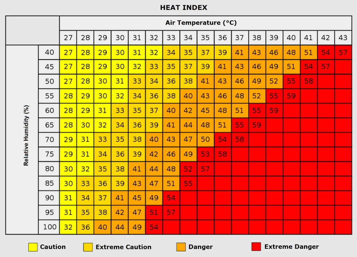
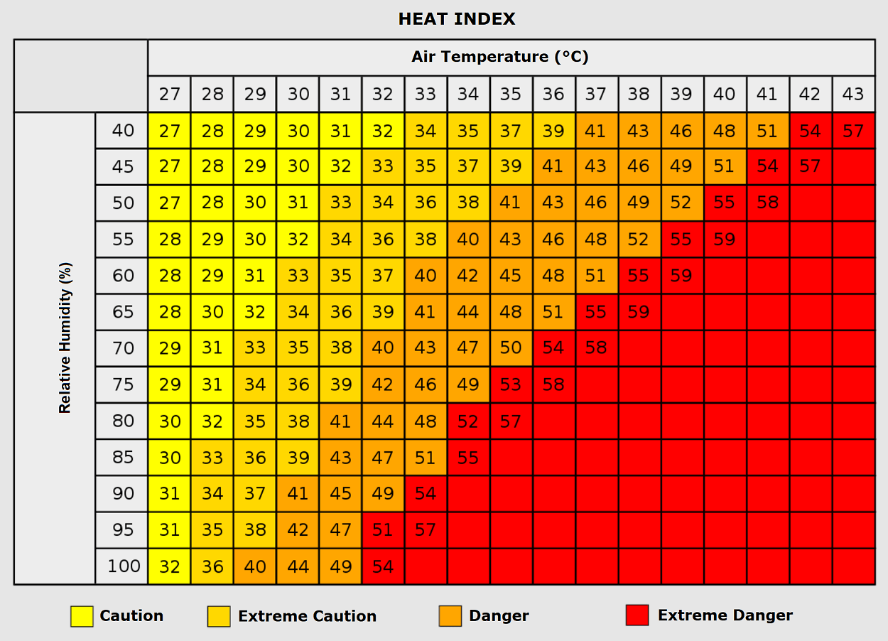
Vulnerable populations—the elderly, children, and those with pre-existing cardiovascular or respiratory conditions—are at the highest risk. Furthermore, the combination of high humidity and extreme heat increases the "Heat Index," or the "feels-like" temperature. In humid conditions, the body’s primary cooling mechanism—sweating—becomes inefficient. If the relative humidity remains high while temperatures hover near 35°C, the body can perceive temperatures near 50°C, a threshold that can trigger heat stroke and other life-threatening conditions.
Beyond human health, the agricultural sector remains on high alert. The sustained, dry heat can accelerate the maturation of late-season crops or, conversely, stress plants that have already begun their winter dormancy. Urban centers, characterized by concrete and asphalt, will act as heat islands, trapping the warmth and exacerbating the nocturnal temperature spikes.
Meteorological Data and Forecast Reliability
Current modeling from the GFS (Global Forecast System) and ECMWF (European Centre for Medium-Range Weather Forecasts) shows a high degree of confidence in the persistence of this blocking pattern. The "dipole" structure—the pairing of an intense Atlantic low and a continental high—is a classic, albeit extreme, setup.
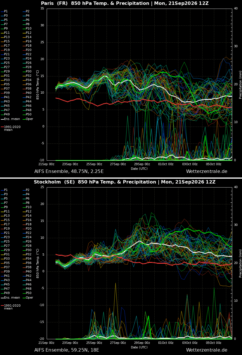
The data indicates that the ridge will not dissipate quickly. Instead, it is likely to reorient itself over Northern Europe, which effectively extends the duration of the heatwave. Meteograms for cities like Paris and Stockholm reflect this, showing a long-lived, elevated temperature curve that stays consistently above the 30-year climate average well into the first week of October.
Conclusion: A Changing Climate Pattern?
While individual weather events cannot be solely attributed to climate change, the increasing frequency and intensity of "blocking" events—where the jet stream slows down and traps weather systems in place—is a subject of intense scientific study. This late-season heat dome serves as a poignant reminder of how atmospheric patterns are shifting, bringing extreme conditions to regions and seasons where they were once considered rare.
As we move deeper into the final quarter of the year, the stability of this ridge will be the primary factor in determining how long this "summer" lasts. Authorities across the affected regions are advised to monitor local meteorological updates, as the combination of high heat and potential moisture-driven instability in the north could lead to a volatile weather mix. For now, the continent must prepare for an October that feels, at least for the first week, very much like the height of August.
Data sources for this report include analysis from the ECMWF and GFS models, with visualization support from PivotalWeather and WXcharts. Readers are encouraged to keep a close watch on regional government health alerts regarding the ongoing thermal surge.