As we transition into the latter half of 2026, meteorologists are closely monitoring the rapid intensification of a climate phenomenon that promises to be the definitive driver of global weather for the upcoming winter: the "Super El Niño." With ocean temperature anomalies in the tropical Pacific already shattering historical records, the scientific community is preparing for a winter season characterized by significant, often dramatic, shifts in snowfall distribution across the United States, Canada, and Europe.
Main Facts: The Return of the Super El Niño
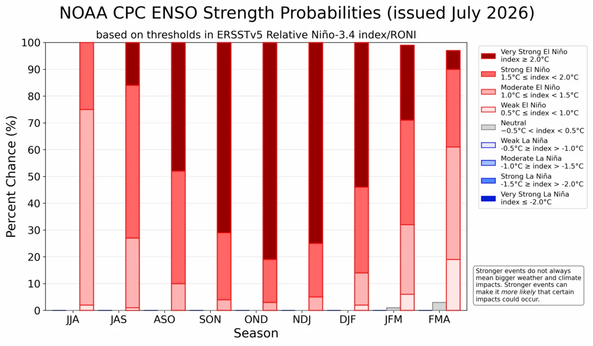
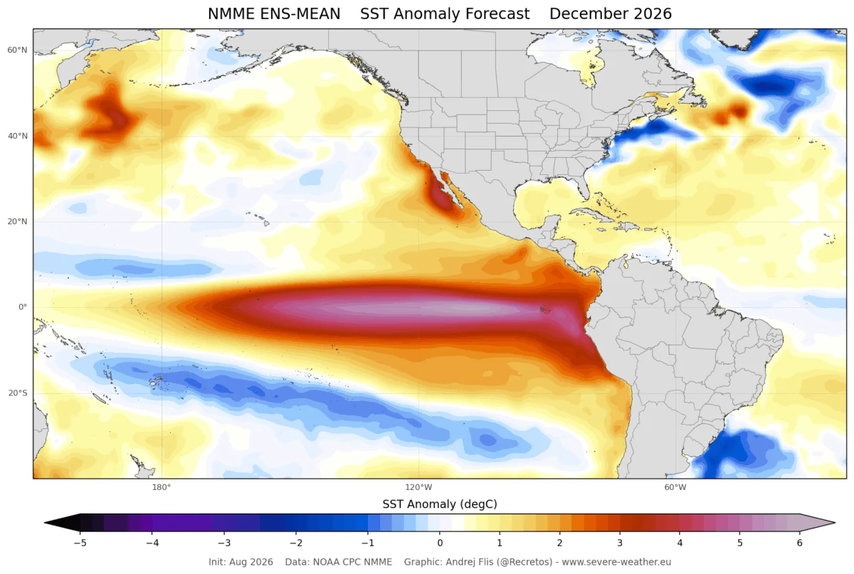
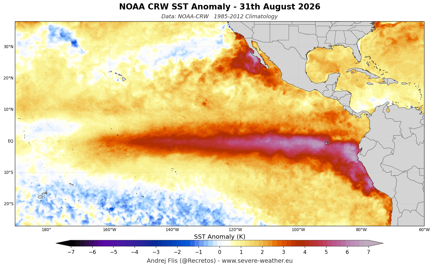
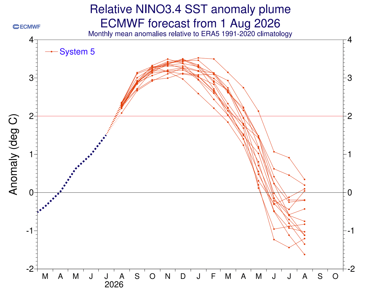
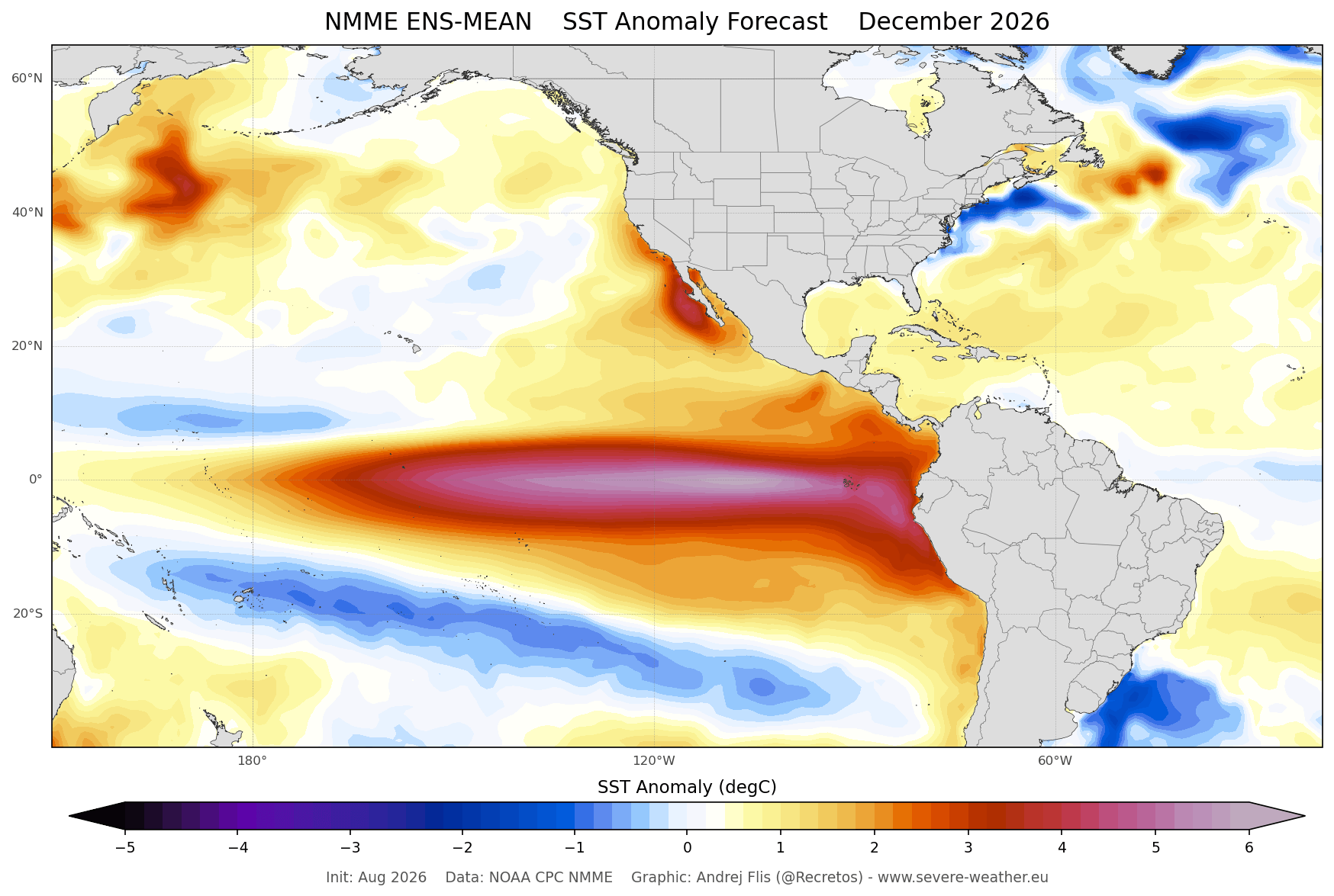
A "Super El Niño" is not merely a standard oscillation of the Pacific; it represents an extreme state of the ocean-atmosphere feedback system. To qualify as such, sea surface temperature anomalies in the central and eastern Pacific must sustain values exceeding +2°C. Current data from NOAA’s Coral Reef Watch (CRW) confirms that we have already surpassed this threshold, with some eastern regions recording anomalies as high as +6°C (10.8°F).
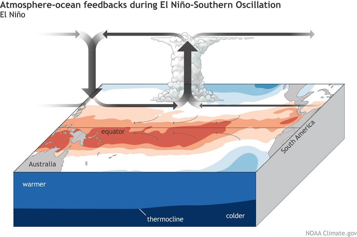
This massive release of energy into the atmosphere is fundamentally reshaping the Walker Circulation—the loop of rising and sinking air that dictates global weather. As the Pacific warms, the jet stream—a high-altitude "river" of air that guides storm systems—is being forced into a new, more meridional configuration. This change in the jet stream’s trajectory is the primary mechanism by which a tropical ocean event dictates whether a suburb in Ohio or a resort in the Alps experiences a record-breaking blizzard or a dismal, green Christmas.
Chronology: From Subsurface Wave to Global Impact
The story of the Winter 2026/2027 season began months ago deep beneath the ocean surface.
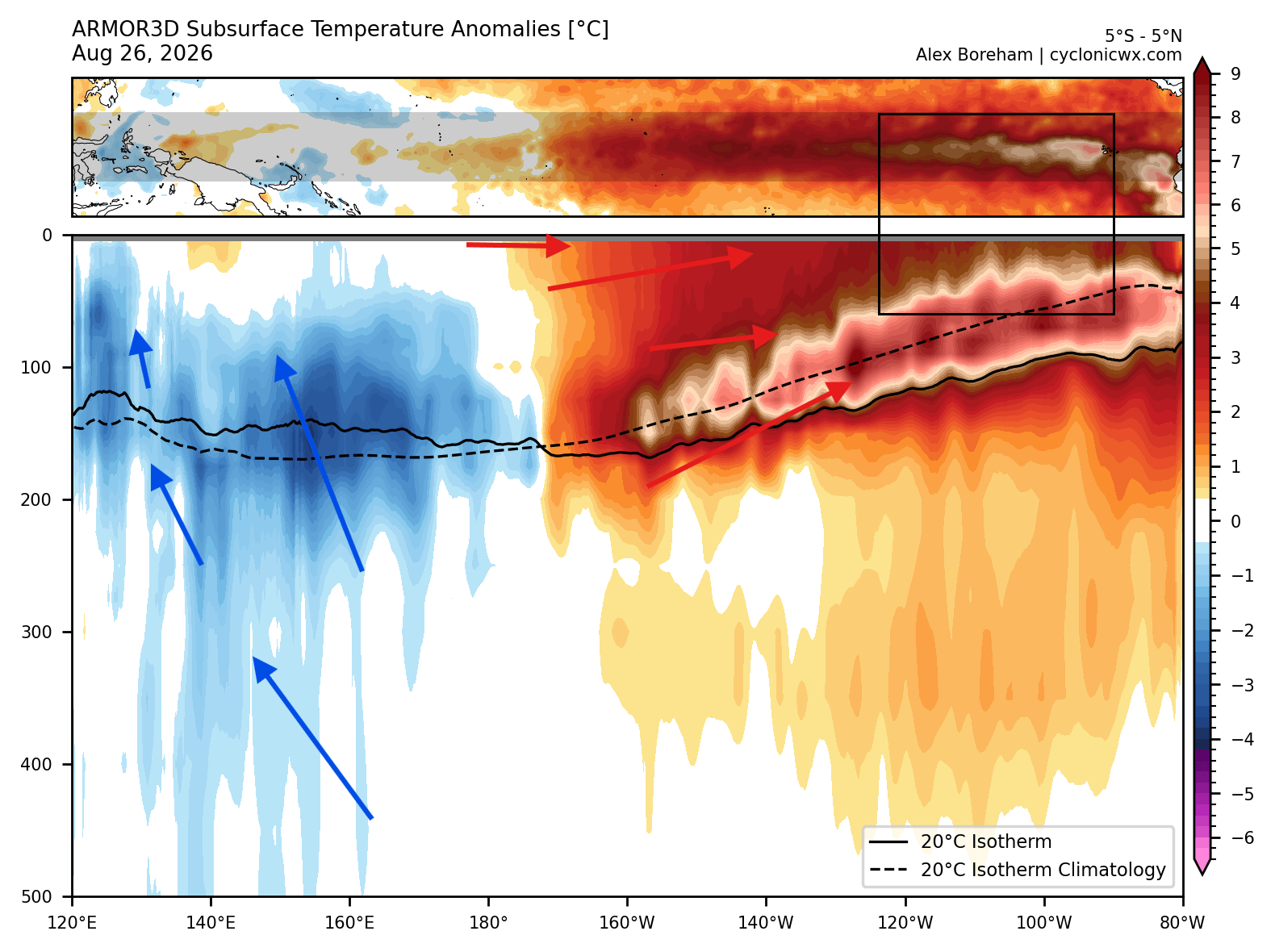
- Mid-2026: Strong westerly wind bursts in the tropical Pacific initiated a massive "downwelling Kelvin Wave." This wave pushed warm, subsurface water eastward, causing the thermocline—the transition layer between warm surface water and cold deep water—to tilt dramatically.
- Late Summer 2026: The Kelvin Wave reached the eastern Pacific, surfacing and fueling the rapid spike in sea surface temperatures. This development cemented the status of the current event as a "Super" grade, exceeding the intensity of most events observed in the last several decades.
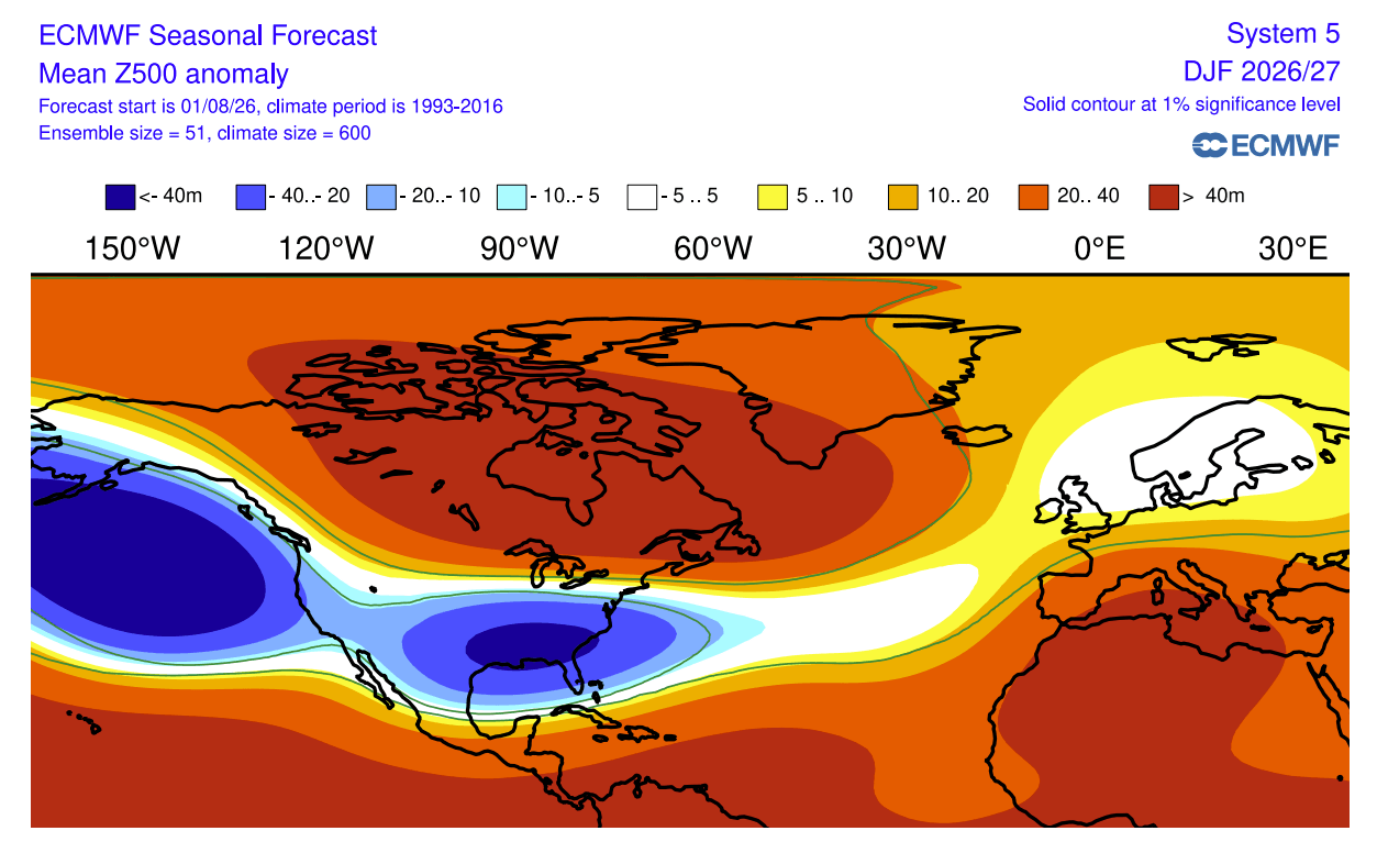
- Autumn 2026: As the event peaks, the atmospheric response is now fully engaged. Long-range seasonal models from the ECMWF (European Centre for Medium-Range Weather Forecasts) and the UKMO (United Kingdom Met Office) have begun to converge on a consistent picture: a strengthening of the subtropical jet stream and the creation of persistent high-pressure blocks in the north.
- Winter 2026/2027: The forecast suggests this pattern will hold through at least February, dictating a split-flow dynamic that will bring moisture to the southern U.S. while largely starving the northern regions of typical winter precipitation.
Supporting Data: Model Consensus and Historical Analogs
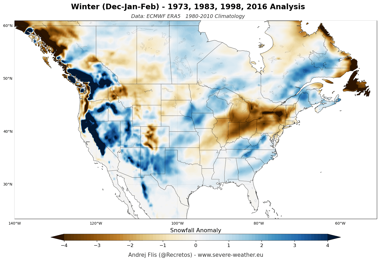
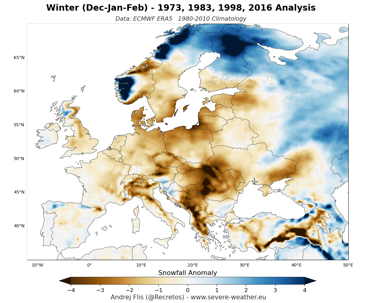
To project snowfall, researchers rely on a combination of historical reanalysis (using ERA5 data from past Super El Niño events) and contemporary ensemble forecasting.
The United States and Canada: A Tale of Two Tracks
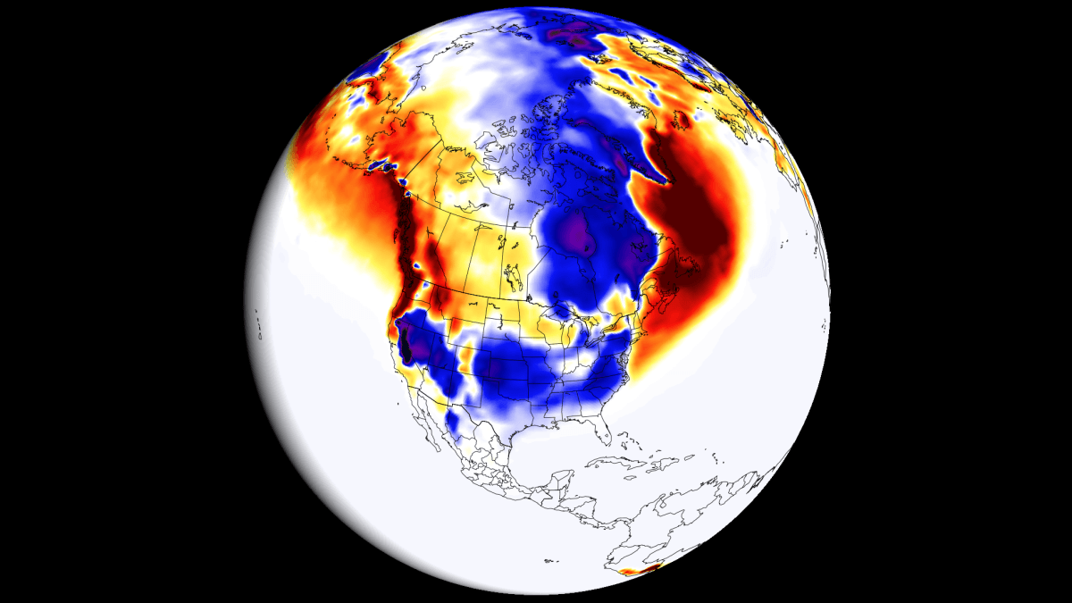
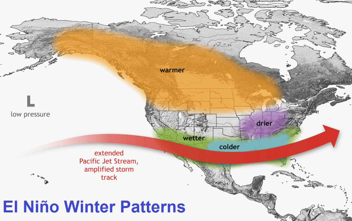
The model data for North America is striking. Both the ECMWF and UKMO models indicate a clear southward shift in the storm track. Because the Pacific jet stream is significantly amplified, it will act as a conveyor belt for moisture, funneling storms into the southwestern and southern United States.
- Above-Normal Snow Potential: The Sierra Nevada, Utah, and the Central to Southern Rockies are currently projected to see significant snowfall. Similarly, the southern Plains, the Ohio Valley, and the Mid-Atlantic regions are expected to benefit from this active southern track, particularly in the January and February periods.
- The Northern Deficit: Conversely, the northern United States and southern Canada face a high-pressure "blocking" scenario. This ridge of high pressure will effectively repel typical winter storm tracks, leading to below-normal snowfall in the Pacific Northwest, the northern Plains, and the Great Lakes.
Europe: The Atlantic Mildness
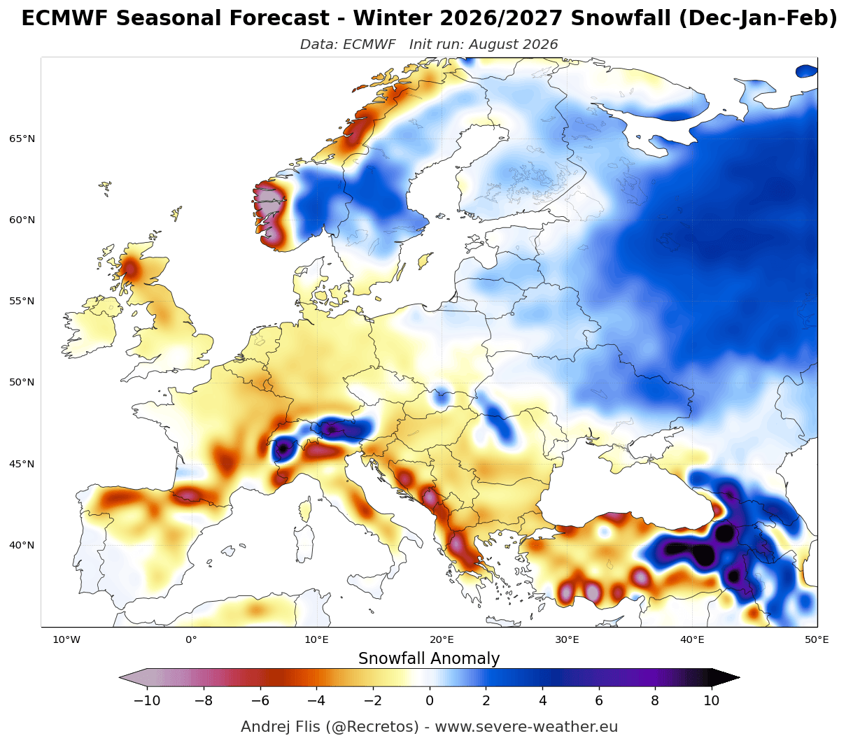
For Europe, the outlook is more uniform. Both major long-range models suggest a winter defined by a mild, westerly Atlantic flow. The configuration of a low-pressure zone over the North Atlantic and a strengthening high-pressure ridge to the south is a classic signal for warmer-than-average temperatures.
For the European lowlands, this implies widespread snowfall deficits. However, elevation remains the "great equalizer." Areas above 1,800–2,000 meters in the Alps may still receive sufficient snow due to high-altitude cold, but mid-to-low elevation resorts and cities are likely to face a challenging season with frequent rain-on-snow events and limited ground cover.
Official Perspectives and Meteorological Implications
Meteorological agencies emphasize that while these long-range seasonal models are more accurate than ever, they provide a "probabilistic" view rather than a day-by-day calendar.
The "Anomaly" Explained
It is crucial for the public to understand that "below-normal" does not equate to a total absence of snow. In meteorological terms, if a region typically receives 100 inches of snow, a forecast for "below-normal" might still result in 70 or 80 inches. The primary implication for infrastructure, municipal planning, and the tourism industry is a shift in the frequency and intensity of storm events rather than a complete climate shift.
Implications for Risk Management
- Energy Consumption: The predicted milder winter in the northern U.S. and Europe may lead to lower heating demands, while the active southern U.S. storm track may increase the demand for power grid stability to handle winter storms in regions less accustomed to frequent heavy snowfall.
- Water Resources: For the American West, the projected snowfall in the Rockies is vital. A strong El Niño year can be a "make or break" scenario for the hydrological year, as the snowpack serves as the primary reservoir for the following summer.
- Agriculture: The shift in moisture patterns will impact soil moisture levels in the Midwest and the Plains, potentially influencing early-season planting conditions for the 2027 cycle.
Conclusion: Preparing for the 2026/2027 Winter
As we look toward the months ahead, the 2026/2027 season stands as a stark reminder of the planet’s connectivity. The "Super El Niño" in the Pacific is not just a distant oceanic curiosity; it is a global atmospheric conductor.
The consensus between the ECMWF and UKMO models provides a high-confidence roadmap for the coming months: a wetter, stormier southern United States, a mild and often rain-dominated winter for European lowlands, and a persistent blocking pattern in the north. While the specifics of every storm cannot be predicted months in advance, the seasonal trends are now clear. Residents in affected areas—particularly those in the southern U.S. who may face increased winter storm activity and those in Europe planning for mountain recreation—should adjust their expectations accordingly.
As we move into the peak of this event, continuous monitoring of the polar vortex and the North Atlantic Oscillation (NAO) will be essential, as these secondary factors will determine the final "flavor" of the winter. For now, the global forecast remains anchored in the overwhelming influence of the Pacific: a season where the traditional maps of snow are being redrawn by the currents of the deep.