Executive Summary: A Dramatic Shift in Atmospheric Conditions
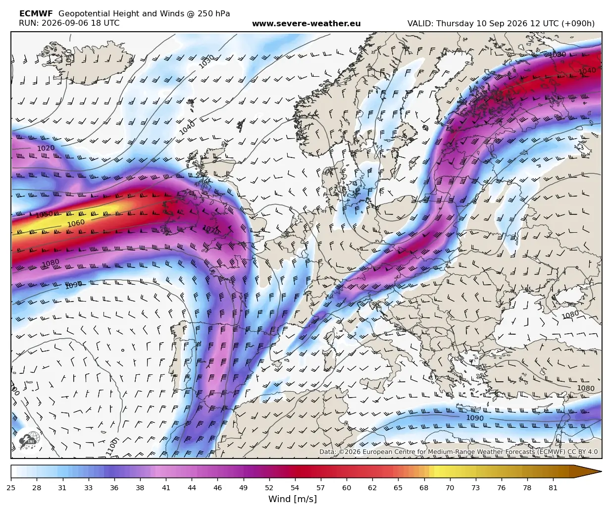
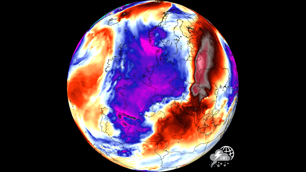
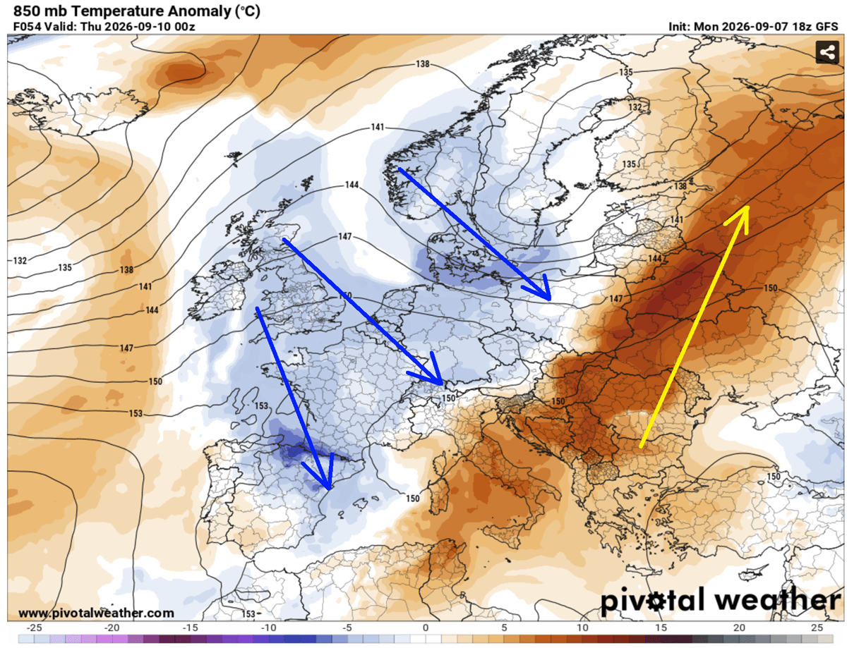
Europe is currently undergoing a radical meteorological transition, marking the definitive end of the persistent "Heat Dome" that has characterized the first half of September 2026. A powerful, high-amplitude upper-level trough, currently originating from the North Atlantic, is driving a vigorous cold front deep into Western and Central Europe. This collision between an entrenched, record-breaking warm air mass and a rapidly encroaching polar-origin surge is triggering a significant severe weather outbreak.
The atmospheric setup is precarious. As the cold front advances, it interacts with extreme levels of moisture sourced from a historic marine heatwave in the Mediterranean. This combination of high-energy instability and strong vertical wind shear has placed regions from the Alps to the Western Balkans under high alert for extreme convective activity, including giant hail, damaging wind gusts, and the risk of localized tornadic events. By the weekend, the continent will experience a "thermal collapse," with temperatures plummeting by 15°C to 20°C in less than 24 hours.
Chronology: The Evolution of the "Summer-Killer" Pattern
Tuesday: The Pre-Frontal Calm Before the Storm
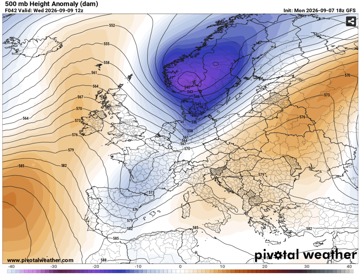
The transition began as the long-standing ridge—the anchor of the September heatwave—began to buckle under the weight of intense upper-level forcing from the west. As the deep low over Scandinavia pushed its influence toward the Azores, the atmospheric "lid" that held the heat in place began to fracture. Tuesday served as the final day of oppressive, static heat for much of Central Europe, with temperatures hovering near 35°C–40°C in many regions.
Wednesday: The Onset of Violence
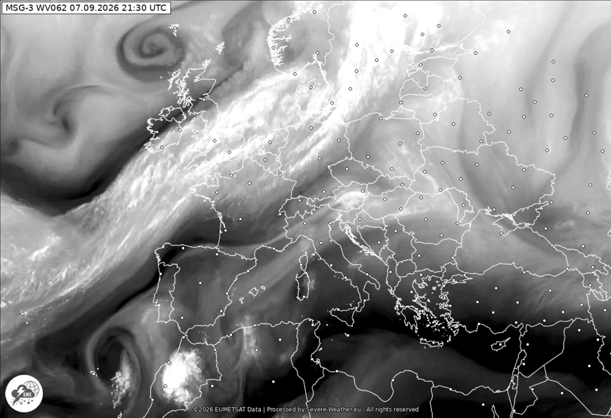
By Wednesday, the frontal boundary began its aggressive push into Eastern France, the Balearic Islands, and Switzerland. As the trough deepened, the contrast between the air masses reached a critical threshold. Meteorological models indicated that the boundary would trigger explosive convective development by midday. Northern Italy, the North Adriatic, and the Austrian Alps became the primary focal points for severe multicell and supercell thunderstorms.
Thursday: Deepening Instability and Flash Flood Risks
As the system moves into Thursday, the development of a secondary low over the northern Mediterranean is expected to slow the frontal progression, causing it to intensify. This "stalling" effect is particularly dangerous, as it allows for persistent, heavy precipitation—or "training cells"—to dump 150–200 mm of rain in localized areas, particularly across the coastal regions of the Adriatic, Ligurian Bay, and Tuscany. The severe weather risk will extend into Slovenia and Croatia, with the cold air mass finally beginning to make its presence felt in the lower altitudes.
Supporting Data: The Physics of the Collapse
Synoptic Setup and the "Summer-Killer" Mechanism
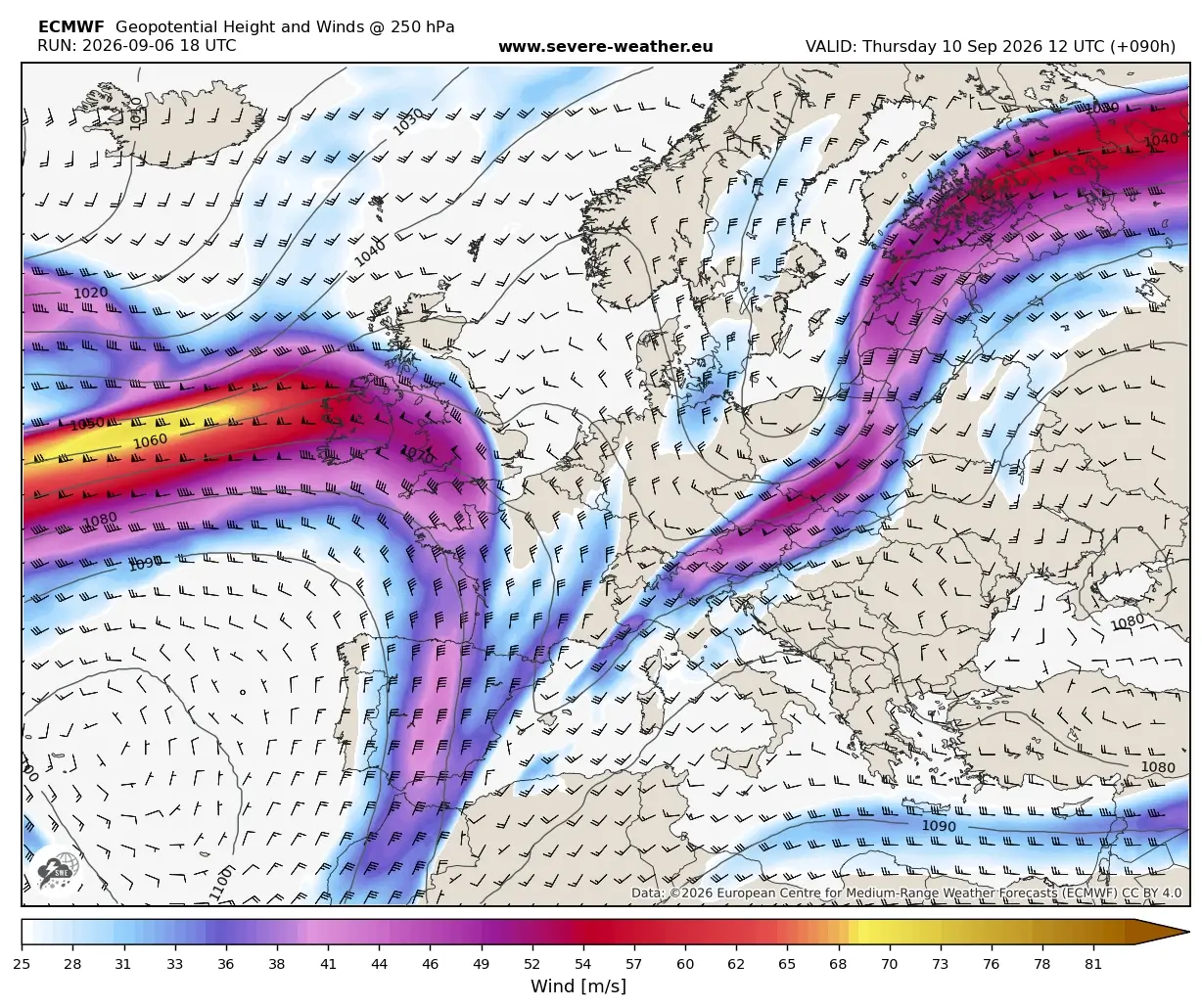
In meteorology, a "summer-killer" pattern is defined by the permanent displacement of a hot air mass by a significantly colder, polar-originated system. This specific event is driven by a massive upper-level wave that effectively "flushes" the heat eastward into Western Russia.
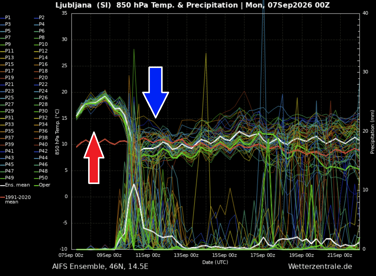
Meteogram data for cities such as Ljubljana, Slovenia, illustrates the sheer violence of this shift. At 850 mbar levels, temperatures were recorded at 10°C above the long-term seasonal average early in the week. Projections show a vertical thermal drop of roughly 15°C within a 24-hour window. This is not merely a seasonal cooling; it is a total structural realignment of the European atmosphere.
CAPE and Moisture Loading
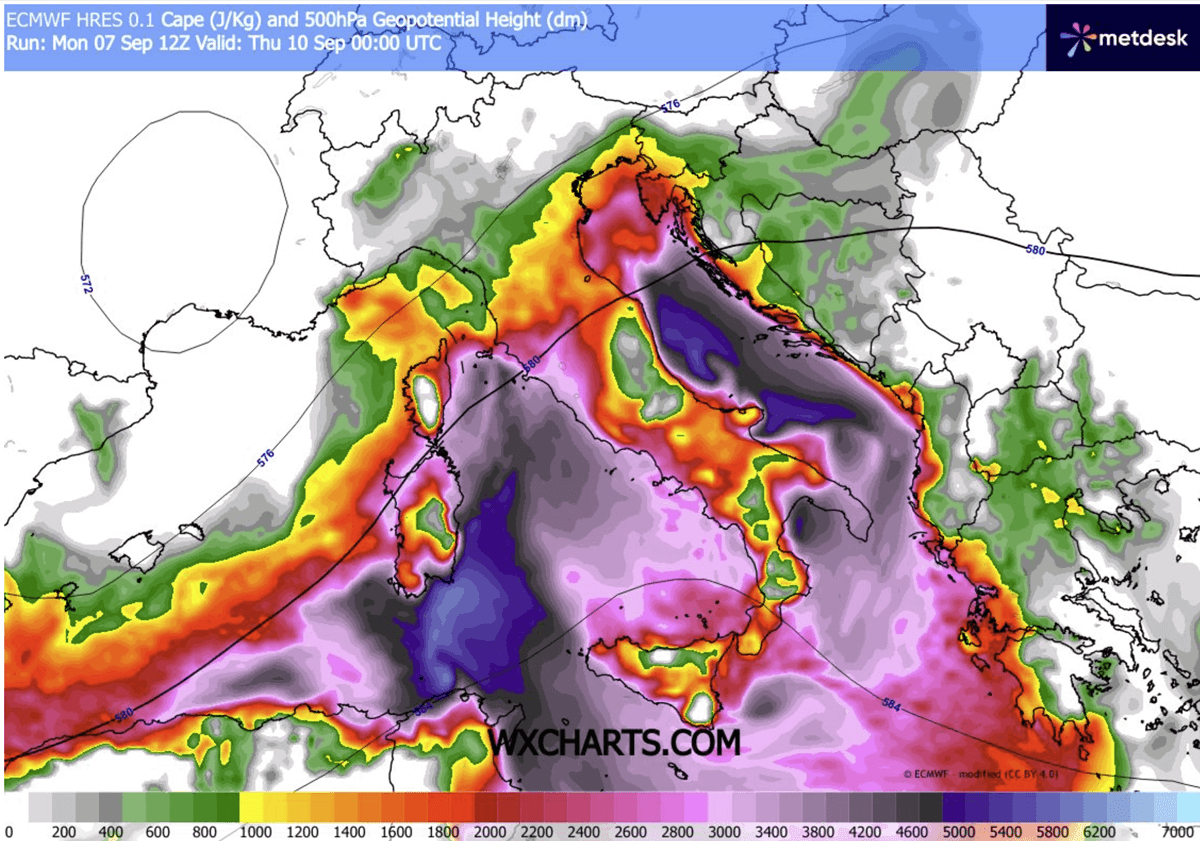
The severity of the forecasted storms is directly tied to the state of the Mediterranean Sea. Recent marine heatwaves have elevated surface temperatures to near-record levels, significantly increasing the dewpoint and total precipitable water available in the lower atmosphere. Convective Available Potential Energy (CAPE) values have been modeled to reach 3000–4000 J/kg in parts of the Northern Mediterranean. When these energy levels are intersected by the high-velocity jet stream winds generated by the advancing cold front, the resulting thunderstorms possess the structural potential to produce giant hail and destructive microbursts.
Implications for the Continent
1. Agricultural and Infrastructure Risks
The primary immediate concern is the risk of widespread flooding. With the soil hardened by weeks of intense, drought-like heat, the sudden influx of 150–200 mm of rain over a short period will lead to immediate runoff. Flash flooding is a high probability for urban areas with limited drainage and mountainous regions prone to landslides. Furthermore, the agricultural sector faces significant damage from giant hail, which can decimate vineyards and orchards in the Alpine and Balkan foothills.
2. The Return of Alpine Snow
One of the most striking indicators of the impending autumn season is the forecast for the Alps. As the polar air mass moves in behind the front, the freezing level will plummet. For the first time this season, high-mountain passes and elevated regions above 2,000 meters are expected to receive significant snowfall. This rapid transition from summer heat to mountain winter conditions will create hazardous travel conditions and necessitates a quick shift in logistics for mountain-based industries and tourism.
3. A Long-Term Pattern Shift
Meteorologists suggest that this event is a definitive marker for the remainder of September. The collapse of the heat dome does not appear to be a temporary fluctuation; rather, it suggests a more dynamic, active pattern characterized by frequent troughs and cooler, more unstable conditions. The "summer-killer" effect serves as the gateway to a more standard, albeit stormy, autumn progression.
Official Outlook and Preparedness
National meteorological services across the affected countries have issued urgent warnings. Residents in Northern Italy, Slovenia, and Croatia are advised to secure loose outdoor property and prepare for power outages resulting from severe wind gusts. Given the "training-cell" nature of the forecasted rainfall, emergency management agencies are emphasizing the risk of rapid river rises in coastal areas.
While the rain is desperately needed in areas that have suffered from the prolonged drought, the intensity at which it is arriving poses a secondary hazard. Citizens are encouraged to monitor local weather radars and follow official directives, as the speed of this transition can result in rapidly deteriorating road and infrastructure conditions.
Conclusion: A New Season Dawns
The events of this mid-week period represent a stark reminder of the volatility inherent in our current climate. The transition from the oppressive, record-breaking heat of early September to the biting, crisp air of the polar-originated front is a testament to the sheer scale of the atmospheric forces at play.
As the deep upper-level trough clears out the heat and the severe storms move into the Western Balkans, Europe stands on the precipice of a new, cooler chapter. While the immediate threat remains the severe weather and flooding, the long-term outlook provides a much-needed period of refreshment for the continent’s ecosystems, even if the arrival of that relief is as violent as it is necessary. We will continue to track the movement of the cold front and provide ongoing updates as the system progresses toward its eventual dissipation over Eastern Europe.
Data provided in part by PivotalWeather and WXcharts.