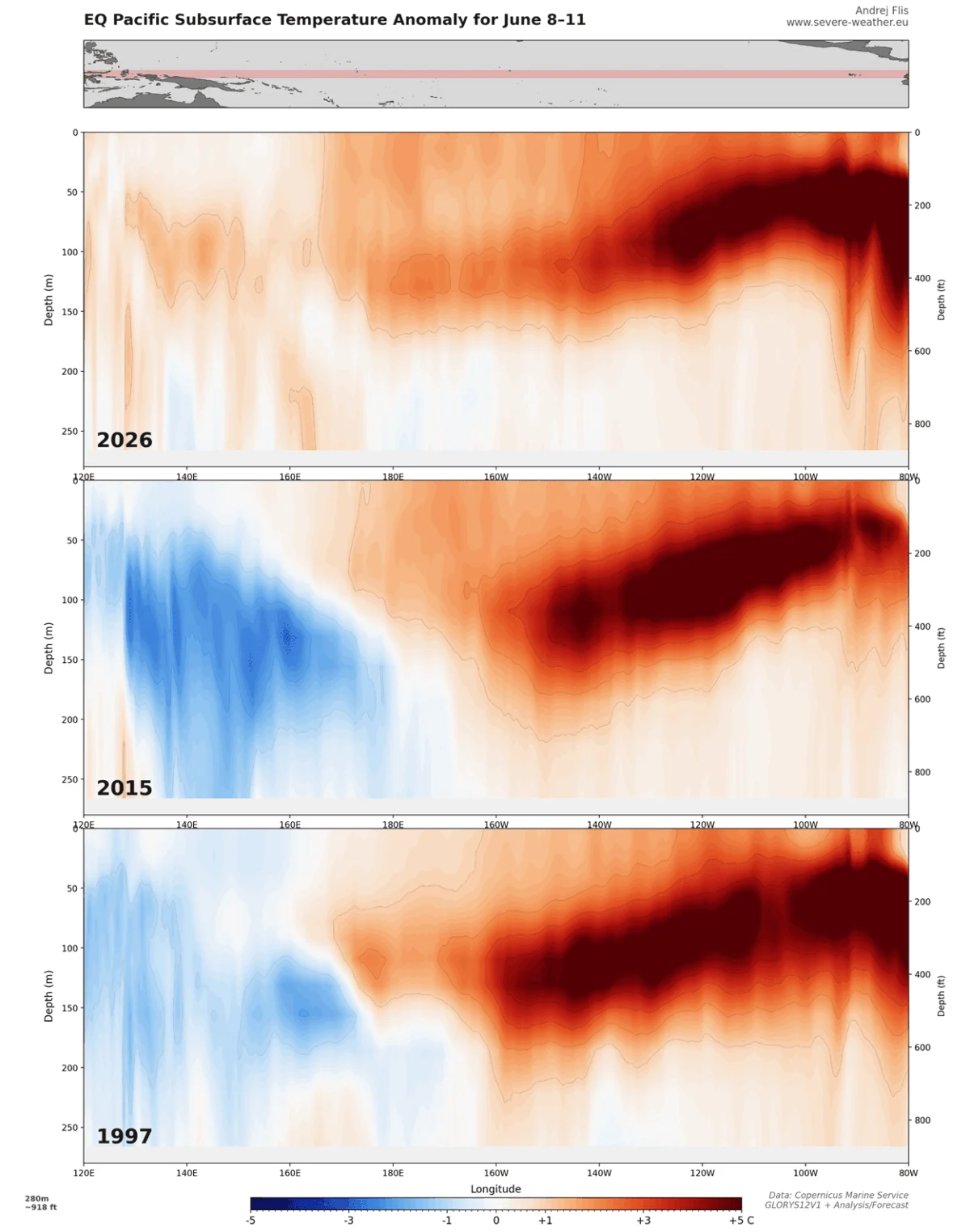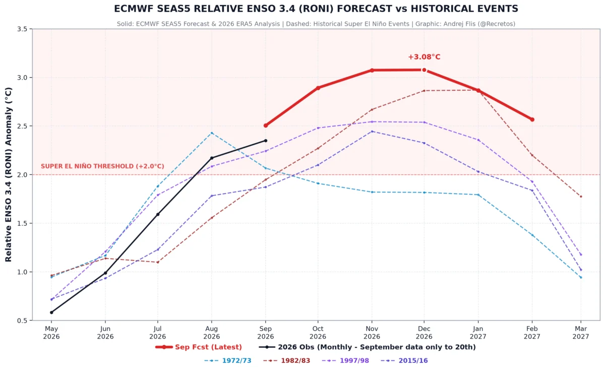
As we transition into the heart of the autumn season, meteorologists and climate modelers have reached a rare consensus regarding the upcoming winter. Data from six primary seasonal climate models—including the highly regarded ECMWF—now present a unified picture for Winter 2026/2027. The driving force behind this year’s forecast is a powerful "Super El Niño" event currently unfolding in the tropical Pacific, which is set to dictate weather patterns across the Northern Hemisphere well into the spring of 2027.
For residents across North America and Europe, this means a significant redistribution of snowfall. The forecast signals a winter characterized by a slow start, with the most intense snowfall expected to arrive in the second half of the season.
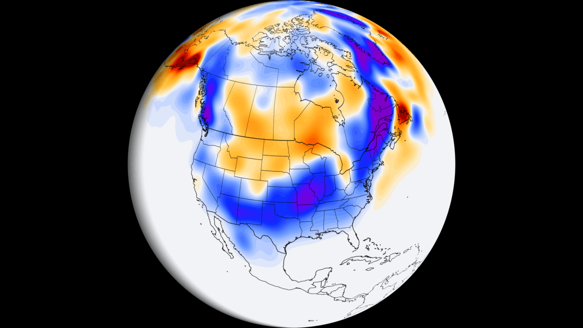
Main Facts: The Super El Niño Signature
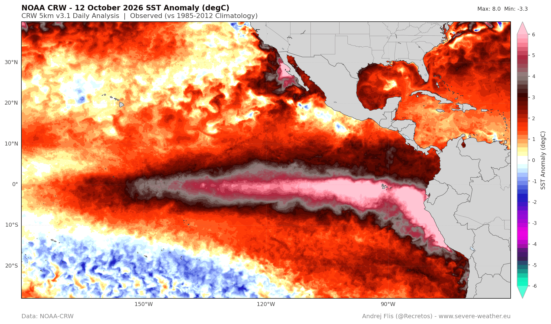
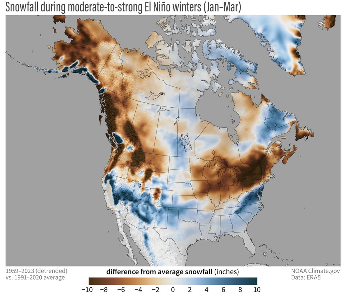
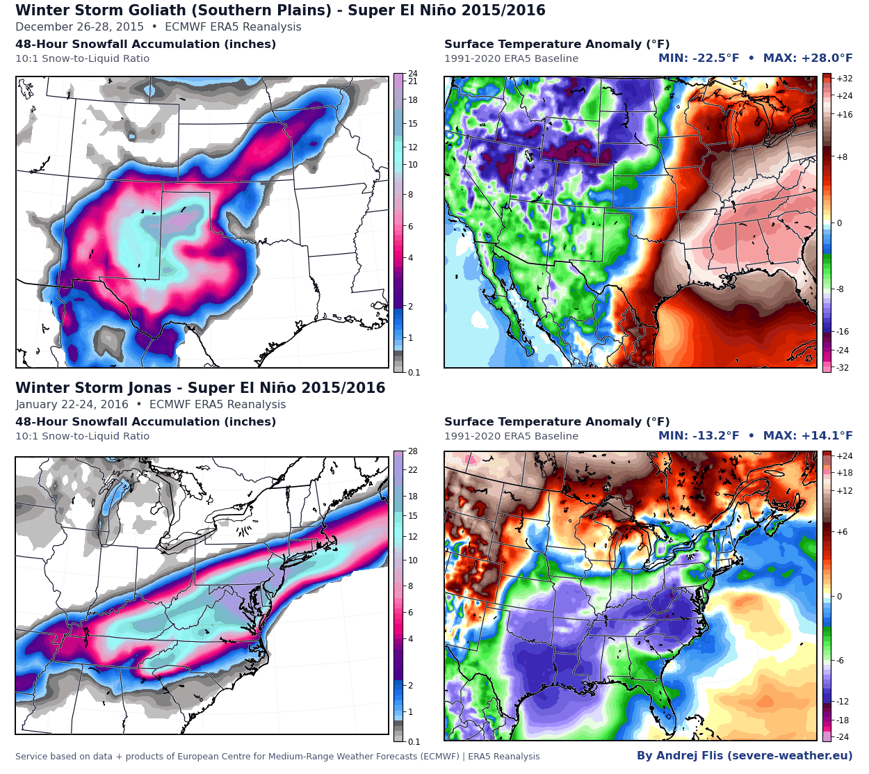
The defining feature of the 2026/2027 winter is the intense warming of the tropical Pacific Ocean. NOAA Climate Prediction Center data indicates anomalies reaching over 7°C above the seasonal norm. Historically, a Super El Niño creates a persistent, extended Pacific jet stream that alters the storm tracks across the United States and Canada.
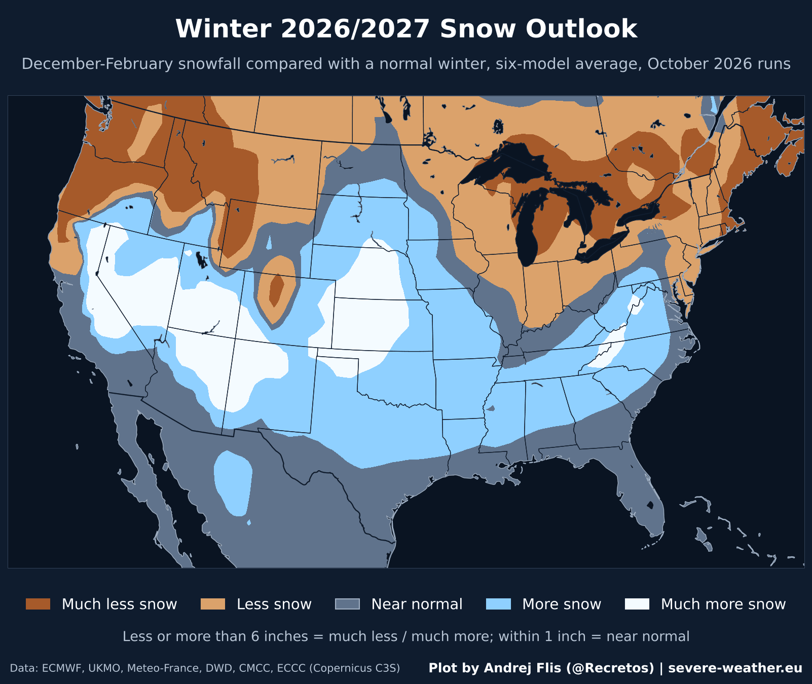
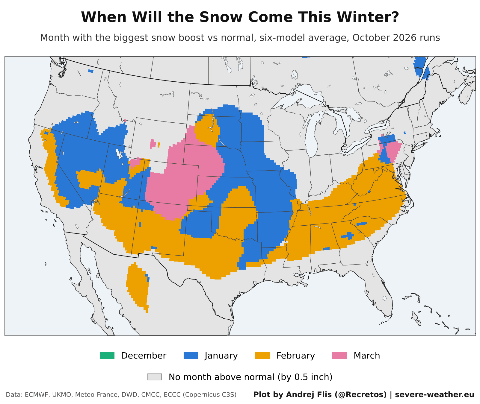
The primary impact is a "north-south split" in snowfall distribution. The southern and central United States, including the Southern Plains, the Ohio Valley, and the Southern Rockies, are currently projected to see above-average snowfall. Conversely, the northern United States, much of southern Canada, and the majority of Europe are facing a potential snow deficit, as high-pressure systems tend to suppress the northern storm tracks that typically bring winter precipitation to those regions.
Chronology: A Season of Two Halves
The models are not only consistent on the where but also on the when. The 2026/2027 winter is forecast to begin with a notably lethargic December. During this period, the atmospheric conditions—driven by the El Niño feedback loop—are expected to keep early-season snow totals below the historical baseline for many regions.
However, the tide is expected to turn in the second half of the winter. As we move into late January and February, the Pacific jet stream is projected to amplify, steering moisture-rich storms into the central and southern United States. This "back-loaded" winter is a classic hallmark of strong El Niño events. For areas in the Southwest, Southern Rockies, and the Central Plains, the peak of the snow season will likely occur in February, with some regions seeing lingering, above-average precipitation extending into March and early spring.
Supporting Data and Regional Breakdown
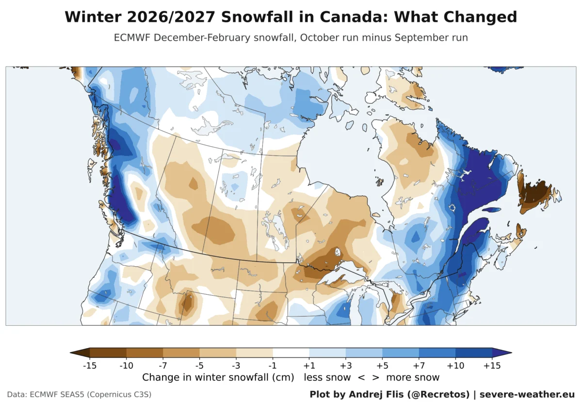
To provide a granular look at these shifts, the October model runs have provided critical updates on snowfall trends compared to the September outlook.
United States: The Shift South
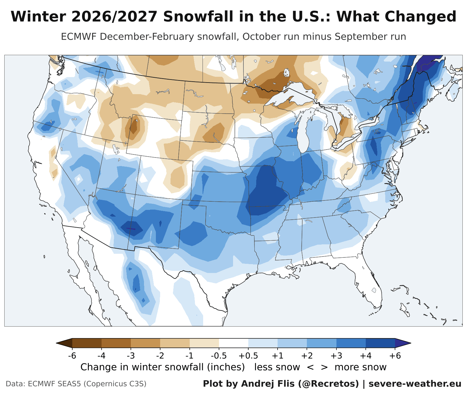
The October ECMWF model run shows a clear increase in snowfall projections for the Southern Plains and Texas, with models estimating an increase of roughly 2.0 inches over previous forecasts. The Ohio Valley and Central Midwest have also seen a boost of 2.7 inches, suggesting a more active storm track through the heart of the country.
While the Northeast has seen a slight increase in projected snowfall compared to the September run, it still remains below the historical average. The Northern Rockies and Pacific Northwest are currently projected to face the most significant deficits, as the primary storm tracks are redirected toward the south.
Canada: A Challenging Season
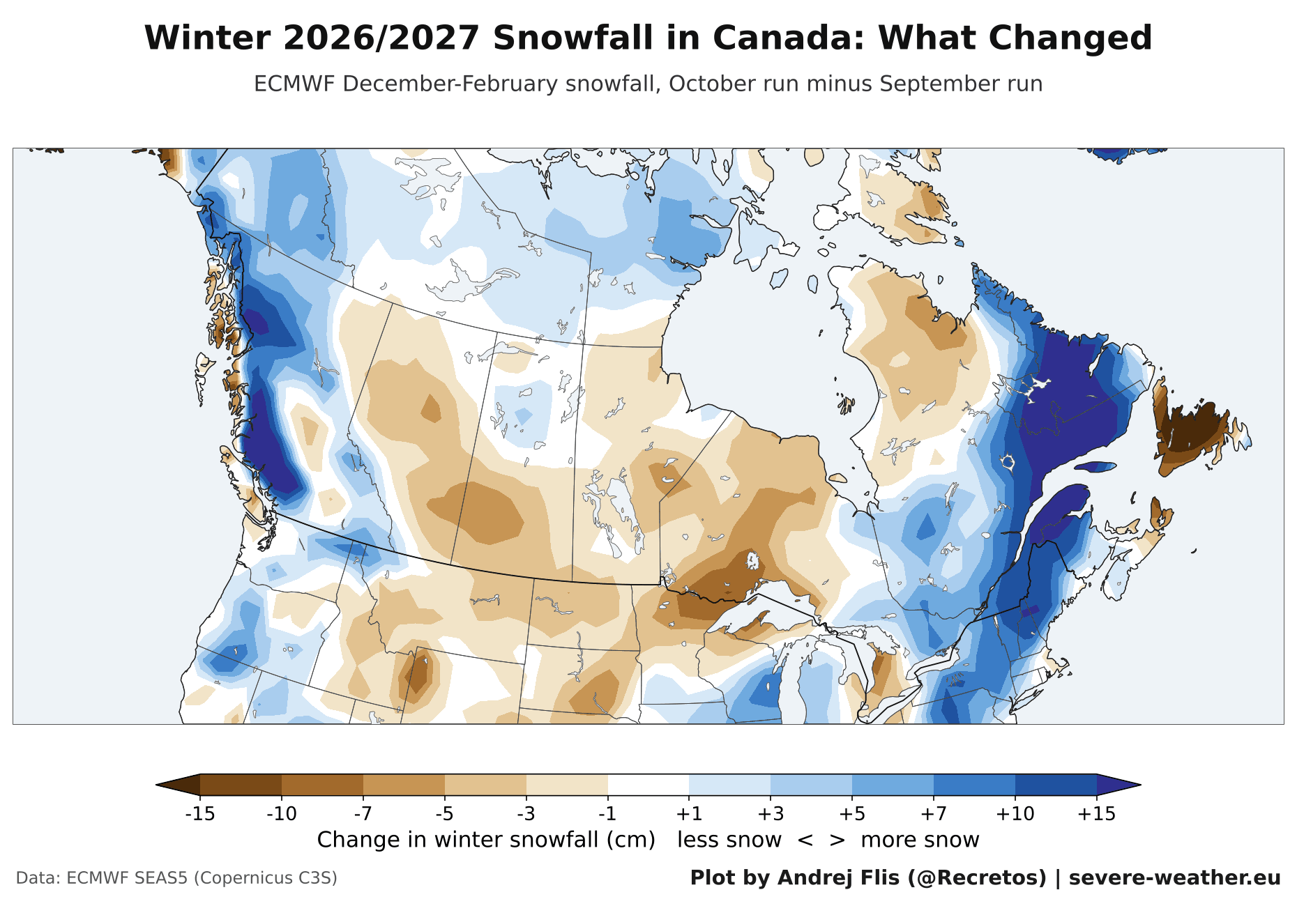
Canada is expected to endure a challenging winter for snow enthusiasts. Every major region, from British Columbia to the Atlantic provinces, is currently trending toward below-normal snowfall. While there were slight adjustments in the October forecast—notably an increase in expected snow for Quebec—the overarching theme for Canada remains one of relative dryness compared to historical averages.
Europe: A Widespread Deficit
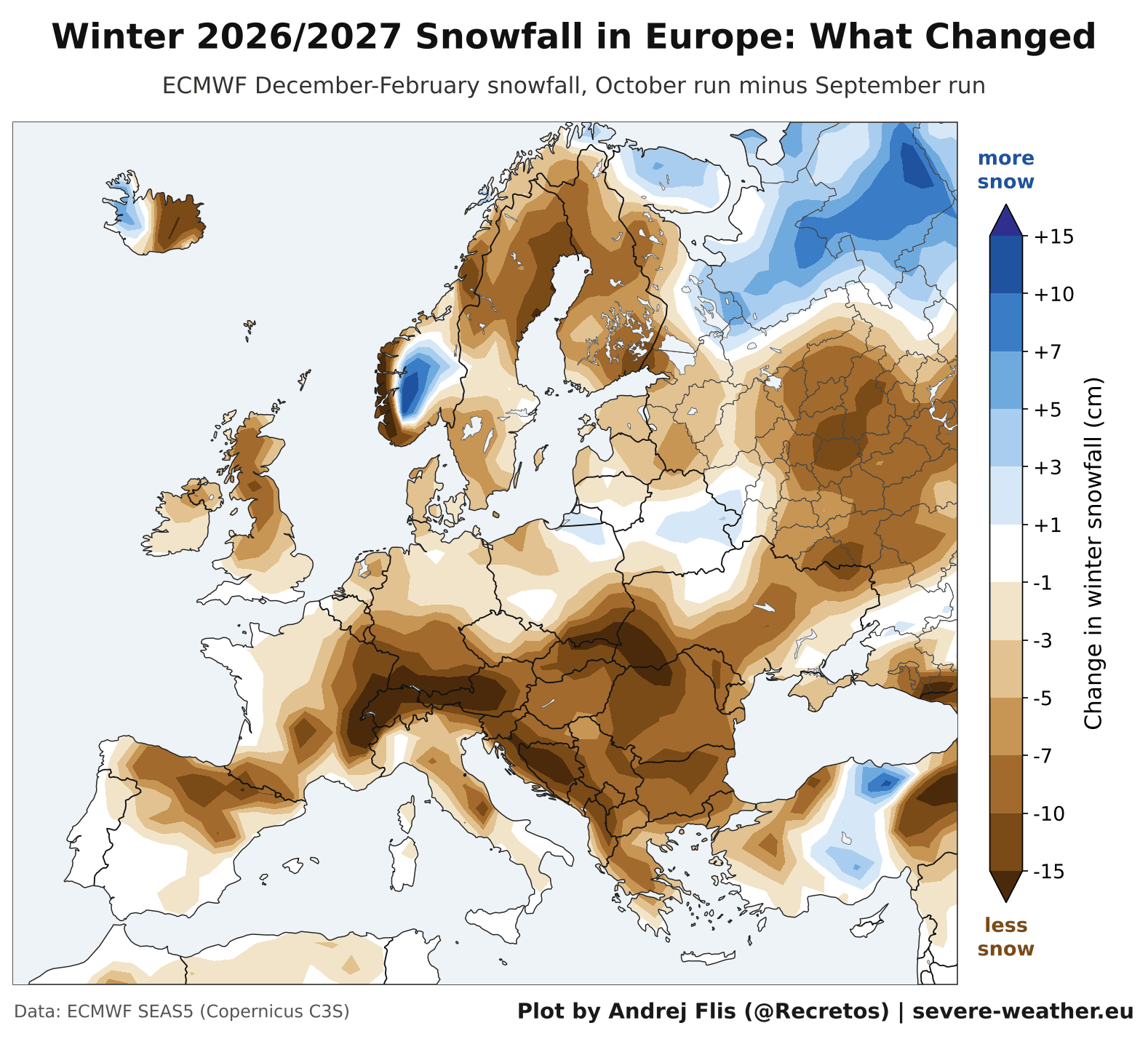
The European outlook is arguably the most uniform. Six seasonal models currently agree that almost the entire continent will experience a weak snow season. The largest deficits are expected across the western coast of Scandinavia, the northern United Kingdom, and the western Balkans. Similar to North America, any potential for above-average snow in Europe is relegated to the far northeast and specific high-altitude zones in the second half of the season, specifically in February and March.
Implications for Ski Resorts and Winter Tourism
The redistribution of snow has significant implications for the winter tourism industry. The "winners" of the 2026/2027 season are undoubtedly the ski resorts in the southwestern United States. Mammoth Mountain leads the outlook with projections of 31 inches above normal, while Lake Tahoe, the San Juan Mountains in Colorado, and the Wasatch Range in Utah are all positioned for a banner year.
Conversely, resorts in the Pacific Northwest and the Northern Rockies—such as Jackson Hole and Big Sky—are bracing for a below-normal season. In Canada, the story is more uniform; major hubs like Whistler and Revelstoke face substantial snow deficits, which may impact operating schedules and season lengths.
In Europe, the situation is more complex. While the general outlook is for a below-average season, the Alps remain a point of high uncertainty. Models are split, with some suggesting near-normal totals and others predicting significant deficits, leaving resort operators in a state of cautious monitoring.
Official Responses and Meteorological Context
While the models provide a high-level view of the season, meteorologists emphasize that these are trends, not guarantees. The "Super El Niño" provides the steering mechanism, but localized conditions—such as the state of the Polar Vortex—remain wildcards.
A major disruption of the Polar Vortex, which can occur later in the winter, has the potential to break the current "stagnant" pattern. If a sudden stratospheric warming event occurs, it could force frigid, arctic air southward, potentially overriding the El Niño-driven jet stream and bringing unexpected, intense snow events to regions currently forecast to be dry.
Furthermore, temperature remains the final arbiter of snowfall. Even if a moisture-rich storm moves across the southern United States, the region requires sufficiently cold air to convert that moisture into snow rather than rain. As with all seasonal outlooks, these models are designed to indicate the probability of climate anomalies, and they will be updated monthly as the winter progresses to account for real-time atmospheric shifts.
Conclusion
The winter of 2026/2027 is shaping up to be a textbook example of how a massive, ocean-driven event like a Super El Niño can fundamentally rearrange the weather patterns of the Northern Hemisphere. For the residents of the southern and central United States, the outlook promises a winter of increased activity and potential for significant snowfall. For the northern regions and much of Europe, the winter may be remembered for its lack of traditional snow cover.
As we approach the winter solstice, it is recommended that residents monitor local forecasts closely. While the broad, multi-model consensus provides a strong framework for what to expect, the inherent volatility of the atmosphere means that late-season shifts, particularly those triggered by the Polar Vortex, could still alter the final outcome of the season.
For those looking to track these changes, the upcoming monthly updates to the Snowfall Explorer will provide the most precise, data-driven insights as the season unfolds. Stay tuned to the latest updates to see how the atmosphere navigates the influence of the 2026/2027 Super El Niño.