As the Northern Hemisphere transitions from the warmth of late summer into the cooling trends of autumn, atmospheric scientists are turning their gaze toward the North Pole. Early data for the upcoming 2026/2027 winter season reveals a complex and evolving narrative: a robust, rapidly forming Polar Vortex that, while starting strong, is currently projected to face significant mid-winter volatility. With the emergence of a "Super El Niño" event in the Pacific, the stage is set for a winter that could bring dramatic weather shifts to the United States, Canada, and Europe.
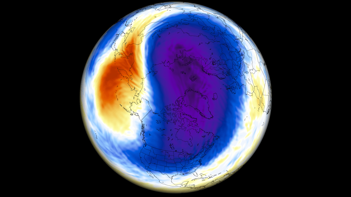
The Polar Vortex: The Engine of Global Winter Circulation
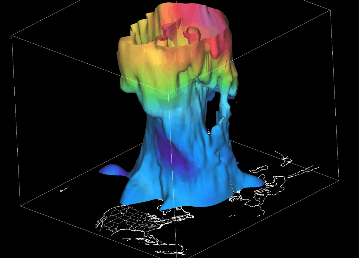
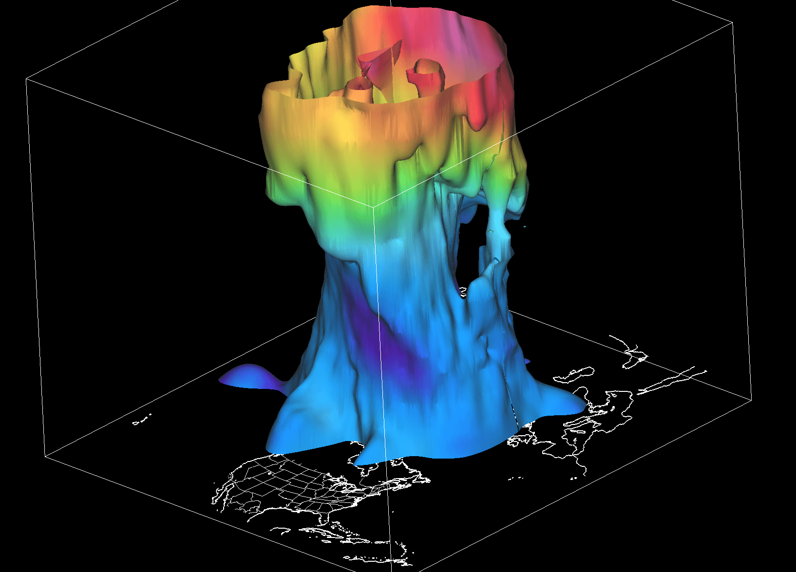
To understand the stakes for the 2026/2027 season, one must first grasp the mechanics of the Polar Vortex. Often misunderstood as a single storm system, the Polar Vortex is actually a vast, semi-permanent, large-scale cyclonic circulation that resides high above the polar regions. It functions as a "spinning wall" of air, extending from the Earth’s surface into the stratosphere, approximately 50 kilometers (30 miles) above the ground.
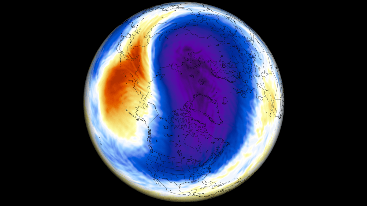
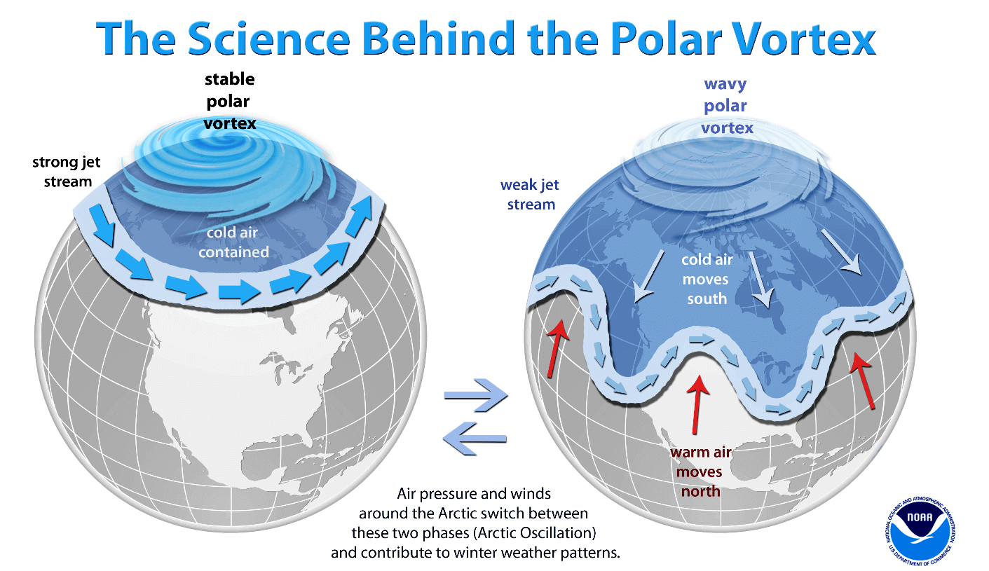
This structure is bifurcated into two distinct layers: the stratosphere and the troposphere. The stratospheric component is typically more symmetrical and stable, acting as a high-altitude containment vessel for frigid Arctic air. In contrast, the tropospheric layer—the one that dictates our daily weather—is inherently more "wobbly." This lower-level instability is driven by interactions with mountainous terrain, massive landmasses, and powerful pressure systems that act as obstacles, causing the vortex to deform and develop "arms" of cold air that extend into lower latitudes.
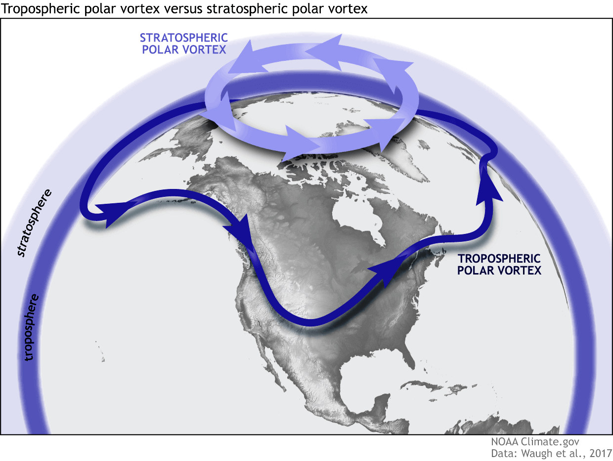
When these "arms" reach toward the mid-latitudes, they are responsible for the severe Arctic outbreaks and winter storms that characterize harsh winters in North America and Europe. The strength of the stratospheric vortex is the key; a strong, tight vortex keeps the cold air locked in the Arctic, while a weakened or disrupted vortex allows that cold air to spill southward.
Chronology of the 2026/2027 Formation
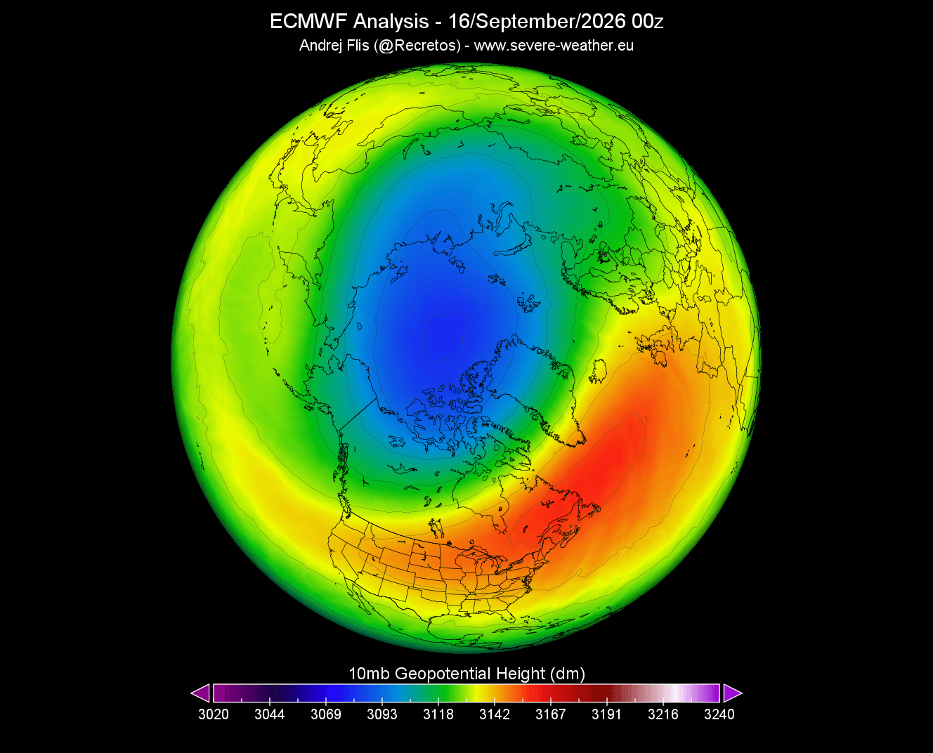
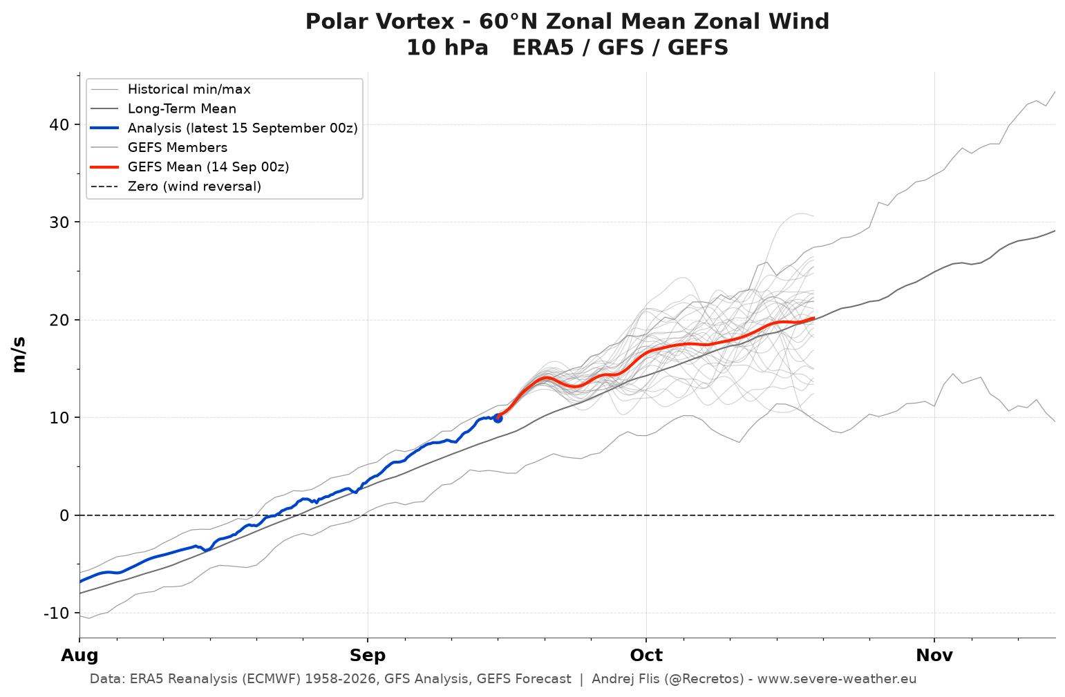
The lifecycle of the Polar Vortex begins in late summer. As sunlight diminishes in the Arctic throughout August, September, and October, the stratospheric temperatures plummet. This rapid cooling creates a stark temperature gradient between the pole and the warmer southern regions, forcing air pressure to drop and initiating the development of the cyclonic vortex.
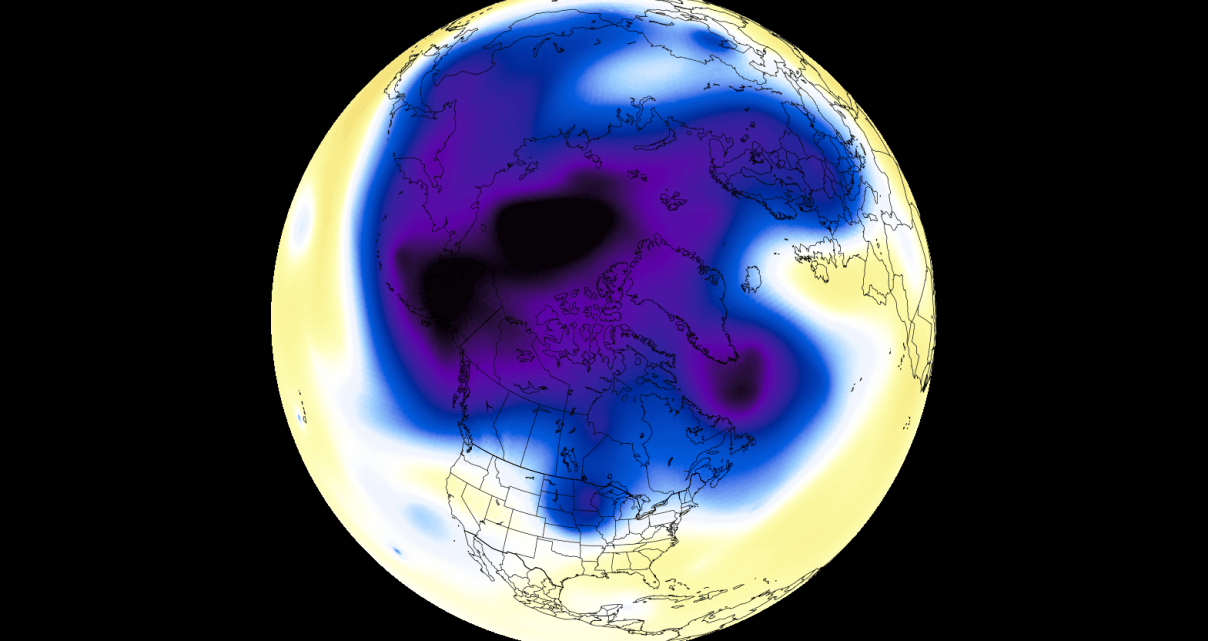
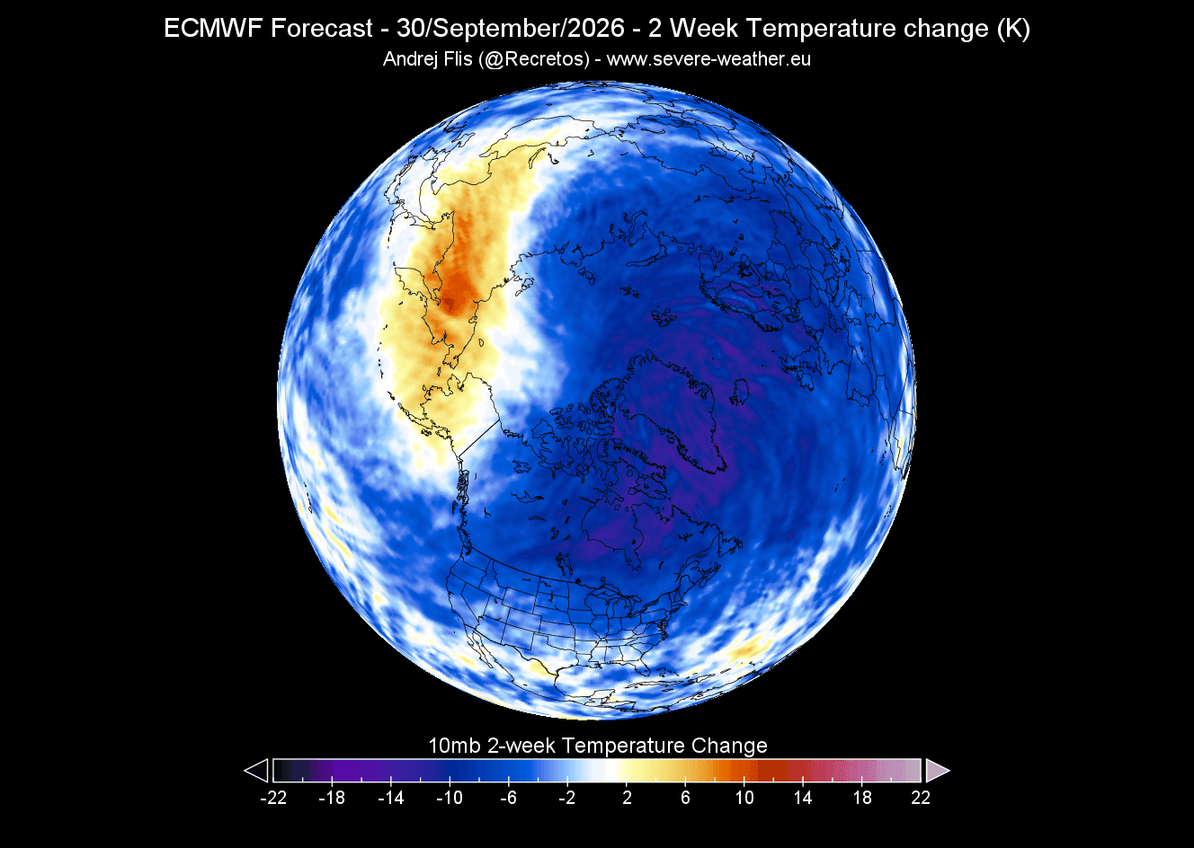
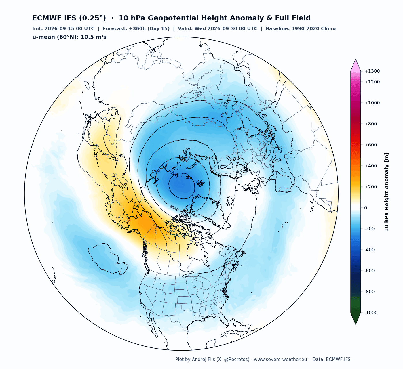
- Late August to September: The current data indicates that the 2026/2027 Polar Vortex is forming with greater intensity than its predecessor. Recent 10mb-level (30km altitude) temperature charts show a defined cold core establishing itself over the polar cap.
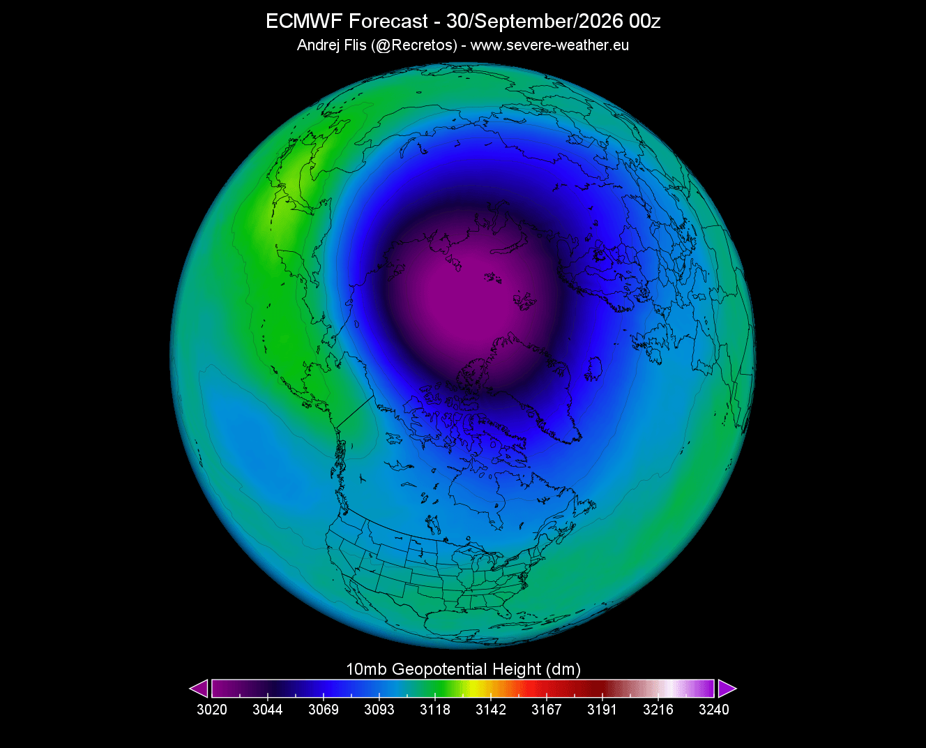
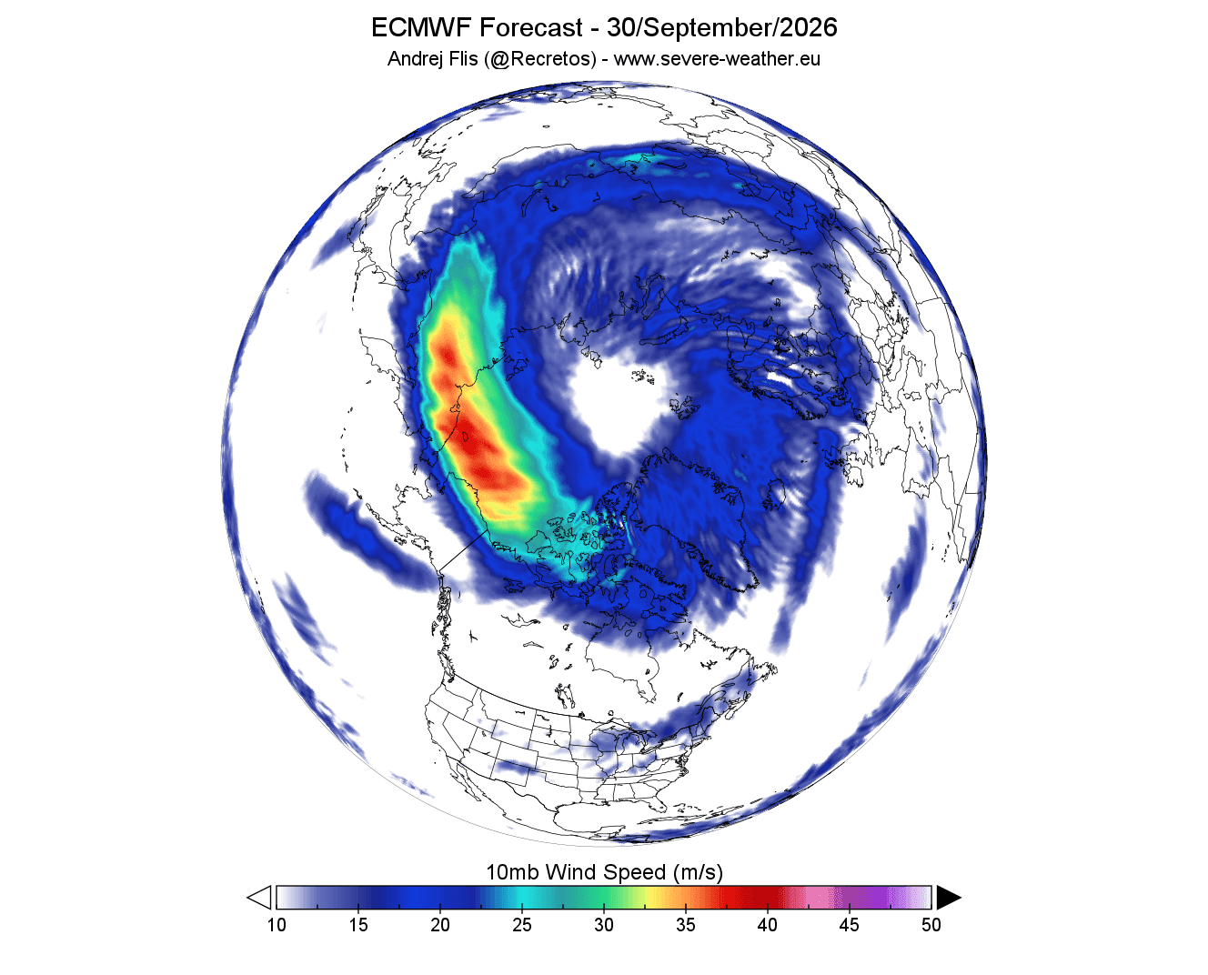
- October Projections: As we head deeper into autumn, the system is expected to increase in size and depth. Forecasts show the pressure core deepening and the "night jet"—the high-speed winds surrounding the vortex—organizing into a clear, circular "donut" shape.
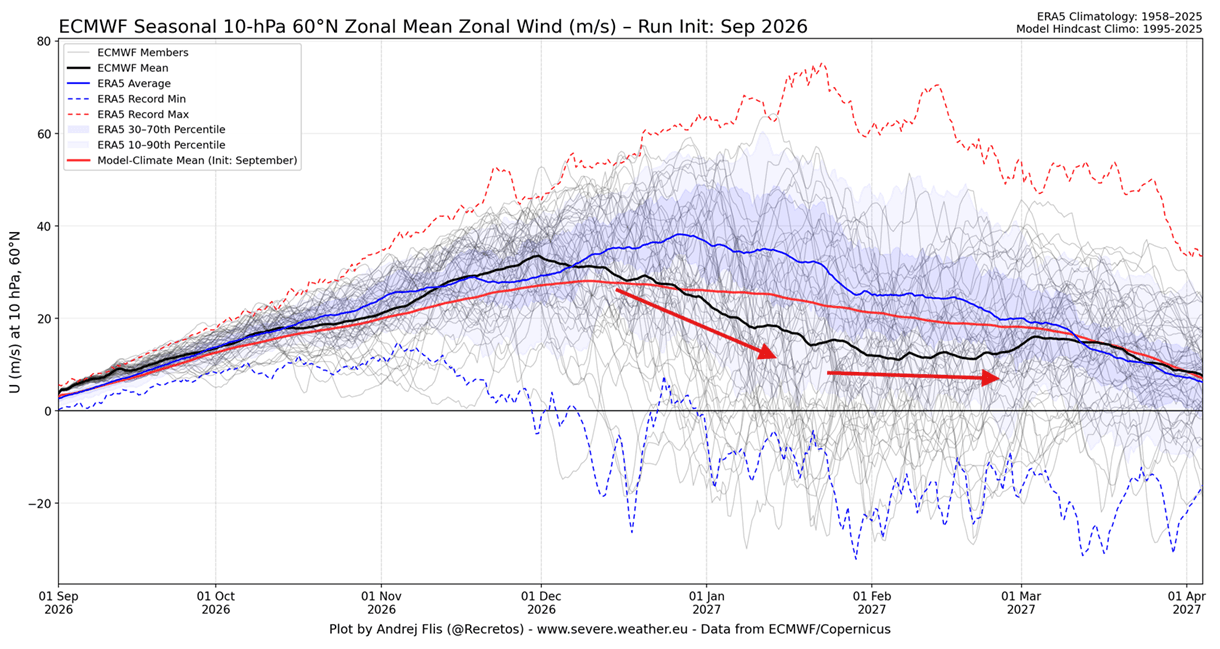
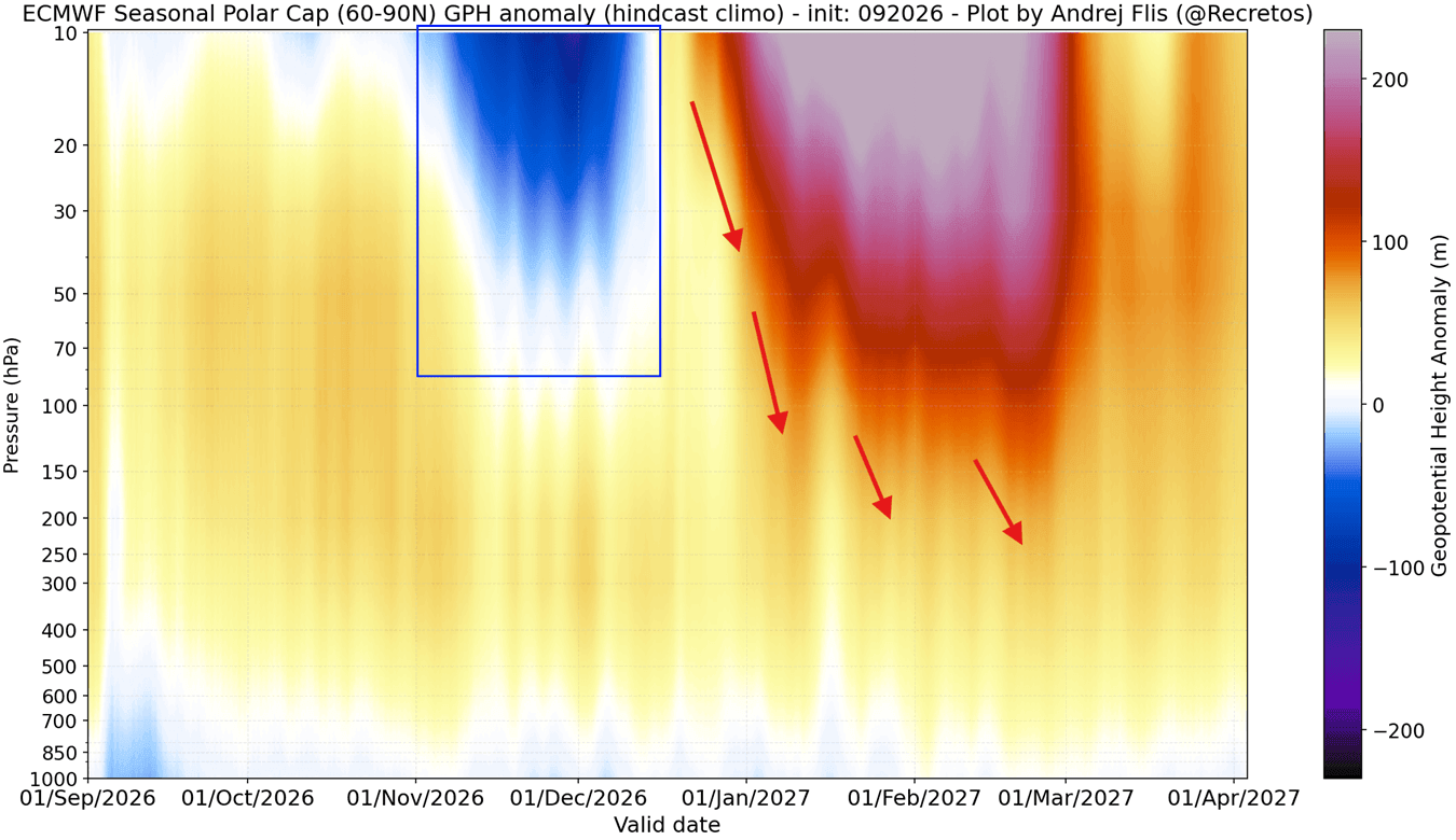
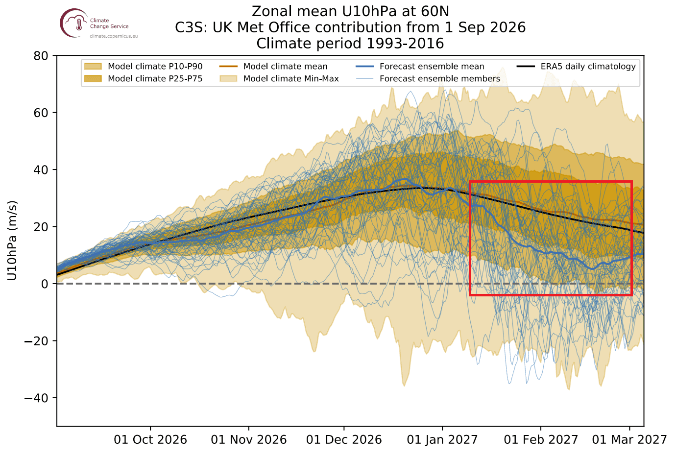
- The Mid-Winter Pivot: Unlike the steady, stable winters of the past, seasonal modeling from major meteorological centers, including the ECMWF and UKMO, indicates a significant deceleration of the vortex in January 2027. This suggests a transition from a strong, stable early winter to a chaotic mid-to-late winter period.
Supporting Data: The "Super El Niño" Factor
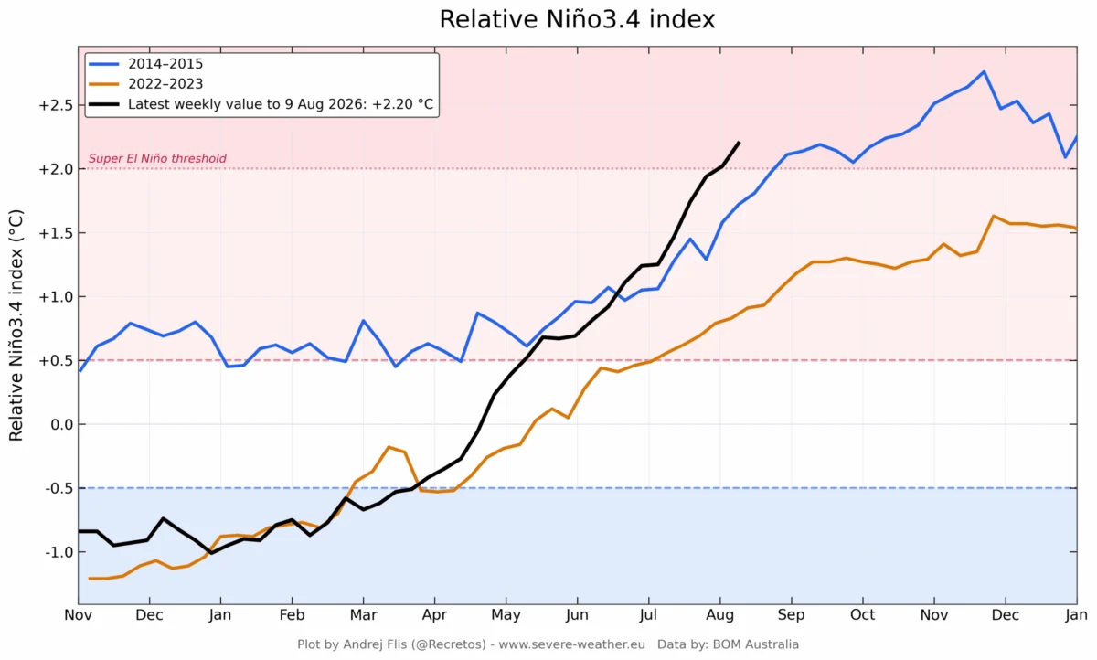
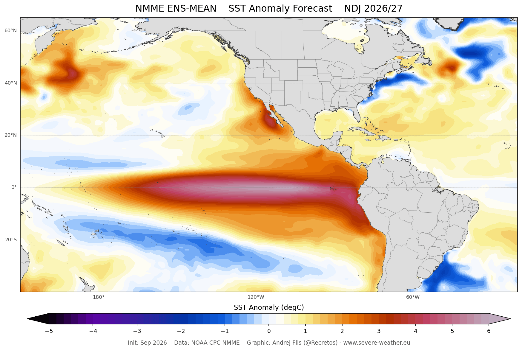
A critical, if not dominant, factor in this year’s forecast is the rapid development of a "Super El Niño" in the Pacific. Ocean temperature anomalies in the tropical Pacific are already exceeding the +2.0°C threshold, a level associated with significant global atmospheric disruption.
Scientific studies regarding the relationship between El Niño and the stratosphere have consistently shown that strong ENSO (El Niño-Southern Oscillation) events act as a catalyst for stratospheric deceleration. The mechanism is a phenomenon known as "planetary wave propagation." During a Super El Niño, the Pacific jet stream is modified in a way that generates stronger-than-normal pressure waves. These waves travel vertically from the troposphere into the stratosphere. When these waves strike the stratospheric Polar Vortex, they disrupt its flow, often triggering a "Sudden Stratospheric Warming" (SSW) event.
Current multi-model ensembles—including data from the Copernicus climate service and the NMME—confirm that these anomalies are likely to reach peak intensity just as the winter season hits its stride. This creates a high-probability scenario for a significant disruption or partial collapse of the Polar Vortex by early 2027.
Implications: The Potential for a "Polar Vortex Collapse"
The most dramatic event in the winter weather calendar is the Sudden Stratospheric Warming (SSW). This occurs when temperatures in the stratosphere spike by several tens of degrees in just a few days. The resulting pressure rise destroys the vortex’s structural integrity.
The Mechanism of Collapse
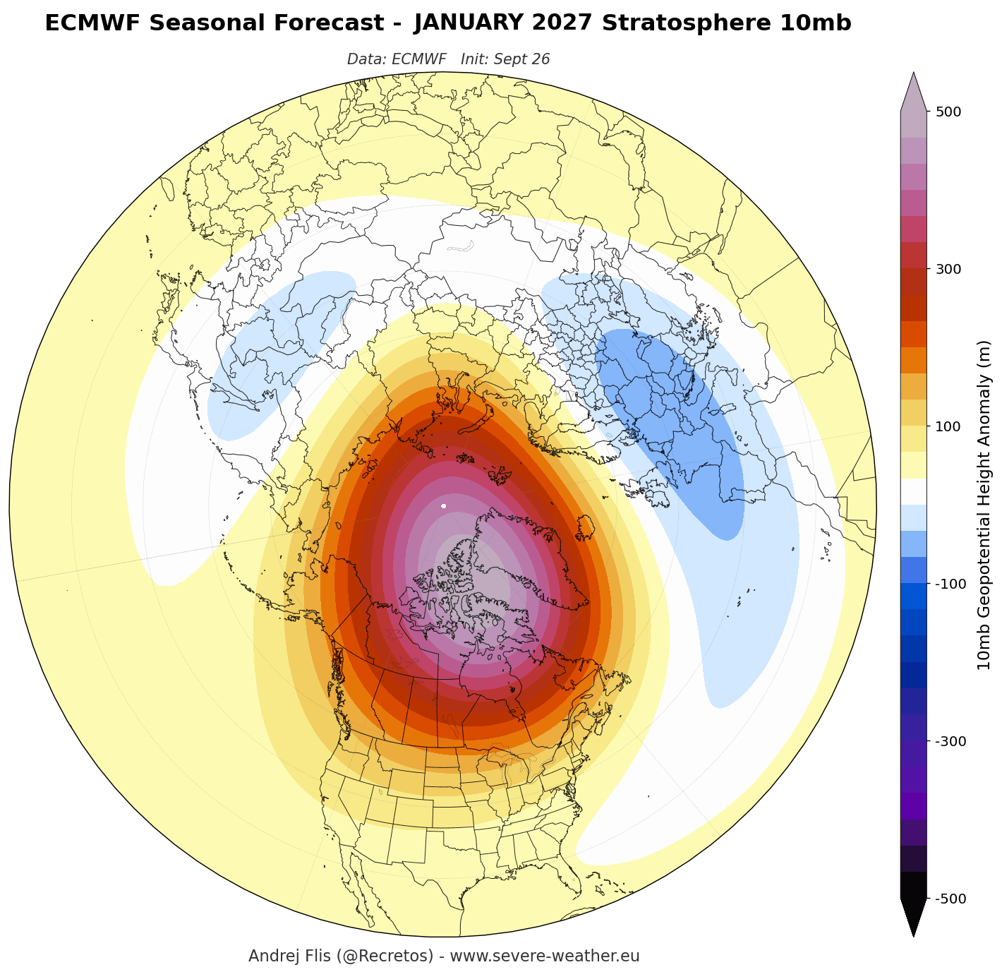
When an SSW occurs, the vortex can either be displaced from its central position over the pole or split entirely into two smaller, weaker vortices. If the vortex splits, the consequences for the mid-latitudes are often severe.
Based on historical data from 34 major SSW events, the subsequent 10 to 30 days are typically characterized by a collapse in the "Polar Express"—the stable jet stream—which allows massive amounts of polar air to flood southward.
Regional Weather Impacts
- United States and Canada: A disrupted vortex often leads to prolonged, extreme cold snaps. If the vortex is pushed into North America, the result is a persistent "block," where deep-freeze conditions can settle over the central and eastern states for weeks at a time.
- Europe: Similarly, a split vortex often redirects cold air from the Arctic across the European continent, potentially bringing heavy snowfall to regions that are typically milder.
It is important to note that a "full collapse" is not required to create chaos. Even minor disruptions, such as the event observed in January 2026, can cause the vortex to elongate and sag, creating "cold arms" that deliver severe winter storms to densely populated regions.
Official Meteorological Perspectives
While forecasting an SSW with pinpoint accuracy months in advance remains a "holy grail" of meteorology, the consistency across global models is noteworthy. The ECMWF seasonal ensemble is particularly telling; the black forecast line for zonal winds at the 10mb level shows a sharp downward trajectory in January 2027, plunging well below the long-term historical average.
The UKMO model corroborates this trend, suggesting that the "disruption signal" is not a statistical fluke but a recurring feature across high-resolution ensemble runs. Meteorologists caution that while these models are excellent at identifying tendencies, the exact timing and the specific geographic impact of a disruption depend on the "pre-existing conditions" of the troposphere at the moment of the event.
Preparing for Winter 2026/2027
As we look toward the months ahead, the combination of a record-setting Super El Niño and the observed structural instability of the nascent Polar Vortex points toward a winter of high volatility. For those in the Northern Hemisphere, this implies that the traditional "winter forecast" may be less reliable than in previous years, as the season is susceptible to high-impact "black swan" weather events.
The scientific consensus is that while the early winter may feel deceptively normal, the middle of the season carries a heightened risk of significant, record-breaking cold outbreaks. As the data continues to flow in, the priority for meteorological agencies will be monitoring the stratospheric wave energy. If the energy from the troposphere continues to intensify, the probability of a major mid-winter disruption increases significantly.
Ultimately, the 2026/2027 winter season serves as a reminder of the delicate balance within our atmosphere. The Polar Vortex, an invisible engine operating miles above our heads, remains the ultimate arbiter of winter’s severity. With the added weight of a Super El Niño, the upcoming season will likely be one of the most closely watched periods in recent meteorological history, offering a masterclass in how global teleconnections dictate the climate of our local environments.
Residents across North America and Europe should remain vigilant, as the transition from a stable vortex to a disrupted one can occur rapidly, turning a mild winter into a severe one in a matter of weeks. As data is updated daily, long-range forecasts will become increasingly precise, providing a clearer window into whether the "Polar Express" will indeed descend upon the mid-latitudes this coming January and February.