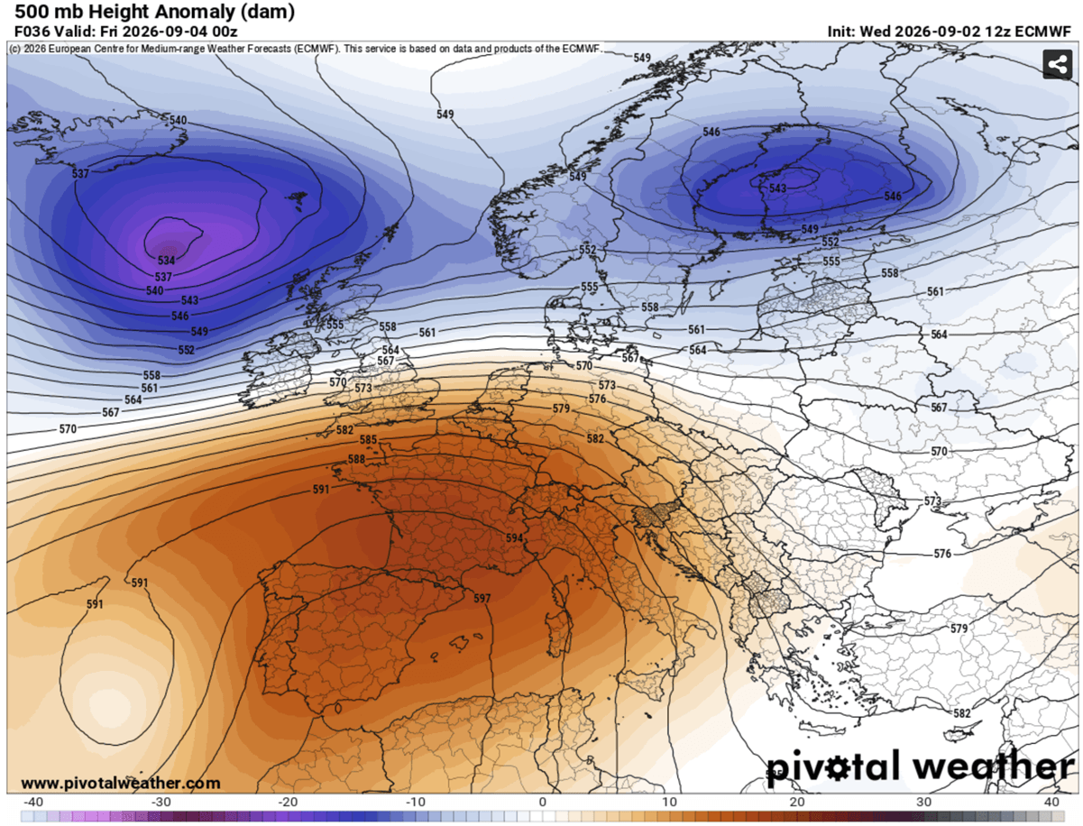
A powerful and expansive "heat dome" is currently tightening its grip on Europe, signaling an unusually aggressive end to the summer season. Meteorological models indicate that a massive plume of scorching air originating from North Africa is surging northward, establishing a high-pressure blocking system that will subject much of the continent to temperatures significantly above seasonal averages through the coming week.
As this atmospheric phenomenon settles over the Mediterranean Basin, surface temperatures are forecast to soar into the high 30s, with localized readings expected to breach the 40°C (104°F) threshold. From the sun-baked plains of the Iberian Peninsula to the historic urban centers of Italy and the Balkan Peninsula, Europe is entering a period of prolonged, intense thermal stress that threatens to rewrite meteorological records for early September.
The Mechanics of the Heat Dome: A Atmospheric Lid
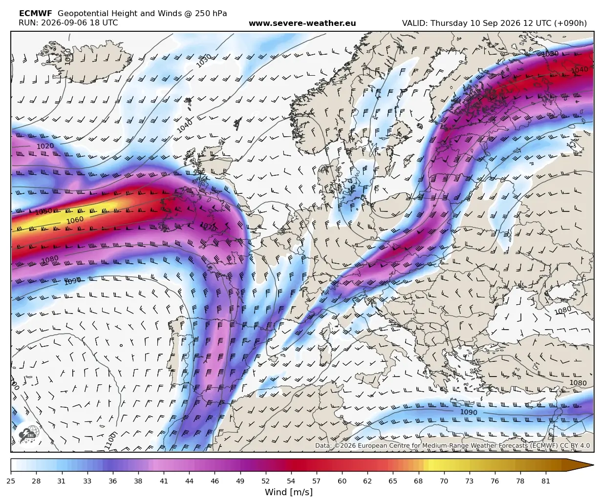
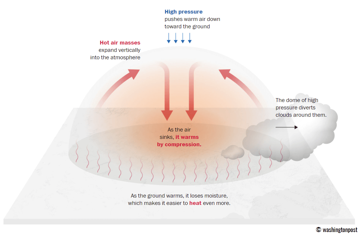
To understand the severity of this event, one must look at the synoptic-scale dynamics of the "heat dome." In meteorology, this term describes a persistent high-pressure system that functions much like a lid on a boiling pot. As the upper-level ridge settles over the continent, it forces air to descend—a process known as adiabatic compression. As the air sinks, it warms rapidly, while the high-pressure system simultaneously acts as a barrier, preventing cooler, maritime air from infiltrating the region.
This trapped air mass becomes stagnant, causing heat to build up day after day. Because the system is stationary, the lack of atmospheric circulation means that even as the sun sets, the heat remains locked in the lower levels of the atmosphere. This is the primary driver behind the anticipated "tropical nights," where temperatures are expected to refuse to dip below 24°C, providing no respite for the human body or the cooling infrastructure of major cities.
Chronology of the Thermal Surge
The expansion of this ridge is occurring in distinct phases, moving from west to east across the continent:
- Late Week (Thursday–Friday): The heat is most concentrated across the Iberian Peninsula. Spain and Portugal will face the brunt of the initial surge, with inland temperatures expected to hit 40°C to 44°C. This intense heat will begin to push into southwestern France, setting the stage for a wider continental impact.
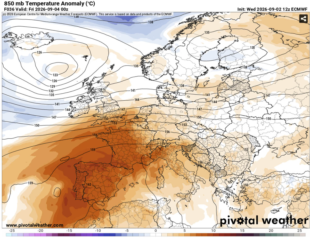
- The Weekend: As the ridge expands, the core of the heat dome shifts. While the UK and far Western Europe will see a brief spike in temperatures into the high 20s, the real focus will be the Mediterranean corridor. Italy and the Balkans will experience a significant temperature anomaly, with mercury levels climbing 10°C to 14°C above the long-term historical average for this time of year.
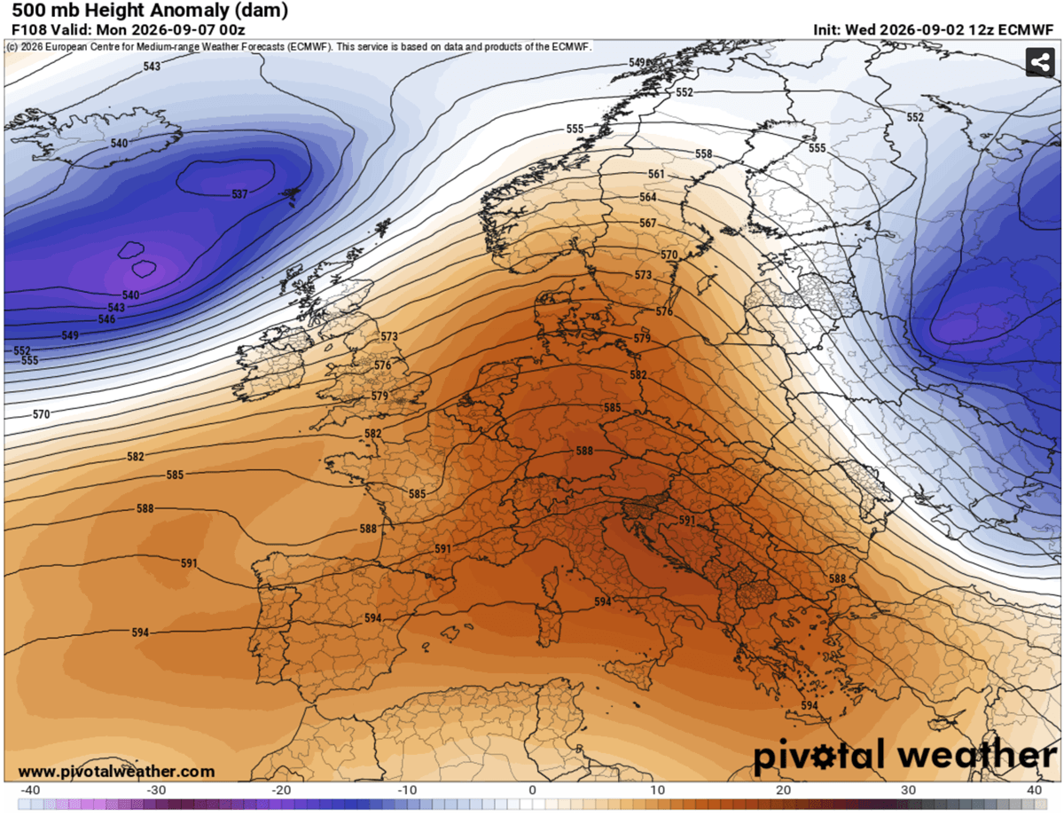
- Early Next Week: The high-pressure system will solidify its hold over Central Europe and the Balkans. During this window, the intensity of the heat will peak in cities across Italy, Greece, and the surrounding regions, where daytime highs will consistently remain between 38°C and 41°C.
- Mid-Next Week (The Pivot): Meteorological models suggest a breakdown of this stable pattern by mid-week. A deep low-pressure system currently brewing in the North Atlantic is expected to push eastward, forcing the heat dome to retreat. This transition is likely to be marked by a period of instability, potentially delivering much-needed rainfall, but also increasing the risk of severe weather as the cooler, moist air clashes with the residual heat.
Supporting Data: Anomalies and Projections
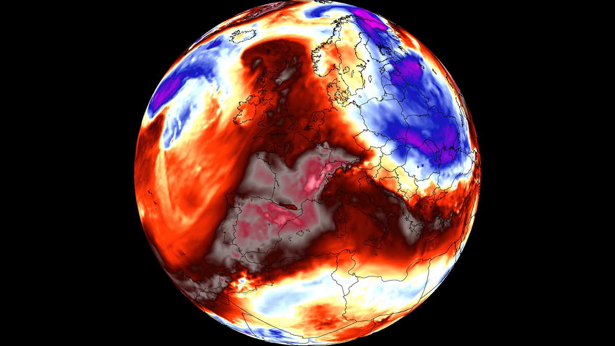
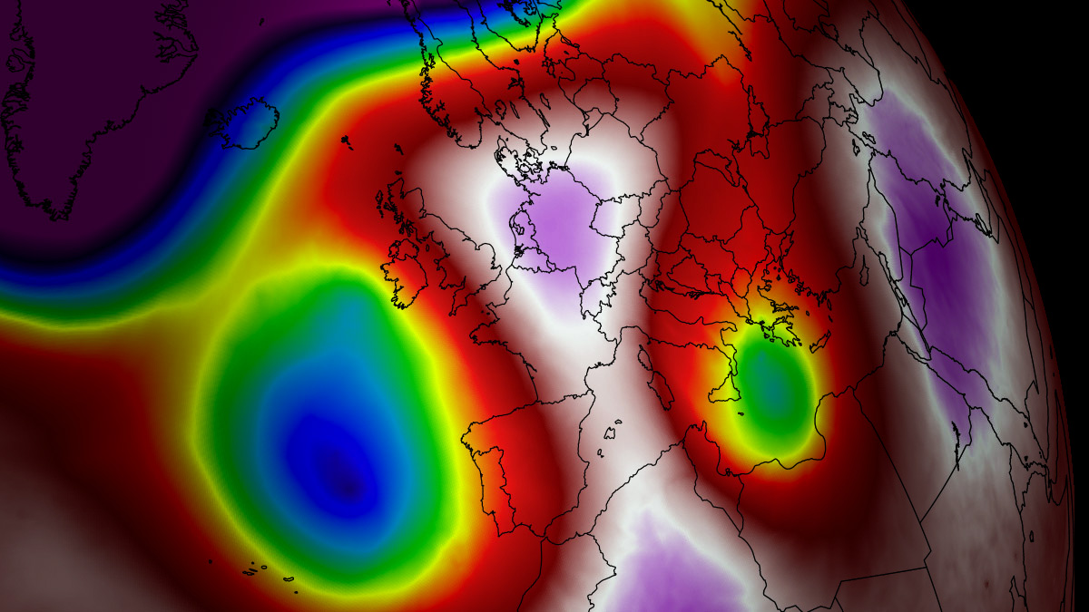
The magnitude of this event is underscored by the 850 hPa temperature anomalies, which indicate a column of air significantly warmer than the climatological norm. While standard summer heatwaves are expected, this late-season event is exceptional in its duration and intensity.
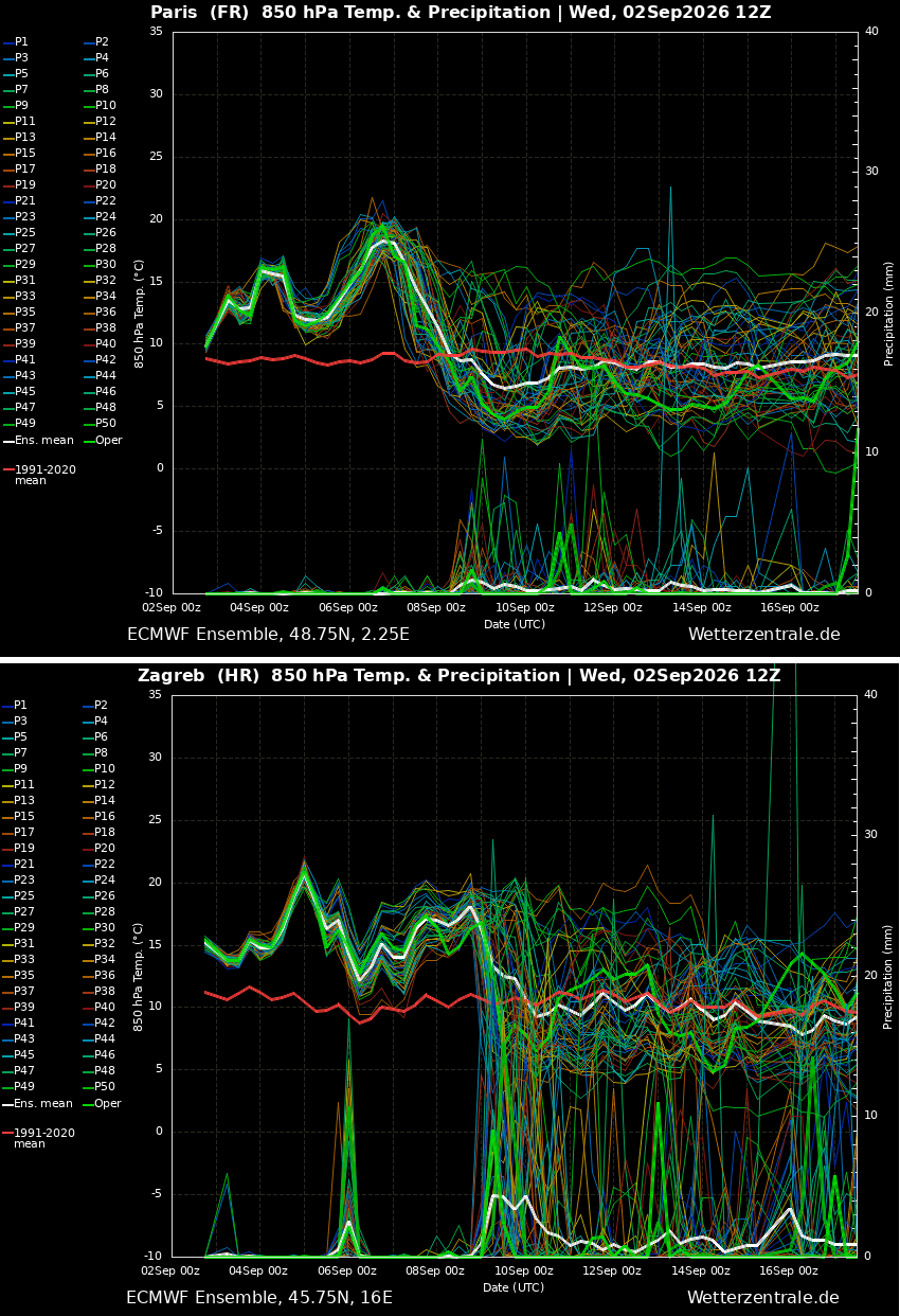
Data from meteograms for major hubs like Paris and Zagreb suggest a long-lived event that deviates sharply from the cooling trend typically associated with the transition into autumn. Soil moisture, already depleted by a long summer, will likely face further exhaustion, exacerbating the risk of wildfires in mountain regions and rural corridors where dry, continental winds are expected to accelerate the drying process.
Physiological and Societal Implications
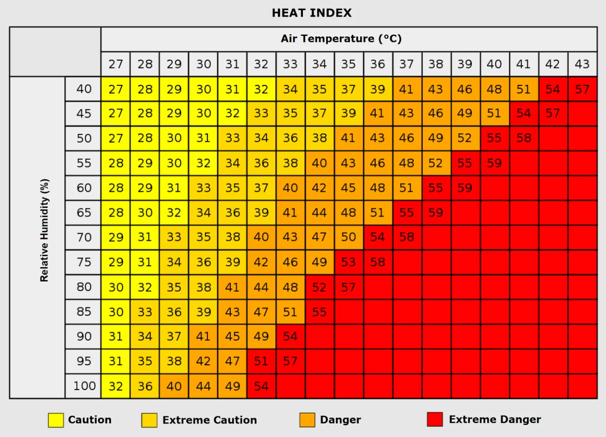
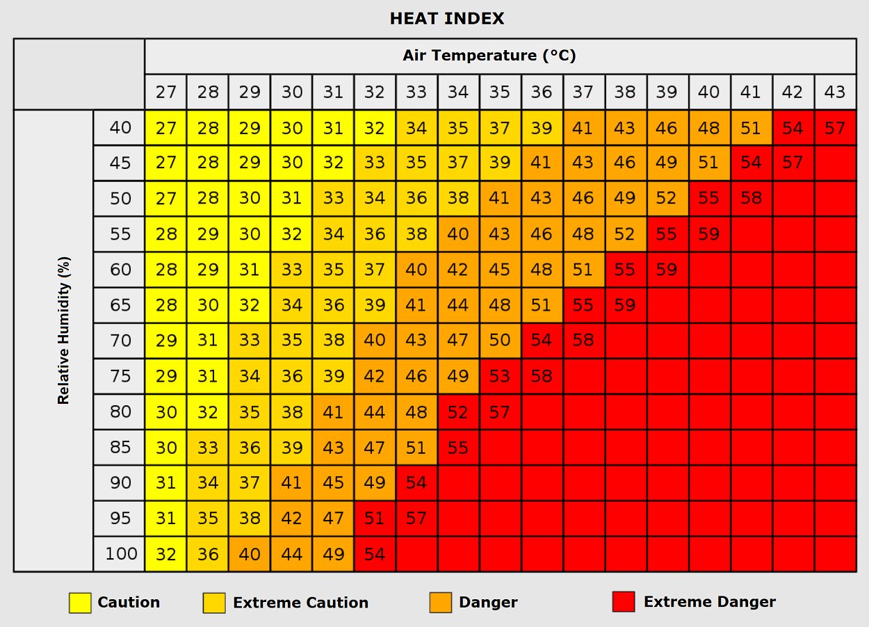
The human toll of such a prolonged heatwave is significant, particularly when nighttime temperatures provide no relief. The lack of nocturnal cooling is a critical factor in heat-related morbidity; without the ability for the body to recover during the night, the cumulative physiological stress leads to a higher incidence of heat exhaustion, heat stroke, and cardiovascular distress.
Public Health Concerns
Vulnerable populations, including the elderly, children, and those with pre-existing respiratory or cardiovascular conditions, face the highest risk. Furthermore, outdoor workers—particularly in the agricultural and construction sectors—are at the front lines of this heatwave. Experts advise that employers in affected regions adjust work hours to avoid the peak solar radiation between 1:00 PM and 5:00 PM.
Energy Grid Demand
The sustained nature of this heat dome will place unprecedented strain on energy grids. With air conditioning usage projected to hit summer-peak levels well into September, energy providers face the dual challenge of meeting high demand while managing the physical limitations of electrical infrastructure under thermal stress. The risk of localized outages increases as transformers and cooling systems are pushed to their operating limits.
Environmental Impact: The Wildfire Threat
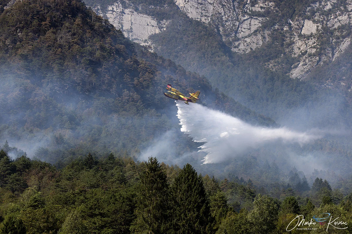
The combination of record-breaking heat and dry, desiccated vegetation creates a "tinderbox" scenario. Across the Mediterranean and Southern Europe, local authorities are maintaining high-alert status for wildfire outbreaks. The absence of humidity, combined with gusty surface winds, can turn a small ignition into a large-scale fire emergency in a matter of hours.
Official Responses and Safety Recommendations
While governmental agencies in the affected countries have begun issuing heat-health warnings, the public is encouraged to remain vigilant. National meteorological services, including those in Spain (AEMET), Italy (Servizio Meteorologico), and France (Météo-France), are providing updated hourly forecasts.
Key safety recommendations include:
- Hydration: Increasing water intake significantly, regardless of physical activity level.
- Structural Cooling: Closing blinds and curtains during the day to prevent the "greenhouse effect" inside homes and buildings.
- Community Wellness: Checking on elderly neighbors or those living alone who may be less capable of managing the indoor climate.
- Activity Modification: Limiting strenuous outdoor activity and heavy exercise until the heatwave breaks.
Implications for the Future
The occurrence of such a robust heat dome in early September is a subject of intense scientific scrutiny. While high-pressure systems are a natural component of European weather, the increasing frequency, intensity, and duration of these events in recent years have sparked a broader conversation regarding climate resilience.
This current event is not just a statistical anomaly; it serves as a practical test for Europe’s infrastructure, urban planning, and emergency response protocols. As cities like Paris, Rome, and Zagreb adapt to a changing climate, the "heat dome" of 2026 will likely be studied as a primary example of the need for improved heat-mitigation strategies, such as increased urban greening, reflective building materials, and more robust energy storage solutions.
Looking Ahead: The Pattern Flip
As we look toward the middle of the month, the shift in the synoptic pattern remains the primary focus for meteorologists. The expected arrival of a maritime air mass from the Atlantic promises a "refreshment" for the continent, likely ending the heatwave and lowering temperatures back to, or perhaps even below, seasonal norms.
However, the transition is expected to be abrupt. When the cold air finally pushes the heat out, the contrast in air masses could trigger severe convective storms. Residents in Western and Central Europe should monitor local forecasts closely for updates on this potential pattern flip. For now, the focus remains on navigating the next few days of extreme, stifling heat that has firmly parked itself over the heart of the continent.
The coming week will undoubtedly be a challenge for millions, but it also underscores the vital importance of real-time meteorological data and the necessity of public preparedness. As the heatwave reaches its zenith, the collective effort to manage health risks and infrastructure stability will be the defining story of early September.