The tropical Pacific is currently undergoing a dramatic meteorological transformation. A "Super El Niño" event is strengthening rapidly, with recent oceanographic and atmospheric data suggesting that the 2026-2027 climate cycle is not merely another seasonal oscillation, but a potentially historic anomaly. As sea surface temperatures (SSTs) climb to record levels and atmospheric circulation patterns lock into place, meteorologists are warning that the upcoming Fall and Winter seasons could see weather patterns fundamentally altered across North America and Europe.

Main Facts: The Anatomy of a Super Event
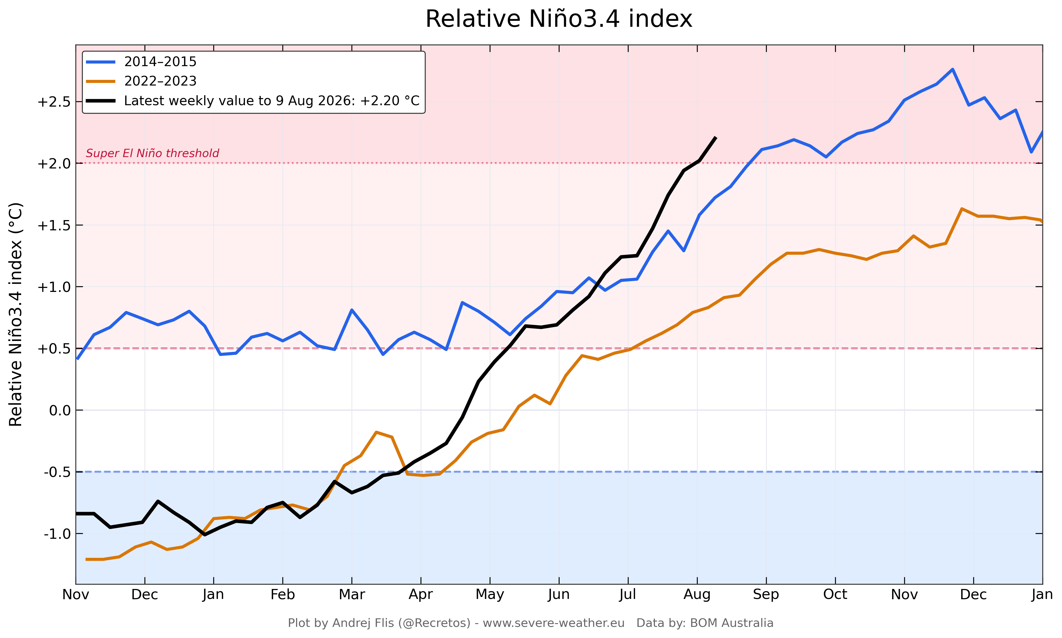
At its core, the 2026 Super El Niño is defined by the massive release of subsurface heat in the equatorial Pacific. An El Niño event is characterized by the warming of central and eastern tropical Pacific waters, which disrupts the standard "Walker Cell"—the atmospheric circulation loop that normally keeps the western Pacific wet and the eastern Pacific relatively dry.
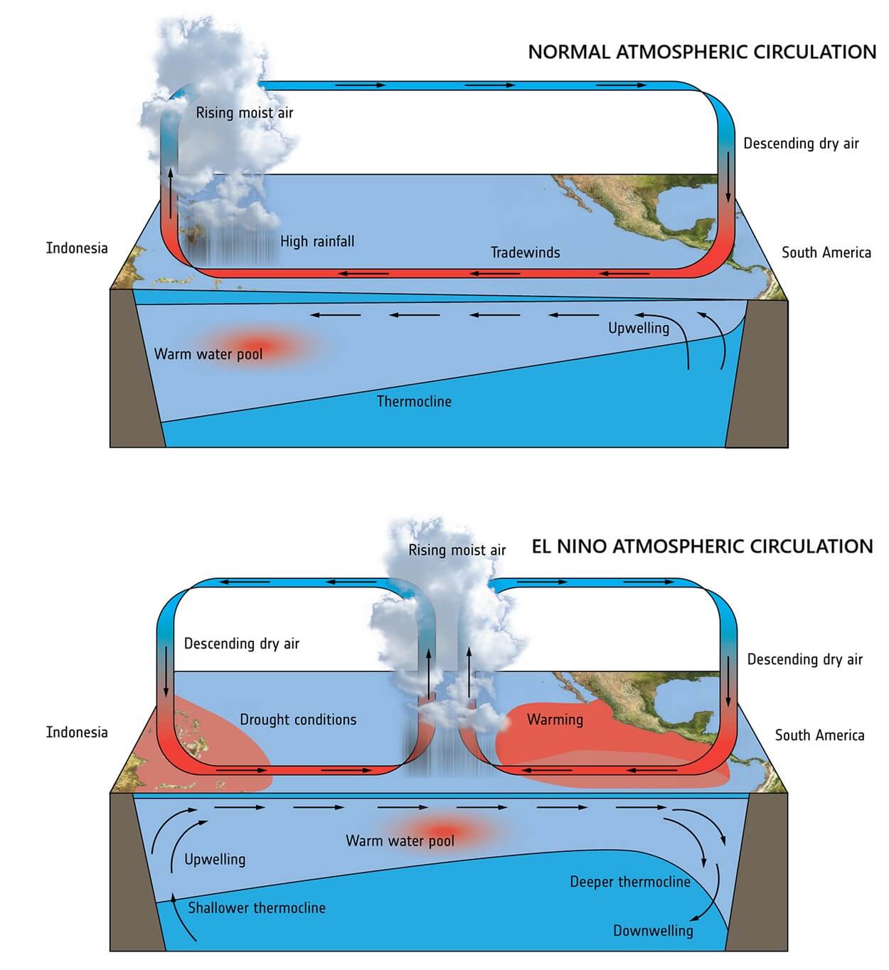
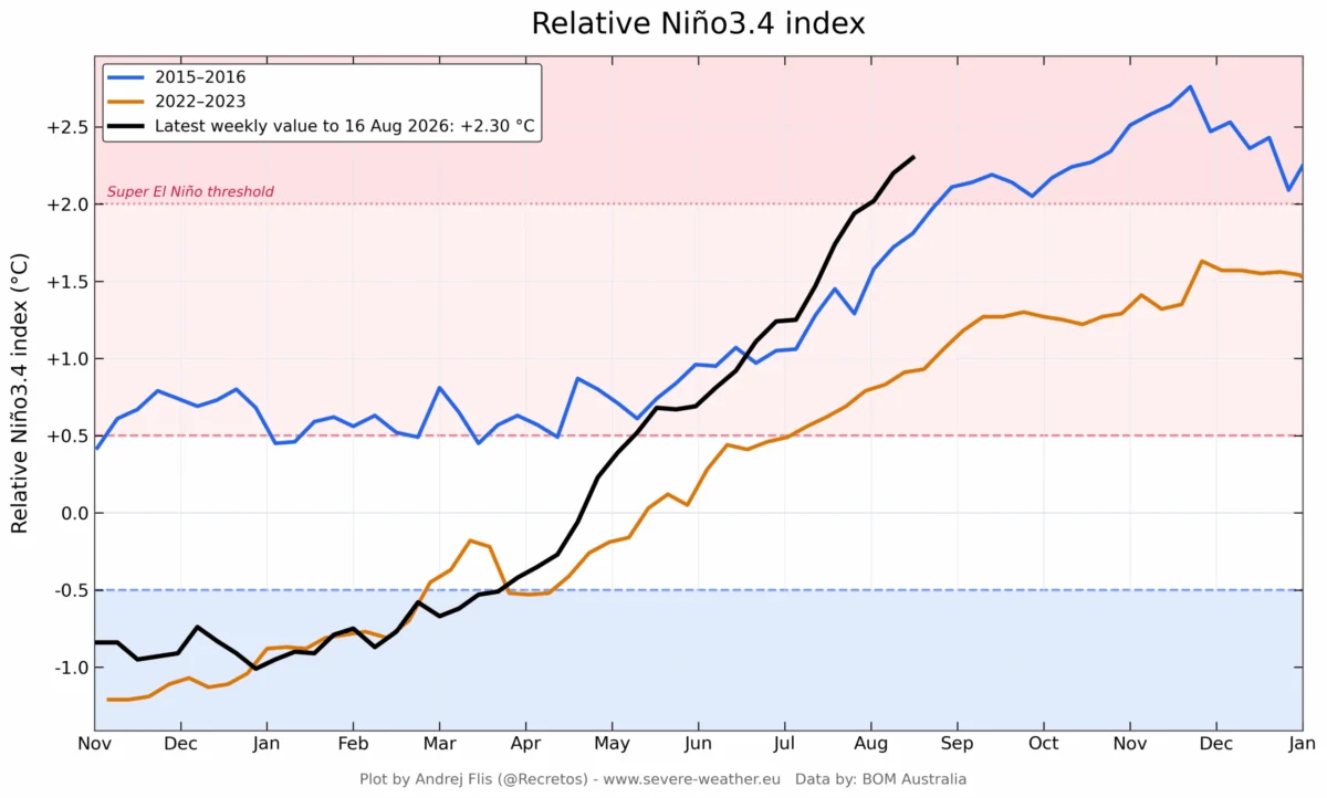
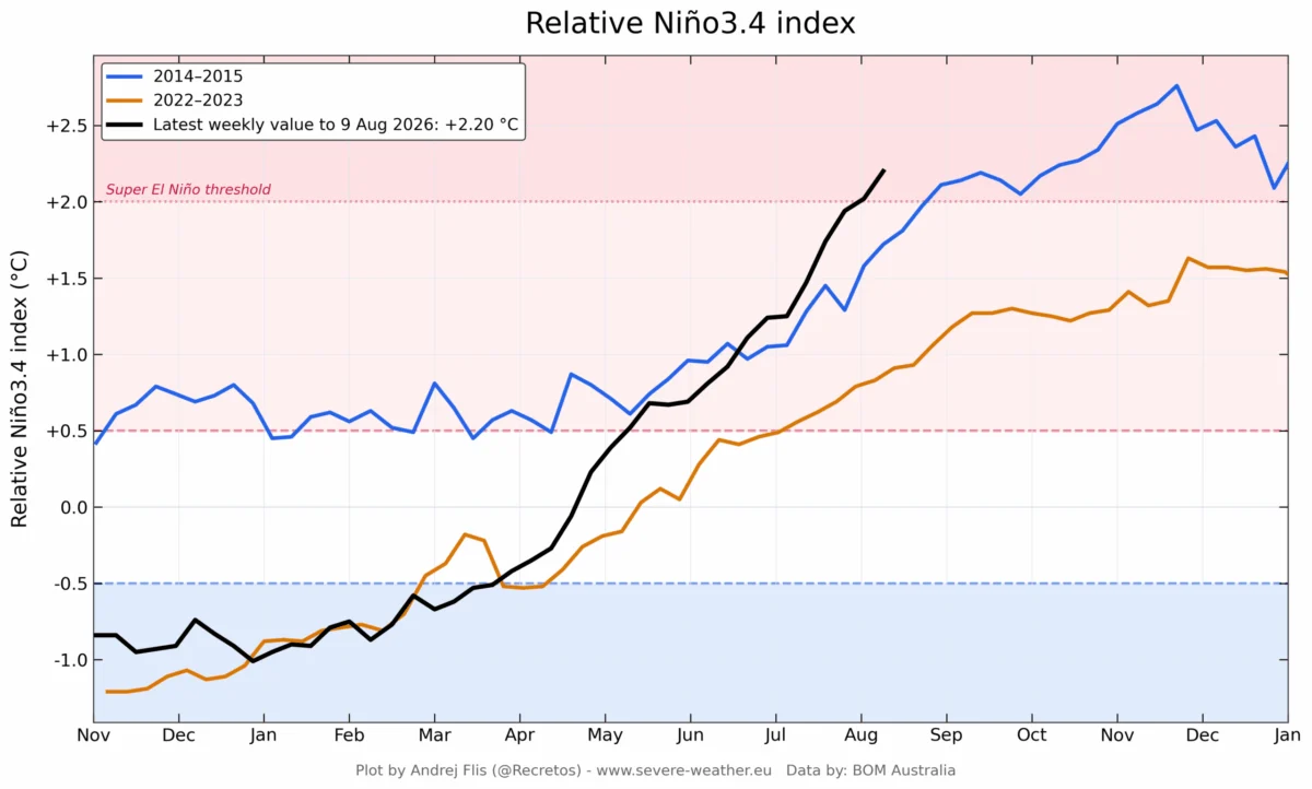
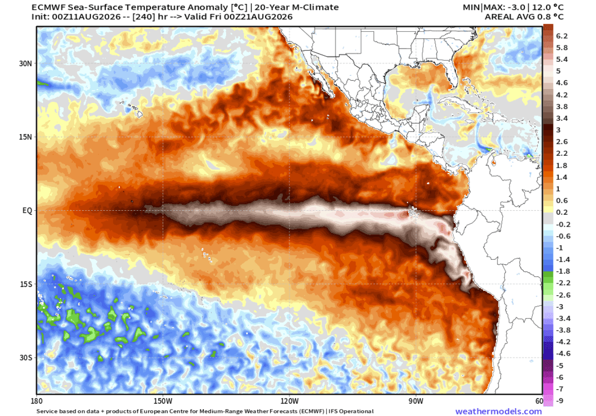
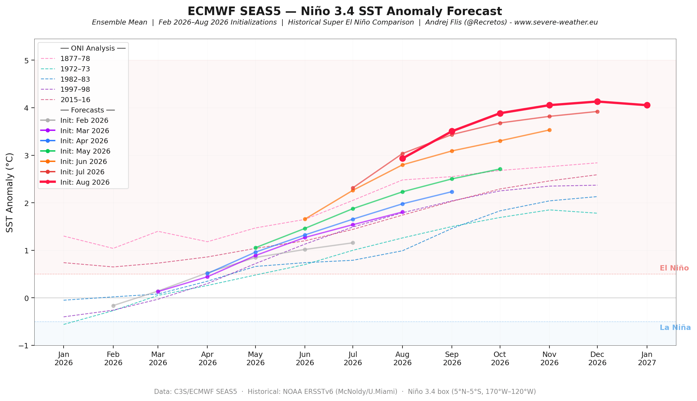
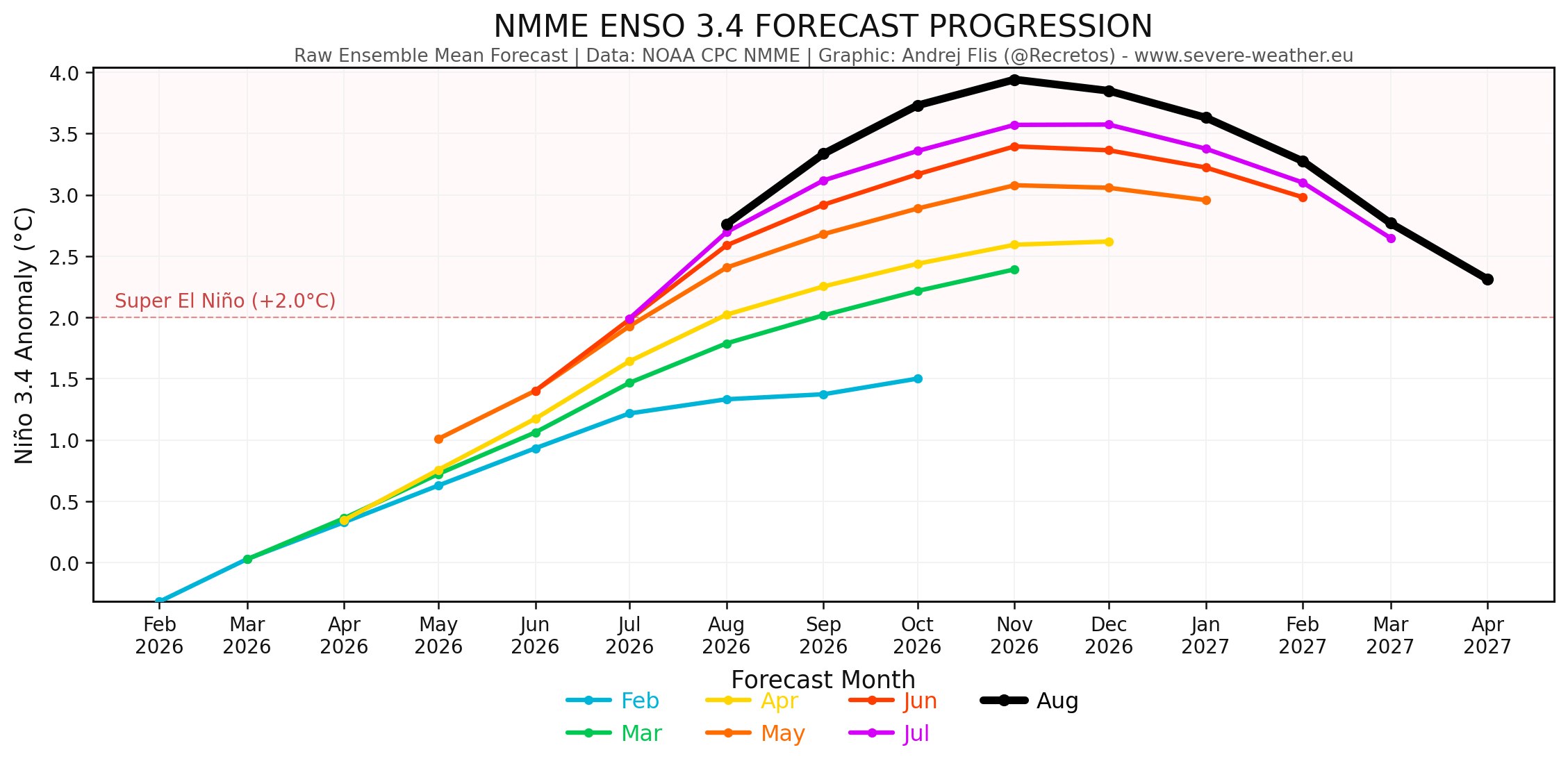
When this event reaches "Super" status—defined by sea surface temperature anomalies reaching or exceeding +2°C above the long-term average—the impact on the global jet stream becomes profound. Current models indicate that the 2026 event is on a trajectory to push well beyond this threshold, potentially challenging records set by the 2015-2016 event. The synergy between persistent westerly wind bursts and the eastward propagation of a powerful Kelvin Wave has created a self-sustaining engine of thermal energy that is currently fueling the rapid intensification of the phenomenon.
Chronology of Development: From Spring Emergence to Summer Surge
The evolution of the 2026 event has been marked by an uncharacteristically fast development cycle. While many El Niño events show a gradual maturation through the summer months, the 2026 cycle displayed signs of an accelerated onset as early as this past Spring.
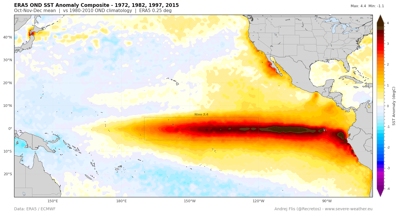
- Spring 2026: Initial subsurface anomalies were detected, signaling the transition from neutral conditions.
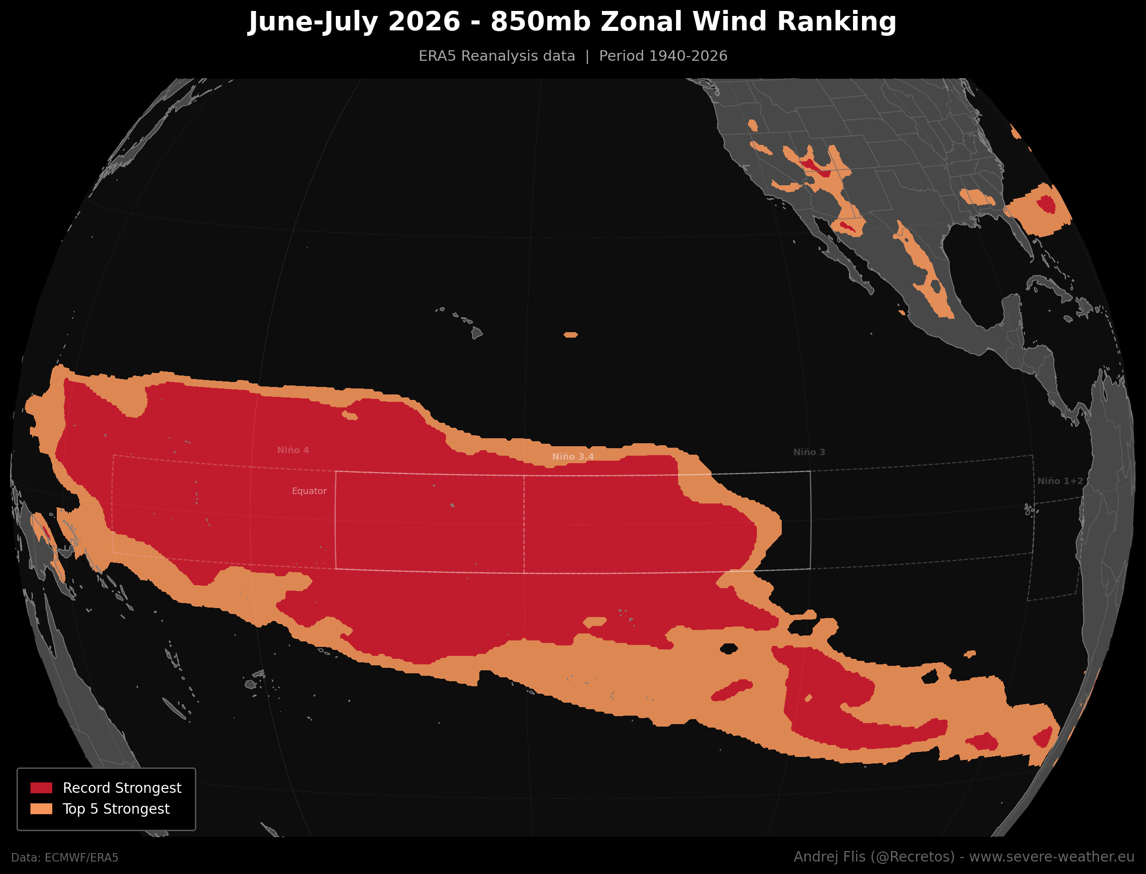
- June–July 2026: The atmosphere began to react in kind, with record-breaking low-level westerly wind anomalies across the central and western equatorial Pacific. These winds are critical, as they act as a "pusher," driving warm subsurface water toward the Americas.
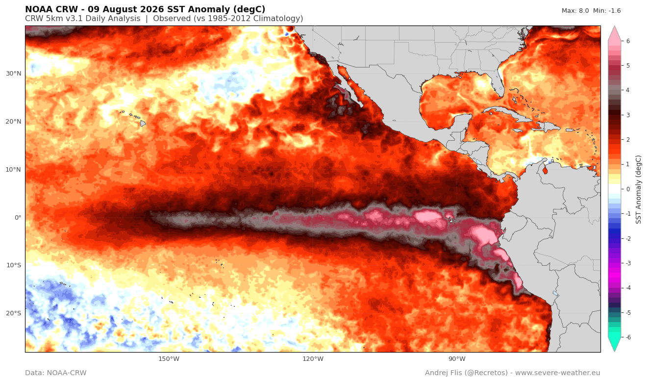
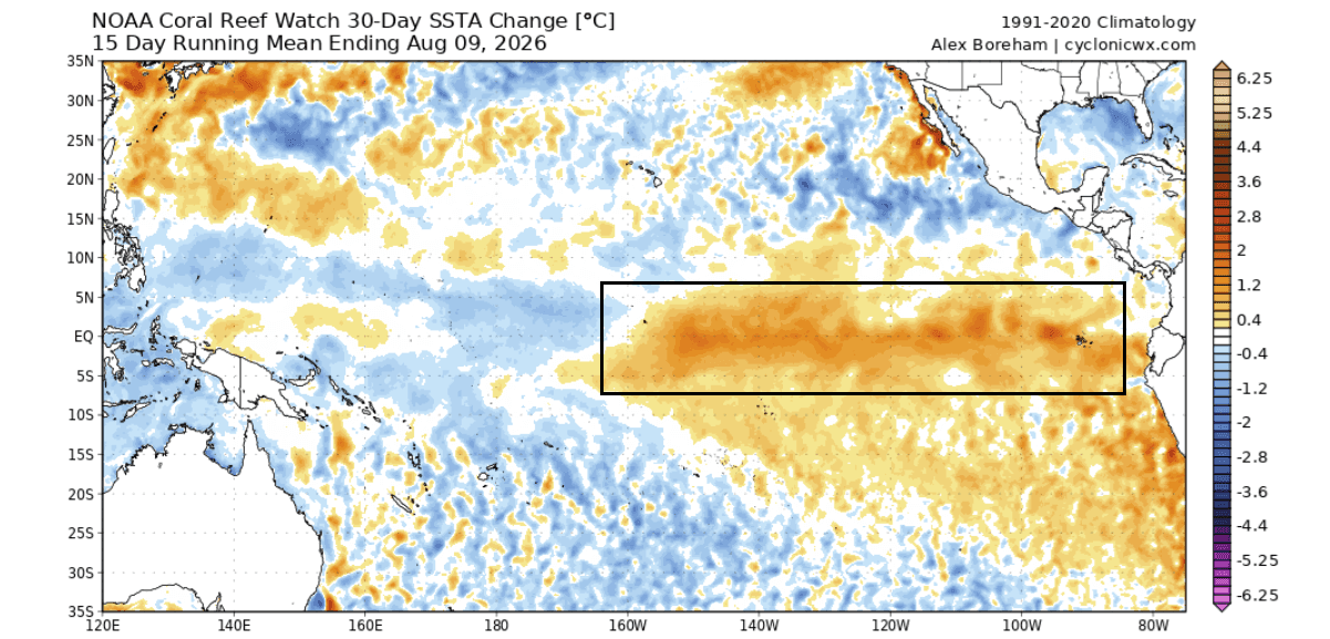
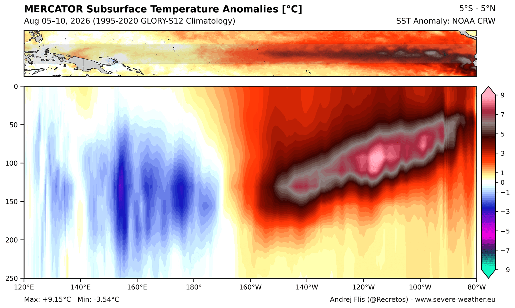
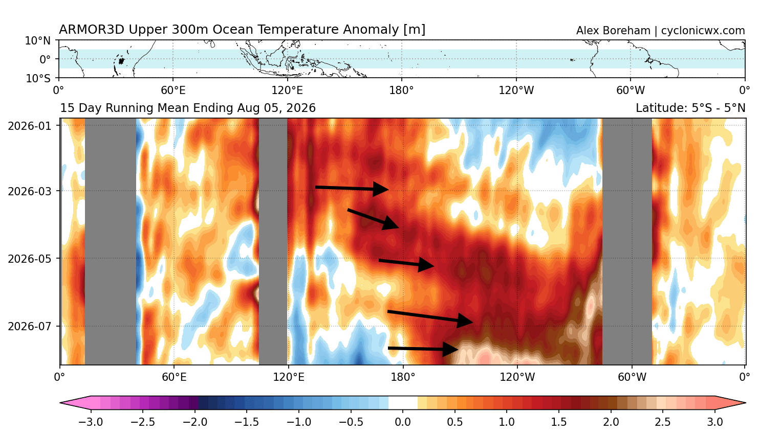
- August 2026: Current analysis shows a fully established, powerful Kelvin Wave. Ocean heat content in the upper 300 meters of the Pacific is currently at historic highs for this time of year.
- Late 2026 Outlook: Projections from the European Centre for Medium-Range Weather Forecasts (ECMWF) and the National Multi-Model Ensemble (NMME) suggest that the peak intensity will likely occur between November and December 2026.
Supporting Data: Why This Event is Different
The scientific consensus regarding the severity of this event is built upon a convergence of three distinct datasets:
1. Subsurface Kelvin Waves
The "engine" of this Super El Niño is the Kelvin Wave—a massive pulse of warm water moving eastward beneath the surface. Current measurements show anomalies exceeding 9°C (16°F) above normal at depth. As this water reaches the surface along the South American coast, it provides a consistent, high-energy supply that prevents the El Niño from waning, ensuring it remains "healthy" throughout the Northern Hemisphere’s winter.
2. Record-Breaking Westerly Wind Anomalies
Using ERA5 reanalysis data, meteorologists have confirmed that the westerly wind bursts experienced in June and July 2026 are the strongest observed in over 86 years. This persistent atmospheric pressure collapse in the western Pacific is the primary reason the ocean surface warming has been so explosive.
3. The Multivariate ENSO Index (MEI)
The MEI, which tracks both oceanic and atmospheric variables, recently hit a record-high value of +2.4 for the June-July period. This is the highest reading since the index began in 1979, confirming that the coupling between the ocean and the atmosphere is tighter and more efficient than in any previous decade.
Implications for Global Weather Patterns
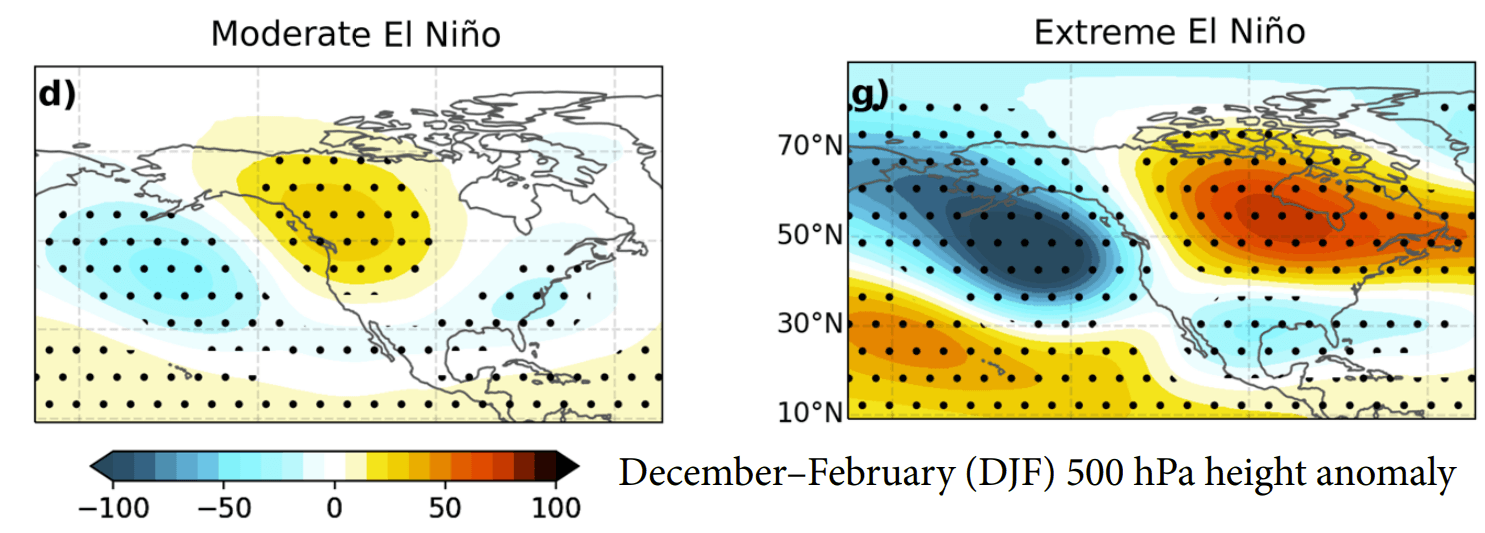
The transformation of the tropical Pacific has immediate and far-reaching consequences for the Northern Hemisphere’s jet stream. A Super El Niño typically forces an "atmospheric standing wave," where weather systems become locked into specific regions for extended periods.
The United States and Canada
The traditional El Niño signature involves a strong, active southern jet stream. For the United States, this suggests:
- Increased Storm Activity: The southern tier of the U.S., particularly the Gulf Coast and the Southeast, is expected to see higher-than-average precipitation and a more active storm track.
- Temperature Divergence: A persistent ridge of high pressure over Canada and the northern U.S. is likely to bring warmer-than-normal temperatures to these regions.
- Winter Snowfall Dynamics: While the northern regions may experience a milder winter, the convergence of cold Canadian air and the moisture-rich southern jet stream creates a "high-risk" scenario for significant winter storms, ice events, and heavy snowfall across the Central Plains, the Midwest, and the Mid-Atlantic.
The European Outlook
The impact on Europe is largely indirect, mediated by changes in the North Atlantic. The current forecast models indicate a deepening low-pressure area in the North Atlantic. This typically results in a pronounced westerly flow, which brings milder, moisture-laden air into Western and Central Europe. While this keeps temperatures above seasonal averages, it also increases the risk of frequent, rain-heavy frontal systems moving inland from the Atlantic.
Official Responses and Meteorological Context
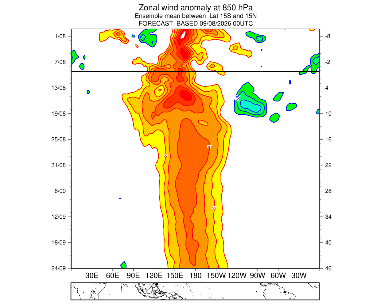
Leading meteorological agencies, including NOAA and the Copernicus Climate Change Service, are actively monitoring the "locking" of the Walker Cell. The current forecast models are being updated in real-time, with each new run suggesting that the peak intensity of the 2026 event may be higher than previously estimated.
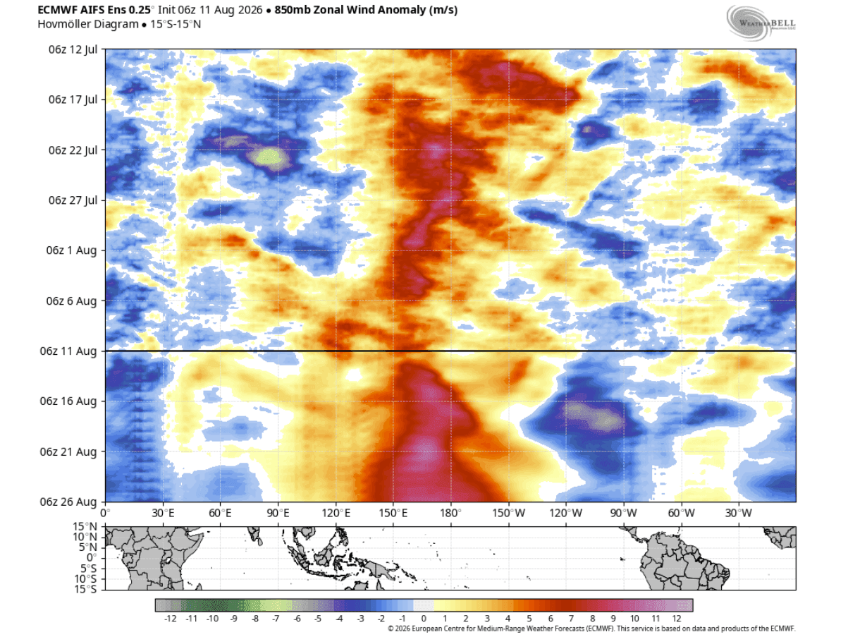
The "Super" designation is not merely a label; it implies a shift in the predictability of the seasonal cycle. Because the energy involved is so immense, the "signal-to-noise" ratio in weather forecasting improves, allowing for higher confidence in the outlook for the coming winter. However, scientists caution that while the broad pattern is well-defined by the El Niño, the specific trajectory of individual winter storms remains subject to smaller-scale atmospheric variables, such as the North Atlantic Oscillation (NAO) and the Arctic Oscillation (AO).
Conclusion: Preparing for an Uncharted Winter
As we move into the final quarter of 2026, the global climate system is effectively under the control of the Pacific Ocean. The sheer magnitude of the 2026/2027 Super El Niño is already influencing atmospheric circulation in a way that is rarely seen in the historical record.
For residents across North America and Europe, this means the coming months will likely be characterized by high-amplitude weather patterns. Whether it is the potential for heavy, moisture-driven winter storms in the U.S. or the persistence of mild, wet, and windy conditions across Europe, the influence of this event will be felt in every household. As the data continues to suggest an intensifying trend, preparedness for volatile weather patterns remains the most prudent course of action for the winter season ahead.
Meteorological agencies will continue to provide refined updates as the atmosphere responds to the ongoing oceanic warming, marking this as one of the most significant climate events of the current decade.