Executive Summary: A Polar Region in Crisis
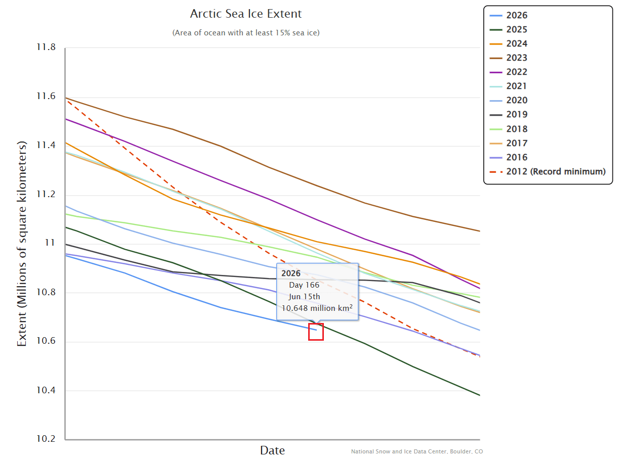
The latest data from the National Snow and Ice Data Center (NSIDC) paints a harrowing picture of the Arctic environment as it enters the peak of its annual melt season. Arctic sea ice has plummeted to a record-low extent for mid-June, signaling a fragile start to the summer. This diminished ice cover, characterized by weak concentration in the Atlantic sector of the Polar region, is not an isolated event. It is occurring in tandem with the rapid development of a "Super" El Niño in the tropical Pacific—a combination that climatologists warn could fundamentally reshape global weather patterns for the remainder of 2026 and into the winter of 2027.

As the Arctic ice cap struggles, current meteorological forecasts indicate a shift in atmospheric pressure that will not only accelerate the melting process but also trigger significant temperature anomalies across North America. The convergence of a weakened polar ice cap and a strengthening El Niño creates a high-stakes scenario for seasonal weather development across the Northern Hemisphere.
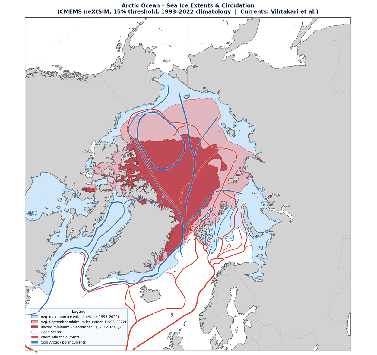
Chronology of the 2026 Melt Season
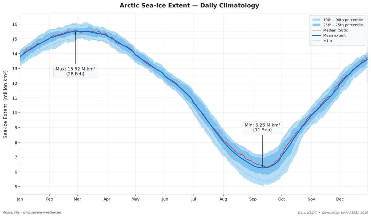
The Arctic, a vast, shallow ocean void of significant landmasses, functions as the planet’s primary heat sink. Its seasonal cycle is a critical component of global climate stability. Typically, the sea ice melt season begins in late March and reaches its nadir in mid-September.
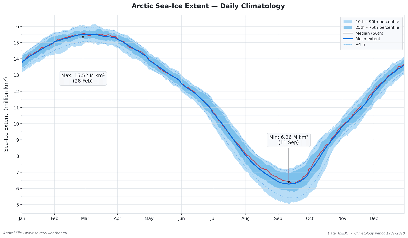
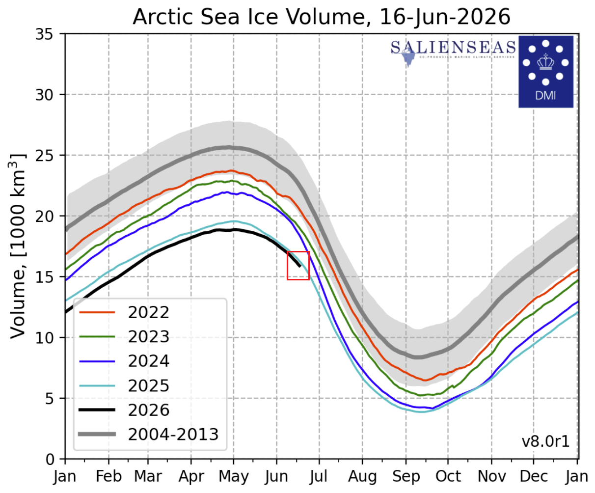
- Late Spring (May 2026): Sea ice volume peaked earlier than in previous years, reflecting a system that is struggling to maintain structural integrity as the sun reaches its highest point.
- Early June 2026: Data began to diverge sharply from the 10-year average. By mid-June, the sea ice extent had not only fallen behind the 2025 levels but was trailing the absolute record-low year of 2012.
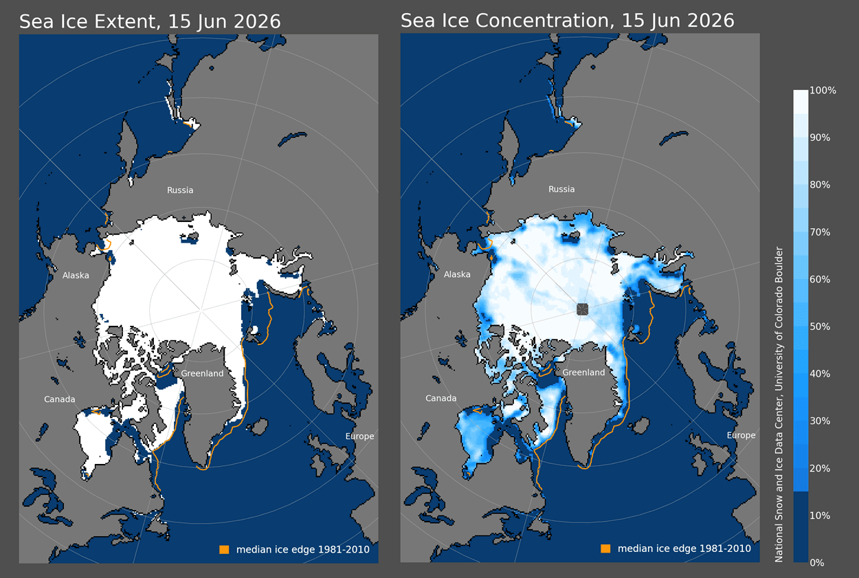
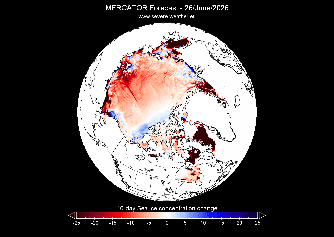
- Present Day: Satellite imagery and concentration analysis reveal "fragile zones" in the Atlantic side of the Arctic. These areas are highly susceptible to rapid, accelerated melting under the current weather patterns.
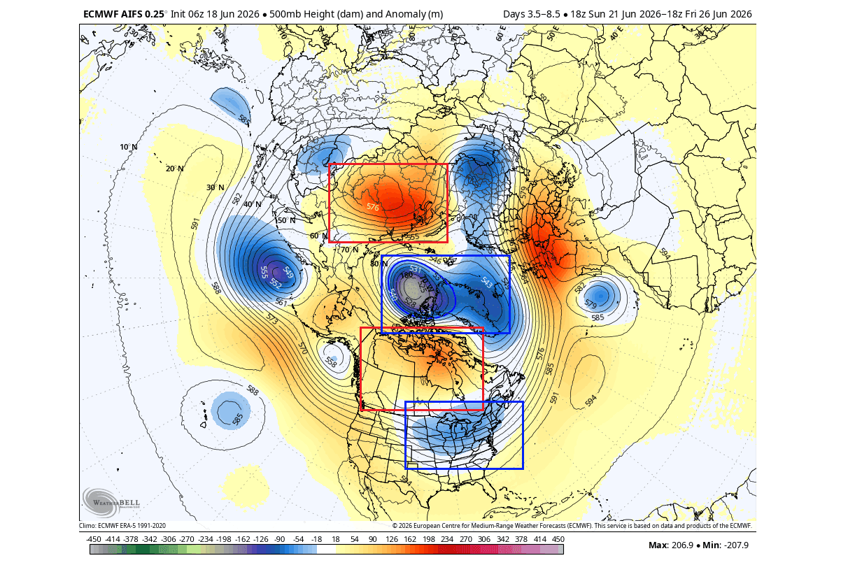
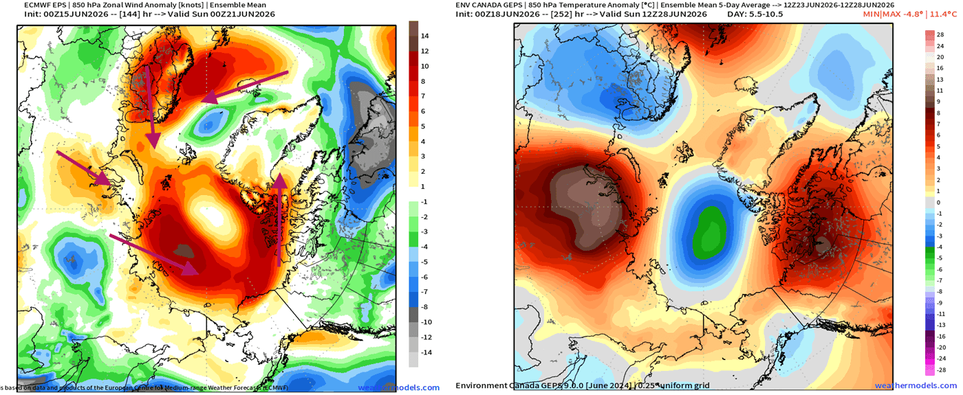
- The Outlook (Summer–Fall 2026): Forecast models from the European Centre for Medium-Range Weather Forecasts (ECMWF) project a sustained melt trend, driven by atmospheric "pumps"—low-pressure systems on both sides of the Arctic that act to draw warmer air from lower latitudes into the Polar Circle.
Supporting Data: Understanding the "Super" El Niño
The development of a Super El Niño is arguably the most significant variable in this year’s climate equation. An El Niño event is defined by the warming of surface waters in the equatorial Pacific, which alters global atmospheric circulation.
The Kelvin Wave and Subsurface Warming
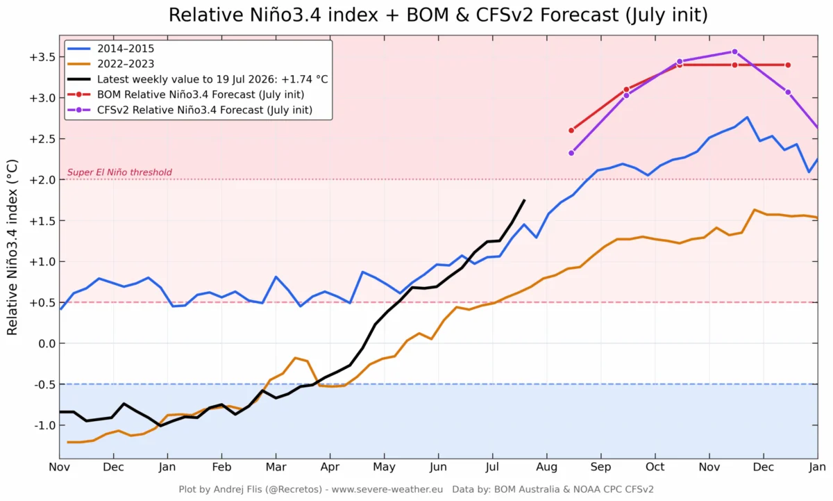
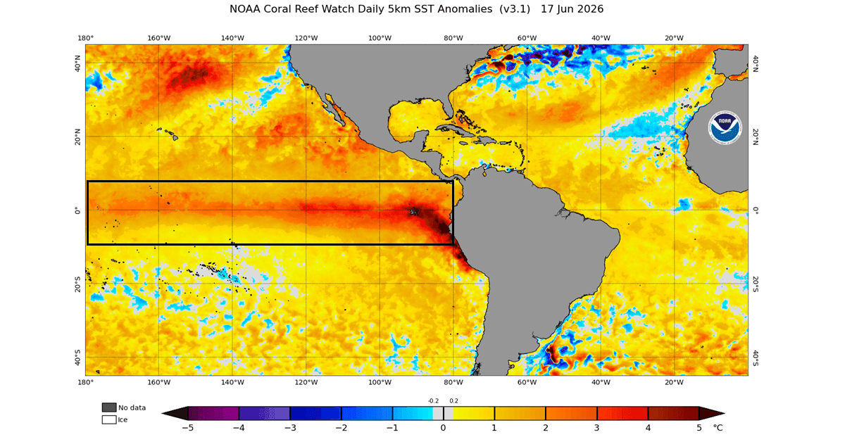
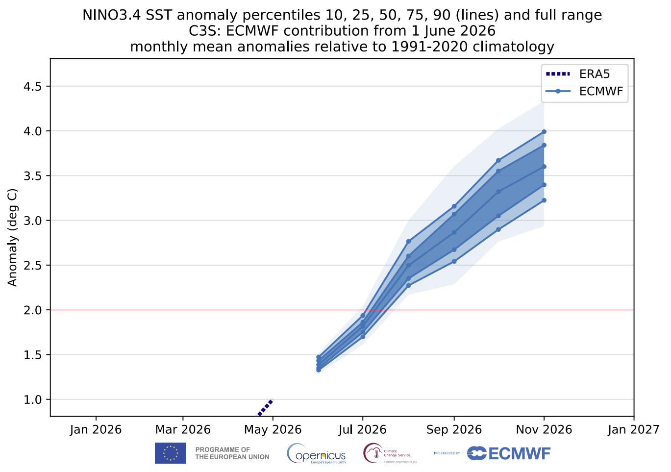
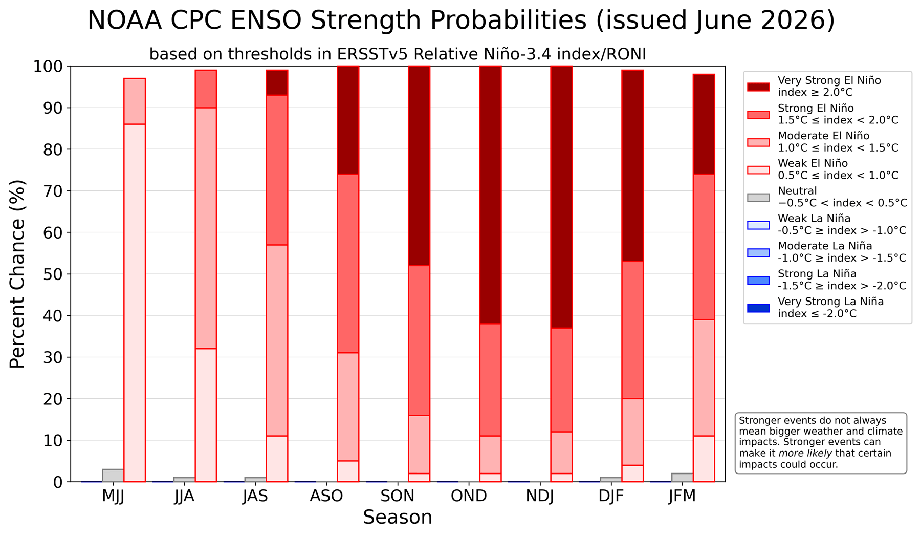
The current event is being driven by powerful subsurface ocean currents known as Kelvin Waves. These waves transport massive volumes of warm water eastward, eventually rising to the surface and fueling the El Niño phenomenon. Monitoring data confirms that the warming in the Niño 3.4 region is already exceeding the thresholds required for a "strong" event, with projections suggesting it could reach "Super" status—defined by anomalies exceeding +2.0°C above the long-term average.
Projections and Modeling
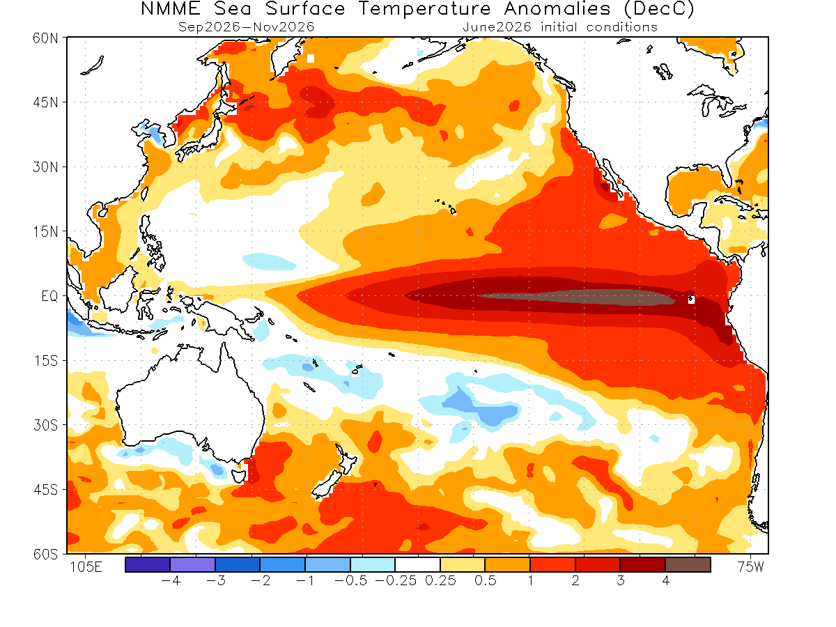
Multi-model ensembles, including the North American Multi-Model Ensemble (NMME), indicate that these sea surface temperature anomalies could peak at +4°C during the September–November window. This is consistent with the strongest events in recorded history. The implications of such a high-intensity event extend far beyond the tropics, as the resulting atmospheric coupling shifts global pressure systems, specifically impacting how air masses move over the Arctic.
The Atmospheric Bridge: How the Arctic Influences North America
There is a direct, measurable link between the melting of the Arctic ice and the weather experienced by citizens in the United States and Canada. This relationship is governed by the state of the Polar Vortex.
The Mechanism of Disruption
The Polar Vortex is a massive, spinning wall of air that typically traps cold, arctic air within the polar circle. When this vortex is stable, it acts as a gatekeeper, keeping frigid conditions contained. However, when the Arctic sea ice is at record lows, the region experiences "stratospheric warming." This warming can compress or even collapse the Polar Vortex.
The North American Impact
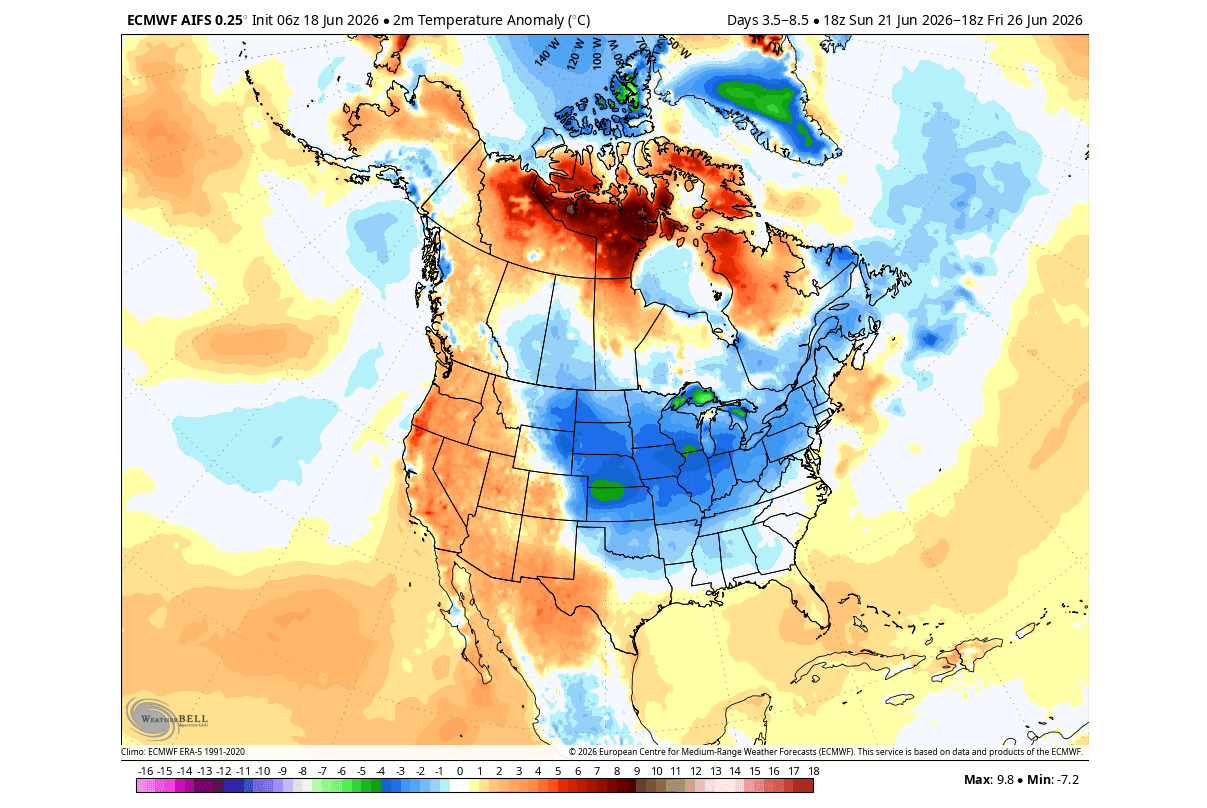
Current 500mb pressure anomaly forecasts show a small, unstable Polar Vortex core. Simultaneously, a high-pressure ridge is developing over Canada, which facilitates a "northerly flow" of air. This configuration is expected to deliver a cold temperature anomaly across the northern, central, and eastern United States throughout the coming weeks. While the public may experience these as "unseasonable cold snaps," meteorologists view them as symptoms of a deeply disrupted polar atmospheric structure.
Implications for Winter 2026/2027
The most critical takeaway from the current climate data is the potential for a high-impact winter season. The synergy between a record-low sea ice year and a Super El Niño is a known "recipe" for a volatile winter.
The "Double-Whammy" Effect
Research into historical Super El Niño winters reveals that they often lead to a weakened, distorted Polar Vortex. When the stratosphere warms—a process frequently triggered by the absence of sea ice—the vortex is prone to breaking down. Once the vortex collapses, the "trapped" cold air is released, spilling southward into mid-latitudes.
Regional Consequences:
- United States and Canada: Expect a higher probability of extreme winter weather events. While El Niño usually brings warmer, drier winters to the northern tier, the disruption of the Polar Vortex can override these norms, leading to intense, short-lived outbreaks of Arctic air.
- Europe: Similarly, the instability of the polar circulation increases the likelihood of sudden, severe winter weather in regions that might otherwise have expected milder conditions.
Scientific Consensus on Winter Risks
While no single weather event can be blamed entirely on one factor, the data suggests that the low sea ice extent provides the "pre-conditioning" for a warmer stratosphere. Combined with the atmospheric forcing of a Super El Niño, the probability of a significantly disrupted winter season is statistically higher than in years where sea ice remains at healthy levels.
Conclusion: Preparing for an Uncertain Future
The Arctic is currently the canary in the coal mine for global climate trends. As the region reaches record-low levels of ice for mid-June, the global community must prepare for a ripple effect that will move from the poles to the mid-latitudes.
The emergence of a Super El Niño adds a layer of complexity that climatologists are watching closely. The "atmospheric bridge" connecting the Pacific Ocean to the Arctic and subsequently to North American weather patterns is currently active and intensifying. As we transition from the summer melt into the fall and winter months, the behavior of the Polar Vortex will be the definitive factor in determining the severity of the upcoming winter.
For those in North America and Europe, the coming months will serve as a test of our climate resilience. The data is clear: the environment is in a state of rapid flux, and the connections between seemingly distant ocean temperatures and local winter snowstorms are tighter than ever. Stay informed, monitor official forecasts from local meteorological services, and prepare for a year of potentially extreme and unpredictable weather transitions.