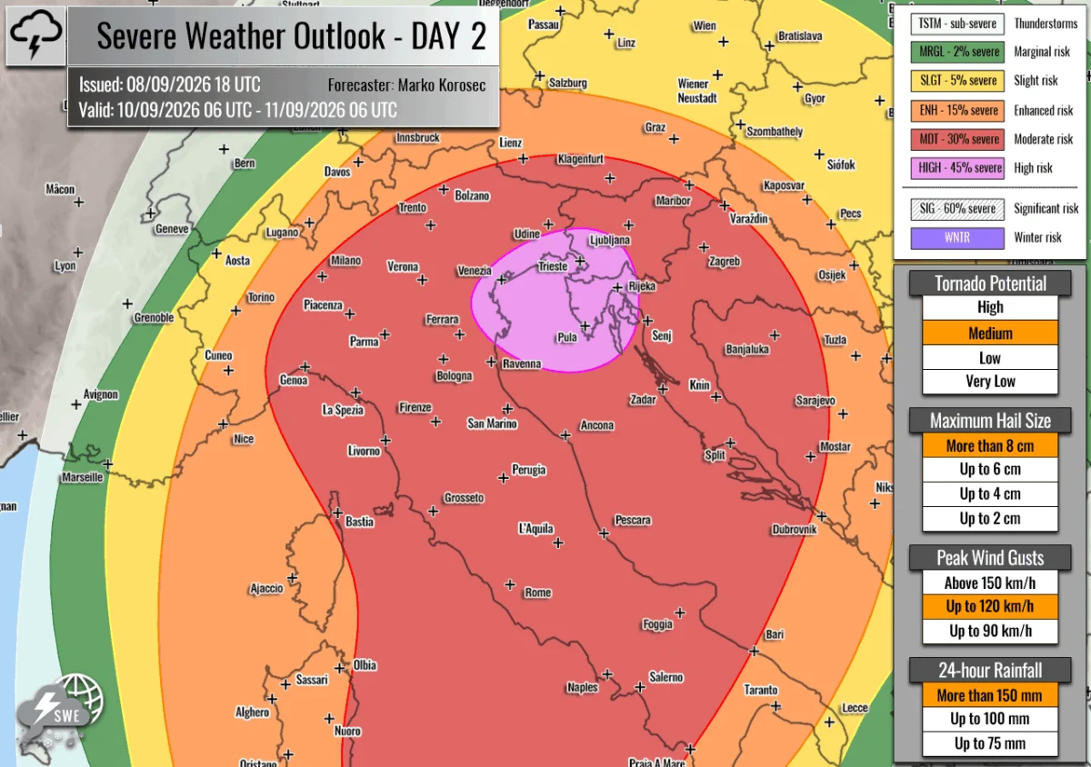
Forecaster: Marko Korošec | Issued by: Severe Weather Europe | Validity: September 9, 2026 – September 11, 2026
A volatile and dangerous meteorological pattern is unfolding across Europe as a significant two-day severe weather outbreak targets the western and northern Mediterranean. Meteorologists have issued a high-level warning, highlighting a potent combination of extreme atmospheric instability and powerful wind shear. From the Balearic Islands to the alpine regions of Northern Italy, Slovenia, and Croatia, the coming 48 hours are expected to bring destructive storms, including giant hail, tornadic activity, and life-threatening flash flooding.
Main Facts: A Convergence of Atmospheric Extremes
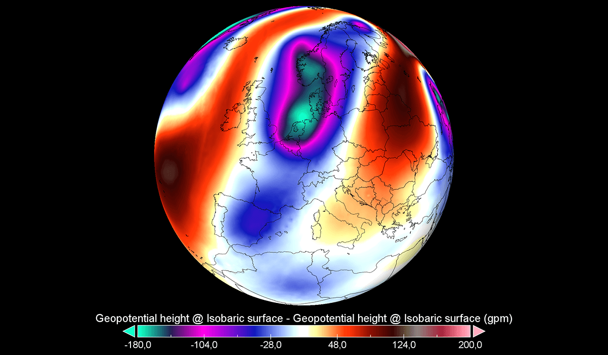
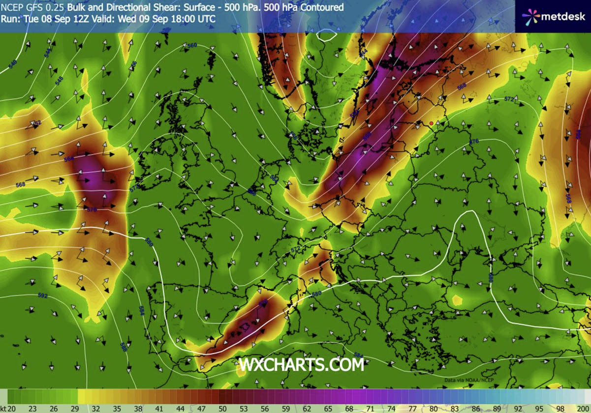
The current crisis is driven by the movement of a deep, upper-level trough pushing eastward from Western Europe. This system is encountering a stubborn, high-pressure ridge over Eastern Europe. As the ridge collapses, it creates a narrow but intense corridor where a powerful southwesterly jet stream acts as a catalyst for explosive storm development.
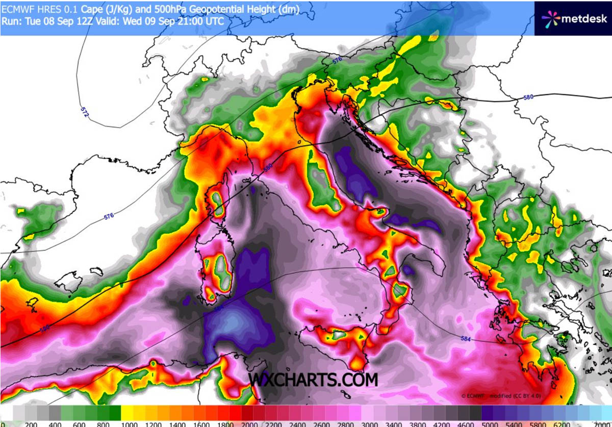
The severity of this event is amplified by the lingering effects of a historic marine heatwave that has gripped the Mediterranean for weeks. Sea surface temperatures remain well above average, acting as a massive fuel source. As moisture is pulled from the sea, dewpoints are reaching levels—near or exceeding 25°C—that are rarely seen in this region. This moisture, when lifted by the incoming cold front, will result in MLCAPE (Convective Available Potential Energy) values ranging between 3000 and 4000+ J/kg. In meteorological terms, this represents a "loaded gun" scenario, where the environment is primed for rapid, violent convection.
Chronology of the Outbreak
Wednesday, September 9: The Initial Surge
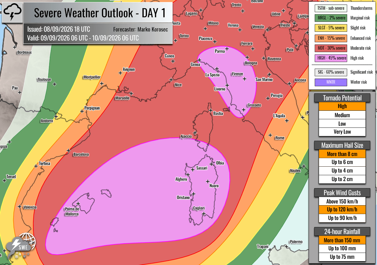
The outbreak begins on Wednesday morning, focusing primarily on the Balearic Islands, the Ligurian Bay, and northwestern Italy. Early reports suggest that the combination of intense solar heating and low-level moisture convergence will trigger isolated but fierce supercell thunderstorms.
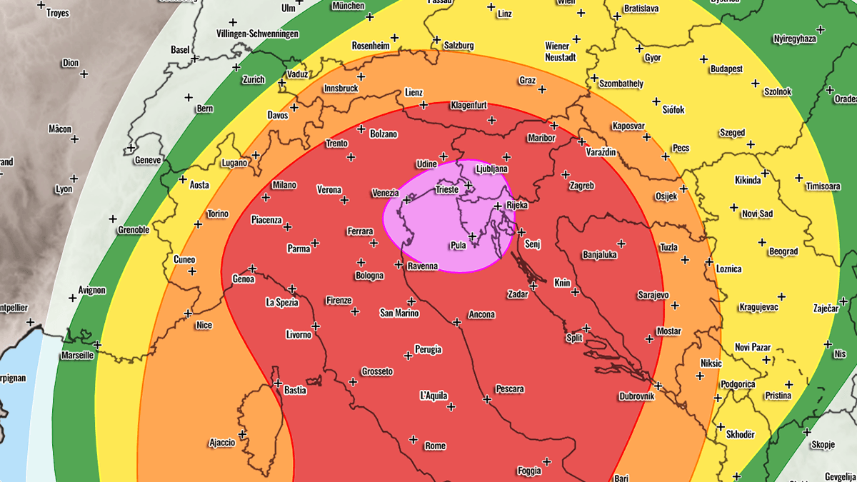
As the day progresses into the afternoon, these storms are expected to migrate east-northeast, impacting southern Corsica and Sardinia. The primary threats for this initial phase are giant hail (exceeding 6-10 cm), extreme wind gusts, and localized tornadoes. By Wednesday night, the atmosphere will likely force these individual cells into massive clusters, moving steadily toward the Po Valley and the northern Adriatic, eventually reaching western Slovenia and northwestern Croatia.
Thursday, September 10: Sustained Volatility
The second phase of the event will shift the focus further east. The high-risk zone for Thursday encompasses northeastern Italy, the northern Adriatic, and the Balkan corridor. The primary mode of storm development transitions from individual supercells to large, slow-moving convective systems.
Meteorologists are particularly concerned about "training" cells—a phenomenon where multiple thunderstorms move over the same geographical area in succession. This, combined with the slow movement of these systems, creates an environment where rainfall totals could reach 200–300 mm in less than 36 hours. In areas previously suffering from long-term drought, the ground’s inability to absorb this volume of water will likely lead to catastrophic, flash-flood events.
Supporting Data and Meteorological Analysis
The synoptic overview confirms that the pressure and temperature gradients currently present are highly anomalous for September. The "left exit region" of the jet stream—an area notorious for its ability to produce the most violent updrafts—is positioned directly over the most vulnerable regions.
Key risk indicators identified by the forecast models include:
- Extreme Instability: CAPE values exceeding 3000 J/kg, which are conducive to high-altitude ice growth, explaining the potential for giant hail.
- High-End Wind Shear: The mid-level jet stream provides the necessary tilt for storms to sustain themselves, allowing them to organize into rotating supercells.
- Low-Level Helicity: The southeasterly flow in the lower atmosphere, interacting with the mountainous terrain of the Apennines and the Alps, creates favorable conditions for tornadogenesis.
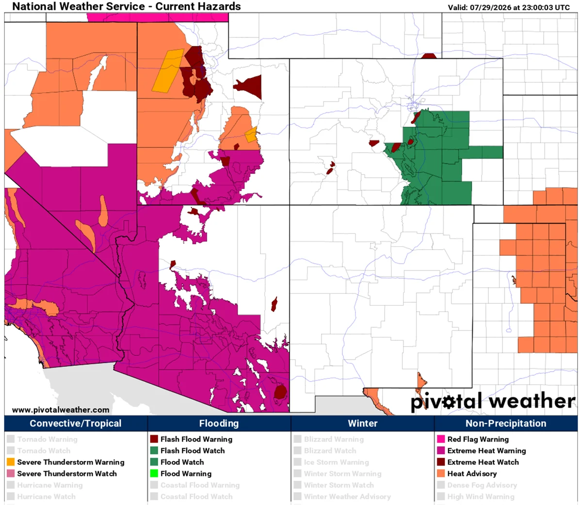
Visual data provided by high-resolution weather models, such as those from PivotalWeather, confirm that the intensity of the moisture transport from the Tyrrhenian and Adriatic Seas will sustain these storms well into Friday.
Implications for the Region
Infrastructure and Urban Vulnerability
The predicted intensity of the weather poses a direct threat to infrastructure. Large hail, frequently described in recent models as "giant," is capable of causing significant damage to vehicles, roofs, and agricultural crops. Furthermore, the wind speeds associated with these supercells may lead to widespread power outages and the destruction of trees and smaller structures.
The Flash-Flood Paradox
One of the most concerning aspects of this event is the juxtaposition of severe drought and sudden, excessive rainfall. Many regions in northern Italy and the Balkans have experienced a dry summer, hardening the soil. This "baked" ground acts like pavement, meaning that even moderate rain leads to immediate runoff. With 200 mm+ of rain predicted in localized areas, the risk of mudslides and urban flash flooding is extreme. Residents in mountainous areas or near riverbanks are at heightened risk of rapidly rising waters.
Maritime and Coastal Threats
The Balearic Islands and the Italian coastline are under the most immediate threat. Coastal regions, particularly those facing the Ligurian and Tyrrhenian seas, will face the brunt of the storm-relative helicity, making them hotspots for tornadic activity. Maritime traffic and coastal tourism are strongly advised to heed local government warnings, as conditions can change in a matter of minutes.
Official Responses and Public Safety Recommendations
As of the current issuance, regional civil protection agencies are being urged to heighten their alert status. While specific government mandates will vary by country (Italy, Spain, Slovenia, and Croatia), standard emergency protocols for such high-risk events include:
- Immediate Monitoring: Residents are encouraged to follow local meteorological agencies and stay tuned to emergency broadcasts.
- Preparation for Power Outages: Given the wind and lightning forecasts, citizens should ensure they have emergency supplies, including flashlights, water, and portable chargers.
- Flood Precautions: Those living in flood-prone areas should move vehicles to higher ground and secure outdoor items that could become projectiles in high winds.
- Shelter Protocols: If a thunderstorm warning is issued, the safest location is inside a sturdy building, away from windows. If caught outdoors, seek shelter immediately and avoid high points, trees, or metal structures.
Conclusion: A Significant Meteorological Event
This two-day event stands as a significant test of regional disaster preparedness. The combination of "historic" marine moisture, a powerful jet stream, and the unique topography of the Mediterranean basin creates a worst-case scenario for severe convection.
The forecast provided by Marko Korošec and the team at Severe Weather Europe serves as a critical warning. While the precise path of individual storms can shift, the overall setup—characterized by HIGH risk zones and the potential for 300mm of rainfall—demands that the public treat this threat with the utmost seriousness. The transition from drought to extreme flooding in such a short window underscores the increasing volatility of Europe’s weather patterns, requiring constant vigilance from both authorities and the general public throughout the duration of this outbreak.
Disclaimer: This report is based on current meteorological data. Weather conditions are subject to rapid change. Please consult your local national weather service for localized warnings and real-time radar updates.