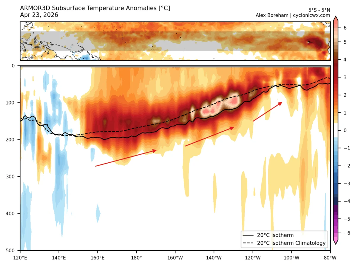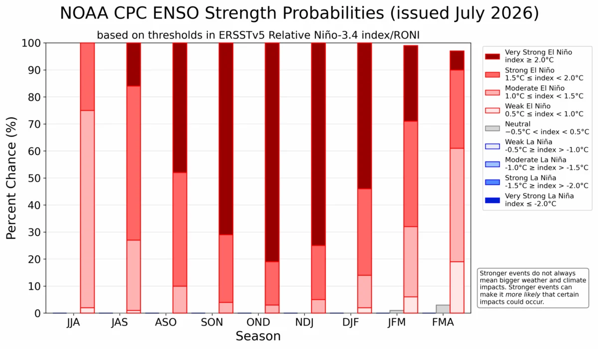
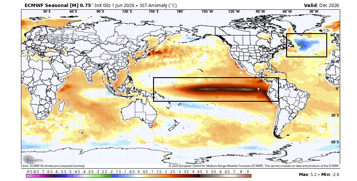
As meteorologists and climate scientists cast their gaze toward the horizon, a rare and complex atmospheric alignment is beginning to take shape. A significant "cold blob"—a persistent anomaly of frigid water—is intensifying in the far North Atlantic, while concurrently, a powerful Super El Niño is rapidly developing in the tropical Pacific. This dual-driver system is already providing researchers with strong, early indicators of the global weather patterns expected for the upcoming Winter 2026/2027 season.

The interplay between these massive oceanic drivers and the global atmosphere is not merely a curiosity; it is a critical barometer for seasonal climate forecasting across the United States, Canada, and Europe. As we move into the latter half of 2026, the question is not just how these anomalies will behave, but how their collision will reorganize the Northern Hemisphere’s jet stream.
The Anatomy of the North Atlantic ‘Cold Blob’
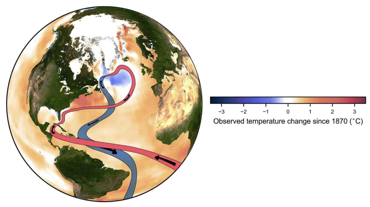
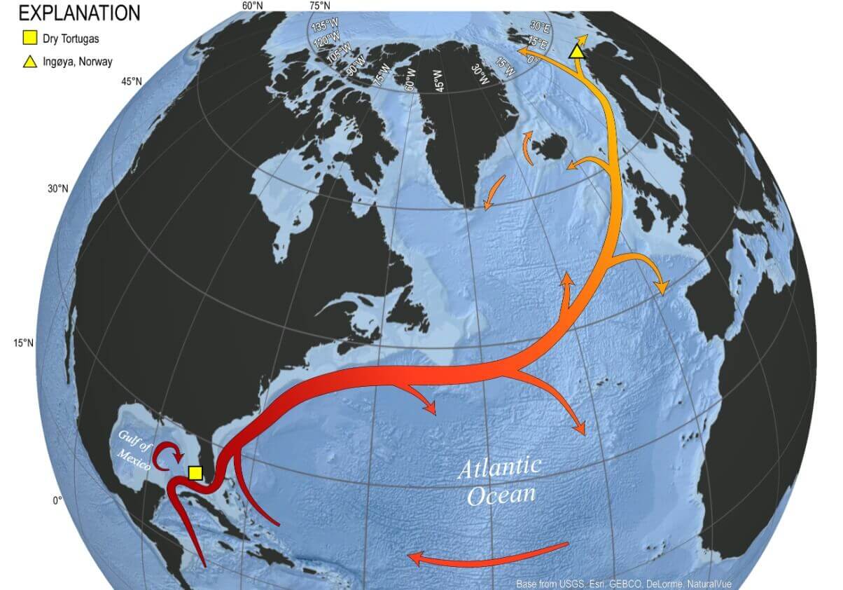
The North Atlantic Ocean is far from a stagnant body of water; it serves as the engine room for global weather through the Atlantic Meridional Overturning Circulation (AMOC). This complex system, which includes the Gulf Stream, acts as a planetary conveyor belt, transporting warm water from the tropics toward the Polar Circle.
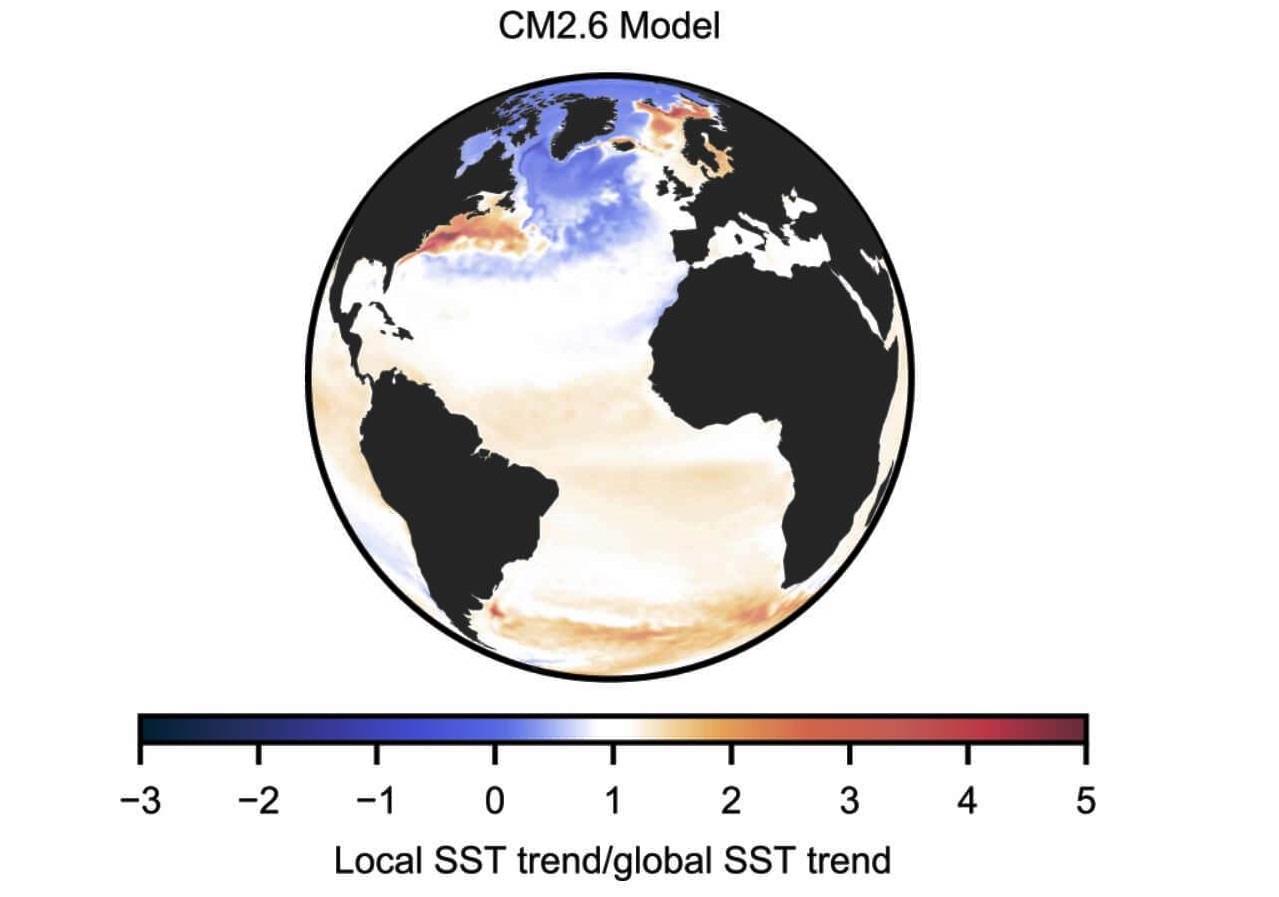
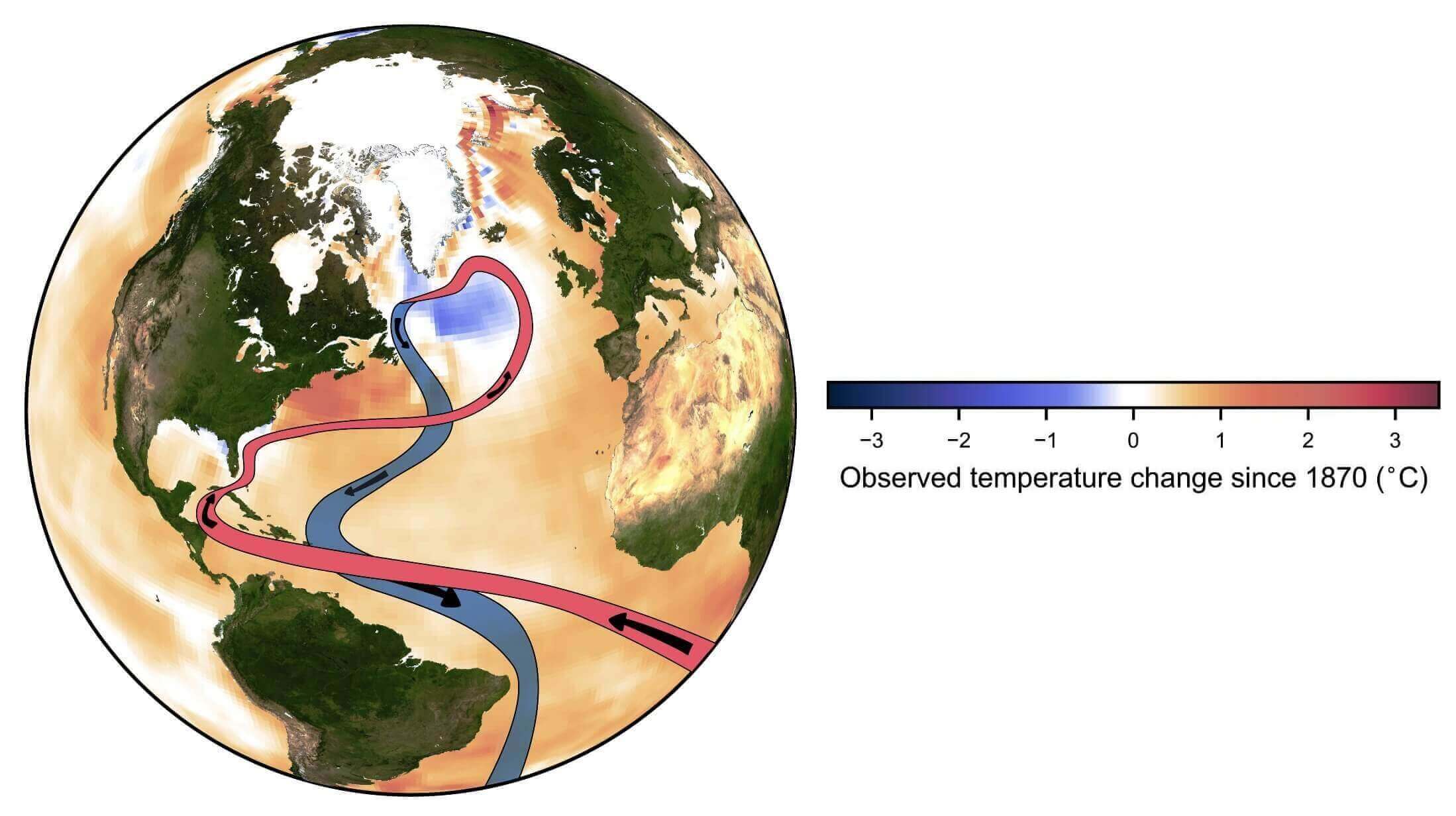
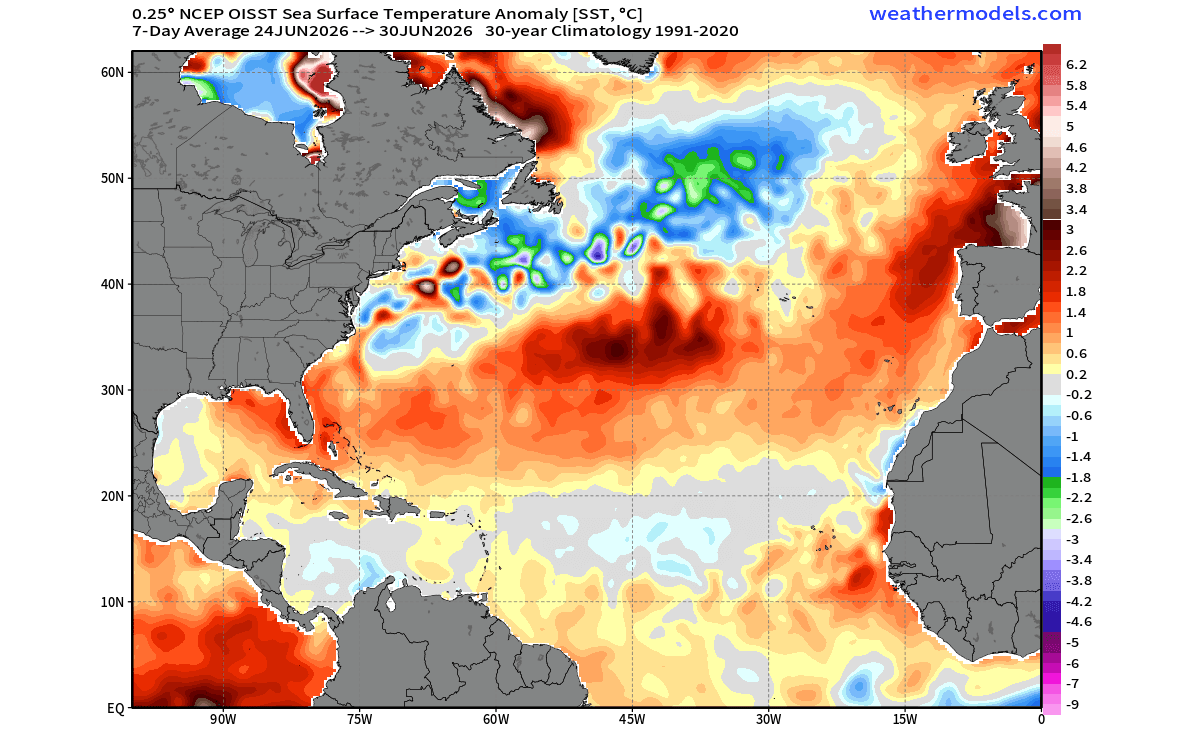
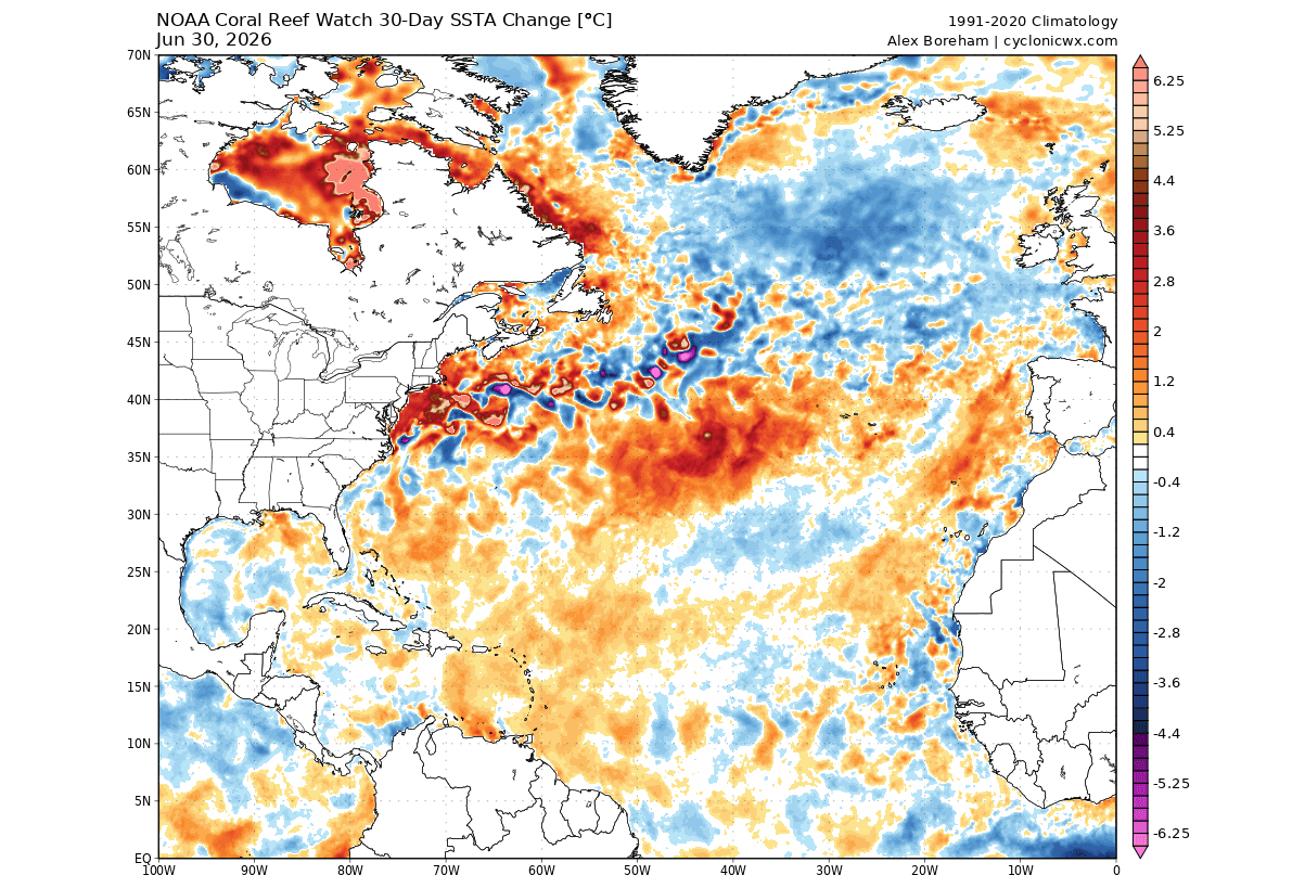
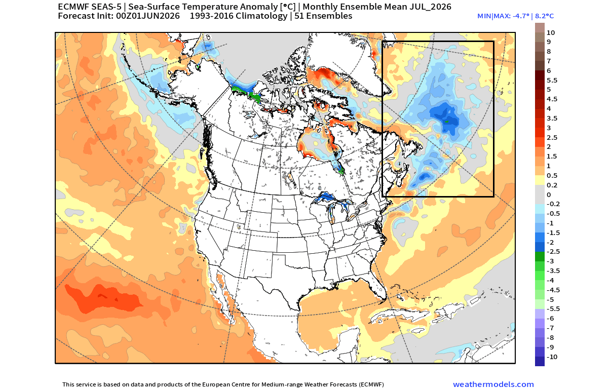
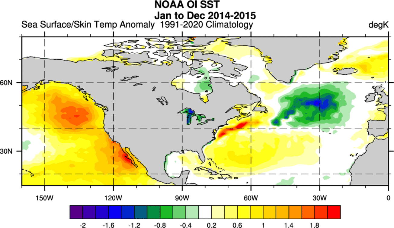
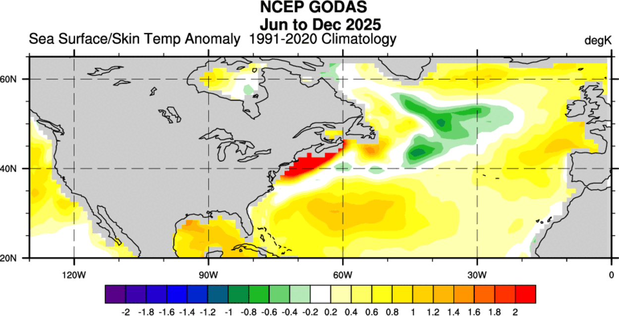
In recent years, however, observational data has suggested that this vital system is slowing down. The hallmark signature of this slowdown is a stark thermal contrast: the warming of the ocean surface along the U.S. East Coast and a pronounced, persistent cooling in the subpolar gyre east of Newfoundland. This region of cooling is what scientists have dubbed the "cold blob."
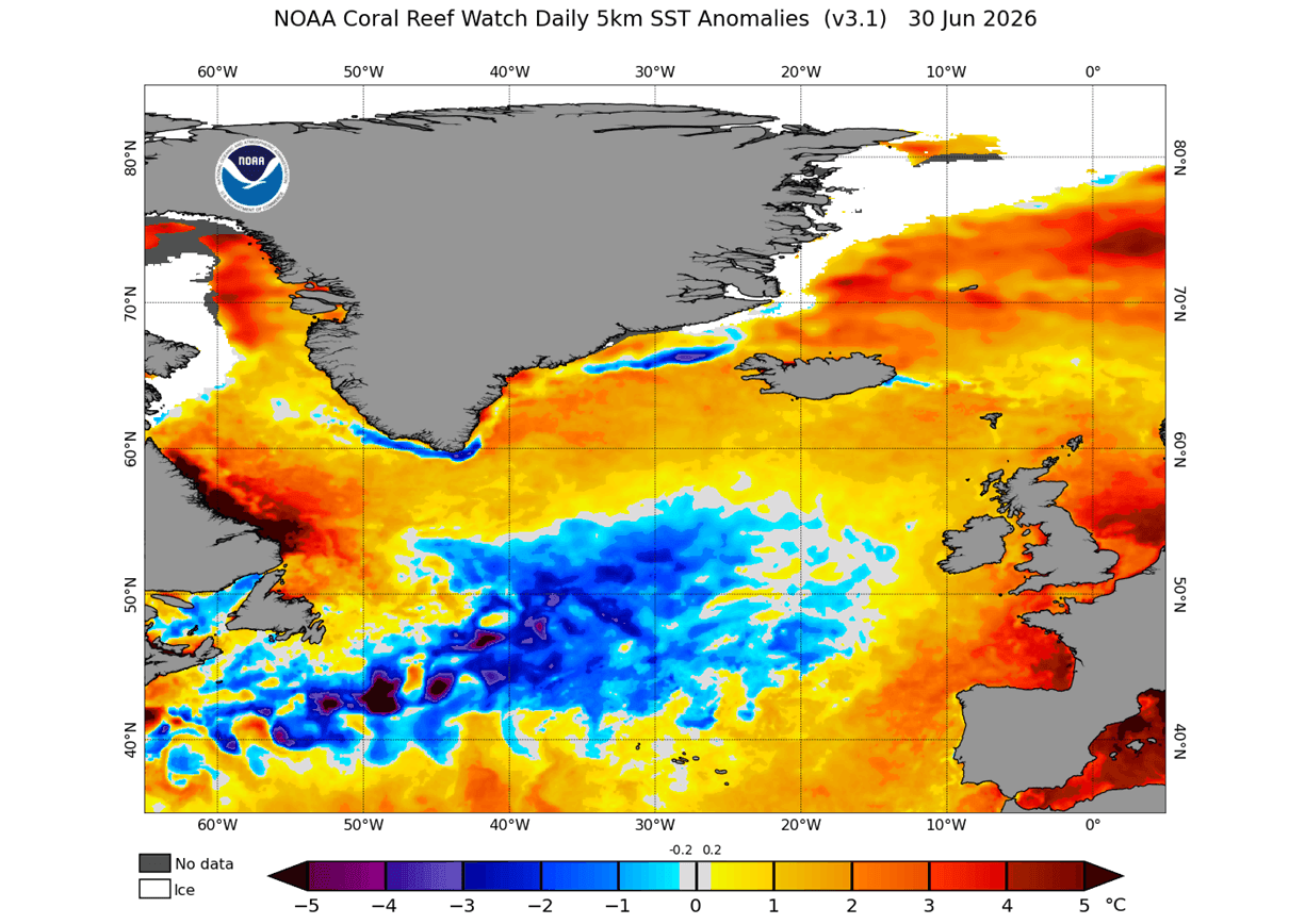
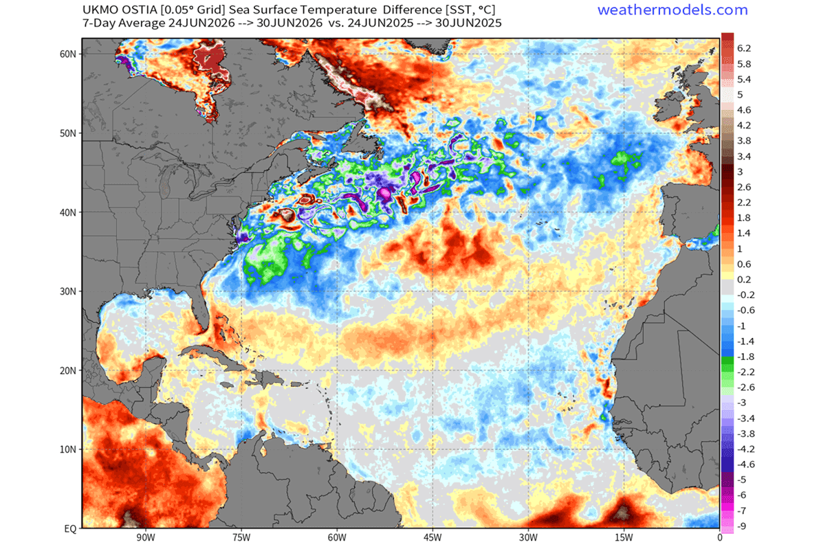
Latest data from the National Oceanic and Atmospheric Administration (NOAA) confirms that this cold anomaly is not only returning but is significantly larger than it was last year. By June 2026, surface temperatures in this region were recorded as 0.5 to 2 degrees Celsius lower than at the same time in 2025. This cooling is not confined to the deep ocean; it is interacting directly with the surface, effectively disrupting the traditional temperature gradients that steer weather systems across the North Atlantic.
Chronology of a Shifting Climate
The development of this year’s cold anomaly follows a recognizable trajectory that has been studied extensively over the last decade.
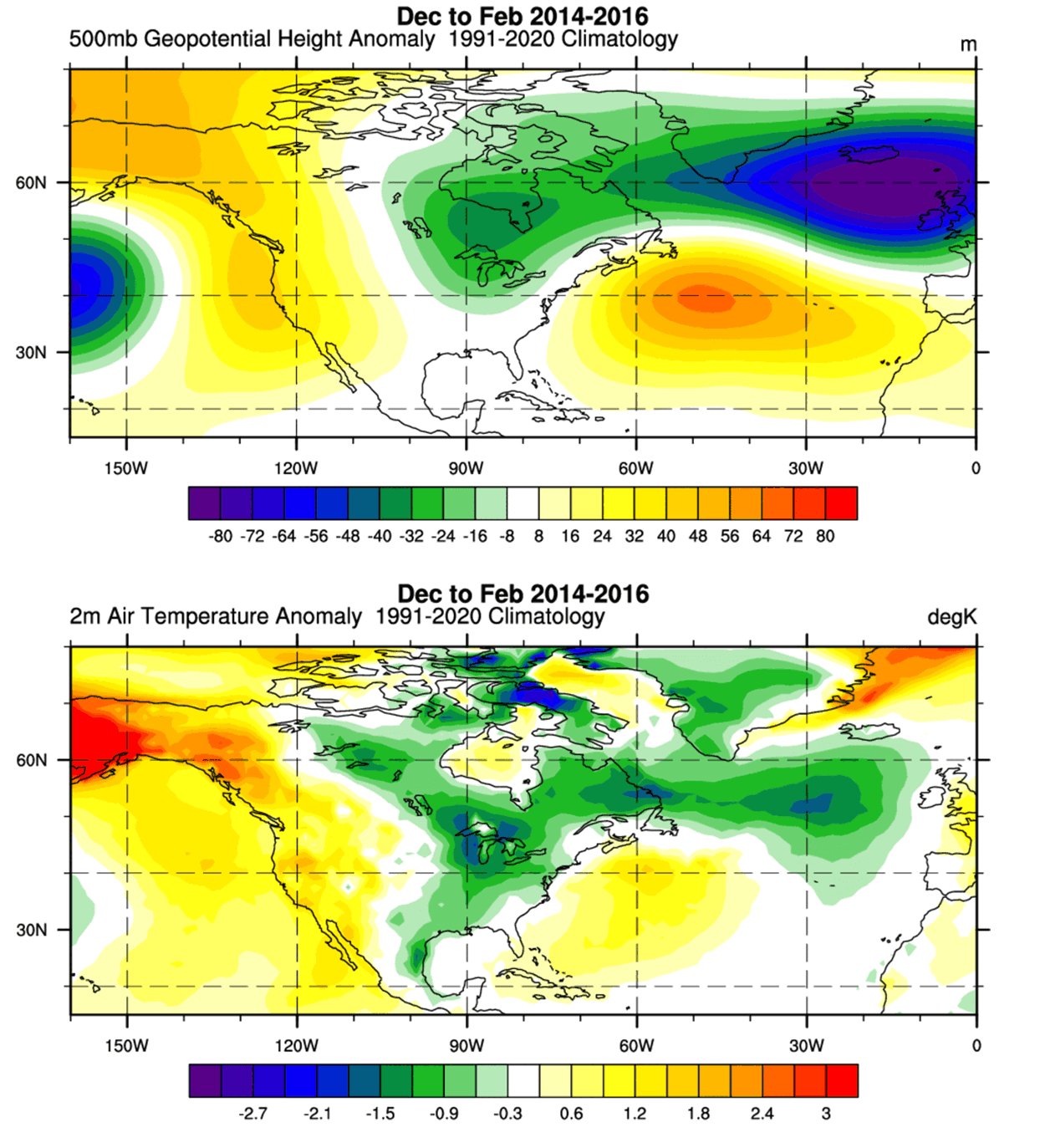
- Mid-2025: Initial signs of a subpolar cooling trend began to emerge, matching patterns seen during the 2014-2015 period, which historically resulted in significant pressure anomalies.
- Early 2026: The cold blob began to organize, showing a clear structural connection to the Gulf Stream flow.
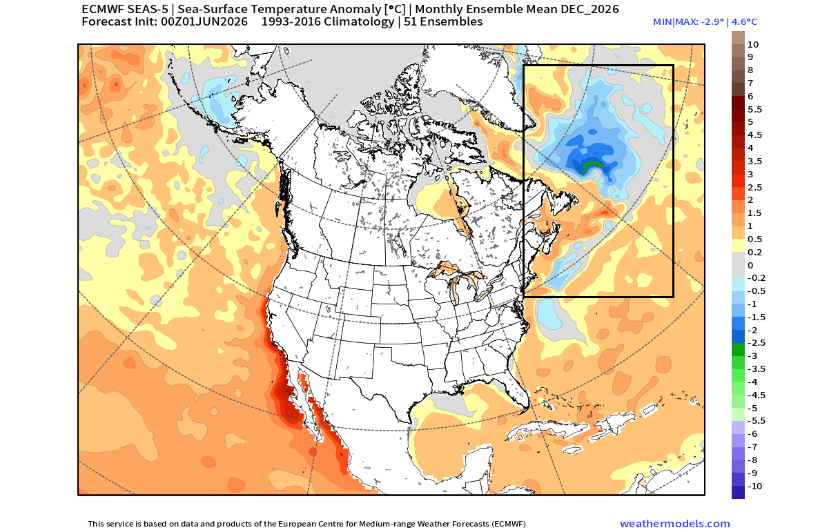
- June/July 2026: Advanced satellite analysis confirmed that the cold anomaly was expanding and becoming more persistent. Forecast models, including the ECMWF and CFS, now project that this feature will remain firmly in place through the winter months.
- Late 2026/Early 2027: The peak of the projected Super El Niño is expected to coincide with the established Atlantic cold blob, creating a dual-force impact on the atmosphere.
This temporal progression suggests that we are witnessing a multi-year shift rather than a transient weather event. The consistency of these indicators across various seasonal forecast models—such as the Canadian Seasonal and Interannual Prediction System (CanSIPS) and the European Centre for Medium-Range Weather Forecasts (ECMWF)—lends high confidence to the prediction that this oceanic setup will influence the upcoming winter.
Supporting Data: The Collision of Two Worlds
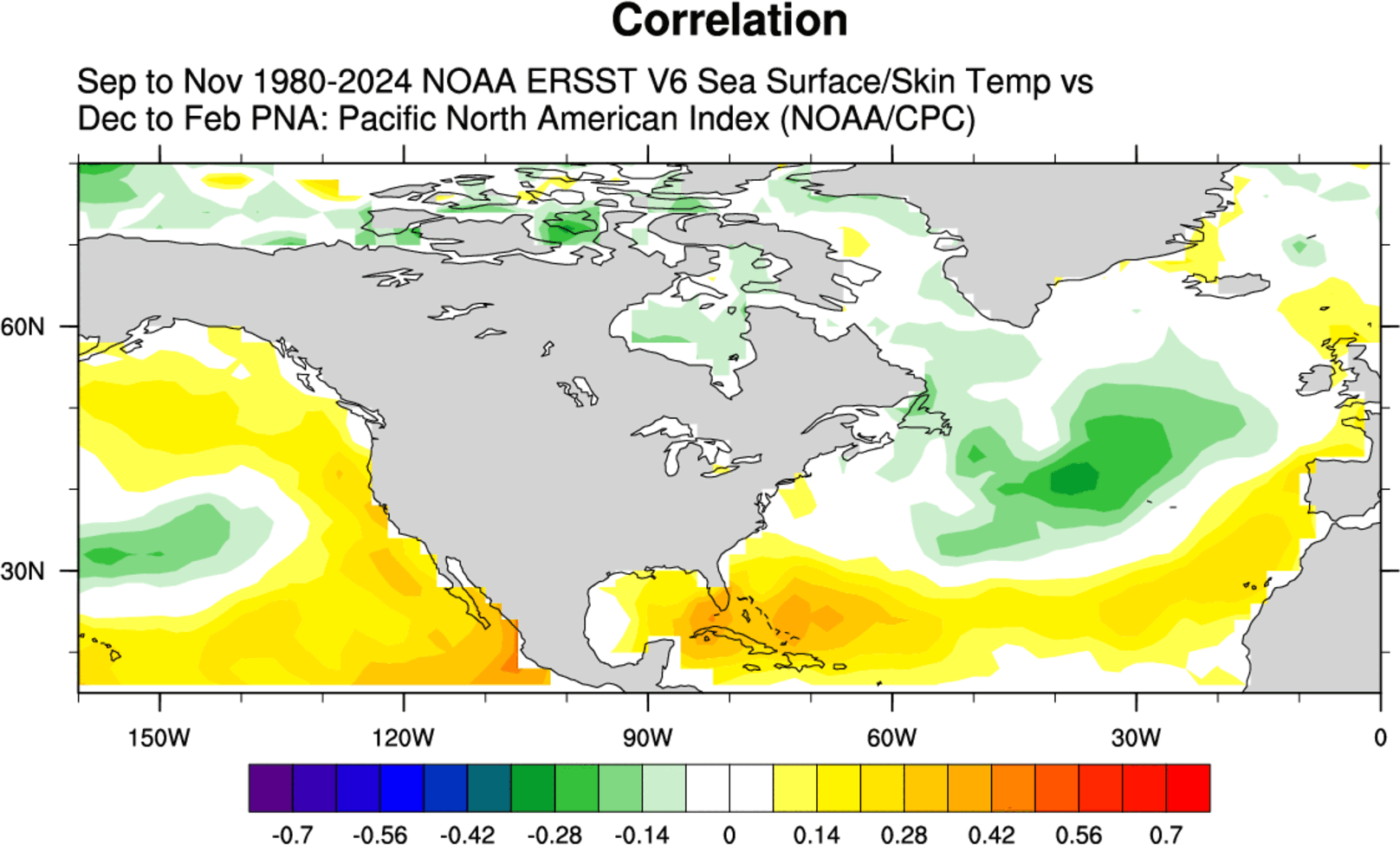
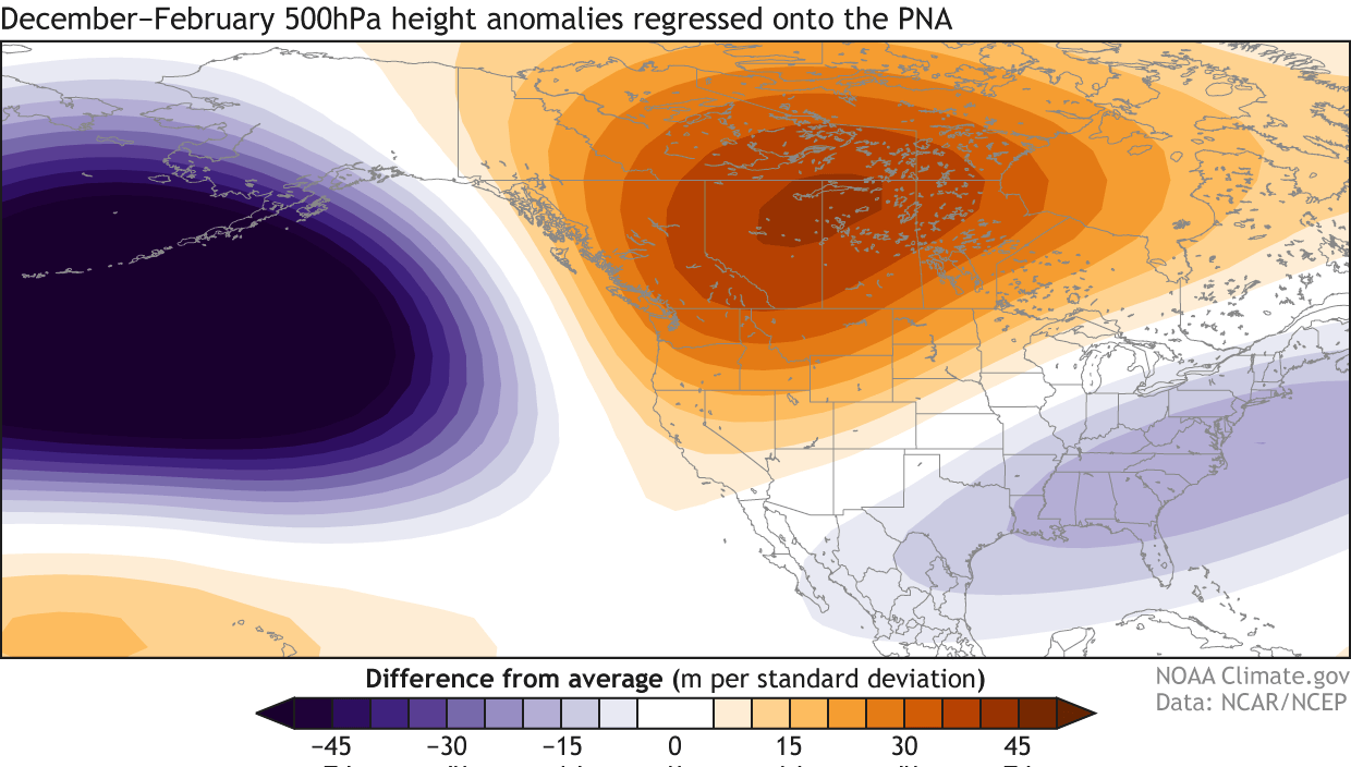
To understand the potential impact, we must look at the data through the lens of the Pacific-North American (PNA) pattern. The PNA index is a major driver of the jet stream, influencing the pressure distribution between the North Pacific and North America.
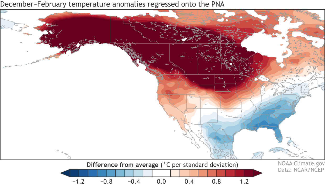
Historically, the presence of a cold North Atlantic blob has been correlated with a "positive PNA" phase during the winter. A positive PNA phase typically features a high-pressure ridge over the northwestern United States and western Canada. This ridge acts as a diversion, forcing the jet stream to dip southward over the central and eastern United States.
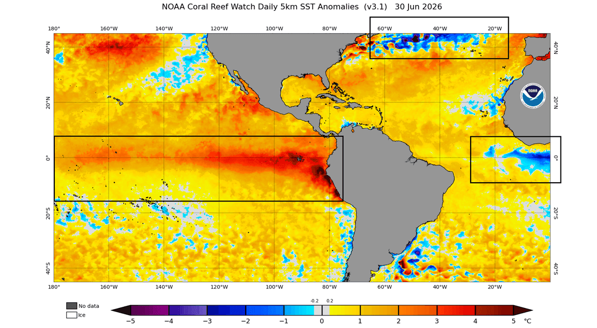
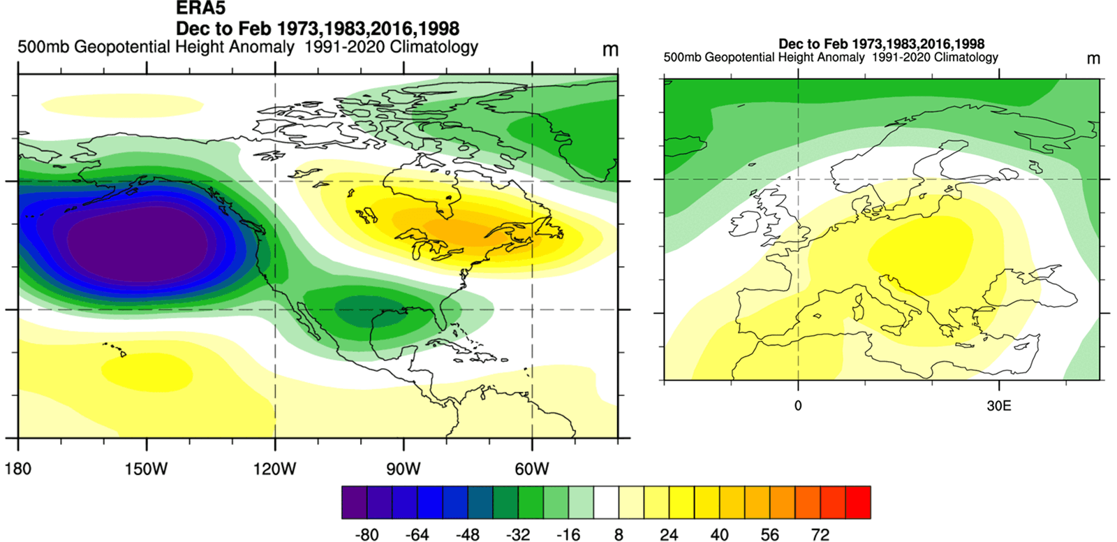
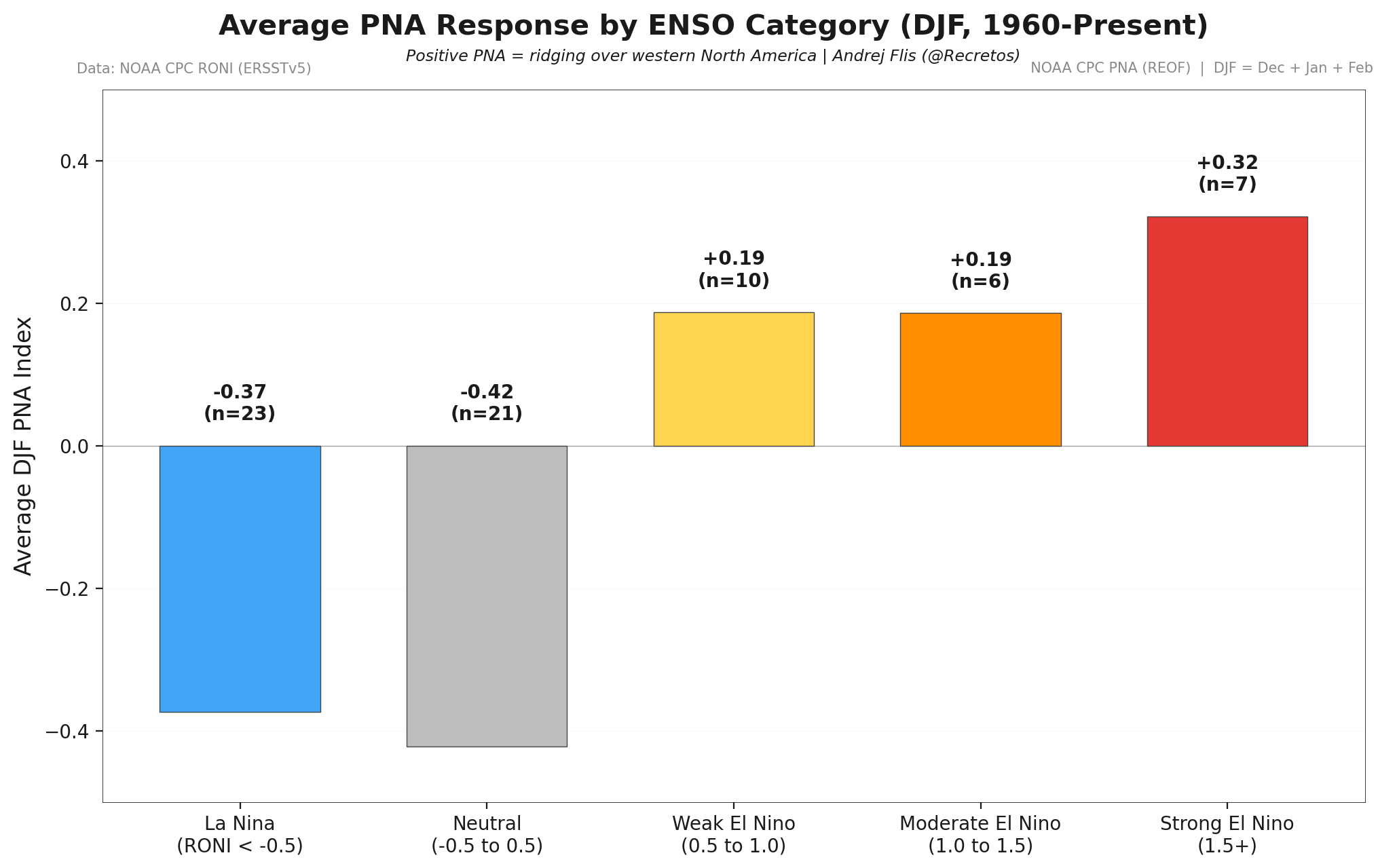
However, this year, the PNA influence is being turbocharged by the developing Super El Niño. When we analyze the last four Super El Niño events, we observe a consistent atmospheric response: a deep low-pressure system in the North Pacific and a high-pressure ridge over Canada.
When the cold Atlantic anomaly and the Super El Niño are overlaid, the resulting "tri-headed" pattern creates a strong, predictable, yet potentially volatile, seasonal outlook. The data shows that the Pacific influence is the primary driver, but the Atlantic cold blob serves as a secondary amplifier, "locking" the jet stream into a configuration that favors cold air transport into the eastern half of the North American continent.
Official Observations and Model Forecasts
The convergence of these forces is being tracked by the world’s most sophisticated climate models. The European ECMWF model, for instance, explicitly forecasts the continuation of the cold North Atlantic anomaly through December 2026. These forecasts demonstrate a rare level of agreement among global meteorological centers.
Looking at the CFS (Climate Forecast System) temperature outlooks for December 2026 through February 2027, a clear dichotomy emerges. While the Super El Niño conditions typically bring warmer-than-average temperatures to the northern tier of the U.S. and Canada, the atmospheric reaction to the North Atlantic anomaly suggests a "cold corridor" extending from the Midwest through the Eastern Seaboard.
Conversely, for Europe, the models suggest a different story. The rise of a high-pressure ridge from the south—a classic symptom of strong El Niño winters—is expected to bring warmer-than-normal conditions to central and southern Europe. This creates a fascinating geographic contrast: North America potentially bracing for volatility and cold-driven weather, while parts of Europe face a more muted, warmer winter regime.
Implications for the Winter 2026/2027 Season
What does this mean for the general public and stakeholders?
1. The North American "Cold Corridor"
If the historical correlation between cold North Atlantic anomalies and the positive PNA pattern holds true, the eastern United States and parts of Canada should prepare for the potential of frequent incursions of Arctic air. The polar vortex, often a wildcard in winter forecasting, will likely be guided by this high-pressure blocking pattern over the North Pacific and Canada, potentially focusing its cold core over the eastern United States.
2. European Weather Dynamics
For Europe, the primary driver will be the shift in pressure patterns caused by the tropical Pacific. The expectation of a persistent high-pressure ridge suggests a milder winter for the continent, but it also implies that the "Atlantic influence"—which normally brings wet, stormy weather—might be diverted or weakened, leading to a different set of challenges, including potential drought in southern regions.
3. Energy and Infrastructure
As energy grids become increasingly sensitive to extreme weather events, the early signal provided by these ocean anomalies is invaluable. Utilities and government agencies now have a window of opportunity to monitor the evolution of the PNA pattern and the strength of the El Niño to better prepare for potential surges in demand caused by temperature extremes.
4. A Diagnostic Tool for the Future
The most profound implication is what this tells us about our planet’s interconnectedness. Ocean temperatures act as the "control lights" on the dashboard of the Earth’s climate system. By recognizing the relationship between the AMOC slowdown, the Atlantic cold blob, and the Pacific ENSO cycle, meteorologists are moving toward a more holistic, systems-based approach to long-range forecasting.
Conclusion
As we approach the winter of 2026/2027, the evidence points toward a season defined by the collision of two massive oceanic forces. While the Super El Niño will likely take center stage in the Pacific, the North Atlantic’s cold blob will play a silent but pivotal role in determining the path of the jet stream.
Nature is providing early warnings through these oceanic markers. By analyzing the data from past events and utilizing modern computational models, we are gaining a clearer picture of the seasonal dynamics ahead. While the long-range forecast is inherently complex, the alignment of these global drivers provides a unique opportunity to understand and prepare for the winter to come. Whether in the heart of the American Midwest or the coastal cities of Europe, the influence of these distant ocean anomalies will be felt, serving as a reminder of the delicate, intricate balance of our global climate.