As we approach the final quarter of 2026, the global meteorological community is bracing for one of the most significant climate events in recent decades: a developing "Super El Niño." This atmospheric phenomenon, characterized by extreme sea surface temperature anomalies in the tropical Pacific, is already exerting a profound influence on global jet stream patterns. For the upcoming 2026/2027 winter season, this implies a radical redistribution of snowfall across North America and Europe, with clear "winners" and "losers" in terms of seasonal accumulation.
Main Facts: A Historic Climate Driver
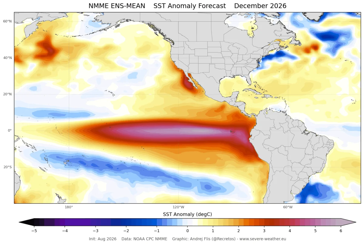
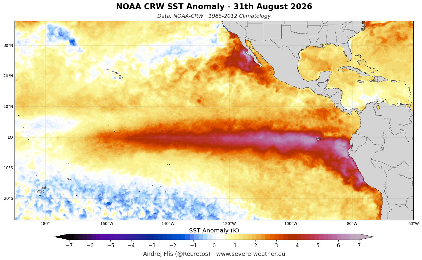
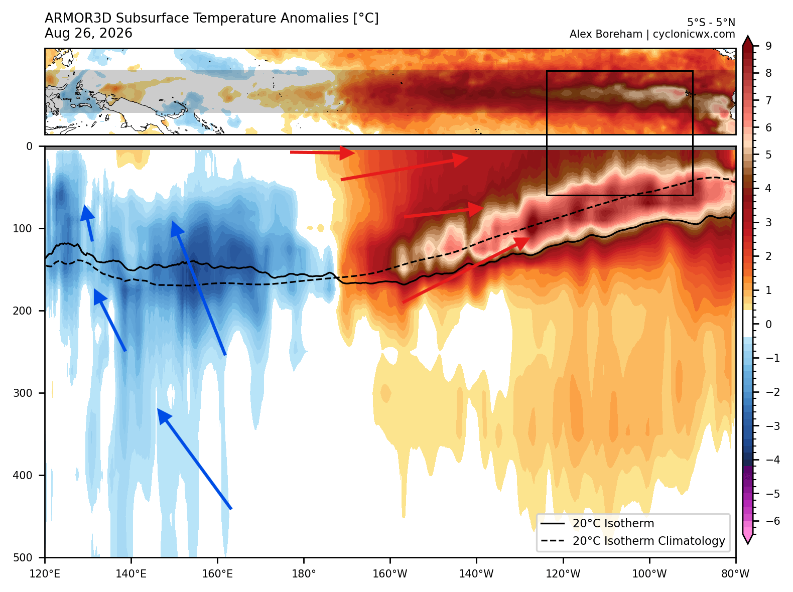
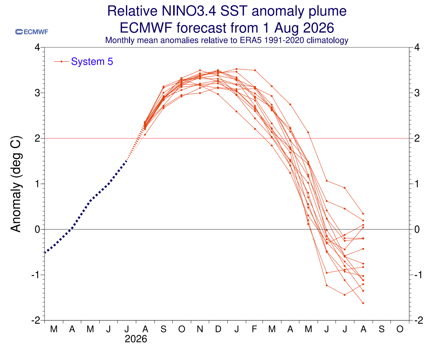
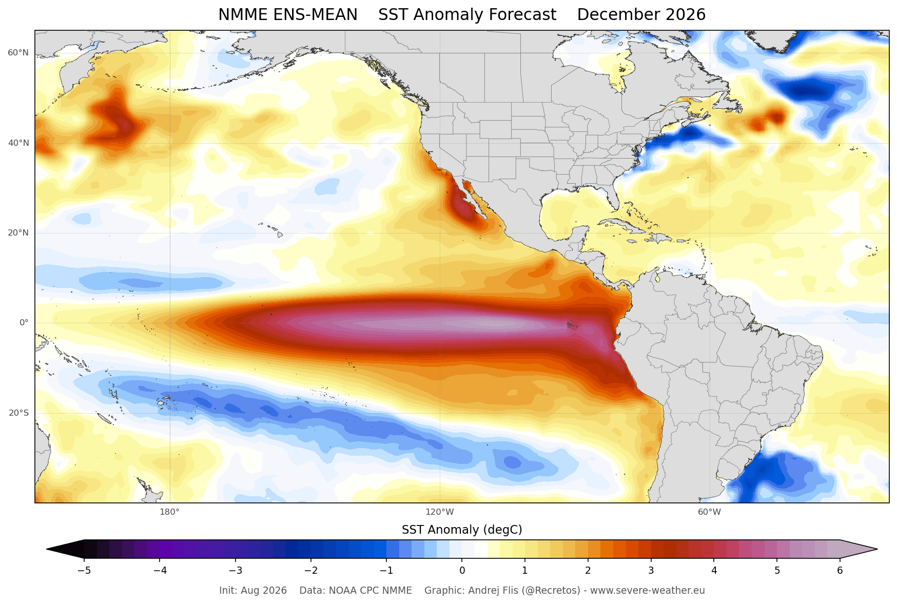
The term "Super El Niño" is not used lightly; it is reserved exclusively for the most powerful iterations of the El Niño-Southern Oscillation (ENSO). To qualify, seasonal temperature anomalies in the key Pacific regions must exceed +2°C. Data from September 2026 confirms that we have not only surpassed this threshold but are trending toward peak anomalies exceeding +3°C.
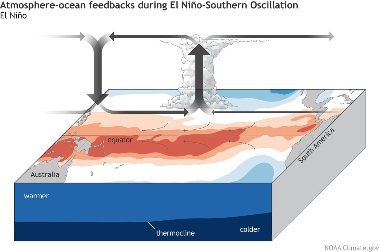
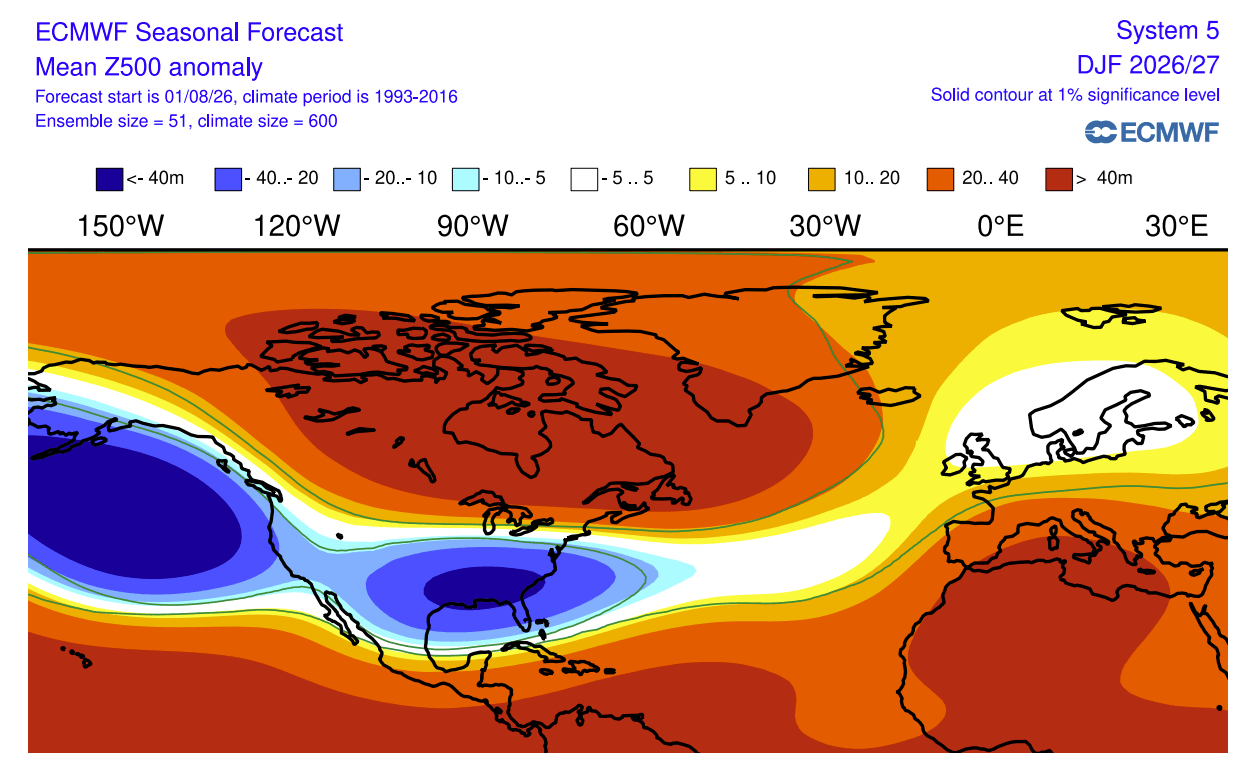
This oceanic heat acts as an "atmospheric bridge," fundamentally altering the Walker Circulation. The result is a consistent shift in the jet stream—the high-altitude "river of air" that steers storm systems. By driving a stronger, more persistent subtropical jet stream across the southern United States and forcing high-pressure ridges over Canada and northern Europe, the Super El Niño is effectively rewriting the map for winter precipitation.
Chronology of the 2026/2027 Winter Development
The transition into winter will be marked by distinct, predictable phases influenced by the atmospheric response to the Pacific warming.
- Late Autumn (November): The season begins with a slow start to snowfall. Model data from both the ECMWF (European Centre for Medium-Range Weather Forecasts) and UKMO (UK Met Office) suggest that the initial high-pressure dominance will limit early-season snow across mid-latitudes.
- Early Winter (December): As the Super El Niño reaches peak intensity, the Pacific jet stream begins to influence the central and eastern United States. We expect to see an uptick in storm activity, though the northern regions may remain unseasonably dry.
- Mid-to-Late Winter (January–February): This period represents the most active phase of the season. Historical analogs and current ensemble forecasts suggest that the southward-shifted storm track will become locked in, delivering sustained, above-average snowfall to the southern and central U.S. plains, while northern regions continue to experience a relative deficit.
Supporting Data: Scientific Consensus
The insights provided in this forecast rely on the synthesis of two of the world’s most robust climate modeling systems: the ECMWF and the UKMO. By comparing their seasonal ensemble data, climatologists can identify high-probability trends.
The European Perspective
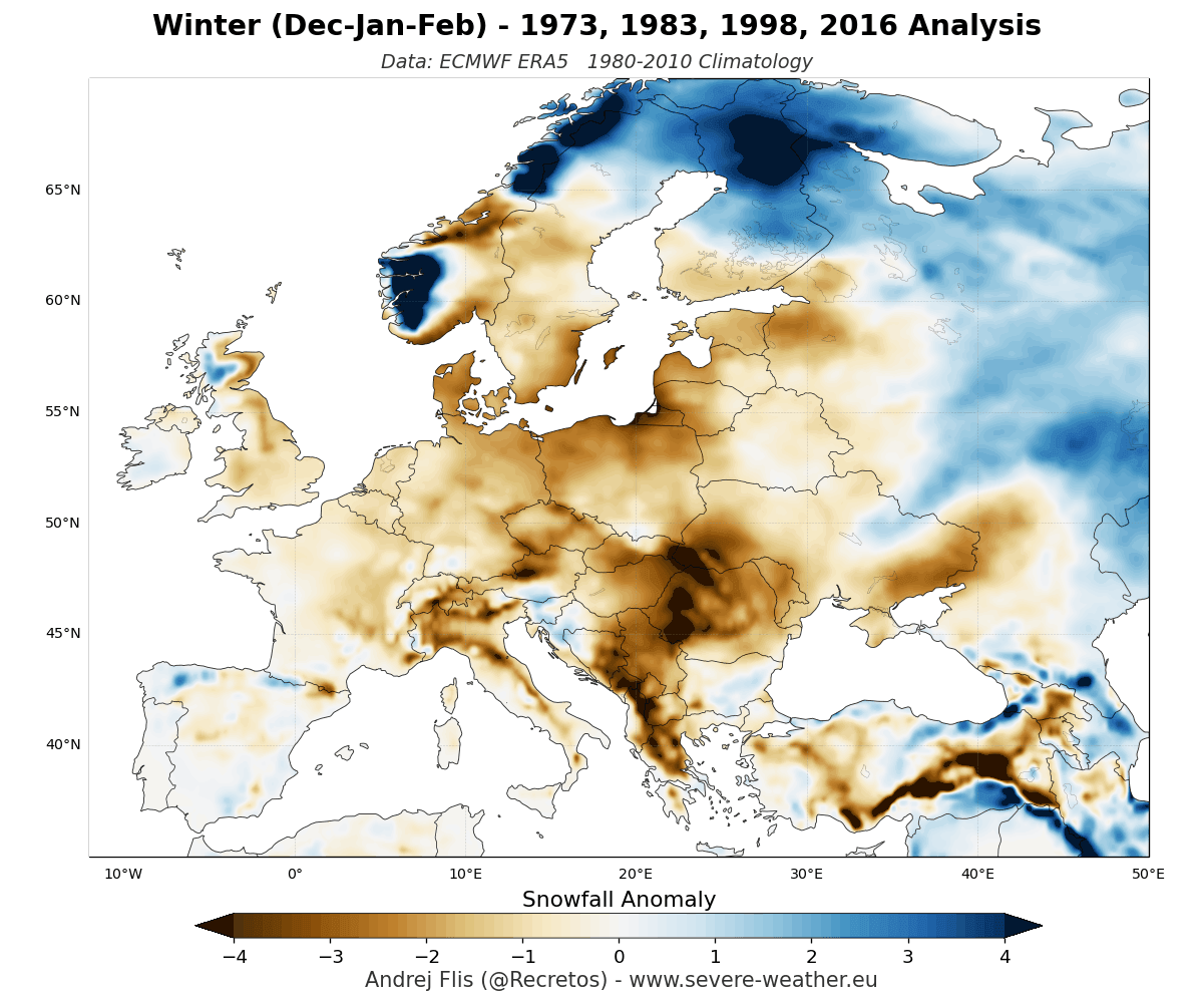
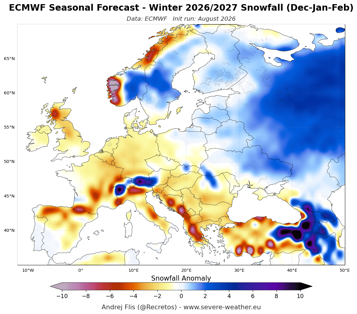
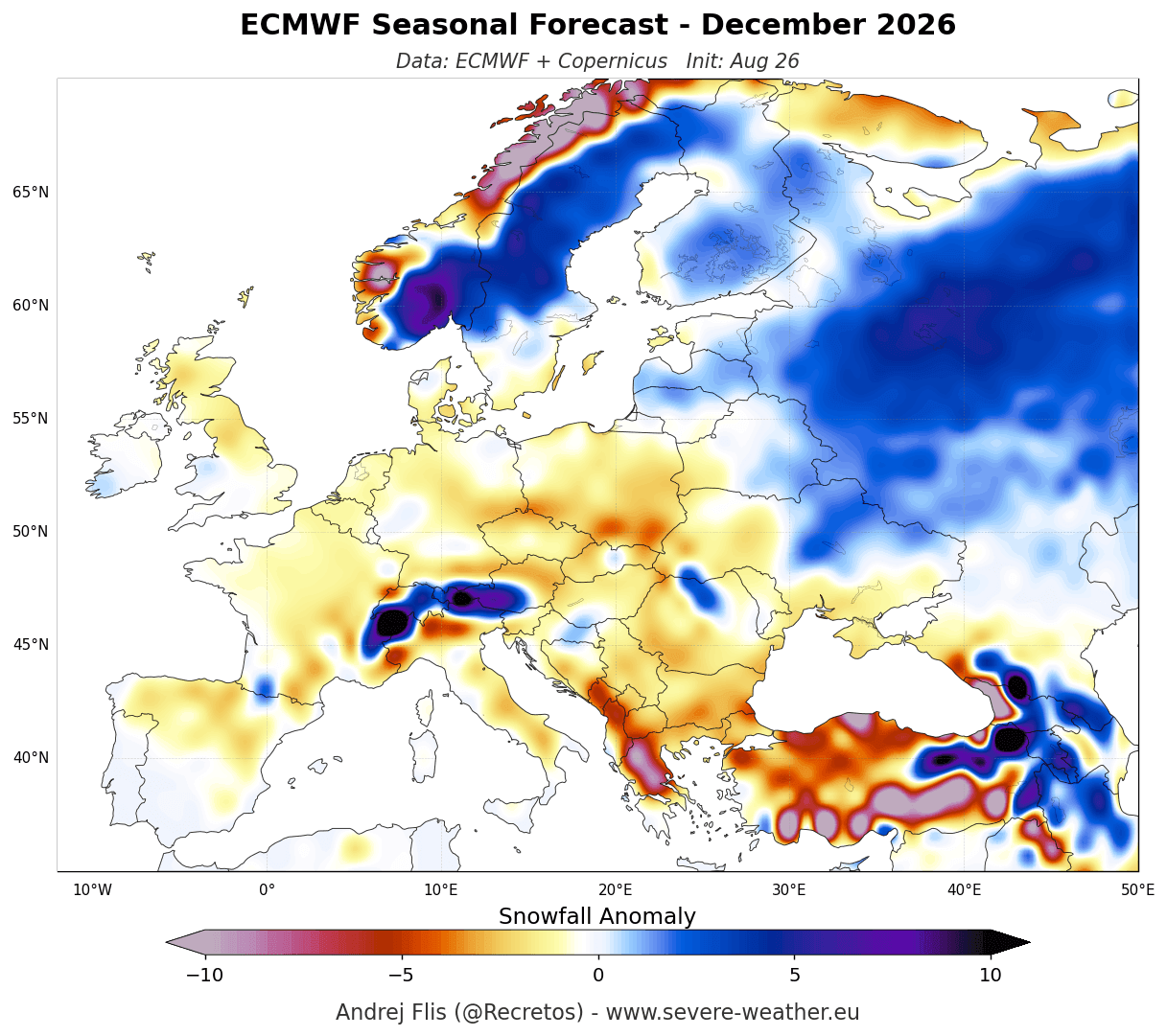
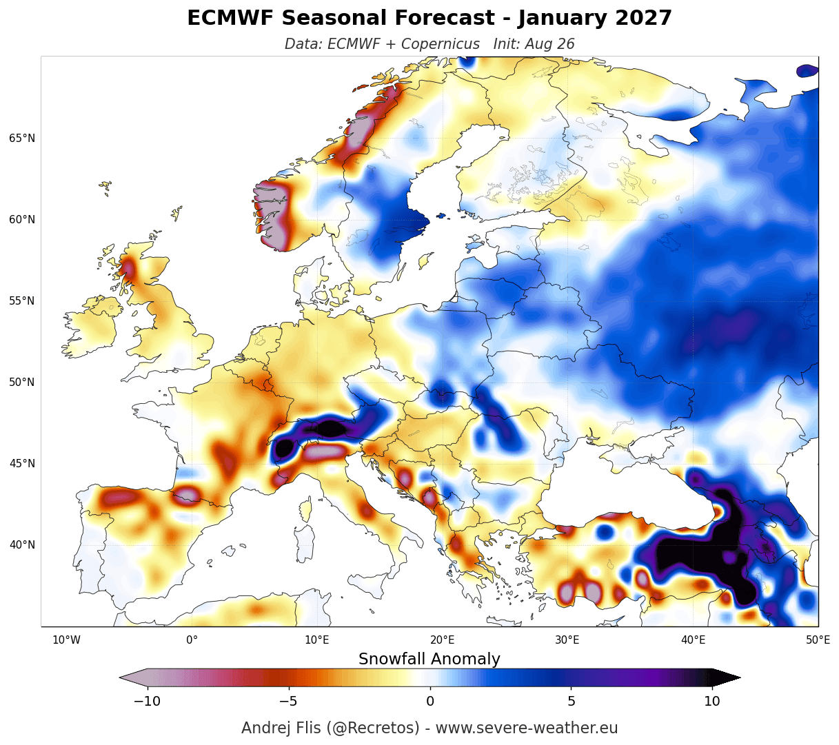
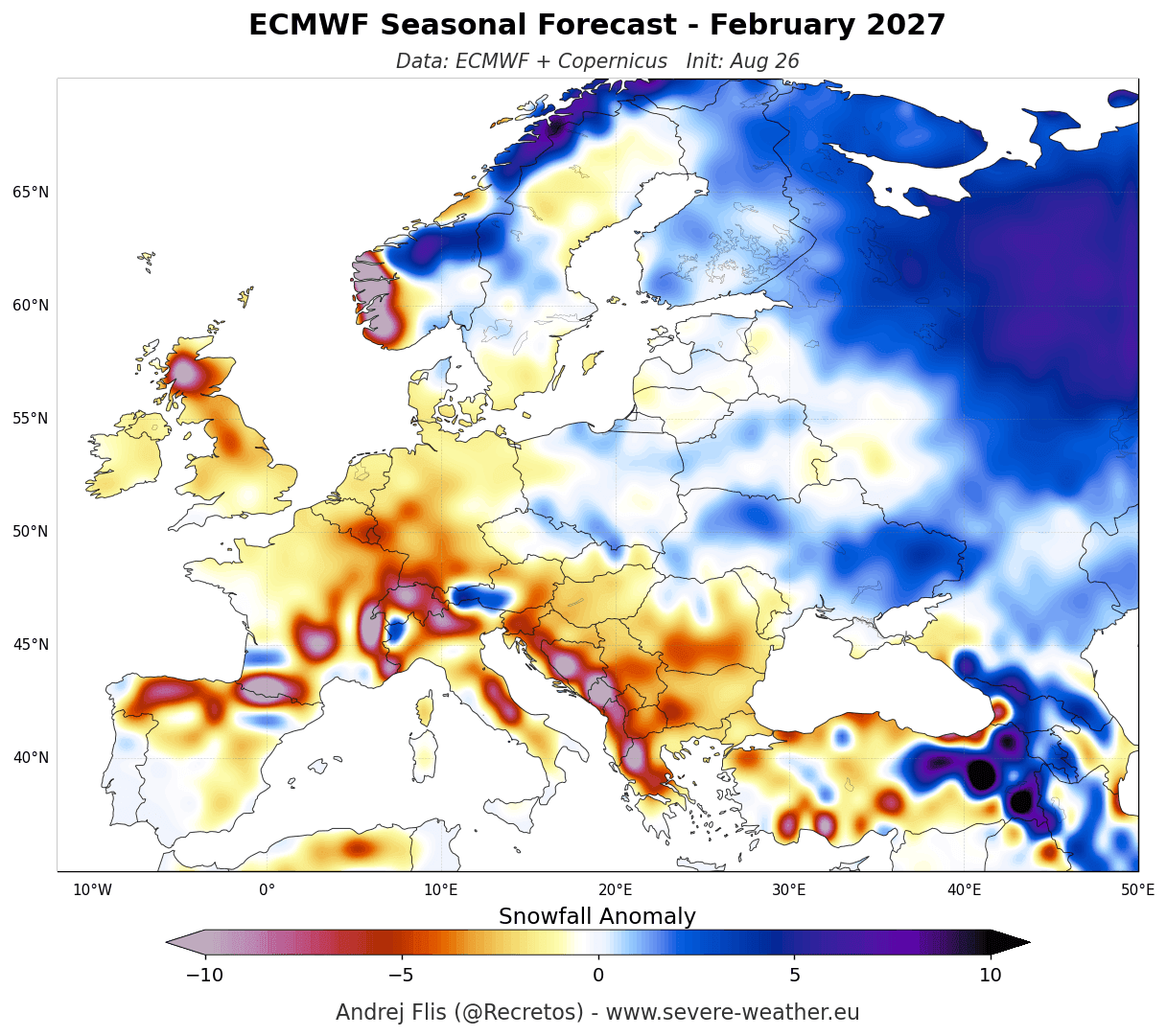
Across Europe, the consensus is sobering for winter sports enthusiasts. The combination of a persistent high-pressure ridge and a strong, mild westerly flow from the Atlantic suggests a below-average snow season for much of the continent. Most low-lying areas in Western and Central Europe are unlikely to see significant, sustained snow cover. However, high-altitude regions—specifically the Alps above 2,000 meters—may benefit from the increased moisture, potentially offsetting warmer temperatures with high-elevation snowfall.
The North American Perspective
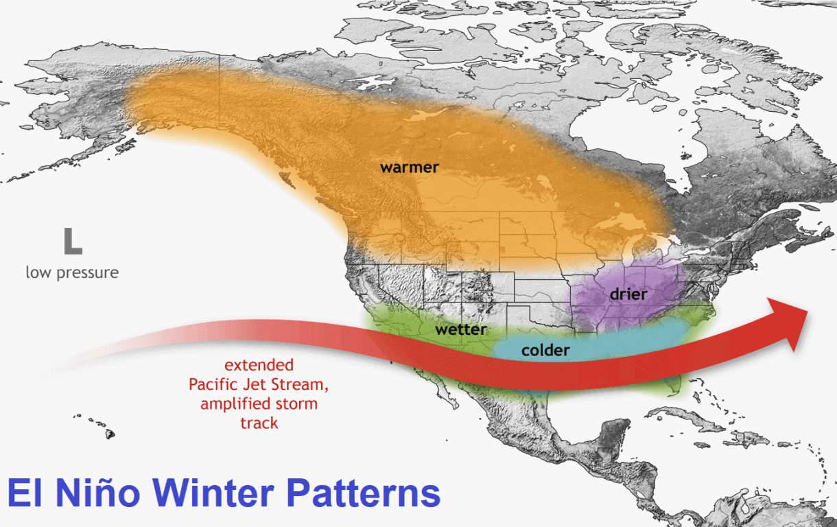
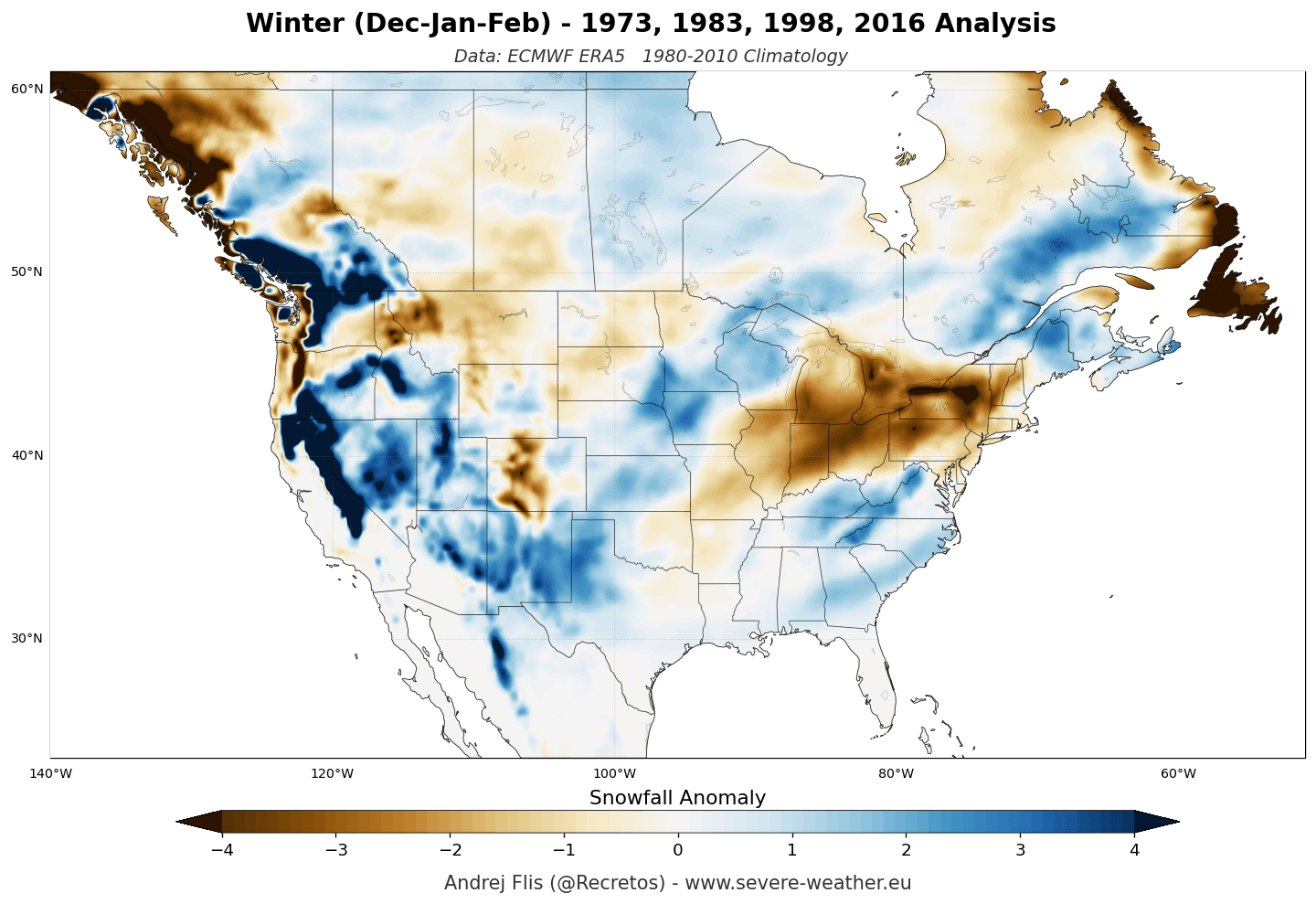
North America presents a more complex, highly variable picture. The "split-flow" pattern, a hallmark of Super El Niño years, suggests the following:
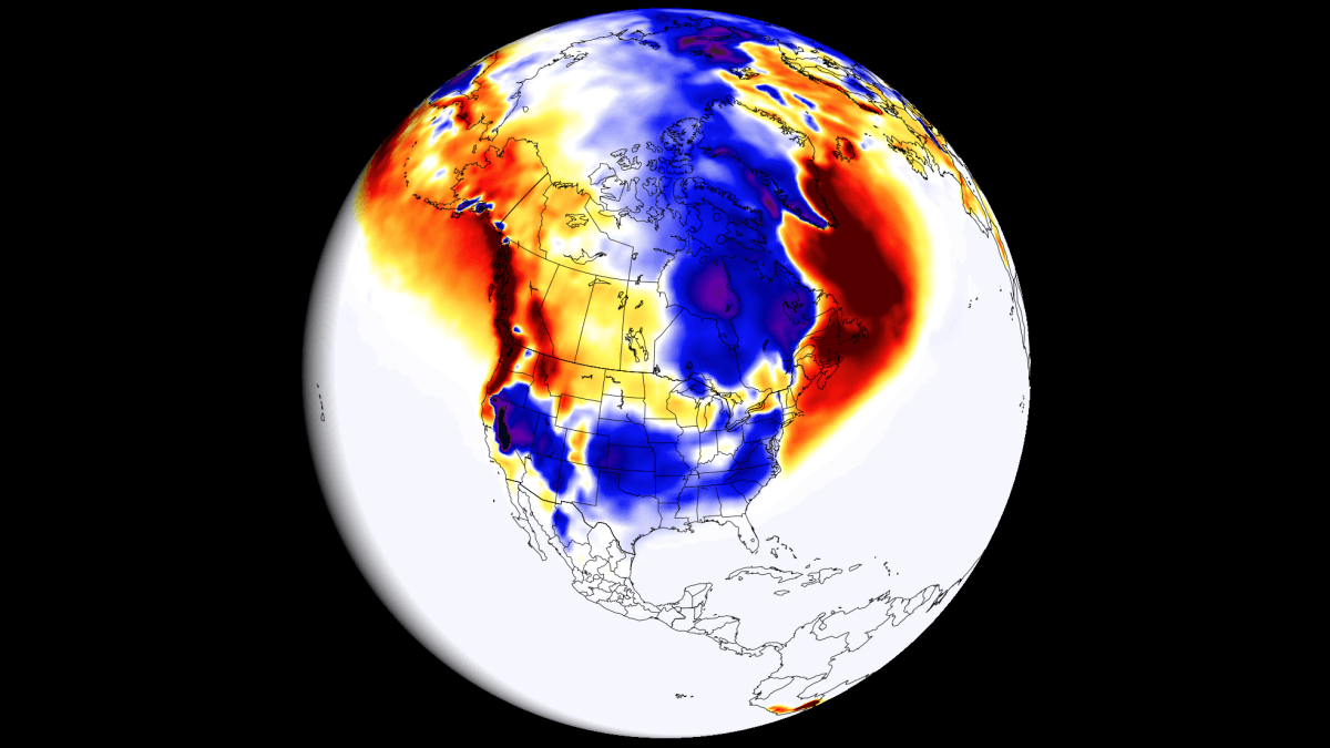
- Increased Snowfall Potential: The Sierra Nevada, the Four Corners region, the Central Plains, and the Mid-Atlantic are currently projected to see above-normal snowfall. These areas sit directly under the path of the active, moisture-rich subtropical jet.
- Snowfall Deficits: Conversely, the Pacific Northwest, the Great Lakes, and much of southern Canada are projected to see below-normal snowfall. The persistent high-pressure system over the north acts as a barrier, preventing cold Arctic air from interacting with moisture in the way required for massive snow events.
Implications for Regions and Industry
The economic and social implications of this forecast are substantial. For municipal governments, the shift in snowfall distribution necessitates a re-evaluation of snow removal budgets. Cities in the Southern and Central U.S. that are historically less prepared for heavy, frequent snow events may face logistical challenges, while Northern municipalities may find their salt and plow expenditures significantly lower than the 30-year average.
For the agricultural and energy sectors, the Super El Niño provides a mixed bag. Increased moisture in the Southwest is beneficial for water reservoirs but poses risks for flooding in regions not accustomed to heavy winter precipitation. Conversely, the mild, dry winter predicted for the Great Lakes and the Northeast could reduce heating demand, impacting energy markets.
For the winter tourism industry, the forecast creates a "latitude and elevation" mandate. Ski resorts in the Southern Rockies and California can look forward to a potentially record-breaking season, while operators in New England and the Midwest may need to rely more heavily on artificial snowmaking to mitigate the effects of the predicted deficit.
Official Responses and Meteorological Guidance
While these long-range forecasts provide a high-level roadmap of what to expect, the National Oceanic and Atmospheric Administration (NOAA) and other global weather agencies emphasize that these are probabilistic trends, not set-in-stone guarantees.
"Each winter is unique," notes the latest NOAA-Climate bulletin. "While the Super El Niño is the primary driver, local anomalies, sudden stratospheric warming events (which can disrupt the Polar Vortex), and atmospheric blocking can create localized deviations from the seasonal model."
Consequently, the meteorological community encourages stakeholders to view these models as a guide for strategic planning rather than a tactical calendar. Regular updates will be provided as the season progresses, with mid-winter adjustments likely if the oceanic anomalies begin to shift or dissipate faster than currently projected.
Summary: Preparing for a Variable Winter
As we move toward the heart of the 2026/2027 season, the message from the data is clear: the Super El Niño is an architect of change. The upcoming winter will not be a year of uniform weather; it will be a year of extremes. The southern and central reaches of the United States should prepare for an active, potentially volatile winter, while the northern latitudes and much of Europe may experience a season defined by mild, wet, and relatively snow-starved conditions.
For residents, this means staying informed. As weather patterns fluctuate, the specific tracks of low-pressure systems will determine whether a given town experiences a record-breaking blizzard or a rainy, slushy winter. By utilizing the latest seasonal models and keeping an eye on monthly updates, communities can better navigate the complexities of this historic, super-charged climate event.
Disclaimer: This article provides a long-range outlook based on current climate data models. Weather, by its nature, is subject to rapid change. Please consult your local meteorological services for short-term, high-precision forecasts throughout the winter season.