The tropical Pacific Ocean is currently the stage for a meteorological phenomenon of extraordinary proportions. A "Super El Niño"—a rare and potent intensification of the El Niño-Southern Oscillation (ENSO)—is currently strengthening at a pace that has left climate scientists and long-range forecasters recalibrating their models. With ocean temperatures surging and atmospheric circulation patterns showing early signs of a major shift, the 2026/2027 event is rapidly moving into historic territory, promising to redefine weather patterns across the Northern Hemisphere for the coming winter.

The Mechanics of a Super Event
To understand the gravity of the current situation, one must look beneath the surface. El Niño is driven by the Walker Cell, an atmospheric circulation pattern that dictates global rainfall and pressure systems. In a neutral state, trade winds blow warm water toward the western Pacific. During a Super El Niño, these trade winds collapse or reverse, allowing a massive pool of heat to slosh eastward toward the Americas.
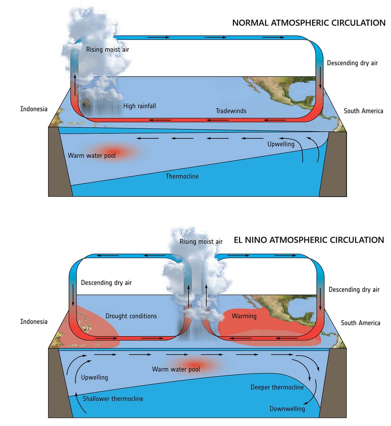
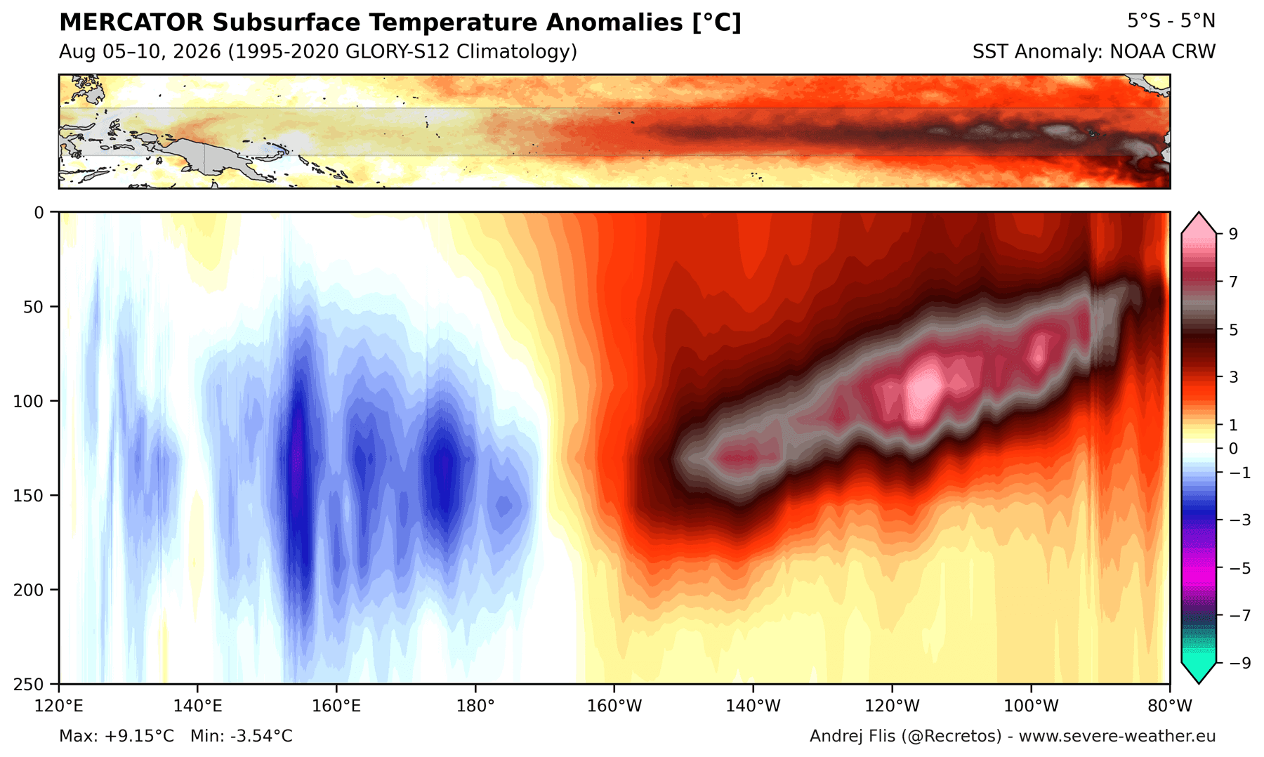
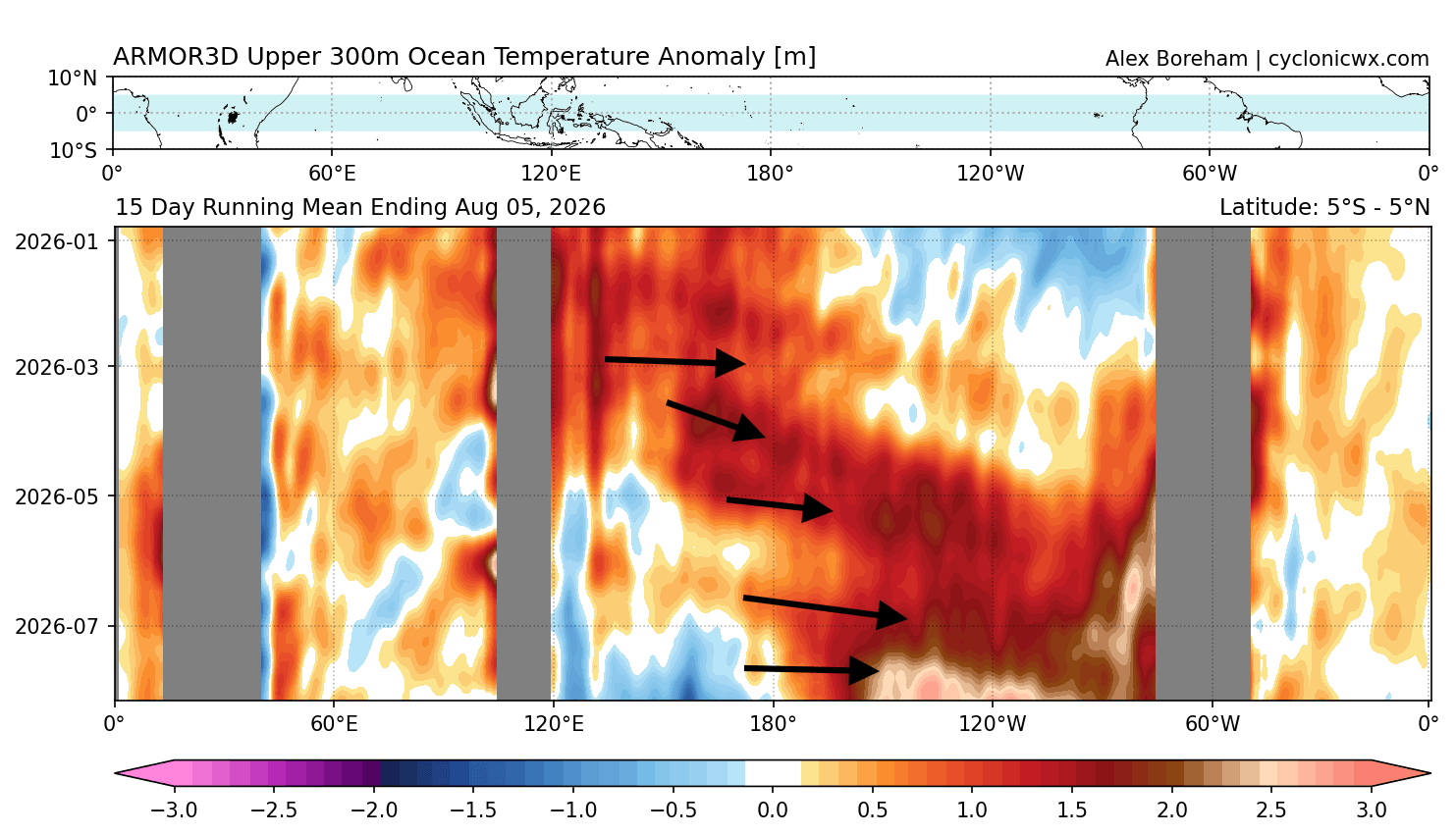
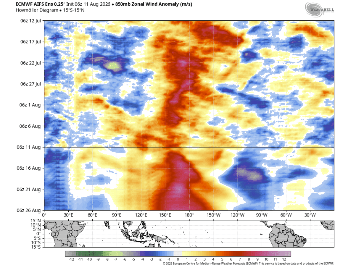
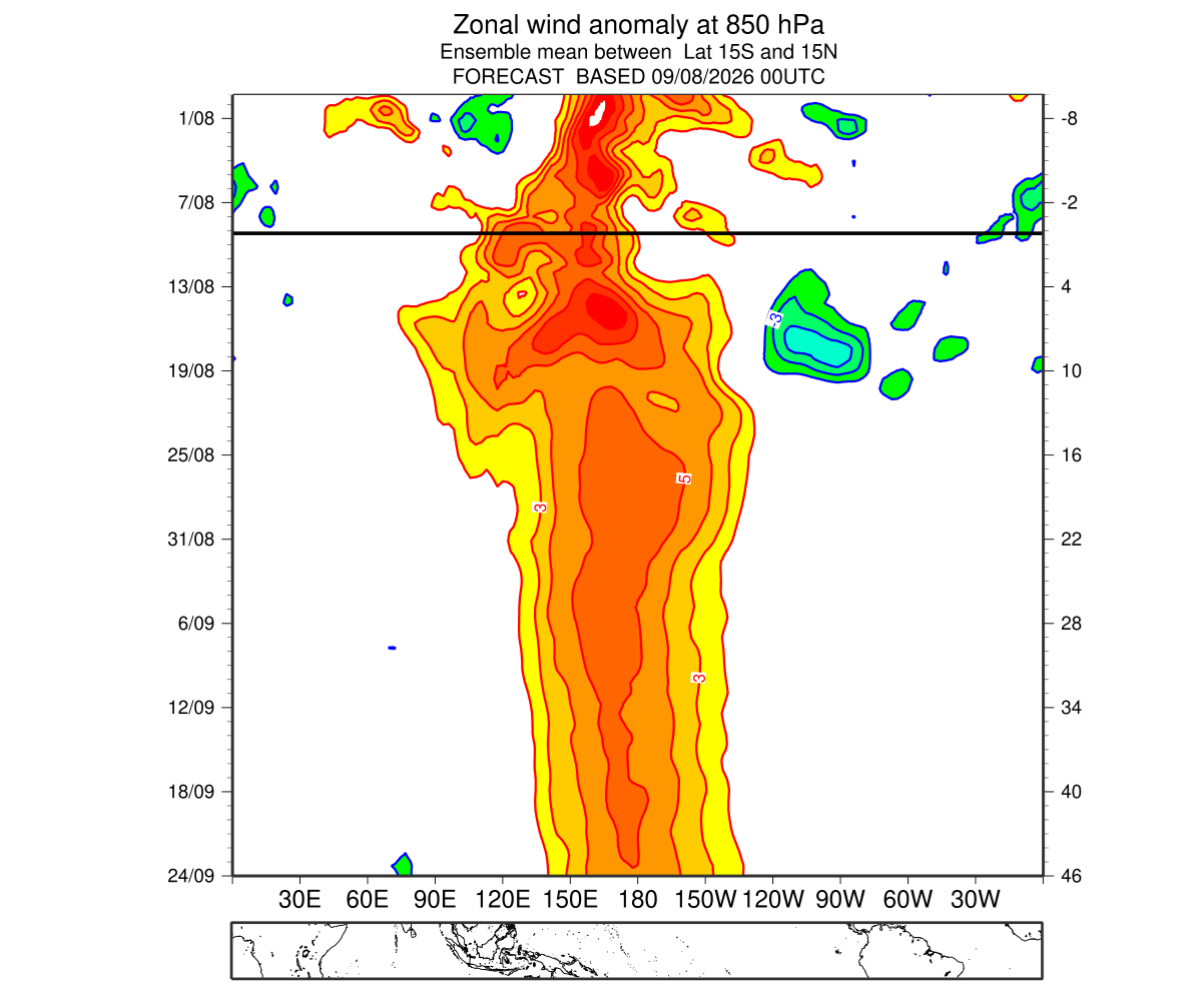
This specific event is being fueled by an unprecedented combination of westerly wind bursts and a subsurface "Kelvin Wave"—a massive pulse of warm water moving eastward beneath the ocean’s surface. Recent data suggests that the energy signature of this year’s Kelvin Wave exceeds almost every previous Super El Niño on record. This acts as a perpetual battery, pumping thermal energy into the surface waters and sustaining the anomaly well into the upcoming season.
A Chronology of Rapid Acceleration
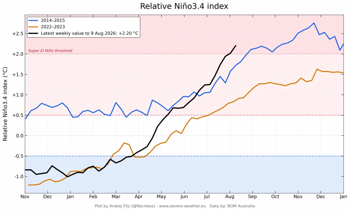
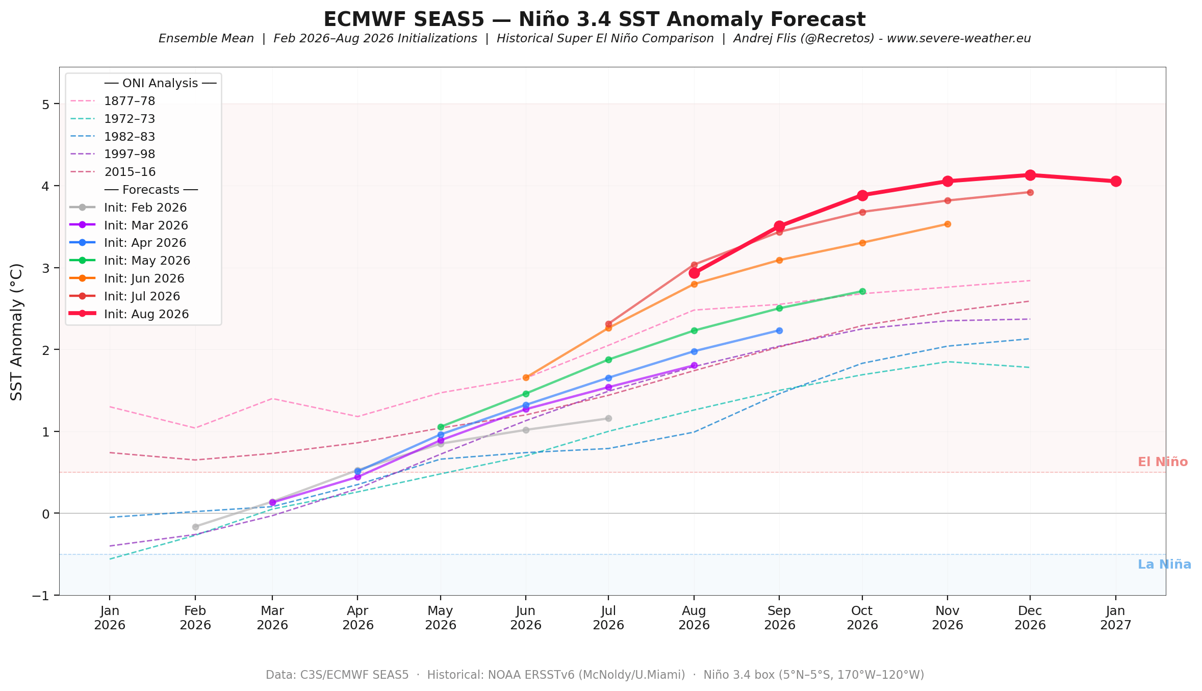
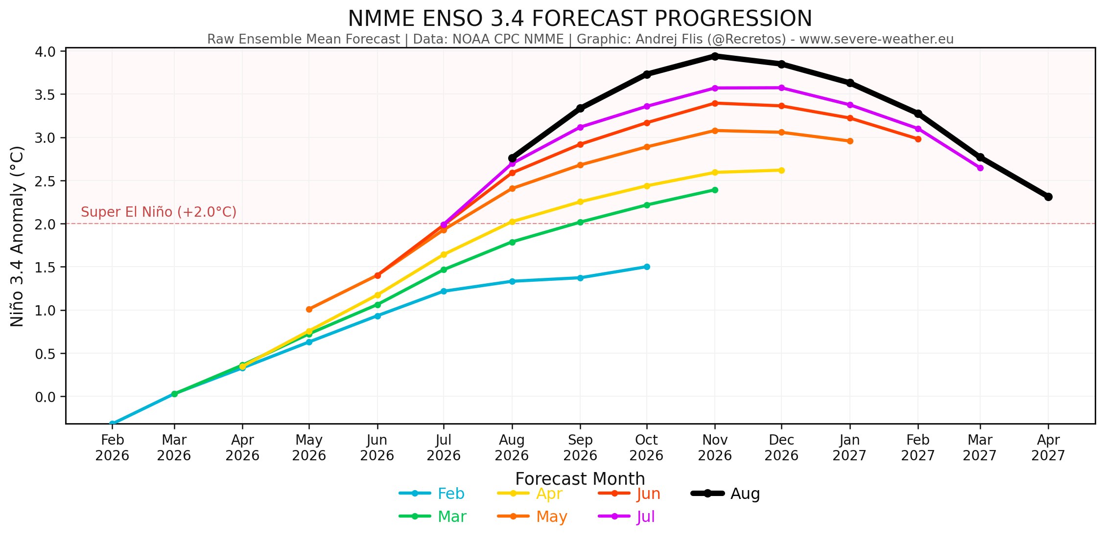
The development of this event has been nothing short of exponential. Since the spring of 2026, climate models have consistently underestimated the rate of growth. Every subsequent forecast run from the European Centre for Medium-Range Weather Forecasts (ECMWF) and the NOAA Multi-Model Ensemble (NMME) has pushed the projected peak higher.
- Spring 2026: Initial signs of a developing El Niño were identified, but at moderate levels.
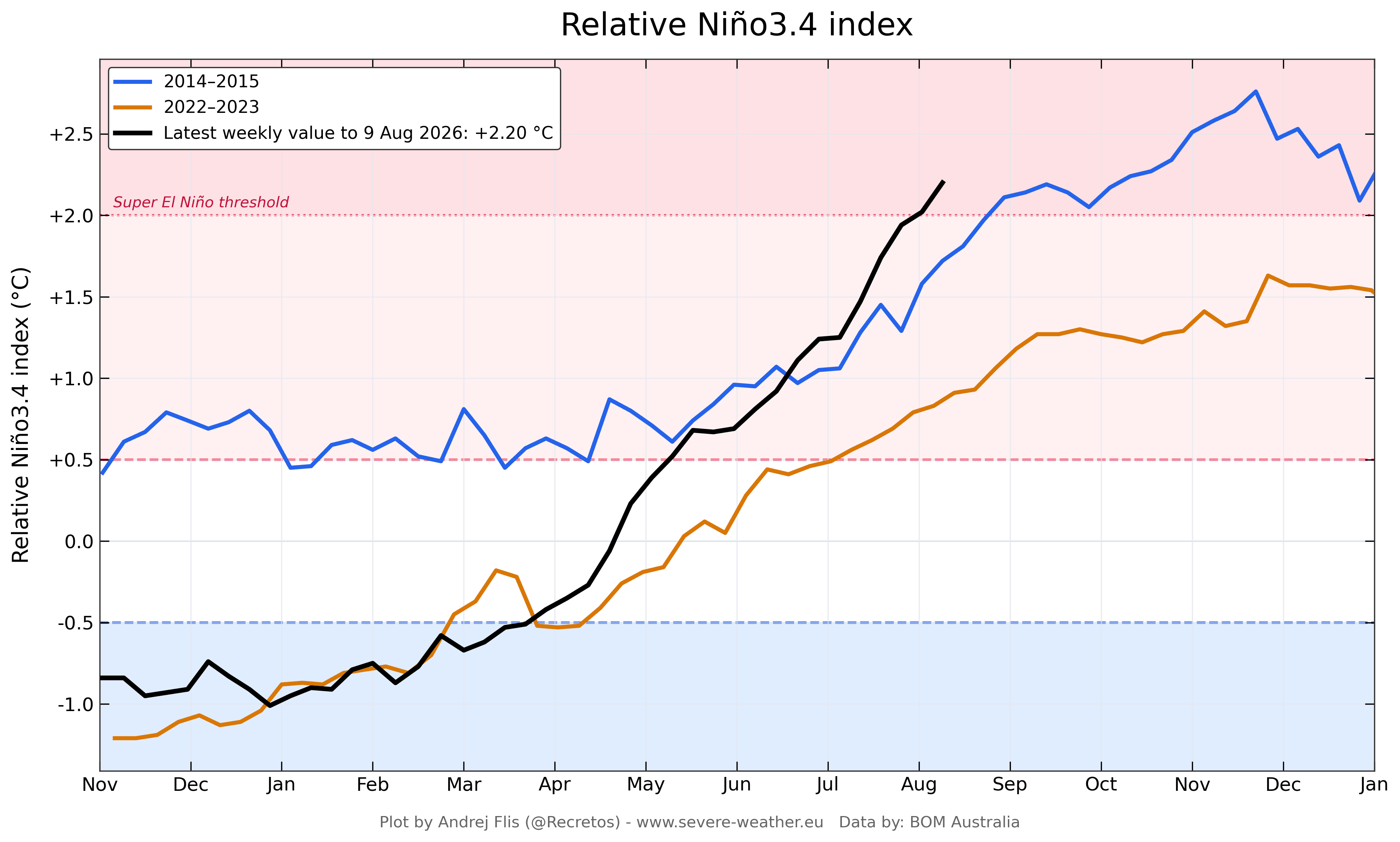
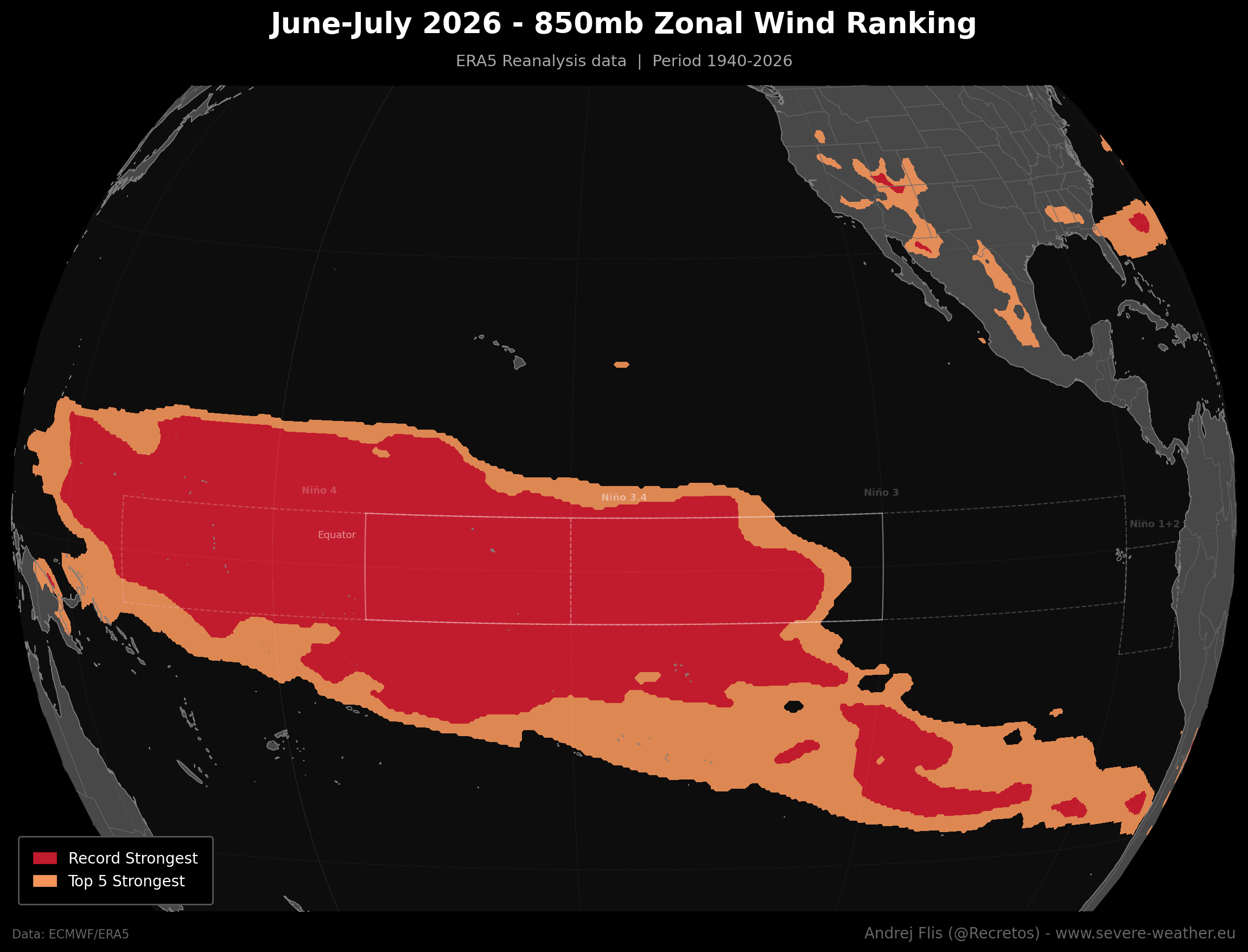
- June–July 2026: Record-breaking westerly wind anomalies across the equatorial Pacific began to break down the barrier between the western and eastern basins. The Multivariate ENSO Index (MEI) surged to +2.4, the highest value for this period since records began in 1979.
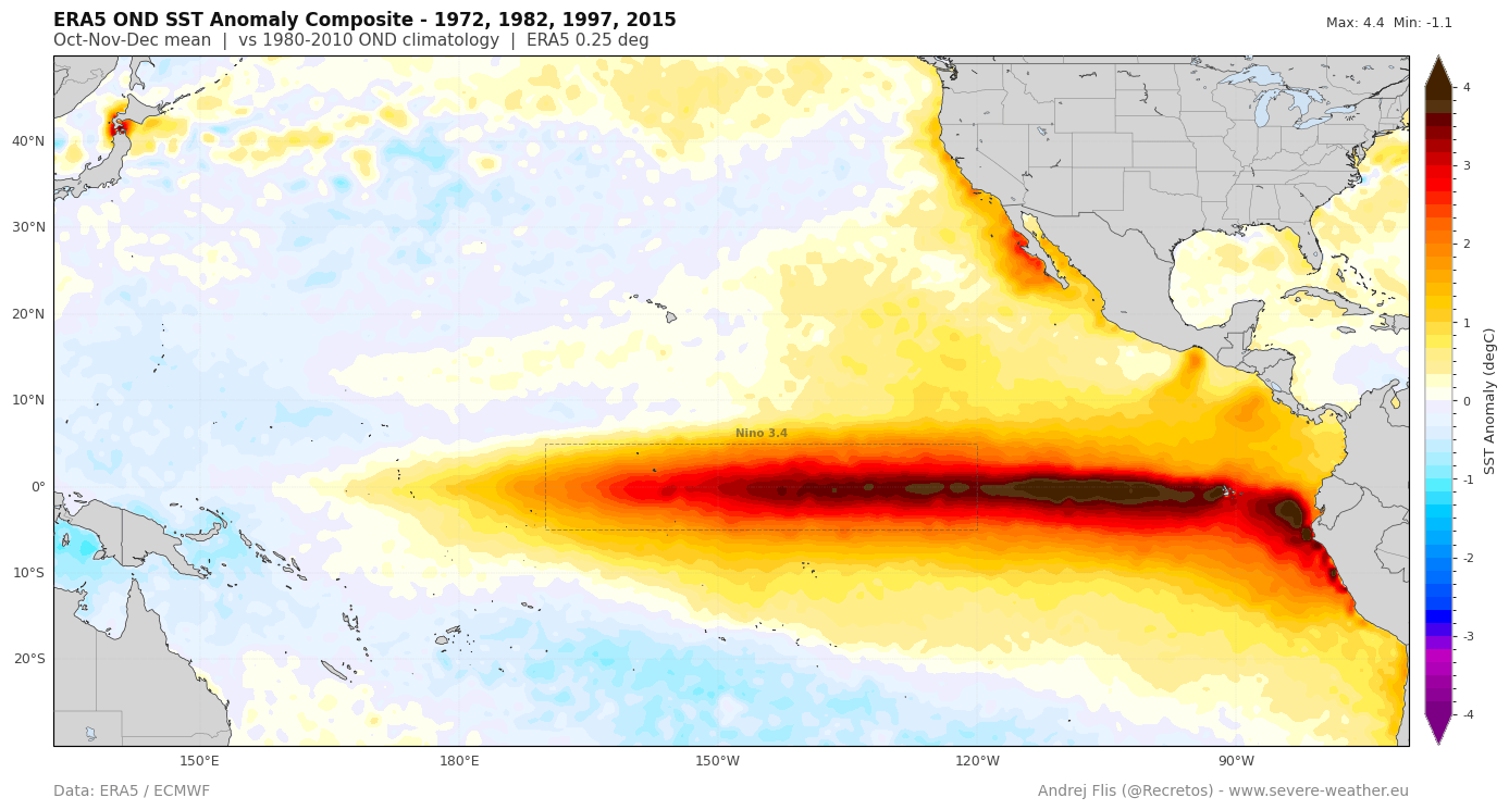
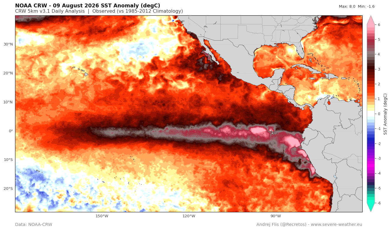
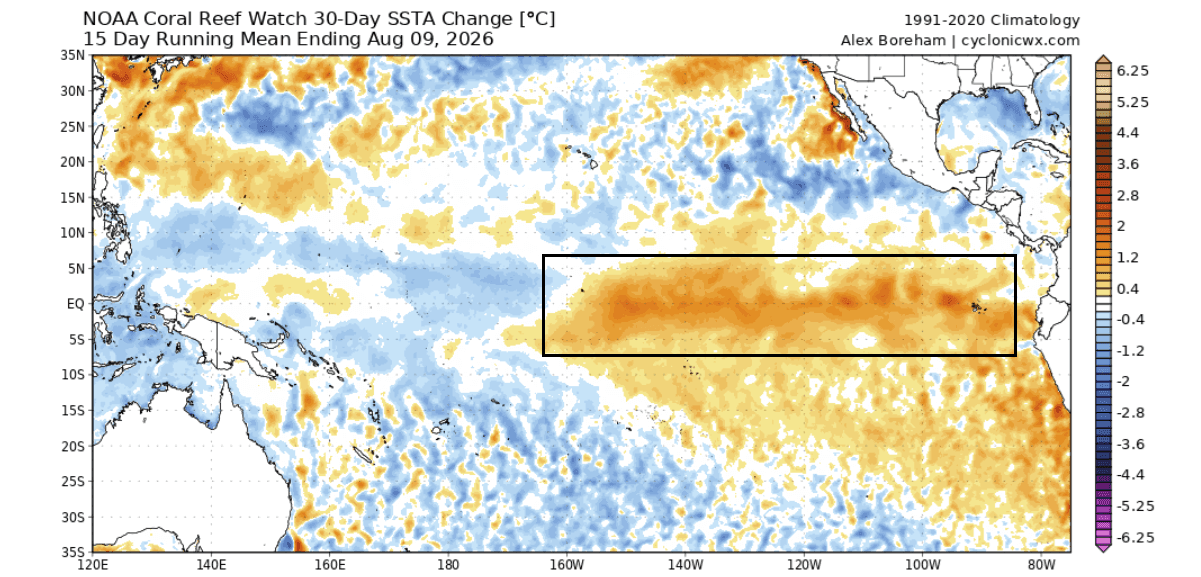
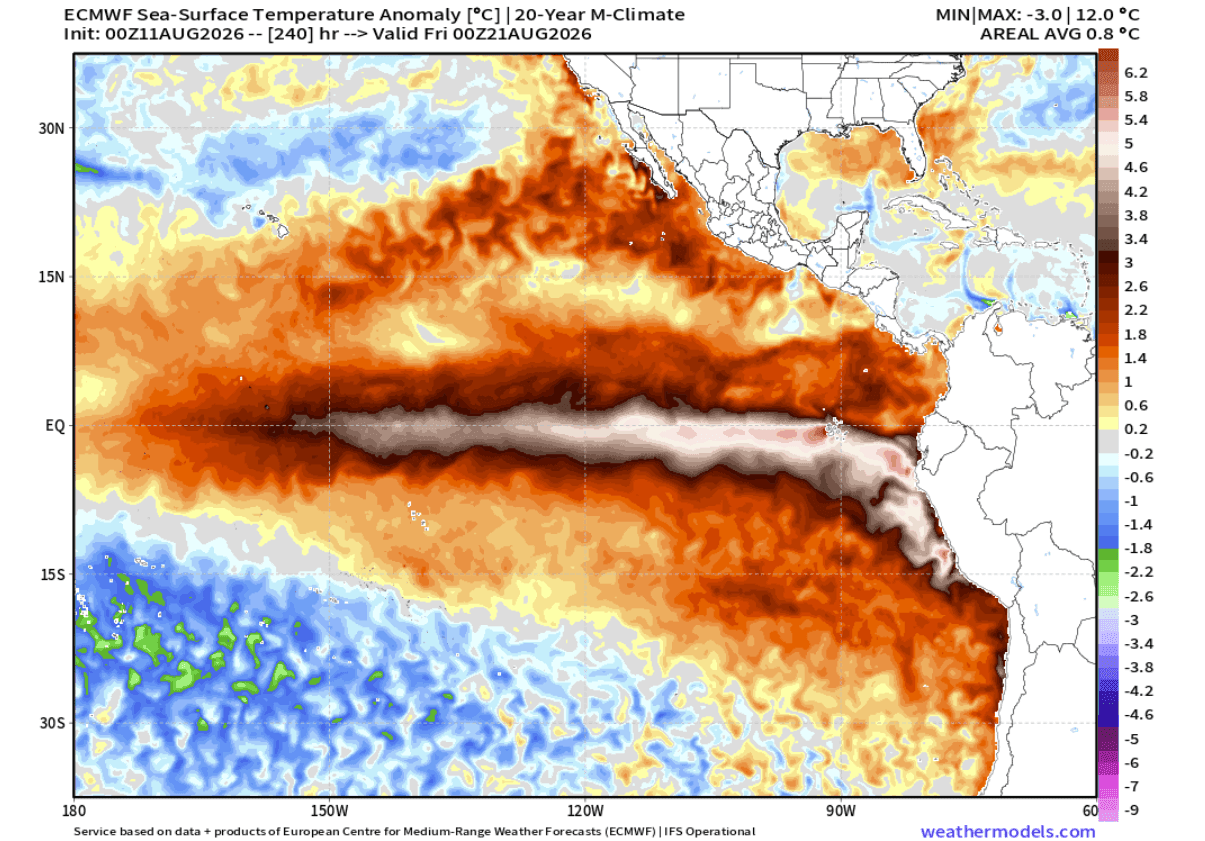
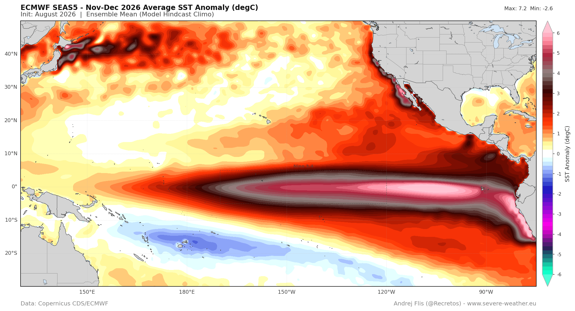
- August 2026: The event transitioned from a "strong" to a "Super" designation. Current satellite and buoy data show sea surface temperature anomalies in the central Pacific reaching +5°C to +6°C above normal.
- Late 2026 Outlook: Forecasts now suggest a peak in the November-December timeframe, with the potential to exceed the extreme +3.0°C threshold, placing it in the same tier as the most powerful events of the last century.
Data-Driven Insights: The Engine of Warming
The "engine" driving this event is visible in the subsurface temperature anomalies, which extend to depths of 250 meters. While the surface manifests as warm water, the deep-ocean heat content is the true indicator of sustainability. The recent 30-day change in ocean temperature shows a broad, rapid warming trend, with anomalies increasing by more than 1.5°C over vast swathes of the Pacific.
Furthermore, the "zonal wind ranking" for the past two months confirms that the atmosphere is not merely a passive recipient of this heat but an active participant. The record-setting westerly wind bursts observed in June and July are indicative of a sustained collapse of the trade winds. When these winds fail, the "standing wave" of the atmosphere becomes locked. This locks the jet stream into a configuration that, for the Northern Hemisphere, means a total reshuffling of winter weather probabilities.
Global Atmospheric Forcing and Standing Waves
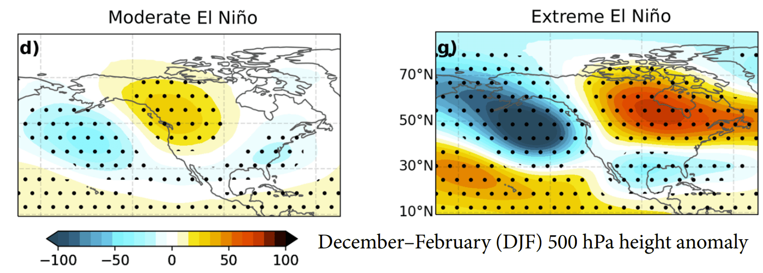
The influence of a Super El Niño is not limited to the equator; it ripples globally. By altering the position of the jet stream, the event creates a "standing wave" in the atmosphere. Current velocity potential maps show a massive rising air anomaly over the central Pacific and sinking air over the Indian Ocean.
This formation is a hallmark of an extreme event. It forces the atmosphere to prioritize specific storm tracks. In North America, this typically manifests as an "atmospheric highway"—a deeper Pacific trough and a stronger Canadian ridge. This combination essentially invites a series of moisture-rich storm systems to take a southern route across the United States, while northern regions experience anomalous warmth.
Implications for North America: Fall and Winter 2026/2027
The shift in atmospheric pressure is already being felt. The Fall 2026 forecast indicates that the typical "El Niño Winter" pattern is arriving earlier than historical averages suggest.
The United States and Canada
The predicted pressure anomalies for the coming months show a persistent high-pressure zone over Canada, which will act as a buffer against deep arctic air for much of the northern tier. Conversely, the Southern United States, including Texas and the Gulf Coast, is looking at a highly active storm track.
For the winter months (December through February), the forecast suggests:
- Warmer Temperatures: Northern U.S. and Canada will likely see reduced cold-stress days as the Canadian ridge dominates.
- Storm Corridors: An active southern jet stream will drive moisture into the Southern Plains, the Southeast, and the Mid-Atlantic. This increases the potential for heavy precipitation, which, when it meets intermittent cold fronts, could lead to significant ice and snow events.
- Snowfall Anomalies: While the Pacific Northwest and the northern Great Lakes may face a drier-than-average winter, the Central and Eastern U.S. should prepare for above-normal snowfall potential.
Europe’s Outlook: A Milder, Westerly-Driven Season
Europe’s climate is influenced by the North Atlantic Oscillation, which is often modified by the global "teleconnections" of a Super El Niño. The current model projections for Europe show a strong pressure gradient between the north and south.
The extension of low-pressure systems from the Atlantic into Northern Europe is expected to drive a strong westerly flow. This suggests a milder-than-average winter for much of the continent. While the UK and Ireland may experience frequent, moisture-laden systems, the broad continental snowfall totals are currently projected to be below average, except in high-altitude central regions and the far northeast.
The Scientific Consensus: A Period of Uncertainty
While the models are consistent, the scientific community emphasizes that Super El Niños are highly non-linear. The record-breaking nature of this event means we are operating in a data landscape that has few direct historical parallels.
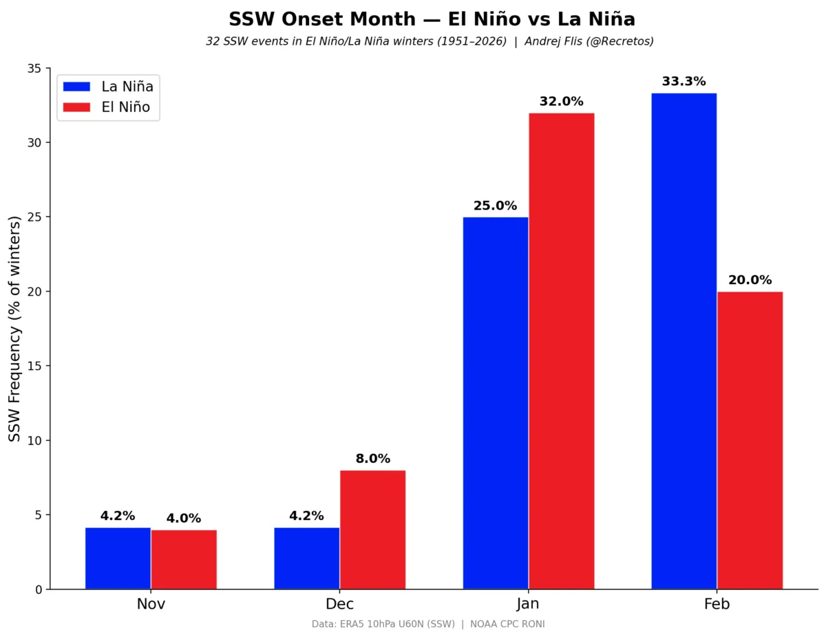
Official responses from agencies like NOAA and the ECMWF highlight that while the oceanic coupling is exceptionally robust, the atmospheric response can occasionally be interrupted by sudden stratospheric warming or other internal climate variability. However, the current "lock-in" of the Walker Cell suggests that the odds of a major deviation from this forecast are diminishing by the week.
Conclusion: Preparing for a Historic Season
The 2026/2027 Super El Niño is a definitive climate event. Its rapid onset and the sheer magnitude of its subsurface heat content suggest that it will exert a dominant influence on the global climate for the remainder of the year and into the next.
For residents in the Southern and Eastern United States, the coming winter may be characterized by high-impact, moisture-driven weather events. For those in Europe, the outlook leans toward a milder, westerly-dominated season. As the atmosphere continues to respond to this massive influx of oceanic heat, the coming months will be a critical test of our meteorological modeling capabilities. The world is watching, as this historic event unfolds in real-time, reshaping the atmospheric architecture of our planet.