As we approach the final months of 2026, the global meteorological community is bracing for a winter defined by an extraordinary climatic driver: a "Super" El Niño event. With ocean heat content in the tropical Pacific reaching record-breaking thresholds, major long-range forecast models are converging on a scenario that promises to reshape the atmospheric landscape across North America and Europe. This in-depth analysis explores the mechanics of this rare phenomenon and what it signifies for the coming cold season.

Main Facts: The Anatomy of a Super El Niño
A Super El Niño is not merely a warm-water anomaly; it is a fundamental reconfiguration of the Earth’s climate system. At its core, the current event involves a dramatic shift in the Walker Cell—the system of atmospheric circulation over the tropical Pacific.
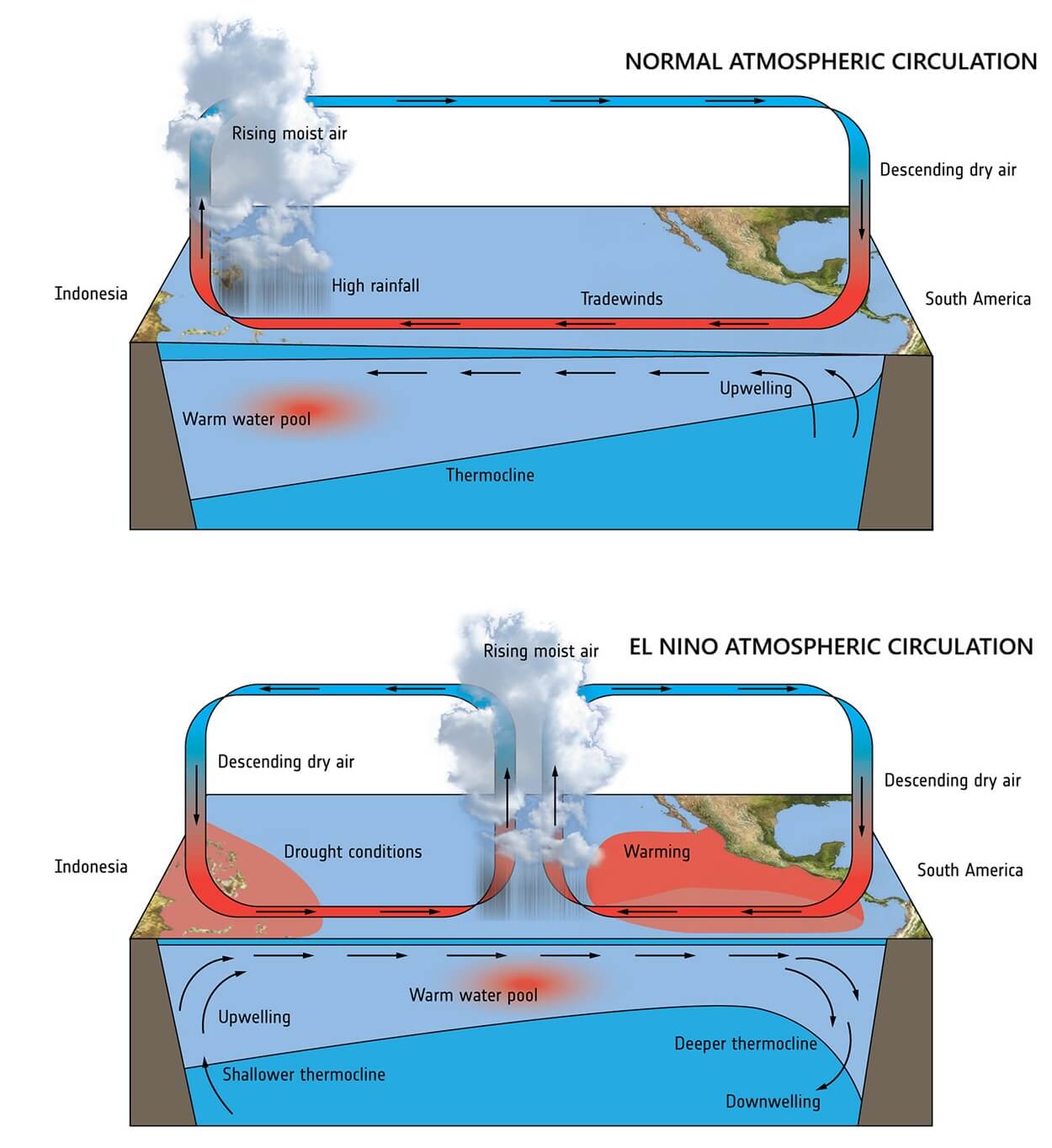
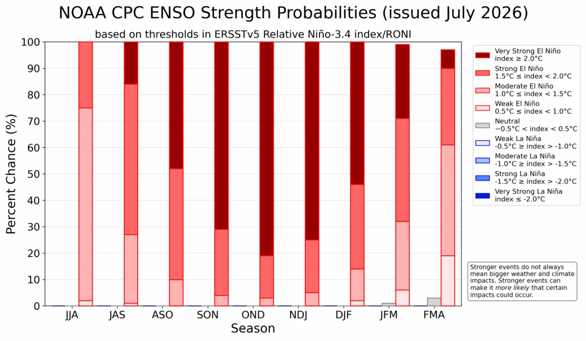
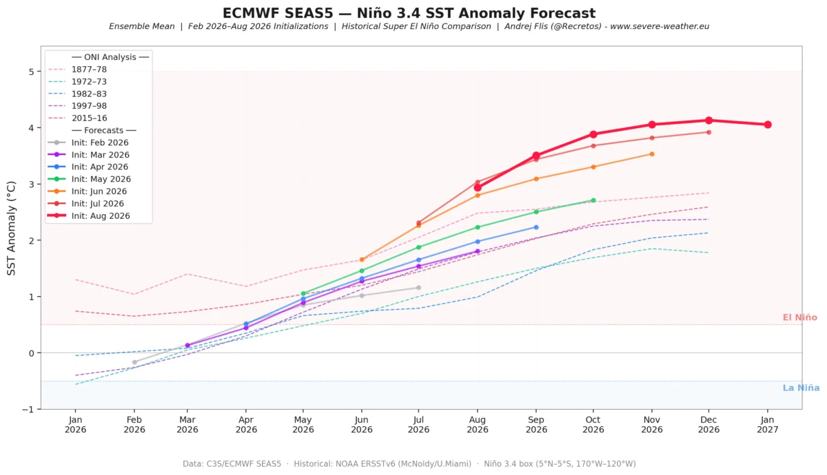
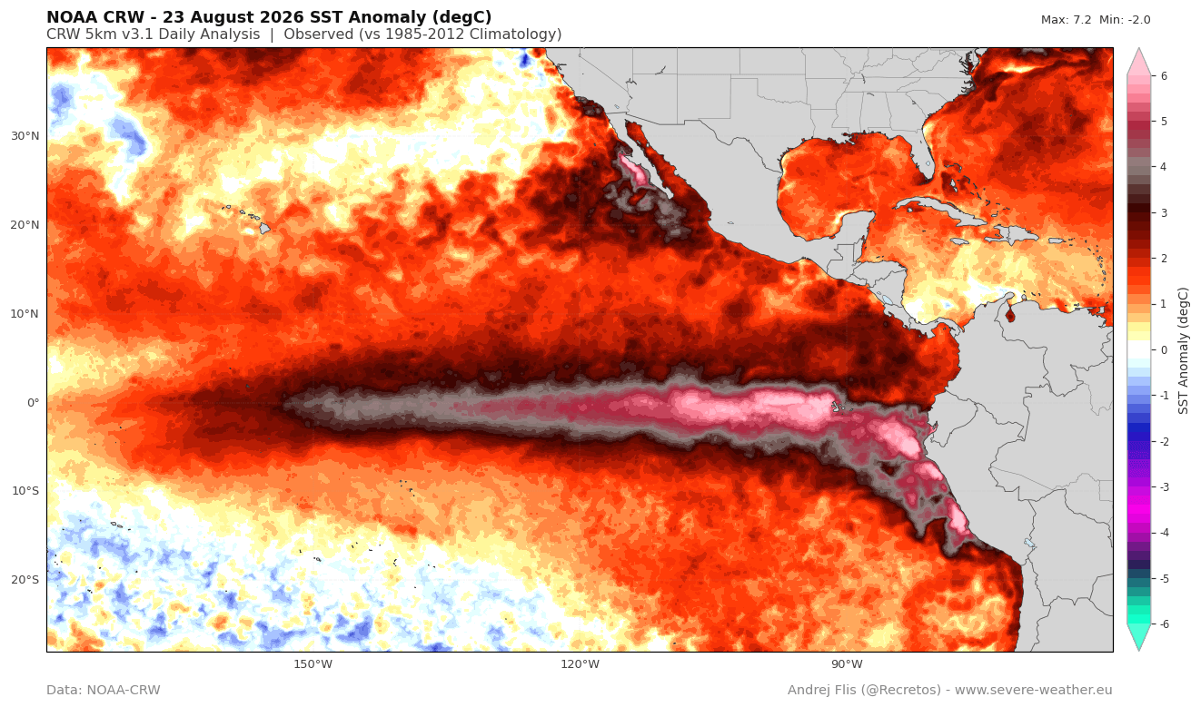
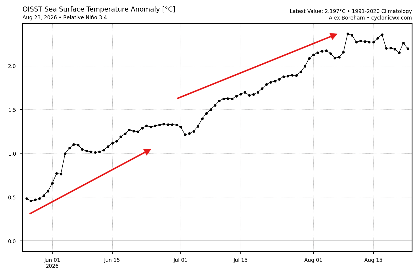
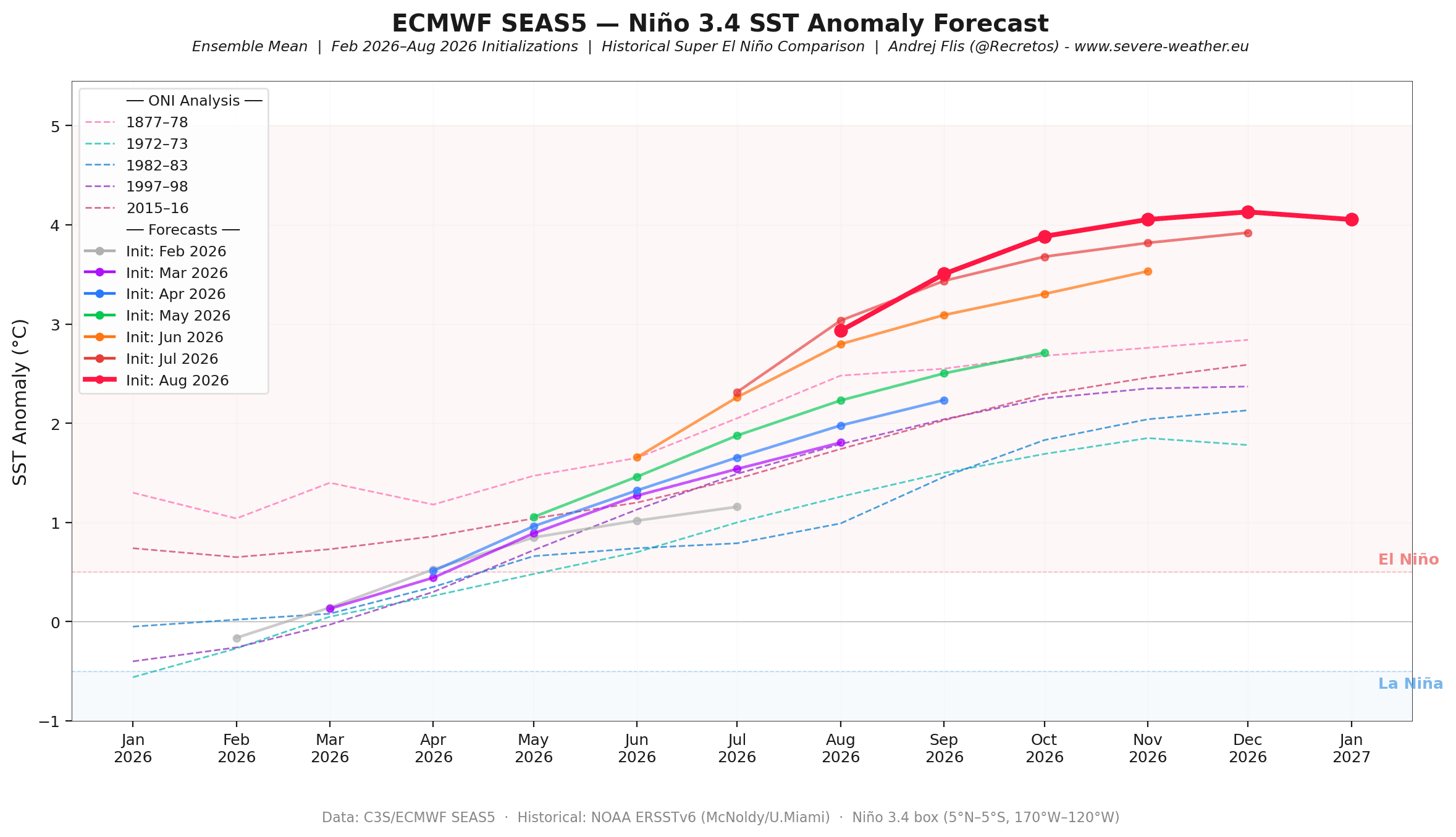
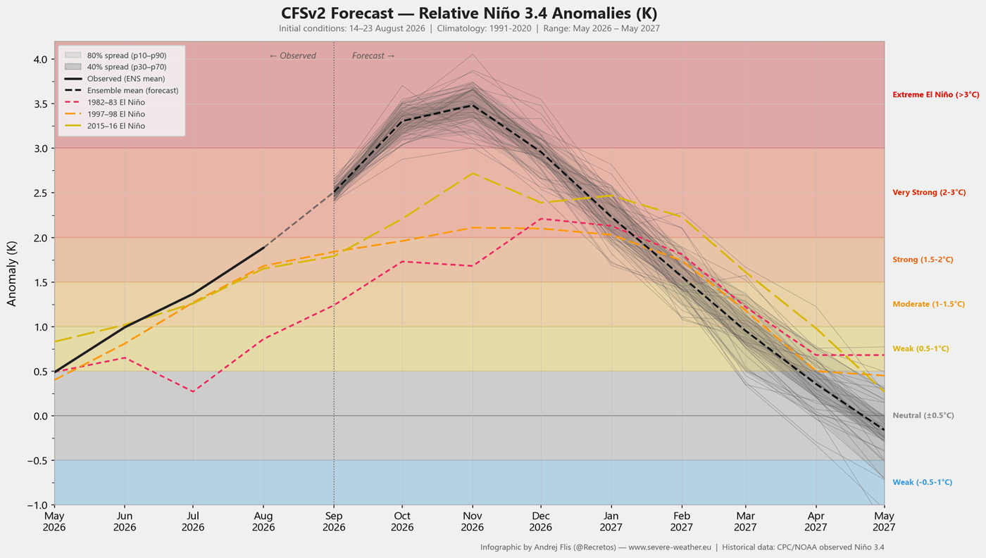
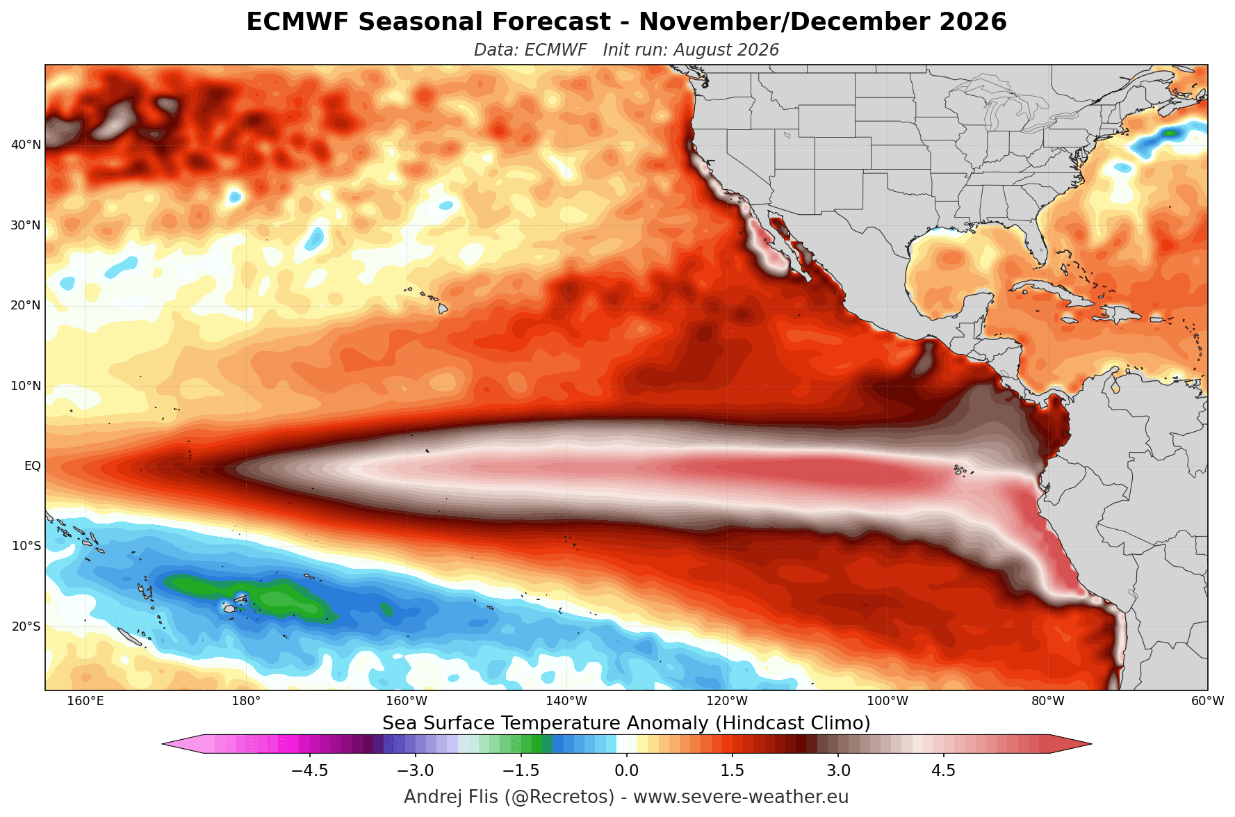
Under normal conditions, strong trade winds push warm surface waters toward the western Pacific. In a Super El Niño, these winds weaken or reverse, allowing a massive pool of warm, subsurface water—known as a Kelvin Wave—to surge eastward. Our current tracking, based on NOAA Coral Reef Watch and OISST data, confirms that sea surface temperature anomalies in the central and eastern Pacific have already surpassed the +2°C threshold required for the "Super" classification, with some readings spiking above 6°C above the seasonal norm.
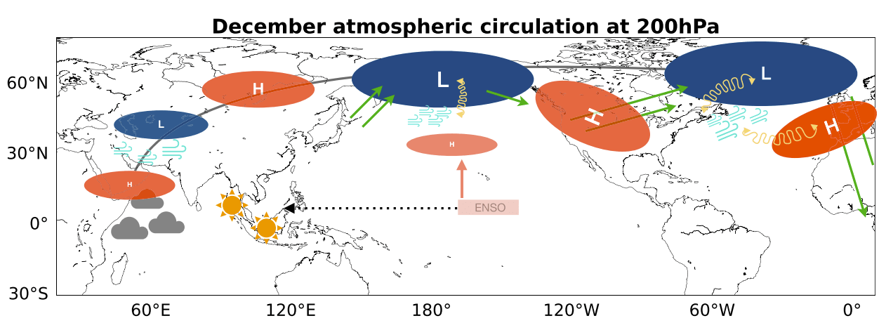
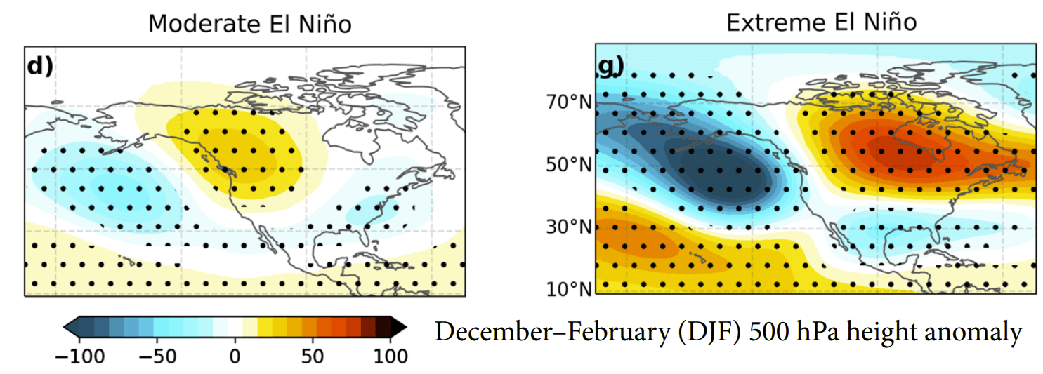
This thermal energy acts as a giant engine for the atmosphere, forcing a planetary wave train that alters the position of the jet streams. For the Northern Hemisphere, this implies a highly amplified winter pattern characterized by a deep low-pressure trough over the North Pacific and a resilient high-pressure ridge over Canada.
Chronology: From Development to Seasonal Peak
The evolution of the 2026 event has been rapid and consistent.
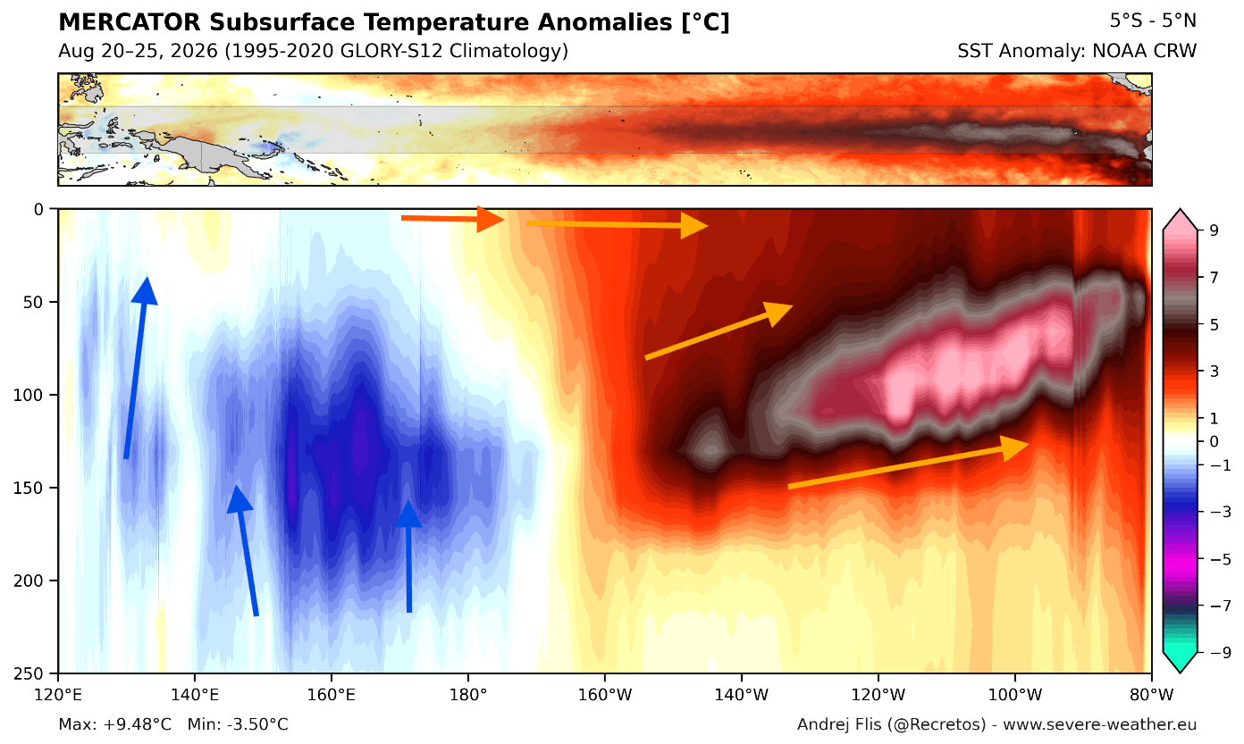
- Late Summer 2026: Subsurface Kelvin Waves, with anomalies peaking at 16°F above normal in the top 800 feet of the ocean, provided the fuel for the current surface warming.
- Autumn 2026: As the atmospheric coupling tightened, the global circulation began to mirror historical Super El Niño patterns.
- December 2026 – February 2027: Models indicate that the peak impact will occur during these months. Unlike standard El Niño years, the "Super" status suggests that the atmospheric forcing will become increasingly amplified as we progress from December into the heart of January and February.
Supporting Data: Converging Forecast Models
The confidence in this winter’s forecast is bolstered by the consensus between the European Centre for Medium-Range Weather Forecasts (ECMWF) and the North American Multi-Model Ensemble (NMME).
Both systems demonstrate a clear "split-flow" pattern. The ECMWF’s latest pressure anomaly forecasts show a deep, persistent low-pressure zone in the North Pacific, which drives a powerful, moisture-laden subtropical jet stream across the southern United States. Simultaneously, a blocking high-pressure ridge over Canada is expected to deflect the polar jet stream, leading to warmer-than-average conditions in the northern latitudes.
Furthermore, the NMME system supports these findings, showing a high degree of correlation regarding precipitation anomalies. Both models predict wetter-than-normal conditions for the southern and western United States, while the Pacific Northwest and southern Canada face potential precipitation deficits due to the persistent Canadian ridge.
Polar Vortex and Stratospheric Interactions
One of the most critical variables for any winter is the state of the stratospheric Polar Vortex—a vast area of low pressure and cold air surrounding the Earth’s poles.
Current seasonal simulations from both the ECMWF and the UK Met Office (UKMO) show a notable deceleration of stratospheric zonal winds between late December and January. While this does not guarantee a Sudden Stratospheric Warming (SSW) event, it serves as a "red flag" for a weakened vortex. Historically, when a Super El Niño creates significant wave energy that propagates upward, it can destabilize the vortex. If the vortex is disrupted, the resulting "Polar Express" pattern can funnel arctic air into the mid-latitudes, momentarily countering the general El Niño-driven warmth in parts of the United States and Europe.
Regional Implications: A Tale of Two Winters
North America: The North-South Divide
The primary characteristic of this winter for North America will be the sharp north-south temperature and precipitation contrast.
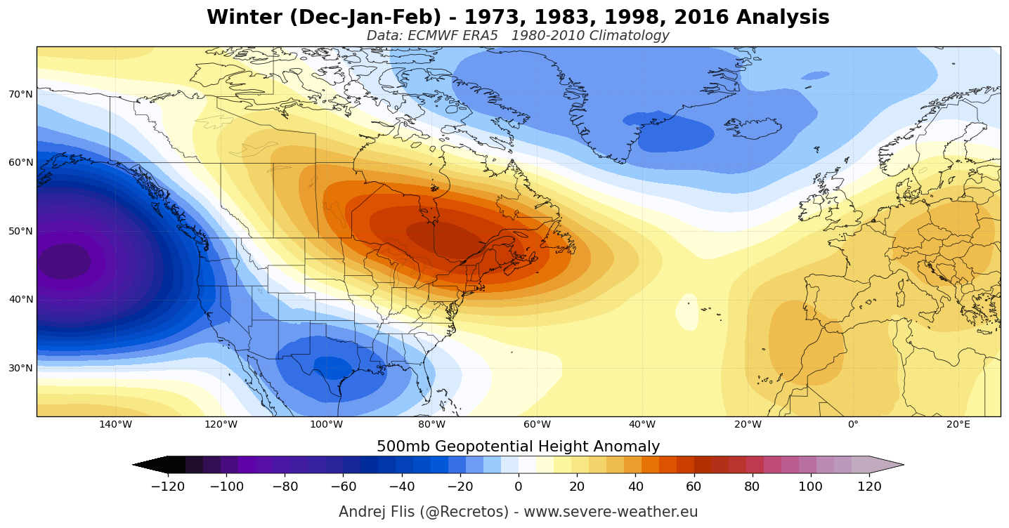
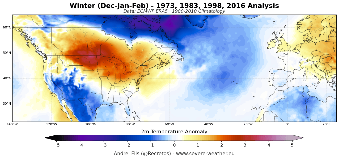
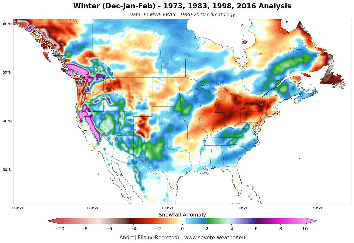
- The North: Canada and the northern United States, including the Great Lakes and the Northeast, should prepare for a milder winter with higher-than-average temperatures. Snowfall in these regions may be inconsistent, as the Canadian ridge limits the frequency of arctic intrusions.
- The South and West: Conversely, the southern tier—from California through Texas and across to the Southeast—will likely experience an active, unsettled winter. The amplified subtropical jet will drive a series of low-pressure systems, leading to increased rainfall and a heightened potential for mountain snowfall in the Sierra Nevada and the Southern Rockies.
Europe: Atlantic Dominance
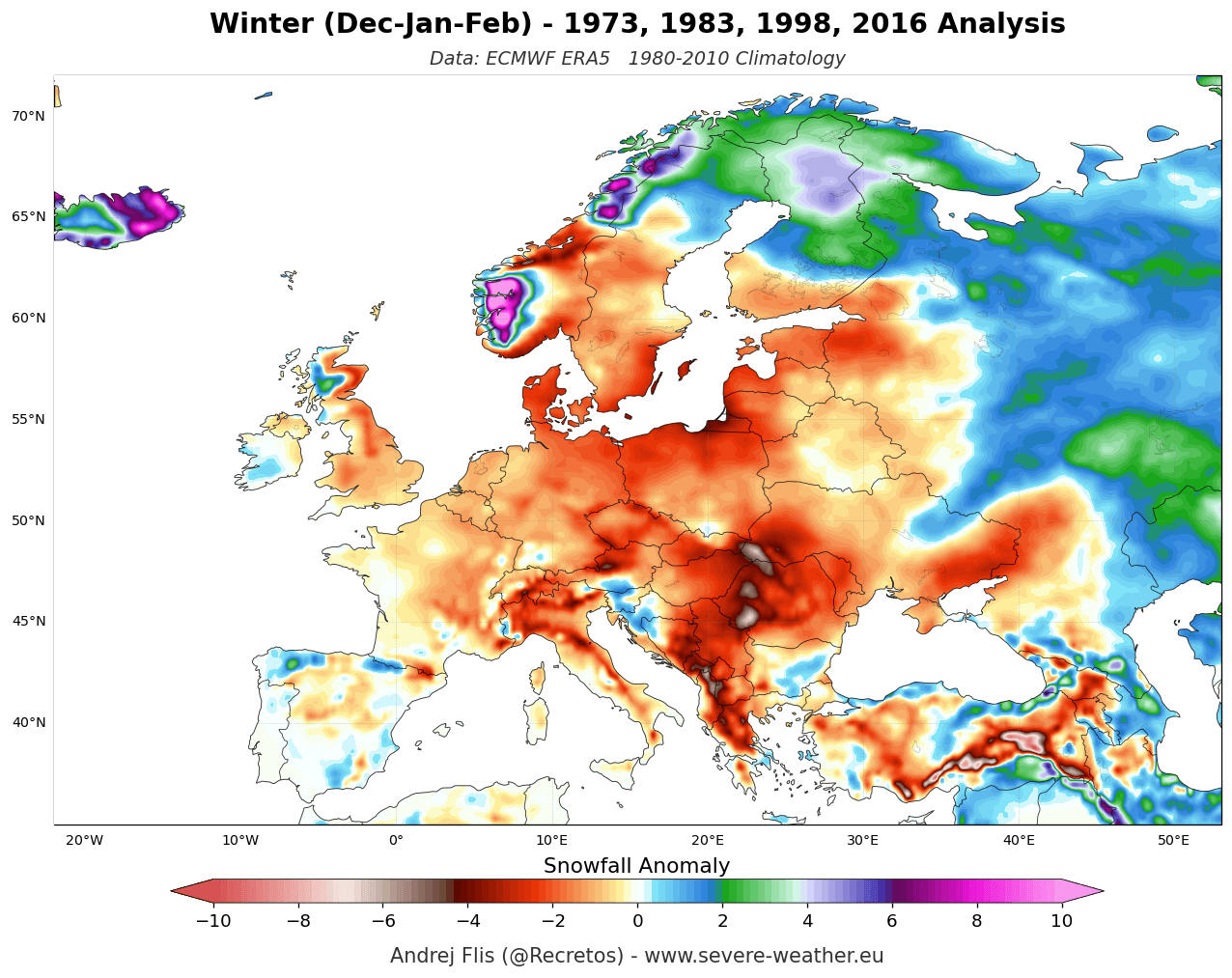
For Europe, the Super El Niño signal is tied to the North Atlantic oscillation. The dominant trend is a mild, westerly flow from the Atlantic. This will likely result in above-normal temperatures across much of the continent. While the moisture-rich air will bring increased precipitation to western and central Europe, snowfall will be highly elevation-dependent. Only at higher altitudes—particularly above 1,800 meters in the Alps—are we likely to see consistent snowpacks, while low-lying areas may struggle with persistent, rain-heavy, and slushy conditions.
Summary of Potential Impacts
As we synthesize these data points, several key themes emerge for Winter 2026/2027:
- Increased Storminess in the Southern U.S.: The strengthening of the subtropical jet stream will likely result in a very active storm track, necessitating heightened vigilance for flood risk and severe weather in southern and southeastern states.
- Ski Season Disparity: Mountain resorts in the Southern Rockies and Sierra Nevada are well-positioned for an excellent snow season. In contrast, resorts in the Pacific Northwest and parts of the Northeast may face a difficult winter with lower-than-average snow cover.
- European Winter Dynamics: The persistent westerly flow will keep Europe generally mild, making this a challenging season for lower-elevation winter sports, though high-altitude regions may benefit from the moisture influx.
- Mid-Winter Volatility: The projected weakening of the Polar Vortex in January provides a wild card. While the broad seasonal trend is for warmth in the north, any disruption to the stratospheric vortex could introduce sudden, sharp cold snaps that break the established El Niño pattern.
Conclusion
The 2026/2027 winter season represents a rare convergence of oceanic and atmospheric forcing. By understanding the mechanisms of this Super El Niño—from the subsurface Kelvin Waves to the stratospheric response—we gain a clearer picture of the challenges ahead. While the broad-scale models provide a high-confidence forecast of a split-flow pattern, the complexity of atmospheric physics reminds us that weather is inherently dynamic. As the season progresses, monitoring the interaction between the El Niño-driven jet stream and the evolving Polar Vortex will be essential for navigating the potential extremes of the coming months.
Disclaimer: This forecast is based on current seasonal model data and historical analysis of past Super El Niño events. Seasonal forecasting involves significant uncertainties, and local weather patterns can be influenced by daily atmospheric variability that cannot be predicted months in advance.