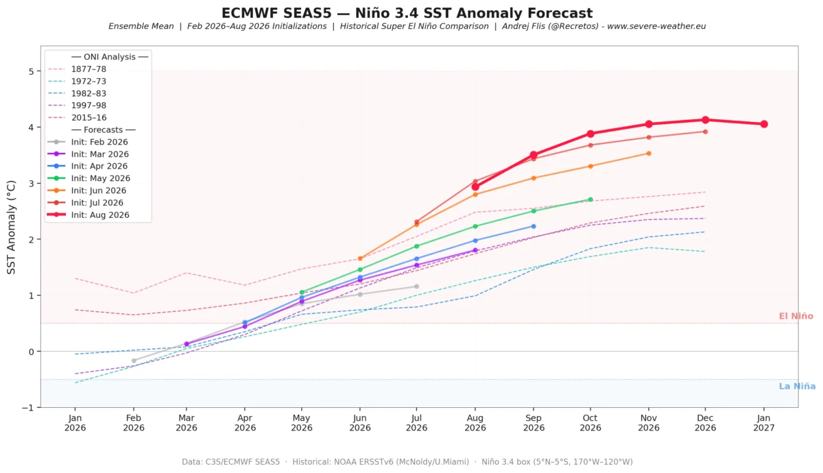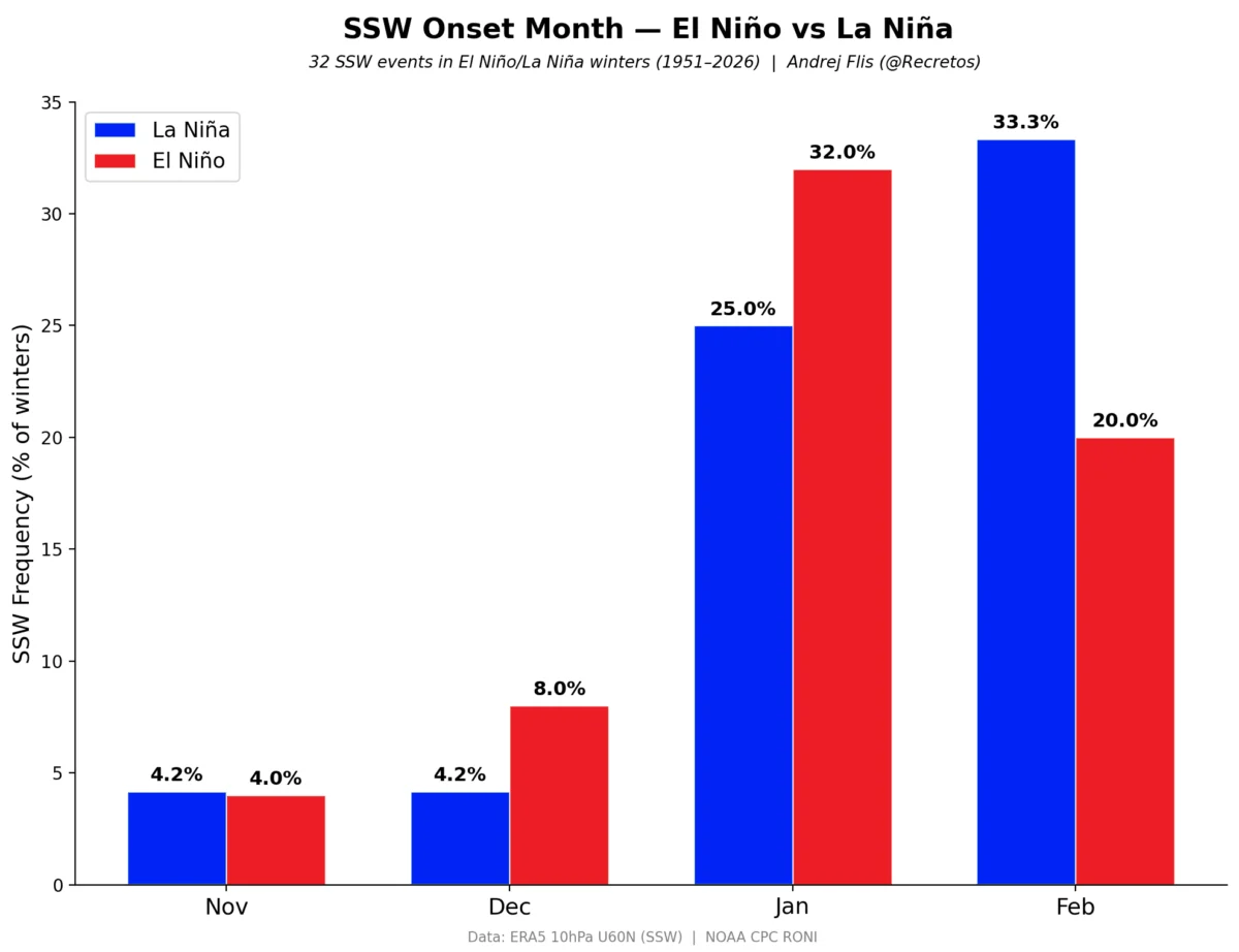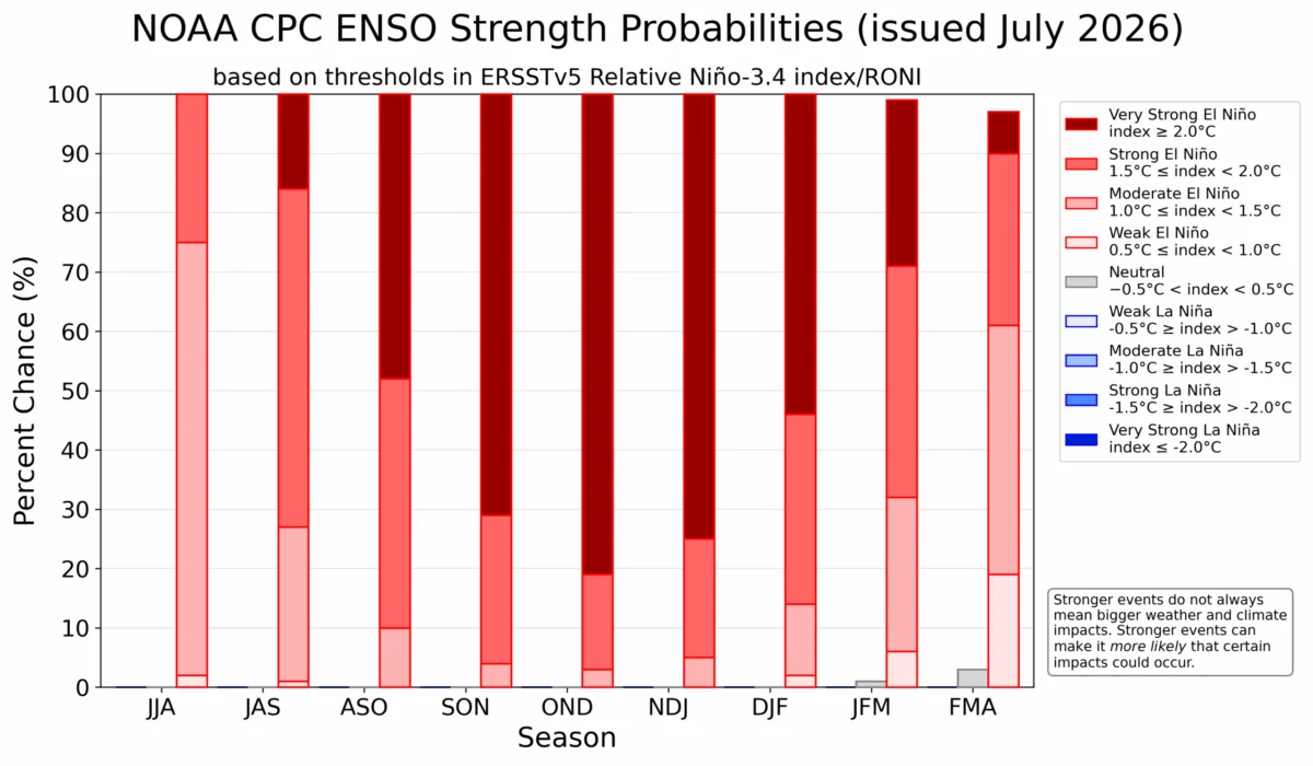
August 26, 2026 — A rare and potentially record-breaking meteorological phenomenon is unfolding across the tropical Pacific. The rapid development of a "Super El Niño" is no longer a theoretical projection; it is now a tangible driver of global atmospheric circulation. As ocean surface temperatures continue to climb, meteorologists are witnessing a profound reconfiguration of the jet stream, signaling a volatile transition from late summer into a winter season that promises to be anything but ordinary for North America and Europe.
The Mechanics of a Super El Niño
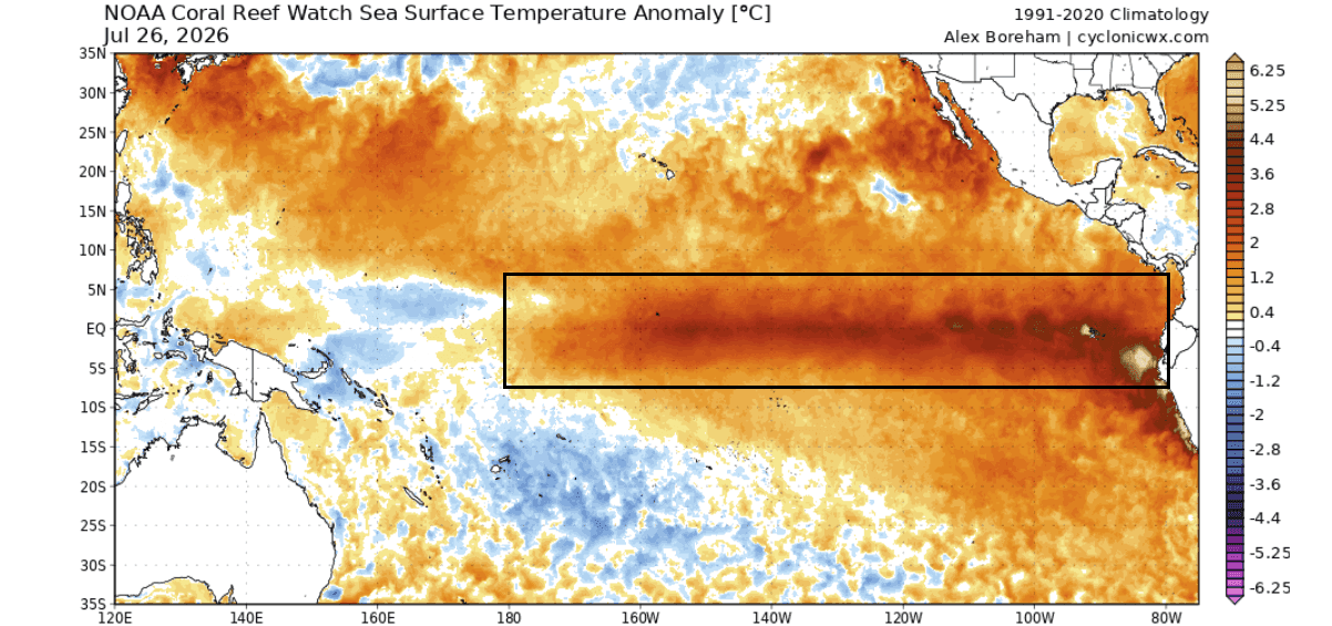
At the heart of this event lies a massive warm temperature anomaly in the equatorial Pacific. When surface temperatures in this region soar—in this case, reaching or exceeding +5 degrees Celsius above normal—it triggers a systemic change in the "Walker Cell," the atmospheric circulation pattern that dictates tropical rainfall and pressure.
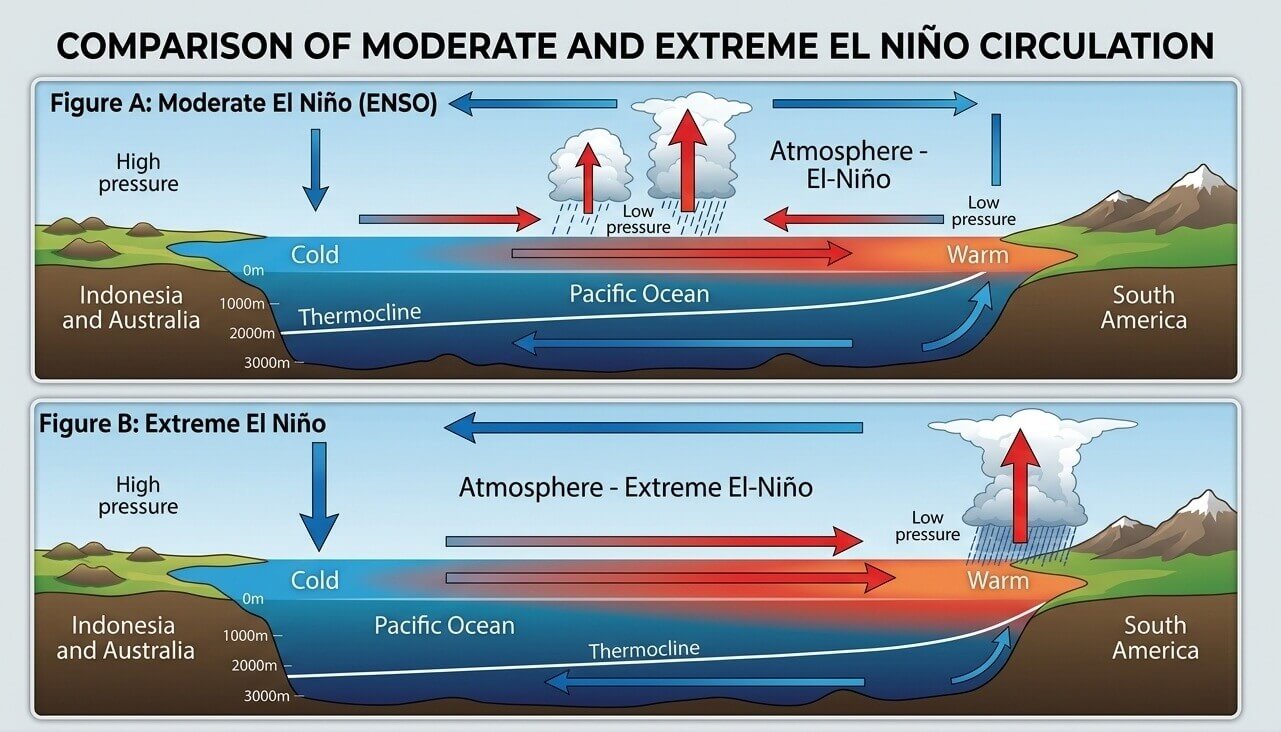
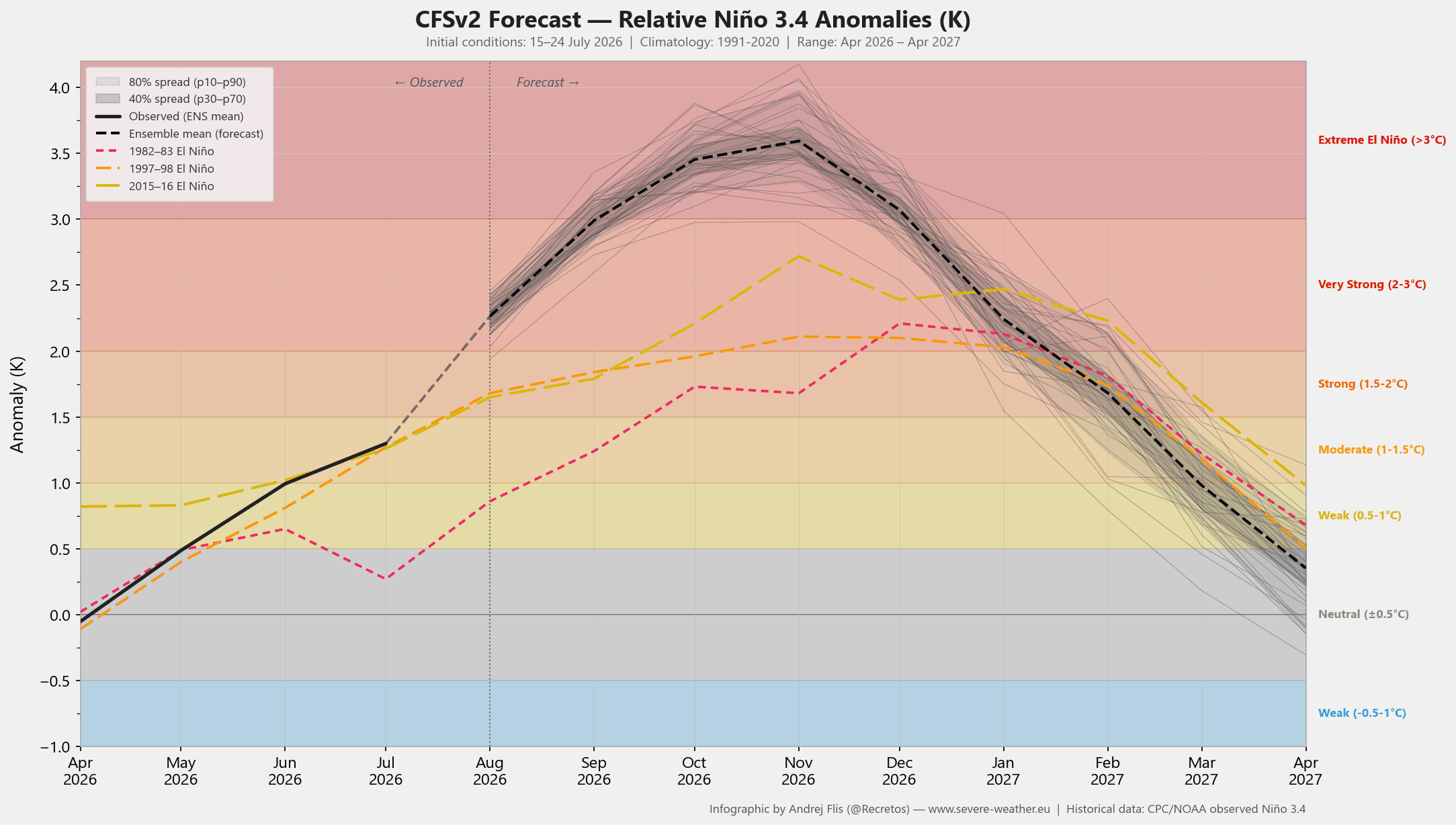
The current 2026 event is distinguished by its rapid acceleration. Unlike moderate El Niño events that often evolve slowly, the current data from the NCEP CFSv2 model suggests we are on a trajectory that could surpass the intensity of the most significant events in recorded history. This intensification is driven by powerful "Kelvin Waves"—massive subsurface pulses of warm water that rise to the surface, effectively locking the atmosphere into a persistent, high-energy state. This "atmospheric standing wave" acts as a structural anchor, forcing weather systems across the globe to deviate from their traditional seasonal norms.
Chronology of Development: From July Trends to Winter Forecasts
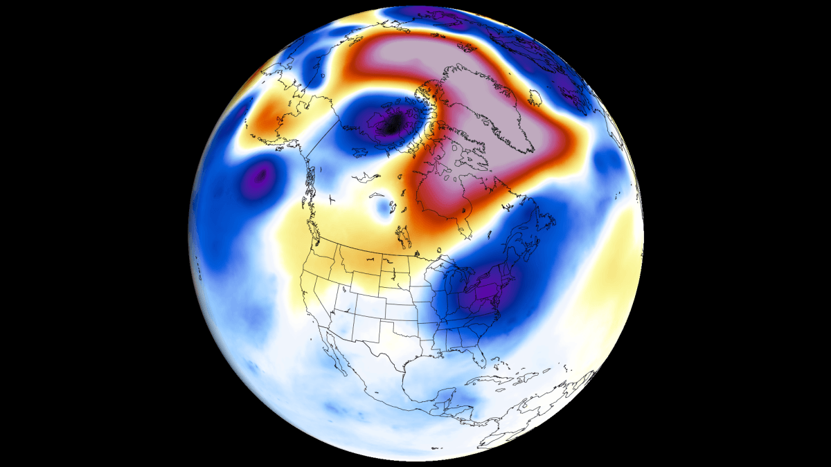
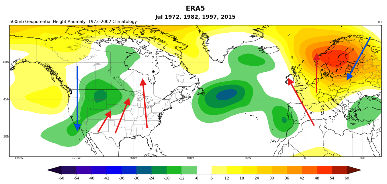
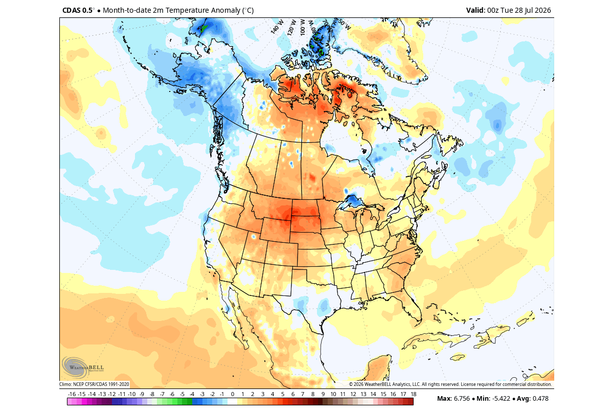
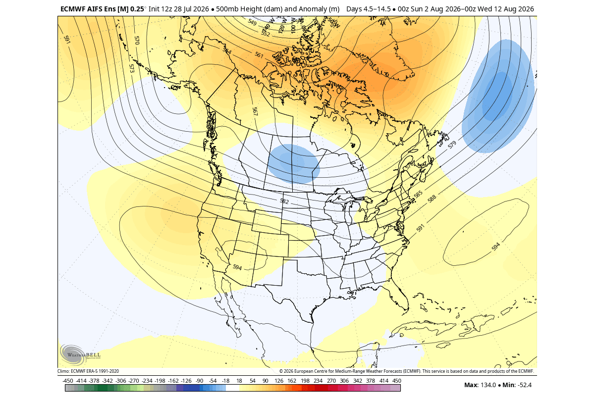
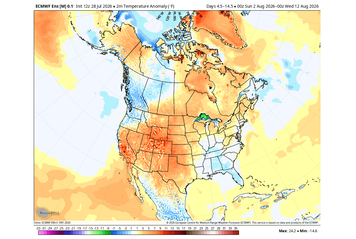
The atmospheric response to this Pacific forcing has already begun. July 2026 provided a definitive preview of what is to come, with pressure and temperature anomalies across the United States and Canada mirroring the signatures of past extreme El Niño years.
- July/August 2026: Initial signs emerged with a shift in the Pacific jet stream. A low-pressure anomaly, typical of early-stage Super El Niño events, began to influence North American patterns, fostering a ridge over the west-central United States while steering cooler, moisture-laden air into the eastern regions.
- Late Summer/Fall 2026: As we move toward October and November, the "atmospheric bridge" between the tropical Pacific and the mid-latitudes will solidify. The subtropical jet stream is expected to amplify, creating a persistent storm track across the southern tier of the United States.
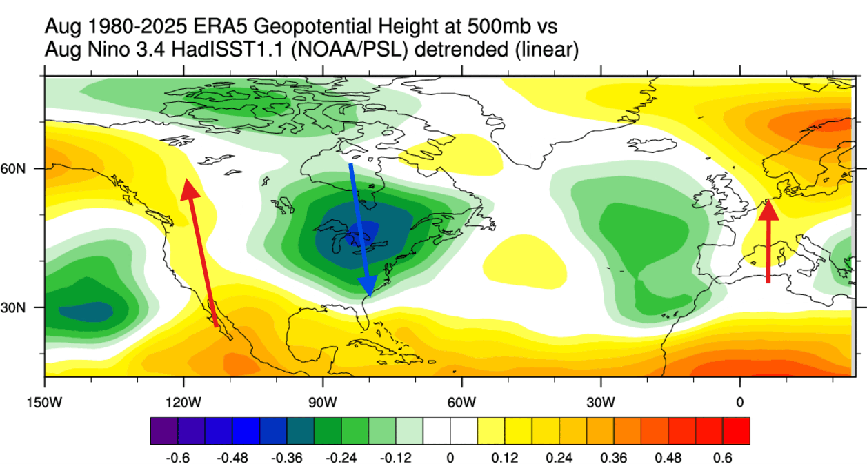
- Winter 2026/2027: The peak of the event is projected for the heart of winter. Models indicate a "split-flow" pattern: high pressure will likely dominate the northern latitudes, effectively suppressing deep Arctic air for much of the Northern Plains and Great Lakes, while the southern U.S. will face an active, stormy, and potentially colder-than-average winter.
Supporting Data: Decoding the Models
The scientific community is relying on multi-model ensembles—including the ECMWF and NOAA’s CFSv2—to track the evolution of this event. The data consistently points to an "Eastern Pacific" (EP) type El Niño, which, when coupled with its extreme strength, creates a more aggressive distortion of the jet stream than a Central Pacific event would.
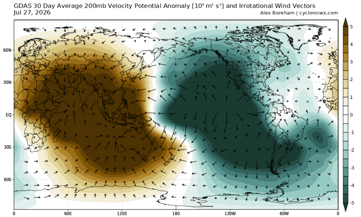
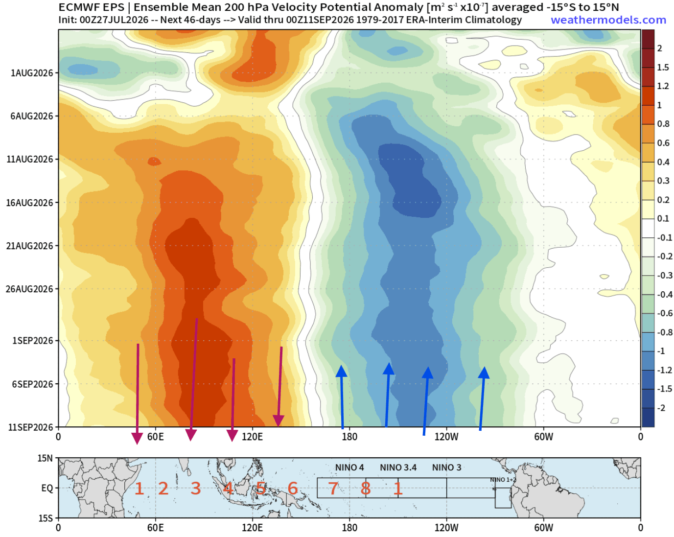
Velocity Potential anomalies, measured at the 200mb level (roughly 12 kilometers altitude), confirm the presence of an immense atmospheric bridge. We are observing strong rising air motion over the central and eastern Pacific, balanced by sinking air over the Indian Ocean. This confirms that the global atmosphere is now effectively "under the control" of the Pacific anomaly. The implications of this are stark: when the tropical engine is this powerful, the "ripple effect" propagates downstream, influencing weather patterns from the Pacific Northwest to the coast of Europe.
Official Outlook and Scientific Implications
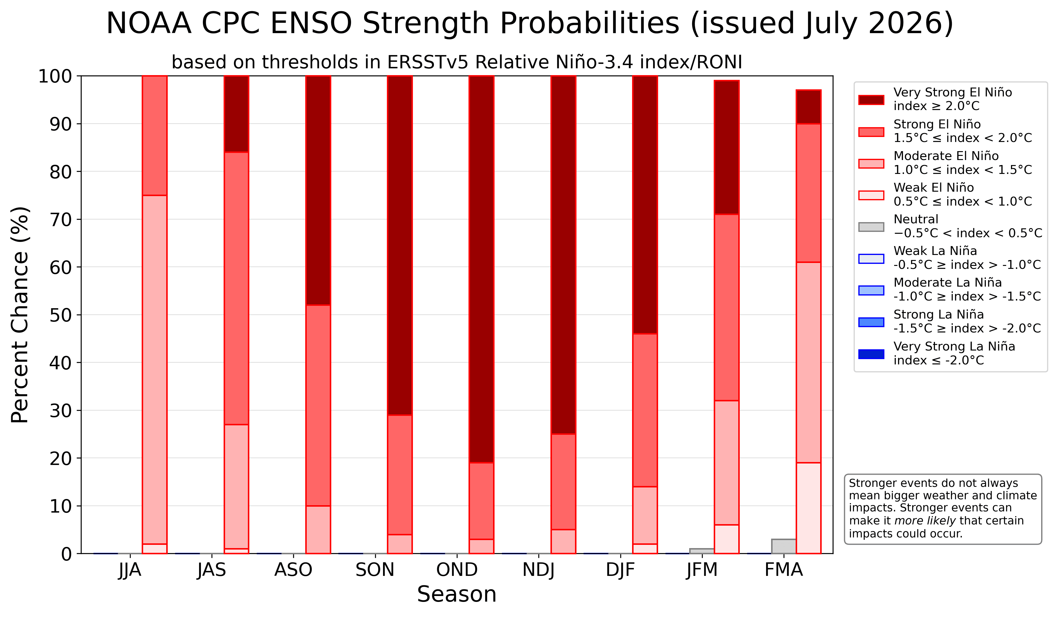
While agencies like the NOAA Climate Prediction Center (CPC) are providing the baseline for these projections, the unprecedented speed of the 2026 development has drawn significant attention from climate researchers worldwide.
The primary implication of an Extreme El Niño is the "amplification" of seasonal weather. In a standard year, regional variability often masks the influence of ENSO (El Niño-Southern Oscillation). However, in a Super El Niño year, the forcing is so dominant that it overrides typical local weather drivers.
For the United States, this means a winter of contrasts. The northern states are likely to see warmer, drier conditions as the jet stream is pushed south. Conversely, the Southern Plains, the Gulf Coast, and the interior Mid-Atlantic should prepare for increased precipitation and frequent cold air intrusions as the southern storm track becomes the primary conveyor belt for moisture and energy.
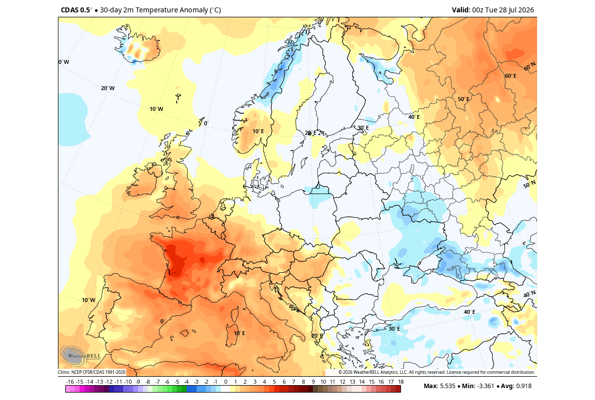
For Europe, the signal is more complex and currently exhibits a lag. While early August showed a resistance to the typical El Niño forcing—characterized by high-pressure blocks over the continent—the trend moving into late summer suggests that the Atlantic low-pressure zone will eventually exert more influence. As the season progresses, a more zonal, westerly flow is expected to bring milder temperatures to the western and central parts of the continent, though the North remains vulnerable to cold outbreaks depending on the exact positioning of the Atlantic jet.
Strategic Implications: Why This Matters
The shift toward a "split-flow" winter is not merely a curiosity for meteorologists; it has profound implications for infrastructure, energy demand, and agriculture.
- Energy Markets: A warmer-than-average northern tier of the United States will likely lower heating demand in the upper Midwest, while increased storm activity in the South may stress local power grids.
- Hydrology and Agriculture: The shifting storm track is a double-edged sword. While the southern United States may benefit from increased rainfall, the suppression of storms in the northern and central regions could lead to soil moisture deficits in key agricultural corridors.
- Winter Preparedness: The shift of snowfall potential from the Great Lakes toward the Southern Plains and the Mid-Atlantic requires a realignment of emergency management resources. Municipalities that are not accustomed to handling heavy, wet winter storm systems may find themselves at a disadvantage if the active jet stream delivers moisture to these latitudes.
A Global System in Flux
As we look toward the final quarter of 2026, the message from the data is clear: the atmosphere is in a state of rapid adjustment. The "Super El Niño" of 2026/2027 is a reminder of the Earth’s interconnected systems, where a temperature change in the deep Pacific creates a cascading sequence of events that reaches every corner of the Northern Hemisphere.
The coming months will be a period of significant volatility. Whether it is the expansion of cold air into the Southern U.S. by February or the moisture-heavy autumn expected across much of Europe, the signature of this event is its ability to "lock" weather patterns into place.
Meteorologists will continue to monitor the subsurface Kelvin Waves and the surface-level pressure anomalies on a weekly basis. With fresh data arriving from the ECMWF and other global models, the forecast for the upcoming winter will continue to be refined. For now, the takeaway is one of heightened vigilance: the 2026/2027 season is poised to be a benchmark event that will test the resilience of regional weather models and the communities they serve. As the Pacific continues its warming trend, the global atmosphere will continue its dance to a new, more powerful rhythm, setting the stage for a winter defined by the sheer magnitude of the tropical Pacific’s influence.