As the Northern Hemisphere transitions from the heat of summer into the autumnal months, a colossal climatic force is brewing in the equatorial Pacific. Meteorologists and climatological research centers are tracking the rapid intensification of what is now classified as a "Super El Niño" event. Data for the 2026/2027 season suggests that this is not merely a standard El Niño occurrence, but a record-breaking phenomenon that is already forcing the global atmosphere into a premature winter-like configuration.

The implications of this event are far-reaching. From the high-pressure blocking patterns over Canada to the storm-lashed southern United States and the unpredictable dynamics of the stratospheric Polar Vortex, the 2026/2027 cold season is shaping up to be one of the most volatile in recent memory.
The Main Facts: A Global Driver of Unprecedented Strength
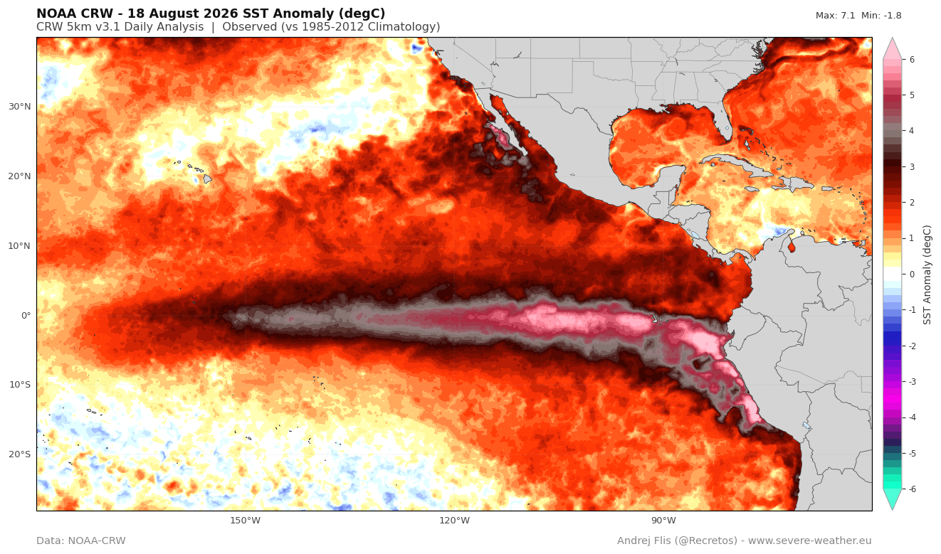
The core of the current climatic disruption is an El Niño event that has surpassed previous historical benchmarks in its early development. Unlike standard oscillations, this "Super El Niño" is characterized by sea surface temperature (SST) anomalies that have already shattered records for this time of year.
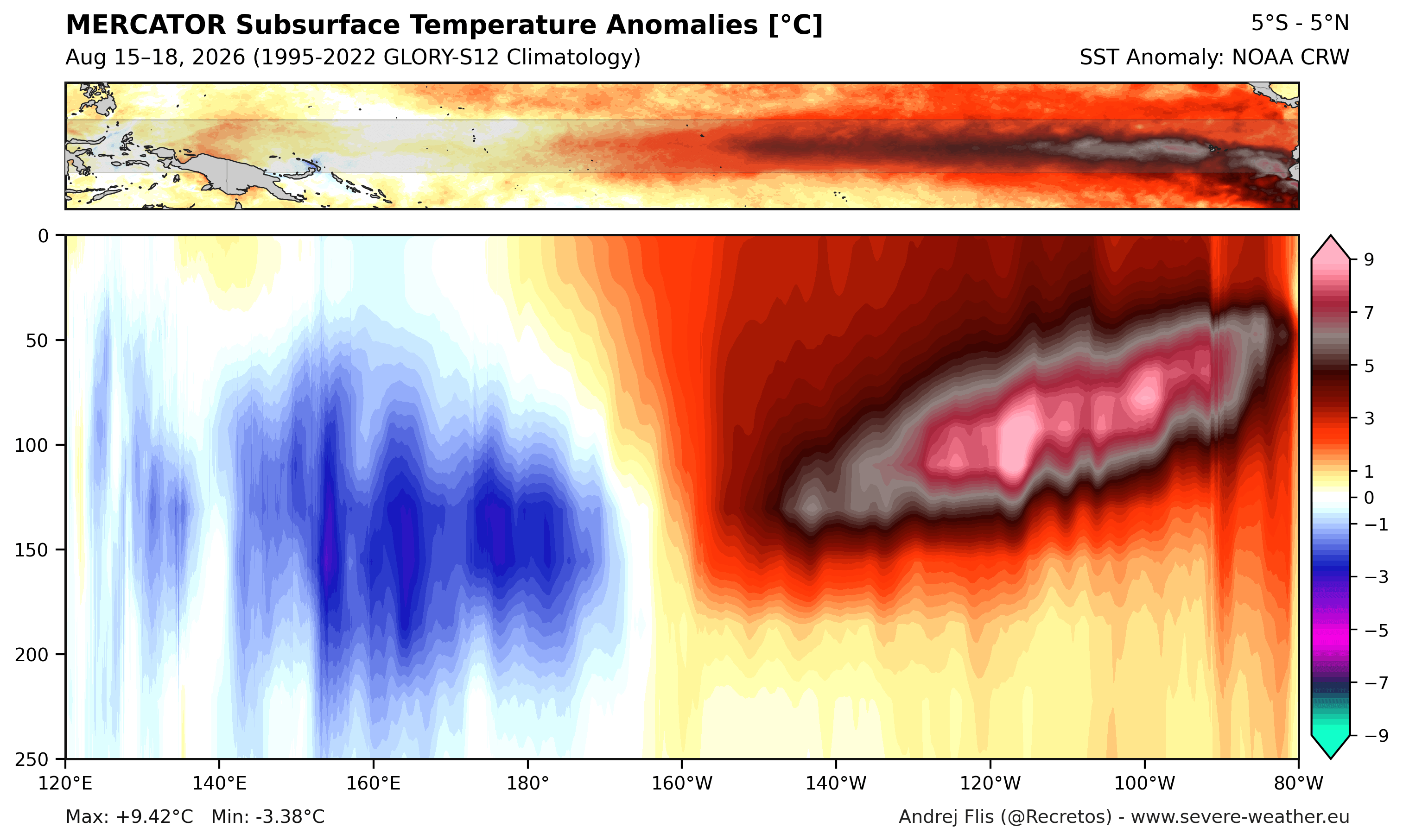
Current analysis from the National Oceanic and Atmospheric Administration (NOAA) and the European Centre for Medium-Range Weather Forecasts (ECMWF) confirms that the tropical Pacific is experiencing a massive downwelling Kelvin Wave—a surge of subsurface heat that serves as the "heart" of the event. With subsurface temperature anomalies exceeding 9°C (16°F) above normal, this thermal reservoir is providing the necessary energy to sustain the El Niño well into the winter months.
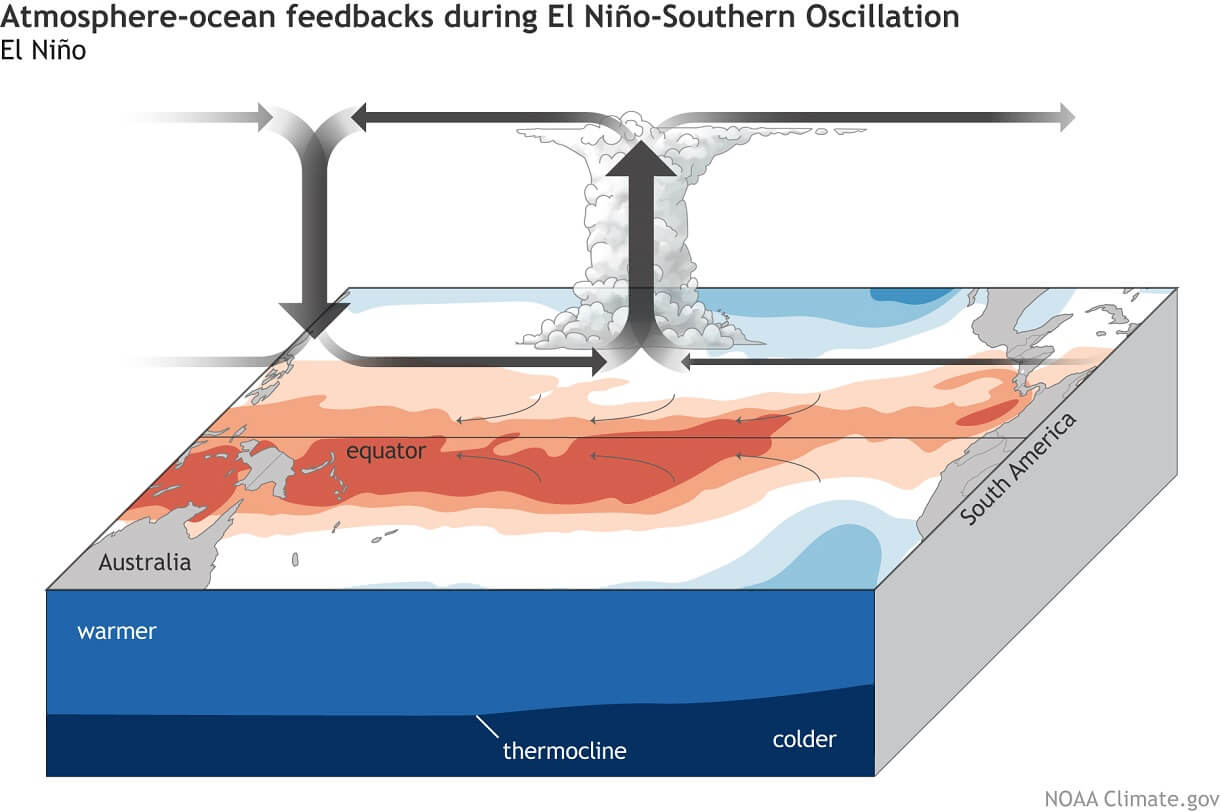
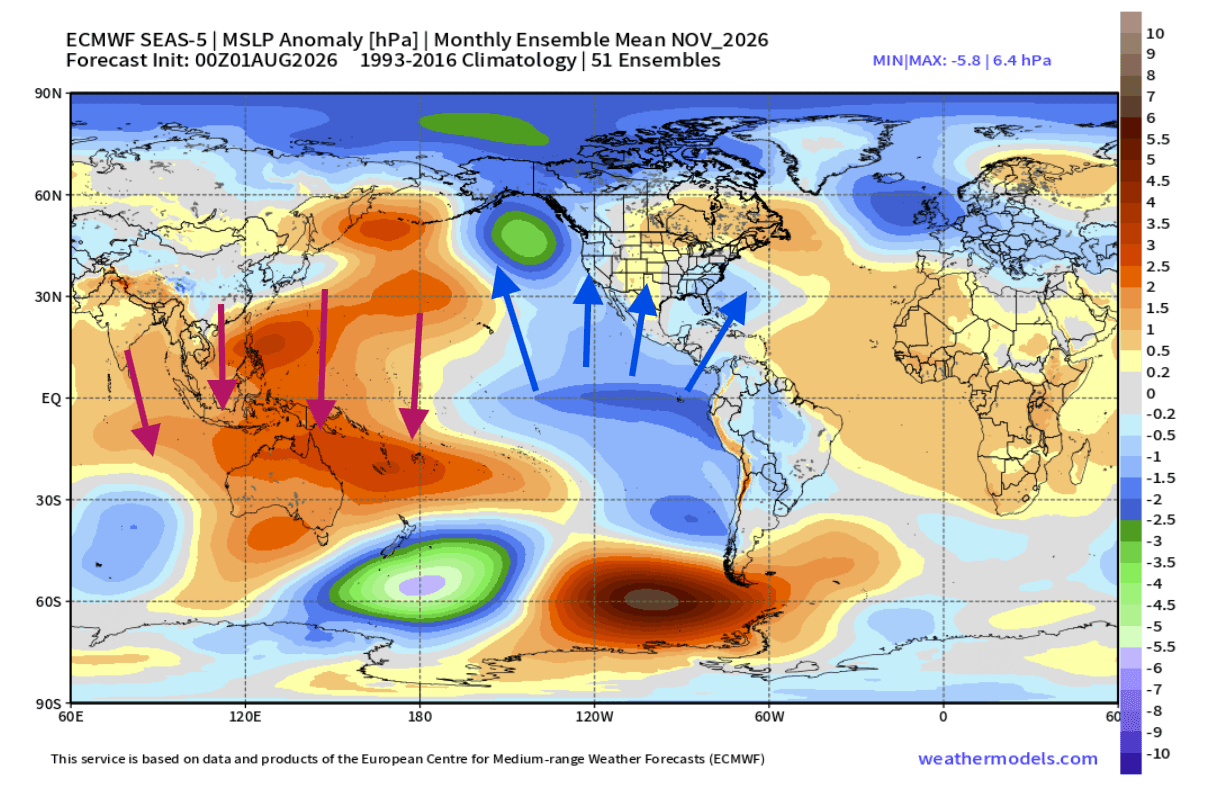
The primary atmospheric signal is a shift in the Walker Circulation. Rising air over the central and eastern Pacific is leading to increased precipitation and lower pressure in those regions, while simultaneously creating stable, high-pressure conditions in the western Pacific. This shift is not isolated; it is cascading into a global realignment of jet streams, directly impacting weather across North America and Europe.
Chronology of the Super El Niño 2026
The rapid onset of this event has caught even seasoned observers by surprise. While climate modeling typically provides a slow, predictable growth curve for ENSO (El Niño-Southern Oscillation) events, the 2026 iteration has displayed an aggressive, exponential trajectory.
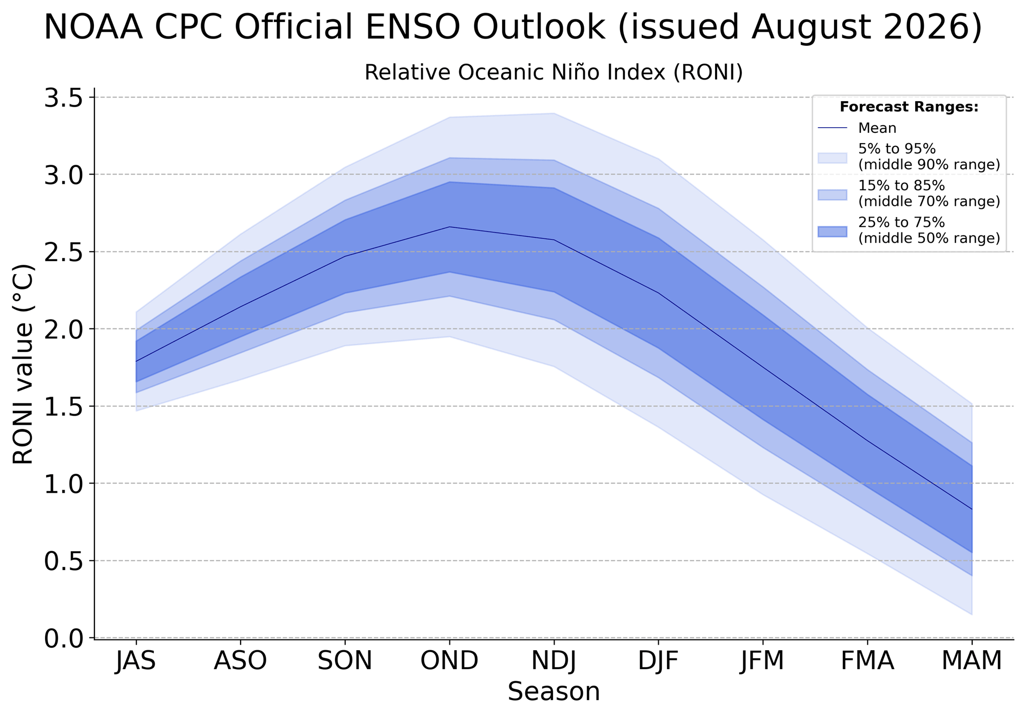
- Early 2026: Initial signals emerged in the Pacific, with models beginning to suggest a stronger-than-average warm phase.
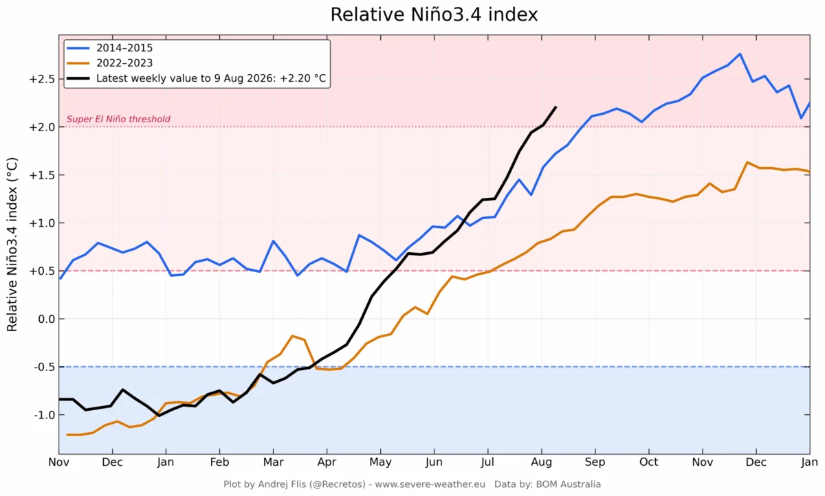
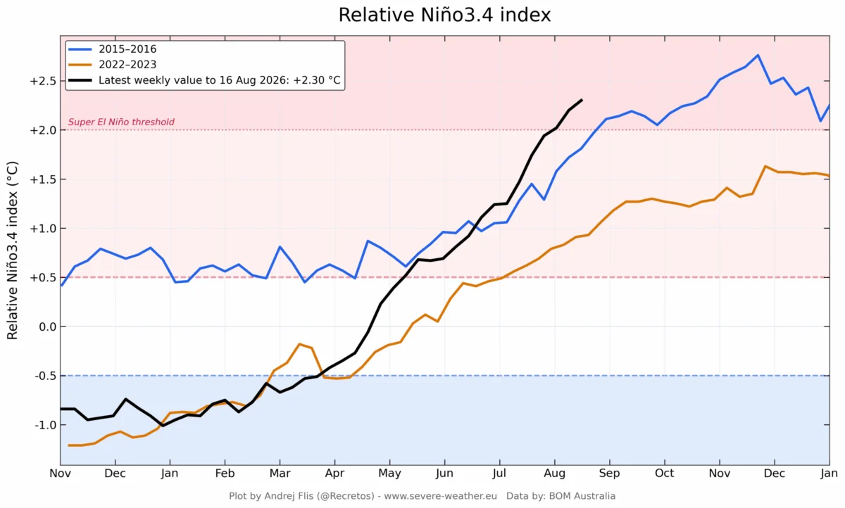
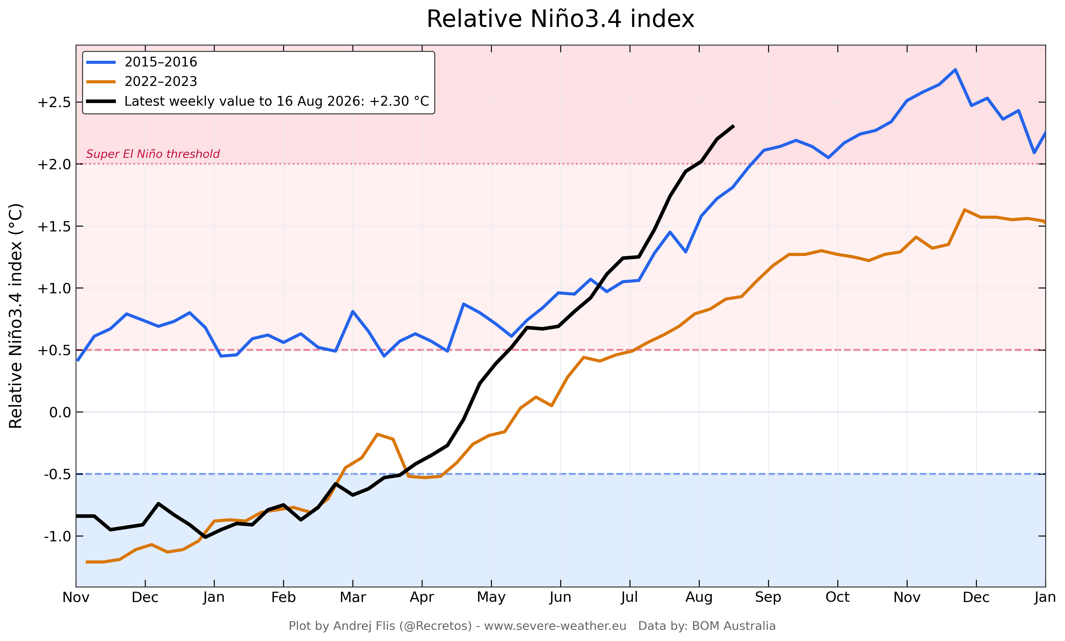
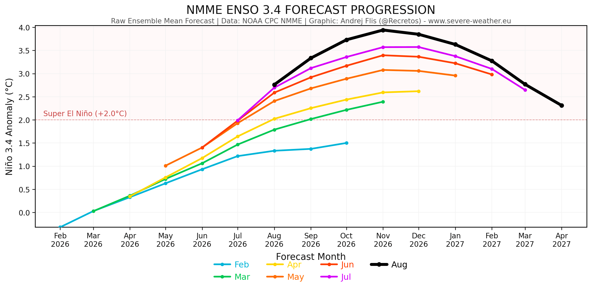
- Late Spring to Summer 2026: The warming trend accelerated. By August 2026, the ENSO region anomalies were significantly higher than those observed during the historic 2015/2016 Super El Niño at the same stage of development.
- Current Status: The event has sustained values well above the +2°C threshold required to be labeled a "Super" event. The sustained nature of these anomalies suggests that the event is not merely a transient spike but a locked-in state that will dominate the meteorological landscape through the end of the year and into early 2027.
Supporting Data: The Multi-Model Consensus
The scientific community relies on the North American Multi-Model Ensemble (NMME) and the ECMWF seasonal forecasts to peer into the coming months. The consensus is clear: the Pacific is acting as a massive engine for global weather modification.
Atmospheric Pressure Anomalies
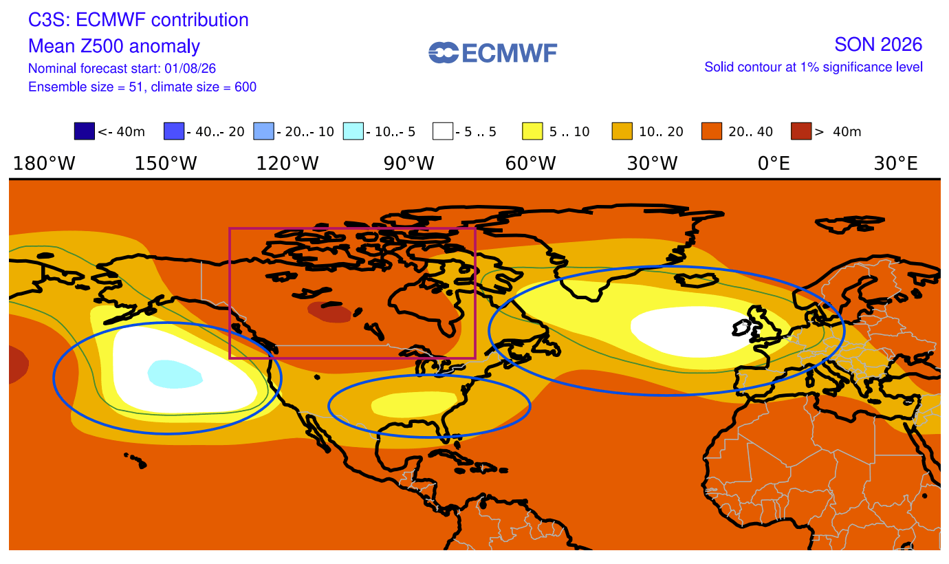
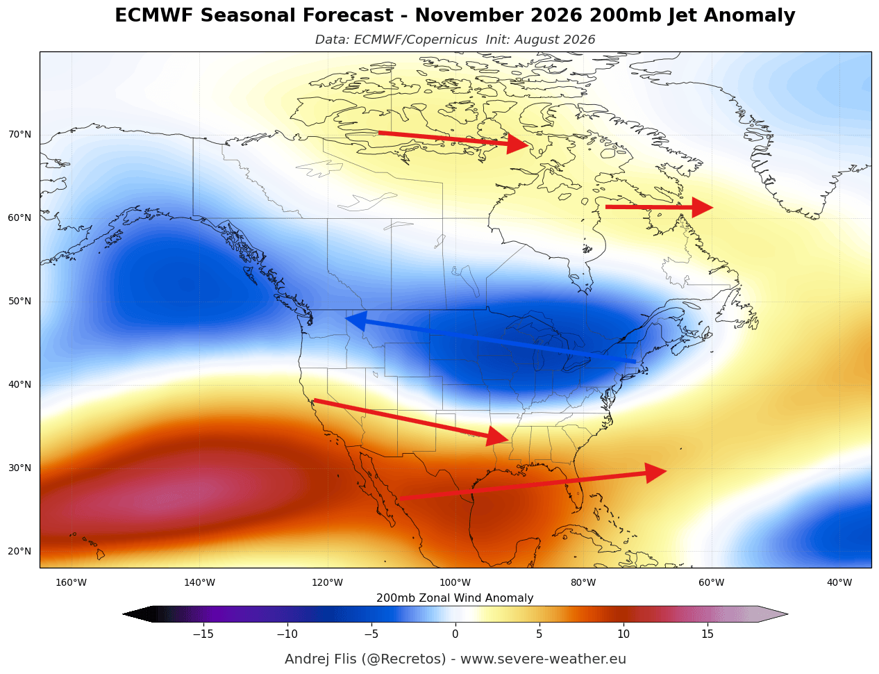
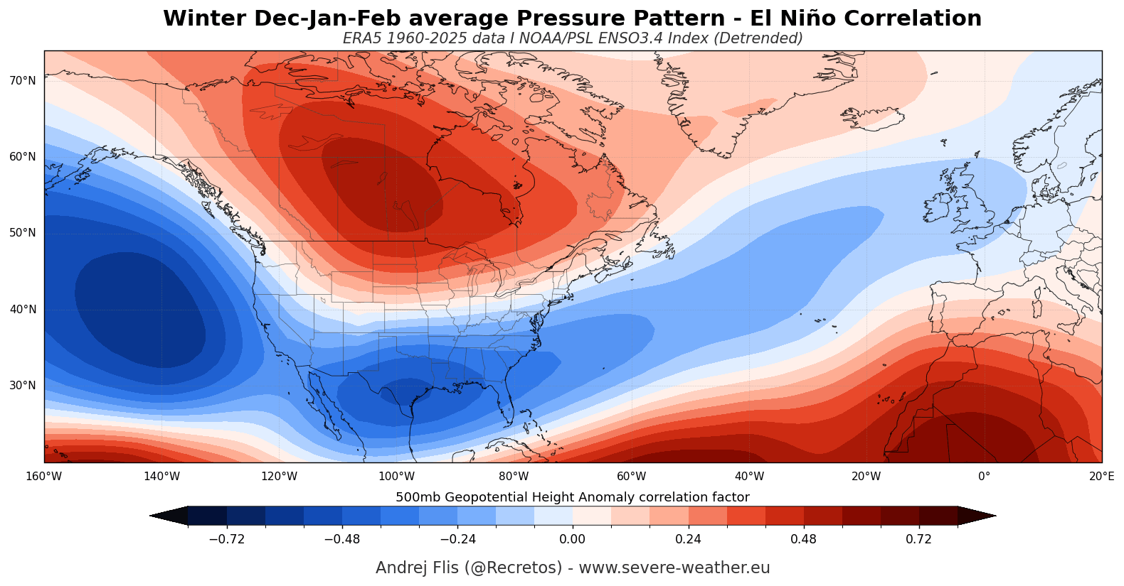
Models are currently projecting a persistent high-pressure anomaly over Canada. This "blocking" feature acts as a formidable barrier, forcing the polar jet stream to warp and shift. Meanwhile, a chain of low-pressure systems—fueled by the moisture-rich Pacific—is expected to track across the southern United States. This "split-flow" pattern, where the polar jet remains locked to the north while the southern jet intensifies, is a classic hallmark of a mature El Niño winter, yet it is appearing with surprising clarity as early as this fall.
Sea Surface Temperature (SST) Trends
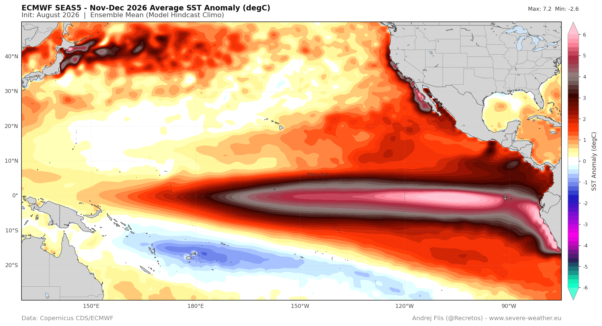
The spatial distribution of the warming is critical. Current data indicates an Eastern Pacific (EP) based event. Historically, EP events generate a more intense pressure response over the North Pacific compared to Central Pacific (CP) events. This specific positioning is likely responsible for the dramatic moisture transport toward the southern U.S. and the increased rainfall patterns projected for the coming months.
Implications for North America and Europe
The forecast for the remainder of 2026 and early 2027 suggests a winter of distinct contrasts.
North America: The Tale of Two Climates
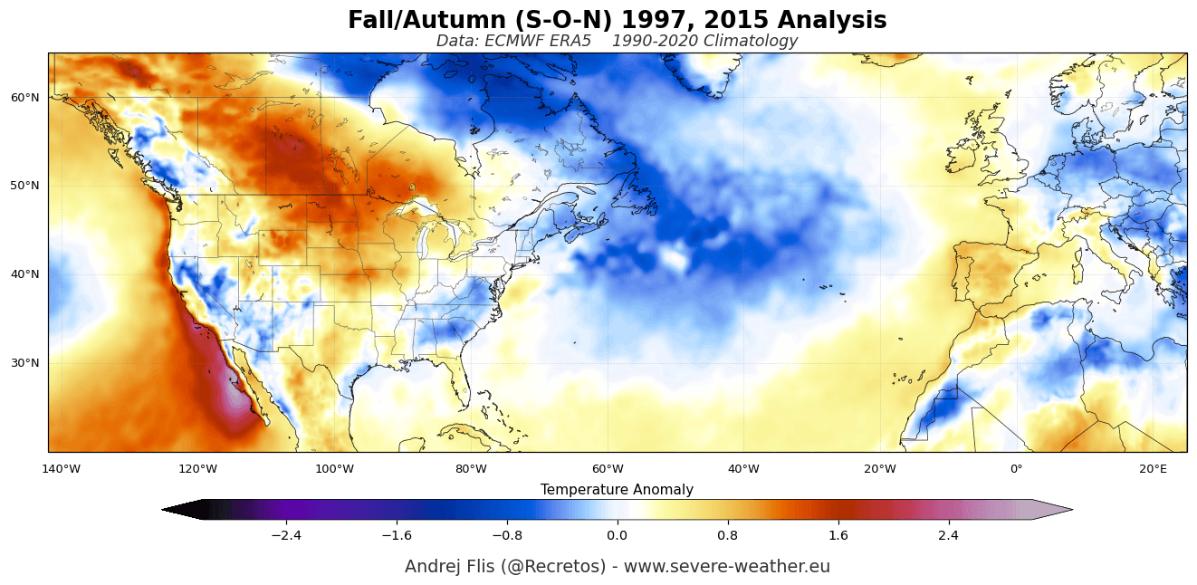
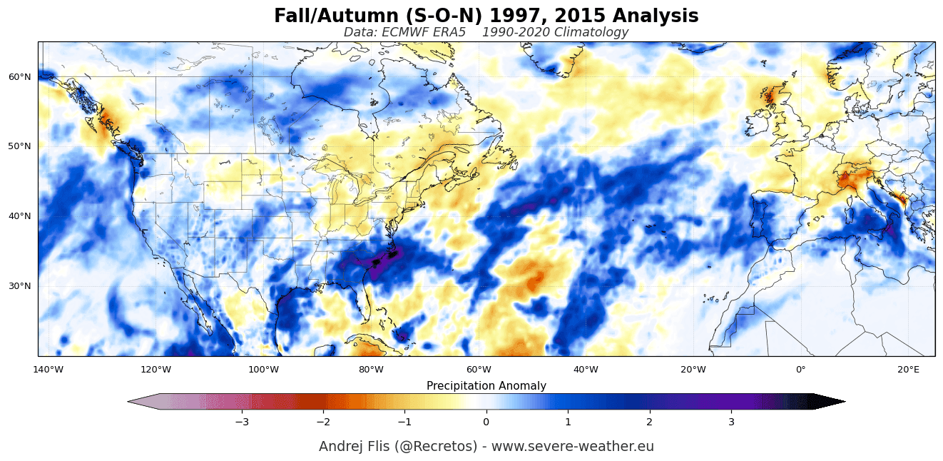
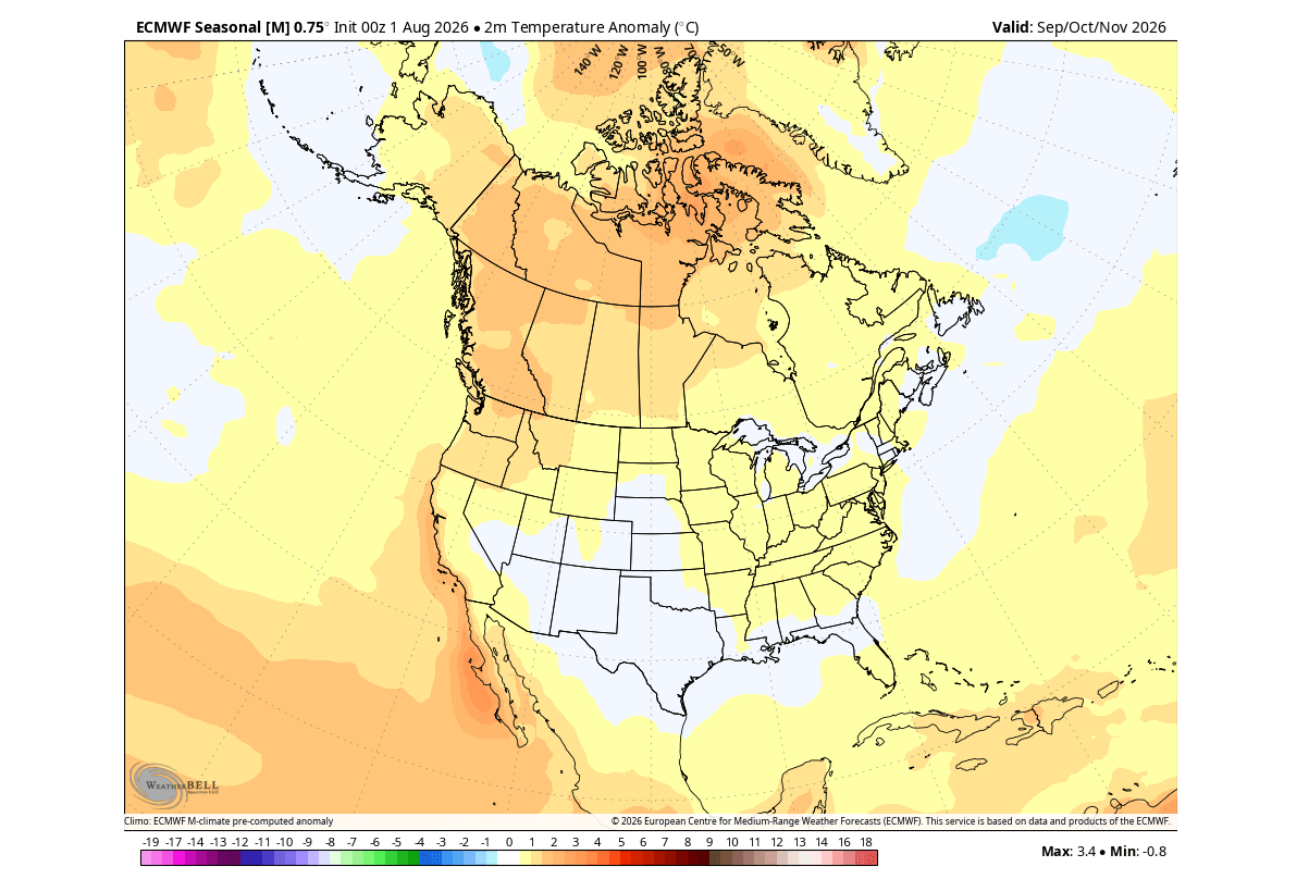
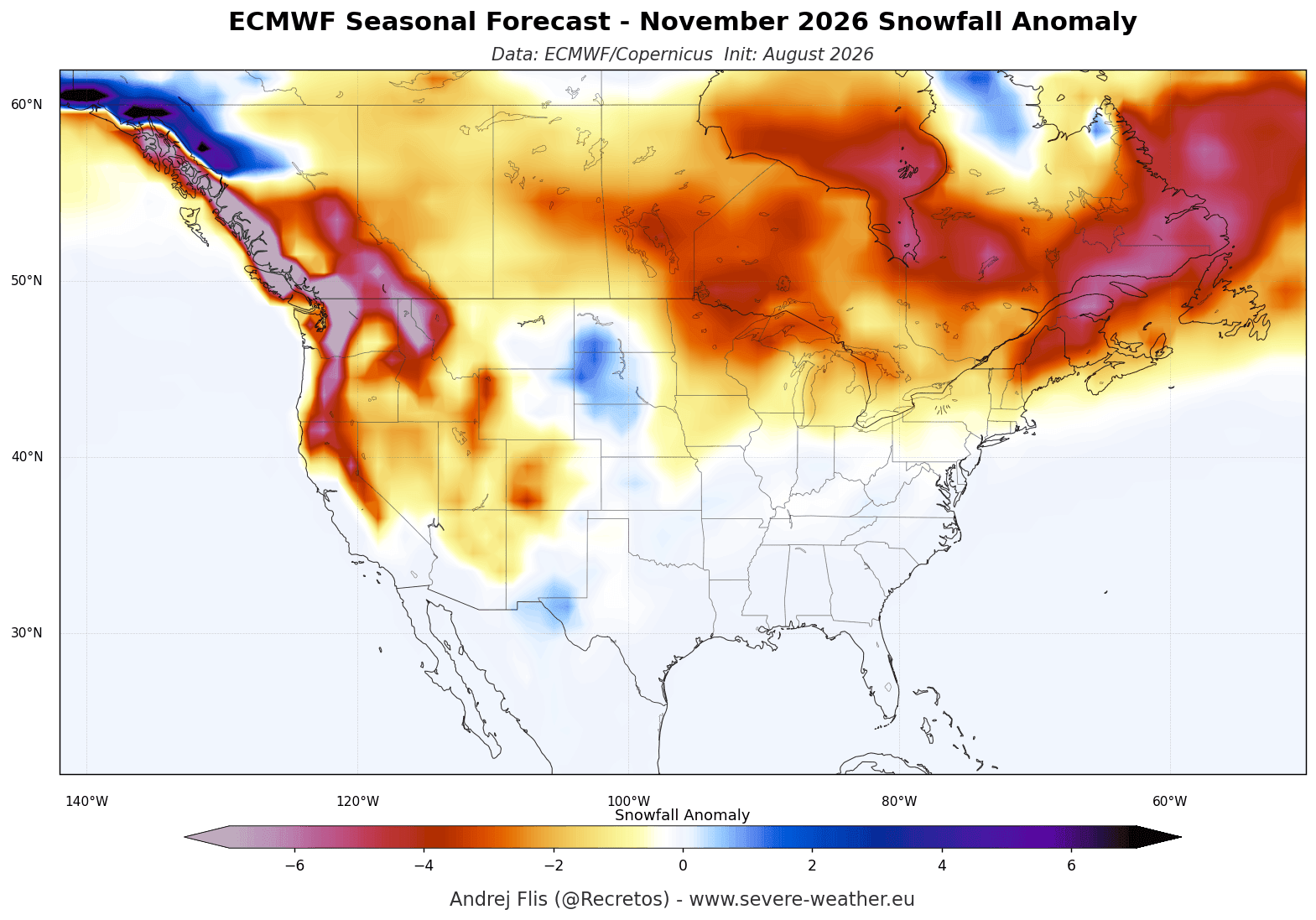
For the United States and Canada, the Super El Niño implies a winter of geographical bifurcation. The northern tier of the U.S. and the western half of Canada are projected to see warmer-than-average conditions due to the high-pressure ridge preventing cold air mass intrusions. Conversely, the southern and central United States are in the crosshairs of a highly active, moisture-laden subtropical jet stream. This will likely result in increased precipitation, potentially leading to severe weather outbreaks in the south and significant snowfall events in higher elevations that are caught in the conflict zone between the southern storm track and residual cold air.
Europe: The Atlantic Connection
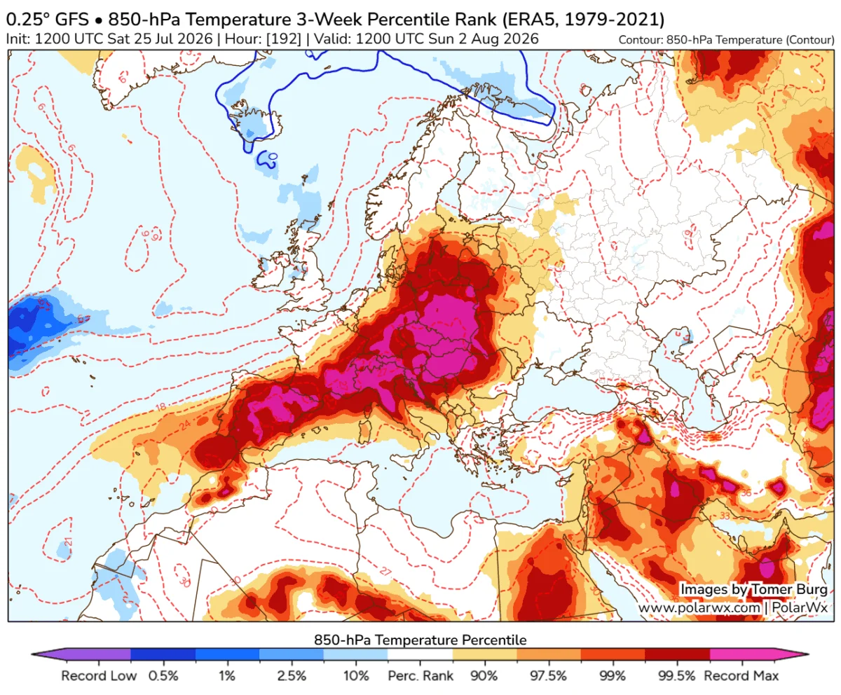
Europe’s weather is currently being dictated by a low-pressure zone forming in the North Atlantic. This configuration facilitates a steady, westerly flow of mild, maritime air. Most of the European continent can expect warmer-than-normal temperatures, particularly in the central and western regions. While this points to a generally mild winter, the increased precipitation from the Atlantic storm track could lead to wetter, windier conditions for the continent, with significant snowfall likely restricted to higher-altitude regions like the Alps.
The Polar Vortex: The Wild Card of Winter 2026/2027
Perhaps the most significant factor in the long-range outlook is the stability—or lack thereof—of the Polar Vortex. The Polar Vortex is the massive, cyclonic engine spinning over the Arctic, effectively trapping the coldest air on the planet within the polar circle.
Research indicates that Super El Niño events have a higher propensity for triggering "Sudden Stratospheric Warming" (SSW) events. When the atmosphere is perturbed by the energetic waves emanating from the Pacific, that energy propagates upward, potentially disrupting the stratospheric flow.
If the Polar Vortex undergoes a major disruption or "collapse," the results are typically dramatic: the containment of polar air fails, allowing massive, frigid air masses to spill southward into the mid-latitudes. Current forecasts from the ECMWF and the UKMO (United Kingdom Met Office) are already highlighting an unusual deceleration of stratospheric winds in late December and January. This suggests a heightened risk of a Polar Vortex disruption in mid-winter, which could override the generally mild outlook for parts of the U.S. and Europe, leading to severe, short-lived cold snaps.
Official Responses and Strategic Planning
Governmental meteorological agencies are already treating the 2026/2027 forecast with extreme caution. The primary challenge for infrastructure and emergency management is the speed at which this Super El Niño has developed.
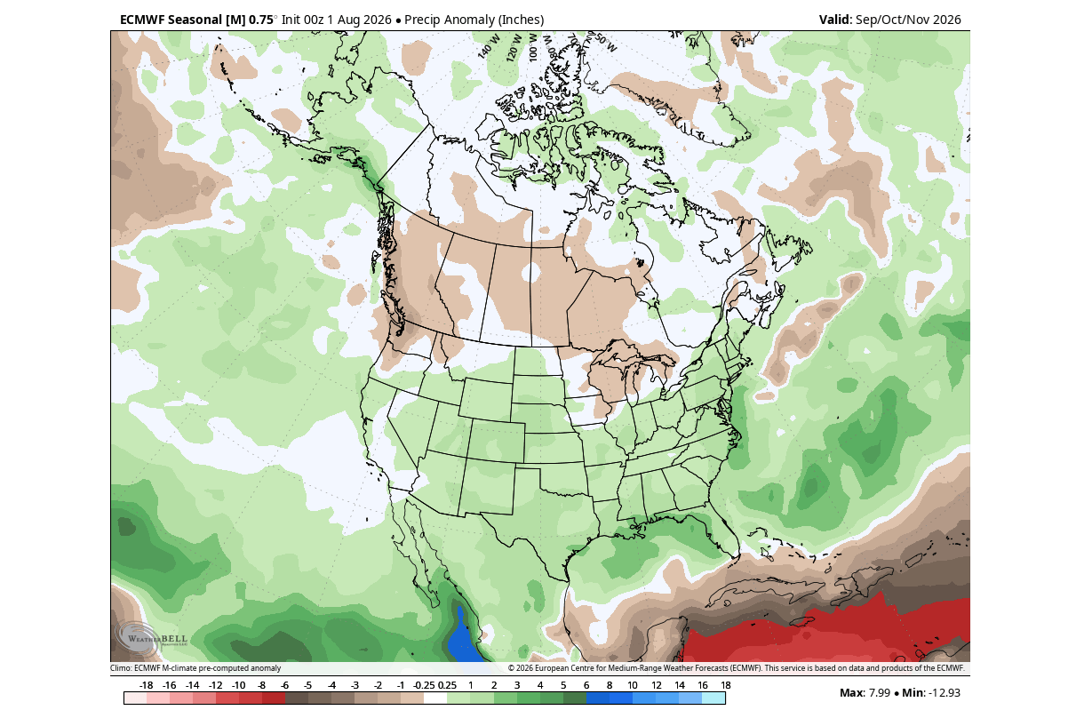
Agricultural sectors in the southern U.S. are being warned of potential flood risks due to the expected increase in precipitation. Conversely, energy markets in the northern regions are preparing for lower heating demand due to the projected warm anomalies, though they remain on high alert for the potential volatility that a Polar Vortex disruption could introduce.
Conclusion: A Season of Unprecedented Volatility
The 2026/2027 winter season is poised to be defined by the "Super" label assigned to this El Niño. The sheer scale of the ocean-atmosphere interaction, the intensity of the Kelvin Waves, and the early formation of winter-like pressure patterns all point to a season where historical averages may prove less useful than ever before.
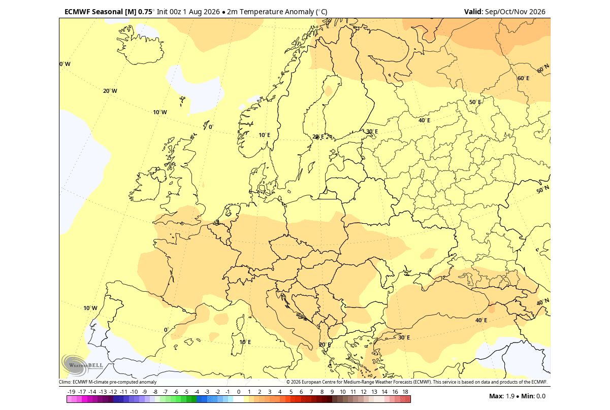
As the atmospheric bridge between the Pacific and the rest of the globe continues to strengthen, the public should remain prepared for a winter that defies simple characterization. Whether it is the persistent moisture in the southern U.S. or the looming possibility of a stratospheric breakdown, the 2026/2027 cold season demands close attention to updated forecasts. The Titan of the Pacific has awakened, and its influence will be felt in every corner of the Northern Hemisphere.