The global climate system is currently bracing for a transformation of historic proportions. According to the latest oceanographic and atmospheric data, a "Super El Niño" event is not only strengthening across the tropical Pacific but is doing so with an acceleration that has stunned meteorologists. As of late August 2026, long-range forecasts have consistently revised peak intensity projections upward, signaling that the current event is poised to enter the record books alongside the most powerful El Niño episodes of the last century.

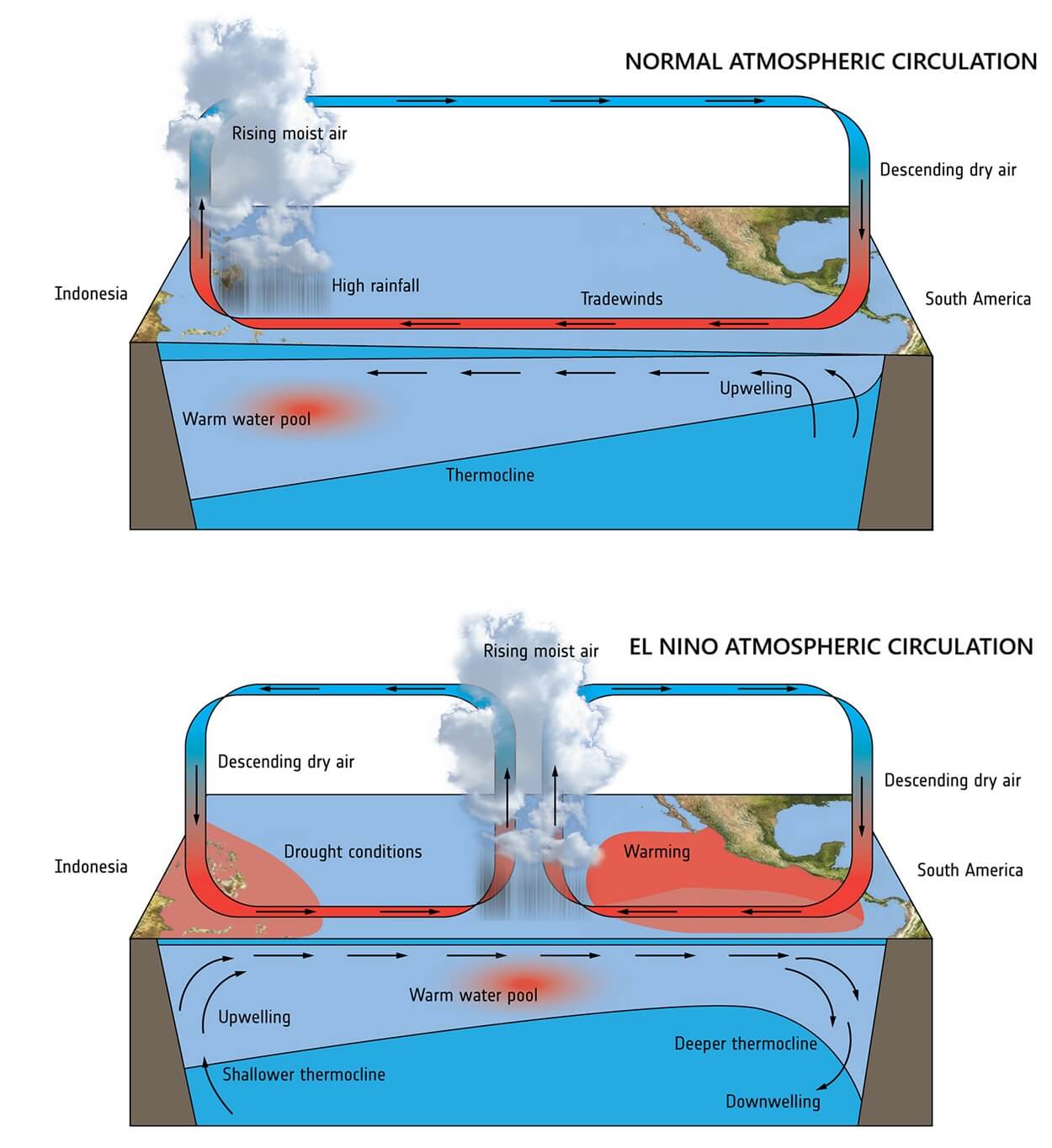
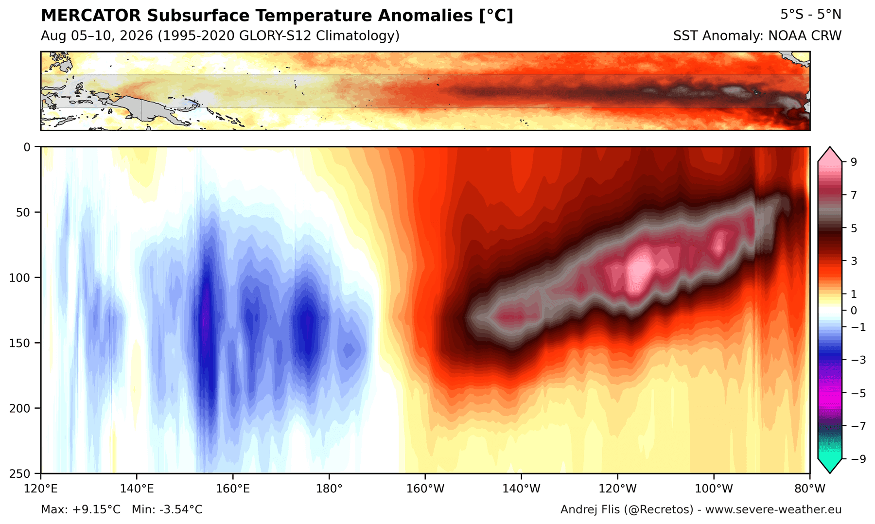
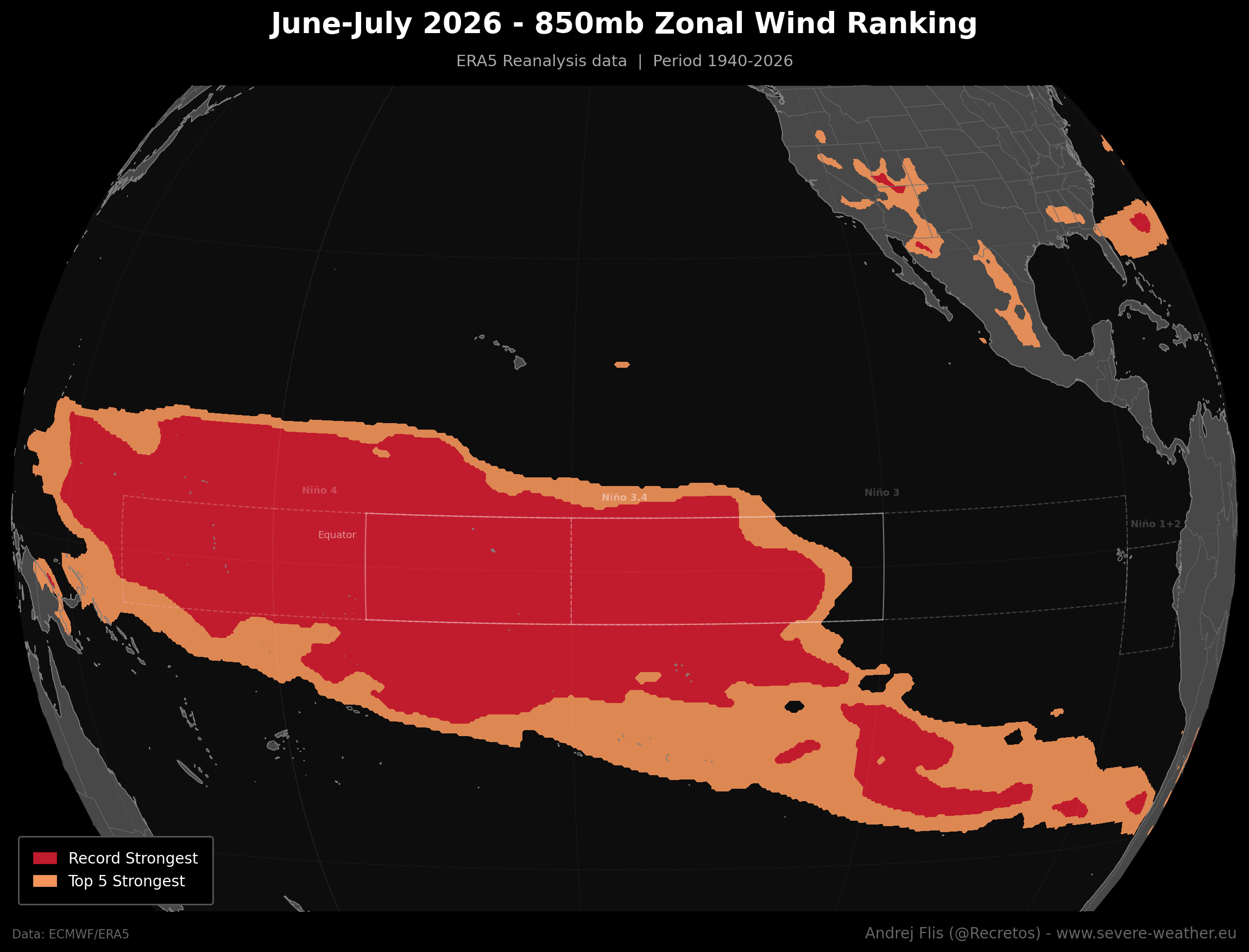
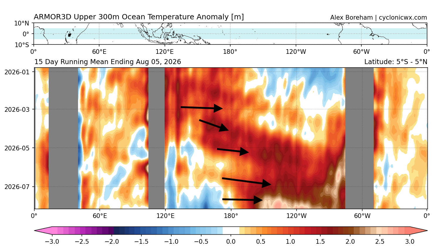
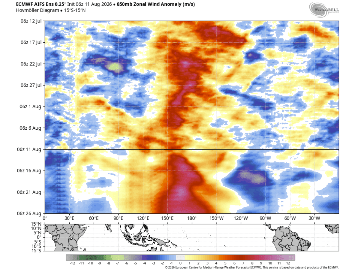
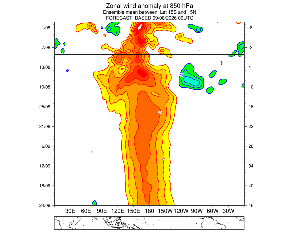
At its core, this event is fueled by a volatile synergy between record-breaking westerly wind anomalies and a massive pulse of subsurface heat known as a Kelvin Wave. As this thermal engine surges eastward, it is fundamentally altering the Walker Cell—the primary atmospheric circulation pattern over the tropics—thereby setting the stage for a dramatic shift in weather patterns across North America and Europe for the upcoming Fall and Winter seasons.
The Anatomy of a Super El Niño
To understand the gravity of the 2026 event, one must first look at the mechanics of the ENSO (El Niño-Southern Oscillation) cycle. A standard El Niño event involves a warming of the central and eastern tropical Pacific, which typically leads to a mild shift in the jet stream. However, a "Super" event—a rare phenomenon occurring once a decade or less—triggers an aggressive restructuring of the global atmosphere.
The process begins with "westerly wind bursts." When these winds weaken or reverse across the equatorial Pacific, they allow warm water stored in the west to move eastward. This warm water travels beneath the surface as a Kelvin Wave, effectively "recharging" the eastern Pacific with immense thermal energy. Current satellite and buoy data confirm that the 2026 event is being fed by an energy signature that exceeds virtually every previous Super El Niño on record. The ocean heat content in the upper 250 meters is currently tracking at anomalies of 9°C (16°F) above normal, providing a constant supply of fuel to maintain the event’s strength well into the new year.
Chronology of Development: A Rapid Ascent
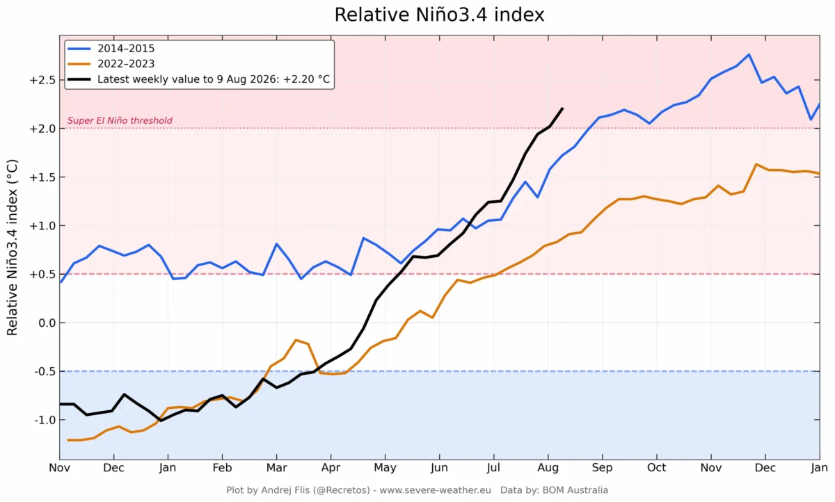
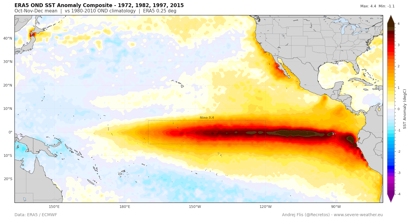
The trajectory of the 2026 Super El Niño has been nothing short of extraordinary. Since early spring, meteorologists have tracked a consistent acceleration in sea surface temperature (SST) anomalies.
- Spring 2026: Initial signs of an emerging El Niño began to manifest. While standard models initially predicted a moderate event, the emergence of persistent westerly wind anomalies hinted at a more aggressive outcome.
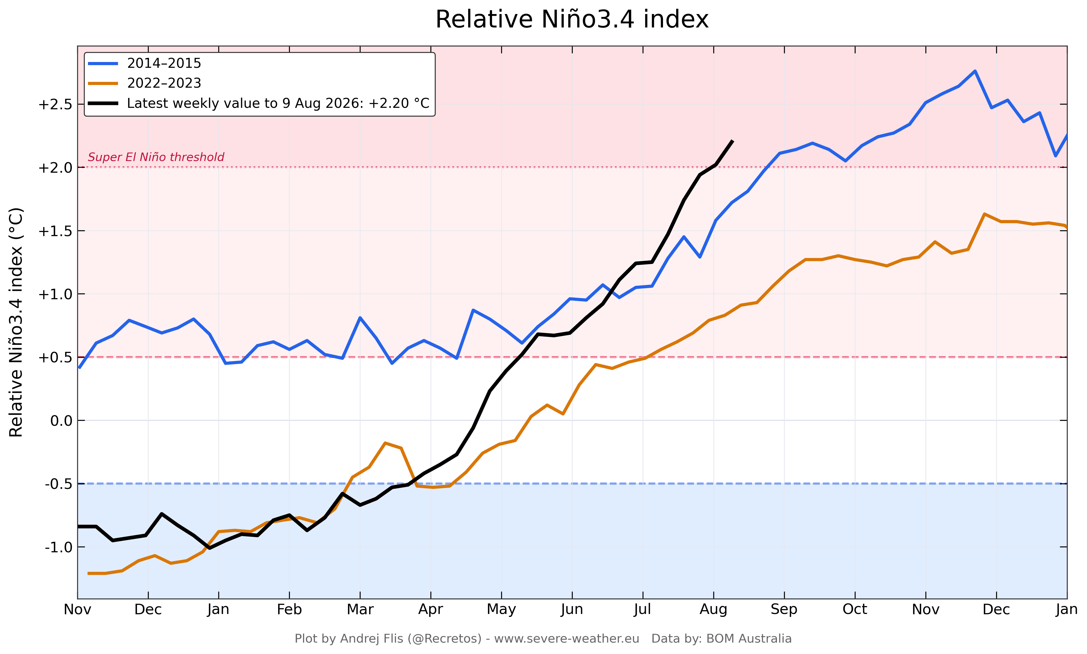
- June–July 2026: The Multivariate ENSO Index (MEI), which aggregates both oceanic and atmospheric data, hit a record-high value of +2.4—the highest for this time of year since the index began in 1979. This jump from a cool phase to a record-high positive phase in just four months is unprecedented.
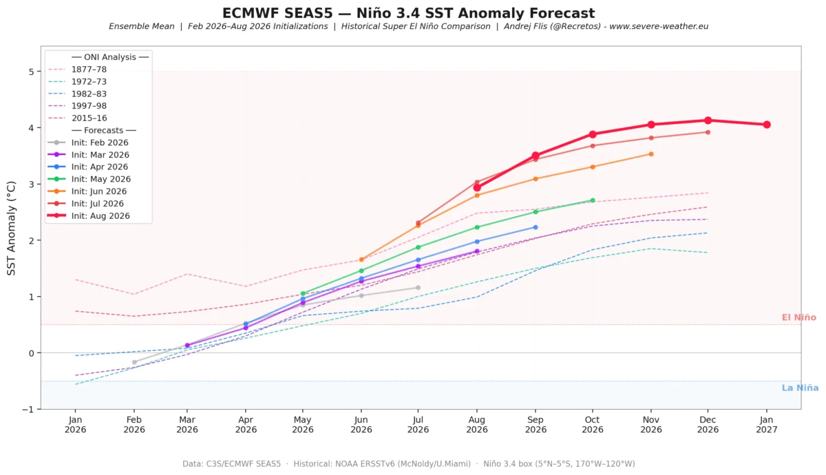
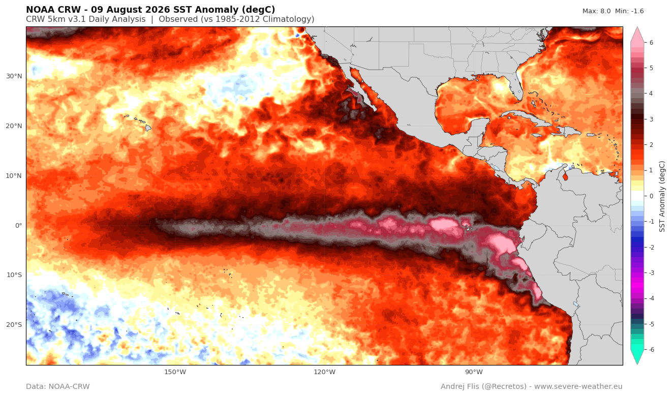
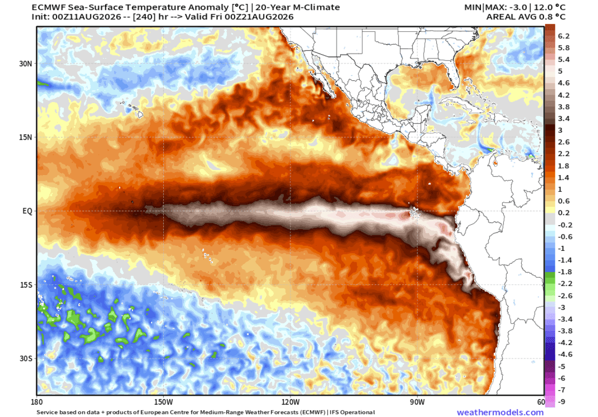
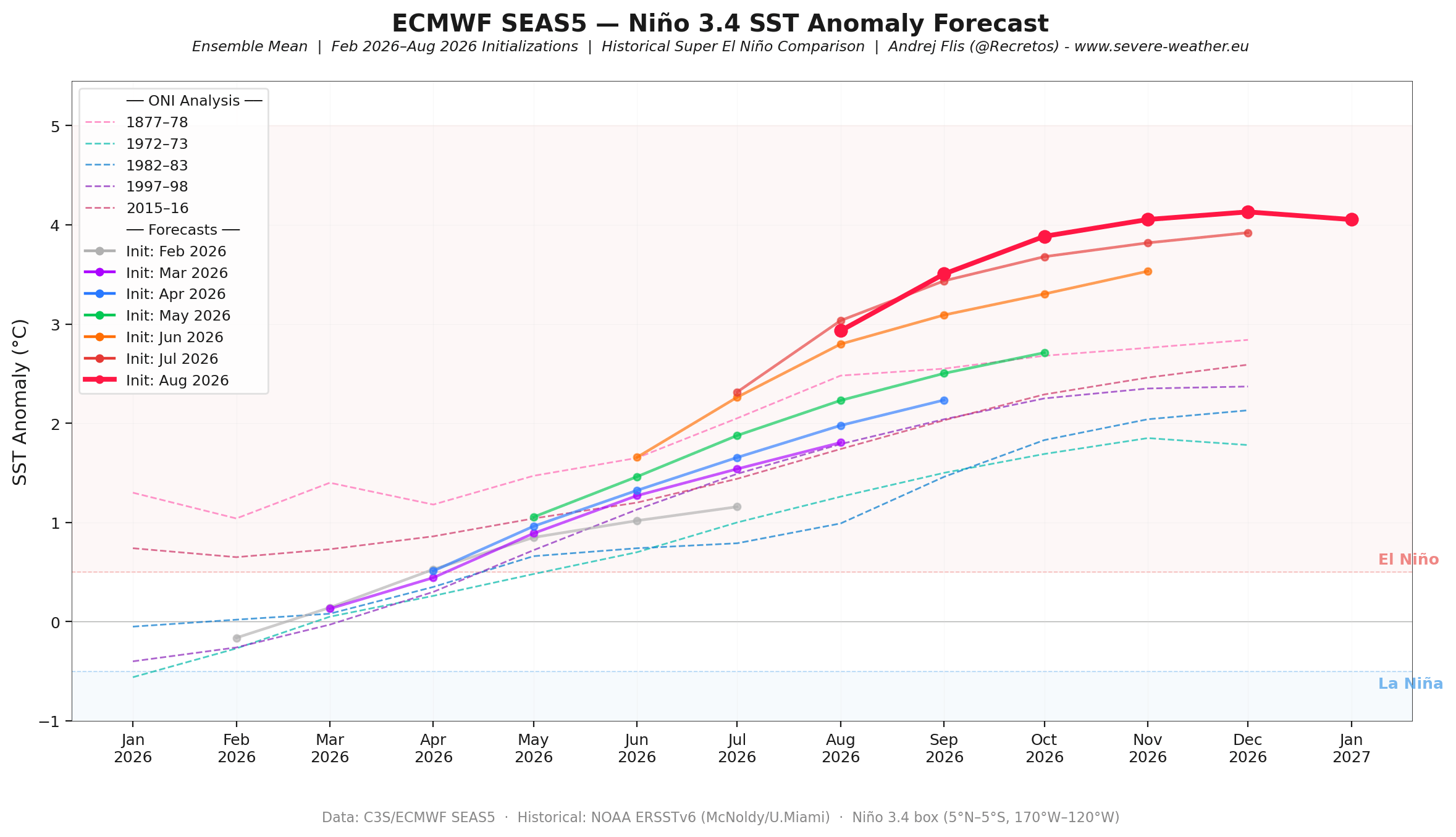
- August 2026: The current "growth phase" shows no signs of waning. Recent ECMWF (European Centre for Medium-Range Weather Forecasts) data suggests that the area of +5°C (9°F) anomalies is expanding rather than contracting, indicating that the peak is still several months away.
Supporting Data: Why This Event is Unique
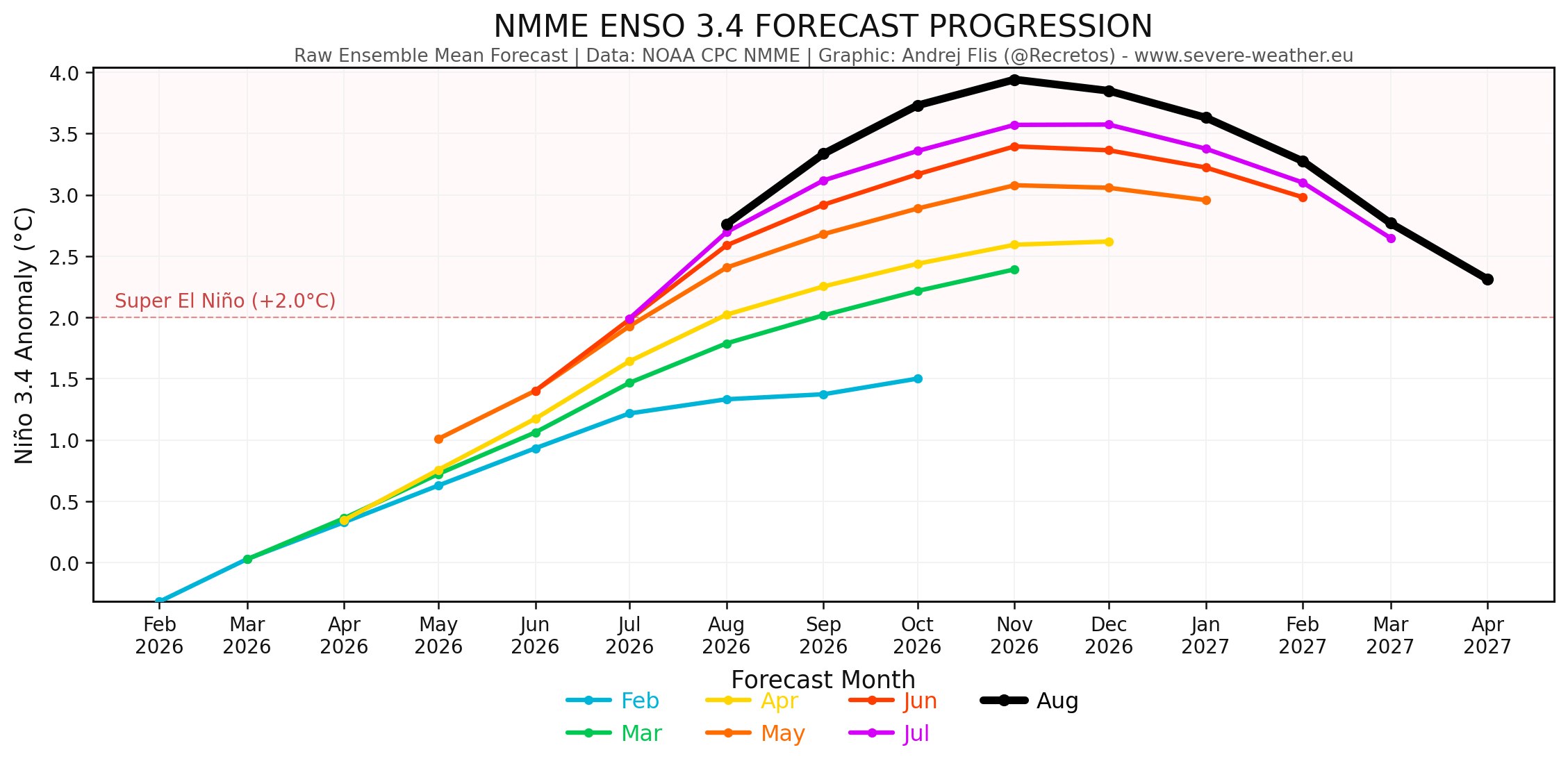
The scientific community relies on multi-model ensembles to predict these events, yet even the most sophisticated models have struggled to keep pace with the 2026 event. Because seasonal models often fail to simulate the granular, day-to-day impacts of individual westerly wind bursts, they have historically under-forecasted the strength of this event.
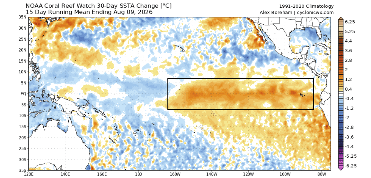
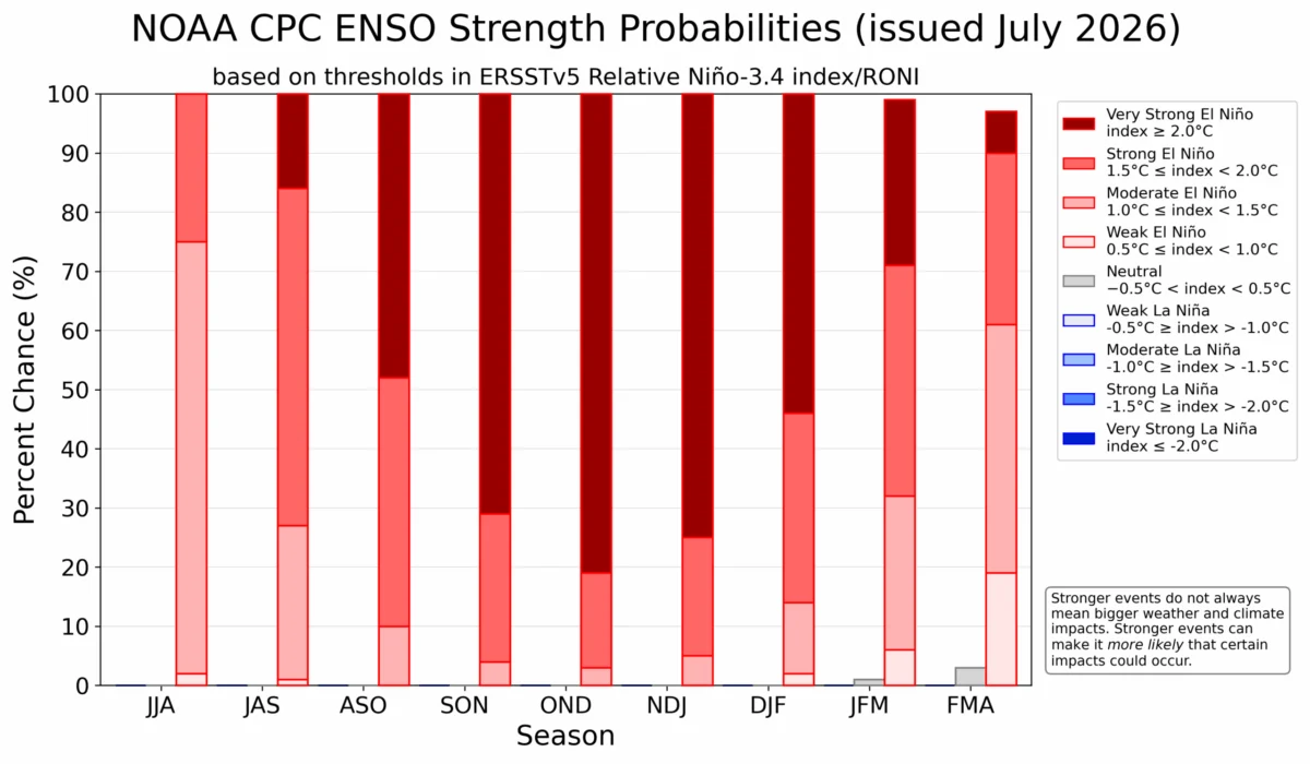
However, as each new run of the ECMWF and NOAA’s NMME (North American Multi-Model Ensemble) is released, the projected peak intensity of the 2026 event has been pushed higher. We are currently observing a trend where the anomaly values for the main ENSO region are approaching +4°C. For context, an event is classified as "Super" when it exceeds +2°C; the 2026 event is currently threatening to shatter the +3°C threshold, placing it in a category of its own.
The atmosphere is already responding to this oceanic forcing. The formation of a "standing wave"—a stationary area of rising and sinking air—over the Pacific indicates that the El Niño is now in total control of the tropical circulation, overriding other moving weather drivers.
Global Implications: Impacts on North America
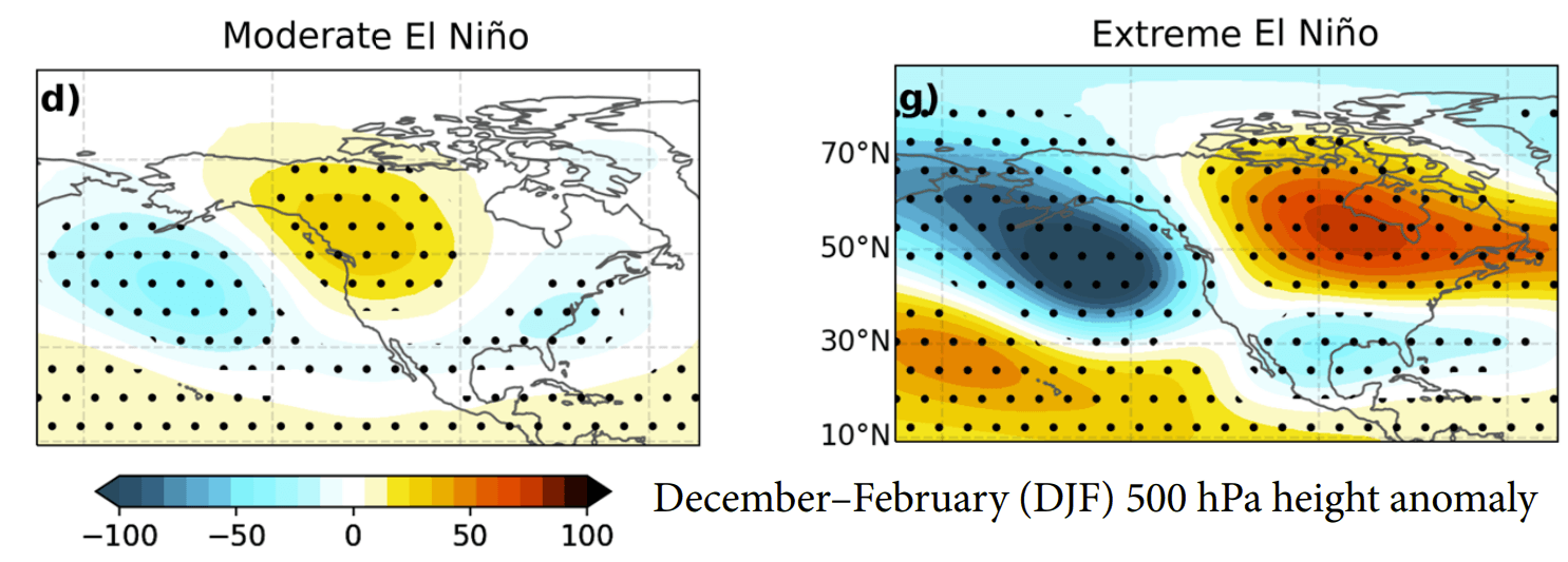
The influence of a Super El Niño on North American weather is profound. The primary mechanism is the "atmospheric bridge" created by the Pacific jet stream.
Fall 2026 Outlook
We are already seeing an "early" manifestation of an El Niño winter pattern. Typically, these patterns solidify in late winter, but the current strength of the forcing has caused an premature shift. Expect a high-pressure ridge to anchor itself over Canada, while a persistent low-pressure storm track develops across the southern United States. This will likely result in:
- Warmer than normal temperatures across the northern United States and Canada.
- Increased precipitation across the southeastern and eastern United States, driven by the invigorated southern branch of the jet stream.
- Drier conditions in the Pacific Northwest, as the jet stream is diverted southward.
Winter 2026/2027 Projections
As we move into the heart of winter (December–February), the pattern is expected to become highly amplified. Meteorologists are watching for a "deepening" of the pressure wave over the U.S., which could lead to significant cold anomalies in the central and southern states by February.
Perhaps most significant is the snowfall potential. While the northern tier may face a snow-starved winter due to warmer temperatures and a displaced jet stream, the central and eastern U.S. may see an uptick in "heavy hitter" storms. When moisture-laden air from the southern jet stream intersects with sporadic cold fronts from the north, the potential for high-impact ice events and heavy snow increases dramatically.
European Weather: The Atlantic Connection
While the impact of El Niño is most direct in the Pacific Basin, its "downstream" effects on Europe are mediated by the North Atlantic. The 2026/2027 forecast suggests that the amplified pressure pattern over North America will push a vigorous westerly flow across the Atlantic toward Europe.
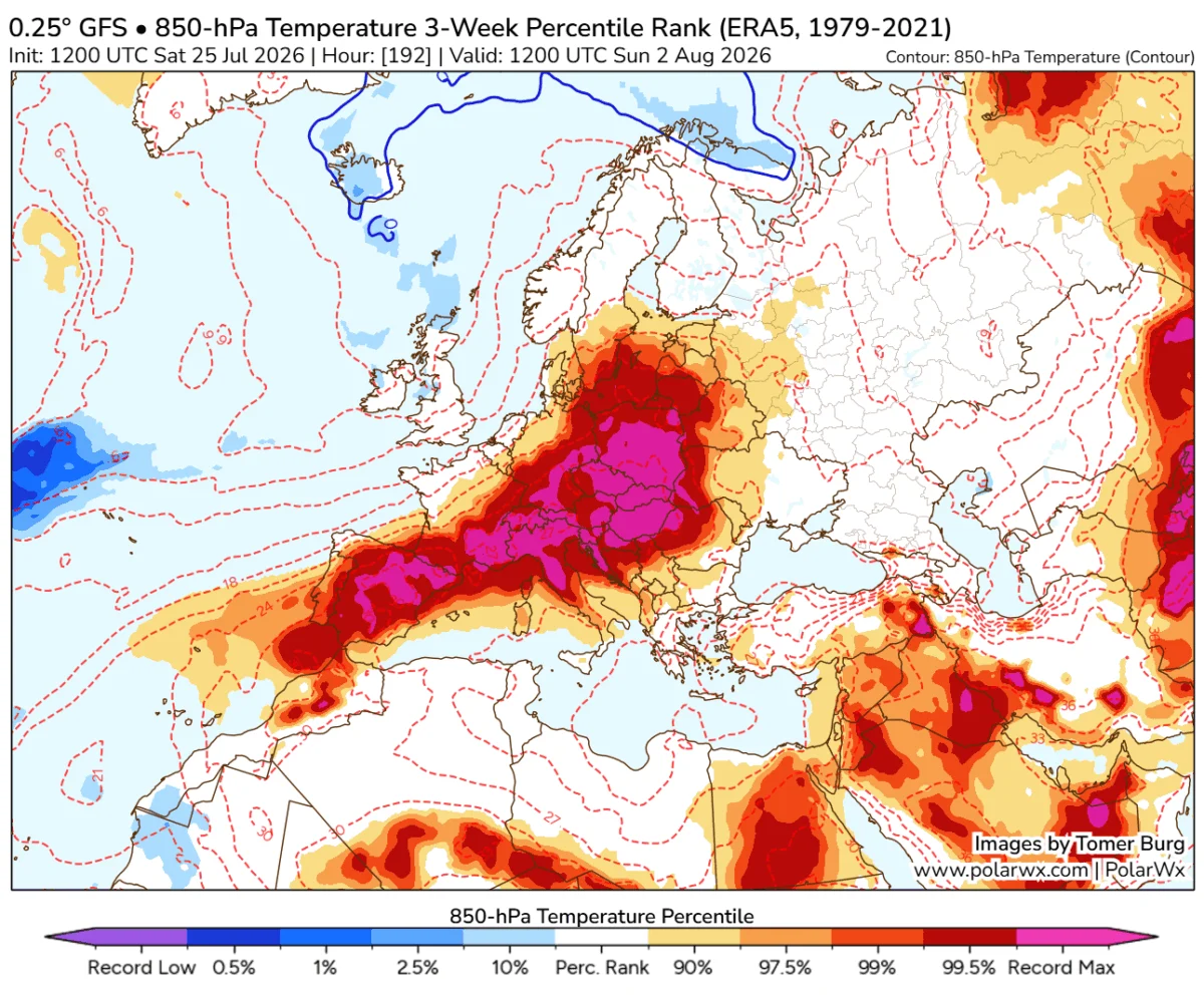
For much of Europe, this implies a milder-than-average winter. The dominance of Atlantic-driven air masses typically prevents the intrusion of deep, continental cold air. However, this also brings a higher risk of stormy, wet conditions, particularly for the UK, Ireland, and northwestern Europe. Snowfall in Europe may be restricted to higher elevations and the far northeast, as the prevailing westerly winds act as a thermal buffer, keeping temperatures above the freezing mark for significant stretches of the season.
Conclusion: Entering Uncharted Territory
The 2026/2027 Super El Niño is not merely a weather anomaly; it is a fundamental shift in the global climate state. With the atmospheric coupling now firmly established and the subsurface "engine" of the Kelvin Wave still surging, the world is entering a period of high volatility.
The record-breaking nature of this event, as evidenced by the Multivariate ENSO Index and the persistent westerly wind anomalies, suggests that traditional seasonal averages may not be reliable guides for the coming months. From the storm-track changes in the American South to the moisture-heavy Atlantic flow affecting Europe, the 2026 Super El Niño will leave an indelible mark on the climate history of the Northern Hemisphere. As the event approaches its winter peak, constant monitoring and adaptive planning remain essential for all sectors, from agriculture to emergency management.