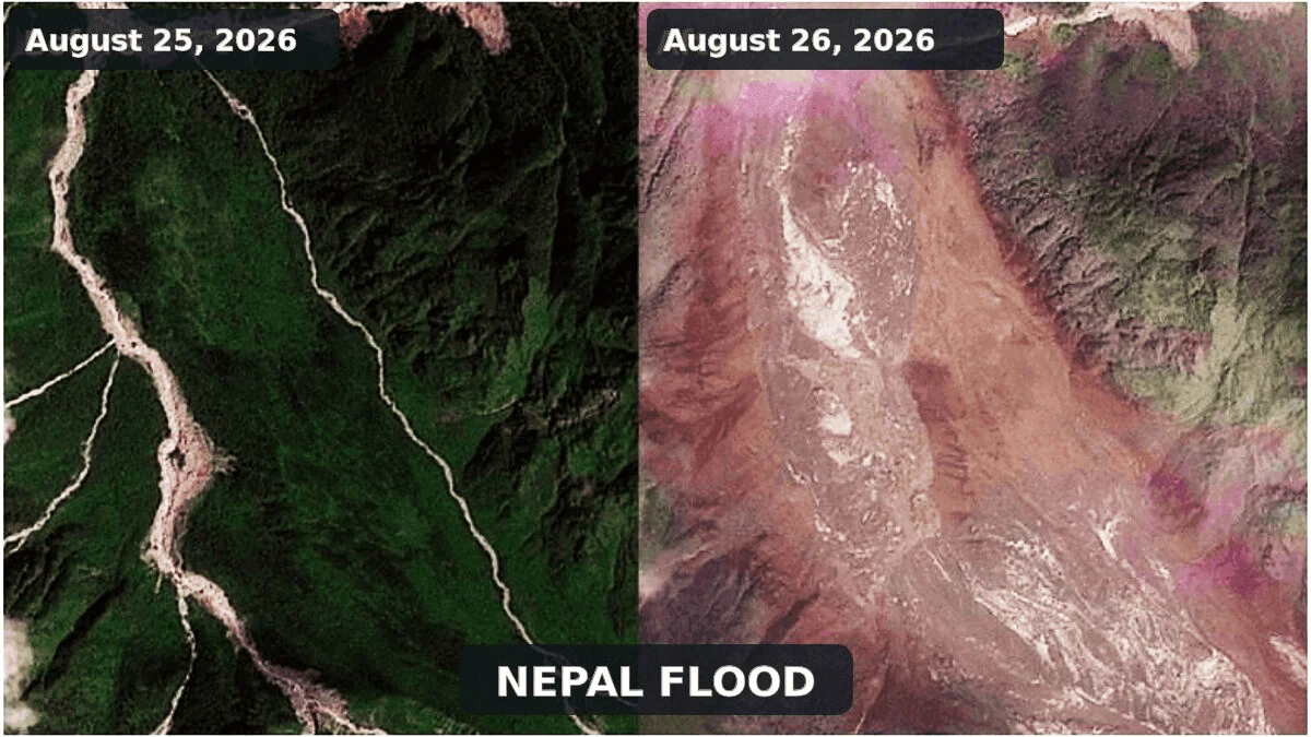
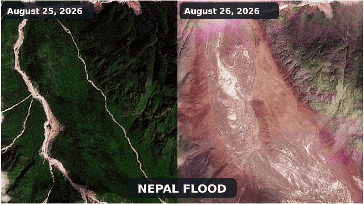
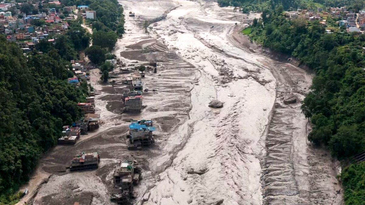
The transboundary region connecting northern Nepal and southern Tibet became the site of a harrowing environmental catastrophe on August 26, 2026. A massive, high-velocity surge of water, mud, and boulders tore through the Bhote Koshi-Trishuli river system, obliterating critical infrastructure, severing transit arteries, and burying remote settlements under an unforgiving layer of debris.
As rescue teams struggle to navigate the inaccessible, unstable terrain, the human toll continues to climb. Early reports from the Associated Press indicated at least 160 confirmed fatalities, though officials and disaster experts warn that this figure is almost certainly a conservative estimate. With hundreds of tourists, hydropower workers, and local residents still unaccounted for, the tragedy has evolved into a logistical nightmare, hampered by the destruction of roads and bridges that previously connected these rugged mountain communities.
The Trigger: Reclassifying the Seismic Signature
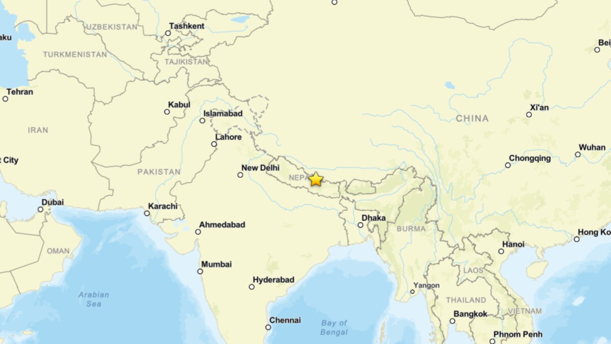
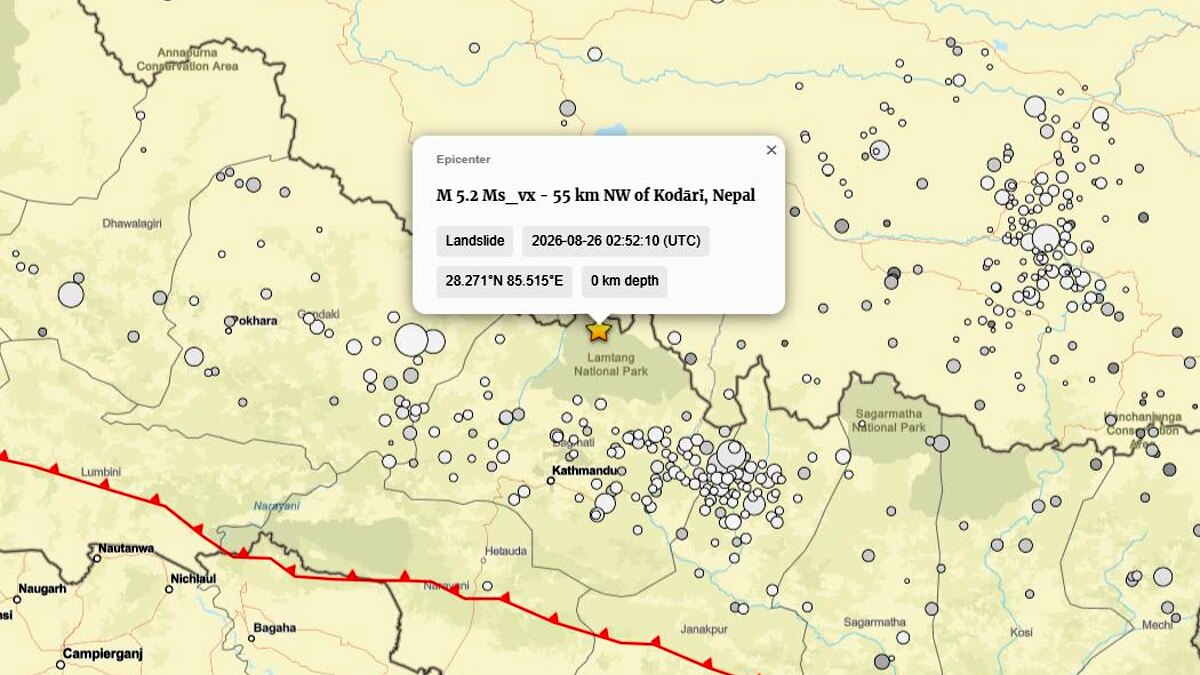
In the chaotic hours immediately following the disaster, seismic sensors picked up a signal that initially led the U.S. Geological Survey (USGS) to catalog a magnitude 4.4 earthquake near the Nepal-Tibet border. This preliminary interpretation suggested a tectonic trigger for the ensuing flash flood. However, as seismologists analyzed the waveform data, the narrative shifted dramatically.
The USGS eventually reclassified the event (us7000tbwb) as a magnitude 5.2 landslide. This reclassification is pivotal: it confirms that the seismic waves were not the cause of the catastrophe, but rather the result of it. The massive kinetic energy released by the collapse of millions of tons of rock and ice generated the shaking, rather than a tectonic shift triggering the collapse. This distinction effectively rules out an earthquake as the primary catalyst, redirecting scientific scrutiny toward high-mountain slope instability.
Chronology of a Cascading Event
The disaster did not unfold as a single, isolated incident but rather as a violent, multi-stage cascade. According to preliminary assessments provided by the International Center for Integrated Mountain Development (ICIMOD), the event originated in the upper Lhende Khola, a tributary of the Bhote Koshi.
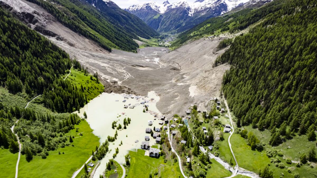
- The Initial Failure: A steep, glacierized slope in the upper Lhende Khola underwent a catastrophic loss of mechanical support. A mixture of glacier ice, snow, and bedrock detached and accelerated downslope, forming a massive ice and rock avalanche.
- The Obstruction: As the avalanche reached the valley floor, it did not dissipate. Instead, it choked the narrow Lhende Khola, creating an unstable, permeable dam composed of shattered ice and debris.
- The Outburst: Water began to accumulate behind this makeshift dam. As pressure mounted, the blockage failed—likely through a combination of overtopping and internal erosion. This released a sudden, high-energy surge of water and sediment downstream.
- The Transformation: As this wave traveled through the Bhote Koshi and Trishuli rivers, it entrained additional material from the riverbanks and bed, transforming into a lethal debris-rich flash flood. Reports suggest that water levels on the Trishuli rose by as much as nine meters in a span of just 30 minutes, catching many by surprise.
Supporting Data: Understanding the Physics of the Collapse
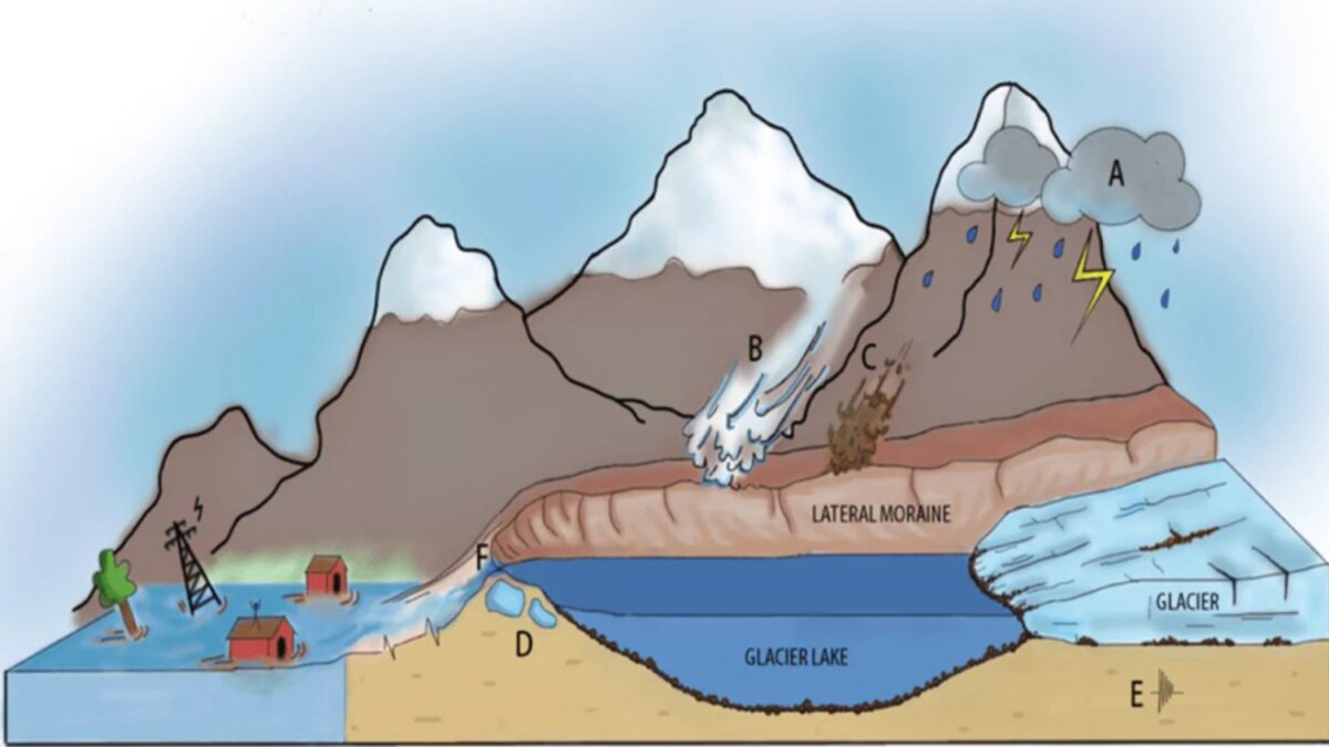
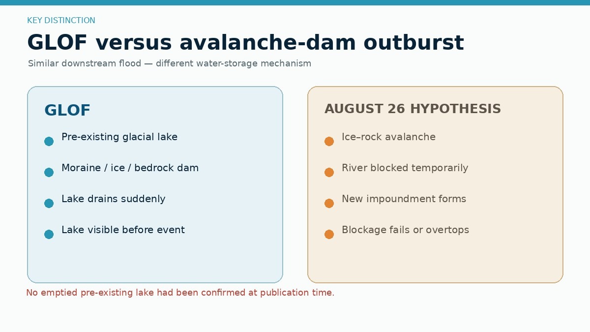
To understand the magnitude of this event, one must distinguish between the various types of mountain hazards. While the initial reports from the ground frequently used the term "GLOF" (Glacial Lake Outburst Flood), current satellite evidence suggests this is inaccurate.
A GLOF refers specifically to the drainage of a pre-existing lake formed by moraines or ice. In the case of the August 26 event, the evidence points toward an "ice and rock avalanche-induced landslide-dam outburst." The difference is critical for future mitigation. Unlike a stable, mappable glacial lake, an avalanche dam is a spontaneous and ephemeral hazard that provides little to no warning time for downstream communities.
Lessons from Marmolada and Blatten
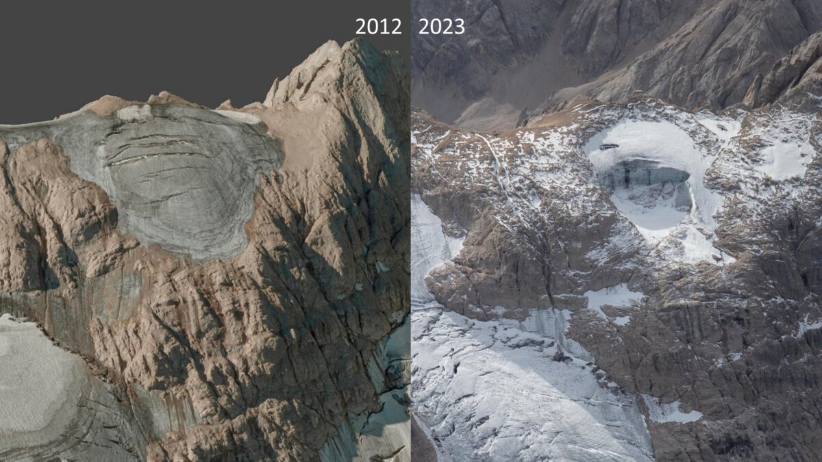
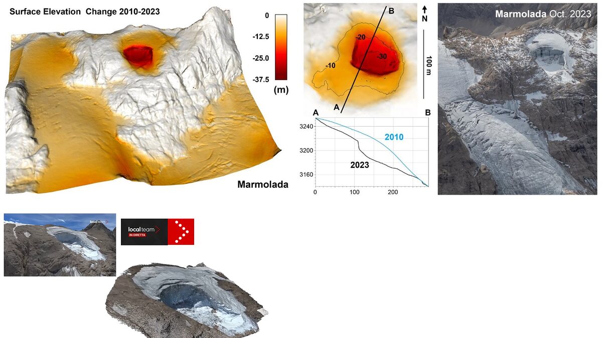
The 2026 disaster shares chilling parallels with recent Alpine tragedies. The 2022 collapse of the Marmolada Glacier in Italy, which claimed 11 lives, served as a stark warning of how warming temperatures can destabilize glacier bodies. In that instance, water-filled crevasses and hydrostatic pressure turned a stable glacier into a kinetic weapon.
Similarly, the 2025 Blatten disaster in Switzerland provides a hauntingly close analog. In that event, a progressive rock failure on the Kleines Nesthorn loaded the Birch Glacier, eventually leading to a 9.5-million-cubic-meter collapse that buried the village of Blatten. The 2026 Nepal event mirrors this "domino effect," where environmental conditions—early snow loss, glacier thinning, and permafrost degradation—created a fragile baseline that finally shattered under the weight of local mechanical stress.
Official Responses and Rescue Challenges
The transboundary nature of the disaster has complicated the official response. Coordination between Nepalese and Chinese authorities is essential, yet the physical destruction of infrastructure has turned the border region into an "island" of isolation.
Government agencies, in partnership with international bodies like ICIMOD, are currently utilizing high-resolution satellite imagery to assess the volume of the failure scar and the remaining instability in the Lhende Khola. The presence of residual debris in the upper valley remains a primary concern; should this remaining mass fail or continue to impound water, a secondary, potentially equally devastating flood could follow.
Prime Minister-level statements from both nations have emphasized the need for "expedited search and rescue" and "long-term infrastructure resilience," but the current reality is one of triage. The loss of hydropower installations, which are critical to the energy grid of the region, adds a layer of economic catastrophe to the humanitarian one.
Implications: A New Era of High-Mountain Risk
The 2026 Lhende Khola disaster forces a re-evaluation of how we assess mountain hazards. For decades, the focus has been on inventorying glacial lakes. While necessary, this event proves that the "non-lake" hazards—the sudden collapse of steep, glacierized slopes—are equally, if not more, dangerous.
The Climate-Attribution Debate
While it is tempting to point to climate change as the direct cause, scientific consensus remains cautious. The Hindu Kush Himalayas are undeniably warming, and this warming undoubtedly predisposes slopes to failure by degrading permafrost and thinning glaciers. However, attributing this specific event to climate change requires granular data that is not yet fully synthesized.
What is certain is that the baseline has changed. The degradation of ice-bearing permafrost means that slopes that were stable for centuries are now susceptible to failure. As geomorphologist Ludovic Ravanel has noted in the context of the Alps, the frequency of rockfalls has spiked due to these shifting environmental conditions.
Strengthening Transboundary Warning Systems
The most significant implication is the necessity for a robust, real-time, transboundary monitoring network. Rivers do not respect borders, and the current delay in sharing hydrological data allows hazards to outpace warnings.
The future of mountain safety lies in:
- Seismic Monitoring for Mass Movements: Expanding networks capable of distinguishing between tectonic earthquakes and landslide-generated seismic signals to ensure rapid alerts.
- Automated River Gauges: Deploying sensors in high-altitude tributaries to detect sudden changes in flow, providing the "precious minutes" needed for downstream evacuations.
- Integrated Data Sharing: Establishing a permanent, high-level intelligence-sharing framework between Nepal, China, and regional scientific institutions to manage the transboundary risks of the Bhote Koshi-Trishuli system.
Conclusion: The Path Forward
The August 26, 2026, disaster serves as a sobering reminder of the volatility of our high-altitude landscapes. It was not a "natural" accident in the sense of an unavoidable earthquake, but a complex, cascading failure of mountain systems already under stress.
As the recovery efforts continue, the scientific community must work to decode the specific mechanics of the Lhende Khola collapse. By moving beyond the simplistic labels of "GLOF" or "Earthquake," and acknowledging the complex reality of ice-and-rock avalanches, authorities can better design the warning systems that will protect the millions of people living in the shadows of the world’s highest mountains. The disaster was a tragedy, but it must now serve as a catalyst for a more proactive, integrated approach to managing the volatile future of the Himalayan cryosphere.