As of August 12, 2026, atmospheric and oceanic data confirm that the world is in the grips of a rapidly intensifying "Super El Niño." With Pacific sea surface temperatures reaching historic highs, meteorologists warn that the 2026/2027 season is poised to be one of the most significant climate events in over 155 years of recorded history. This massive release of energy is already reconfiguring global circulation, with profound implications for the coming winter across North America and Europe.

The Core of the Phenomenon: Planetary Dynamics
The El Niño-Southern Oscillation (ENSO) is a periodic fluctuation in sea surface temperatures and air pressure across the equatorial Pacific. While El Niño events occur every few years, a "Super" event is an anomaly of rare intensity—typically occurring once a decade or less. These events act as massive "pressure release valves" for the ocean, dumping vast amounts of trapped thermal energy into the atmosphere.
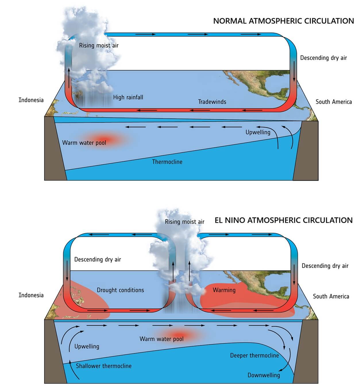
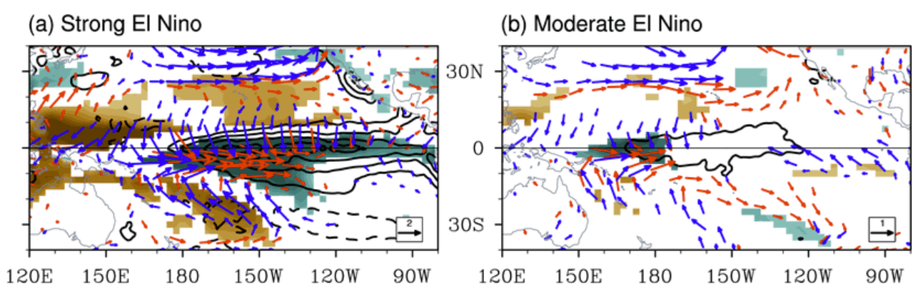
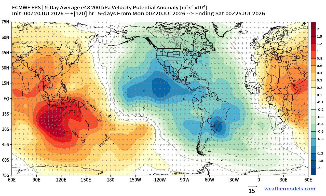
The primary engine of this event is the Walker Cell, an atmospheric circulation pattern that dictates global rainfall and pressure. In a neutral state, this cell moves air in a stable, predictable loop. However, the 2026 Super El Niño has disrupted this, causing a significant pressure drop in the central and eastern Pacific and establishing a high-pressure zone over the western Pacific. This "atmospheric bridge" forces a shift in global jet streams, essentially locking the planet into a new, high-energy weather mode that will likely persist through the spring of 2027.
Chronology: From Subsurface Pulse to Global Impact
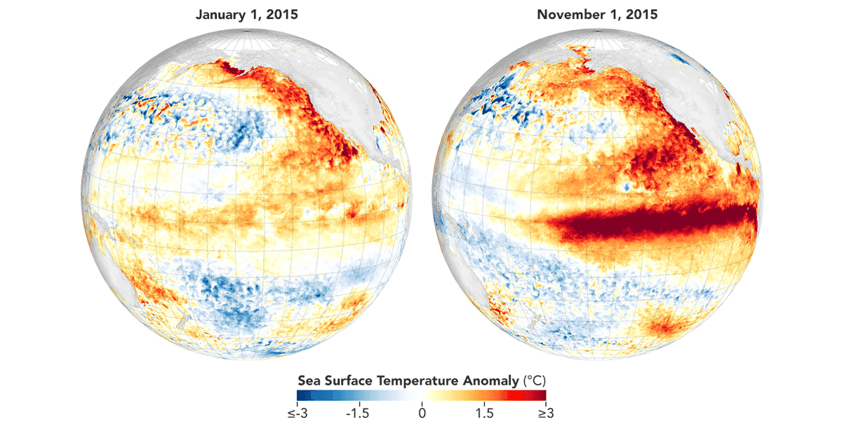
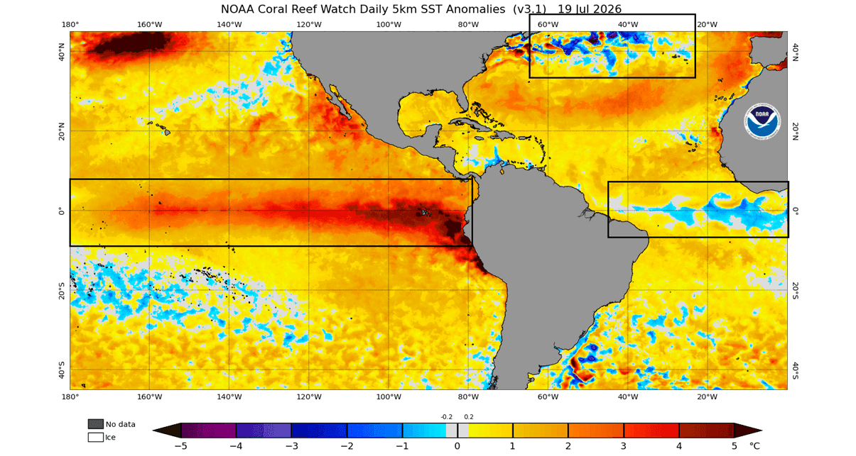
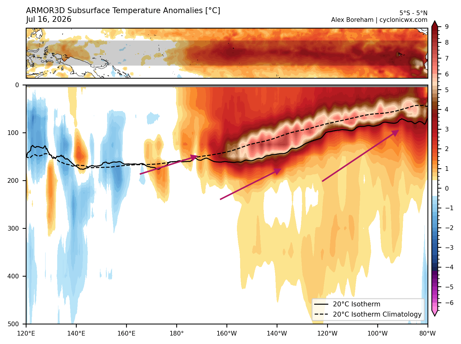
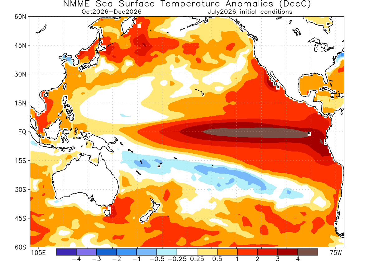
The development of this event has been exceptionally rapid. Oceanographic analysis reveals that the "engine" of this crisis—a massive Kelvin Wave—originated deep beneath the Pacific surface. Kelvin Waves are pulses of warm, subsurface water that travel eastward. In the summer of 2026, these waves surfaced with unprecedented force, with temperatures in some regions exceeding 3–4 degrees Celsius above the long-term average.
- Early 2026: Initial signs of equatorial warming appeared, though they were initially mistaken for a moderate event.
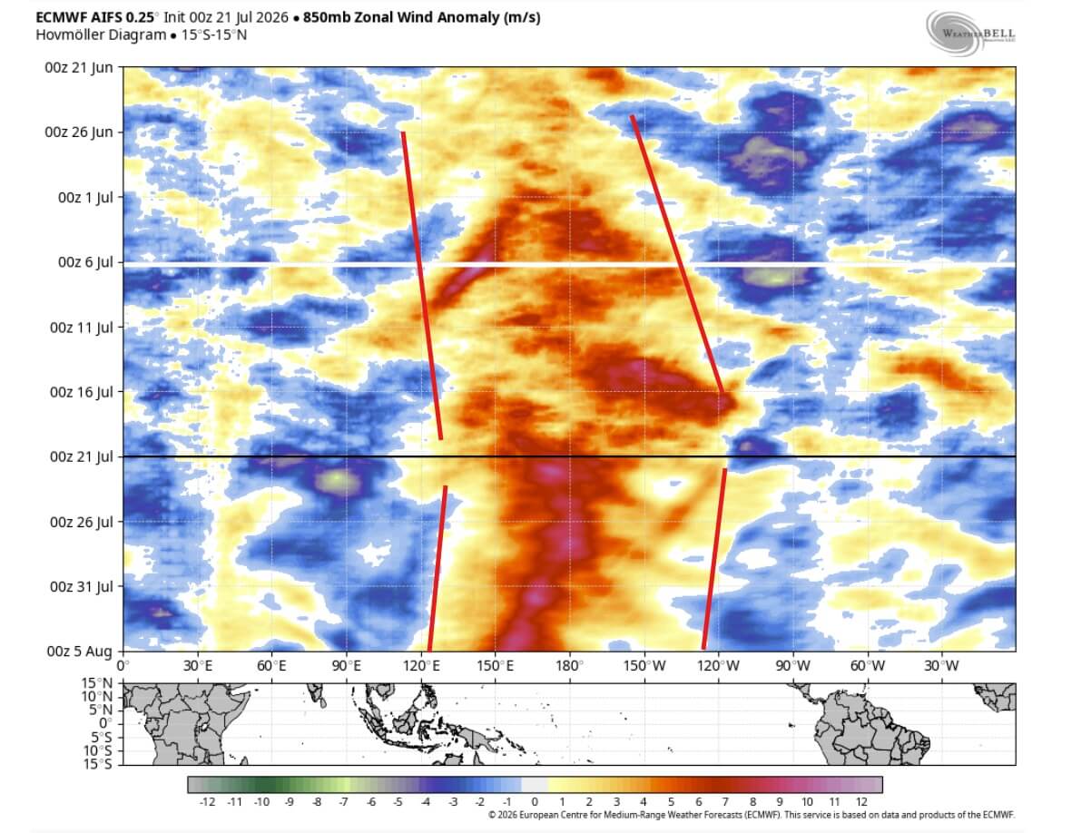
- Mid-Summer 2026: Sustained "westerly wind bursts" occurred across the Pacific. These winds effectively pushed the massive subsurface warm pool toward the Americas, accelerating the surface temperature spike.
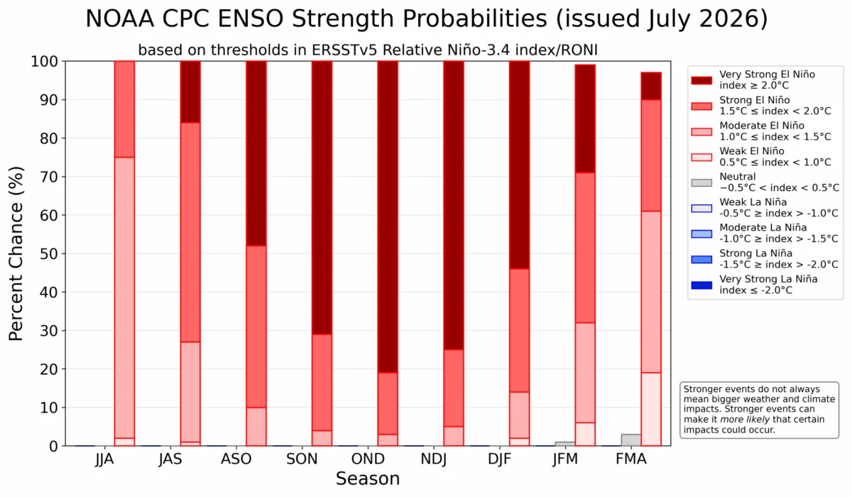
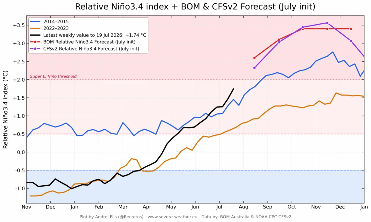
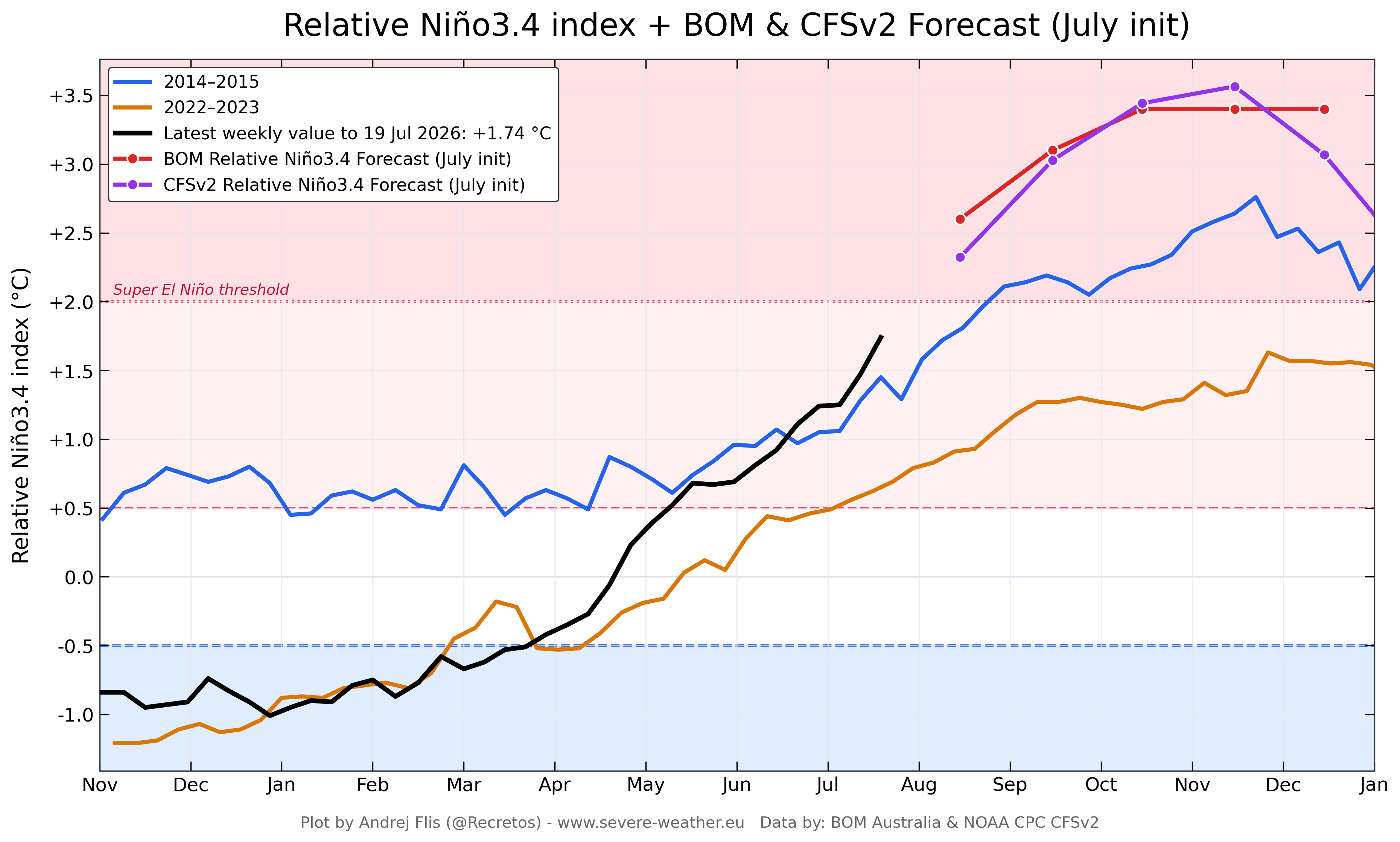
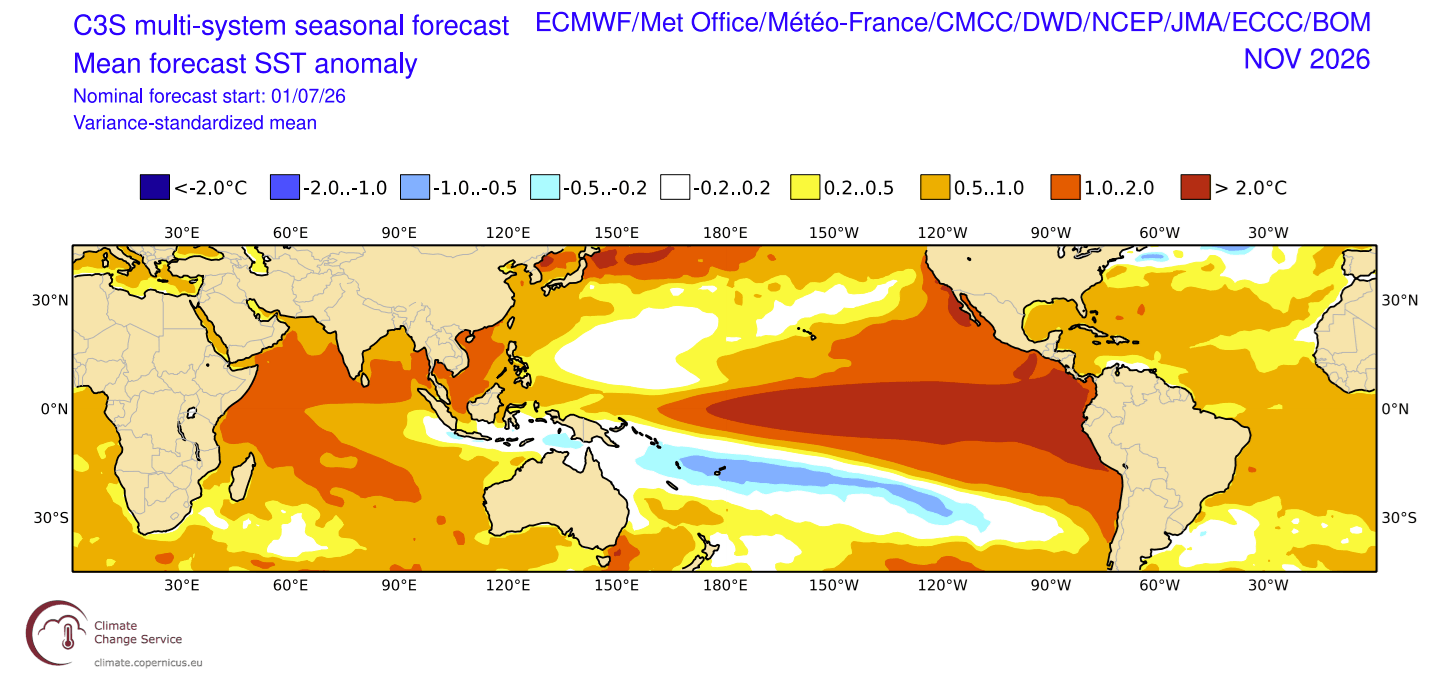
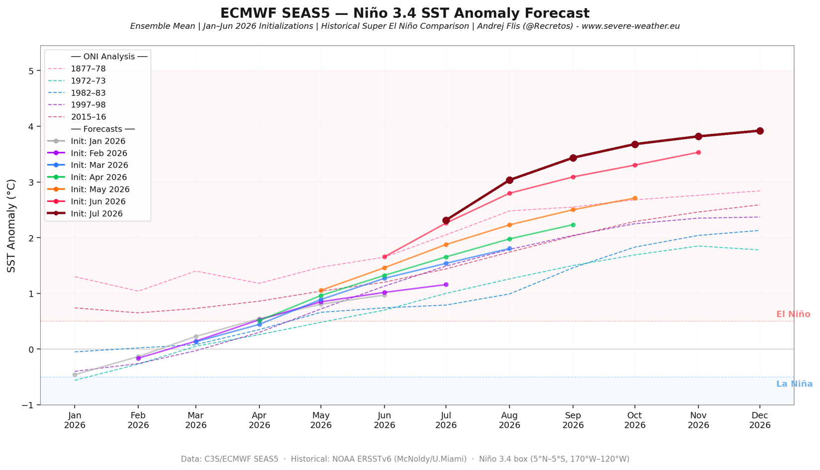
- August 2026: Multiple international meteorological centers, including the NOAA (USA), ECMWF (Europe), and BOM (Australia), converged on a consensus: the 2026/2027 event is not merely "strong," but is trending toward a record-breaking peak exceeding +3.0°C in the ENSO region.
Supporting Data: The Multi-Model Consensus
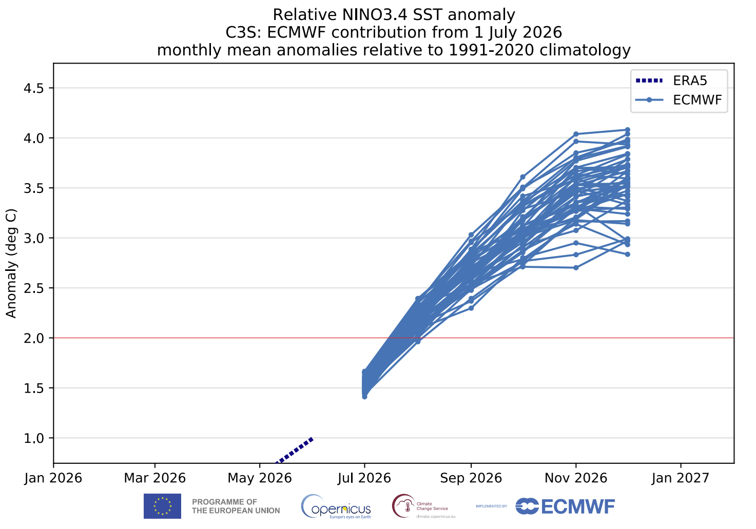
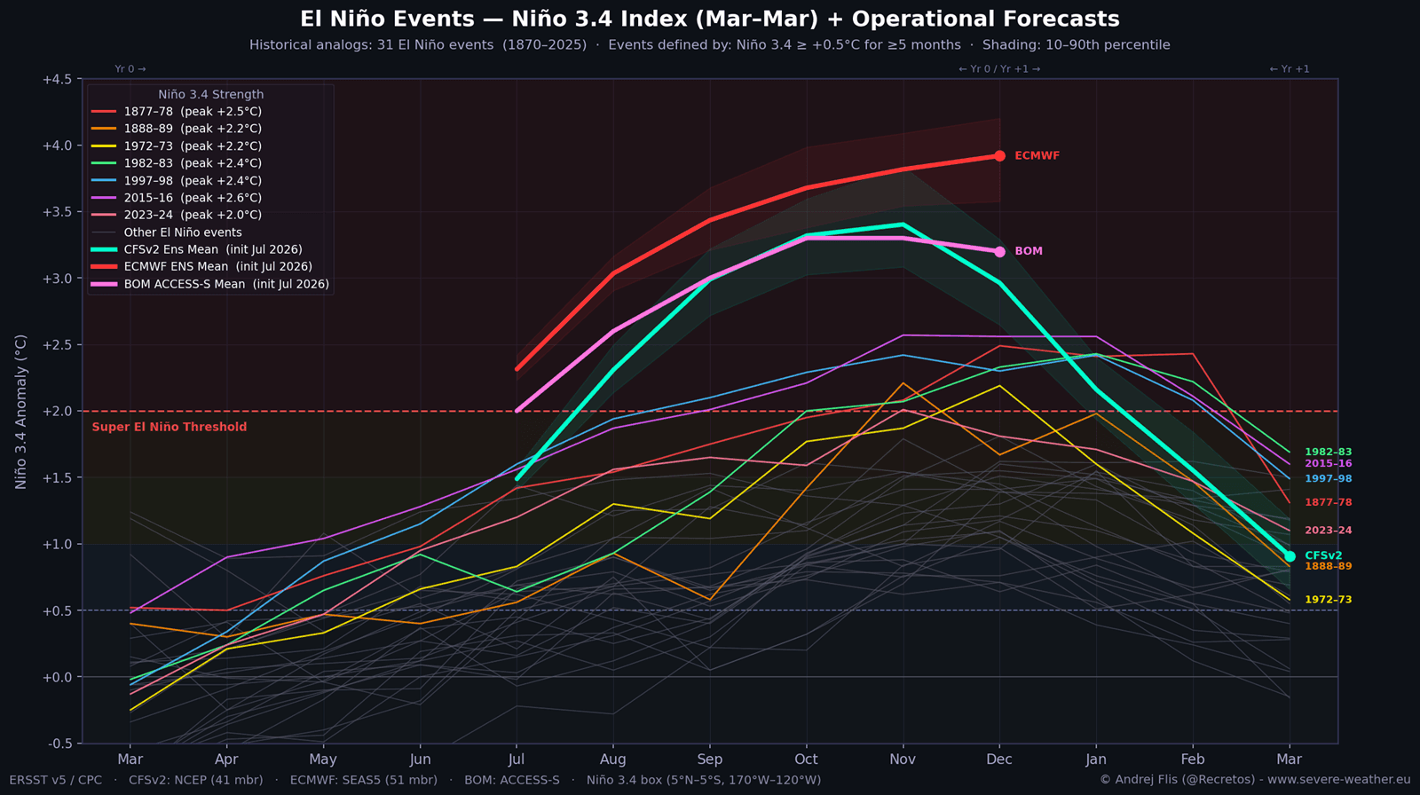
The classification of a "Super" event requires sea surface temperature anomalies to exceed a +2.0 threshold. Current models from the European Centre for Medium-Range Weather Forecasts (ECMWF) and the NOAA CFSv2 model show the anomaly trending well beyond this, potentially peaking near +4.0°C by the end of the year.
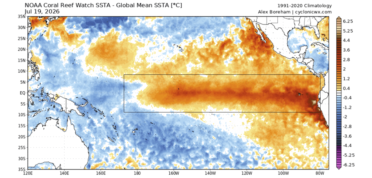
The significance of this cannot be overstated. By comparing this event to the 2015/2016 Super El Niño, scientists have noted that the 2026 event is developing faster and with greater intensity. The data shows that this isn’t a localized Pacific warming; the atmospheric signature is now detectable across more than 10% of the global ocean surface. The persistence of this anomaly is forcing the atmosphere into a "standing wave" configuration, where the usual weather drivers (like migratory pressure systems) are overpowered by the sheer magnitude of the Pacific heat.
Implications for Winter 2026/2027: A Continent-Scale Shift
The impact of this Super El Niño on North America is expected to be profound. In a standard winter, the Pacific jet stream acts as a barrier, but in a Super El Niño year, it becomes an energized conduit for moisture and storm systems.
North America: The Southern Storm Track
Meteorological forecasts indicate a highly amplified pattern for the United States and Canada. A persistent high-pressure "blocking" anomaly is expected to form over Canada, which will act as a wall, deflecting the polar jet stream further north and bringing unseasonably warm temperatures to the northern U.S. and western Canada.
Conversely, the southern half of the United States—from California across to the Gulf Coast and the Southeast—is expected to see a "Super-charged" jet stream. This will likely result in:
- Frequent, moisture-rich storm systems: A significant increase in precipitation.
- Heightened Winter Storm Potential: When this moisture meets cold air masses, the potential for major ice storms and heavy snowfall in the Southern Plains and Mid-Atlantic increases substantially.
Europe: A Tale of Uncertainty
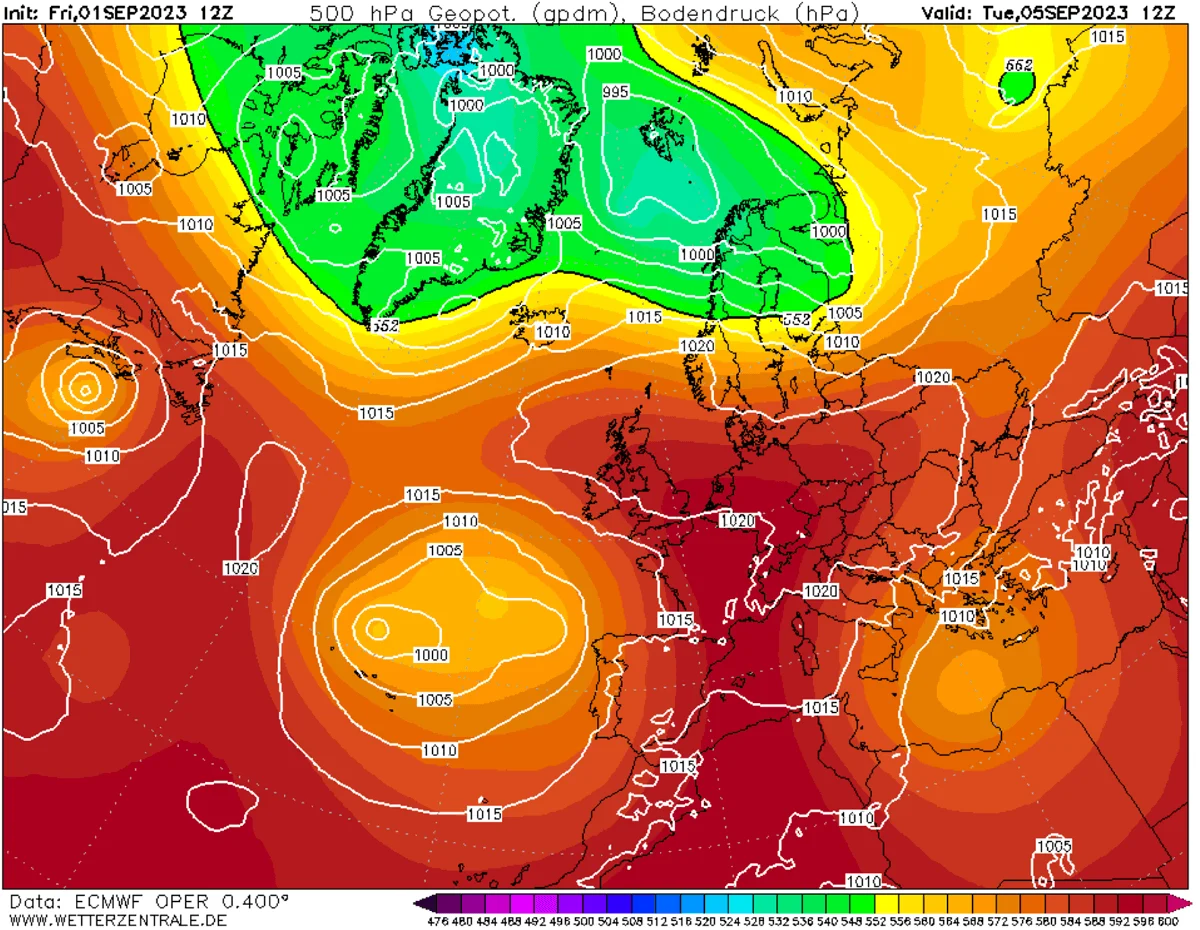
While North America faces a relatively "locked-in" pattern, Europe remains in a state of flux. The models suggest a high-pressure ridge forming to the south, with low-pressure zones potentially impacting northwestern Europe. The degree of winter severity for European nations will depend heavily on whether the high-pressure ridge remains stable or breaks down, allowing cold, northerly air flows to reach the UK and Ireland.
The Polar Vortex: The Wildcard Factor
Perhaps the most dangerous implication of the 2026 Super El Niño is the potential for a Polar Vortex disruption. The Polar Vortex is the band of stratospheric winds that keeps Arctic air trapped at the North Pole.
Historical data confirms that Super El Niño events increase the probability of "Sudden Stratospheric Warming" (SSW). When this occurs, the Polar Vortex weakens, wobbles, or collapses entirely. This allows frigid, Arctic air to spill southward into the mid-latitudes, often triggering extreme "Polar Express" cold snaps. Given the current trajectory of the 2026 event, models indicate a high risk of this disruption occurring in January or February 2027. A full collapse of the vortex, combined with the El Niño-driven moisture, could lead to historic winter weather events across the Northern Hemisphere.
Official Responses and Public Preparedness
While there is no "official" institutional policy to prevent an El Niño, global meteorological agencies are moving to a state of high alert. The primary concern is not just the temperature, but the volatility of the weather patterns this event will produce.
"We are entering uncharted territory," notes the latest summary from global climate modeling authorities. The focus for government agencies is now on infrastructure resilience, particularly in regions prone to flooding in the southern U.S. and areas susceptible to rapid cold-snaps in the event of a Polar Vortex collapse.
Conclusion: A Call for Vigilance
The 2026/2027 Super El Niño is a stark reminder of the planet’s interconnected nature. What begins as a deep-ocean current pulse in the Pacific translates into snowstorms in Texas, drought patterns in the Southern Hemisphere, and potential atmospheric instability across Europe.
As we approach the winter months, the data suggests that the "textbook" definitions of seasonal weather may no longer apply. The sheer scale of this event means that both historical patterns and current infrastructure may be tested. Citizens in affected regions are advised to stay updated with local forecasts and prepare for a winter season characterized by high-amplitude, high-impact weather shifts. The atmospheric "lock-in" caused by this Super El Niño ensures that the coming months will be a period of significant, and potentially historic, meteorological activity.