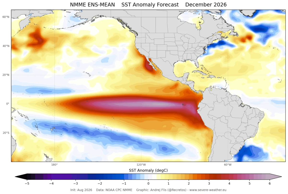
In a rare meteorological convergence, the tropical oceans are currently hosting two simultaneous anomalies that, while physically distinct, are working in tandem to alter the global atmosphere. A rare Atlantic Niña has emerged in the tropical Atlantic basin, occurring alongside a powerful Super El Niño building in the Pacific.
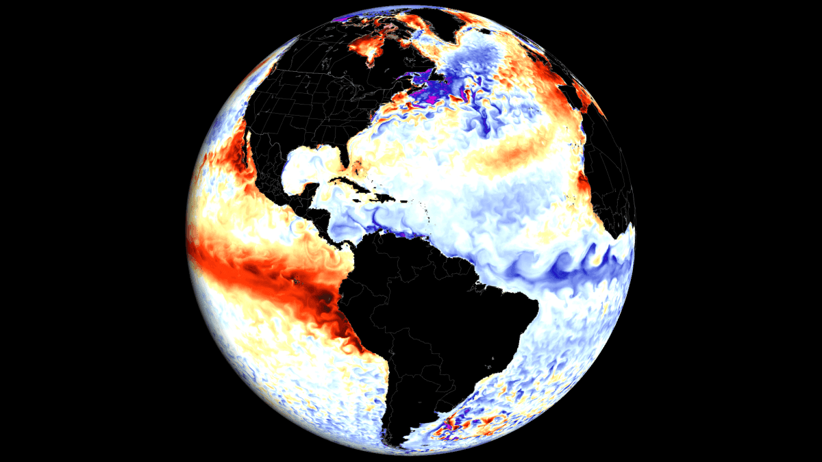
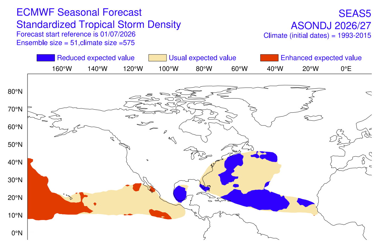
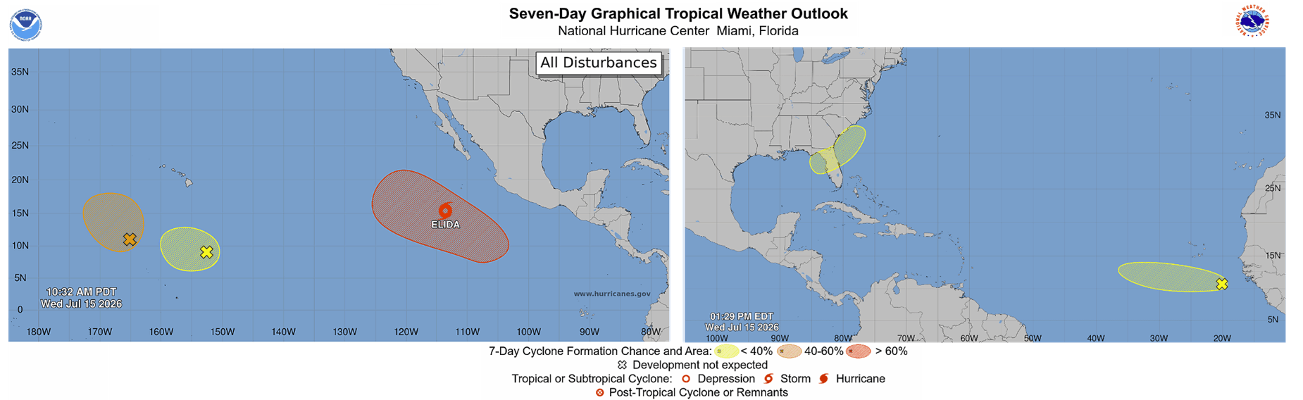
Though these phenomena are geographically separated, their combined impact creates a formidable "atmospheric shield" for the United States. Recent analysis suggests this dual-force setup is establishing a hostile environment for tropical cyclone development, effectively tempering the intensity and frequency of the 2026 hurricane season.
Main Facts: A Convergence of Anomalies
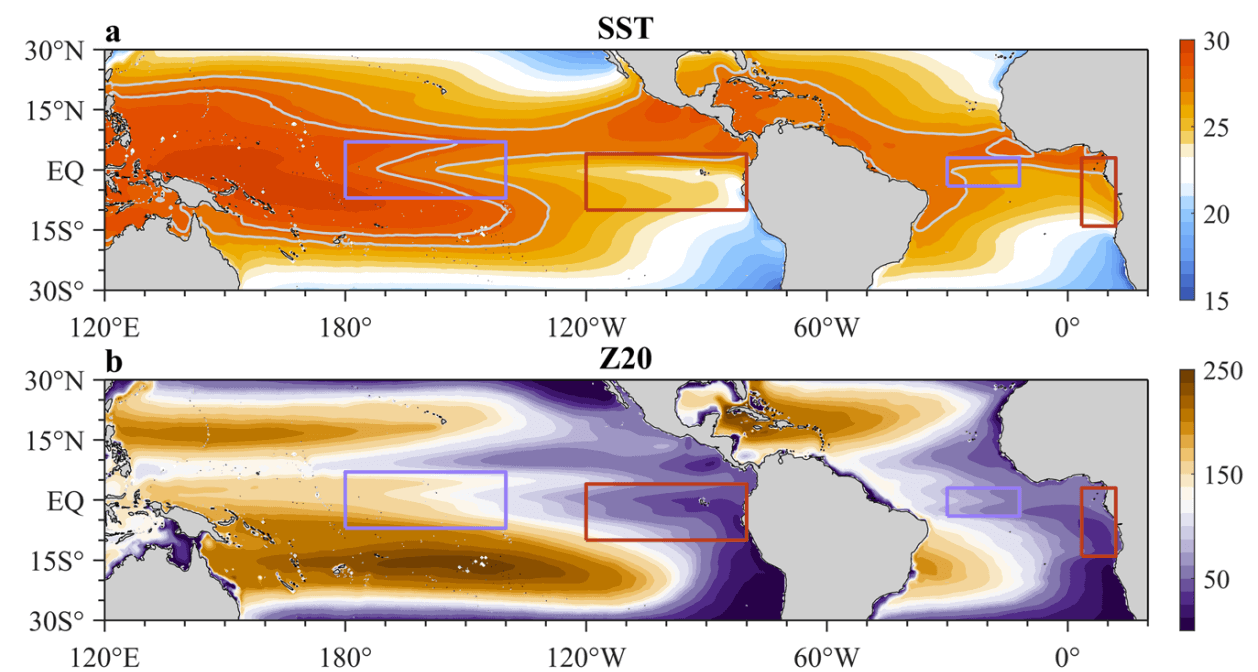
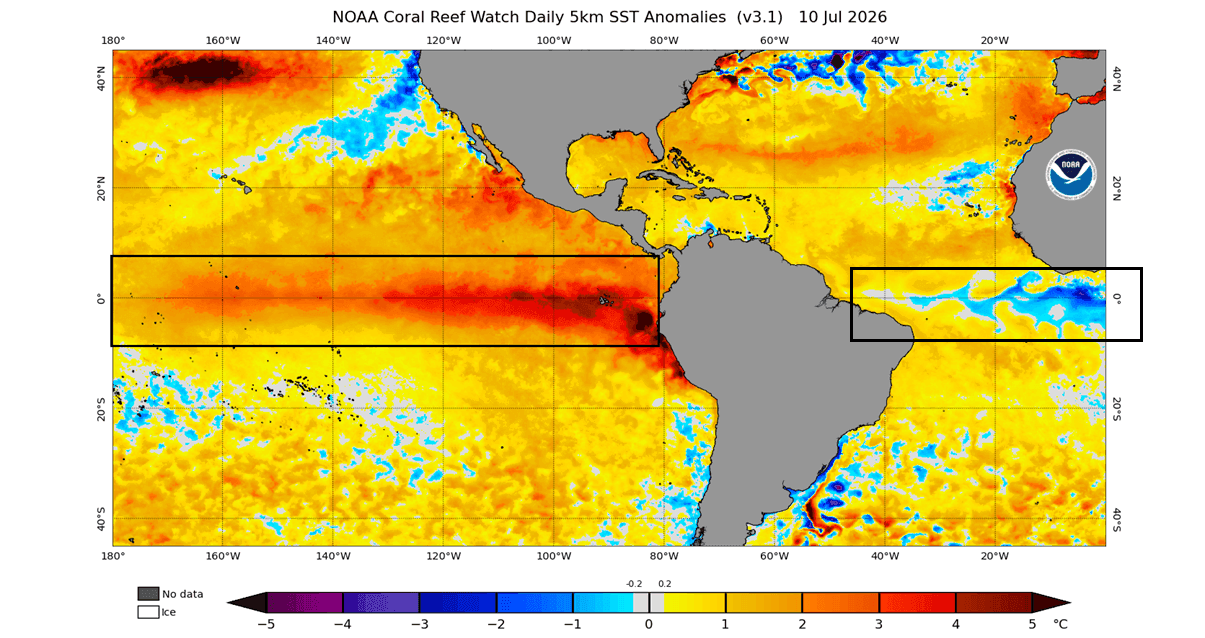
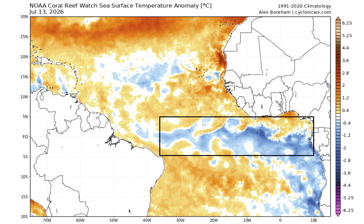
The global climate system is defined by the constant exchange of energy between the oceans and the atmosphere. Currently, the Pacific Ocean is dominated by a robust Super El Niño, characterized by surface temperatures in the central and eastern Pacific soaring 3–4 degrees Celsius above historical averages. Simultaneously, the tropical Atlantic has developed a cold-water anomaly known as an "Atlantic Niña."
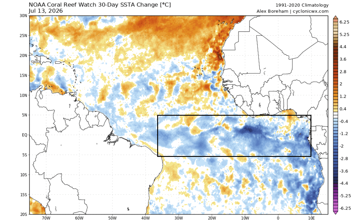
These events are governed by the behavior of the trade winds—the easterly currents that circulate near the equator. When these winds intensify, they trigger "upwelling," where deep, cold ocean water rises to the surface. In the Atlantic, this process has led to a cooling of the main development regions (MDR).
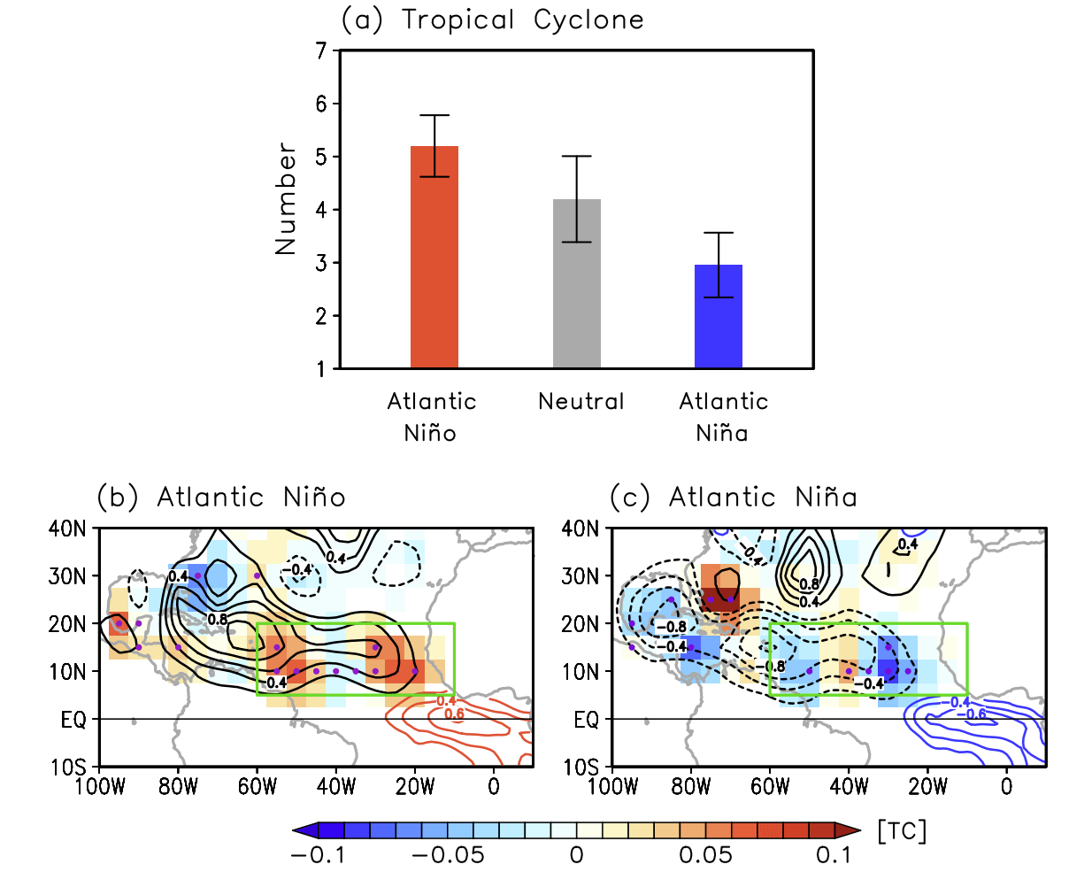
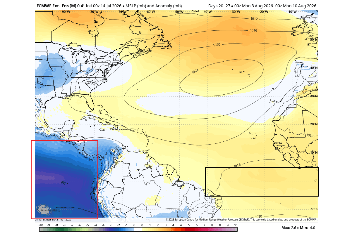
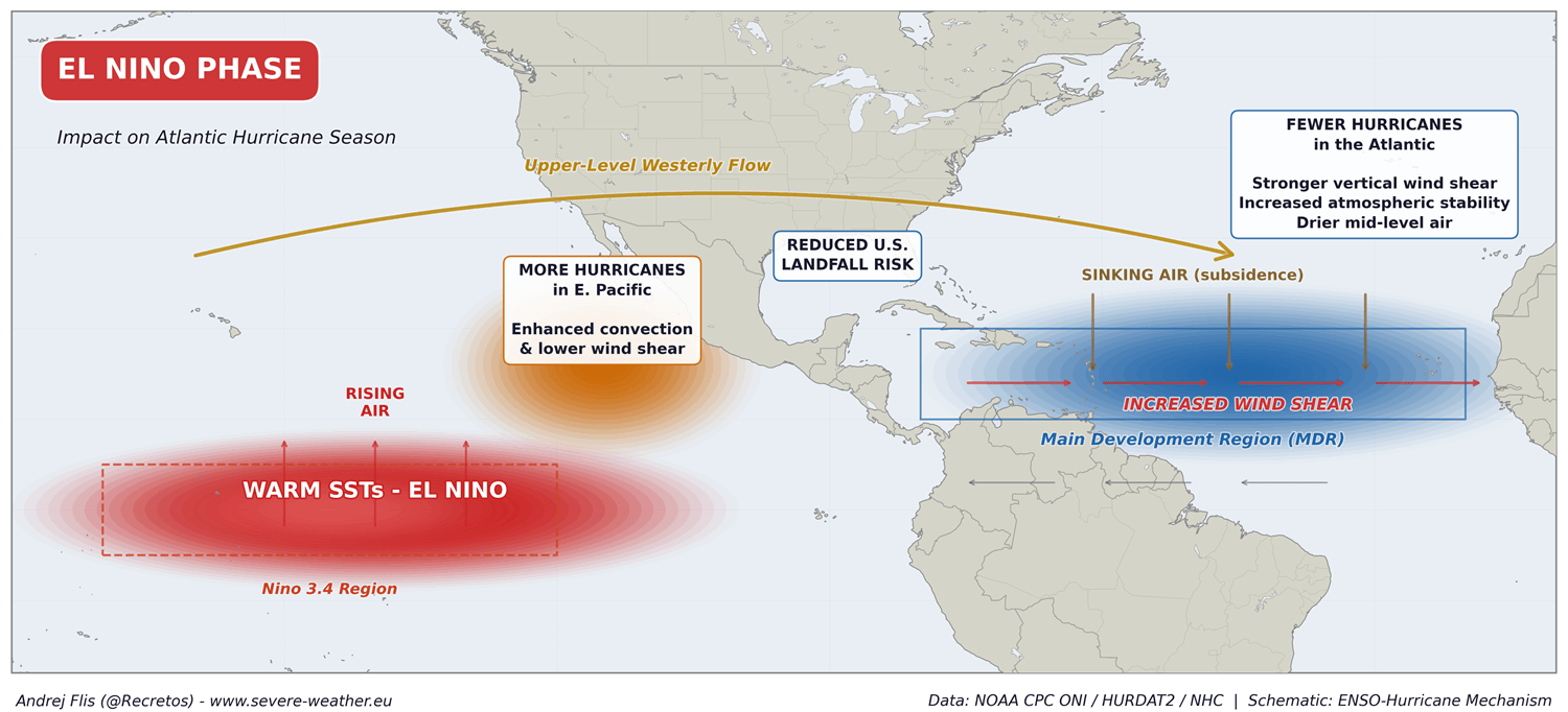
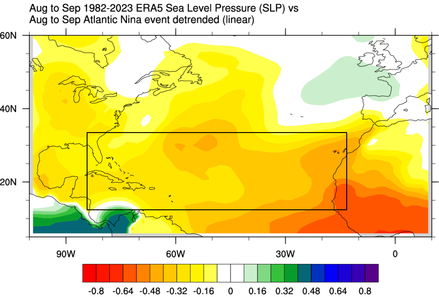
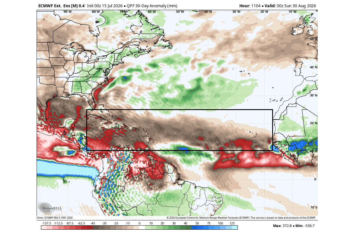
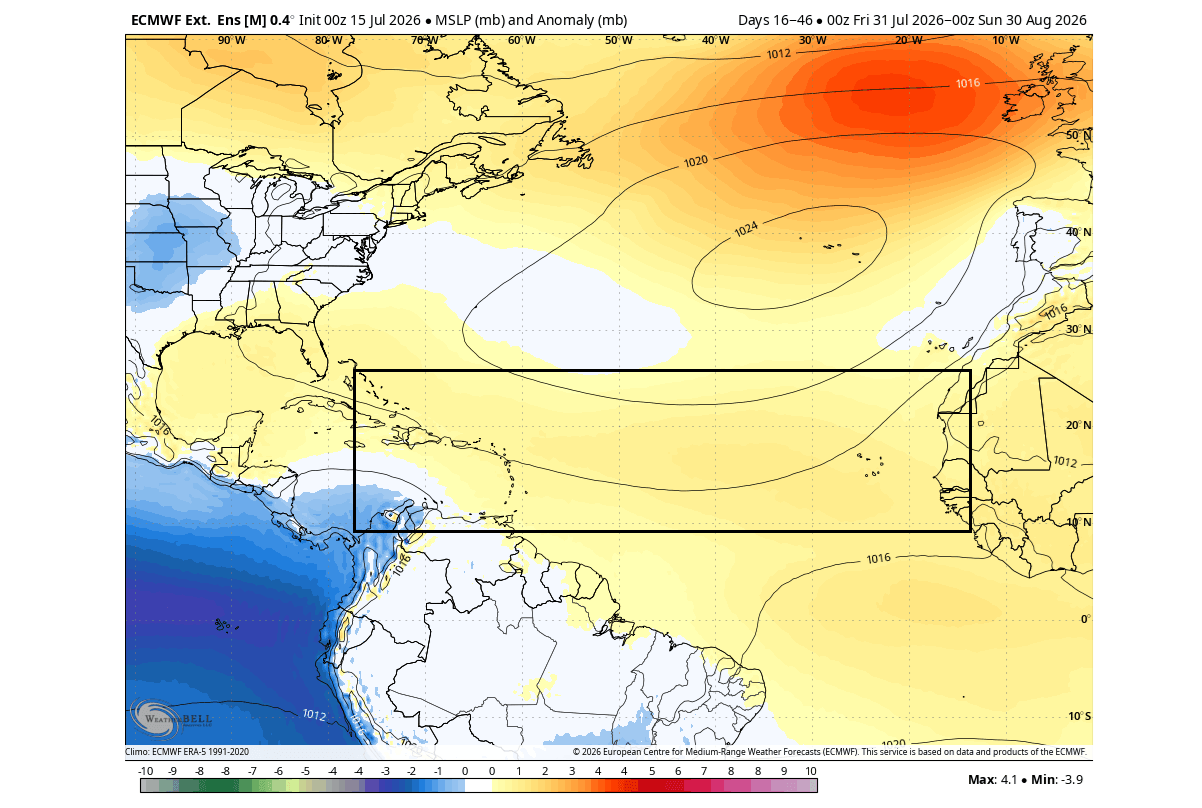
While a warm Atlantic typically fuels hurricane growth, this cold anomaly acts as a structural inhibitor. Combined with the massive atmospheric displacement caused by the Pacific Super El Niño, the Atlantic is currently experiencing increased wind shear, higher surface pressure, and suppressed convective rainfall—the three primary ingredients required to starve a developing storm.
Chronology: The Development of the 2026 Anomalies
The onset of these conditions began in early summer 2026, with ocean monitoring data from the National Oceanic and Atmospheric Administration (NOAA) Coral Reef Watch (CRW) identifying a rapid shift in sea surface temperatures.
- Early June 2026: Initial strengthening of Pacific trade winds begins to falter, allowing the rapid onset of the Super El Niño.
- July 2026: As Pacific waters warm, the Atlantic trade winds show an unexpected, persistent strengthening. This initiates the cooling of the Atlantic MDR, signaling the formation of the Atlantic Niña.
- August 2026: Data from the European Centre for Medium-Range Weather Forecasts (ECMWF) confirms that the Atlantic Niña has persisted, with temperatures 1–3 degrees Celsius below average.
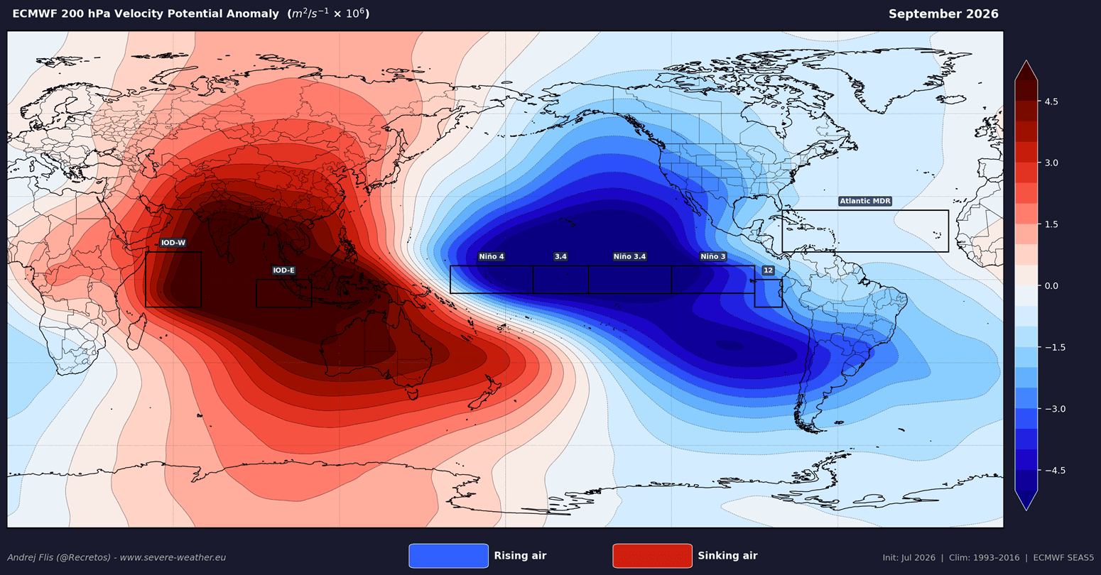
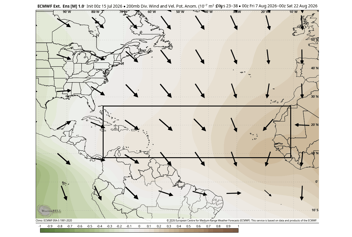
- September 2026 (Projected): This month represents the climatological peak of the hurricane season. Current models suggest that the "atmospheric shield" will be at its most potent, with the Pacific El Niño driving significant rising air (lift) in the West, forcing compensatory sinking air (subsidence) over the Atlantic, effectively placing a lid on tropical activity.
Supporting Data: Why the Shield Works
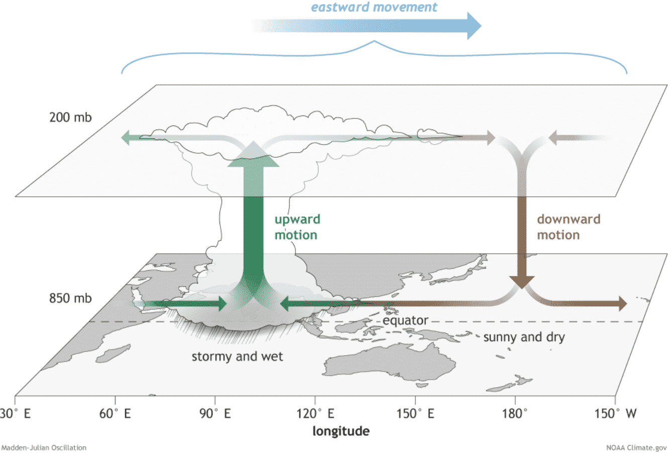
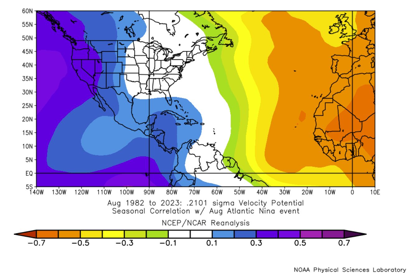
The influence of these anomalies is best understood through the lens of "Velocity Potential"—a metric used by meteorologists to track where air is rising and sinking globally.
During a typical hurricane season, the MDR is characterized by rising air, which facilitates the growth of deep thunderstorms. However, the current data shows that the Pacific Super El Niño is drawing the atmosphere’s "lift" away from the Atlantic. This creates an area of high pressure and sinking air over the Atlantic basin.
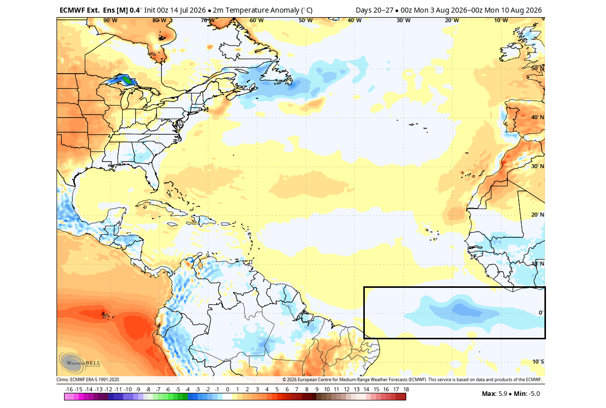
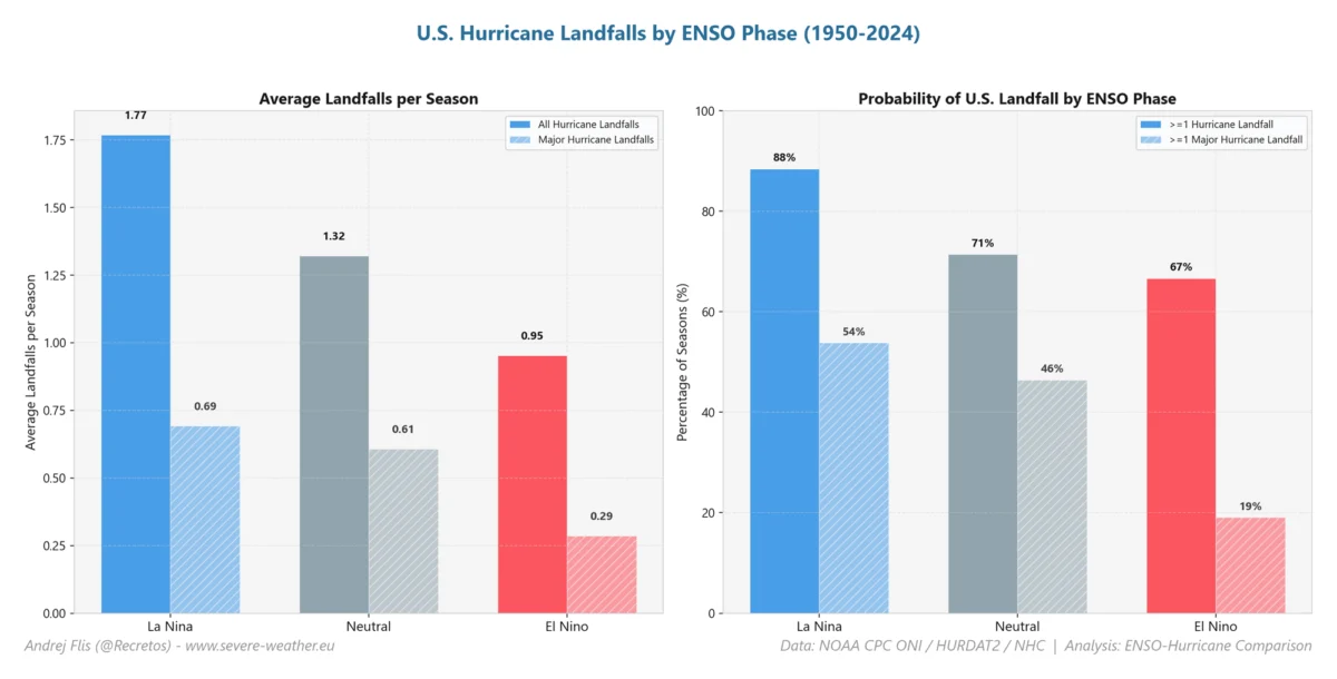
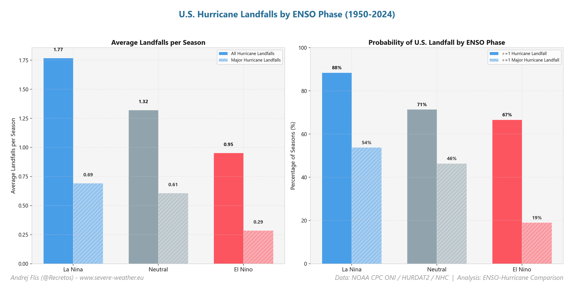
According to historical data from the last 40 years, an Atlantic Niña event reduces the number of tropical cyclones by approximately 50% compared to a neutral or warm phase. When layered on top of the inhibitory effects of an El Niño, the result is a significant statistical reduction in the probability of U.S. landfalls.
Furthermore, the Accumulated Cyclone Energy (ACE) index—a metric used by NOAA to express the energy used by a tropical system over its lifetime—is forecast to be well below the long-term average for the 2026 season. CSU projections confirm that coastal regions from the Texas Gulf Coast to the Canadian Maritimes face a suppressed risk profile this year.
Official Responses and Meteorological Outlooks
The Colorado State University (CSU) tropical research team, led by Dr. Philip Klotzbach, remains a primary authority on these seasonal outlooks. Their latest assessments indicate that the combination of these anomalies has shifted the probability of landfall significantly downward.
However, meteorologists emphasize a vital caveat: a quiet season is not a risk-free season.
History provides a stark reminder of this reality. In 1992, during an El Niño-suppressed season, Hurricane Andrew—a catastrophic Category 5 storm—made landfall in South Florida. Experts warn that while the "atmospheric shield" creates a statistically lower threat, it only takes one major storm to define a year. The current forecast does not negate the necessity of preparedness; it merely adjusts the statistical likelihood of widespread activity.
Implications: The Connection to Winter 2026/2027
One of the most compelling aspects of current atmospheric science is the "teleconnection" between a quiet hurricane season and the subsequent winter. The global circulation patterns that suppress tropical activity in the Atlantic often signal broader shifts in the jet stream.
The Polar Vortex and Winter Weather
Analysis suggests that the same factors creating the 2026 hurricane "shield" may contribute to a weakened Polar Vortex in the coming winter months. When the stratosphere experiences warming—a phenomenon often observed following suppressed tropical activity—the Polar Vortex can become unstable.
A weak or disrupted Polar Vortex loses its ability to contain frigid, arctic air at the poles. Instead of remaining locked in the high latitudes, this cold air can spill southward into the United States, Canada, and Europe.
While a quiet hurricane season is generally welcomed by coastal residents, it serves as a "leading indicator" for meteorologists. If the current patterns hold, the 2026/2027 winter could see:
- Increased volatility in the jet stream: Leading to more frequent mid-latitude storms.
- Arctic air outbreaks: A higher probability of sudden, extreme cold events in the lower 48 states due to the breakdown of the stratospheric vortex.
- Snowfall anomalies: The potential for increased snow cover in areas that have experienced relatively mild winters in recent years.
Conclusion: A Global Weather System in Transition
The 2026 hurricane season serves as a masterclass in how ocean-atmosphere coupling functions on a global scale. The presence of the Atlantic Niña acts as a localized brake on hurricane development, while the Pacific Super El Niño acts as a global atmospheric disruptor.
As we progress through the remainder of the hurricane season, the primary takeaway for the public should be one of cautious optimism tempered by vigilance. While the atmospheric conditions are heavily skewed against the formation of major hurricanes, the complexity of the climate system remains high.
Looking forward, the focus of the meteorological community will shift from the tropical nurseries of the Atlantic to the stratosphere. The data gathered during these coming months will be instrumental in predicting the severity of the 2026/2027 winter, providing a glimpse into whether the current "shield" will eventually lead to a shift toward a colder, more unstable winter season.

Residents in vulnerable regions should continue to monitor local weather bulletins, as the transition from an El Niño-dominated summer to a potentially volatile winter will require consistent updates and proactive preparation. As the atmosphere continues to respond to these rare ocean anomalies, the scientific community remains committed to deciphering the intricate connections that dictate our weather from the tropics to the poles.