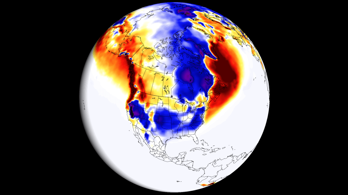
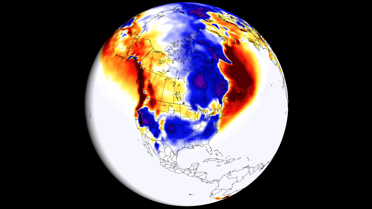
As we transition into the latter half of 2026, the global meteorological community is bracing for one of the most significant climate drivers in recent decades: a developing "Super" El Niño. Current long-range forecast data from the European Centre for Medium-Range Weather Forecasts (ECMWF) and the UK Met Office (UKMO) indicate that this phenomenon is not merely a seasonal fluctuation but a profound systemic shift that will reshape snowfall patterns across North America and Europe throughout the 2026/2027 winter season.
The Science of the Super El Niño
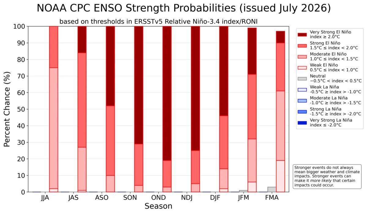
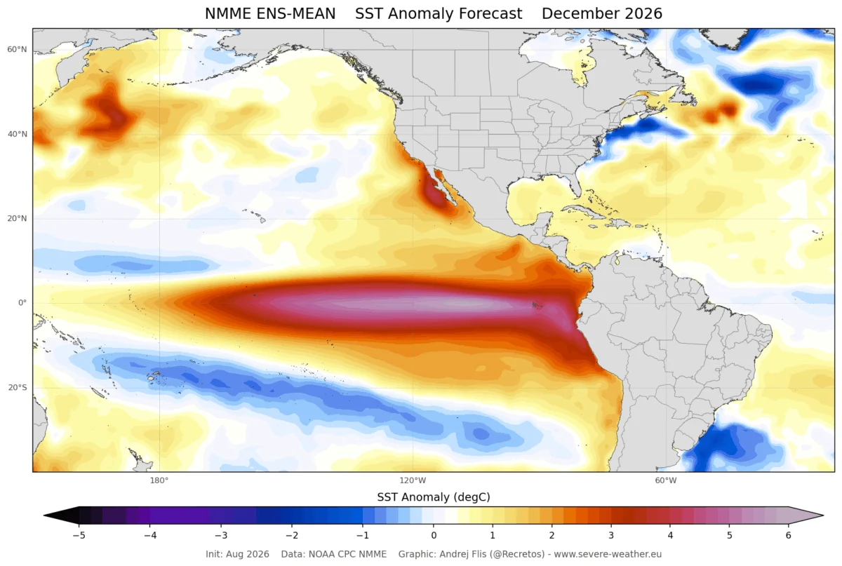
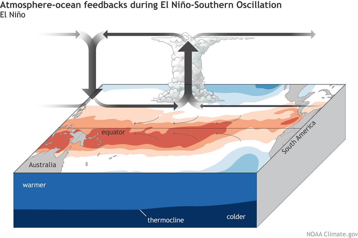
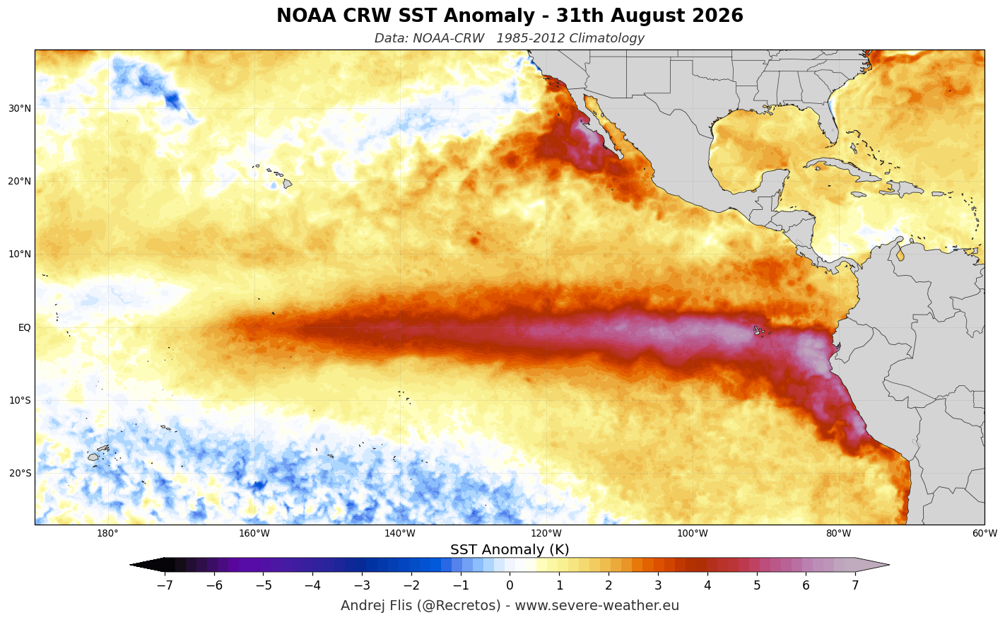
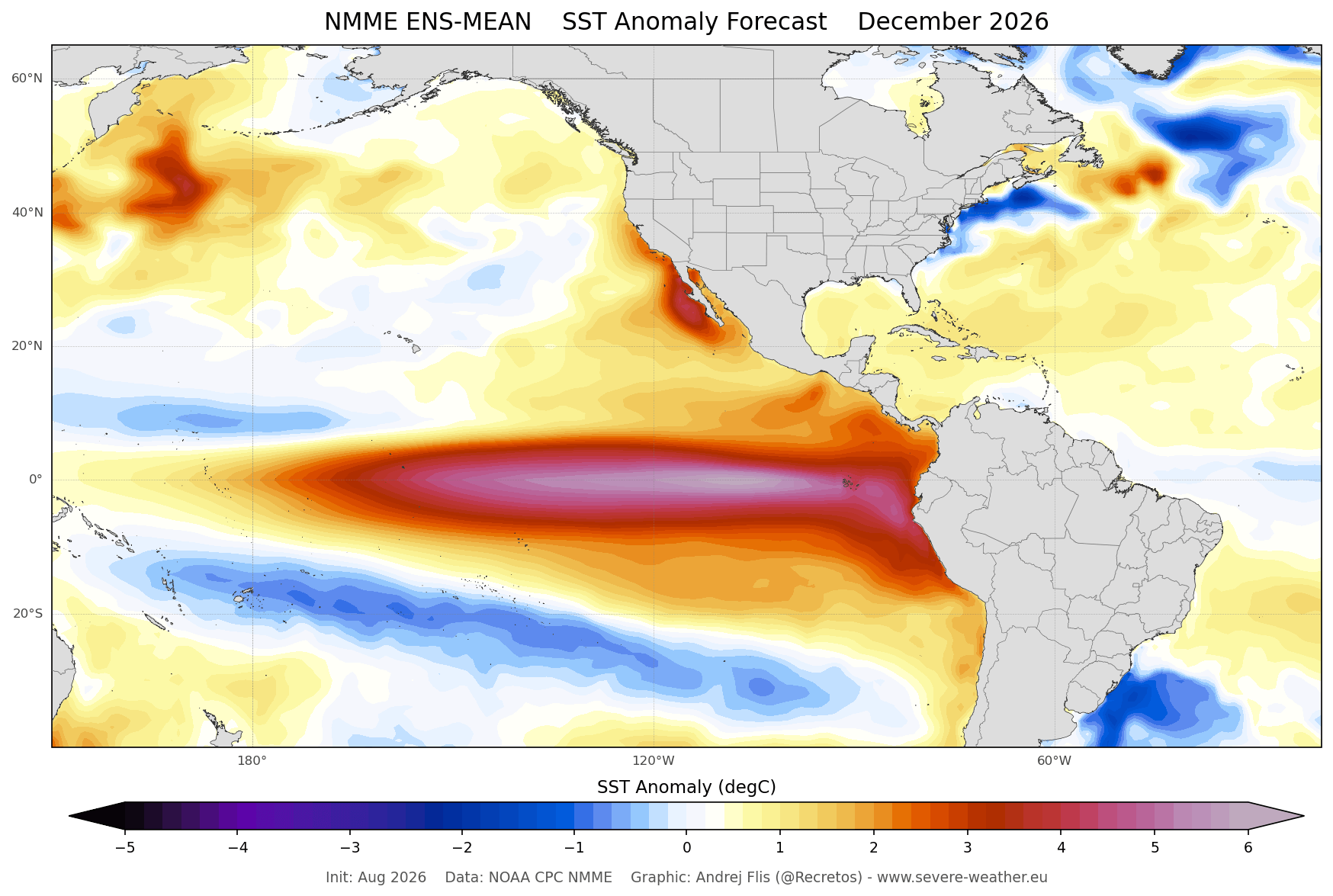
At its core, El Niño is defined by a significant warming of ocean surface temperatures in the central and eastern tropical Pacific. When these anomalies reach sustained values exceeding +2°C, the event is classified as a "Super" El Niño. As of September 2026, ocean analysis via NOAA-CRW data shows peak anomalies exceeding 6°C above normal in certain eastern regions.
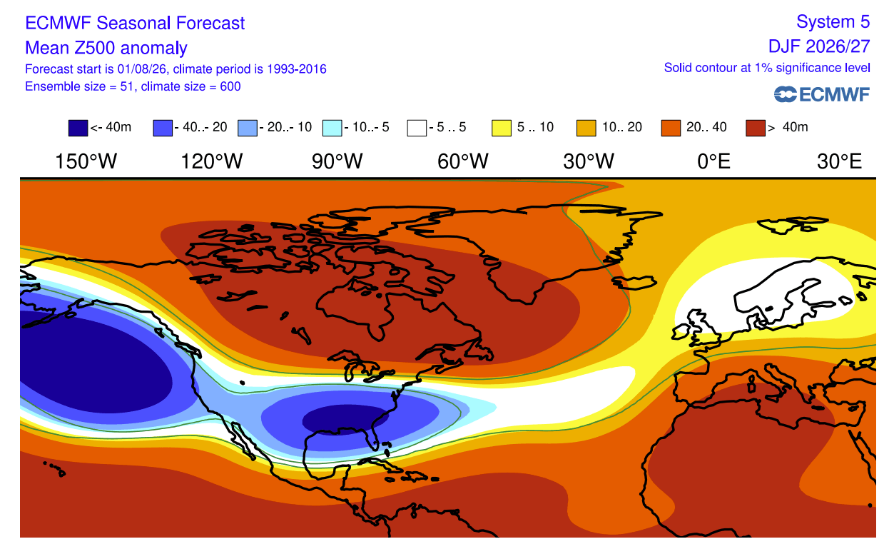
This massive release of heat energy into the atmosphere alters the "Walker Circulation," a loop of air movement that governs tropical rainfall and pressure. The subsequent atmospheric bridge creates a ripple effect, shifting the position of the jet stream—a high-altitude river of air that steers storm systems across the globe. By displacing the jet stream, the Super El Niño effectively dictates which regions will experience moisture-rich storms and which will remain under the influence of high-pressure blocking.
Chronology of Development: From Subsurface to Surface
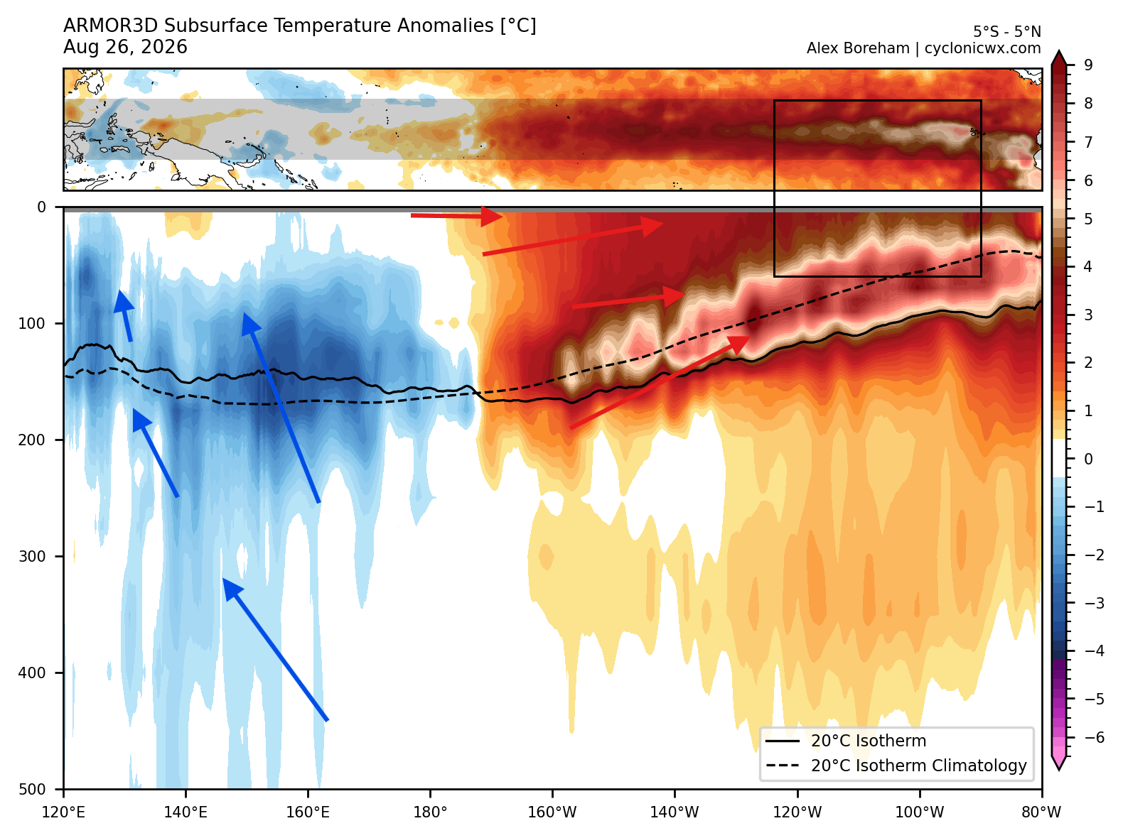
The intensity of the 2026 event is largely driven by a powerful subsurface feature known as a "downwelling Kelvin Wave." Over the past three months, high-resolution ocean data has tracked this massive pool of warm water, spanning the top 250 meters of the Pacific, as it moved eastward.
- Late Summer 2026: Subsurface anomalies surged, with temperatures reaching 10°C above the seasonal norm.
- Autumn 2026: These subsurface waters reached the surface in the eastern Pacific, solidifying the event’s "Super" status.
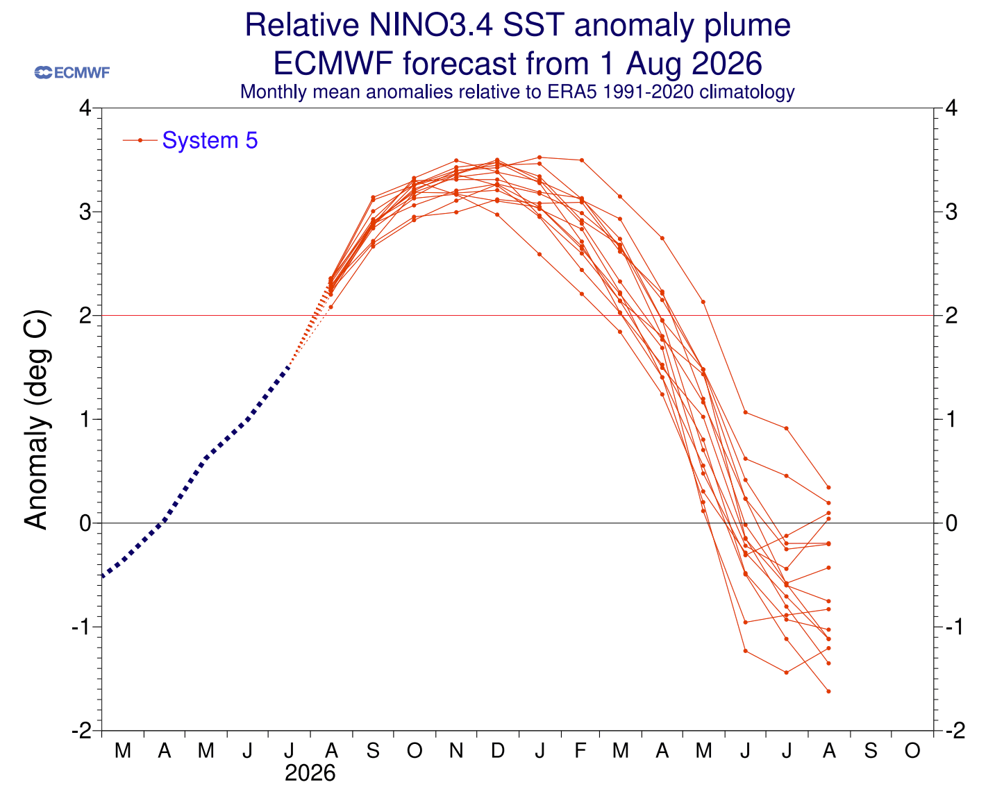
- December 2026 (Projected Peak): Both the ECMWF and the North American Multi-Model Ensemble (NMME) suggest that the event will reach its maximum intensity around the start of the meteorological winter, locking in the pressure anomalies that will dominate the coming months.
Supporting Data: North American Snowfall Trends
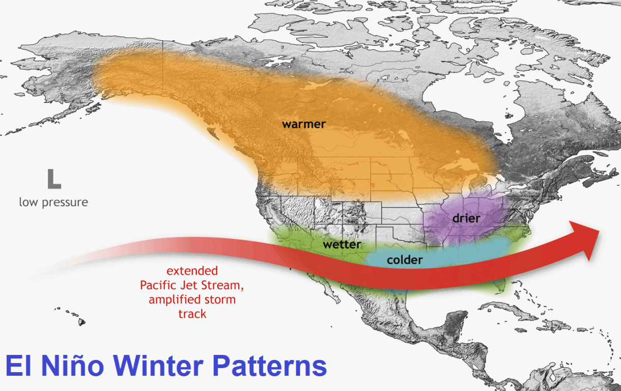
For the United States and Canada, the Super El Niño creates a distinct "split-flow" pattern. By strengthening the subtropical jet stream across the southern U.S., the event provides a reliable corridor for moisture-laden low-pressure systems.
The Southern and Central Shift
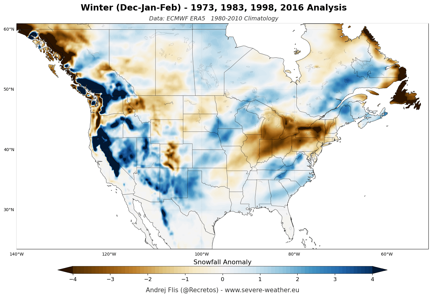
Historical analysis of previous Super El Niño events (such as those in the late 20th century) shows a marked increase in snowfall across the Sierra Nevada, the Four Corners region, and the Southern Rockies. In the 2026/2027 season, models project:
- January–February 2027: A distinct expansion of snowfall potential across the central and southern Plains, extending into the Ohio Valley and the Mid-Atlantic.
- The Texas Trend: Even in more southern latitudes, long-range ensemble data indicates an upward trend in snowfall frequency for mid-to-late winter, defying historical norms for these regions.
The Northern Deficit
Conversely, the northern United States and southern Canada are expected to face a snowfall deficit. The presence of a persistent high-pressure ridge over the Pacific Northwest and the northern plains will likely block cold air intrusions and steer the primary storm tracks further south. Consequently, areas like the Great Lakes and New England may see fewer, albeit potentially more intense, snow events compared to historical averages.
European Implications: A Milder Outlook
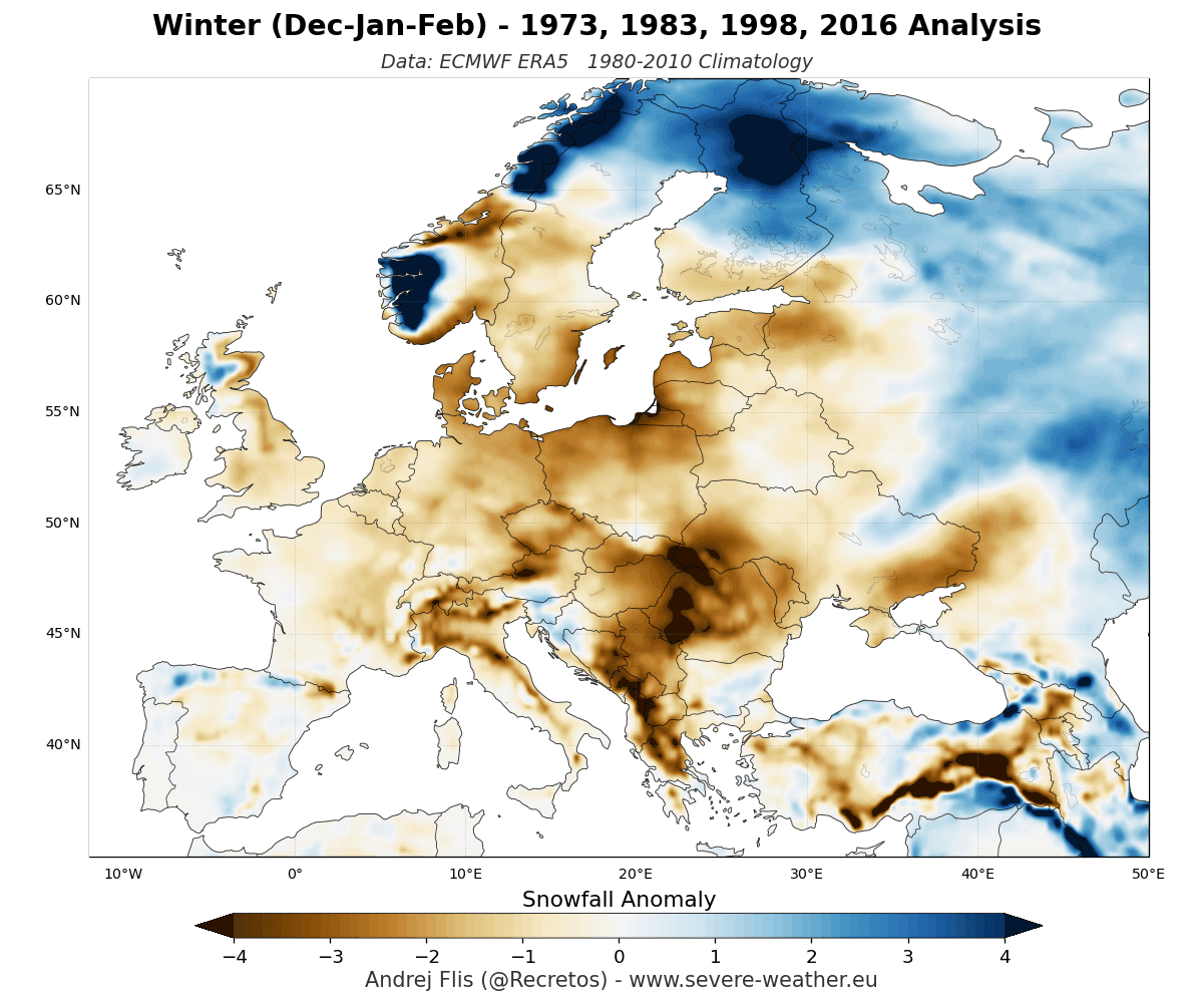
The outlook for Europe is starkly different. During a Super El Niño, the atmospheric pressure difference between a deep North Atlantic low-pressure zone and a strengthening southern high-pressure ridge tends to create a dominant, mild westerly flow across the continent.
- The Atlantic Influence: This flow brings warm, moist air from the Atlantic, which generally suppresses snowfall in the lowlands.
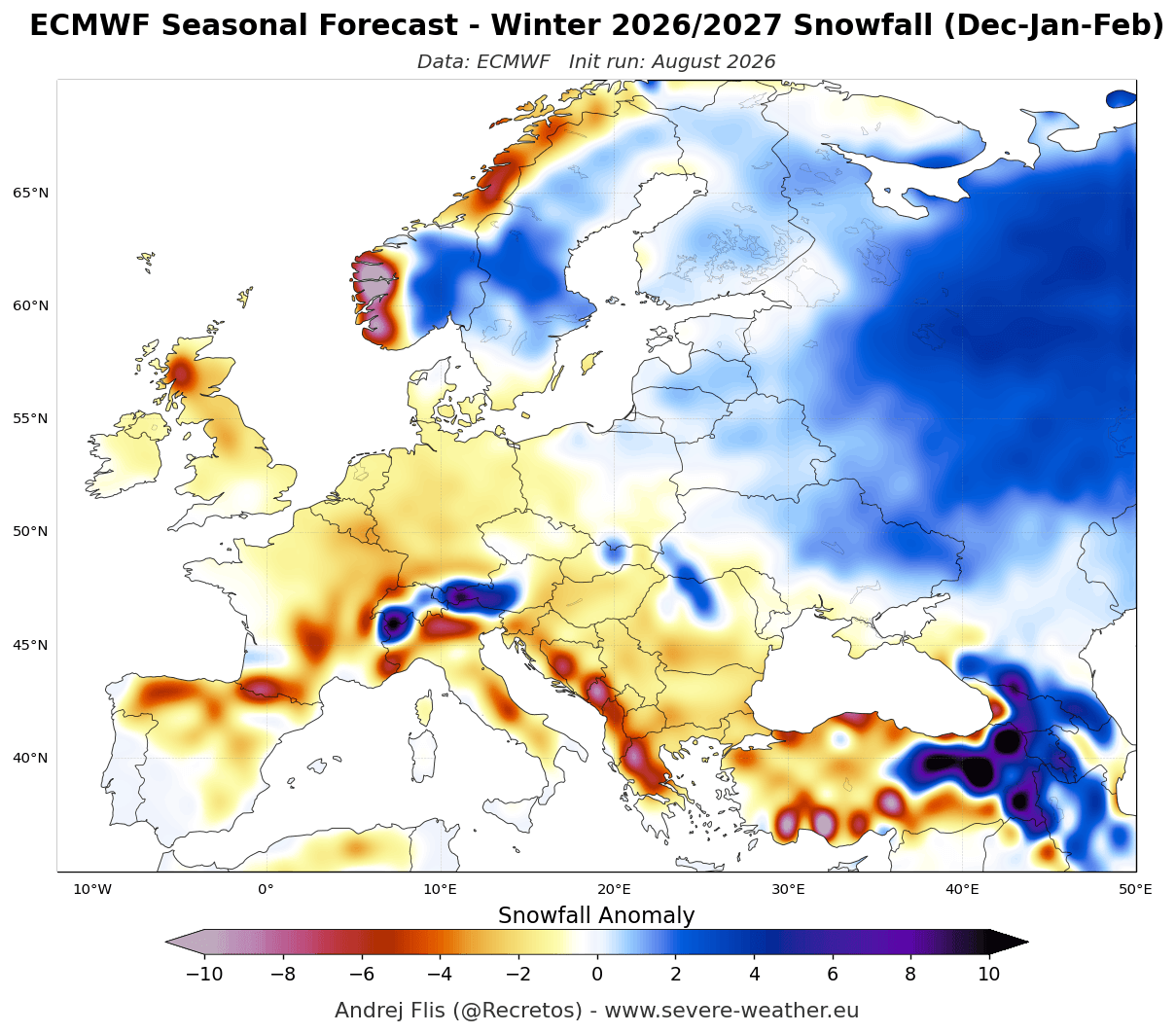
- The Elevation Factor: Snowfall will likely be highly stratified by elevation. While central and western European lowlands face a high probability of below-normal snow cover, high-altitude regions—particularly in the Alps above 1,800–2,000 meters—may still benefit from significant snowpack due to the sheer volume of moisture being transported across the continent.
- Late Winter 2027: Both the ECMWF and UKMO models highlight a potential for the most significant snowfall deficits to occur in February, when the high-pressure ridge is predicted to be most entrenched.
Official Meteorological Perspective
Meteorological agencies emphasize that while El Niño provides a "statistical skeleton" for the winter, it does not guarantee a uniform outcome. The final weather patterns will be influenced by secondary factors, such as the state of the Polar Vortex and local atmospheric blocking events.
According to researchers like Kunkel and Angel, the southward shift in cyclone activity is the most reliable predictor during these strong El Niño events. However, modern modeling now incorporates high-resolution reanalysis data (ERA5), which allows for a more nuanced look at how specific regions, such as the Appalachians, may experience anomalous "Nor’easters" that thrive on the increased moisture availability provided by the subtropical jet.
Implications for Industry and Infrastructure
The potential for an extreme winter season carries significant implications for various sectors:
- Ski and Tourism Industry: Resorts in the U.S. Southwest and the higher elevations of the Alps are positioned for a potentially record-breaking season. Conversely, operators in the U.S. Pacific Northwest and European lowlands should prepare for shorter seasons and reduced snow cover.
- Municipal Infrastructure: Cities in the southern U.S. that are not traditionally equipped for frequent snow removal may face logistical challenges should the projected mid-winter snowfall increases manifest.
- Agriculture: The moisture distribution associated with this Super El Niño could be a "double-edged sword." While increased snowfall helps replenish reservoirs in the American West, the deficit in the northern plains could impact spring soil moisture levels for the upcoming planting season.
Conclusion: Preparing for the Unpredictable
As the 2026/2027 winter approaches, the primary takeaway is one of contrast. The developing Super El Niño is forcing a departure from standard seasonal expectations. While the models show clear trends—wetter, snowier conditions for the southern and central U.S., and a warmer, more muted winter for Europe and northern North America—these are probabilities rather than certainties.
The meteorological community remains in a state of high alert, continuously refining these projections as real-time data from the tropical Pacific continues to evolve. For the public, the message is clear: while the broad-scale drivers suggest specific outcomes, the "Super" nature of this El Niño increases the likelihood of extreme weather volatility. Staying informed through updated long-range forecasts will be essential as the northern hemisphere approaches the peak of what promises to be a historic winter.