As we head into the final quarter of 2026, the global climate system is bracing for a rare and powerful synchronization of two of the most significant meteorological phenomena on Earth. A developing "Super" El Niño in the tropical Pacific is rapidly intensifying, currently joined by a newly emergent positive Indian Ocean Dipole (IOD). Together, these ocean-atmosphere anomalies are forming a colossal "dual-ocean" weather engine that scientists predict will fundamentally reshape jet stream patterns, temperature trends, and snowfall distribution across the Northern Hemisphere for the 2026/2027 winter season.

Main Facts: A Convergence of Climate Anomalies
The current state of the global tropics is defined by two primary drivers:
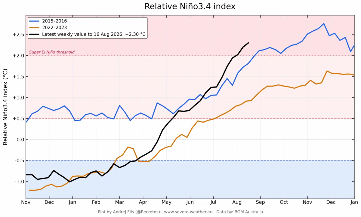
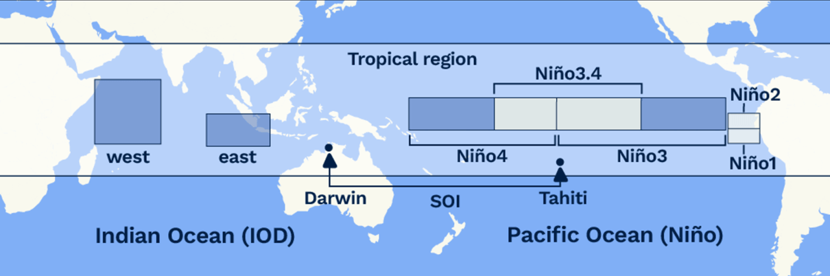
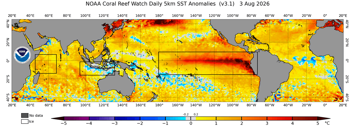
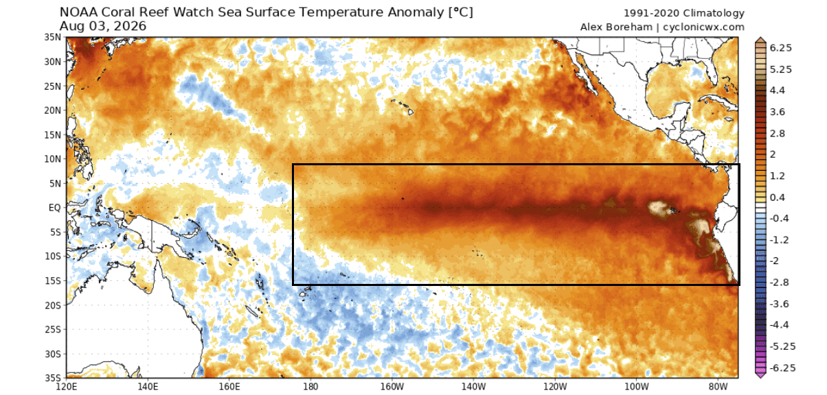
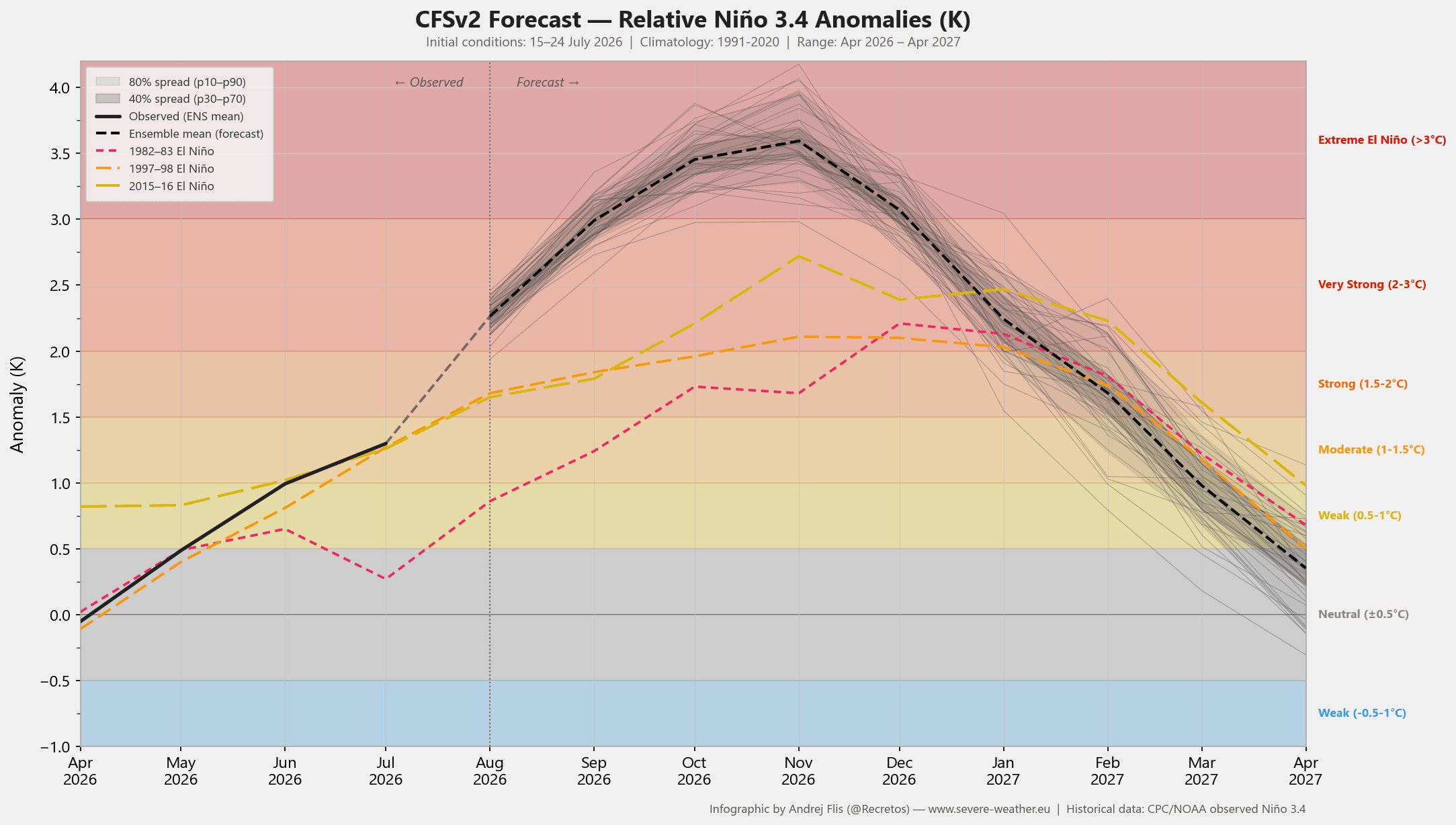
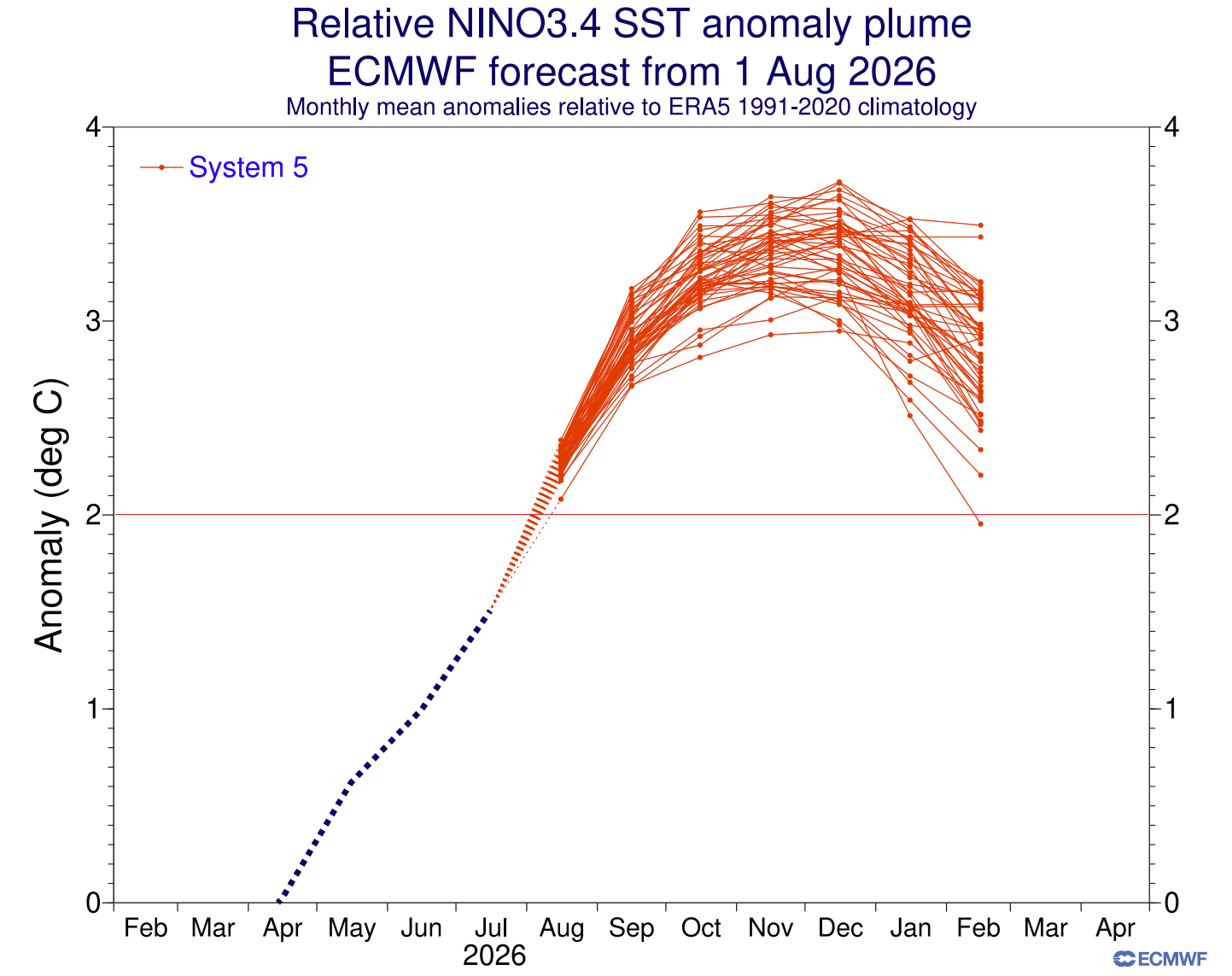
- The Super El Niño: Characterized by ocean surface temperatures in the central and eastern Pacific reaching or exceeding +3°C to +4°C above the seasonal average, this event is on track to become one of the most intense in recorded history.
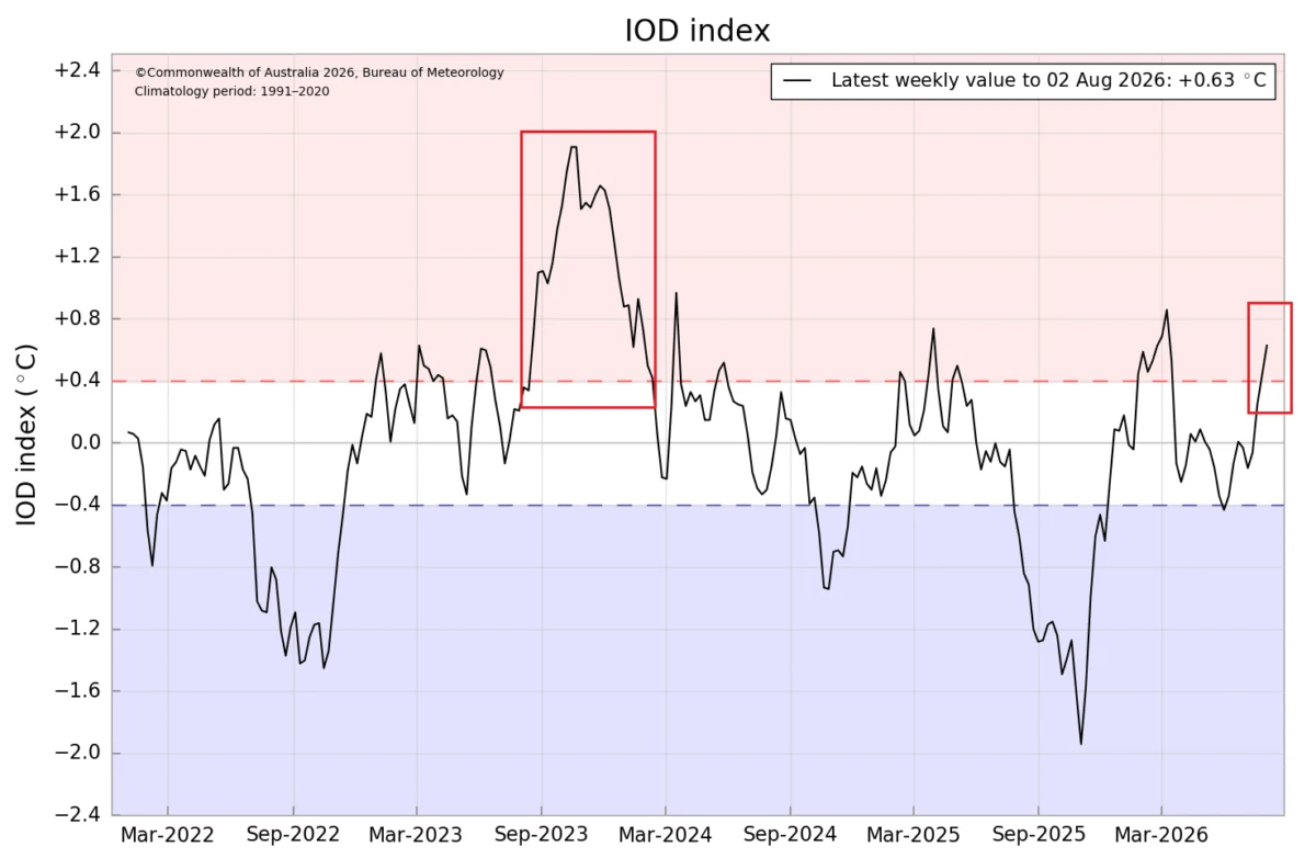
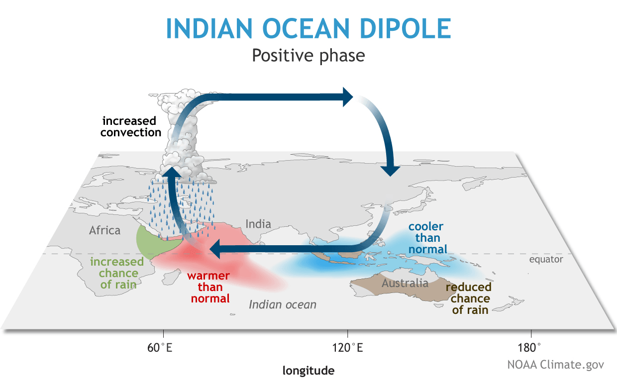
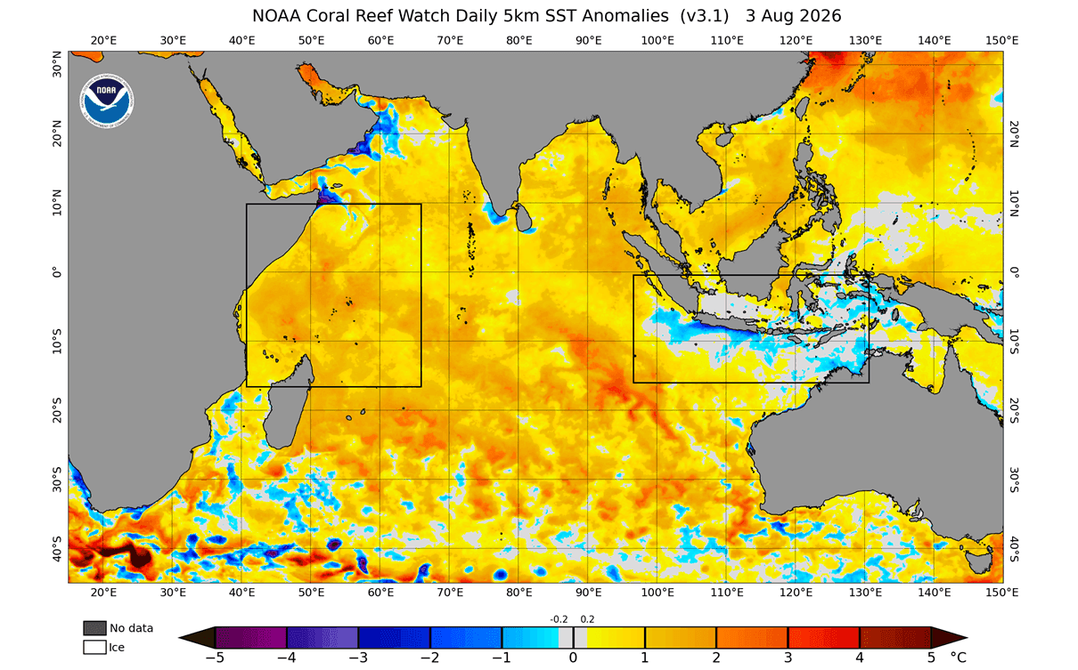
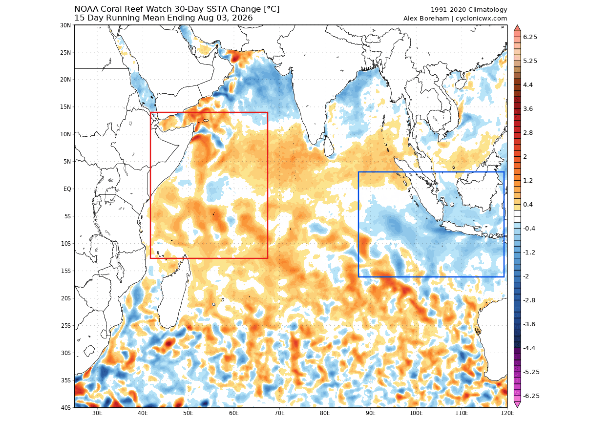
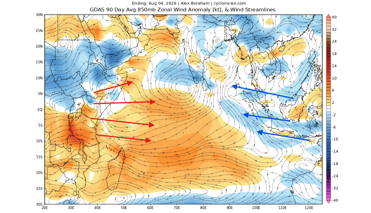
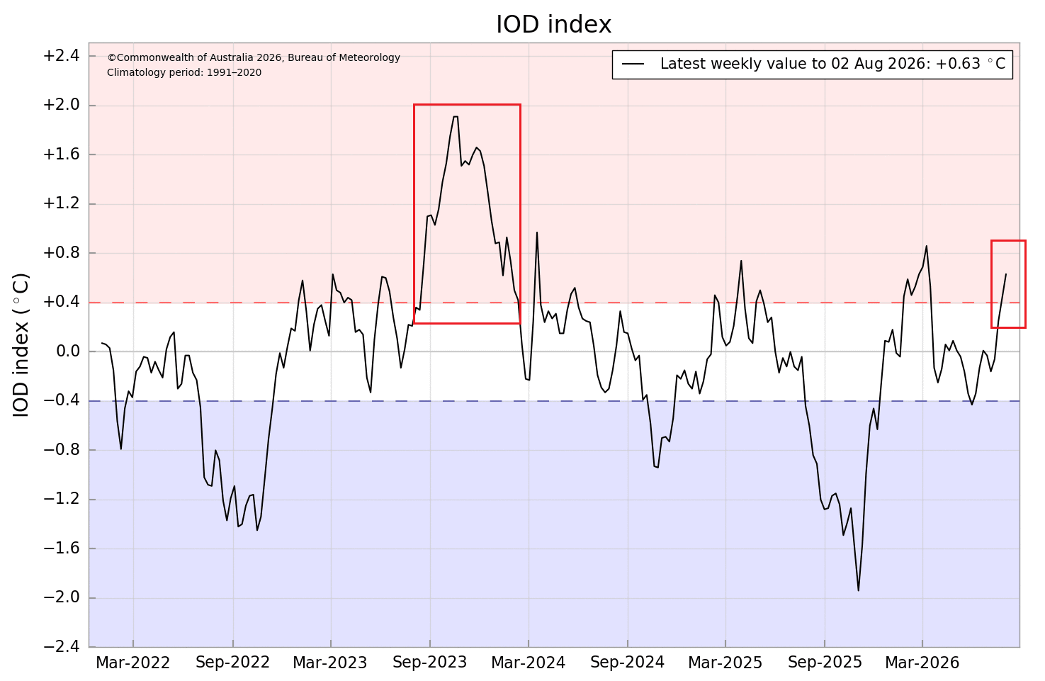
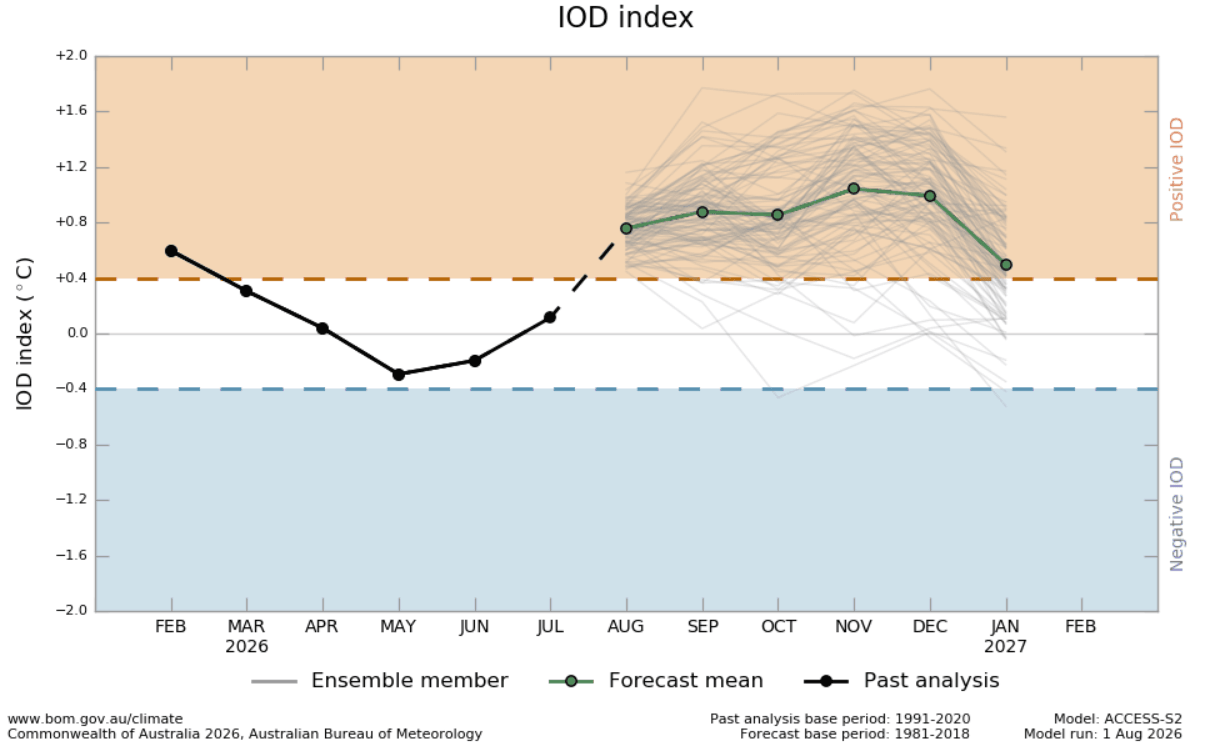
- The Positive Indian Ocean Dipole (IOD): Often referred to as the "Indian Niño," the positive IOD phase is marked by warmer-than-average sea surface temperatures in the western Indian Ocean and cooler waters in the east. This temperature gradient creates a massive atmospheric cell that alters global circulation.
When these two events occur simultaneously, they do not act in isolation. Instead, they operate as a synchronized, dual-ocean atmospheric system. The "tropical forcing" generated by these coupled anomalies creates an atmospheric wave train—a series of high and low-pressure oscillations that propagate from the tropics toward the poles, steering the jet stream with exceptional force.
Chronology of Development
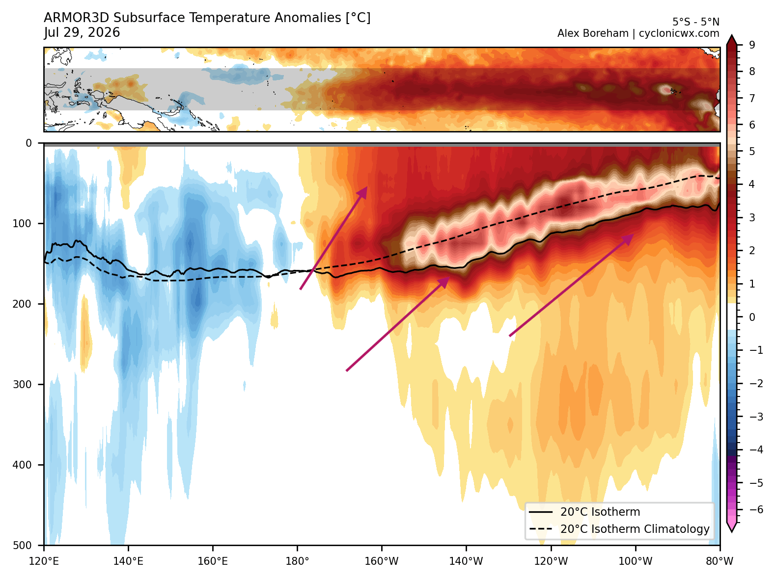
The transition into this high-impact state began in mid-2026, with sub-surface Pacific warming reaching critical thresholds. By August, observational data confirmed the rapid growth of a massive Kelvin Wave—a deep-ocean thermal pulse moving eastward along the equator. This wave serves as the "fuel" for the current Super El Niño.
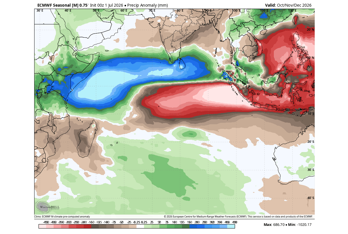
As the Pacific warming accelerated, the trade winds began to falter, failing to cool the ocean surface as they normally would. Simultaneously, the Indian Ocean began to show the classic signature of a positive IOD, with cooling trends in the eastern sectors and warming in the west. Meteorological models, including the latest ECMWF (European Centre for Medium-Range Weather Forecasts) ensembles, indicate that this dual-forcing setup will reach its peak impact during the November 2026 to February 2027 window.
Supporting Data and Meteorological Analysis
The scientific community relies on sophisticated numerical modeling to interpret these trends. Current analysis of the tropical Pacific shows a persistent "atmospheric standing wave." In this state, there is intense rising air over the central Pacific, balanced by sinking air over the Indian Ocean. This "Walker Circulation" footprint is the hallmark of a Super El Niño.
Subsurface Thermal Core
Perhaps the most alarming indicator of this year’s strength is the temperature anomaly in the top 500 meters of the Pacific. Data from August shows a core temperature anomaly exceeding +8°C. This deep-ocean heat is the engine that drives the surface manifestation. When this massive volume of warm water rises, it dictates the positioning of the jet stream, forcing it into a "split-flow" pattern that will dominate the upcoming winter.
Precipitation and Pressure Anomalies
ECMWF seasonal precipitation forecasts highlight the dramatic impact of this system. The eastern Indian Ocean is projected to face a significant rainfall deficit, while the western Indian Ocean and the central Pacific experience anomalous, high-volume rainfall. These shifts in tropical rainfall are not merely localized; they act as the "source" for planetary-scale waves that ripple across the United States, Canada, and Europe.
Implications for North America: Winter 2026/2027
For North America, the forecast suggests a classic, albeit highly amplified, El Niño winter. The atmospheric setup involves a high-pressure ridge parked over Canada and the northern United States, which will likely act as a "boulder in the stream," diverting polar air away from the northern latitudes.
Temperature and Precipitation Trends
- The Northern Tier: Canada and the northern U.S. are expected to experience a milder-than-average winter. The high-pressure blocking will keep extreme arctic outbreaks at bay, leading to above-normal temperature anomalies.
- The Southern and Eastern U.S.: The southern jet stream is projected to be hyper-active. As it interacts with Pacific moisture, we can expect a persistent, stormy pattern. This will bring cooler-than-normal temperatures to Texas, the Gulf Coast, and the Southeast, driven by constant cloud cover and frequent precipitation.
The Snowfall Divide
The snowfall outlook is perhaps the most significant outcome of this "split-flow" pattern. Because the primary storm track will be pushed toward the southern and central United States, these regions are at an increased risk of significant winter storm activity. Areas from the Southwestern U.S. through the Central Plains and into the Mid-Atlantic may see increased winter storm frequency. Conversely, the Pacific Northwest and the northern Great Lakes may see below-average snowfall due to the dominant northern ridge.
Implications for Europe: A Westerly Outlook
While Europe is further removed from the direct tropical source, it remains susceptible to the downstream effects of the atmospheric wave train. The current forecast for Europe suggests:
- Westerly Flow: A high-pressure ridge from the south, coupled with low-pressure zones over the North Atlantic and northwestern Europe, will strengthen the prevailing westerly winds.
- Mild and Wet: The majority of the continent is expected to experience above-normal temperatures throughout the winter, as the Atlantic provides a constant influx of mild, moist air.
- Snowfall Limitations: The overall pattern is not conducive to broad, continent-wide snowfall. However, the North, Northeast, and higher elevations of Central Europe may still see periodic snowfall as individual low-pressure systems move inland, creating "individual opportunities" for wintry weather.
Official Projections and Future Outlook
Climate scientists warn that because the current anomalies are so strong, the predictability of the seasonal trends is higher than in average years. However, the intensity of the "Super" event introduces variables that exceed historical averages, making this a "live" research event for meteorologists.
The coupling of the Indian Ocean Dipole with the Pacific Super El Niño creates a "planetary domino effect." As the atmosphere attempts to balance the massive heat release in the tropics, the resulting waves are forced to travel around the globe, locking the jet stream into a configuration that will likely persist until early spring 2027.
Monitoring the Situation
As we move deeper into the fall, the focus will remain on the intensity of the atmospheric response to the ocean forcing. The scientific community is currently using the following primary tools for real-time monitoring:
- ECMWF and NCEP CFSv2 Models: Providing long-range pressure, temperature, and precipitation ensemble forecasts.
- Satellite Observations: Tracking the "Kelvin Wave" development and sea-surface temperature (SST) gradients.
- Atmospheric Circulation Regressions: Analyzing the velocity potential to determine where rising and sinking air currents are creating the most significant disturbances.
For the public, this means preparing for a winter of extremes. While the North will likely enjoy a reprieve from traditional bitter cold, the Southern and Eastern United States should prepare for a season defined by frequent, moisture-heavy storm systems. As always, local weather agencies will provide the most accurate short-term forecasts, but the global "engine" for the 2026/2027 winter is already firmly in place. Stay tuned for updates as the peak of the Super El Niño approaches in the coming months.