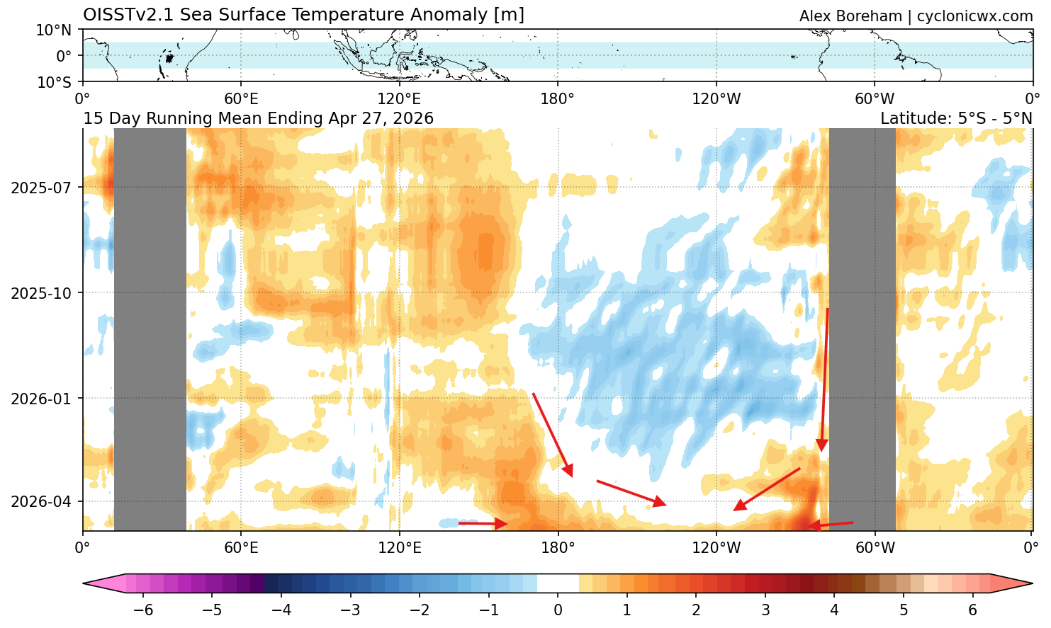
The global climate system is currently undergoing a profound, rapid transition. Recent oceanic analysis and atmospheric modeling for Summer 2026 indicate that the El Niño Southern Oscillation (ENSO) is evolving with unexpected velocity and intensity. Latest data suggests that we are witnessing the birth of a climate event that could reach "Super El Niño" status by the second half of the year, potentially eclipsing the influence of the multi-year La Niña phase that dominated recent seasons.
This shift is not merely a regional Pacific phenomenon; it is a global atmospheric catalyst. As a powerful oceanic Kelvin wave—a massive pulse of warm water moving eastward beneath the surface—surfaces, it is actively reconfiguring the global jet stream. For the Northern Hemisphere, this implies a summer defined by altered pressure gradients, shifting temperature baselines, and a potential "natural shield" against the Atlantic hurricane season.
The Chronology of Transition: From La Niña to Super-Heating
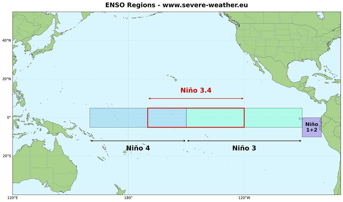
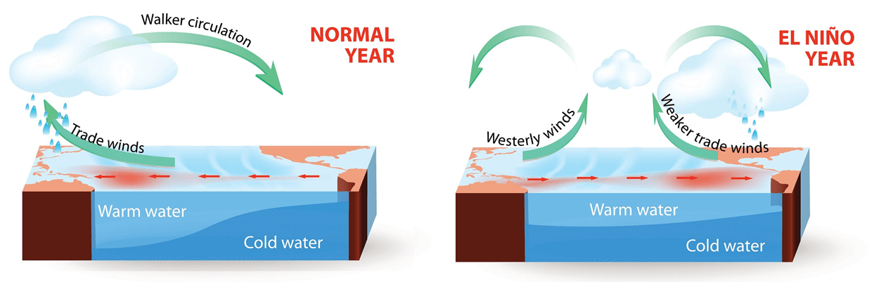
To understand the gravity of the Summer 2026 forecast, one must first recognize the "indicator light" nature of the ENSO cycle. ENSO represents the equatorial Pacific’s fluctuation between cold (La Niña) and warm (El Niño) phases. These phases act as the primary engines of global atmospheric circulation, dictating everything from agricultural yields to storm frequency.
The Mechanism of Rapid Warming
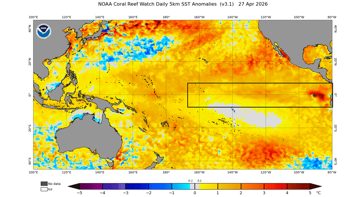
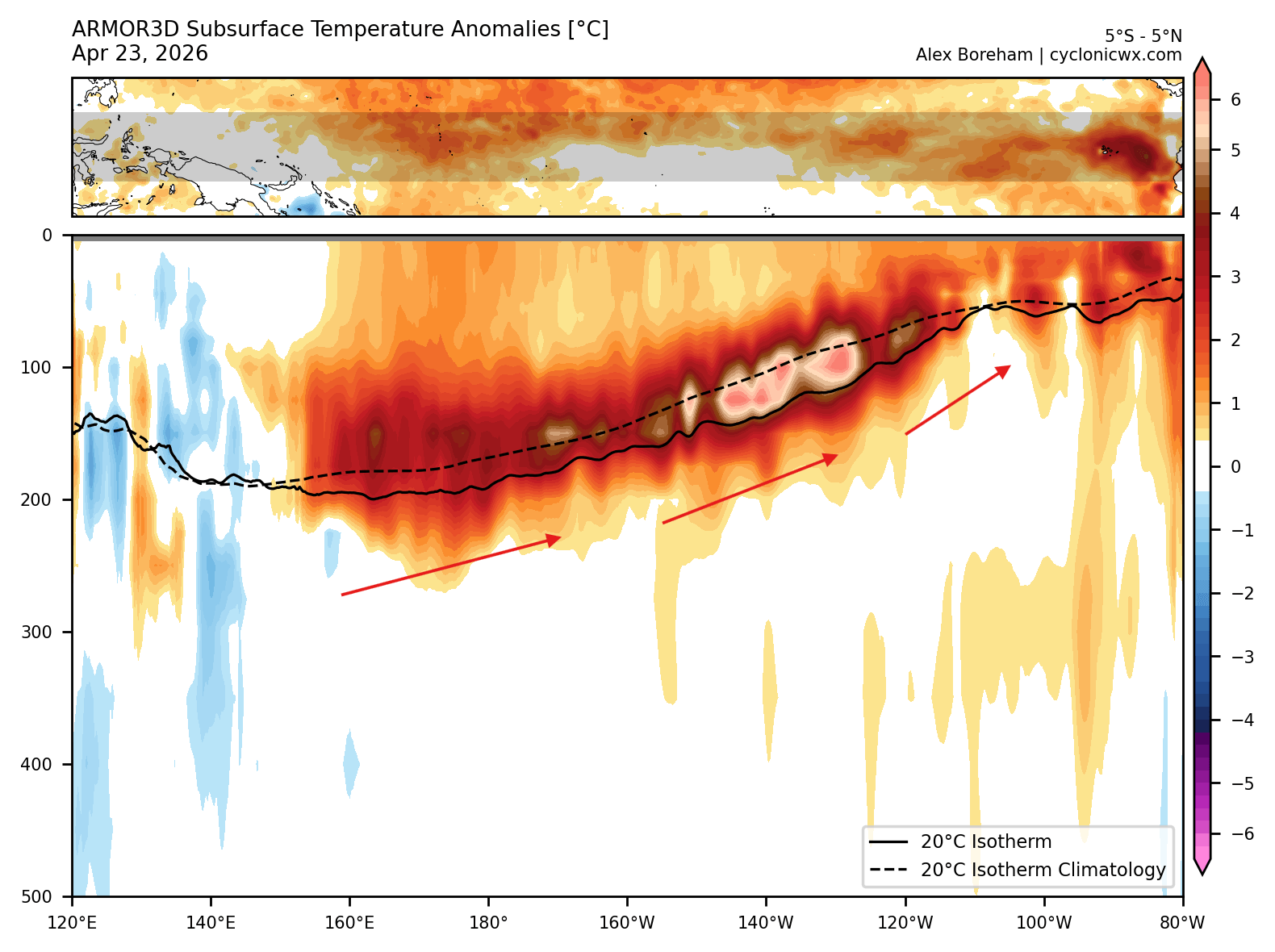
The current transition began in late winter, as the previously stable La Niña conditions rapidly dissolved. The primary driver of this current acceleration is a massive intrusion of warm anomalies into the Niño 3.4 region. Meteorologists have observed a significant shift in trade winds, which has triggered a powerful Kelvin wave. This wave, currently measured at depths of 50 to 250 meters, has pushed subsurface temperatures to nearly 8°C above normal.
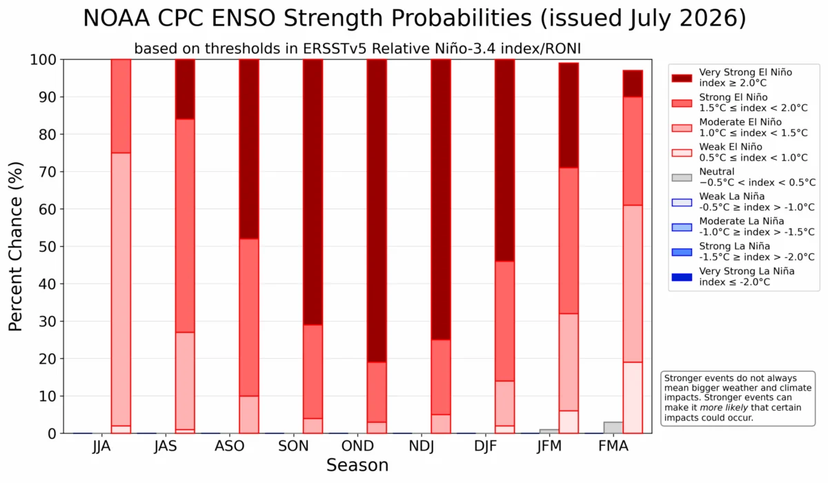
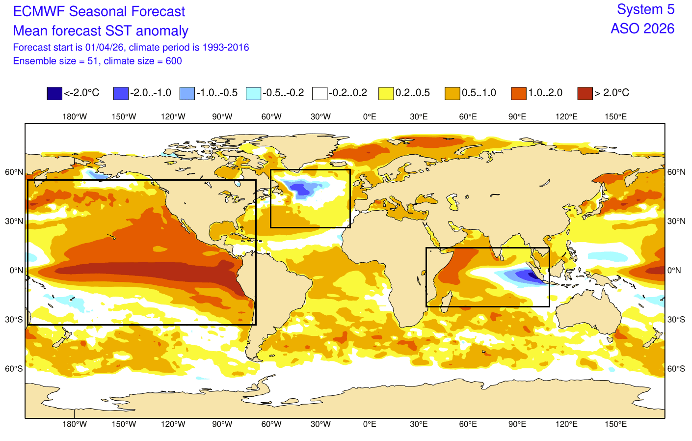
As these warm waters rise to the surface, they solidify the El Niño signal. Unlike moderate events, the forecast models from the ECMWF (European Centre for Medium-Range Weather Forecasts) and the UKMO (United Kingdom Met Office) now suggest that the Pacific is on a direct trajectory toward a Super El Niño event, characterized by sea-surface temperature anomalies exceeding +2°C across the central tropical Pacific.
Supporting Data: Modeling the Super El Niño
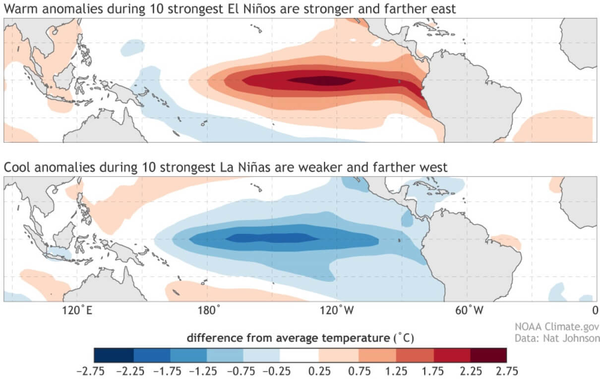
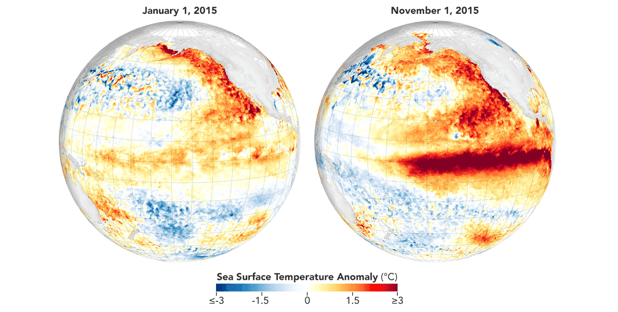
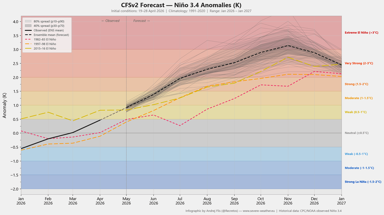
The professional consensus, derived from the NOAA CFSv2 model and corroborated by the ECMWF’s SEAS5, points to an event that rivals the historical 2015 Super El Niño.
The Walker Cell Disruption
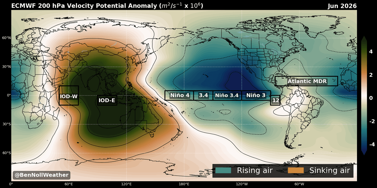
A critical diagnostic tool used by meteorologists is the "Velocity Potential" (VP) analysis. This parameter tracks the health and position of the Walker Cell—the massive, circular atmospheric loop that governs tropical weather. Current June 2026 forecasts show a clear reversal of this cell: rising air over the Pacific and sinking air over the Indian Ocean. This configuration is the hallmark of a fully established El Niño, providing high confidence that the atmosphere is already responding to the Pacific’s thermal surge.
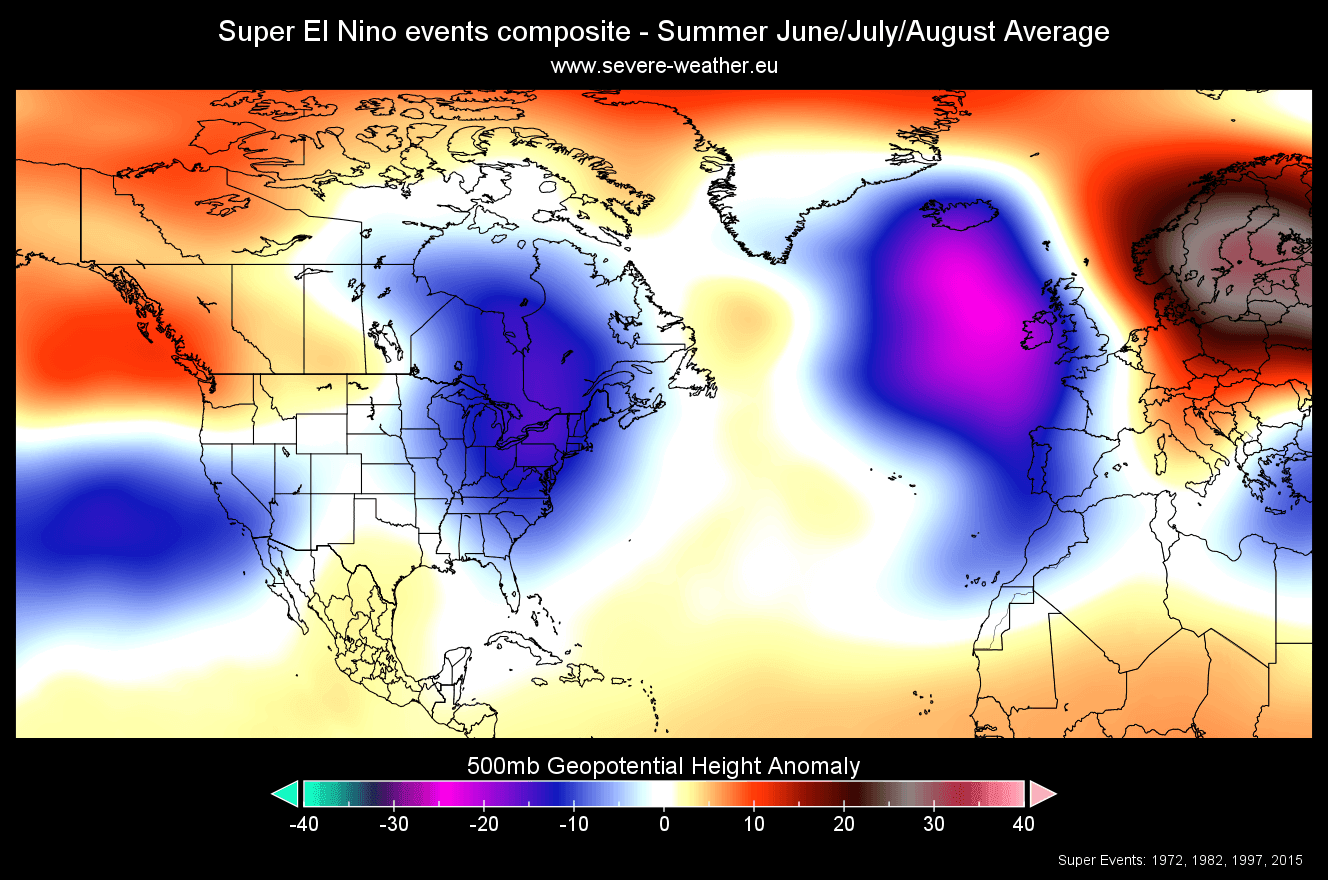
Historical Precedent
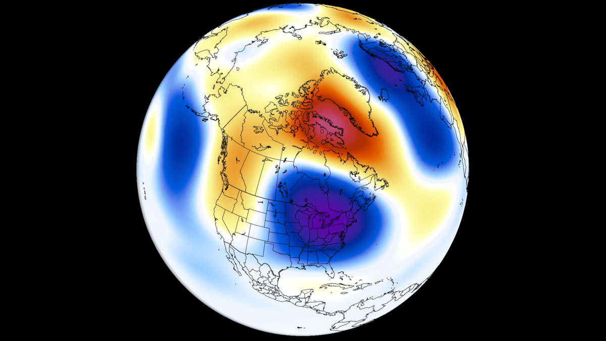
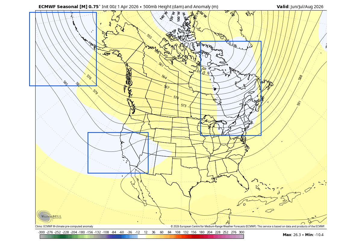
By analyzing historical "Super" events, researchers have identified a consistent signature: a persistent low-pressure area over eastern Canada and the northeastern United States. This historical baseline provides a reliable framework for what to expect in the coming months. While no two events are identical, the recurrence of specific pressure patterns in previous super-cycles offers a blueprint for the expected temperature and precipitation anomalies of 2026.
Regional Implications: Temperature and Precipitation
The influence of a Super El Niño is geographically diverse, creating a "tug-of-war" between regions.
North America: A Tale of Two Climates
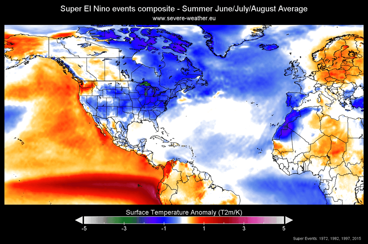
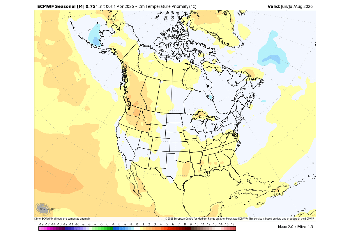
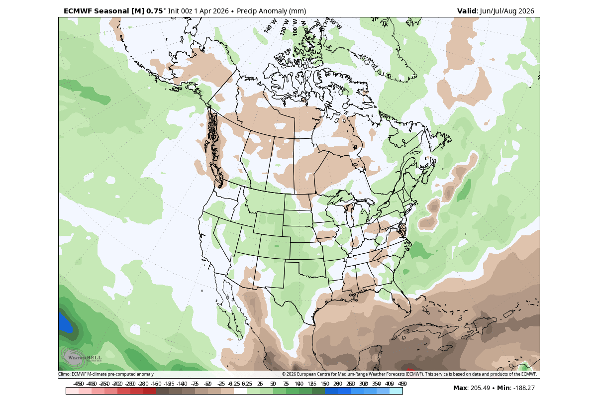
For the United States and Canada, the emerging pattern suggests a split. The low-pressure area expected over eastern Canada and the Northeast acts as a heat moderator, likely keeping temperatures in these regions closer to seasonal norms. Conversely, the northwestern United States and western Canada are projected to face above-normal temperatures.
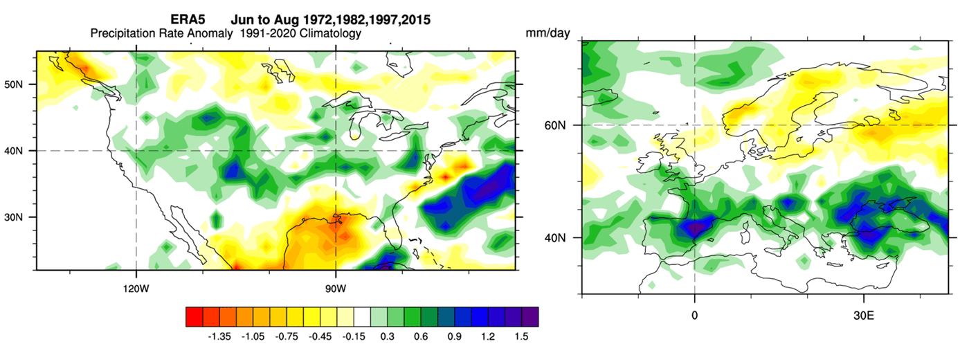
Precipitation trends show a marked increase in rainfall for the central, western, and northeastern United States. This is driven by a more active subtropical jet stream, which pulls moisture inland. However, this poses a contrast to the southern plains, where drier conditions may prevail.
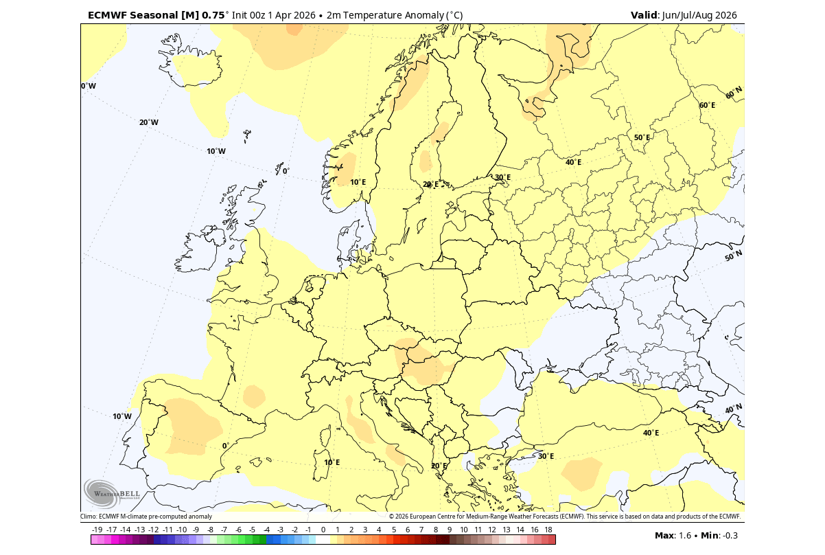
Europe: The Westerly/Southerly Flow
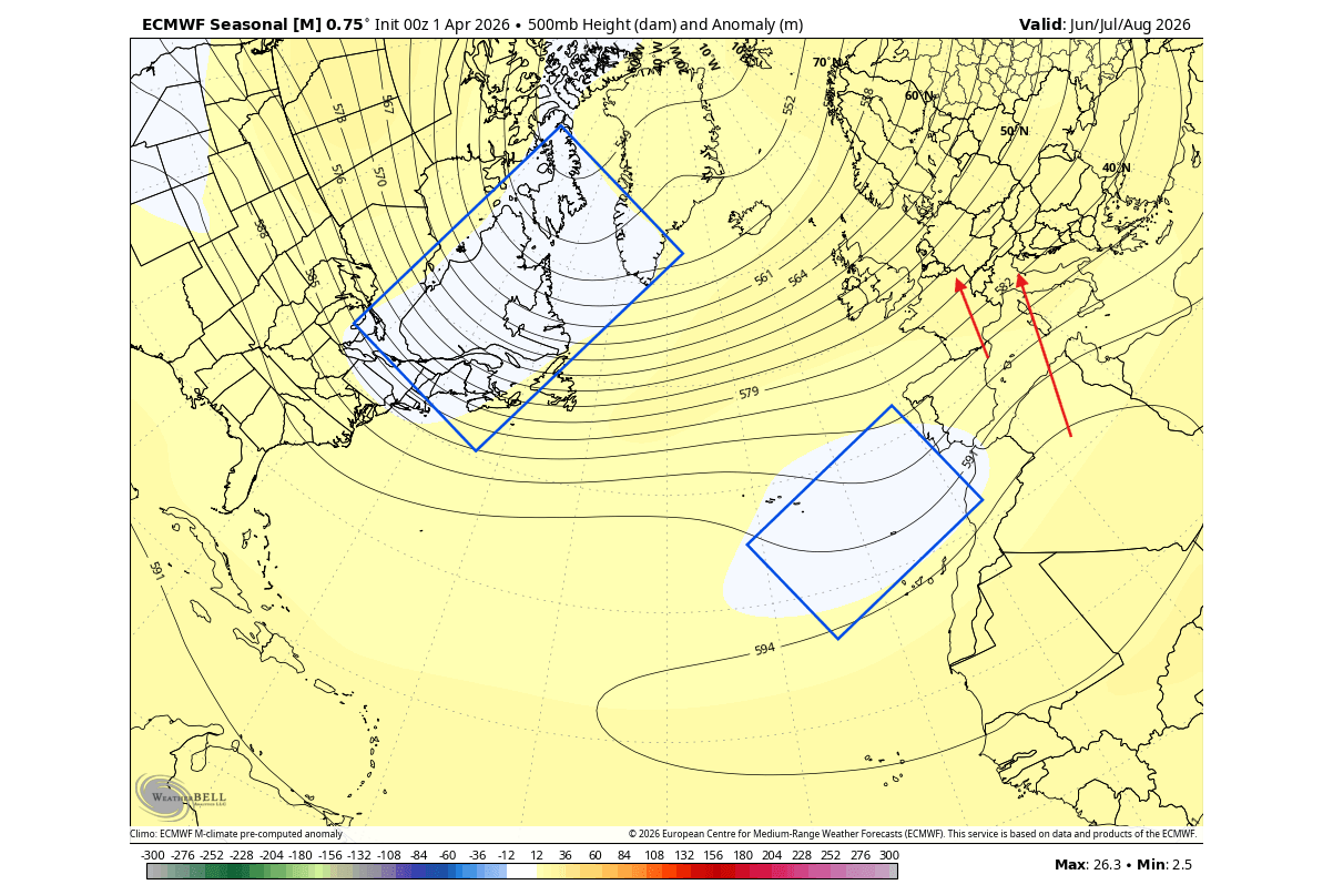
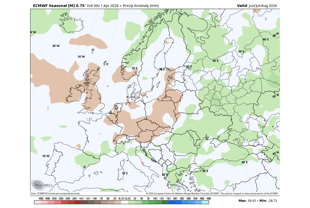
Across the Atlantic, the presence of a low-pressure zone near the Azores and southwestern Europe is set to dictate the continent’s summer. This configuration encourages a warmer, more humid southerly flow. While this provides some relief in western regions, the combination of high temperatures and localized precipitation patterns suggests a rising drought risk for Central Europe, as rainfall may be unevenly distributed compared to historical averages.
Official Responses and Meteorological Outlooks
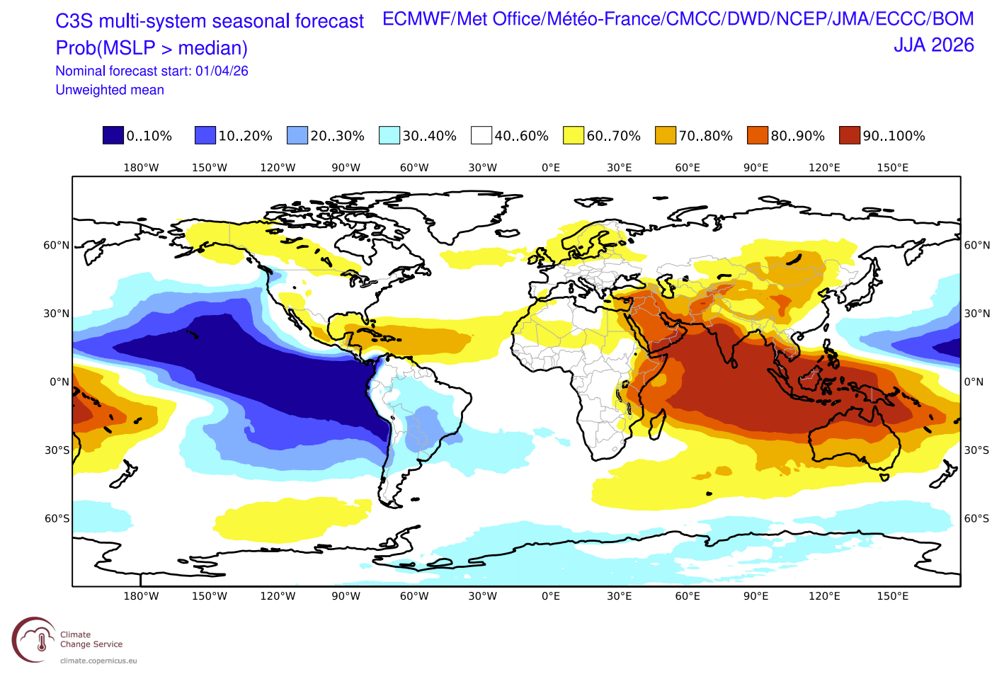
The NOAA/CPC (Climate Prediction Center) has issued outlooks that generally align with the long-range models, though with notable nuances.
NOAA vs. Global Models
NOAA’s official temperature outlook forecasts a broadly warmer-than-average summer for much of the U.S. However, it notably highlights a "normal" temperature band across the Midwest and East, aligning with the "low-pressure shield" effect identified by the ECMWF.
The primary discrepancy lies in the precipitation forecast. While global operational models suggest increased rainfall for the central U.S., NOAA’s outlook remains more conservative, pointing toward potential drying in the central and northwestern regions. Meteorologists expect these models to converge as the seasonal transition fully takes hold in the coming weeks.
The Atlantic Hurricane Season: A Natural Shield
Perhaps the most significant consequence of a 2026 Super El Niño is its role in the Atlantic hurricane season.
Why El Niño Suppresses Storms
El Niño is notorious for creating a hostile environment for Atlantic hurricanes through two primary mechanisms:
- Vertical Wind Shear: The El Niño circulation increases upper-level winds, which effectively "decapitate" developing tropical systems, preventing them from organizing into major hurricanes.
- Atmospheric Stability: The shift in global pressure creates a more stable, sinking air environment over the Atlantic basin, which suppresses the convection necessary for storm formation.
Implications for 2026
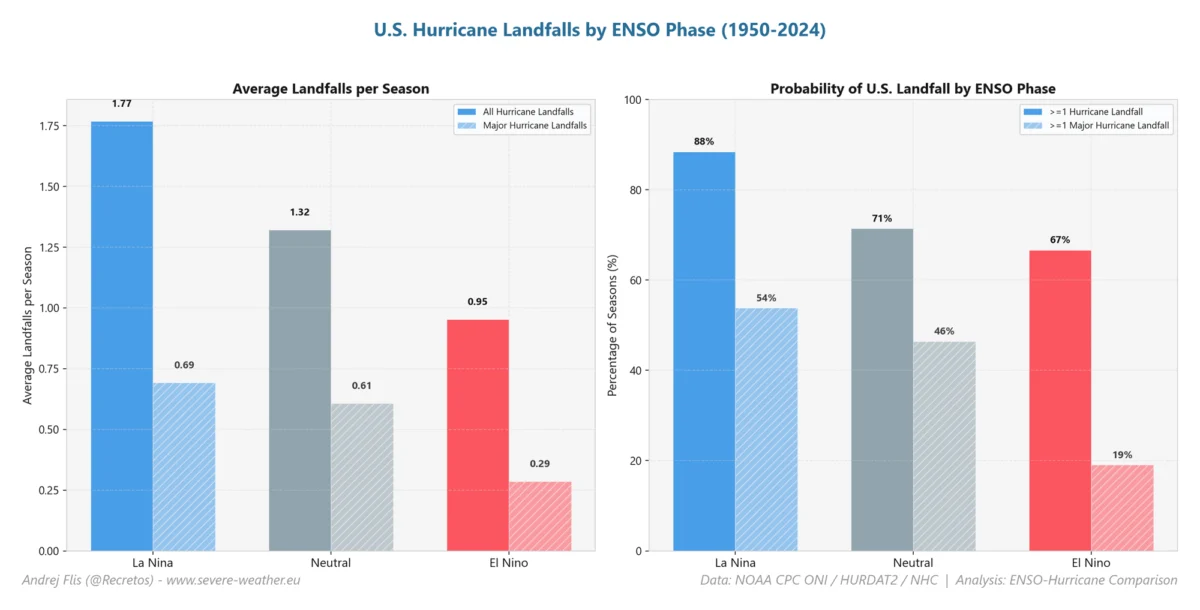
Data from previous Super El Niño years shows a significant reduction in tropical activity within the Main Development Region (MDR). Precipitation reanalysis confirms that tropical storm landfalls in the Caribbean and the U.S. Gulf Coast are historically less frequent during these phases.
While this serves as a "natural shield," it is not a guarantee of total safety. Even in strong El Niño years, individual storms can occasionally penetrate the atmospheric "cracks." However, the overarching statistical probability for a season of intense, land-falling hurricanes is markedly lower than during a neutral or La Niña year.
Conclusion: Preparing for a Shift
The Summer of 2026 will be defined by the rapid maturation of this Super El Niño. From the cooling of the Eastern U.S. by way of shifted jet streams to the increased drought risks in Central Europe and the suppression of Atlantic hurricane activity, the Pacific’s influence is absolute.
As we move through the next quarter, the focus of the meteorological community will remain on the placement of the low-pressure centers and the precise strength of the Kelvin wave’s impact on the surface. Residents in affected regions are encouraged to monitor local weather services, as the shift in the global circulation will likely result in a highly active and variable summer season.
For ongoing updates on the 2026/2027 winter implications, including the potential for Arctic sea ice loss and its feedback loops into the polar vortex, please continue to follow our seasonal analysis reports.