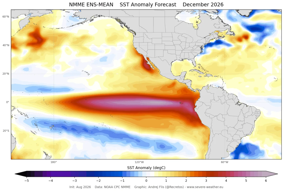
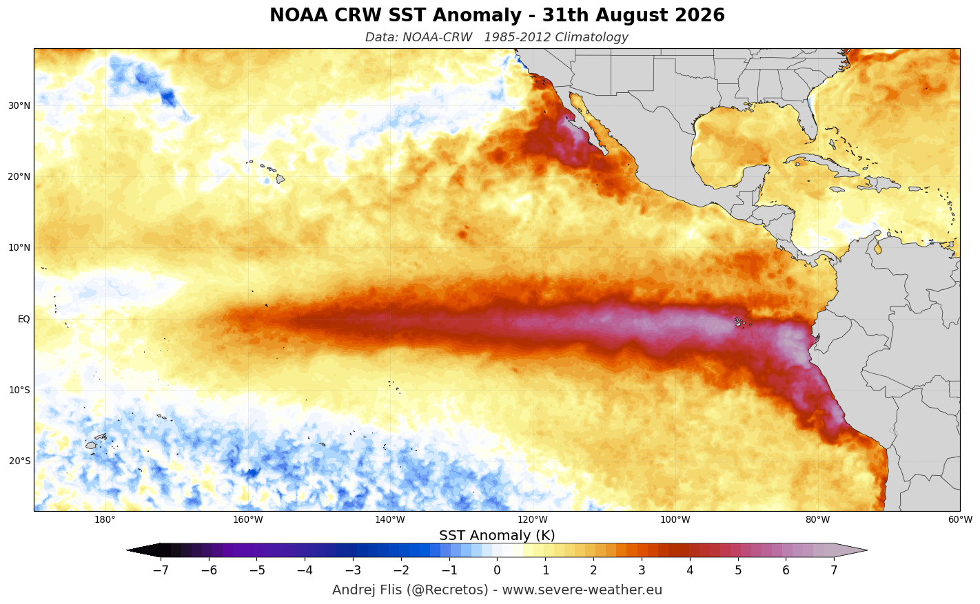
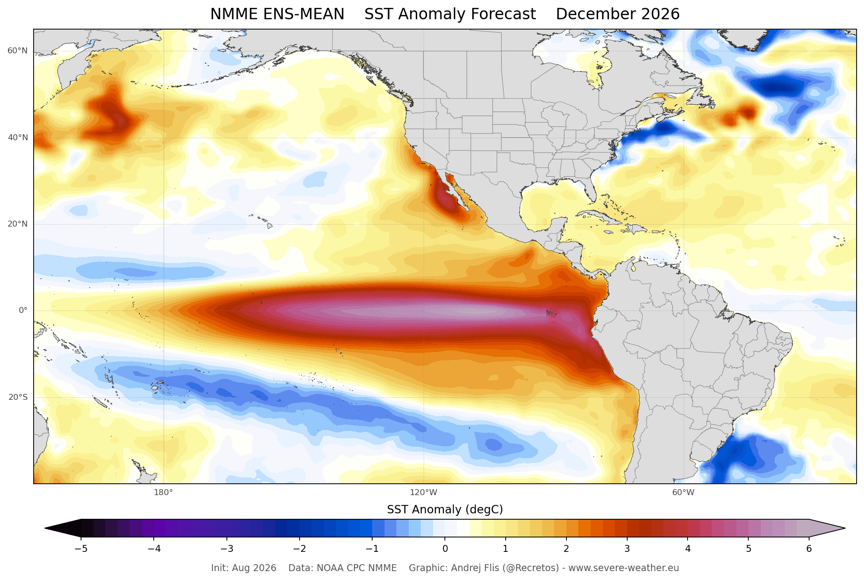
As we approach the winter of 2026/2027, the global meteorological community is bracing for the significant influence of a developing "Super El Niño." Forecast models from the European Centre for Medium-Range Weather Forecasts (ECMWF) and the UK Met Office (UKMO) indicate that this phenomenon is not merely a seasonal variation but a major driver of atmospheric circulation, poised to reshape snowfall patterns across North America and Europe. With ocean surface temperatures in the eastern Pacific peaking at over 6°C (10.8°F) above normal, this event is already tracking to be one of the most powerful on record.
Main Facts: A Historic Climate Driver
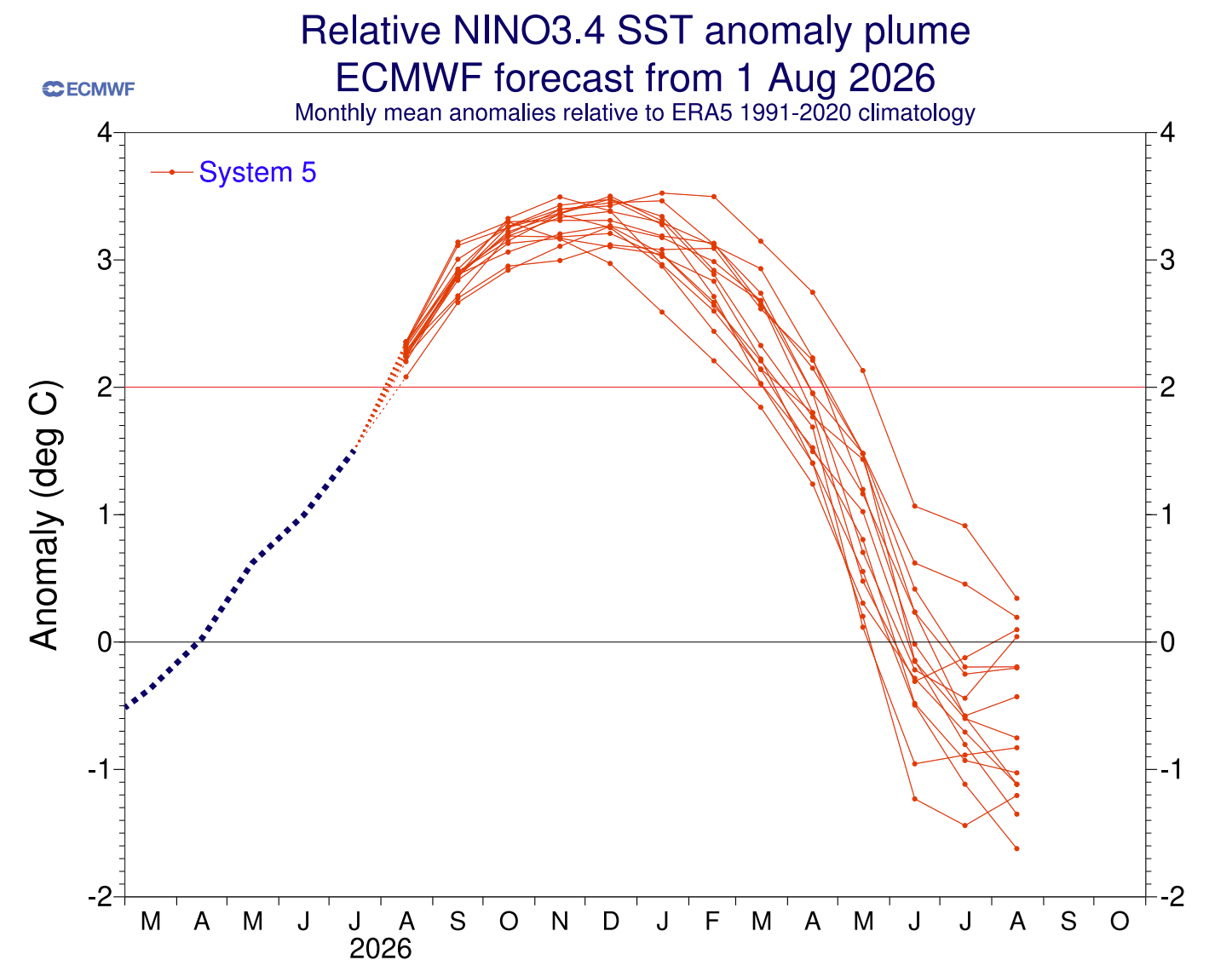
A "Super El Niño" is defined by sustained, extreme sea surface temperature anomalies in the tropical Pacific, typically exceeding the +2°C threshold. The current 2026 event has not only surpassed this benchmark but, according to the latest ECMWF extended seasonal models, is expected to peak with anomalies exceeding +3°C as we move toward December.
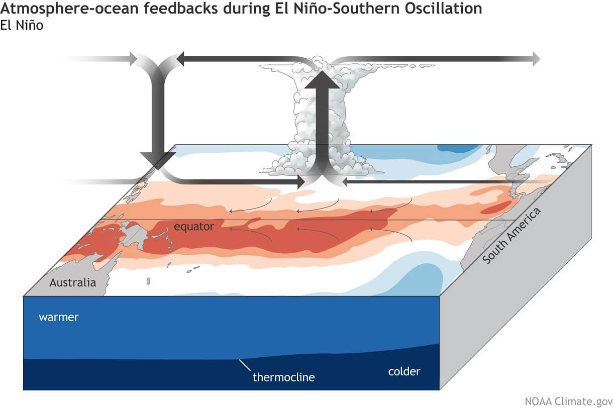
This oceanic warming fundamentally alters the "Walker Circulation"—the loop of air currents that dictates global rainfall and pressure. Under normal conditions, the western Pacific experiences stable, high-pressure weather, while the east remains cooler. During a Super El Niño, this dynamic reverses. Rising air in the central and eastern Pacific increases precipitation and suppresses pressure, while descending air in the west creates stable, high-pressure conditions. This "atmospheric bridge" acts as a steering mechanism for the jet stream, which in turn determines where snow will fall across the Northern Hemisphere.
Chronology of Development
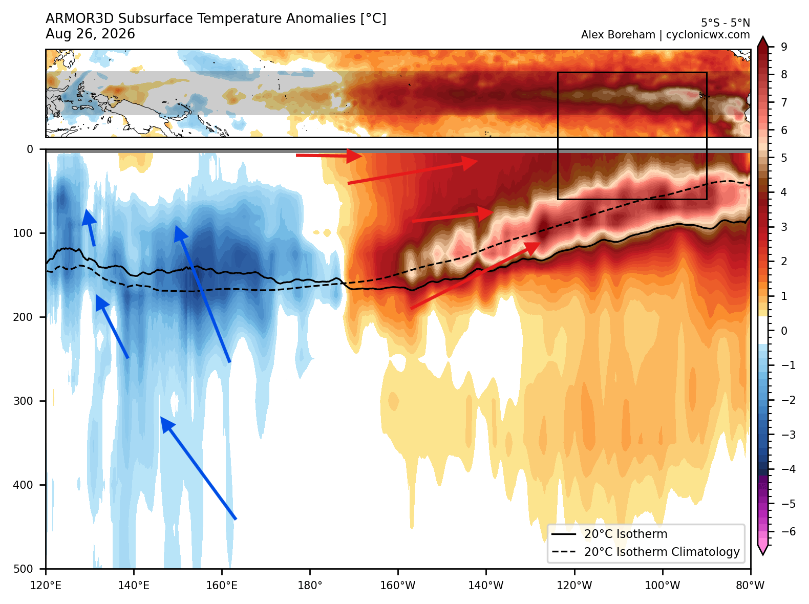
The intensification of this El Niño has been tracked via subsurface oceanic data, specifically the movement of "Kelvin Waves." These massive, warm-water currents move eastward beneath the surface of the Pacific. Recent data shows a powerful downwelling Kelvin Wave with subsurface anomalies exceeding 10°C (18°F) above average. This energy source is currently "surfacing," providing the necessary heat to sustain the El Niño deep into the winter months.
- Late Summer 2026: Initial surface anomalies began to connect with deep-water Kelvin Waves, signaling the transition to a "Super" event.
- Autumn 2026: Atmospheric feedback loops established a strong, amplified subtropical jet stream, setting the stage for winter precipitation anomalies.
- December 2026 (Projected): Forecast models anticipate the peak of the El Niño event. This is expected to be the primary catalyst for early-winter storm tracks in the United States and Canada.
- January–February 2027 (Projected): The secondary phase of the winter, where the established jet stream pattern will likely solidify snowfall deficits in the north and surpluses in the south.
Supporting Data: Regional Snowfall Projections
The North American Outlook
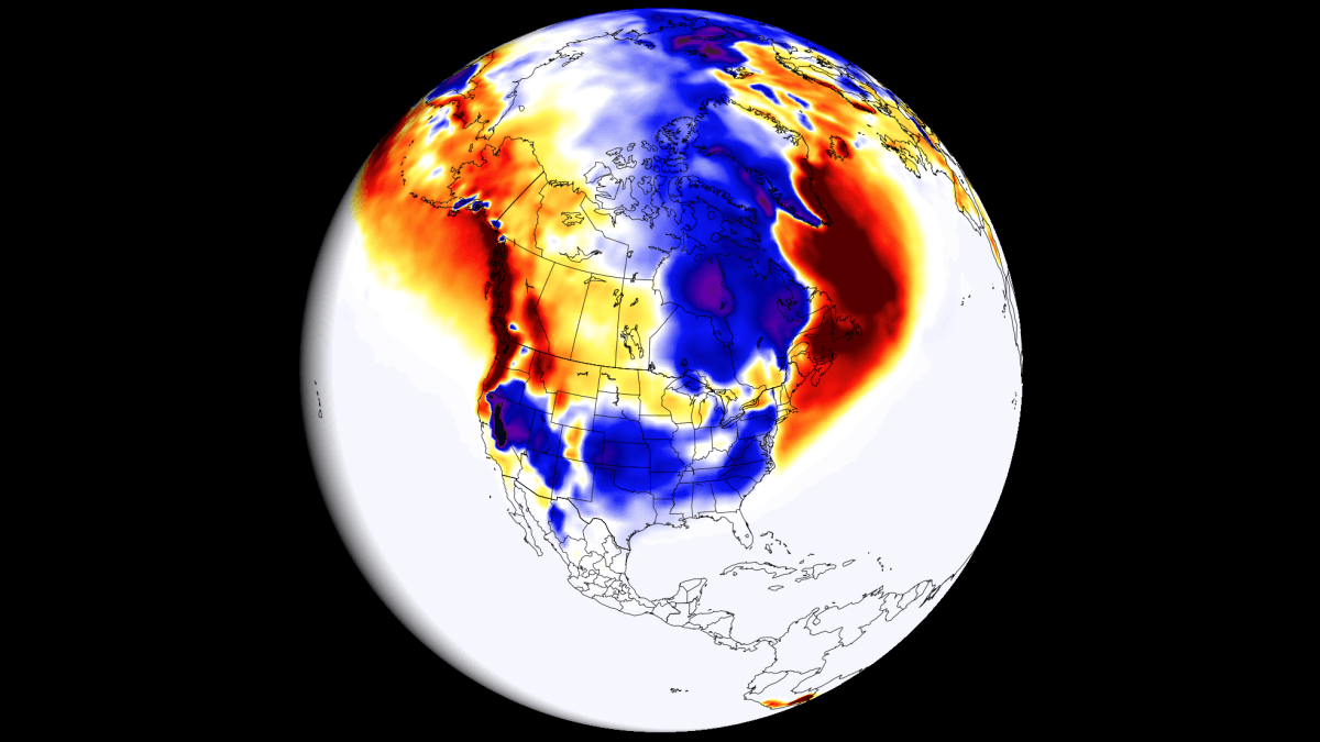
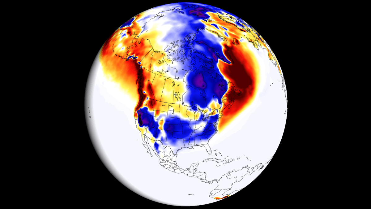
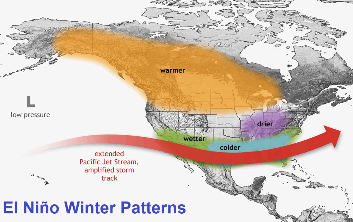
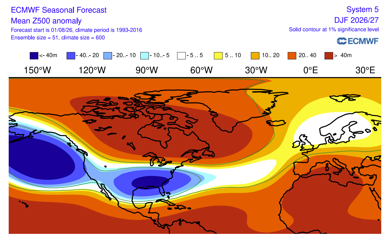
In North America, the primary impact of a Super El Niño is the strengthening and southward shift of the Pacific jet stream. By bringing lower pressure and cooler, moisture-rich air into the southern United States, the climate pattern creates a distinct contrast between the northern and southern latitudes.
United States and Canada Trends:
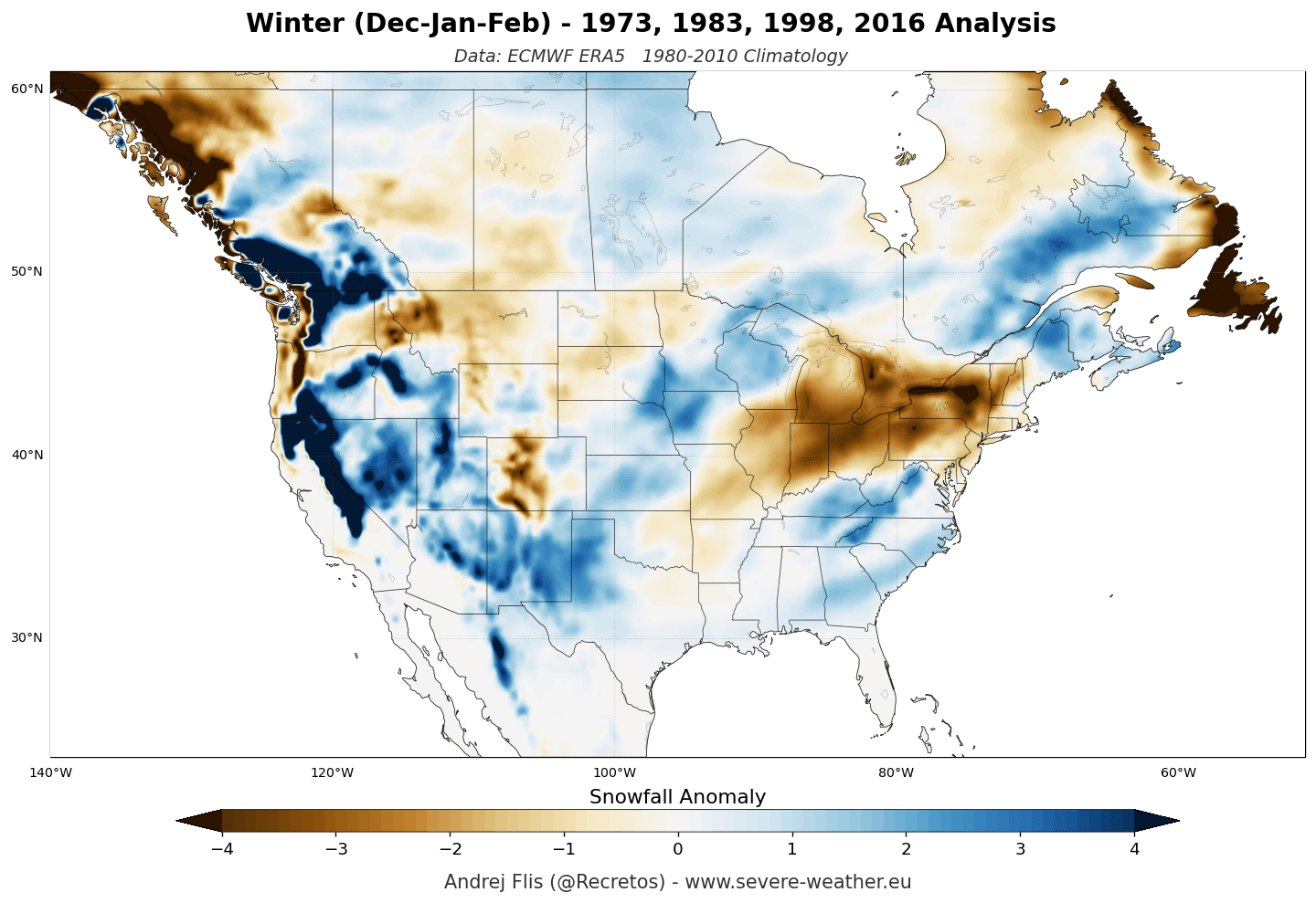
- The Southern and Central U.S.: Forecasts show significant potential for above-normal snowfall across the Sierra Nevada, the Four Corners, the Southern Rockies, and the Central Plains. As the jet stream remains active, these regions are projected to see increased storm activity, particularly in January and February.
- The Northern U.S. and Southern Canada: Conversely, the Pacific Northwest, the Great Lakes, and the Northeast are facing a potential snowfall deficit. A persistent high-pressure ridge over Canada acts as a barrier, limiting cold air intrusions and pushing storm tracks further south.
- The Texas Factor: Long-range ensemble data for Texas indicates a shift toward above-normal snowfall in mid-to-late winter. While absolute totals in these regions are generally lower, the upward trend relative to the 30-year average is a hallmark of the intensified southern storm track.
The European Perspective
Europe’s winter is predicted to be defined by a more dominant, mild westerly flow from the Atlantic. Both the ECMWF and UKMO models are in strong agreement: the upcoming season will likely be characterized by a "weak" snowfall outlook for much of the continent.
- Elevation is Key: For European ski resorts, the season will be highly dependent on altitude. Lowlands are projected to see consistent snowfall deficits. However, high-altitude regions (above 1,800–2,000 meters) in the Alps may still benefit from natural snowfall, provided the moisture-rich Atlantic flow hits the terrain at appropriate temperatures.
- Persistent High Pressure: A strong southerly high-pressure ridge is expected to dominate, preventing cold, continental air from reaching western and central Europe. This pattern generally results in higher-than-average temperatures, which significantly reduces the probability of sustained snow cover in northern, western, and central regions.
Official Meteorological Interpretations
Professional meteorological organizations emphasize that while these long-range forecasts provide vital trends, they are not "fixed" schedules. They are based on historical analogs—specifically, the last four Super El Niño events—and current ensemble modeling.
Research by Kunkel and Angel (1999) established the baseline for how strong El Niño events suppress northern snowfall while fueling southern storms. Modern studies continue to validate this, noting that when the Pacific jet stream is amplified, it effectively "steals" moisture from northern latitudes to feed southern cyclonic activity. Furthermore, 2011 research into East Coast winter storms suggests that during El Niño years, the interaction between the southern jet and Atlantic moisture can produce significant, if infrequent, high-impact storms for the Mid-Atlantic and New England, even if the seasonal average remains below normal.
Implications for the Season Ahead
The 2026/2027 winter season carries significant implications for various sectors, from agriculture and energy consumption to tourism.
- Ski Industry: Resorts in the Western and Southern U.S. can likely plan for a robust season. In contrast, operators in the Great Lakes and European lowlands should prepare for potential revenue volatility due to reduced snowpack.
- Water Management: The predicted increase in precipitation across the Southwestern U.S. and the Sierra Nevada is critical for drought recovery, as these regions rely heavily on the winter snowpack for spring runoff and water storage.
- Infrastructure and Energy: The potential for a milder winter in the northern U.S. and Europe may reduce heating demands, but the increased frequency of southern storm tracks in the U.S. could lead to high-impact flooding or heavy, wet snow events that strain power grids in traditionally warmer climates.
In summary, the Super El Niño of 2026/2027 is a dominant force that will create a "tale of two winters." While the northern regions of the Northern Hemisphere may experience a quieter, milder season, the southern half of the United States is poised for an active, potentially snowy winter. As we move deeper into the season, local weather agencies will refine these long-range projections with short-term, high-resolution data. For now, the consensus remains clear: prepare for a season defined by the shifting geography of the Pacific jet stream.