Executive Summary: A Disaster Unfolding
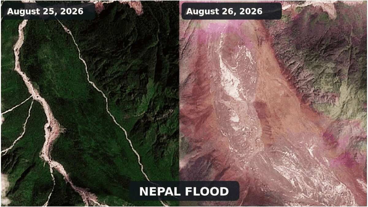
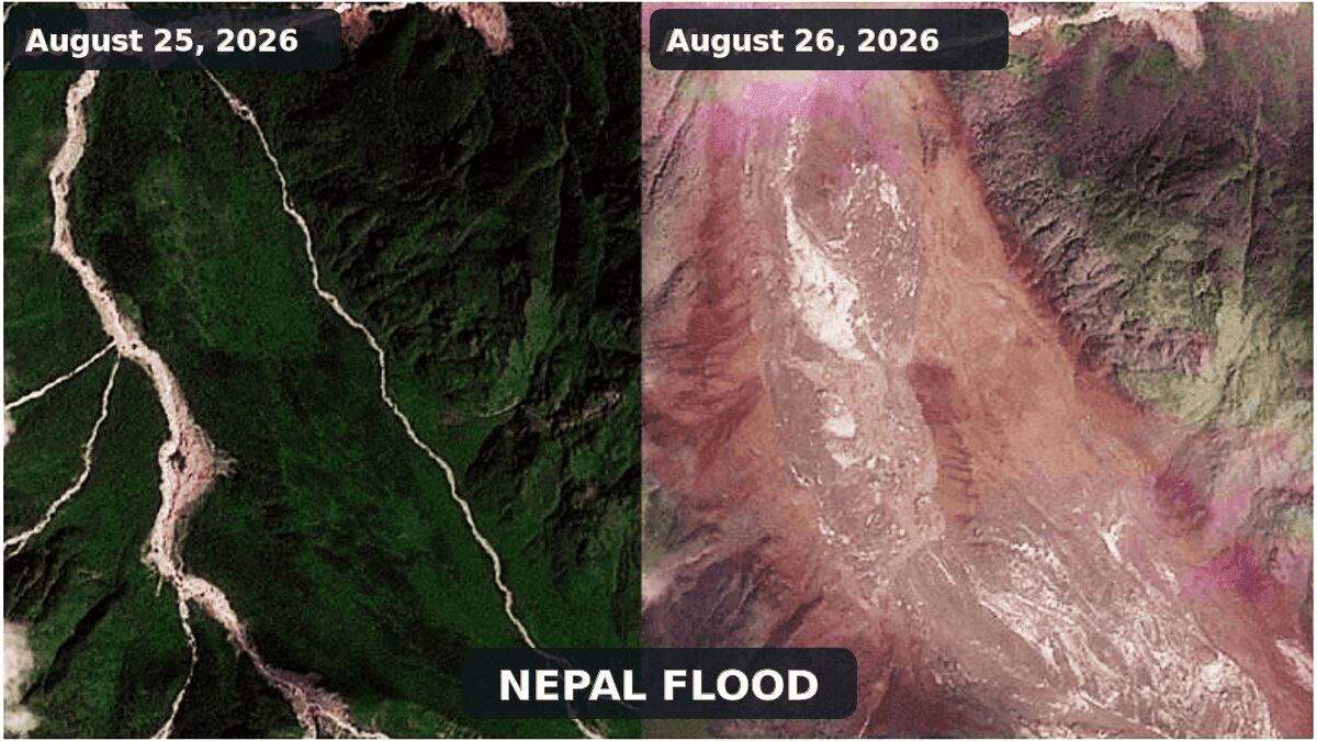
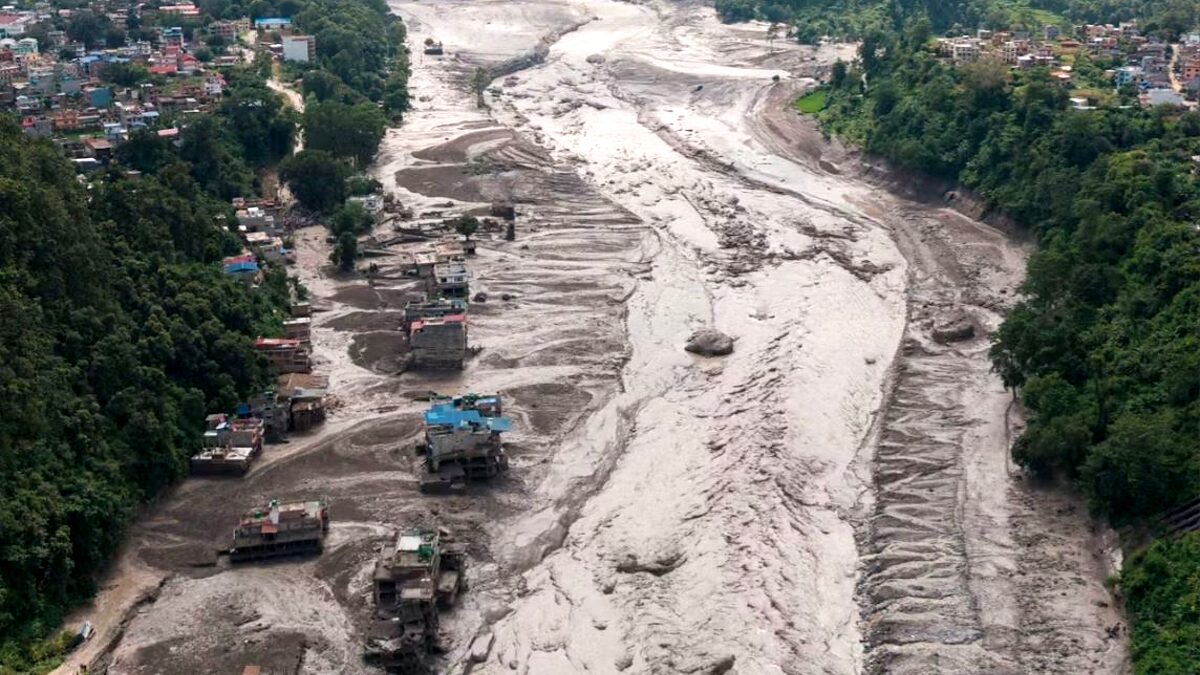
On August 26, 2026, the fragile equilibrium of the high-altitude Nepal-Tibet border region was violently shattered. A massive, high-energy surge of water, glacial ice, mud, and boulders tore through the Bhote Koshi-Trishuli river system, leaving a trail of destruction that obliterated settlements, critical hydropower infrastructure, and vital transit arteries.
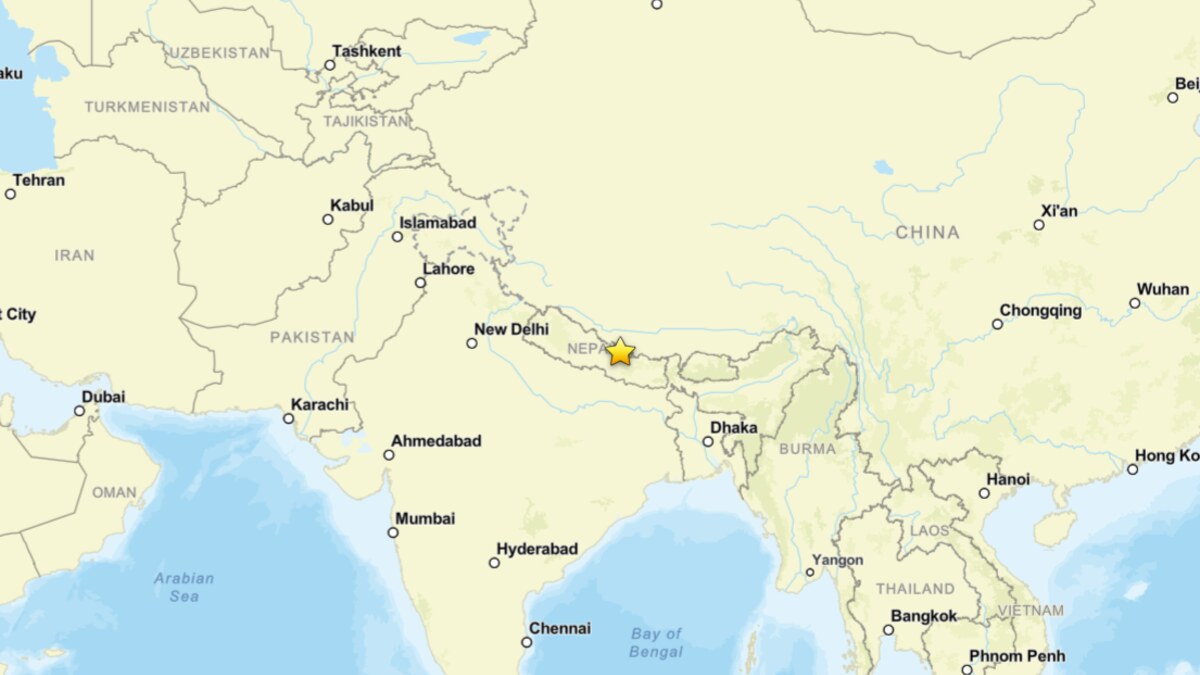
Initial reports from the Associated Press and other international outlets estimated at least 160 fatalities, with hundreds more—including local residents, migrant workers, and adventure tourists—reported missing. However, as rescue operations struggle against near-impassable terrain, authorities warn that these figures are likely significant underestimates. The disaster, which originated in the upper Lhende Khola, serves as a grim reminder of the cascading risks inherent in rapidly warming mountain environments. While initially misidentified as a seismic event or a Glacial Lake Outburst Flood (GLOF), scientific consensus now points to a complex, multi-stage failure: an ice and rock avalanche that induced a catastrophic dam-break flood.
Chronology of the Event: From Silence to Surge
The disaster unfolded with terrifying speed. According to data from the International Center for Integrated Mountain Development (ICIMOD) and satellite reconnaissance, the sequence began in the high-altitude reaches of the Lhende Khola, a tributary of the Bhote Koshi.
- Pre-Event Conditions: The region had been experiencing an exceptionally warm summer, leading to accelerated glacier thinning and the degradation of ice-bearing permafrost. These conditions, while not a direct "trigger," created a baseline of critical instability in the steep, glacierised slopes of the upper valley.
- The Collapse (August 26, morning): A colossal mass of bedrock, glacier ice, and snow detached from a steep slope. This was not a slow-moving event; it was a rapid, granular flow that reached velocities of tens of meters per second.
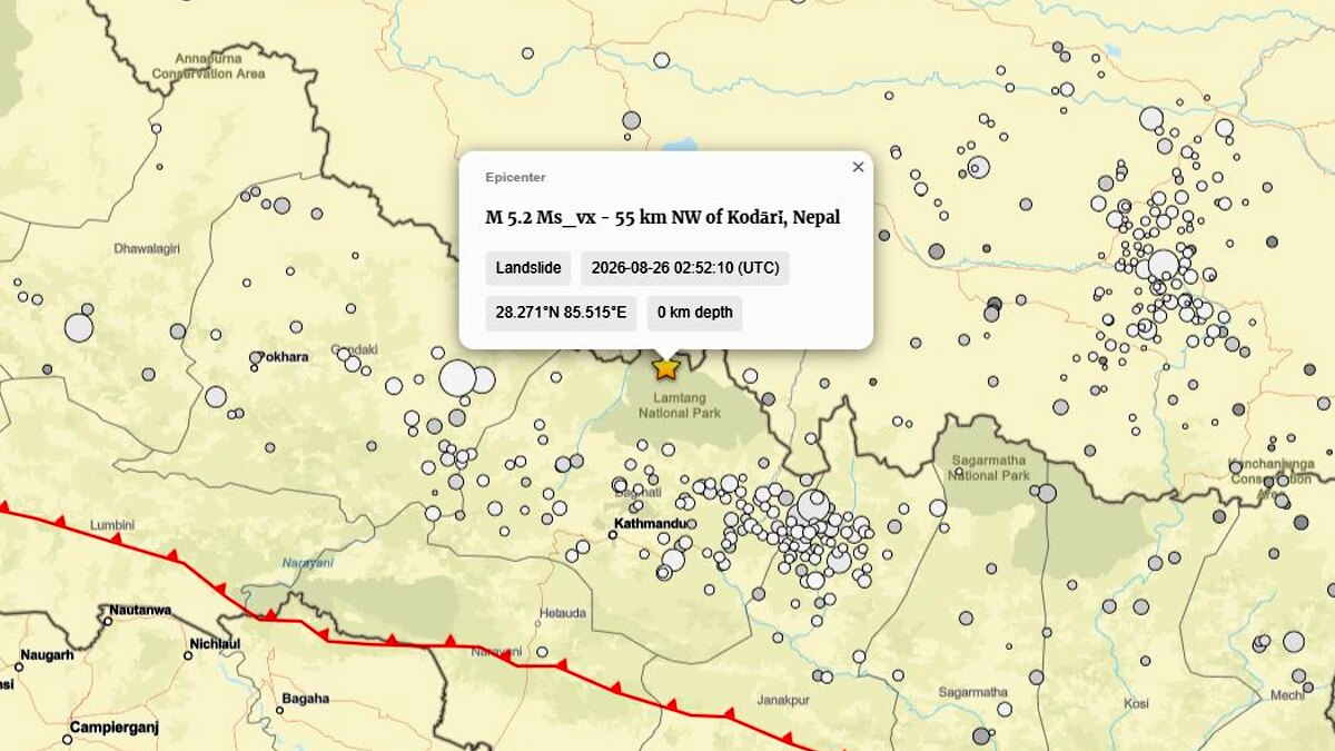
- The Seismic Signature: Early automated seismic monitors recorded a magnitude 4.4 earthquake near the Nepal-Tibet border. This led to initial confusion, with observers suspecting a tectonic trigger. However, subsequent analysis by the U.S. Geological Survey (USGS)—specifically event us7000tbwb—reclassified the signal as a magnitude 5.2 landslide. The "earthquake" was, in fact, the seismic energy generated by the mass movement itself as it impacted the valley floor.
- The River Blockage: Upon entering the narrow valley of the Lhende Khola, the avalanche deposited millions of cubic meters of debris, effectively creating a temporary, highly unstable dam.
- The Outburst: Water trapped behind this debris-laden barrier quickly overwhelmed the blockage. As the dam failed—likely through a combination of overtopping and internal erosion—a violent, sediment-rich surge roared downstream, raising water levels in the Trishuli river by as much as nine meters in under thirty minutes.
Supporting Data and Geophysical Analysis
The classification of this event as a "cascade" rather than a singular phenomenon is vital for understanding why it caused such disproportionate damage.
Why it was not a GLOF
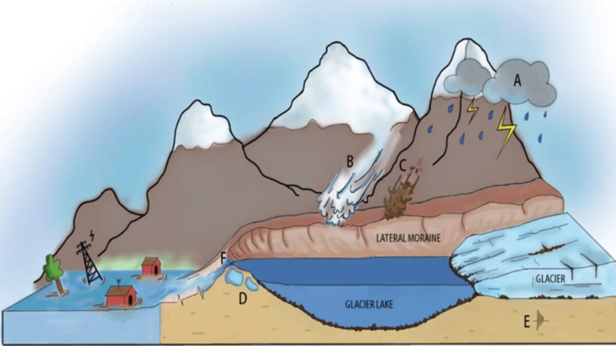
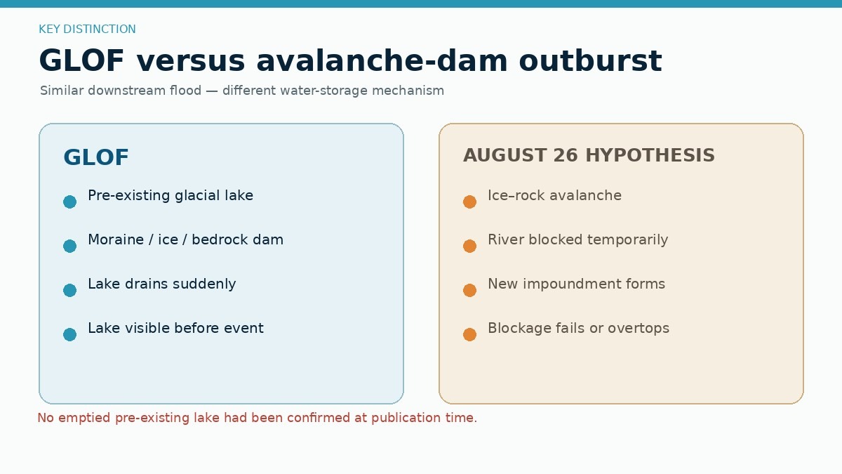
In the immediate aftermath, many labeled the event a "Glacial Lake Outburst Flood" (GLOF). While the symptoms—a sudden flood wave and massive debris transport—are similar, the mechanism differs fundamentally. A GLOF requires the presence of a pre-existing glacial lake (usually moraine-dammed) that breaches. Satellite imagery of the Lhende Khola has yet to confirm the drainage of a primary, long-standing lake. Instead, the evidence points to a landslide-dam outburst flood, where the lake was created only seconds before its destruction by the avalanche deposit itself.
Comparative Case Studies: Marmolada and Blatten
To contextualize the disaster, scientists are looking to recent alpine events:
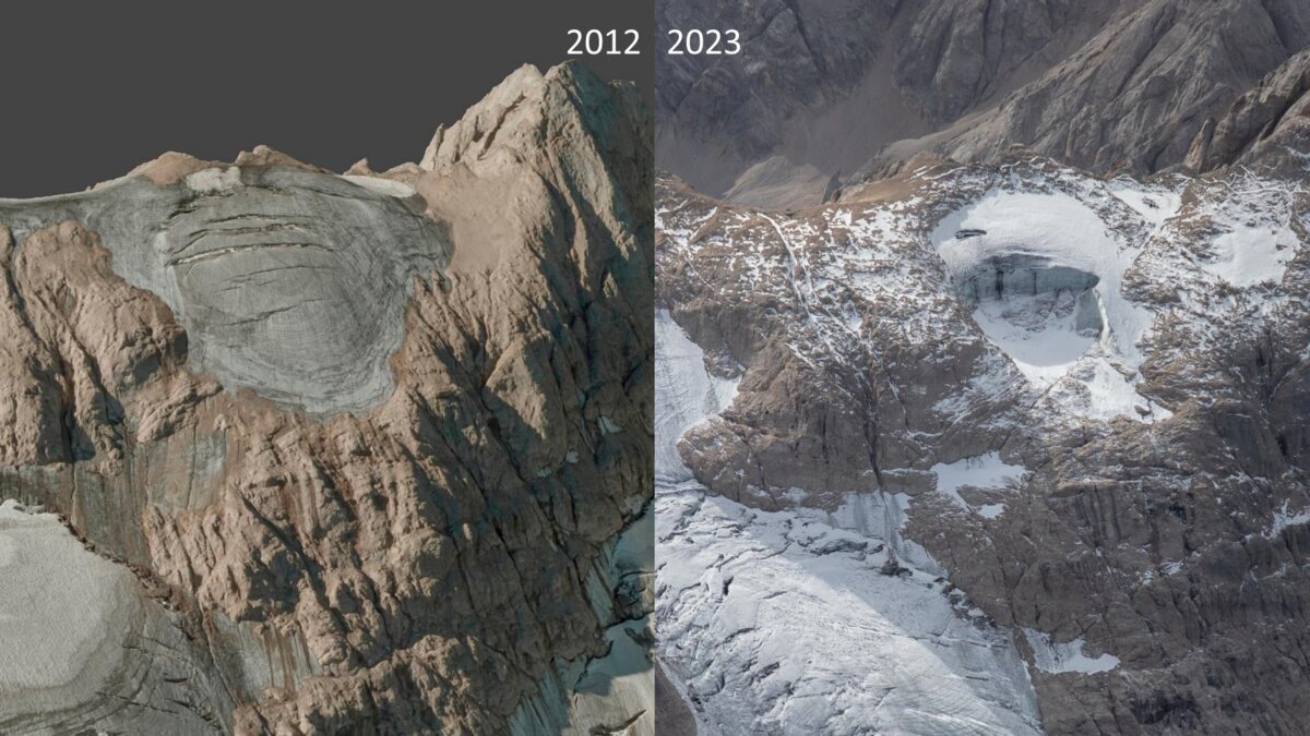
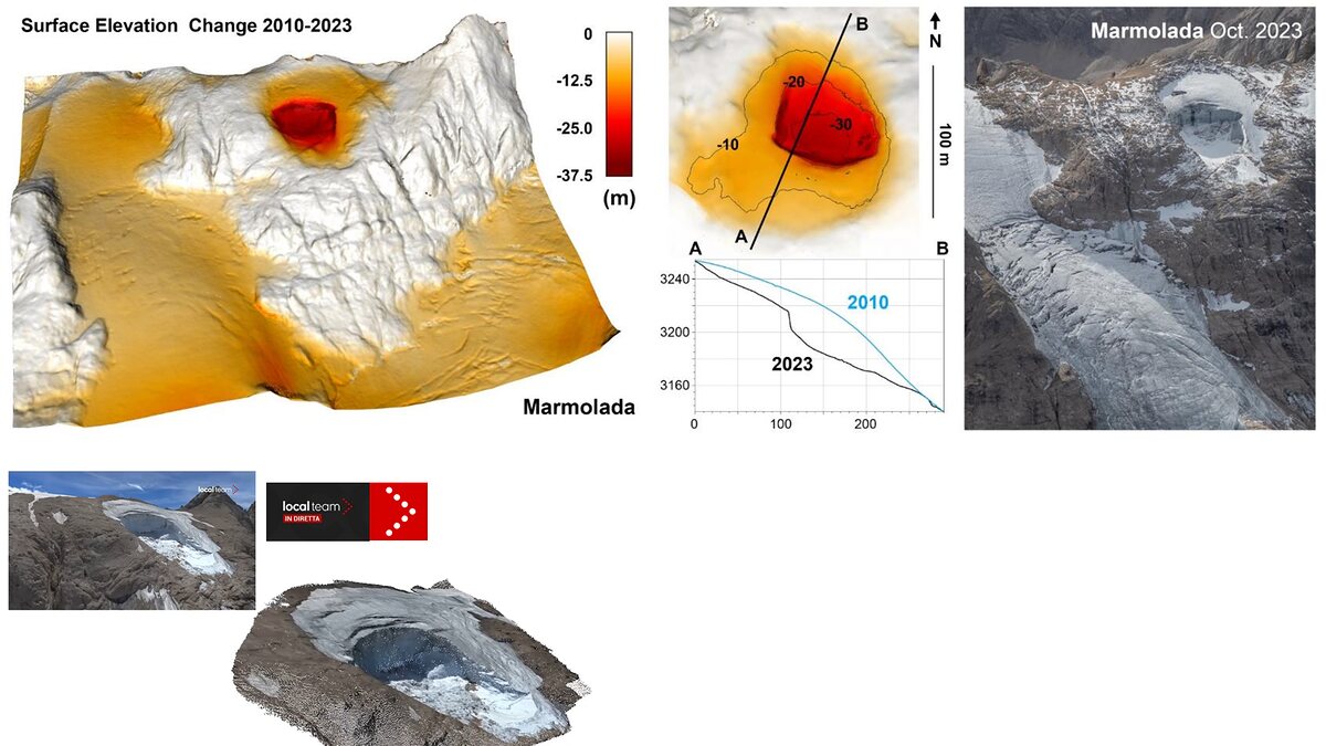
- Marmolada (Italy, 2022): A collapse of 70,000 cubic meters of ice killed 11 people. Like the Nepal event, it was triggered by a combination of hydrostatic pressure and reduced basal friction due to extreme heat. It serves as a reminder that glacier collapses can occur without seismic intervention.
- Blatten (Switzerland, 2025): A more direct analog. A rock and ice avalanche from the Birch Glacier involved 9.5 million cubic meters of material. The Blatten disaster demonstrated the "domino effect": rockfall loaded the glacier, triggering a massive collapse that subsequently dammed the Lonza River. The Nepal-Tibet event appears to follow this exact geophysical trajectory.
Official Responses and Rescue Challenges
The transboundary nature of the disaster has hampered the initial response. With the Bhote Koshi flowing from the Tibetan Plateau into Nepal, the disaster effectively bridged two jurisdictions with different disaster management protocols.
The Nepalese government, supported by international agencies, has prioritized search and rescue in the Rasuwa district. However, the destruction of bridges and roads has created a "last mile" problem that makes the deployment of heavy machinery nearly impossible.
"We are dealing with a landscape that has been rearranged," noted one local emergency coordinator. "Traditional evacuation routes are buried, and the river morphology has changed so drastically that we are essentially operating on a new map."
International scientific bodies, including ICIMOD, are calling for a shift in how these disasters are monitored. Current early warning systems are largely designed to detect GLOFs by monitoring static lake volumes. The Nepal-Tibet disaster underscores the need for real-time monitoring of "unstable glacierised slopes" and the deployment of seismic sensors capable of distinguishing between tectonic activity and mass wasting in real-time to trigger automated downstream alarms.
Implications: The "New Normal" in the Himalayas
The disaster serves as a sobering indicator of the changing environmental baseline in the Hindu Kush Himalaya.
The Climate Attribution Dilemma
While there is a temptation to blame the event solely on climate change, scientists urge caution. Climate change is undeniably warming the Hindu Kush Himalaya, causing glaciers to retreat and exposing fractured rock walls that were previously supported by ice. This increases the probability of slope failure. However, an individual avalanche is often the result of a "perfect storm" of local geology, fracture geometry, and short-term weather events (such as intense, localized rainfall or heatwaves). Attribution of this specific disaster to climate change is premature, though it is clear that the environment in which such disasters occur is becoming increasingly hazardous.
The Infrastructure Crisis
The rapid development of hydropower in Himalayan valleys creates a paradox. While these projects are vital for regional energy transition, they often place high-value, fixed infrastructure in the path of geomorphological processes that are currently poorly understood. The destruction of these installations on August 26 highlights the need for more rigorous geological risk assessments that account for cascading slope-to-river failures, rather than just flood-plain mapping.
Future Monitoring Needs
The most critical implication is the challenge of transboundary warning. Hazard signals do not respect national borders. The disaster has highlighted a desperate need for:
- Integrated Monitoring Networks: Linking satellite data from both Nepal and China to track glacier velocity and slope deformation.
- Seismic-Hydrological Integration: Using seismic sensors to provide instantaneous alerts of mass movements to hydrological gauging stations downstream.
- Community Education: Moving beyond the "GLOF" narrative to ensure local populations understand the threat of sudden, avalanche-induced floods, which may occur with little warning even in areas without known glacial lakes.
Conclusion: A Lesson in Complexity
The tragedy of August 26, 2026, is a stark lesson in the complexity of mountain hazards. It was not merely a flood, nor was it just an avalanche; it was a cascading chain of events that demonstrated the terrifying power of high-mountain geomorphology.
As the recovery efforts continue, the scientific community must work to decode the specific mechanics of the Lhende Khola failure. The reclassification of the event by the USGS from an earthquake to a landslide is a crucial piece of the puzzle—it shifts the narrative from "tectonic bad luck" to "predictable geomorphological hazard."
For the people of the Bhote Koshi and Trishuli valleys, and indeed for all high-mountain communities, the message is clear: the mountains are changing. As the cryosphere continues to thin and melt, the hazards of the past are no longer reliable indicators of the risks of the future. Understanding these cascades—and acting on that knowledge through better monitoring and smarter infrastructure placement—is the only way to mitigate the devastation of the next inevitable collapse.