As autumn settles across the Northern Hemisphere, meteorologists have turned their gaze toward a critical atmospheric engine: the Polar Vortex. Recent stratospheric data indicates that this massive, spinning collection of cold air is currently forming over the North Pole. While the vortex is beginning the season with a robust, healthy structure, long-range forecasts are painting a complex picture for the upcoming 2026/2027 winter season.
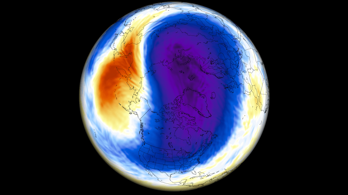
Experts are noting a significant signal of mid-winter instability. Driven by a strengthening "Super El Niño" in the Pacific, the atmospheric conditions appear primed for a potential slowdown or even a major disruption of the vortex. For residents across the United States, Canada, and Europe, understanding these dynamics is essential, as the behavior of this high-altitude circulation often dictates the severity of winter’s bite.
Main Facts: Understanding the Polar Vortex
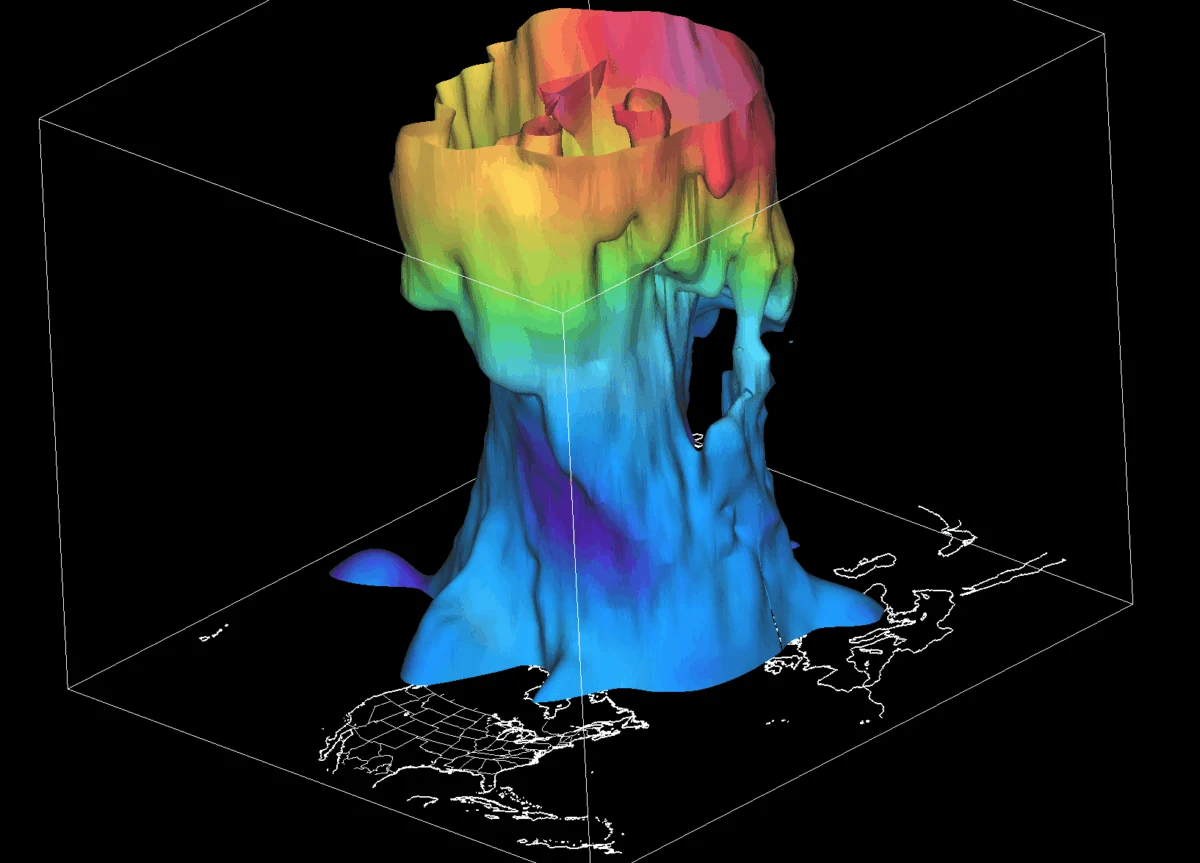
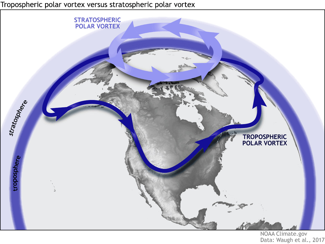
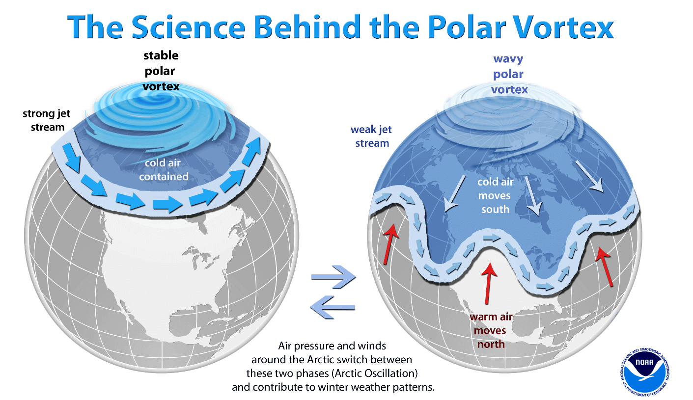
To understand the stakes for the coming winter, one must first grasp the nature of the Polar Vortex. Often misunderstood as a single storm, it is actually a broad, persistent, large-scale cyclone that circulates over the polar regions. It exists in two distinct layers of the atmosphere: the stratosphere (the upper layer, roughly 12–50 km high) and the troposphere (the lower layer where our daily weather occurs).
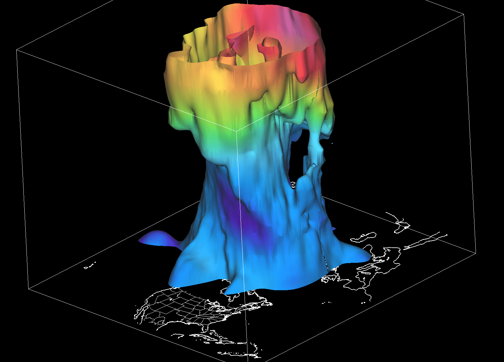
The stratospheric portion of the vortex is typically symmetrical and incredibly powerful, acting as a containment vessel for frigid Arctic air. In contrast, the tropospheric portion is "wobbly" and deformed by mountain ranges and large-scale pressure systems. When the vortex is strong, it acts as a cage, trapping the coldest air within the Arctic Circle. However, when it weakens or becomes "distorted," those cold, icy air masses can break free, spilling southward and triggering the severe winter storms and prolonged Arctic outbreaks that define hazardous winters in the mid-latitudes.
Chronology of Development: From Autumnal Cooling to Winter Instability
The formation of the Polar Vortex is a seasonal process that begins in late August and intensifies through September and October. As the polar regions lose sunlight, temperatures plummet, creating a sharp thermal gradient between the Arctic and the warmer mid-latitudes. This temperature difference causes pressure to drop, fueling the development of a cyclonic circulation.
September: The Initial Build-Up
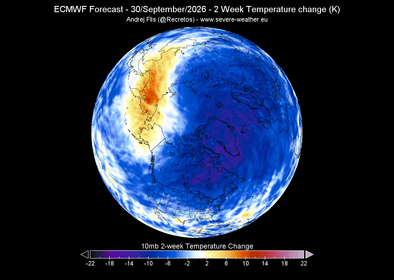
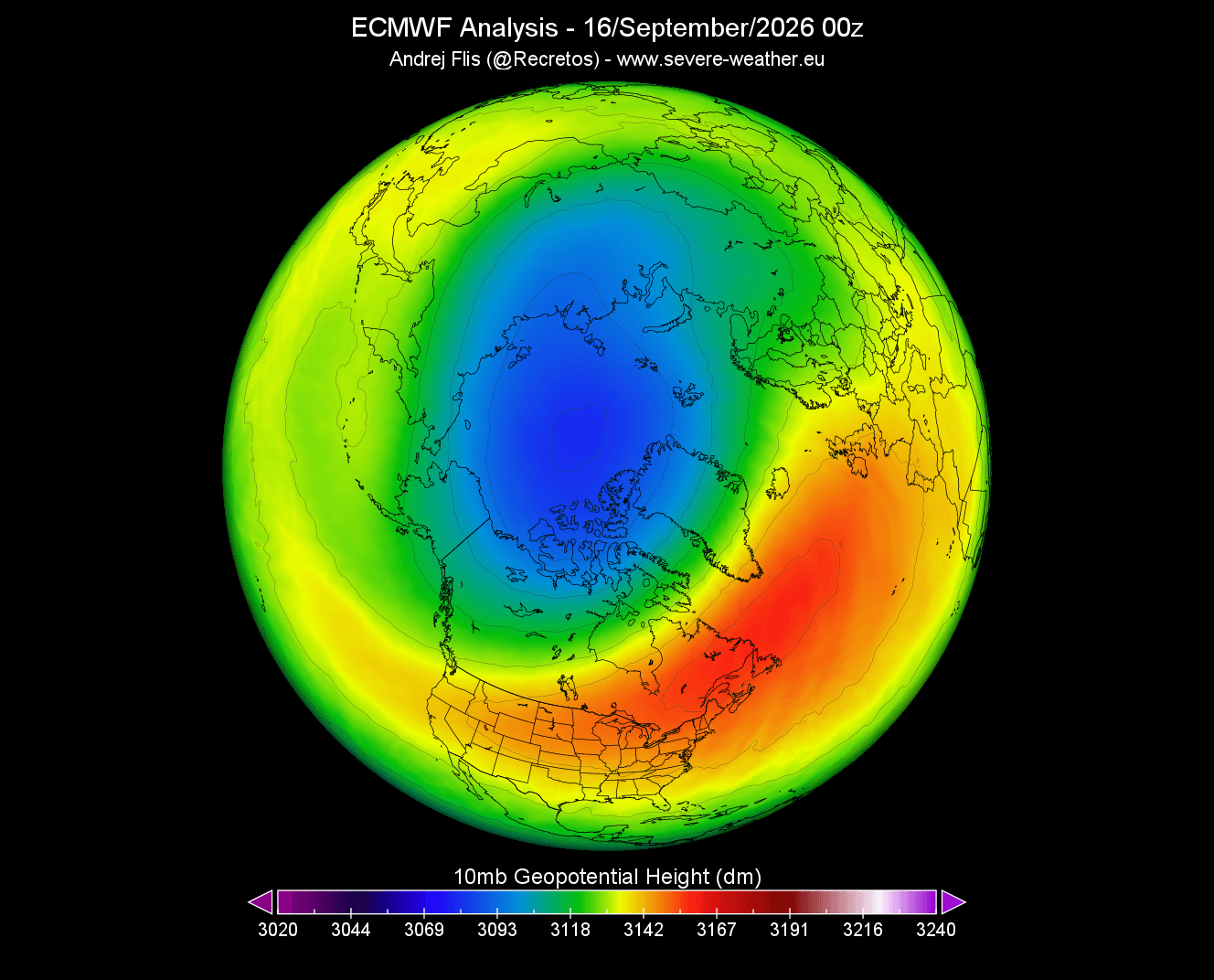
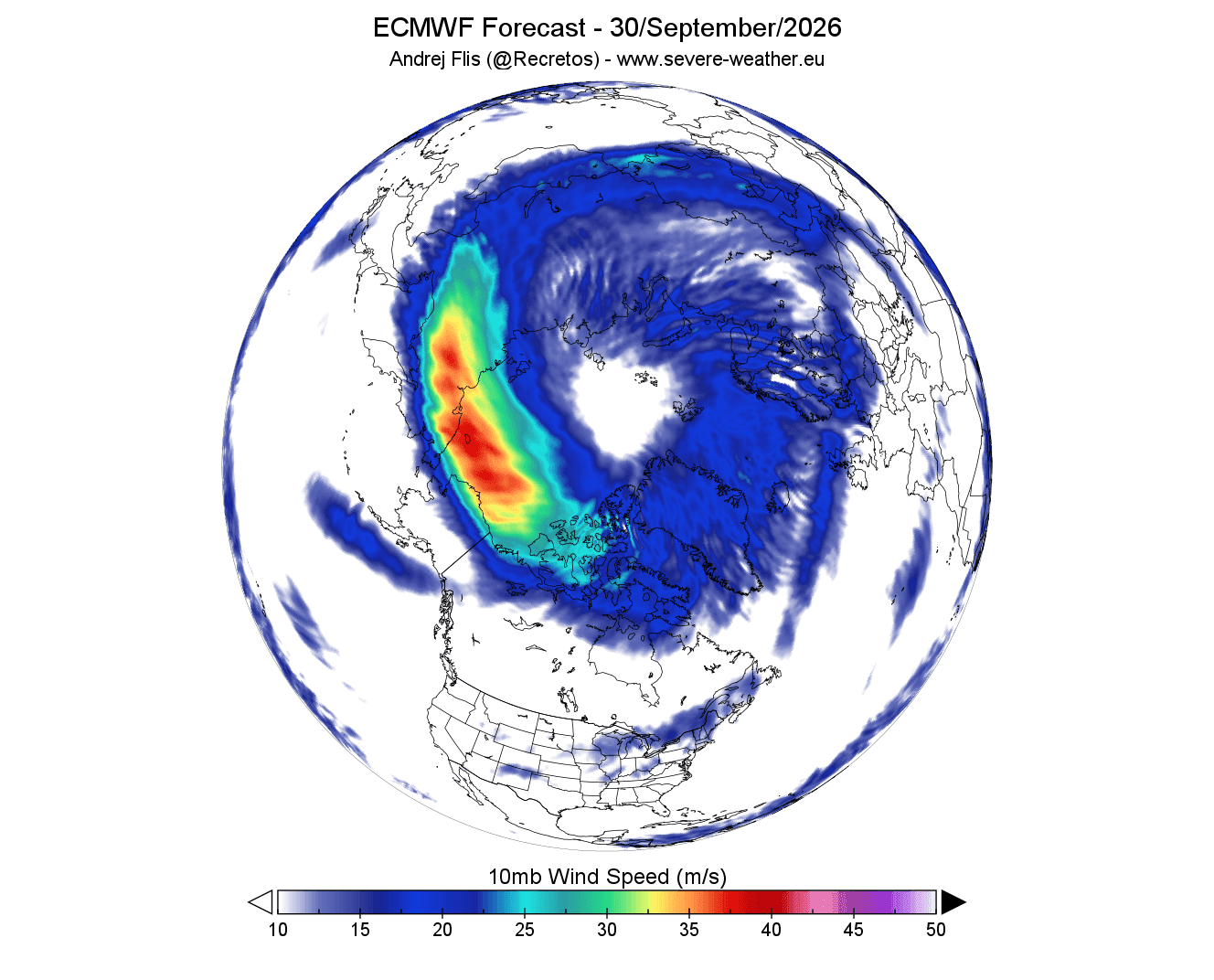
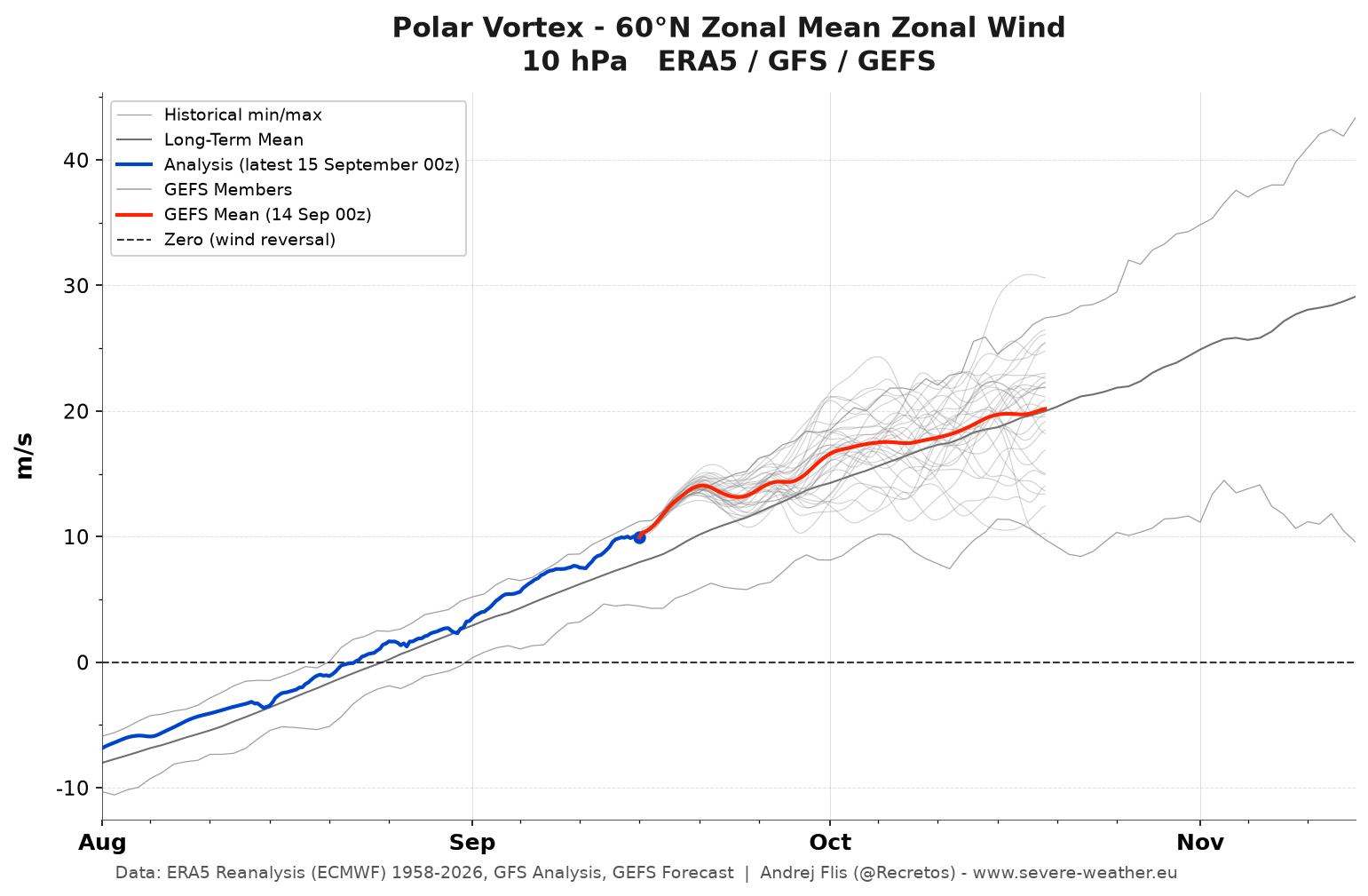
Current atmospheric monitoring shows that the vortex is currently in its growth phase. Late-September data reveals a well-defined, closed-low pressure center at the 10mb level (approximately 30 km altitude). This confirms that the vortex is currently "on schedule" and, if anything, slightly more robust than average for this time of year.
October and November: Strengthening Trends
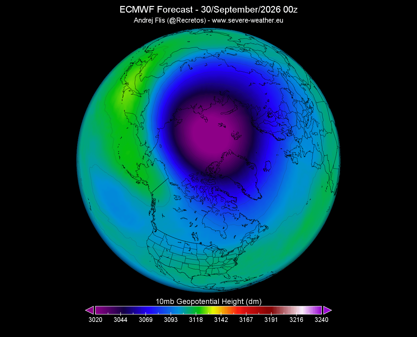
Forecast models, including the ECMWF (European Centre for Medium-Range Weather Forecasts), suggest the vortex will continue to deepen and widen through the remainder of the autumn. During this period, the "stratospheric night jet"—a powerful wind stream surrounding the vortex—will organize into a stable, circular flow.
December to February: The Turning Point
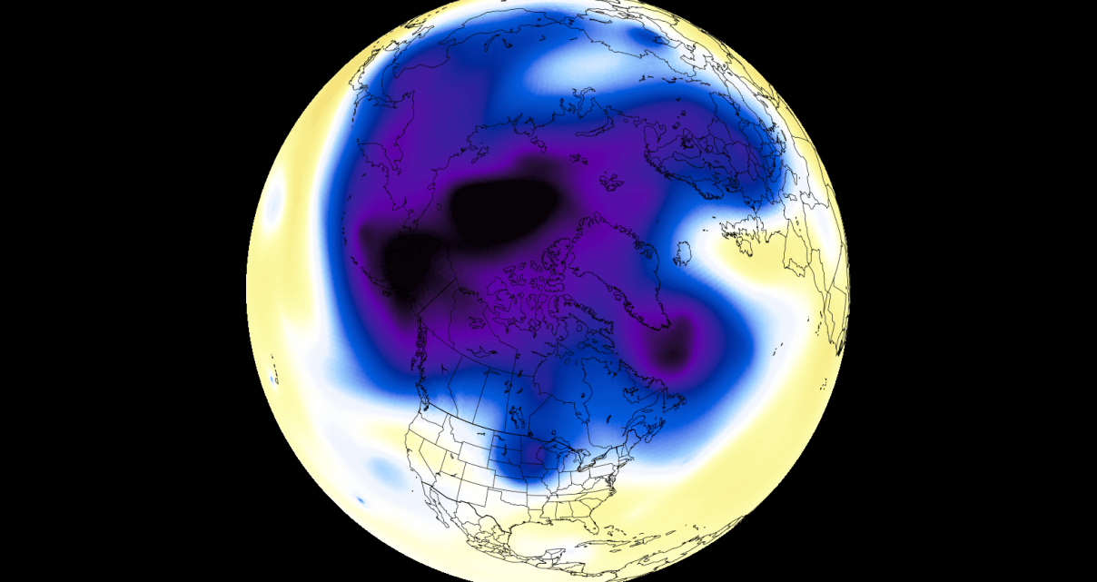
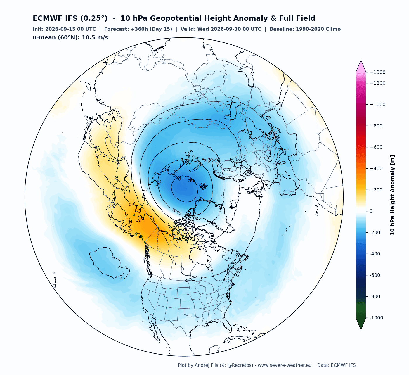
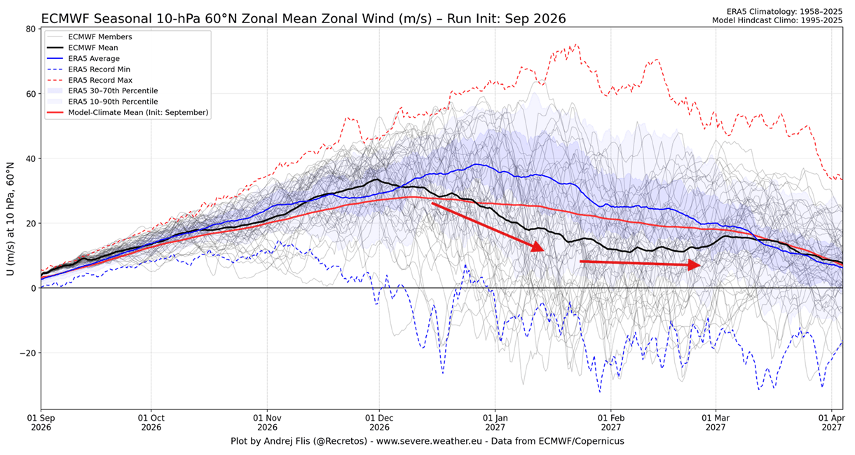
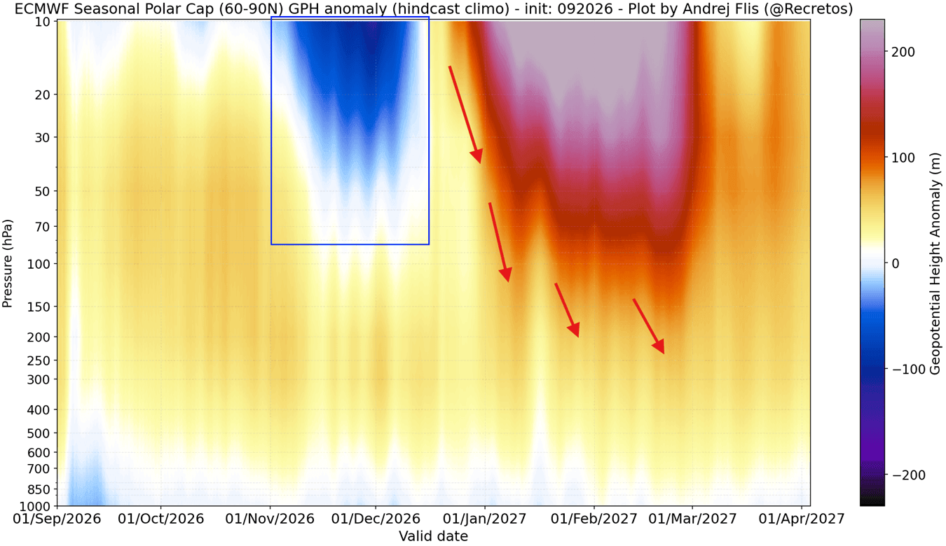
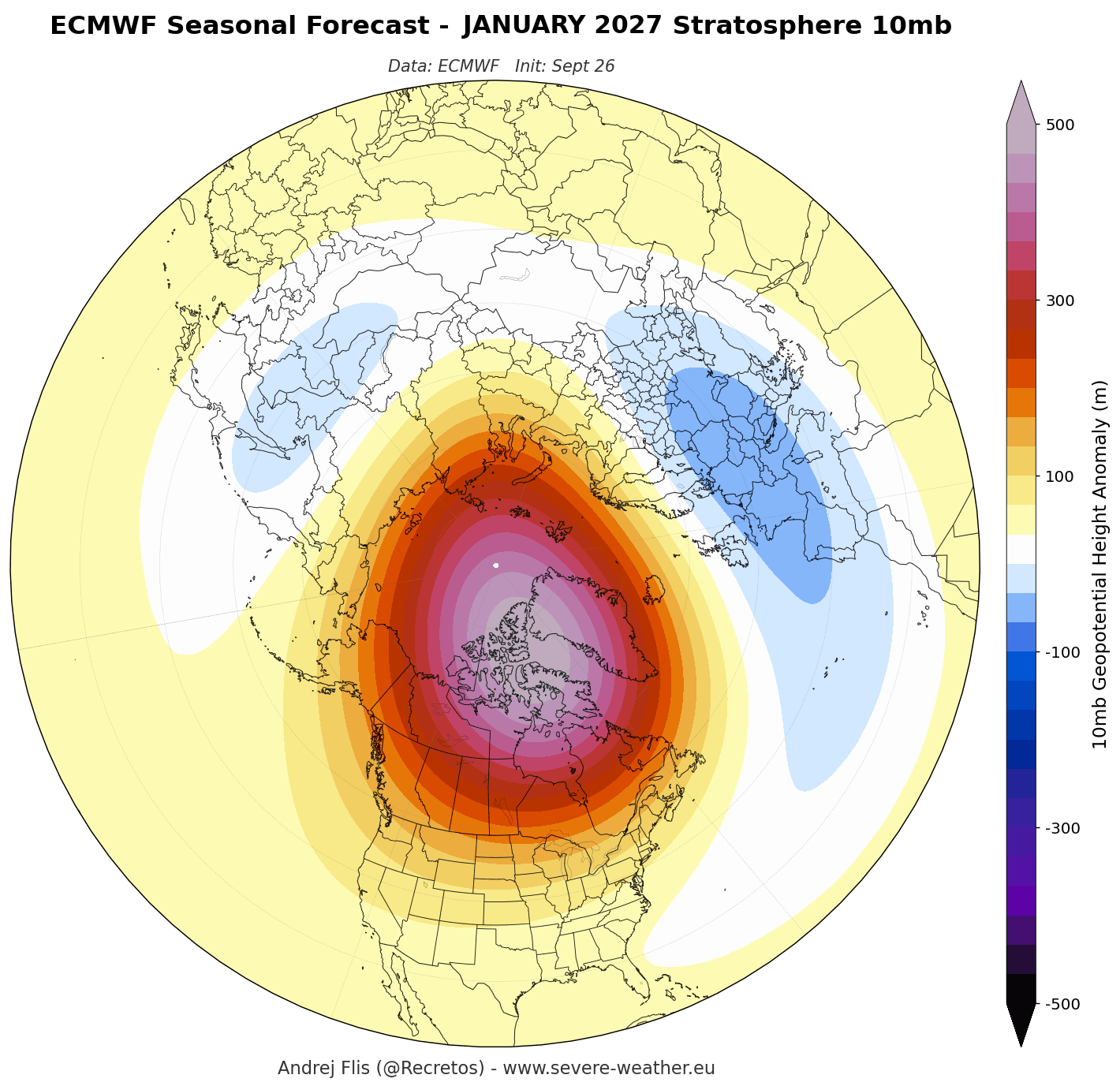
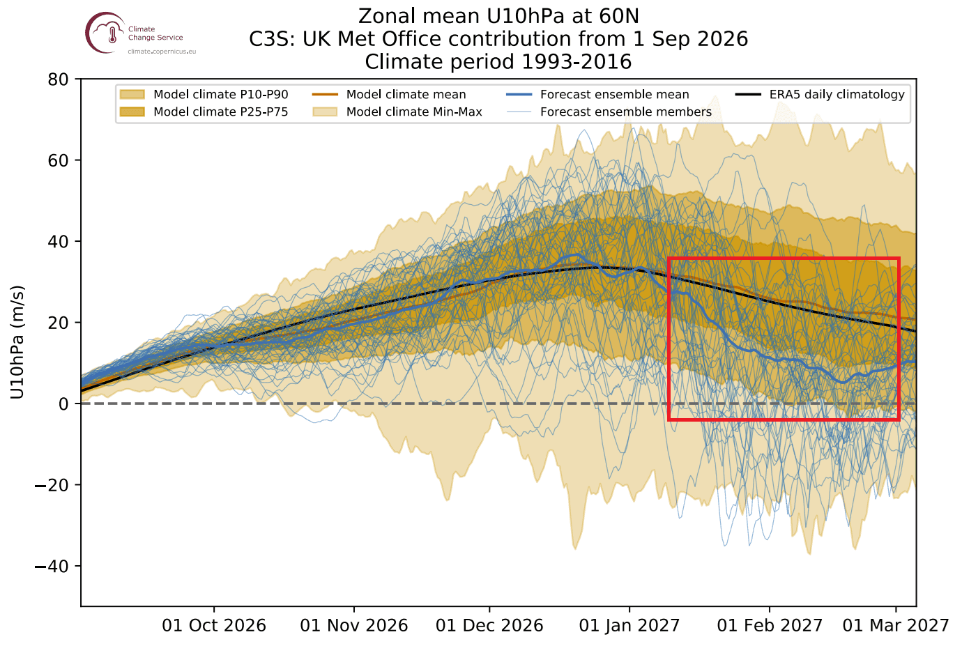
While the early season appears stable, the seasonal outlooks for mid-winter (January and February 2027) diverge sharply. Both the ECMWF and UKMO models are flagging a high-pressure anomaly developing in the stratosphere. This is a critical indicator of a weakening vortex. As high pressure encroaches, it disrupts the polar circulation, slowing wind speeds and potentially initiating a "deceleration" event.
Supporting Data: The Super El Niño Connection
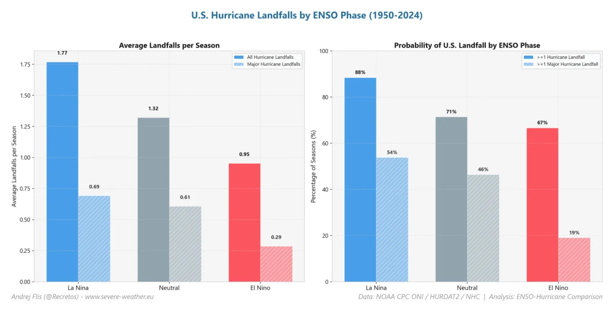
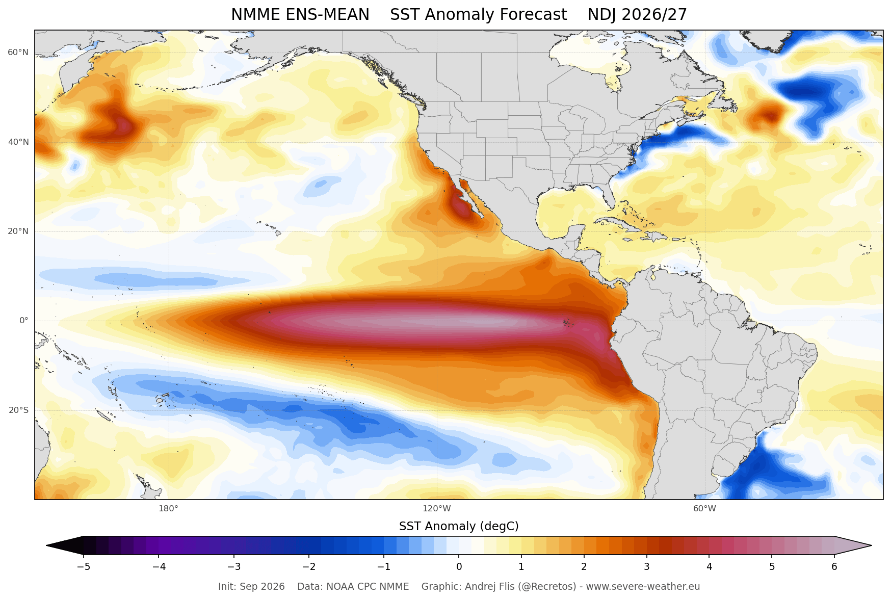
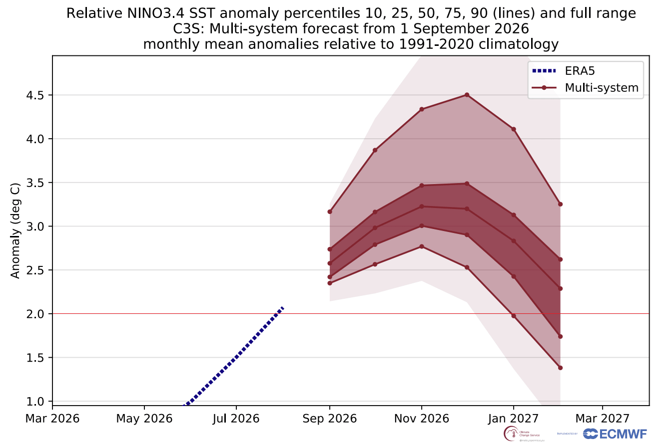
Perhaps the most significant variable for Winter 2026/2027 is the development of a powerful Super El Niño event in the tropical Pacific. Oceanic anomalies are already reaching levels that suggest one of the strongest events in recent decades.
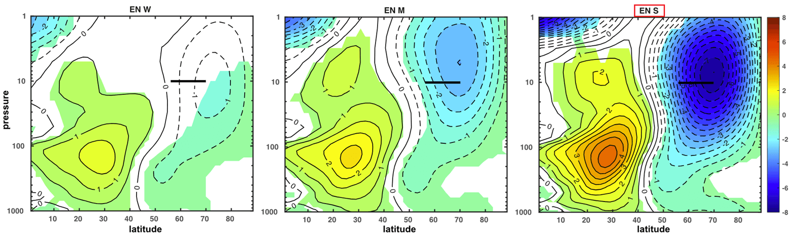
Scientific research has long established a link between El Niño and stratospheric stability. A strong El Niño alters the behavior of planetary waves—massive, undulating air currents that travel from the troposphere into the stratosphere. When these waves are amplified by a Super El Niño, they can exert significant pressure on the Polar Vortex, "bumping" against its structure and forcing it to distort or even split.
Data from recent climate simulations shows that in years with strong El Niño, the stratospheric winds frequently experience a deceleration. This creates a "feedback loop" where the tropical ocean temperatures directly influence the strength of the Arctic circulation, effectively bridging the gap between equatorial heat and polar cold.
Implications: The Potential for a "Polar Vortex Collapse"
The primary concern for meteorologists is a "Sudden Stratospheric Warming" (SSW) event. This is the most dramatic disruption possible, where temperatures in the stratosphere spike by several tens of degrees Celsius in just a few days.
The Mechanics of Collapse
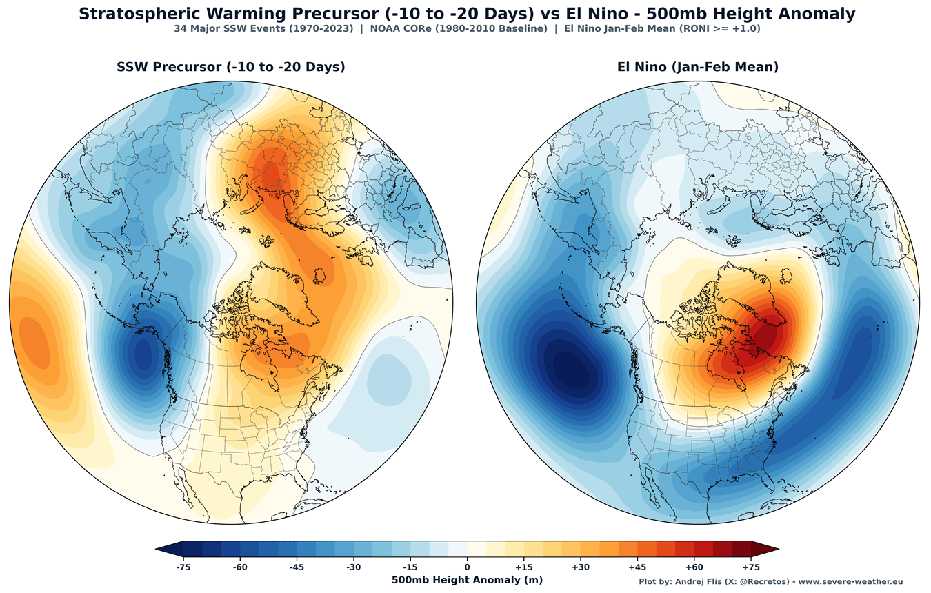
An SSW event often leads to a full reversal of stratospheric winds. When this happens, the vortex can be displaced from the pole or even split into two distinct, smaller cores. Because the stratosphere is "coupled" to the lower atmosphere, a major SSW event acts like a delayed-action trigger. After the warming occurs in the upper atmosphere, a high-pressure wave propagates downward, often leading to a surface-level weather reaction within 10 to 30 days.
Regional Weather Impacts
The aftermath of an SSW event or a major vortex disruption is rarely uniform, but it consistently leads to high-impact weather:
- United States and Canada: A disrupted vortex often pushes the "Polar Express"—a direct channel of Arctic air—into the Central and Eastern United States. This can result in sustained sub-zero temperatures, heavy snow, and blizzard conditions.
- Europe: Similarly, a weakened vortex allows cold, polar air masses to bypass the usual shielding of the jet stream, often bringing deep freezes to Northern and Central Europe.
Historically, such disruptions during Super El Niño years have led to record-breaking winter conditions. For instance, the winter of 2015/2016 saw a stretched, deformed vortex that delivered significant cold outbreaks across the Northern Hemisphere.
Official Perspectives and Meteorological Consensus
While long-range seasonal forecasting is inherently probabilistic, the current consensus among major global weather models is that the 2026/2027 season is at high risk for mid-winter volatility. It is important to note that a "disruption" does not always mean a full collapse; sometimes, the vortex merely elongates, which is sufficient to trigger cold waves.
Meteorologists emphasize that the specific impact of any given disruption depends on the pre-existing weather patterns in the troposphere. If a disruption occurs while the North Atlantic Oscillation (NAO) is in a certain phase, the cold air might favor Europe; if the configuration is different, it might favor North America.
Preparing for a Volatile Winter
As we move into the heart of the 2026/2027 season, the global scientific community will be monitoring the stratospheric winds with unprecedented precision. The combination of an early-season strong vortex followed by a mid-winter weakening trend is a scenario that demands vigilance.
Residents in the Northern Hemisphere should remain aware of long-range forecasts as the winter progresses. While a strong start to the season might suggest a mild beginning, the mid-winter window (January/February) appears to be the period of highest risk for significant atmospheric instability. As data continues to pour in, meteorologists will be looking for the tell-tale "warming signals" in the stratosphere that could act as the final indicator of a potential winter-altering event.
The story of Winter 2026/2027 will ultimately be written in the skies above the North Pole, where the delicate balance between the tropical oceans and the Arctic cold will determine the season’s legacy.