As the world approaches the winter season of 2026/2027, the global climate landscape is undergoing a profound transformation. Meteorologists and climatological research centers are closely monitoring the emergence of a "Super El Niño"—a climate phenomenon defined by extreme ocean-atmosphere coupling in the tropical Pacific. This event, now exhibiting record-breaking intensity, is poised to reshape jet streams, alter storm tracks, and dictate temperature and snowfall patterns across North America and Europe.

Main Facts: The Anatomy of a Super El Niño
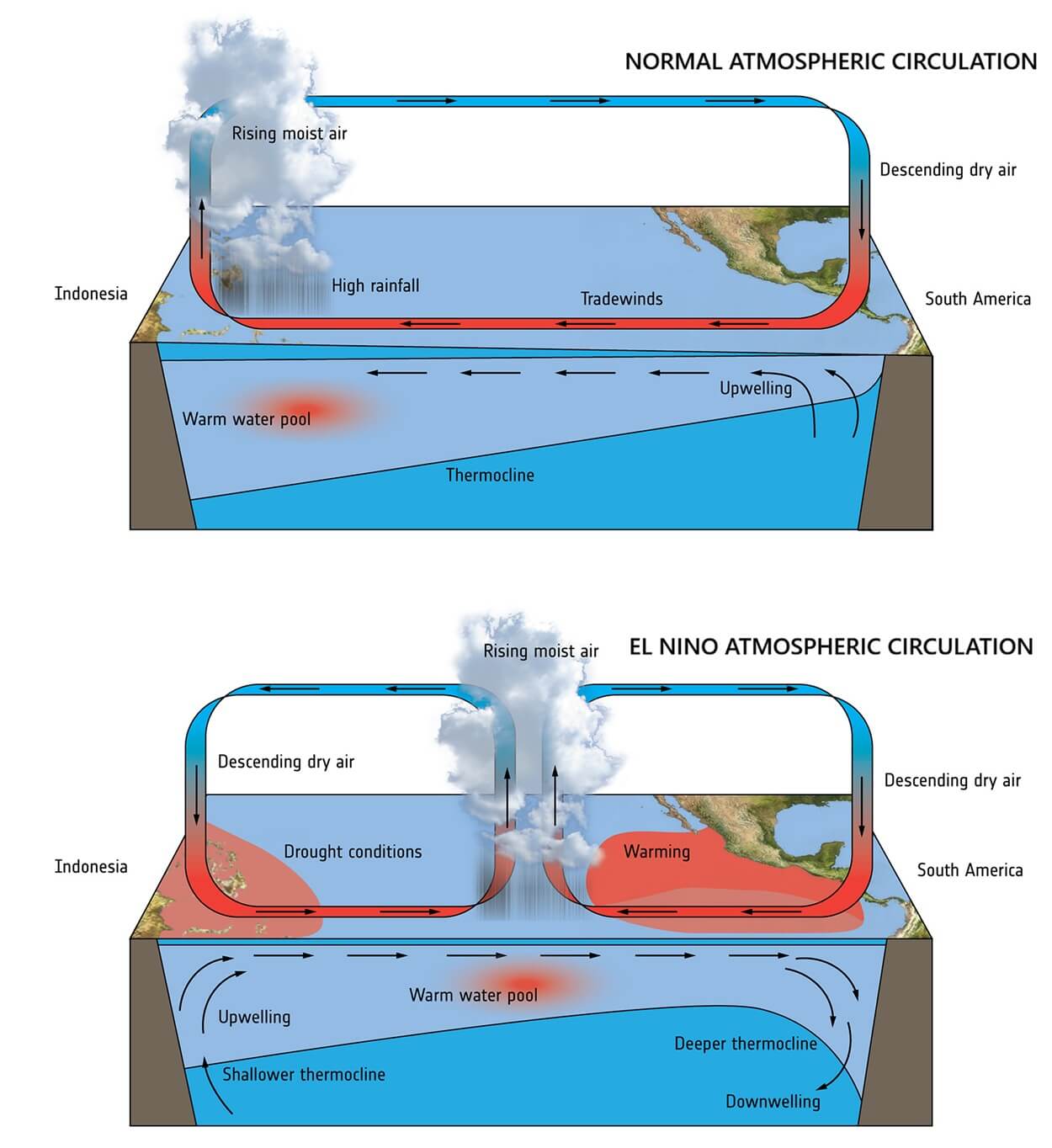
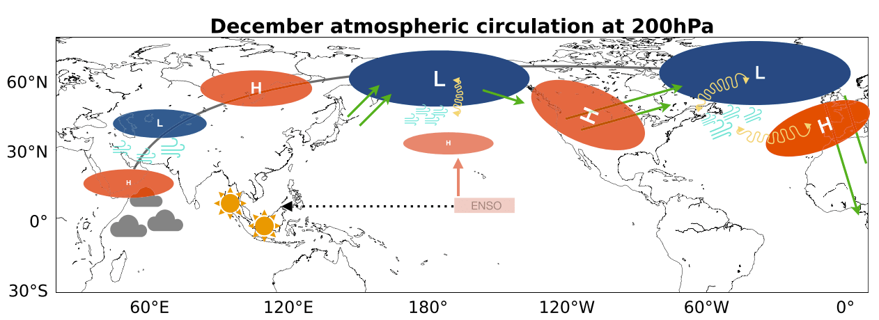
At the heart of the 2026/2027 winter forecast is the Equatorial Pacific. An El Niño event occurs when the atmospheric "Walker Cell" shifts, leading to lower atmospheric pressure in the central and eastern tropical Pacific and higher pressure in the west. This imbalance initiates a planetary-scale wave train, effectively "bridging" the tropical energy to the mid-latitudes.
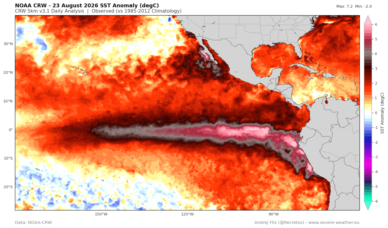
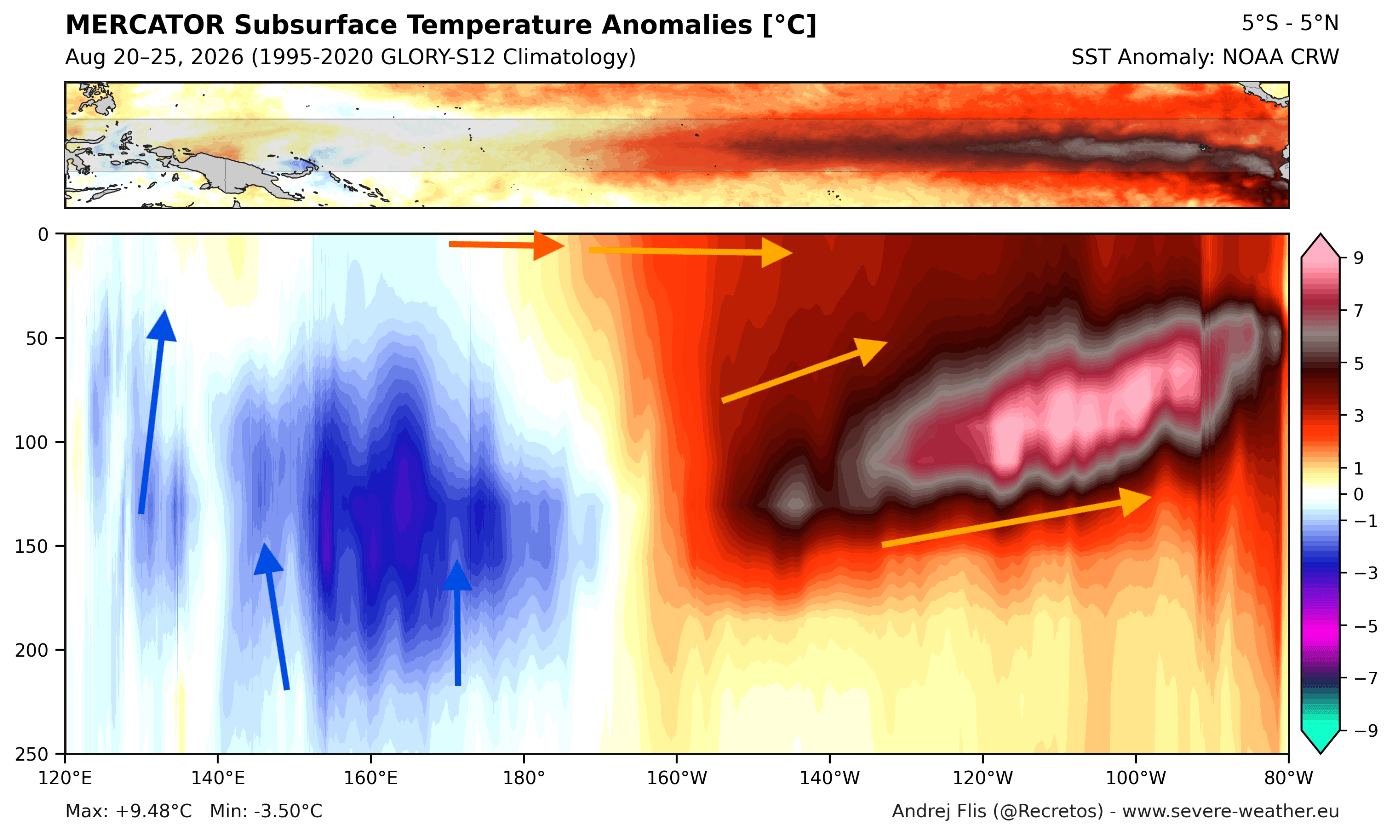
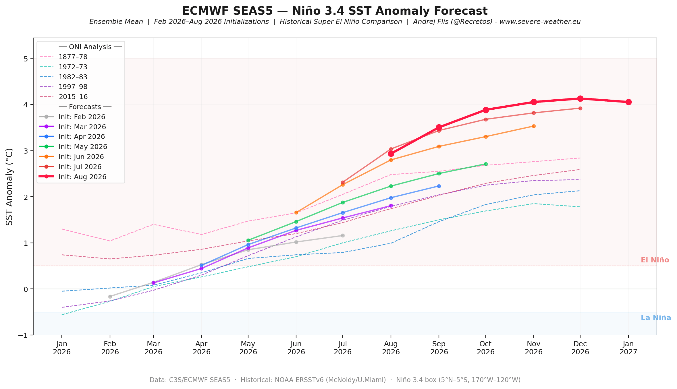
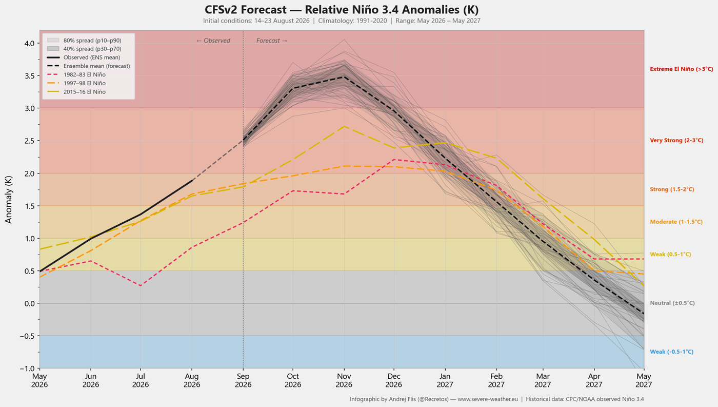
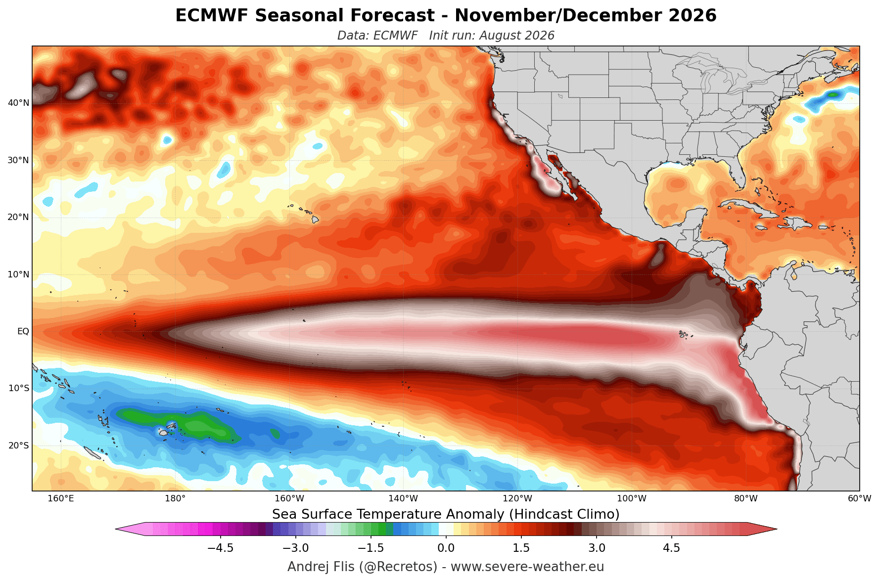
Current data from the NOAA Coral Reef Watch (CRW) indicates sea surface temperature anomalies in the central Pacific exceeding 6°C (11°F) above historical norms. When coupled with a massive, deep-ocean downwelling Kelvin Wave—a phenomenon that transports heat from the subsurface to the surface—this event has officially surpassed the threshold for a "Super" designation. Unlike moderate events, which produce mild deviations, a Super El Niño exerts a dominant influence on the Northern Hemisphere’s circulation, favoring an amplified "split-flow" jet stream.
Chronology: From Development to Mid-Winter Peak
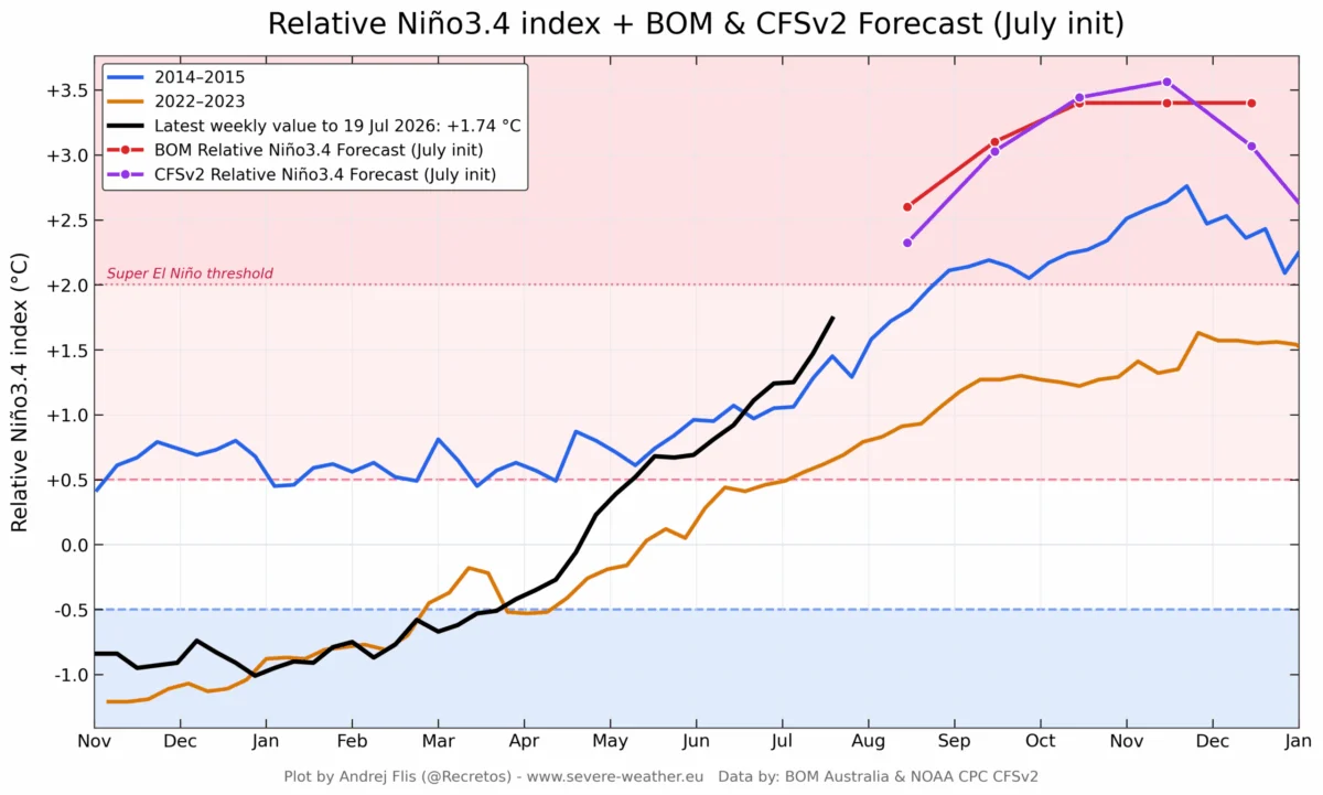
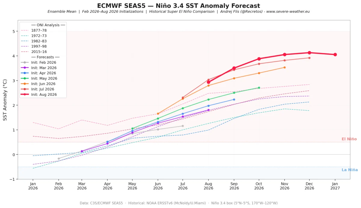
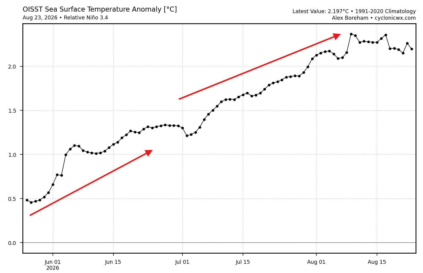
The evolution of this climate driver has been rapid. Throughout the summer and early fall of 2026, subsurface heat content has consistently trended upward. Meteorological models, including the European Centre for Medium-Range Weather Forecasts (ECMWF) and the NCEP Climate Forecast System (CFS), have shown a consistent "strengthening bias" in their seasonal runs. Each subsequent update has pushed the anticipated peak intensity higher, with the event expected to reach its zenith during the November-December 2026 window.
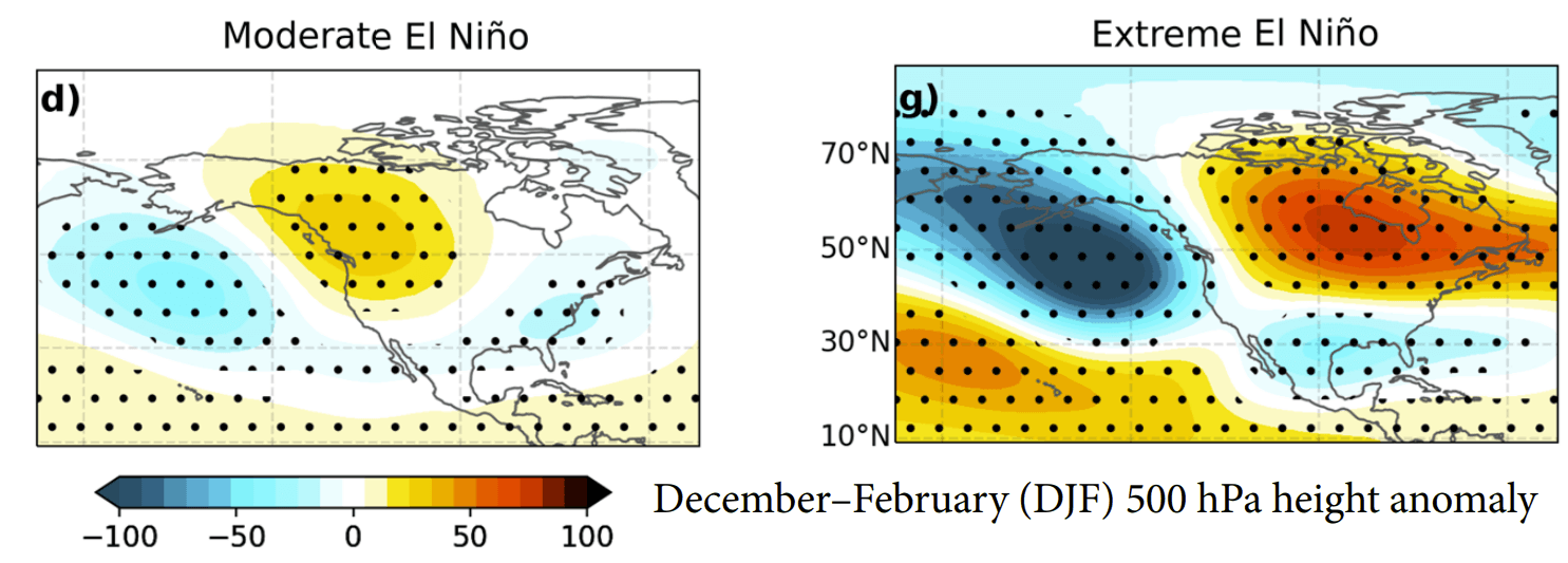
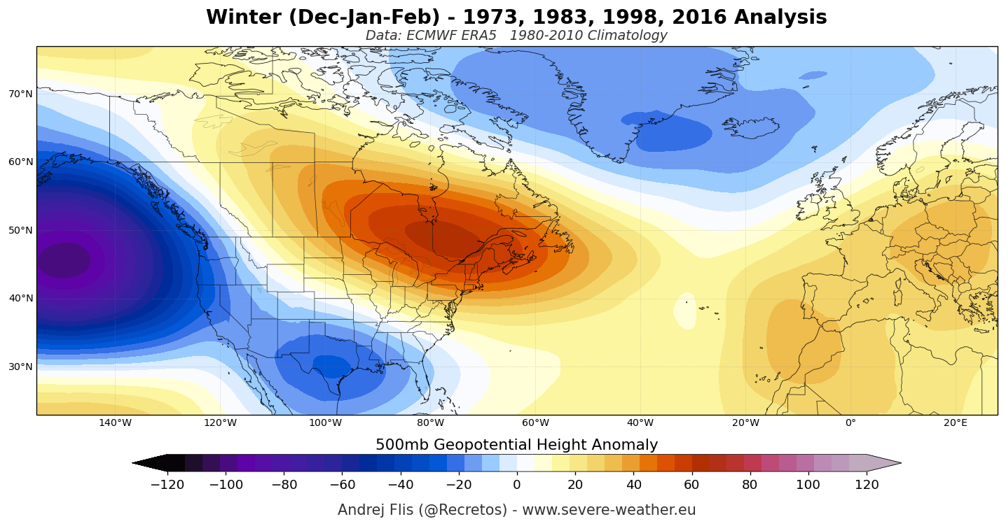
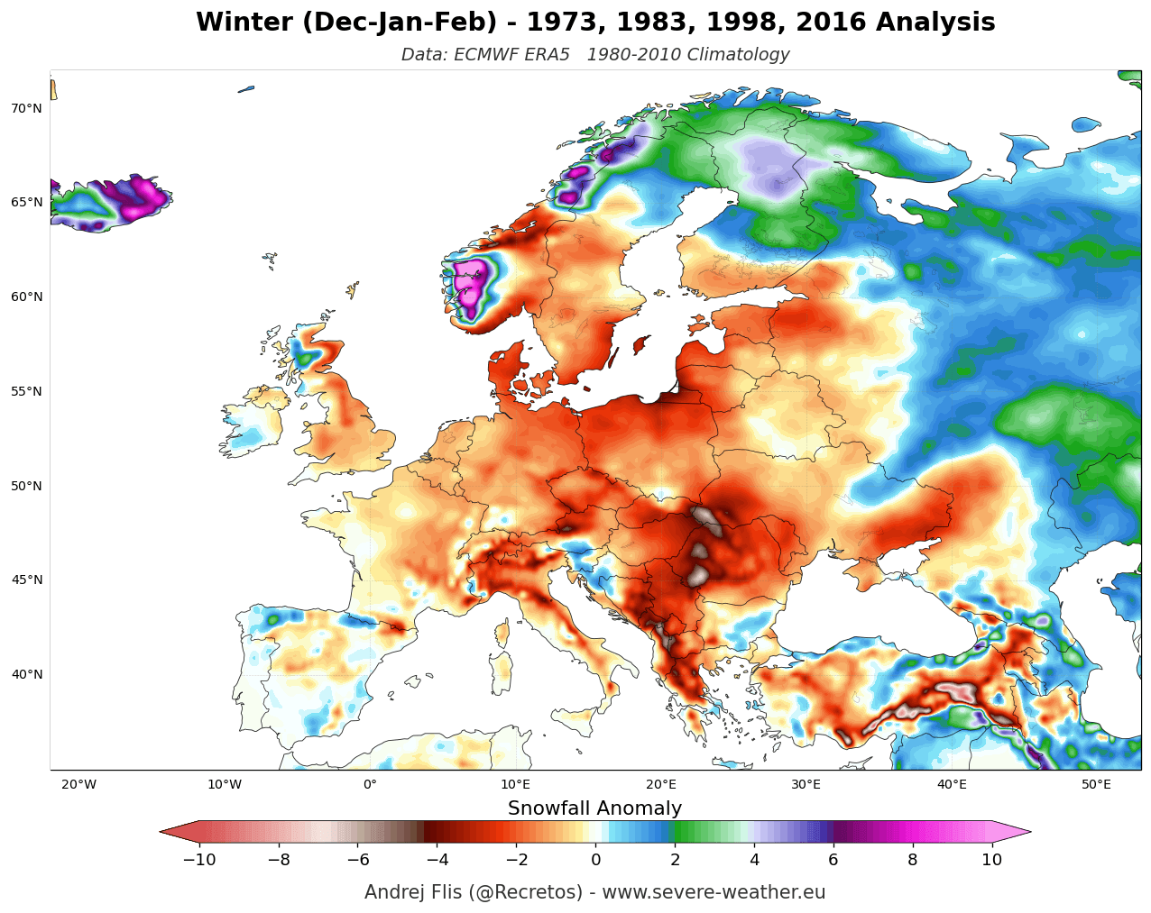
As we move into January and February 2027, the impact of this energy release will be felt most acutely in the atmospheric pressure field. Historical reanalysis of past Super El Niño winters—such as those of 1982/83, 1997/98, and 2015/16—suggests a recurring pattern: a deep, persistent Aleutian Low over the North Pacific, which forces a massive high-pressure ridge over Western Canada and the Northern United States. This "blocking" ridge acts as a gateway, redirecting the polar jet stream and allowing a secondary, more active subtropical jet stream to flourish across the southern tier of the United States.
Supporting Data: Modeling the Atmospheric Response
The consensus among modern global climate models is remarkably high, providing increased confidence in these long-range projections.
The North American Outlook
The ECMWF and NMME (North American Multi-Model Ensemble) systems are in lockstep regarding the North American winter. The forecast for December 2026 through February 2027 highlights:
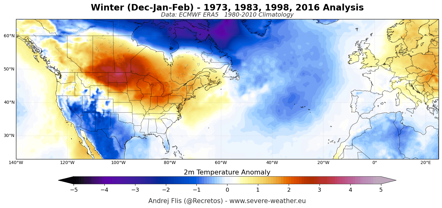
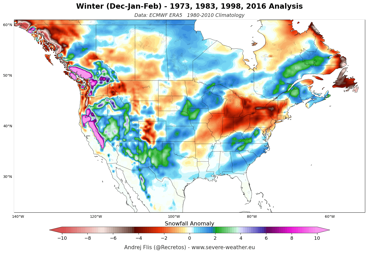
- Northern Tier: Under the influence of the high-pressure ridge, Canada and the Northern U.S. can expect warmer-than-average temperatures and reduced snowfall.
- Southern Tier: The subtropical jet stream will serve as a highway for moisture-rich storm systems. Expect higher-than-average precipitation, particularly across the Southern Plains, the Gulf Coast, and the Southeast.
- Snowfall Dynamics: While the north faces a potential deficit, the central and southern regions—specifically the Sierra Nevada, the Southern Rockies, and parts of the Central Plains—are positioned for potentially significant, moisture-laden snowfall events.
The European Outlook
For Europe, the signature of a Super El Niño is less about direct temperature extremes and more about the configuration of the North Atlantic. Most models suggest a dominant westerly and southwesterly flow from the Atlantic. This is expected to bring milder, wetter weather to the continent. While this limits prolonged "cold waves" in the lowlands, the moisture-rich Atlantic flow provides significant snowfall potential for the higher elevations of the Alps (above 2,000m), even as lower-elevation resorts may struggle with inconsistent snowpack.
Polar Vortex: The Wild Card of Mid-Winter
No winter forecast is complete without considering the stratospheric Polar Vortex—a vast reservoir of cold air circulating over the Arctic. Recent model data from the UKMO (UK Met Office) and ECMWF indicate a significant weakening signal in the stratospheric zonal winds during late December and January.
While this does not guarantee a major Sudden Stratospheric Warming (SSW) event, it highlights a state of "atmospheric vulnerability." Should the vortex undergo a disruption, the resulting "leakage" of Arctic air could penetrate the mid-latitudes, creating localized cold-air outbreaks that contrast sharply with the otherwise mild, El Niño-driven seasonal averages. This creates a complex, high-stakes scenario where the dominant El Niño signal must contend with sudden stratospheric instability.
Implications: Preparing for the 2026/2027 Season
The implications of a Super El Niño winter are widespread, affecting agriculture, infrastructure, and winter recreation.
Socio-Economic and Infrastructure Impacts
The predicted active southern storm track across the United States implies a high risk of flooding and severe weather for the Gulf Coast and Southeast. Municipalities in these regions should prepare for increased precipitation and potential storm surges, as the subtropical jet stream will likely be primed with abundant moisture from the Pacific.
Winter Sports and Recreation
The north-south divide in snowfall will create clear winners and losers for the ski industry. Resorts in the Pacific Northwest and New England may face "low-snow" years, necessitating better snowmaking capabilities or a reliance on elevation. Conversely, resorts in the Southern Rockies and the Sierra Nevada should anticipate a potentially record-breaking season, though they must also manage the risks associated with high-precipitation, heavy-snow events that can lead to avalanches and access issues.
Energy and Agriculture
Warmer-than-average temperatures across the Northern U.S. and Canada will likely reduce heating demand in those regions, potentially lowering energy costs. However, the wet conditions in the South may impact winter crop cycles. For Europe, the reliance on Atlantic air masses means that energy demand will remain largely dependent on the stability of the jet stream; a consistent, mild westerly flow will keep heating requirements modest, but persistent storms could impact renewable energy infrastructure.
Conclusion
Winter 2026/2027 is shaping up to be a defining moment in contemporary climatology. With a Super El Niño anchoring the global atmospheric flow, the patterns of moisture and temperature are becoming increasingly well-defined. While models provide a robust framework for what to expect—a warm, dry North; a wet, active South; and a mild, unsettled Europe—the potential for stratospheric disruption remains a critical factor to watch. As the season approaches, the focus will shift from these broad-scale seasonal averages to the monthly and weekly variations that will ultimately determine the day-to-day experience of this historic winter.