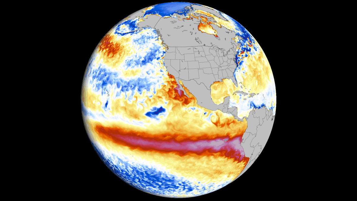
As we move into the final quarter of 2026, meteorologists and climate scientists are monitoring a rapidly evolving atmospheric phenomenon that promises to redefine the winter season. A "Super El Niño" event—the most intense in over a century—is currently undergoing a period of rapid intensification in the equatorial Pacific. With record-breaking oceanic warmth and a fundamental shift in atmospheric circulation, this event is poised to act as the primary driver of global weather patterns deep into the spring of 2027.
The Anatomy of a Super El Niño
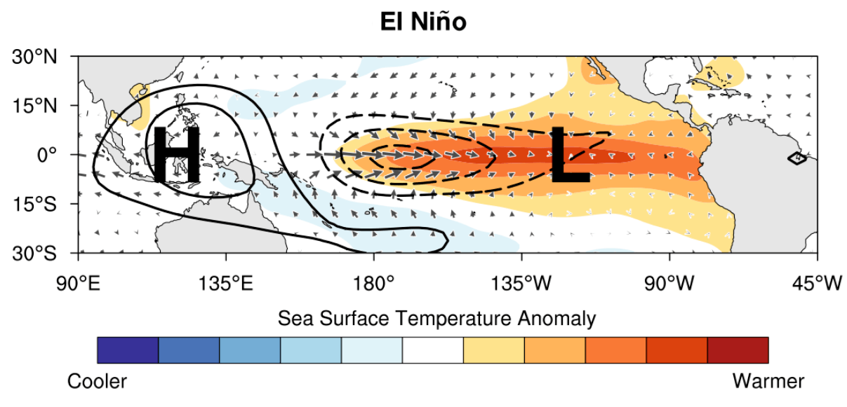
El Niño is formally defined by a sustained warming of sea surface temperatures (SSTs) in the central and eastern tropical Pacific. While moderate events occur with some regularity, the threshold for a "Super" El Niño requires a synergistic collapse of trade winds and a massive, deep-ocean response.
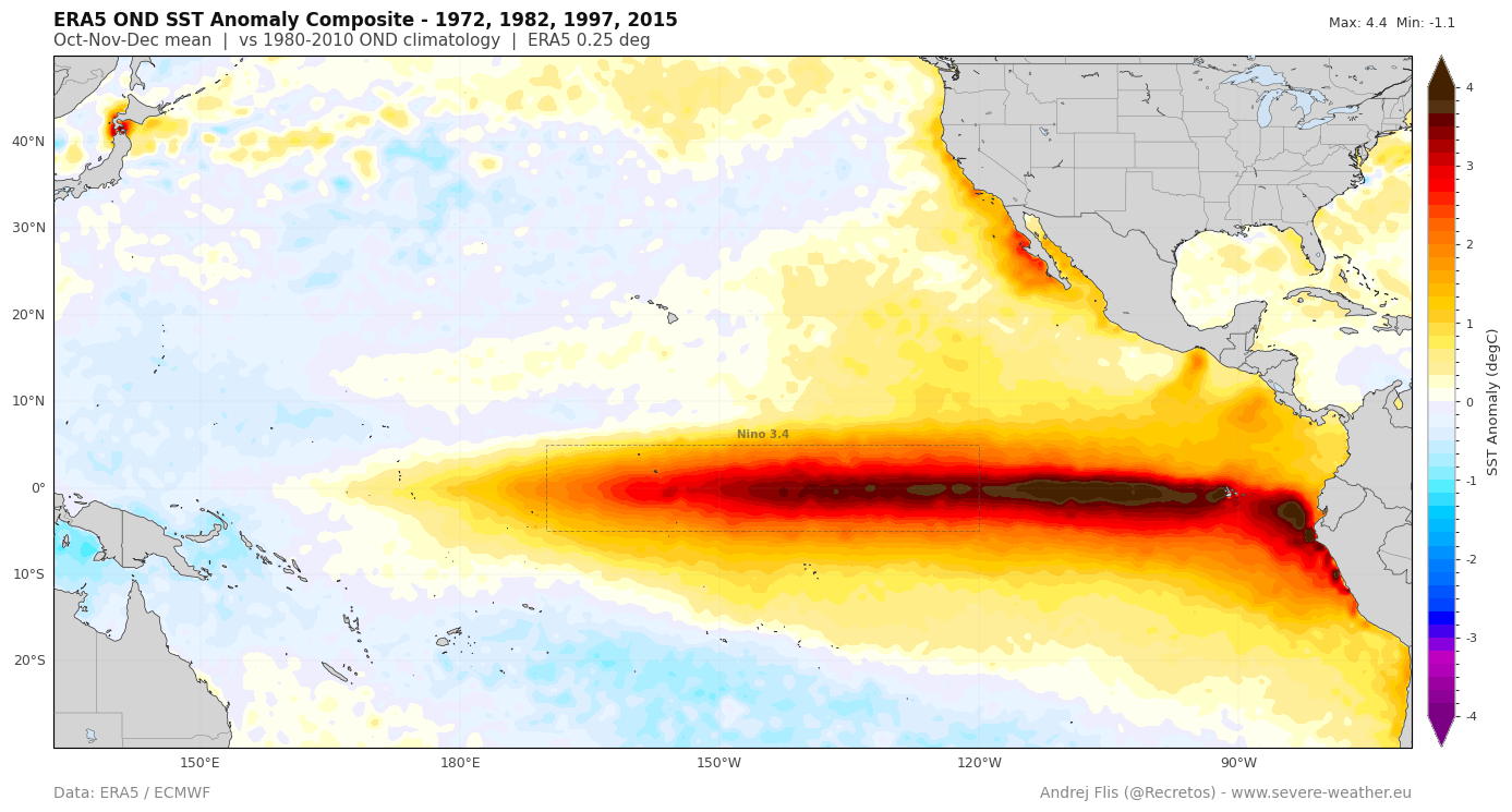
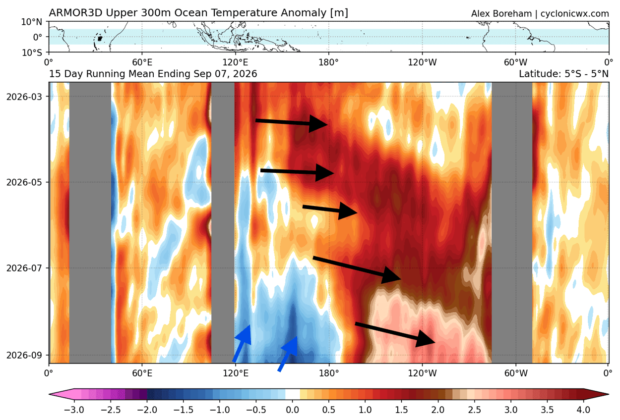
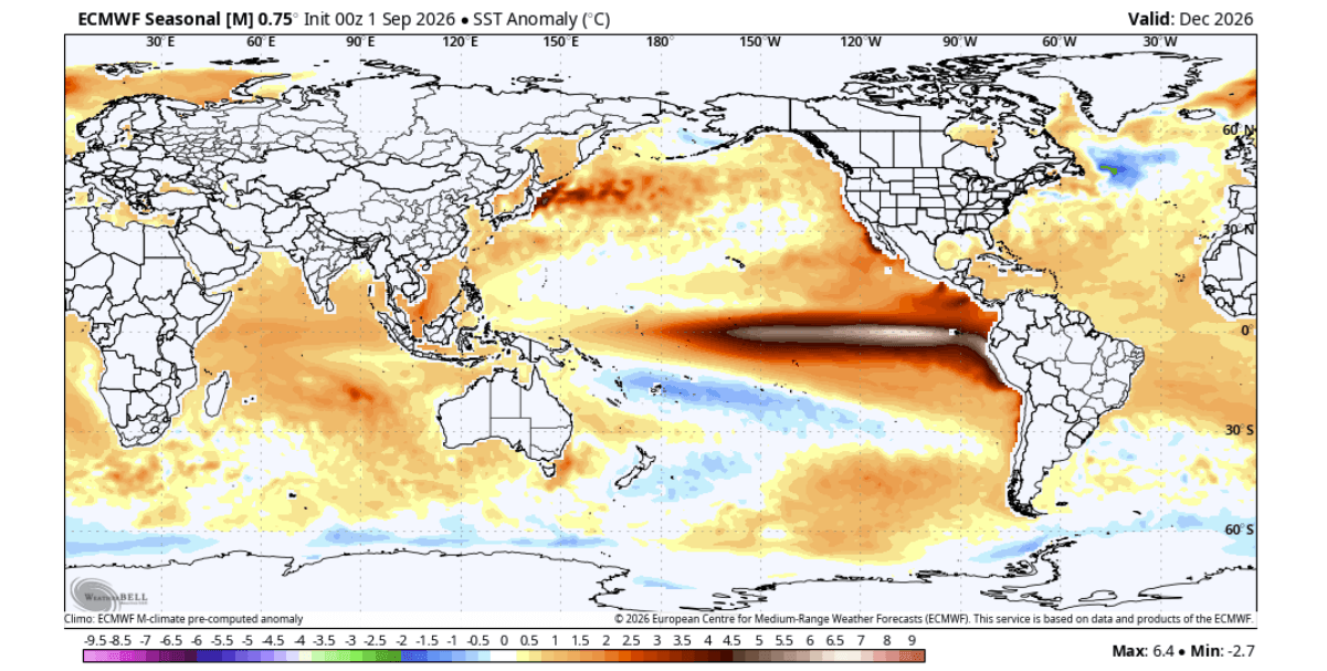
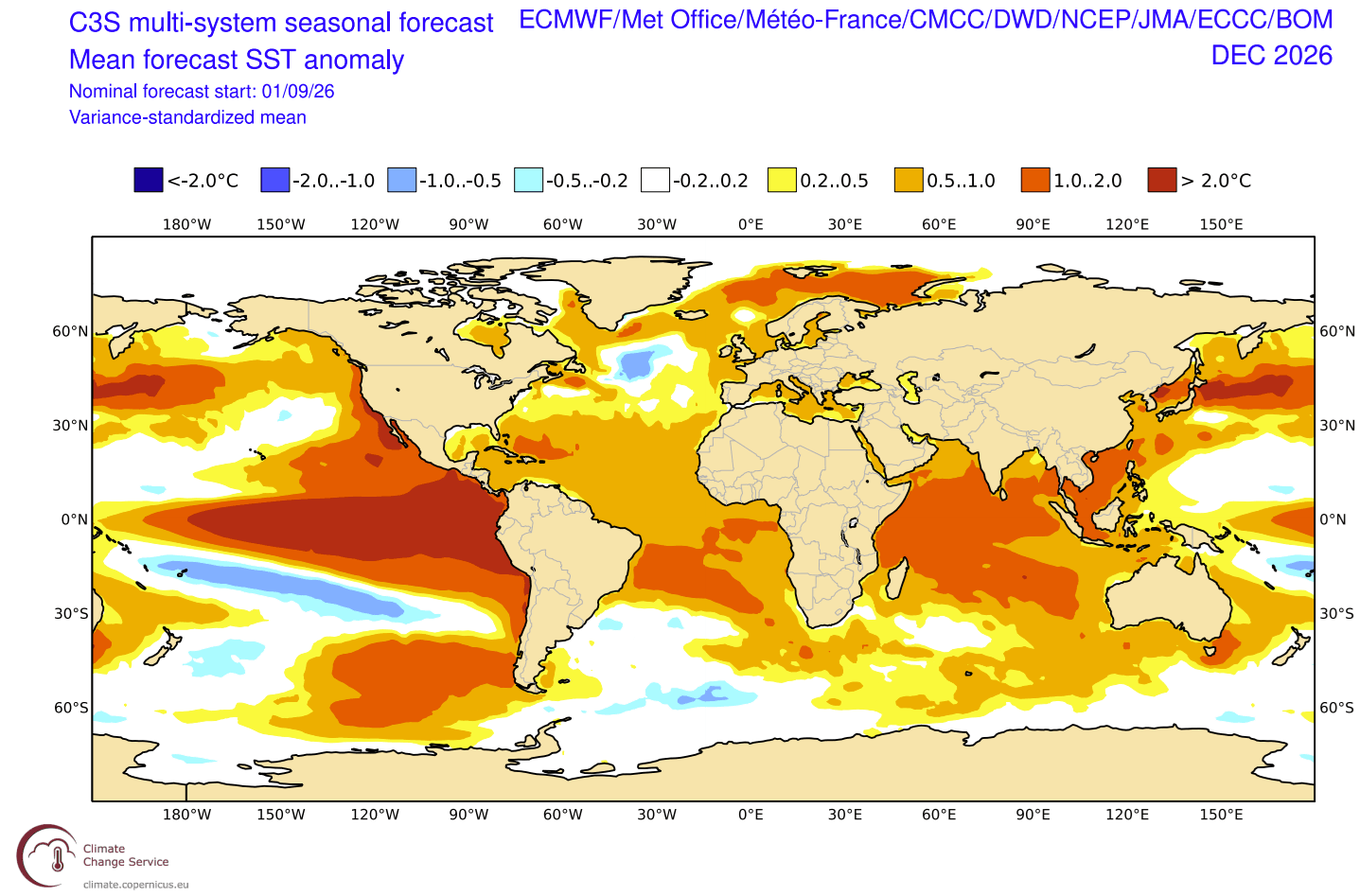
The 2026 event is currently manifesting as an extreme departure from long-term averages. Data from the European Centre for Medium-Range Weather Forecasts (ECMWF) and NOAA confirm that this event is not merely a cyclical fluctuation but a record-setting perturbation. The core of this event is powered by a colossal, deep-subsurface "Kelvin Wave"—a massive pulse of warm water moving eastward—that is currently fueling the surface temperature anomalies.
Chronology of Intensification
The seeds of the 2026 event were sown in early summer, characterized by an uncharacteristic and sustained weakening of the Pacific trade winds. By late summer, the atmospheric response became locked in.
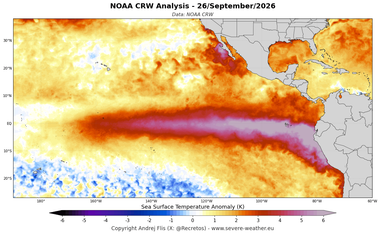
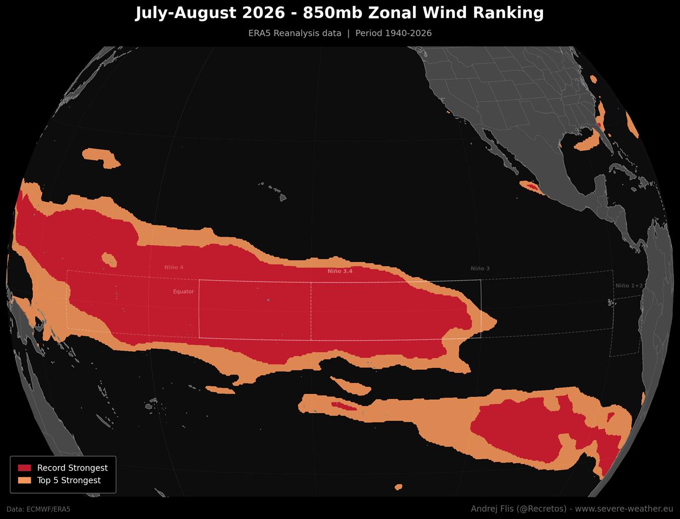
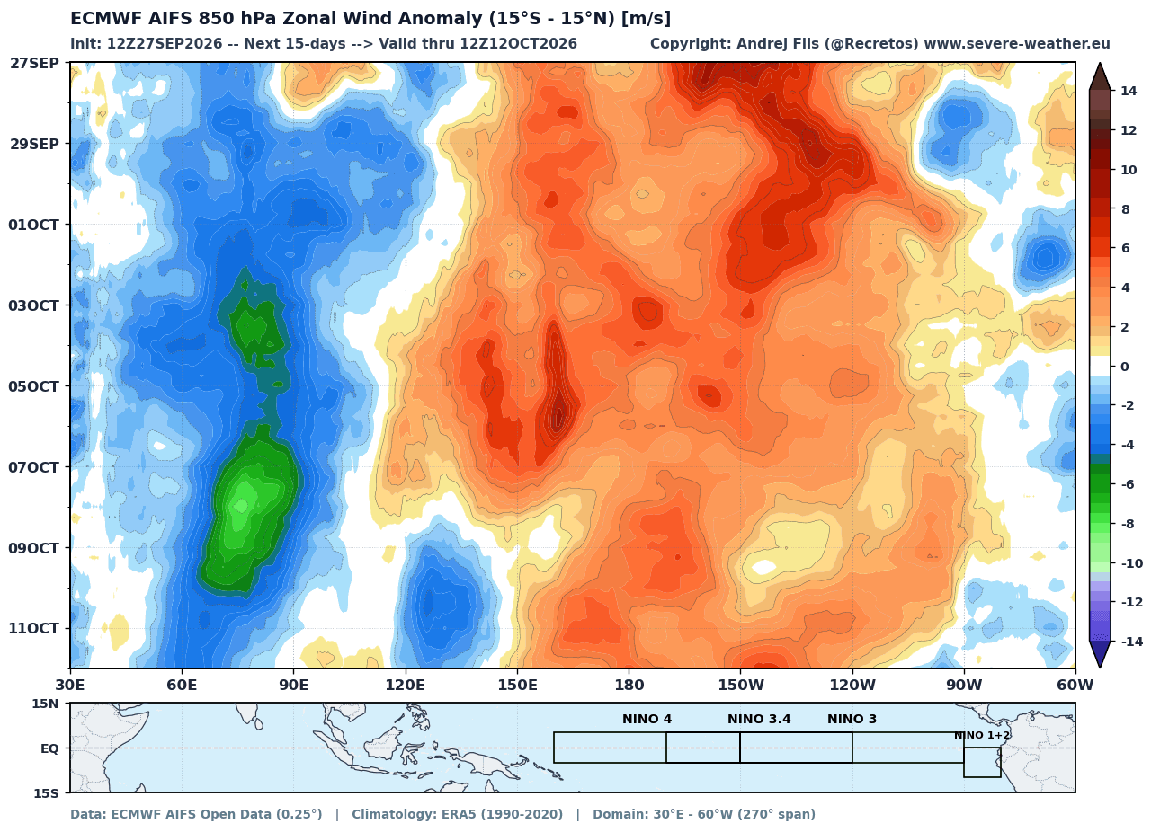
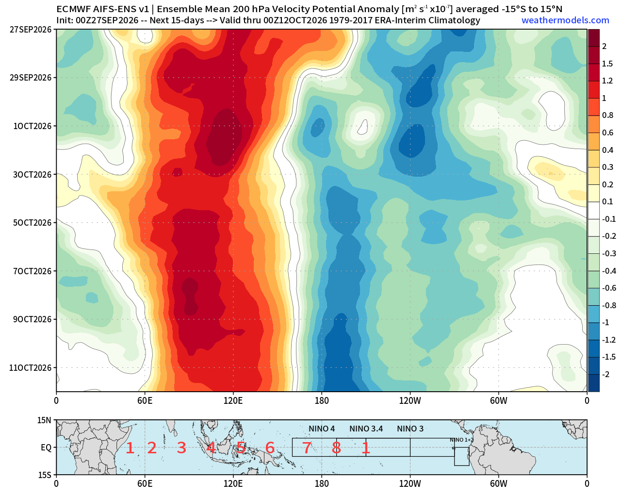
- July–August 2026: Zonal wind anomalies in the equatorial Pacific hit record-breaking levels. These "westerly wind bursts" acted as the catalyst, pushing warm surface waters eastward and suppressing the normal upwelling of cold, nutrient-rich water off the South American coast.
- September 2026: The subsurface heat content reached critical mass. Monitoring stations observed temperatures in the top 200 meters of the Pacific reaching more than 10°C (18°F) above the seasonal norm.
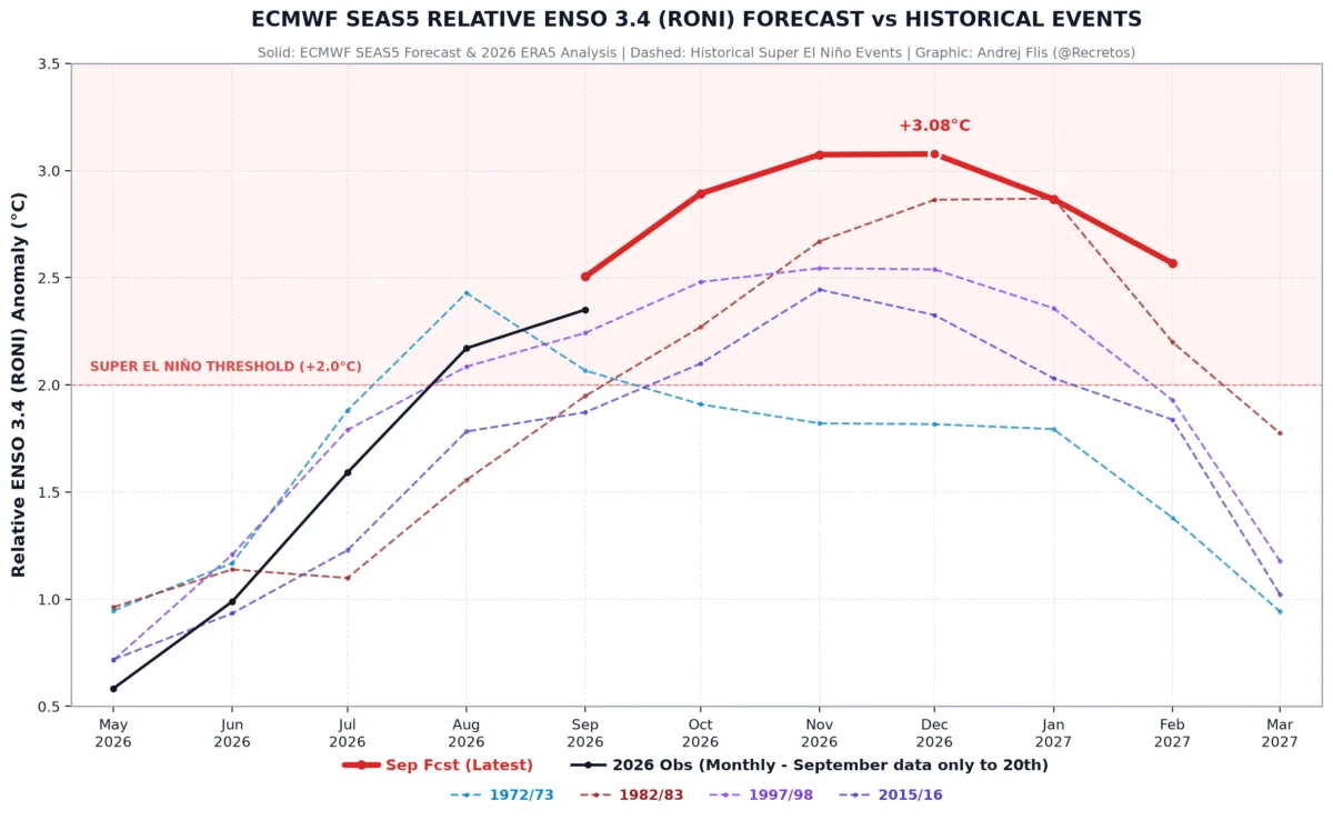
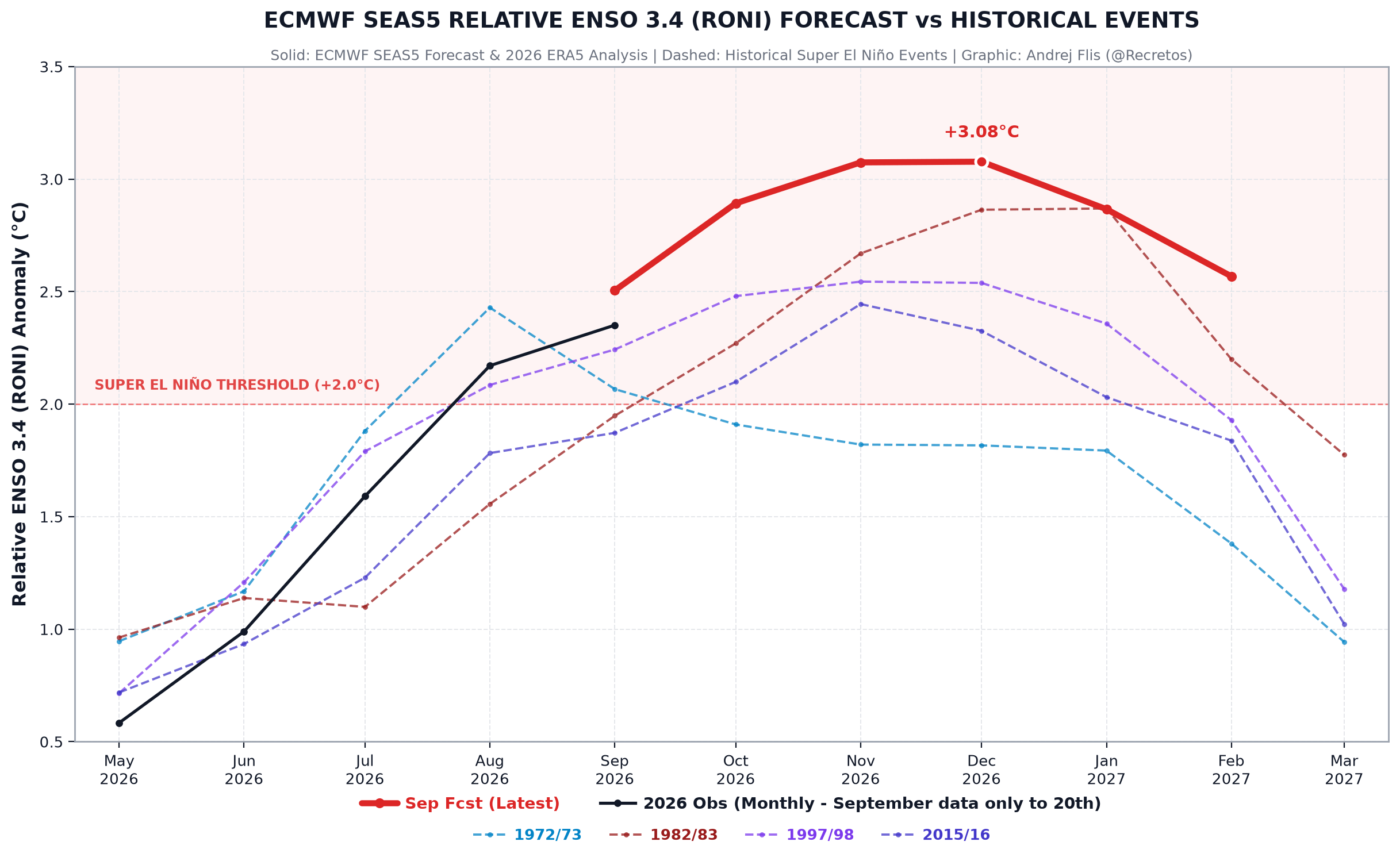
- Current Status: As of late September, the event is on a vertical trajectory. Models consistently show a peak in intensity occurring between November and December 2026, with no historical analog in the last 70 years that matches the current rate of development.
Supporting Data: The "Smoking Gun" of Atmospheric Shift
The credibility of this forecast relies on the convergence of oceanic and atmospheric data. The primary indicator, the Multivariate ENSO Index (MEI), has already climbed to +2.5 for the July-August period. In the history of NOAA records dating back to 1979, a value exceeding +2.0 has been the hallmark of only the most catastrophic El Niño events.
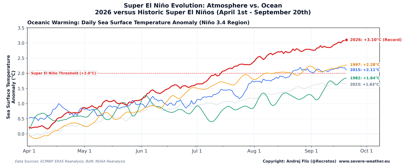
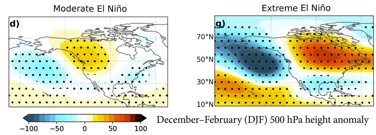
Furthermore, the "atmospheric standing wave" effect is already observable. The Walker circulation—the loop of rising and sinking air that defines tropical climate—has become stationary. This stagnation forces the jet stream into a rigid, amplified pattern. For the northern hemisphere, this creates a "Pacific trough" that acts as a highway for moisture and energy, significantly altering the path of winter storms.
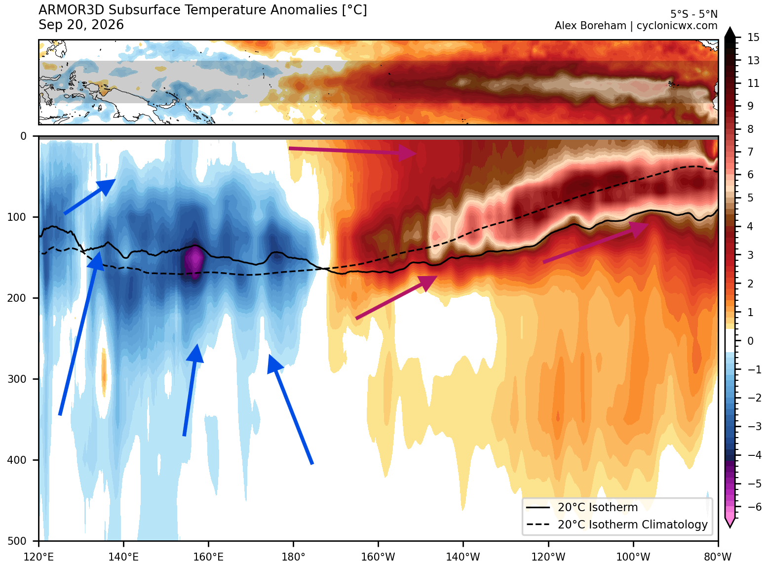
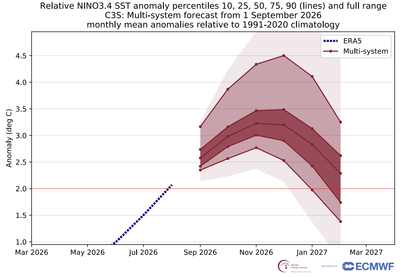
Comparison with the 2015-2016 Super El Niño—previously the benchmark for extreme events—reveals that the 2026 event is not only faster in its development but more aggressive in its temperature profile. Peak anomalies are currently projected to exceed +3°C (5.4°F) in the central Pacific, a level of thermal energy that shifts the global climate equilibrium.
Implications for Global Weather
The atmospheric response to such an extreme Pacific warming is rarely localized. The "Super" designation implies that the ripple effects will be felt on every continent.
North America: The Tale of Two Winters
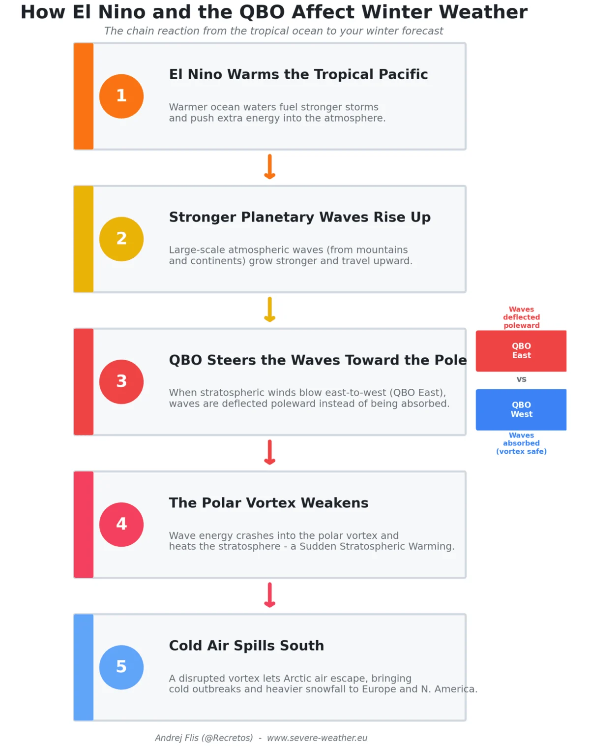
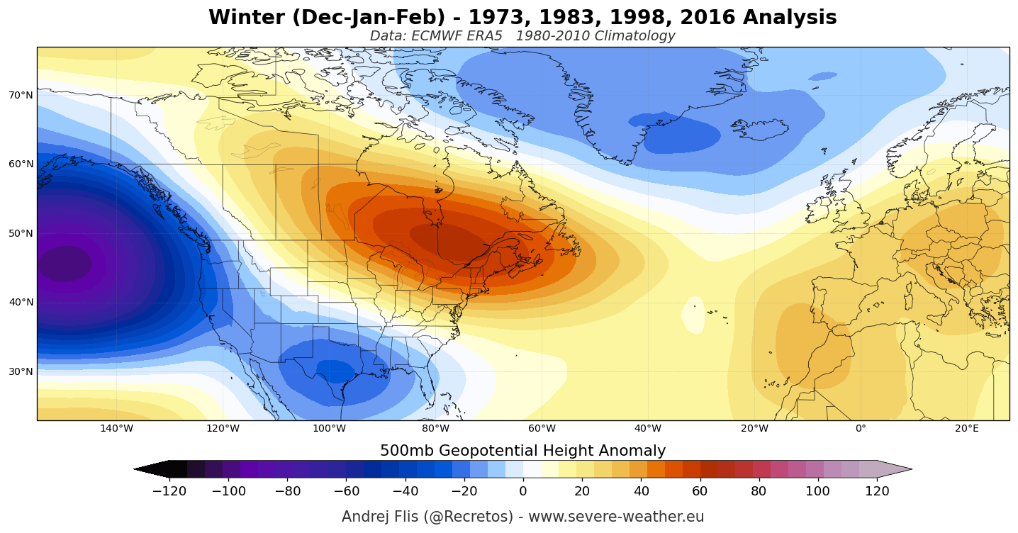
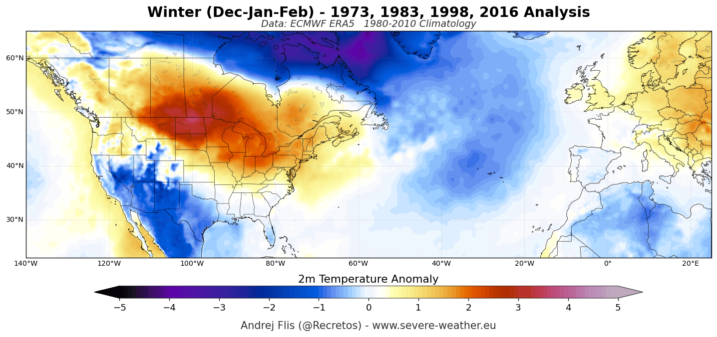
For the United States and Canada, the 2026/2027 winter forecast is defined by a sharp divide. The amplified subtropical jet stream is expected to stay locked in a position that drives an active, storm-heavy track across the southern tier of the United States. Regions from California through the Gulf Coast into the Southeast should prepare for increased precipitation and a higher frequency of storm systems.
Conversely, the northern United States and southern Canada will likely experience a "ridge-dominant" pattern. High pressure is expected to build over these regions, acting as a buffer against arctic air mass intrusions. This suggests a milder, drier winter for the northern plains and the Great Lakes, a distinct departure from the harsh, snowy winters typically associated with these latitudes.
Europe and Asia
The global circulation changes triggered by the Pacific are also projected to influence Europe. The stationary wave pattern typically favors a persistent westerly flow, which generally brings milder, wetter conditions to Western and Central Europe. In Asia, the impact is more complex, with altered monsoon timings and shifting precipitation zones expected to impact agricultural outputs in the coming months.
The Role of Scientific Research and Modeling
Modern forecasting has reached a new level of precision through the use of ensemble modeling. By running thousands of simulations, researchers at institutions like ECMWF and NOAA have been able to isolate the "Super" signature of the 2026 event.
The research highlights a critical feedback loop: as the ocean warms, it triggers westerly wind bursts; these bursts, in turn, facilitate the eastward movement of more warm water, further accelerating the surface warming. This self-sustaining engine is precisely why this event is so difficult to reverse and why its impacts are so widespread.
Official Projections and Preparedness
While official government agencies continue to issue monthly updates, the consensus is clear: the global climate is entering a period of significant volatility. Emergency management agencies in the southern United States have been advised to prepare for a winter that may bring a high volume of atmospheric river events and severe weather, given the increased moisture transport from the Pacific.
Furthermore, the energy sector is watching these developments closely. The shift in temperature patterns will inevitably impact heating demands. A warm northern winter reduces energy consumption in those regions, while a volatile, storm-driven winter in the south can strain local infrastructure and power grids.
Looking Ahead: Beyond the Peak
The 2026/2027 Super El Niño is projected to reach its zenith in December. However, the legacy of such a massive injection of heat into the atmosphere will linger well into the following year. As the event begins to decay in the spring of 2027, the world may see a period of "climate hangover," where the atmospheric circulation takes months to readjust to a neutral state.

For residents across North America and beyond, this winter will be a test of infrastructure and resilience. The combination of historical data and current, high-resolution modeling provides a clear picture: we are entering a phase of extreme weather that will require close monitoring.
As the situation unfolds, meteorologists will continue to track the movement of the Kelvin Wave and the stability of the jet stream. Citizens are encouraged to consult their regional forecasts, as the "Super" nature of this event means that small changes in atmospheric pressure could lead to significant shifts in local snowfall and temperature outcomes.
In an era where climate patterns are becoming increasingly erratic, the 2026/2027 Super El Niño serves as a stark reminder of the interconnected nature of our planet’s atmosphere and oceans. By understanding the forces at play—the westerly wind bursts, the oceanic heat content, and the resulting standing waves—we can better prepare for the seasonal shifts ahead. Stay informed, monitor your local weather authority, and prepare for a winter that will undoubtedly be recorded in the annals of meteorological history.