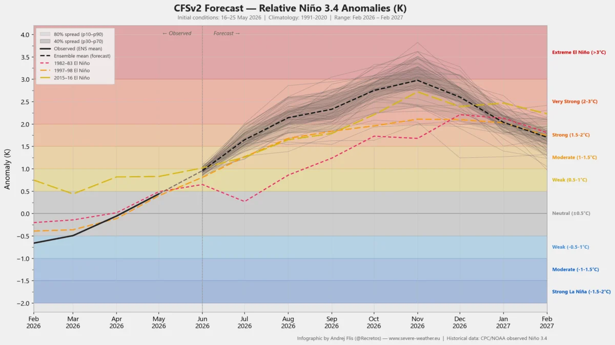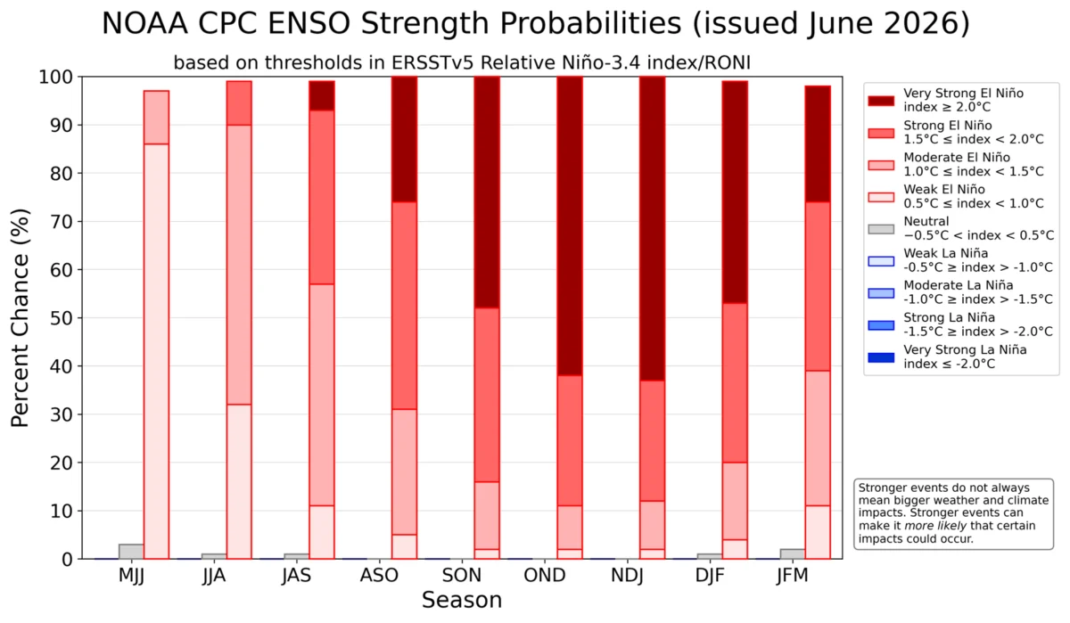
The global climate system is currently undergoing a dramatic transformation as a powerful Super El Niño event rapidly develops in the tropical Pacific. Meteorological data from the past several weeks confirms that the atmosphere is already responding to this massive oceanic anomaly, setting the stage for significant, potentially record-breaking weather shifts across North America and Europe through the remainder of 2026 and into 2027.

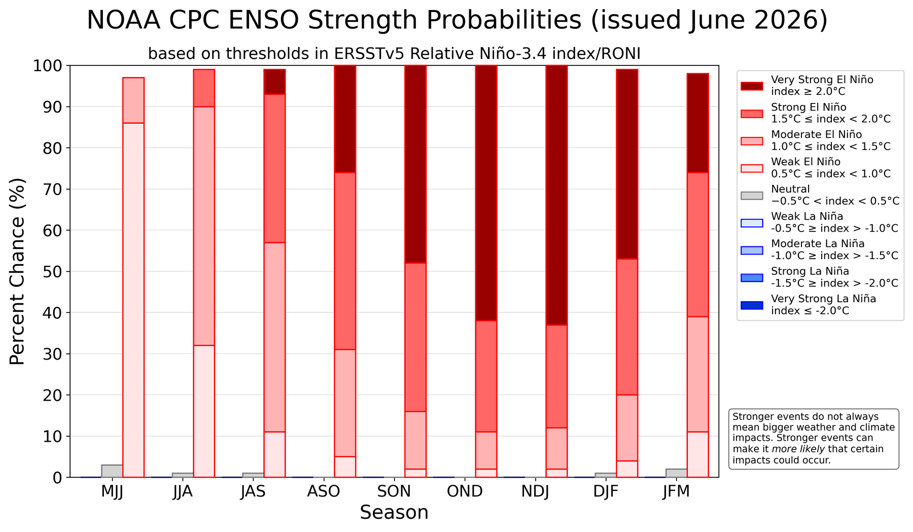
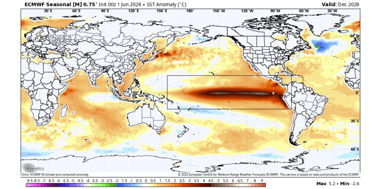
As the equatorial Pacific warms, the global "atmospheric bridge"—the complex feedback loop between ocean temperatures and wind circulation—is beginning to lock into a configuration characteristic of the strongest historical El Niño events. With surface anomalies expected to exceed the +4°C to +5°C threshold, climatologists are monitoring the situation with increased urgency.
The Science of the Shift: A Meteorological Overview
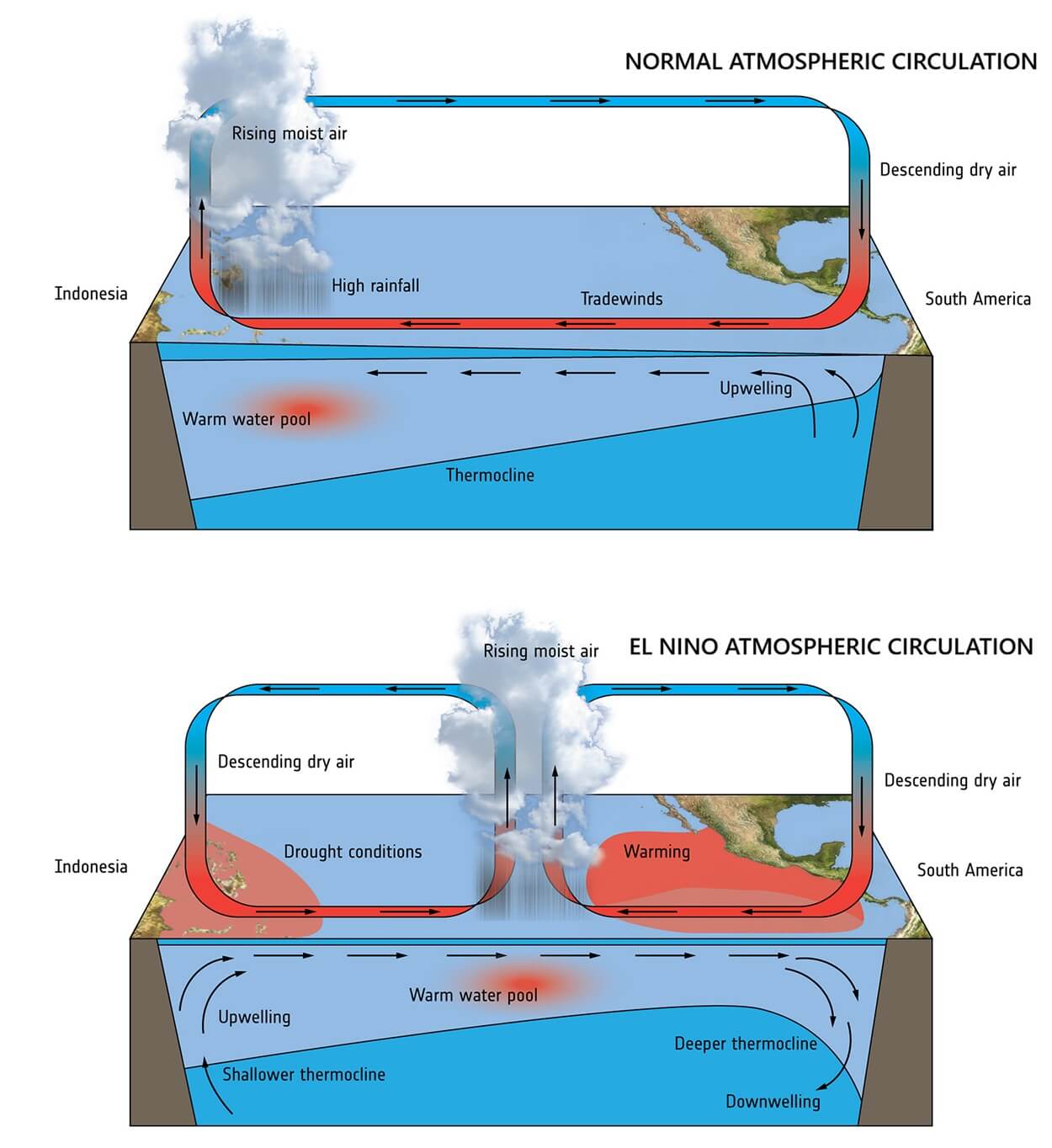
The ENSO (El Niño-Southern Oscillation) cycle is the primary driver of interannual climate variability. During a Super El Niño, the Walker Cell—a massive loop of atmospheric circulation over the tropical Pacific—undergoes a fundamental shift. Typically, trade winds blow from east to west, pushing warm water toward the Western Pacific. During this 2026 event, those winds have weakened significantly, allowing the vast reservoir of warm water to slosh eastward toward the Americas.
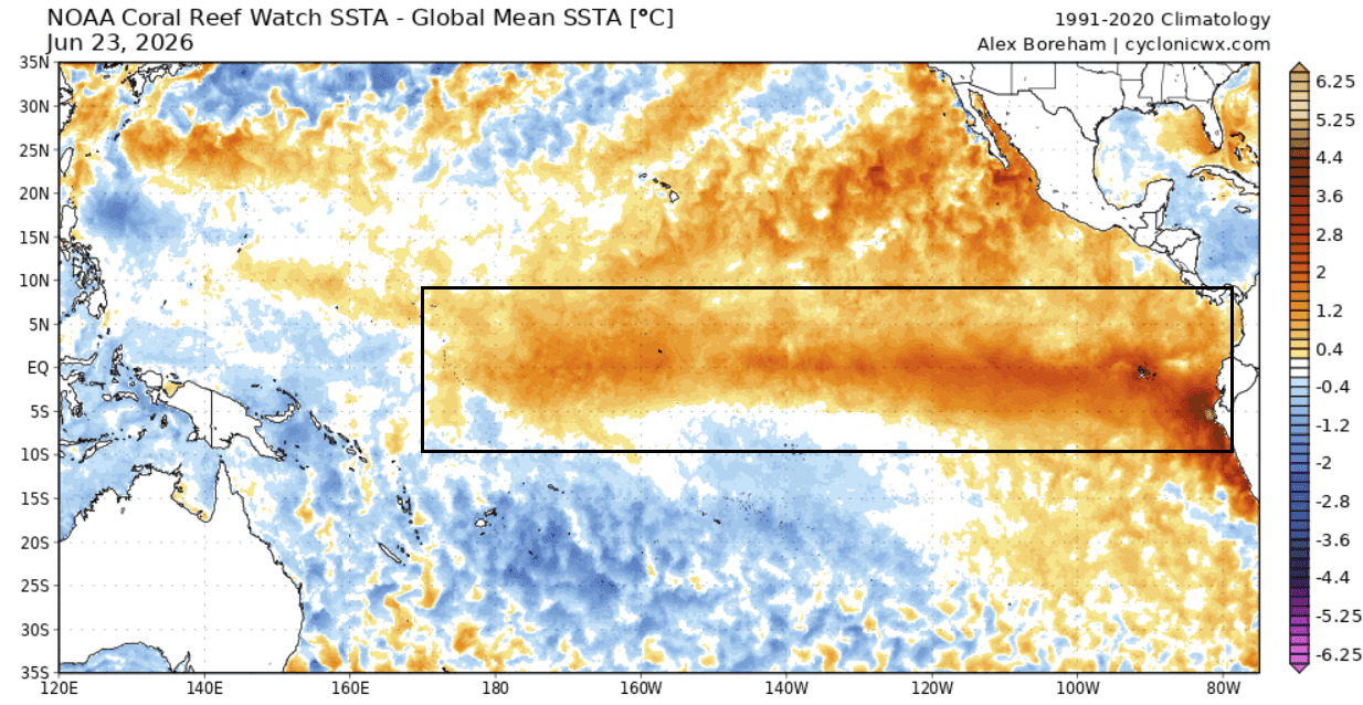
This phenomenon is being fueled by powerful westerly wind bursts, which have triggered a massive underwater Kelvin Wave. As this wave rises to the surface, it creates the signature warm anomalies that characterize a Super El Niño. Unlike moderate events, a "Super" designation implies a profound reorganization of the jet stream, which dictates storm tracks, temperature extremes, and precipitation patterns across the Northern Hemisphere.
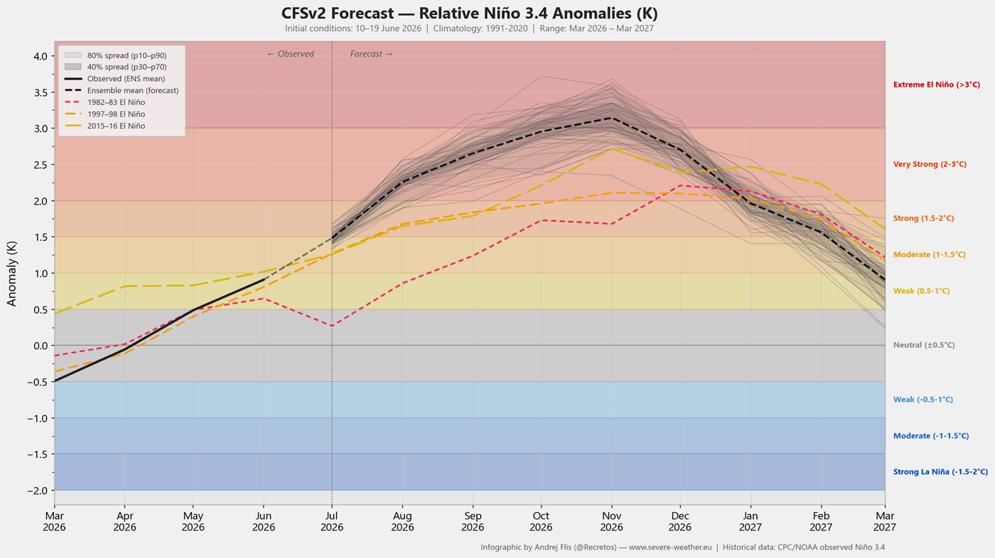
Chronology of Development: From June Emergence to Autumn Lockdown
The transition into this climatic state has been swift. June 2026 served as a harbinger, producing weather patterns in North America that mirrored the onset of previous legendary Super El Niño years.
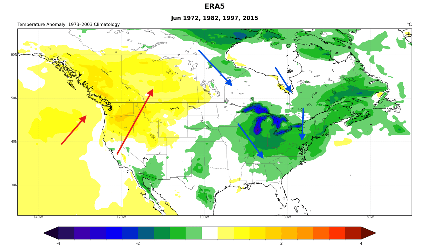
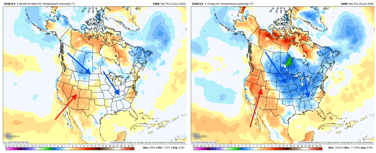
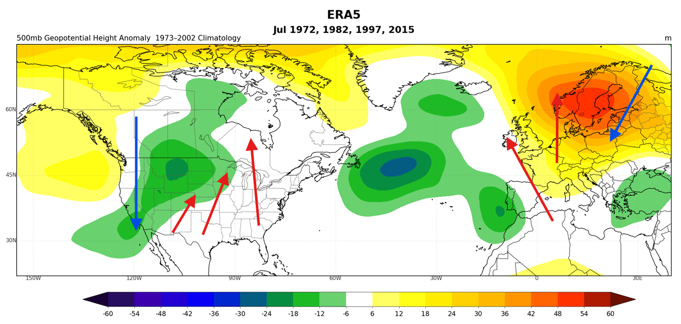
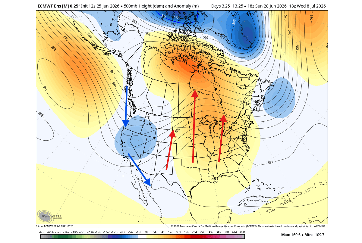
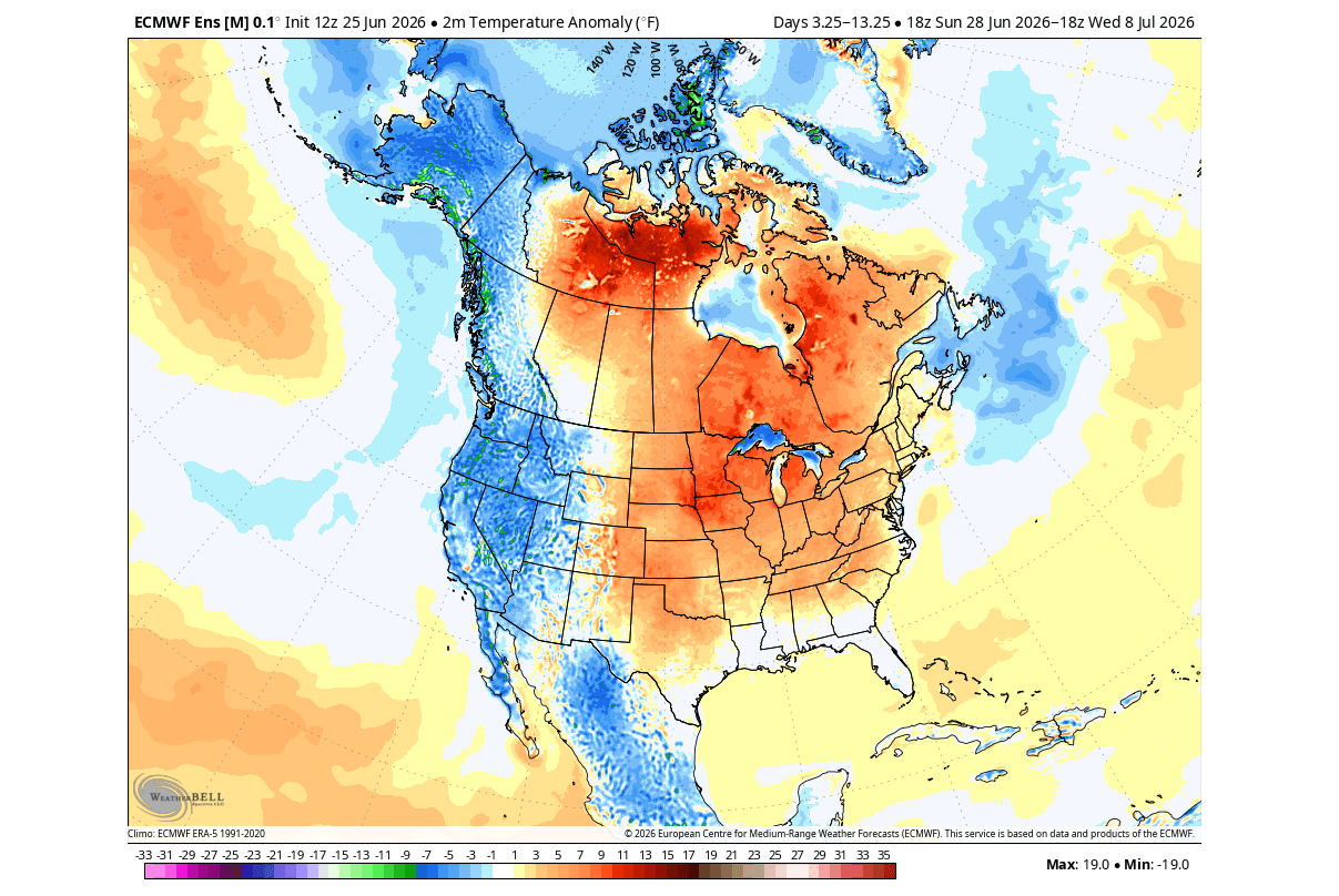
- June 2026: Analysis revealed temperature and pressure anomalies in the United States and Canada that align almost perfectly with historical reanalysis data from previous super-events. Specifically, the development of a low-pressure trough over eastern Canada and the U.S. East Coast triggered a northerly flow, introducing unseasonably cool air to those regions while simultaneously priming the West for heat-related anomalies.
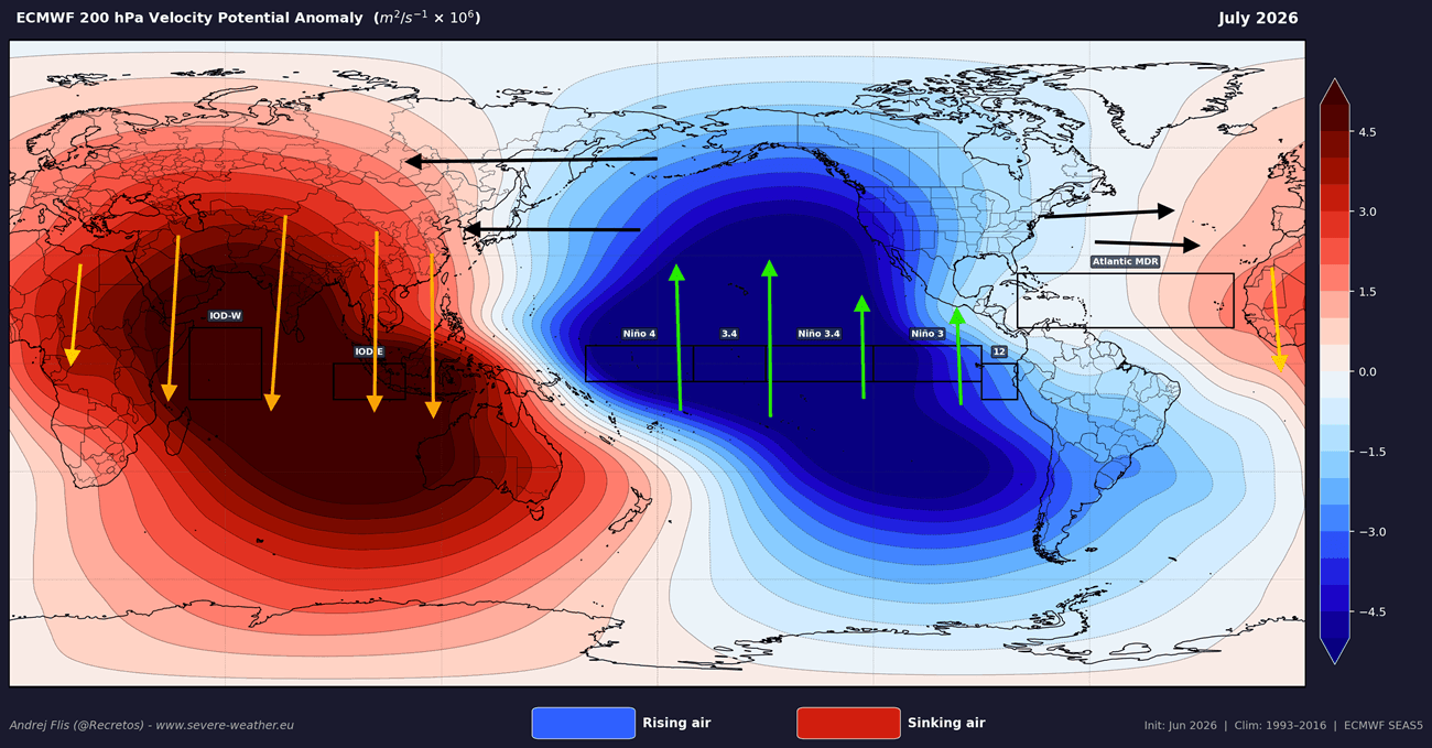
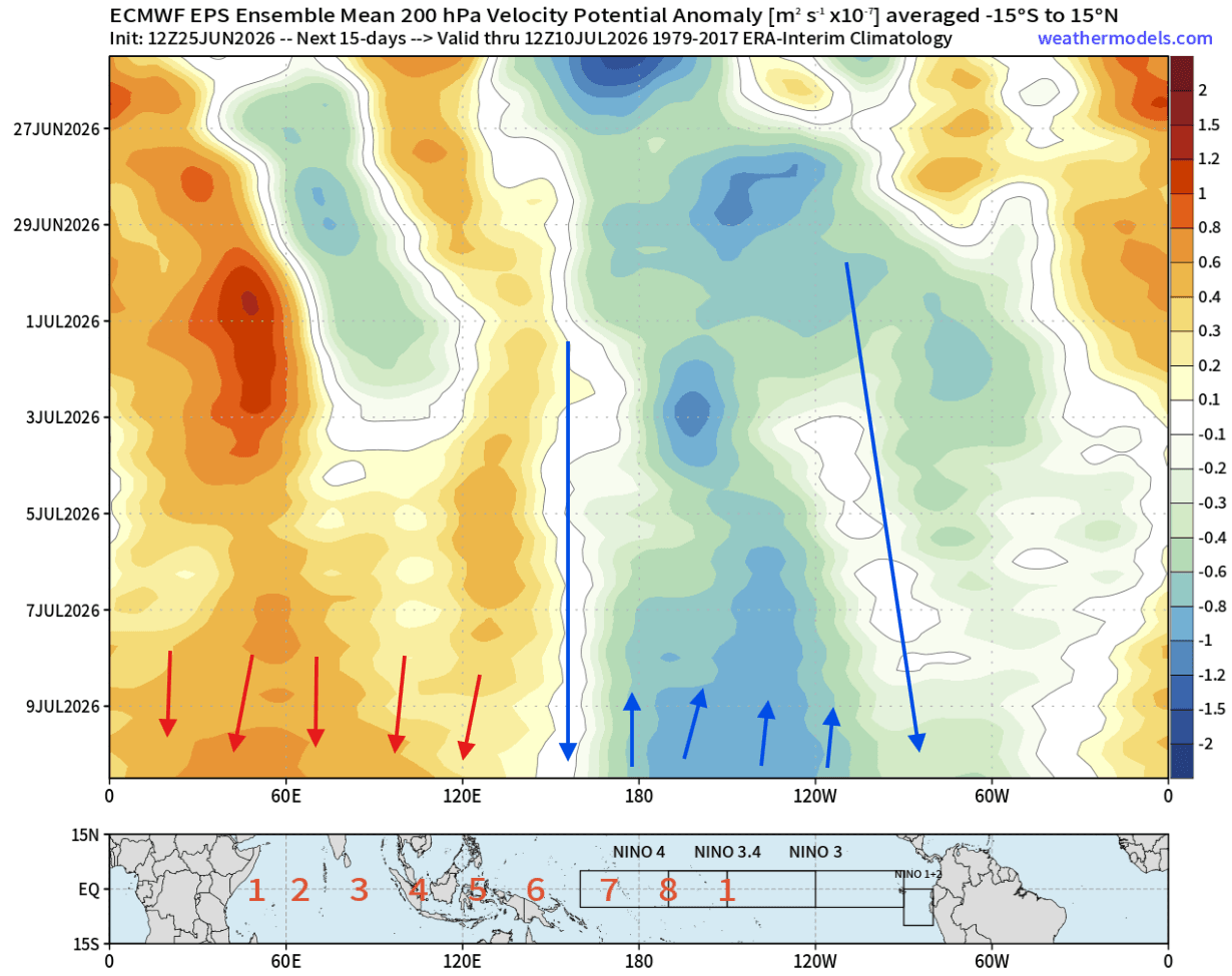
- July 2026: The atmosphere has begun to "deepen" the signal. Forecast models from the NCEP CFSv2 and ECMWF indicate that the atmospheric bridge is now fully operational, with rising air over the central Pacific and sinking air over the Indian Ocean. This confirms that the El Niño is no longer just an oceanographic event, but a global atmospheric driver.
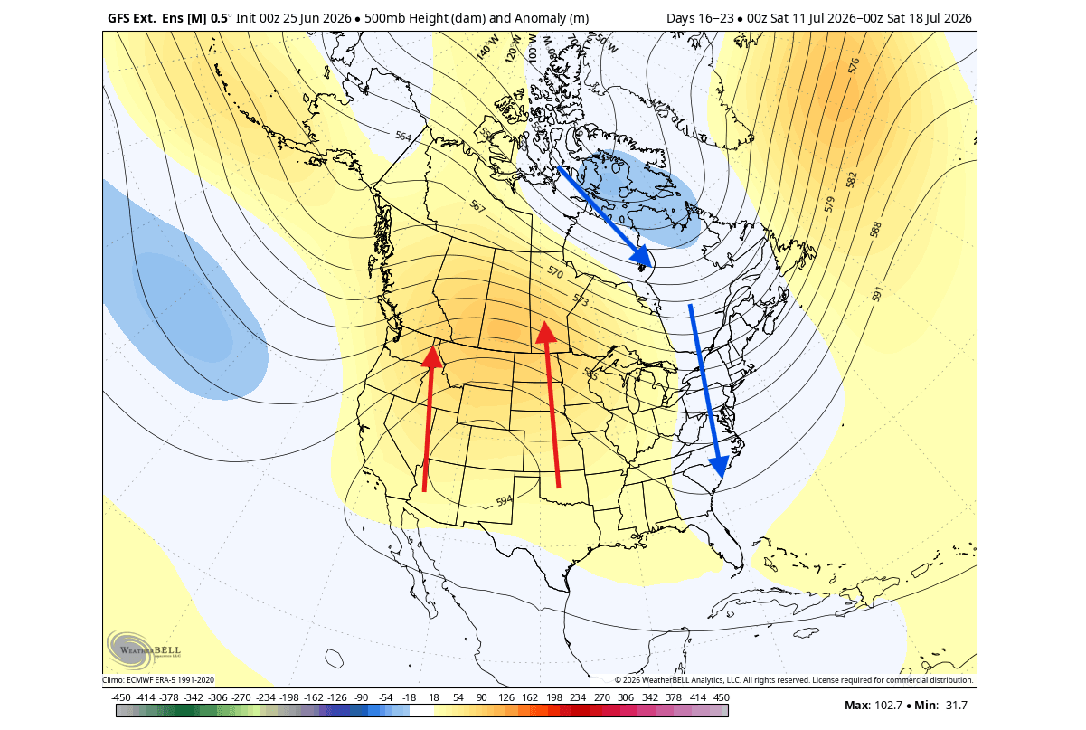
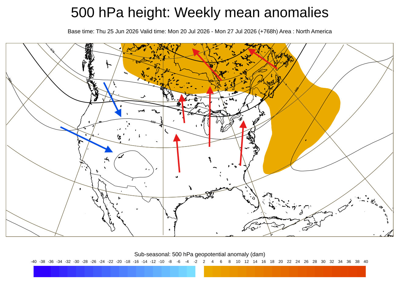
- Late Summer to Fall 2026: Projections for August through October suggest a period of "atmospheric lockdown." As the Pacific jet stream intensifies, we expect to see an Omega blocking pattern over North America, which will likely anchor high-pressure ridges over the central United States and southern Canada, while forcing active storm tracks toward the Pacific Northwest and the southern United States.
Supporting Data and Predictive Modeling
The confidence in this forecast is bolstered by high-resolution ensemble modeling. The European Centre for Medium-Range Weather Forecasts (ECMWF) has provided consistent data showing the expansion of warm anomalies.
The Velocity Potential Signal
By examining the Velocity Potential at the 200mb level—the altitude of the upper-level jet stream—meteorologists can track the "pulse" of the El Niño. Current July forecasts show a robust area of rising air across the Pacific basin, a tell-tale indicator that the atmosphere is responding to the ocean’s heat. This "rising" air acts as a pump, altering the global circulation and forcing shifts in the position of high and low-pressure systems thousands of miles away.
Historical Comparison
When comparing the current 2026 data to the four most significant Super El Niño events of the last half-century, the correlation is striking. The pressure anomalies across the North American continent—specifically the positioning of the troughs and ridges—show that the 2026 event is tracking on a trajectory to become one of the most powerful on record. The use of normalized climatology (1978–2008) allows experts to strip away the "noise" of climate change to observe the pure, event-driven signal of the current El Niño.
Regional Implications: What to Expect
The ripple effects of this Super El Niño will be felt differently depending on geographic location.
North America
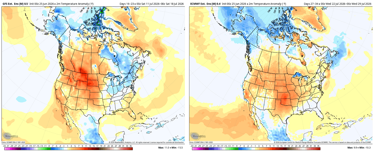
For the United States and Canada, the late summer and fall transition will likely be characterized by a "seesaw" in temperatures. The central and eastern United States can anticipate a warmer-than-average pattern as the high-pressure ridge stabilizes. Conversely, the Pacific Northwest and the far western United States may experience more volatility, including increased storminess as the energized jet stream interacts with the coastal topography.
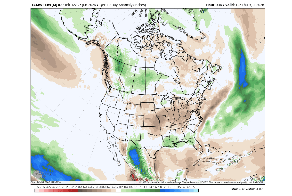
Precipitation trends are also shifting. The Midwest and parts of the Plains are currently trending toward a drier-than-normal late summer. However, the southern United States should prepare for an increase in precipitation, as the strengthened Pacific jet stream often transports moisture directly across the southern tier of the country.
Europe’s Exposure
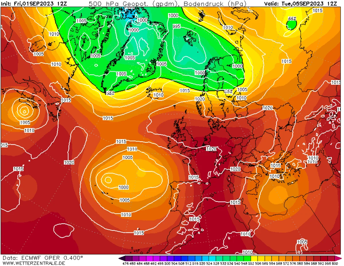
While the influence of El Niño is most immediate in the Pacific basin, its reach extends to Europe by the autumn. Latest forecasts suggest a developing "Rex-block" pattern. This occurs when a high-pressure system becomes "stuck" over northern and north-central Europe, effectively acting as a barrier to the usual westerly flow.
This configuration typically results in:
- Northern Europe: Stable, potentially drier, and warmer-than-average conditions under the blocking high.
- Southern Europe: A higher likelihood of low-pressure "undercutting," which can lead to increased rainfall and storminess in the Mediterranean region.
Implications for Global Weather Stability
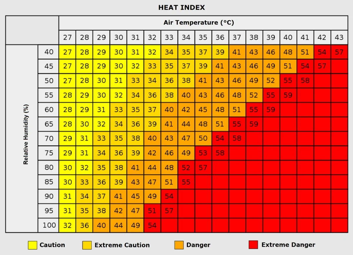
The most significant implication of a Super El Niño is the "lockdown" effect. Once the atmosphere adjusts to these massive sea-surface temperature anomalies, it becomes difficult for the weather to move out of these established patterns. This increases the probability of extreme weather events: prolonged droughts in some regions, persistent, devastating floods in others, and heatwaves that refuse to dissipate.
Furthermore, when this Super El Niño merges with other global factors—such as record-low Arctic sea ice—the complexity of the forecast increases. The combination of an energized Pacific and a changing cryosphere creates a "new normal" for the 2026/2027 season, where standard seasonal averages may no longer be a reliable guide for public safety or agricultural planning.
Conclusion and Looking Forward
As we move into the heart of summer, the evidence is conclusive: the 2026 Super El Niño is not merely a theoretical possibility but a present reality. The atmospheric bridge is strengthening, and the global circulation is being rewritten.
For the public, this implies a need for heightened vigilance. The likelihood of extreme, record-challenging events is statistically higher during a Super El Niño than during neutral years. From the drought-prone Plains of the United States to the blocking-high-prone regions of Europe, the next six months will test the resilience of global infrastructure and climate readiness.
We will continue to provide granular analysis as the Fall seasonal patterns solidify. Meteorologists and policy makers are advised to monitor the evolution of the Pacific jet stream and the positioning of the blocking highs over the coming weeks, as these will be the primary indicators of how the winter season will eventually manifest. Stay tuned to long-range outlooks as we navigate this historic meteorological event.