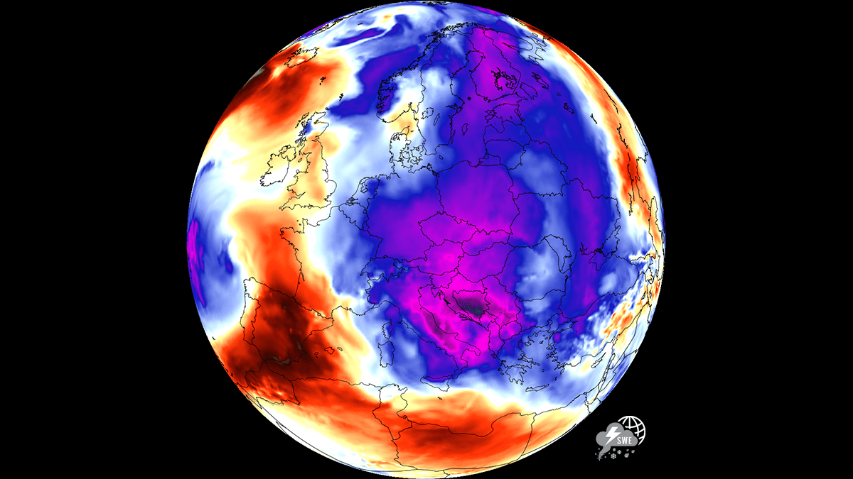
After a brutal, historic stretch of relentless high temperatures that tested the limits of infrastructure and human endurance across the European continent, a profound atmospheric shift is underway. A massive, cold-core air mass is sweeping across Central and Eastern Europe, providing a much-needed reprieve from the stifling heat that dominated the first half of July 2026. This transition marks the end of a punishing period of tropical nights and urban heat island effects that left millions in cities like Budapest, Warsaw, and Bucharest struggling to find respite.
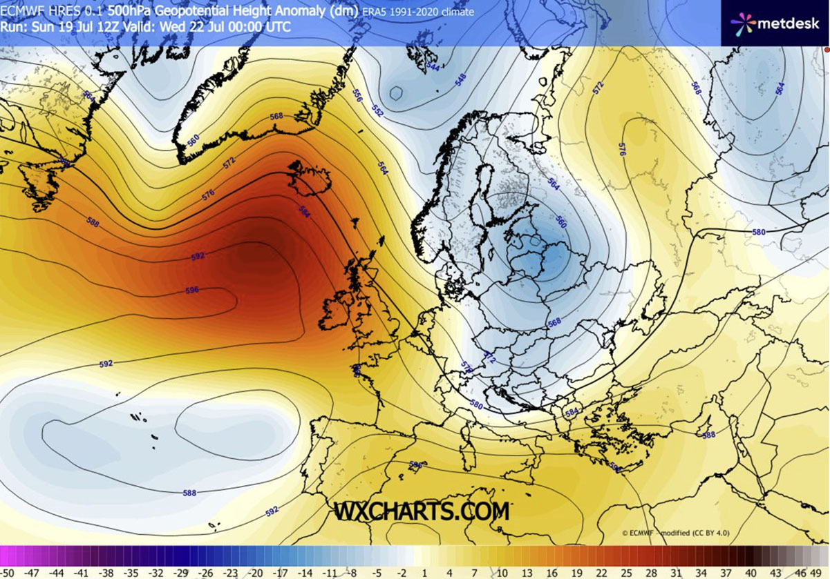
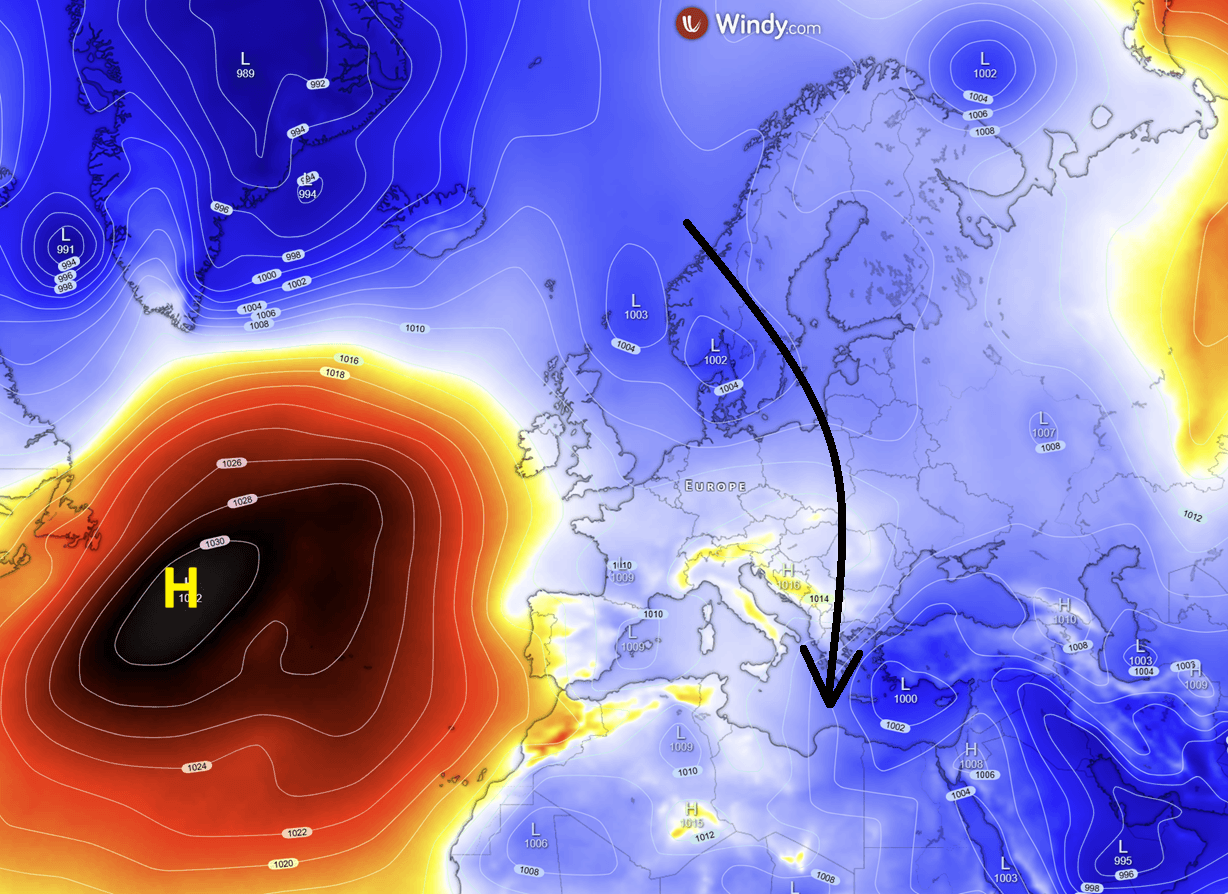
As a dynamic upper-level ridge establishes itself over the Atlantic, the resulting atmospheric "block" has forced a deep, meridional trough to develop. This structural change is effectively carving a path for polar air to surge southward, plunging temperatures across the heart of the continent to levels 4°C to 8°C below the seasonal average. For the millions of residents and tourists currently navigating the peak of summer, this shift offers a rare opportunity to cool down overheated homes and recover from the physiological stress of prolonged heat exposure.
The Meteorological Mechanism: Why the Pattern Flipped
The sudden cooling is not merely a random fluctuation but a direct result of a major reconfiguration of the jet stream. Meteorologists have observed a significant strengthening of an upper-level high-pressure ridge over the Atlantic Ocean. This feature is acting as a "blocking" mechanism, preventing the standard west-to-east progression of weather systems.
In response, the flow of the atmosphere has become increasingly meridional—meaning it is moving more from north to south rather than west to east. This allows a deep low-pressure system, laden with cold, unstable air from the Arctic, to descend directly into the heart of the continent. By mid-week, this cold wave will have fully engulfed Central and Eastern Europe, creating a stark contrast to the persistent, record-breaking heat that defined the region for the previous fortnight.
Chronology of the Cold Surge
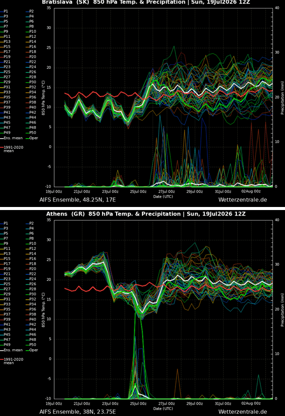
The progression of this weather system is set to unfold in three distinct stages over the coming days:
Phase 1: The Initial Breach (Mid-Week)
By Wednesday and Thursday, the leading edge of the cold front will have pushed across the Benelux, Germany, and Poland, reaching into the northern Balkans. Daytime temperatures, which were consistently hovering in the mid-to-high 30s, will plummet into the comfortable, seasonable 20s. This phase is characterized by a brisk, strengthening northerly wind, which will further amplify the sensation of coolness, particularly for those in urban corridors.
Phase 2: Deep Penetration (Friday and Saturday)
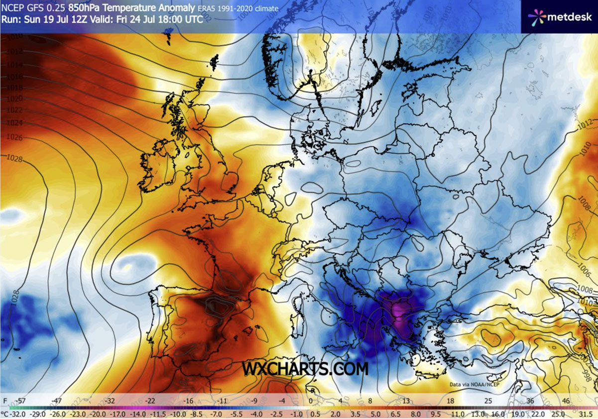
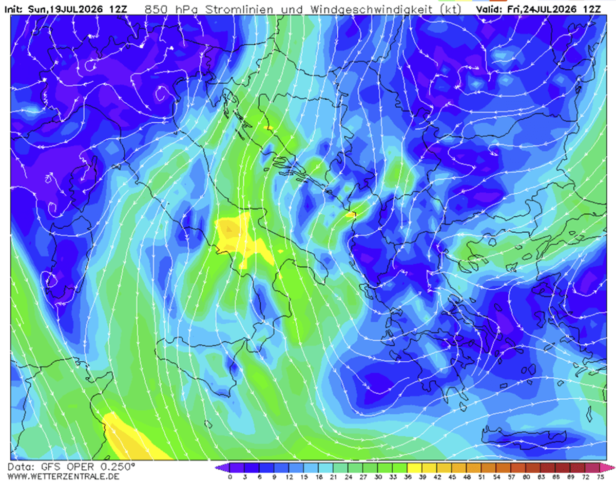
As the trough deepens, the core of the cold air mass will reach its peak intensity, moving deep into the southern Balkans, Italy, and the Eastern Mediterranean. During this period, the temperature anomalies will be most pronounced, with some regions in Greece and the southern Balkans experiencing temperatures 10°C to 12°C below the typical late-July norm. While the Iberian Peninsula remains trapped under a lingering dome of extreme heat, the rest of Europe will find itself in the grip of a truly unseasonable, albeit refreshing, chill.
Phase 3: The Persistent Trough (Following Weekend)
Because of the persistent Atlantic blocking, this weather pattern is expected to linger well into the following weekend. The cold core will settle over the Ionian Sea, ensuring that the relief is not merely a fleeting 24-hour event but a sustained period of manageable temperatures. For residents, this provides a vital window for cooling down infrastructure—a critical necessity after weeks of concrete and steel retaining massive amounts of thermal energy.
Supporting Data and Anomalies
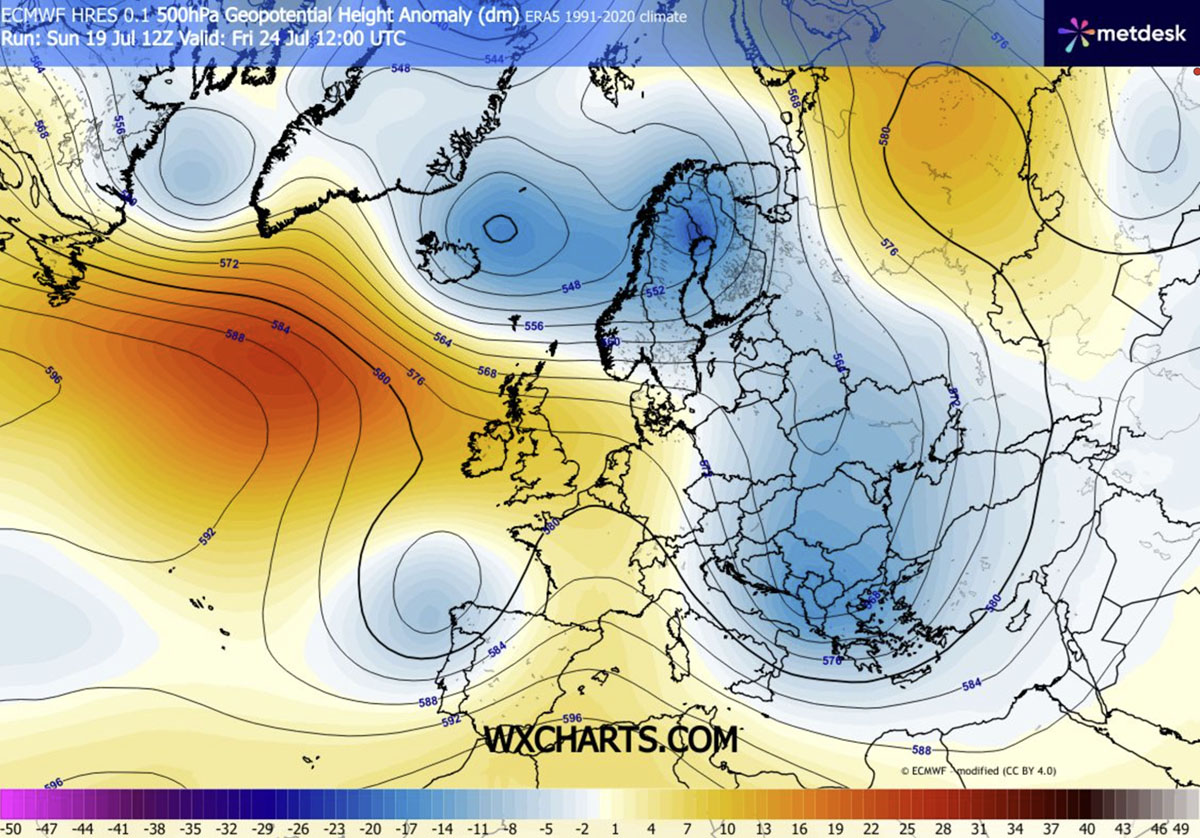
The scale of this event is evident in the meteorological modeling. Atmospheric pressure charts show a distinct "geopotential fall" over Eastern Europe, a signature of cold, dense air replacing the previous warm, expanded air masses.
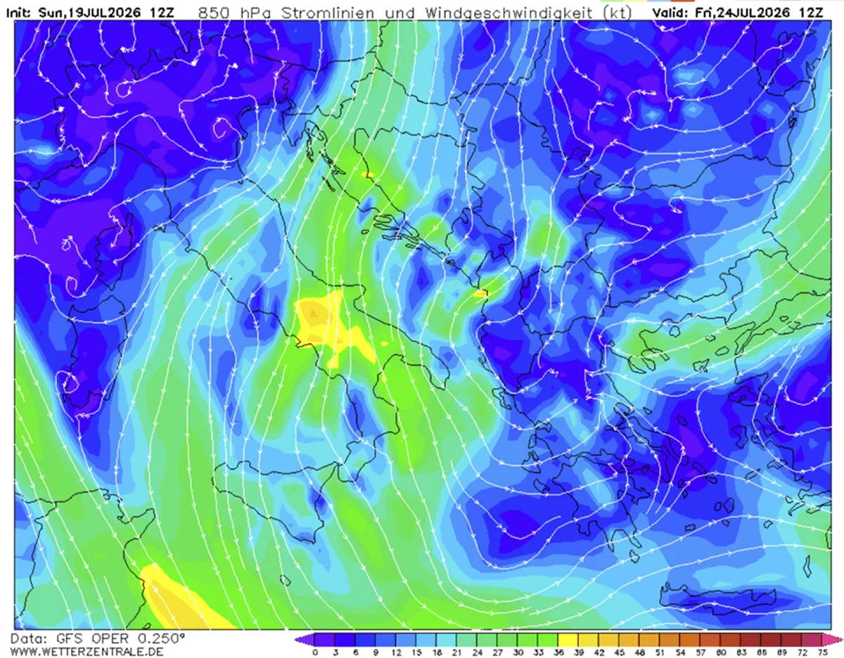
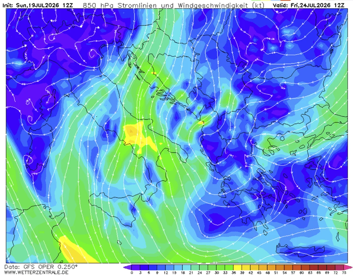
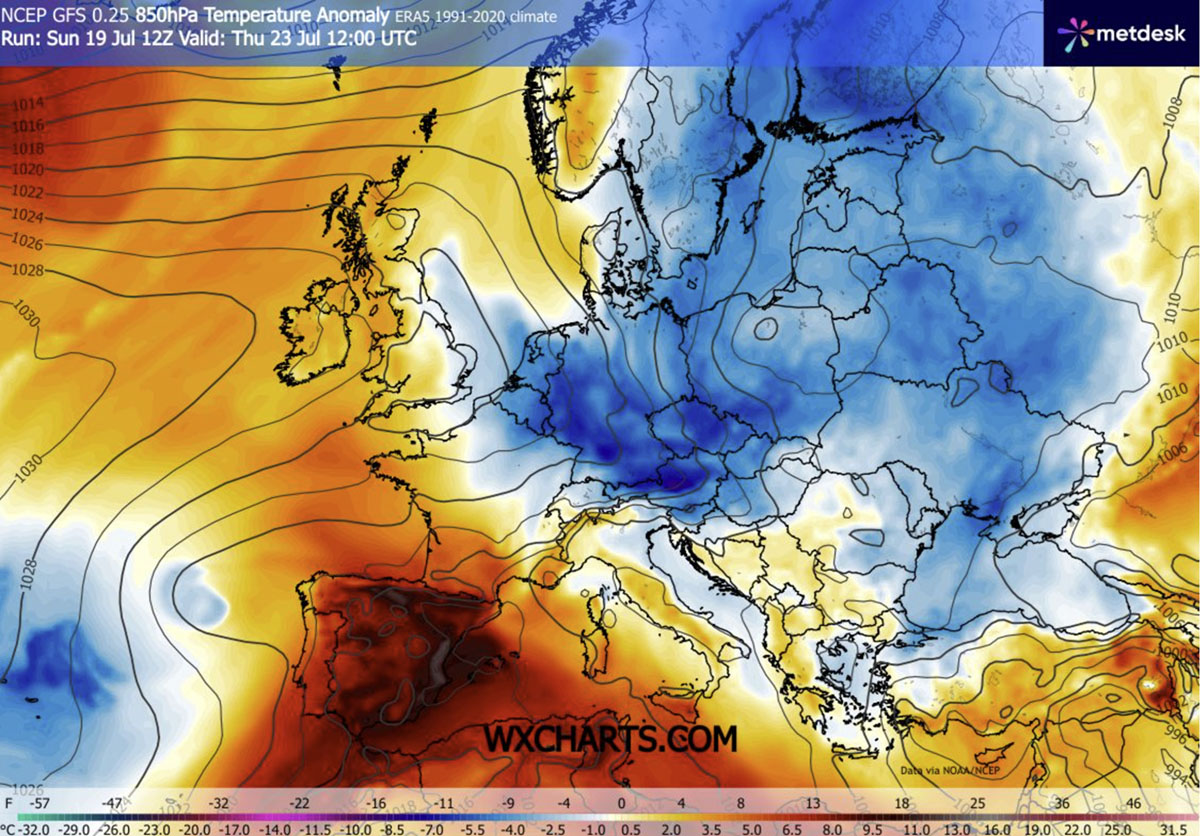
Data from the 850mbar level—a standard benchmark for tracking air mass temperatures—reveals a massive "blue zone" (indicating significant negative temperature anomalies) stretching from Scandinavia down to the Greek islands. While Northern and Central Europe will see the most consistent cooling, the most impressive anomalies—the sharpest deviations from the norm—are projected for the southern latitudes, where the contrast between the incoming polar air and the lingering Mediterranean warmth will be at its peak.
The Double-Edged Sword: Thunderstorms and Wildfire Risks
While the cooler temperatures are universally welcomed, the transition is not without its hazards. The collision of the incoming cold, dense air with the residual, moisture-laden heat over the Mediterranean and the Balkans is creating a "powder keg" of atmospheric instability.
Meteorological models indicate a high CAPE (Convective Available Potential Energy) index, suggesting that the latter half of the week will see the development of potent, potentially severe thunderstorms. These storms are expected to bring localized, intense downpours to regions such as Romania, Greece, and the Black Sea coastline.
However, experts caution that this precipitation is a "mixed blessing." While it may provide short-term relief for agriculture, it is unlikely to be widespread enough to extinguish the deep-seated wildfire risks that have built up over the last month of drought. Furthermore, the combination of dry, windy conditions in the lead-up to the cold front means that fire suppression efforts must remain at a heightened state of alert. The wind, while refreshing for the human body, can turn small sparks into rapidly spreading wildfires in the parched landscapes of the Balkan Peninsula.
Implications for Public Health and Infrastructure
The significance of this cold wave cannot be overstated in terms of public health. Prolonged exposure to "tropical nights"—where temperatures remain above 20°C—has been linked to cardiovascular stress, sleep deprivation, and increased mortality among vulnerable populations.
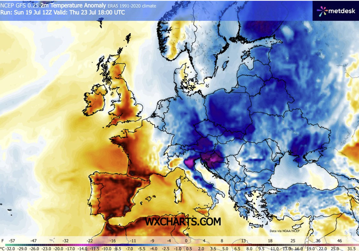
Medical authorities in the affected regions have noted that the coming drop in nighttime temperatures to the low-to-mid 10s is the most critical factor for recovery. This will allow for the natural cooling of buildings, which have been acting as thermal radiators for weeks, and provide a necessary recovery period for the human body.
Furthermore, municipal authorities in cities like Prague, Vienna, and Sofia are expected to shift their emergency protocols from "Heat Emergency" to standard operations. The drop in energy demand for air conditioning units—which have been running at near-maximum capacity—will provide a much-needed break for regional power grids that have been under immense strain since the start of July.
Regional Contrasts: The Iberian Exception
It is important to note that the relief is not continental in scope. While Eastern and Central Europe experience this dramatic downturn, the Iberian Peninsula is currently trending in the opposite direction. Spain and Portugal continue to endure extreme heat, with temperatures stubbornly remaining in the 40s.
This stark disparity highlights the effectiveness of the current atmospheric blocking. The "wall" of high pressure over the Atlantic is effectively shielding the West from the cooler air masses, while simultaneously trapping the heat over the peninsula. Meteorological analysts are preparing separate, in-depth reports on the Iberian situation, as the heatwave there shows no signs of relenting, further underscoring the fragmented and volatile nature of the 2026 summer weather patterns.
Conclusion: A Vital Pause
For the millions of people living and traveling across the Eastern and Central regions, this week represents a "reset button." As the cool, refreshing air from the north settles in, the focus will shift from survival and heat management to the practicalities of recovery.
As we look toward the end of July and into August, this weather pattern serves as a poignant reminder of the volatility inherent in current climate trends. While the current cold wave provides a necessary, albeit temporary, respite, the persistence of these blocking patterns suggests that summer 2026 will continue to be characterized by extreme shifts rather than consistent, moderate weather. For now, however, the cooling breeze is a welcome sight for a continent that has been, quite literally, under fire.