The global climate system is currently bracing for what meteorologists and climate modelers are calling a "Super El Niño" of unprecedented potential. As of mid-2026, the latest observational data indicates that the Pacific Ocean is undergoing a rapid, high-intensity transition into a warm phase that could eclipse every recorded event in the last 155 years.

This is not merely a regional fluctuation; it is a fundamental shift in the global atmospheric engine. As warm Pacific waters expand and intensify, the resulting "tropical forcing" is beginning to reorganize global pressure systems, jet streams, and seasonal weather patterns. With global weather centers—including the ECMWF, NOAA, and BOM—all converging on a consensus, the scientific community is preparing for a winter season that could rewrite climate history.
The Anatomy of a Super Event: Main Facts
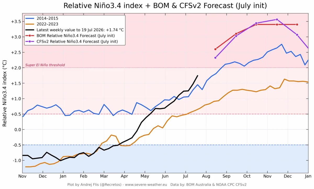
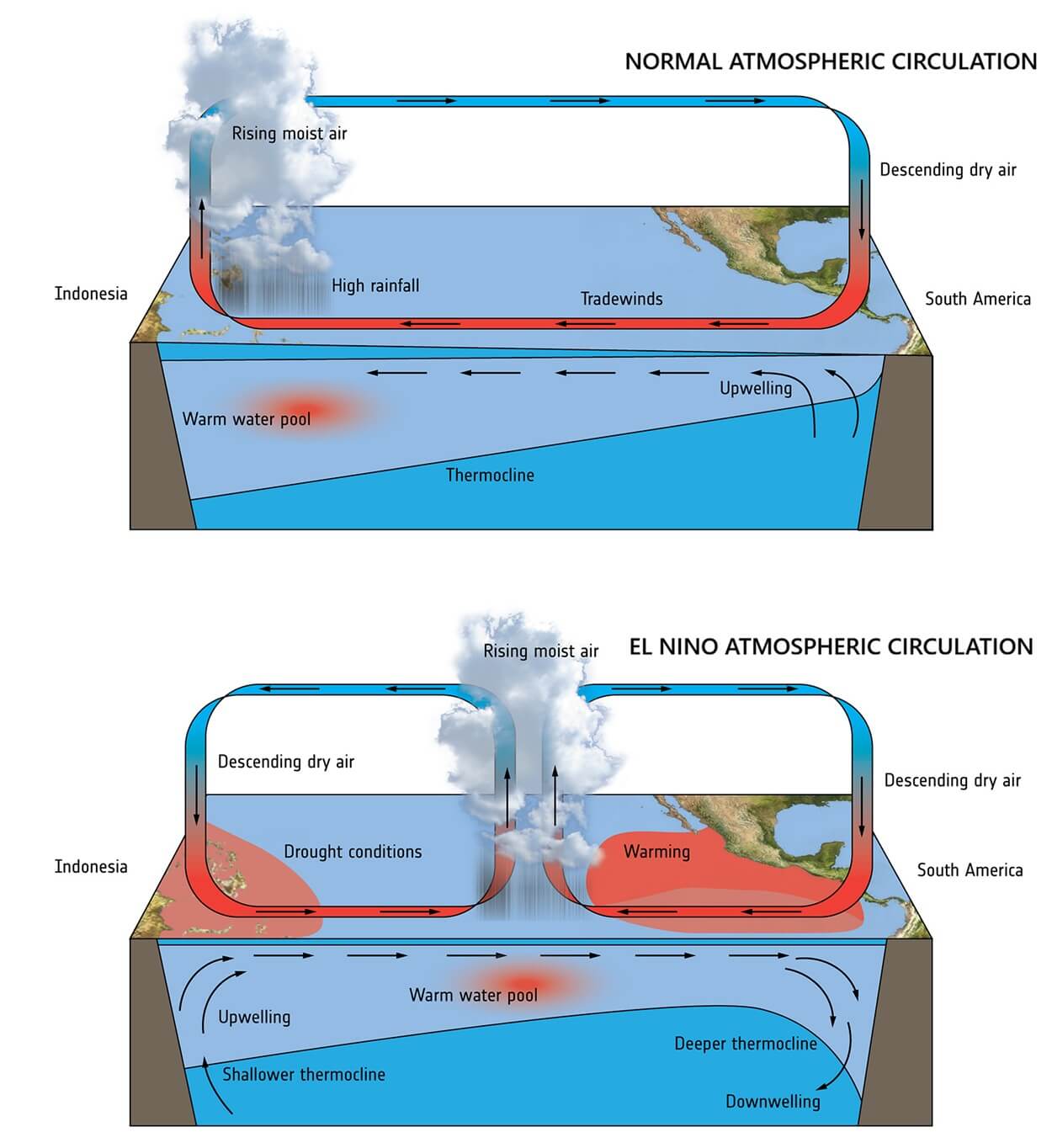
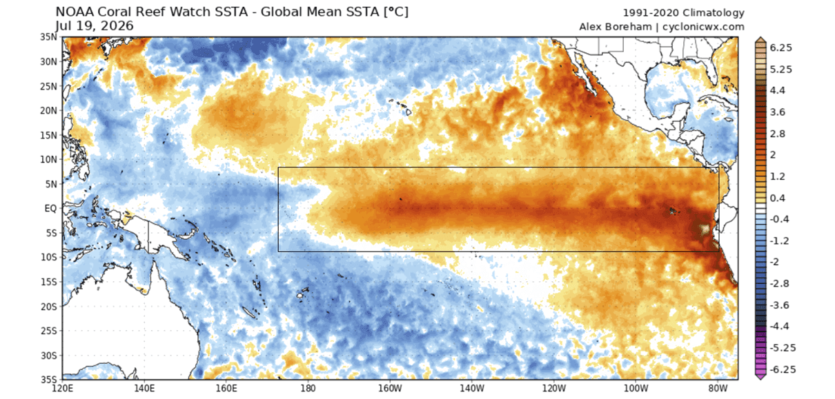
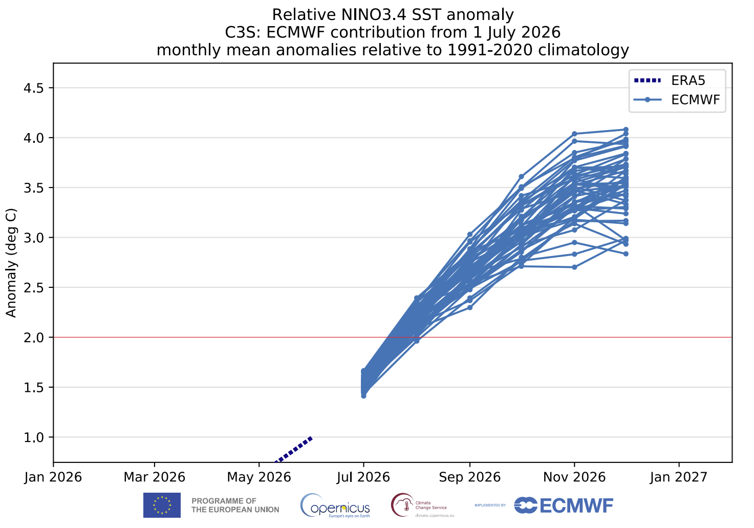
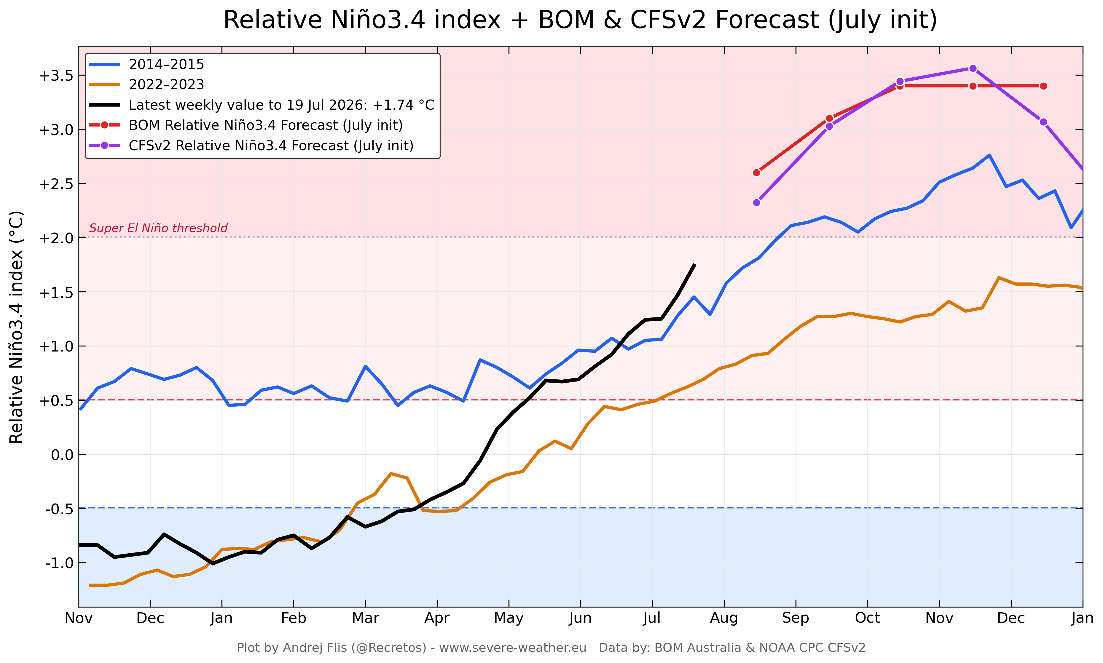
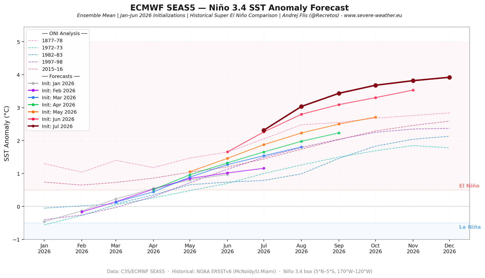
At its core, El Niño is a periodic warming of the central and eastern equatorial Pacific Ocean, which occurs every few years as part of the El Niño-Southern Oscillation (ENSO) cycle. When the sea surface temperature (SST) anomalies in the key regions exceed +2.0°C above the long-term average, the event is categorized as a "Super El Niño."
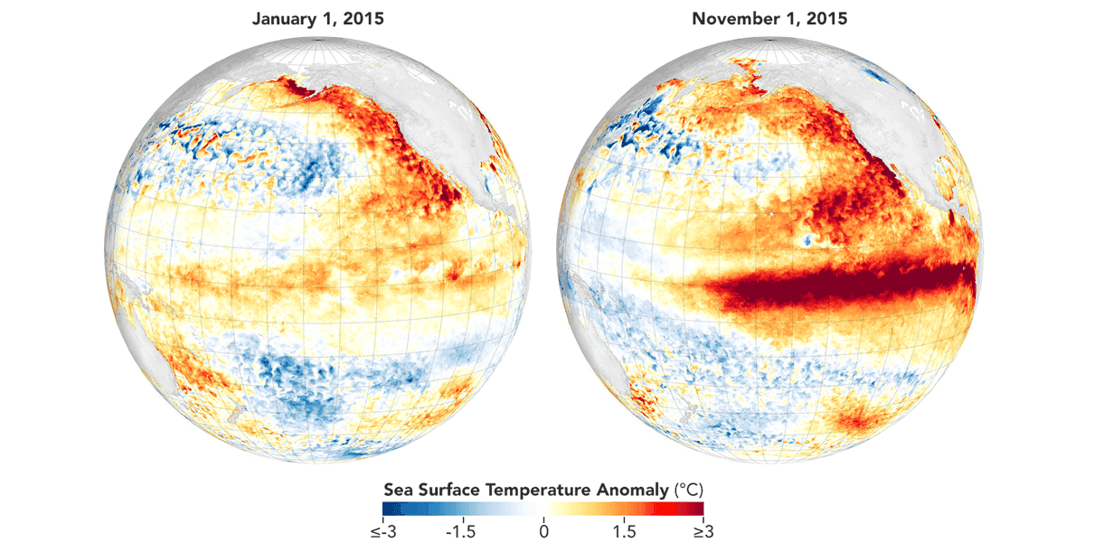
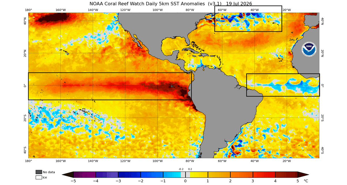
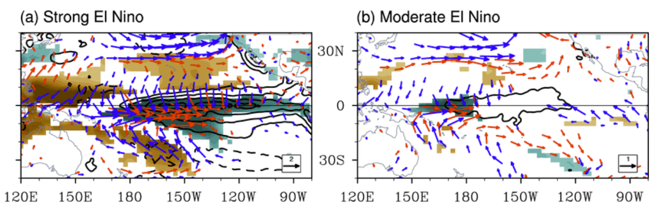
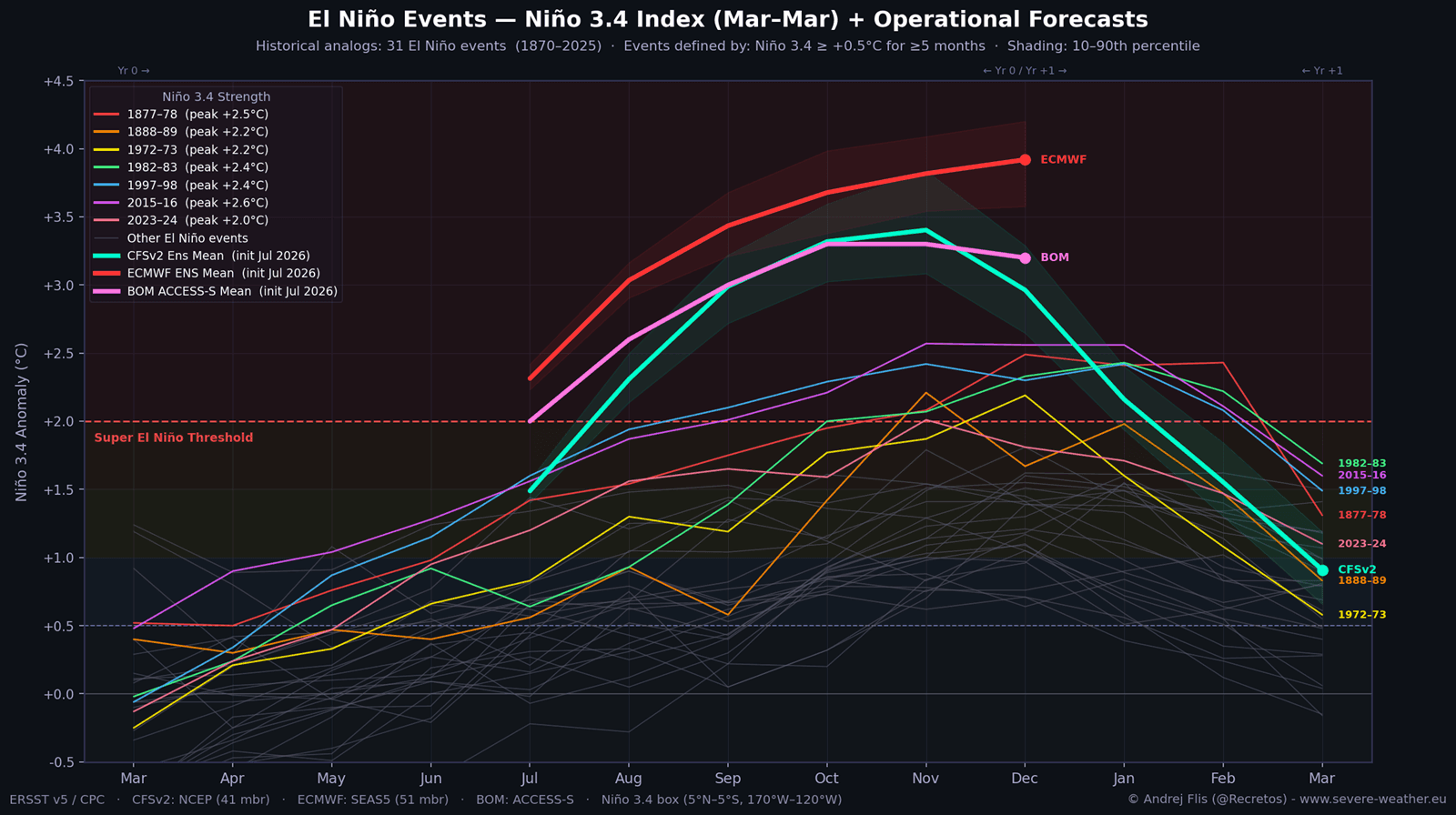
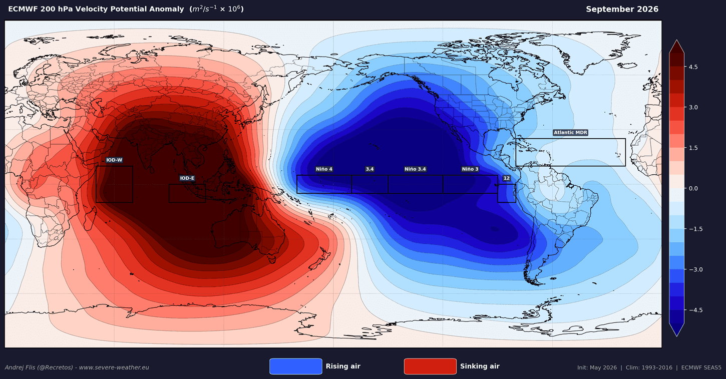
The 2026 event is currently tracking well above this threshold, with models projecting peaks nearing +3.0°C or higher. This signifies an immense release of energy from the ocean into the atmosphere. The "atmospheric bridge"—the mechanism through which this oceanic heat influences global weather—is already locking into place. Lower pressure is establishing itself over the central and eastern Pacific, while higher pressure dominates the western sectors, creating a stationary "standing wave" that dictates the flow of air across the entire planet.
Chronology of Development
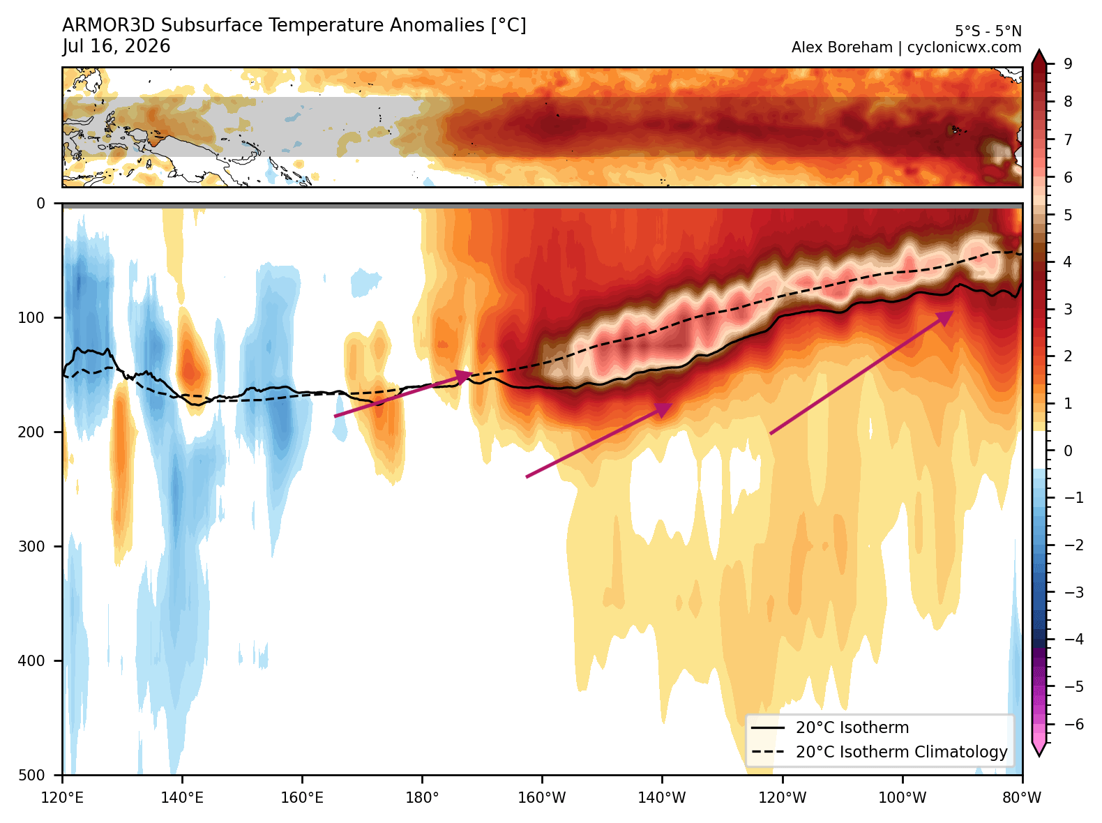
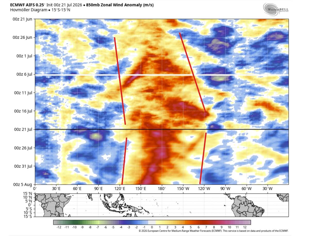
The current intensification began with a massive subsurface warm anomaly—a phenomenon known as a Kelvin Wave. Driven by powerful westerly wind bursts in the tropical Pacific, these warm subsurface waters were pushed eastward, eventually surfacing to create a massive warm pool.
- Early 2026: Initial modeling identified the formation of a warm ENSO phase.
- Spring 2026: Subsurface temperatures began to climb, with the core of the Kelvin Wave reaching anomalies of +7°C at depth.
- Summer 2026: The surface manifestation of the event became clear. Westerly wind bursts increased in frequency and intensity, effectively stripping away the trade winds that usually keep the Pacific cool.
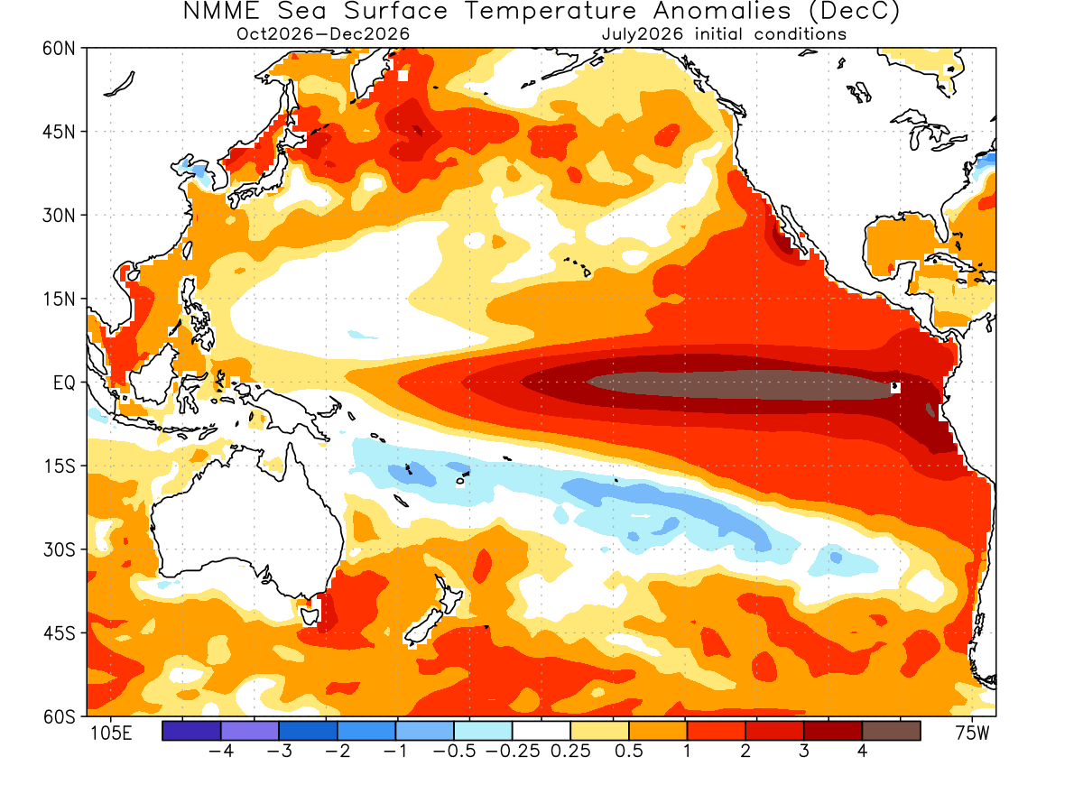
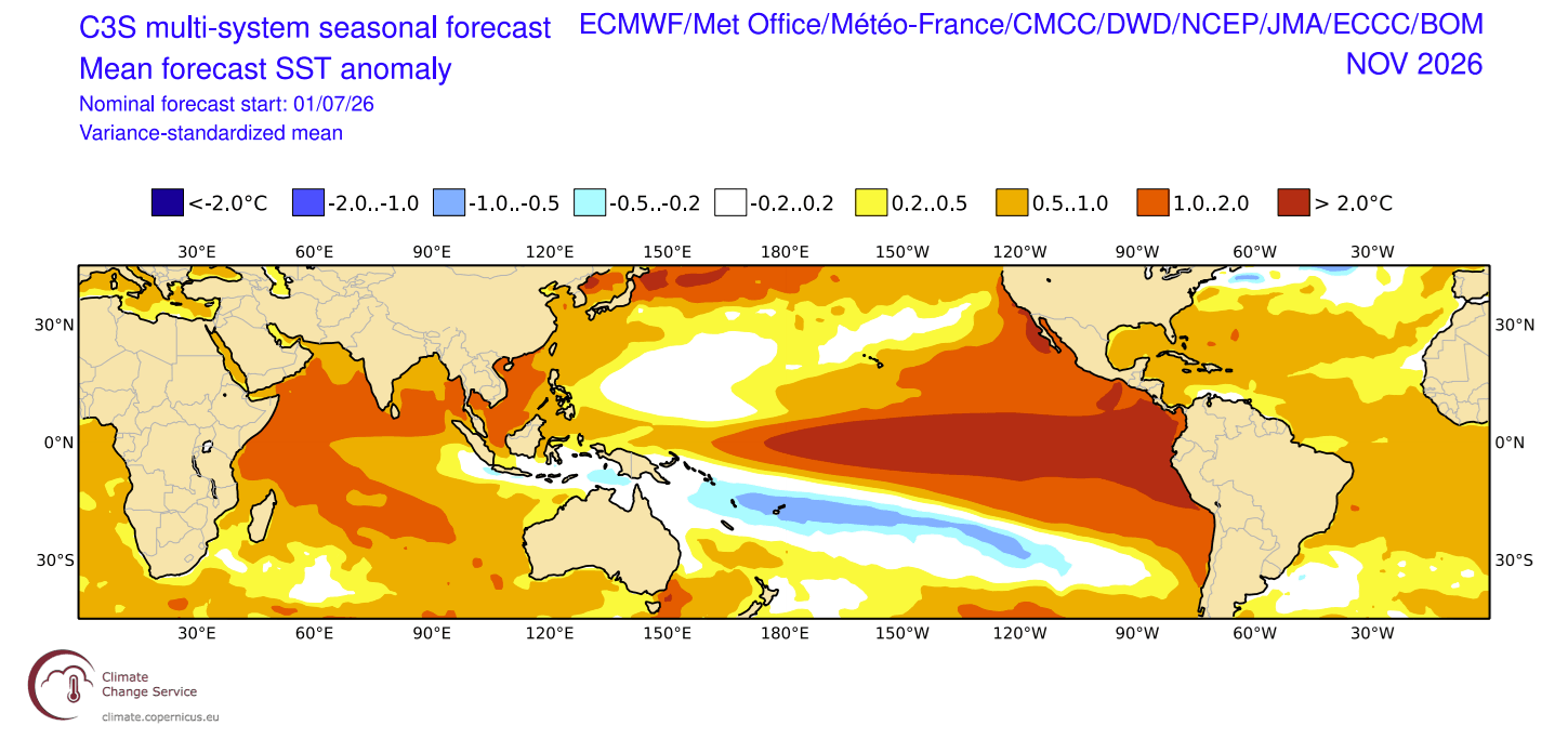
- Autumn 2026 (Projection): The event is expected to reach a state of full maturity. Forecasts indicate that the anomaly will cover more than 10% of the global ocean surface by November, a statistic that underscores the sheer scale of this event.
- Winter 2026/2027 (Outlook): The peak of the event is expected to coincide with the Northern Hemisphere winter, leading to maximum disruption of global circulation patterns.
Supporting Data and Model Consensus
The confidence in this forecast is bolstered by an unprecedented level of agreement among international meteorological agencies. The European Centre for Medium-Range Weather Forecasts (ECMWF), the U.S. National Oceanic and Atmospheric Administration (NOAA), and the Australian Bureau of Meteorology (BOM) have all produced models that point toward a record-breaking winter.
When comparing the current development to the infamous 2015/2016 Super El Niño, current data shows the 2026 event developing at a faster rate and possessing a stronger energy signature. The "relative ENSO" index—a tool used to normalize anomalies across different decades—confirms that the 2026 event is currently operating on a tier of its own, outperforming the historical peak of previous century-defining events.
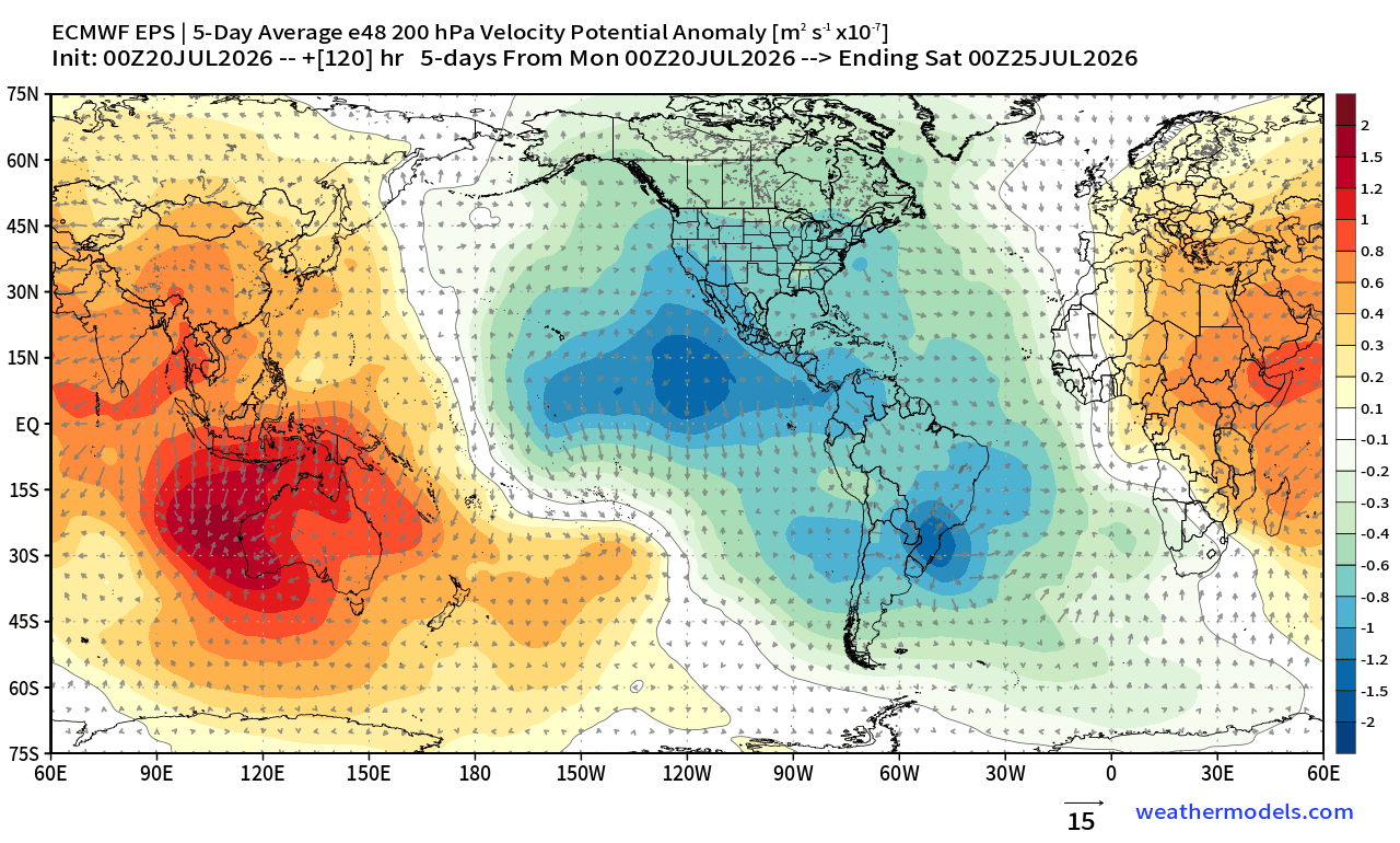
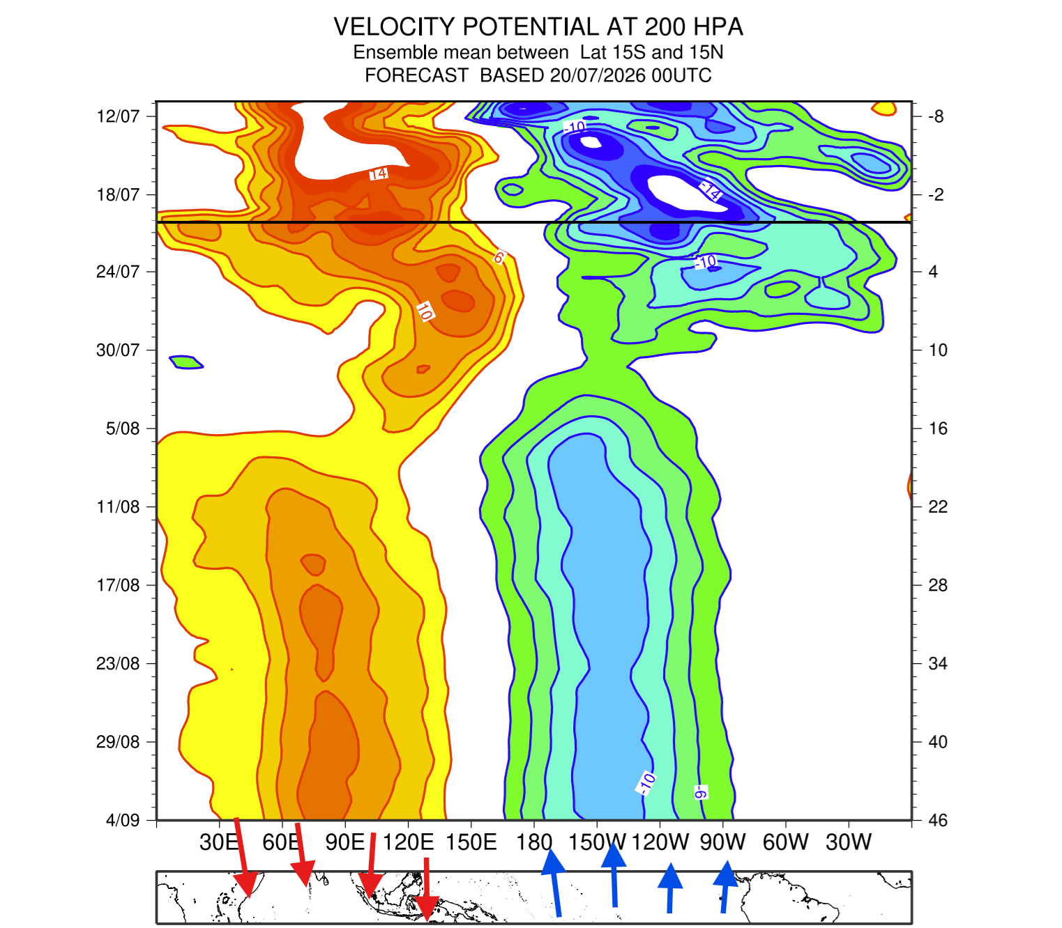
Furthermore, the "Velocity Potential" parameter—which maps rising and sinking air across the globe—shows that the atmosphere is currently "locked" into an El Niño mode. This suggests that the tropical Pacific has effectively hijacked the global circulation, forcing weather patterns to remain in a stationary state for the foreseeable future.
Implications for Global Weather
The implications of a Super El Niño are vast, ranging from agricultural disruption to increased risks of extreme weather events.
North America: The Southern Storm Corridor
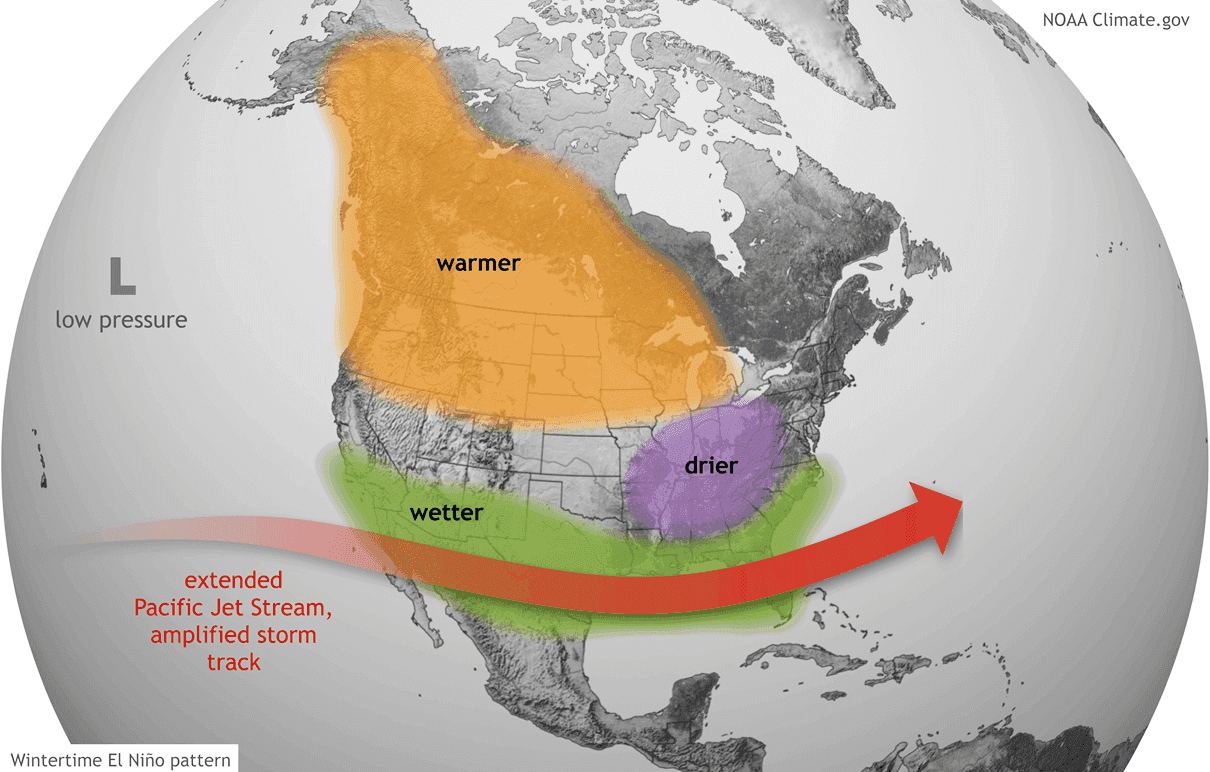
For the United States and Canada, the winter of 2026/2027 is shaping up to be a high-stakes season. The typical El Niño signature involves a strong, persistent low-pressure system in the North Pacific, which displaces the polar jet stream. This usually results in:
- Warmer Winters in the North: Western Canada and the northern United States can expect milder-than-average conditions due to the northward shift of the polar jet.
- Increased Southern Storm Activity: An energized, southern Pacific jet stream will likely bring increased moisture and storm systems across the southern U.S., from California to the Gulf Coast and the Eastern Seaboard.
- Increased Winter Storm Potential: The intersection of this moisture-rich southern track with cold air intrusions—deflected southward by high-pressure blocking over Canada—creates the potential for major winter storms, ice events, and significant snowfall in the Central and Eastern U.S.
Europe: A Less Certain Trajectory
Europe’s response to El Niño is historically more complex and less direct than that of North America. Current models show a potential high-pressure ridge forming to the south, with a low-pressure zone over the northwestern regions. However, this pattern remains fluid. The lack of a direct atmospheric link means European weather may be more heavily influenced by secondary drivers, such as the state of the North Atlantic Oscillation.
The Polar Vortex and the Risk of Disruption
Perhaps the most significant atmospheric wildcard is the stratospheric Polar Vortex. The Polar Vortex acts as a containment vessel for freezing arctic air. When it is strong, the cold remains confined to the poles; when it is weak or disrupted, the cold air spills southward.
Current seasonal forecasts show a strong "disruption trend" for January and February 2027. A Super El Niño often increases the likelihood of a Sudden Stratospheric Warming (SSW) event. An SSW can lead to a partial or total collapse of the Polar Vortex, which would result in a sudden "release" of arctic air into the mid-latitudes.
The data suggests that the combined pressure of tropical forcing and potential stratospheric instability makes this winter an exceptionally high-risk period for "Polar Express" weather events—rapid, deep freezes that could strike parts of the United States, Canada, and Europe in late winter.
Official Outlook and Preparations
While meteorologists emphasize that specific weather events (like individual snowstorms) cannot be predicted months in advance with 100% accuracy, the "envelope" of likely outcomes is becoming clear.
The scientific consensus is that we are entering "uncharted territory." Because this event is projected to exceed the strength of any El Niño in the modern record, the standard textbook impacts may be amplified. Officials in emergency management and agriculture are advised to prepare for a wide range of outcomes, including:
- Heavy Precipitation: Increased flood risk in the southern U.S. and parts of South America.
- Agricultural Volatility: Shifts in growing seasons and precipitation levels that could impact crop yields.
- Grid Stress: Increased demand on energy infrastructure due to unpredictable temperature swings and storm-related outages.
Conclusion
The 2026/2027 Super El Niño is a monumental event in the Earth’s climate history. It is a powerful reminder of how interconnected our planetary systems are, where a warming of the Pacific Ocean can dictate the snowfall in the American Midwest or the temperature of a winter day in Europe.
As we approach the winter months, the focus of the global meteorological community remains on the Pacific engine and the stratosphere. Whether this event marks a new, higher baseline for climate variability remains to be seen, but one thing is certain: the global atmosphere is shifting, and the world is preparing for a winter of significant, record-challenging weather.
This article is based on the latest seasonal climate projections from the ECMWF, NOAA CFSv2, and the Australian Bureau of Meteorology. Monitoring of the equatorial Pacific and the stratospheric Polar Vortex will continue through the winter months.