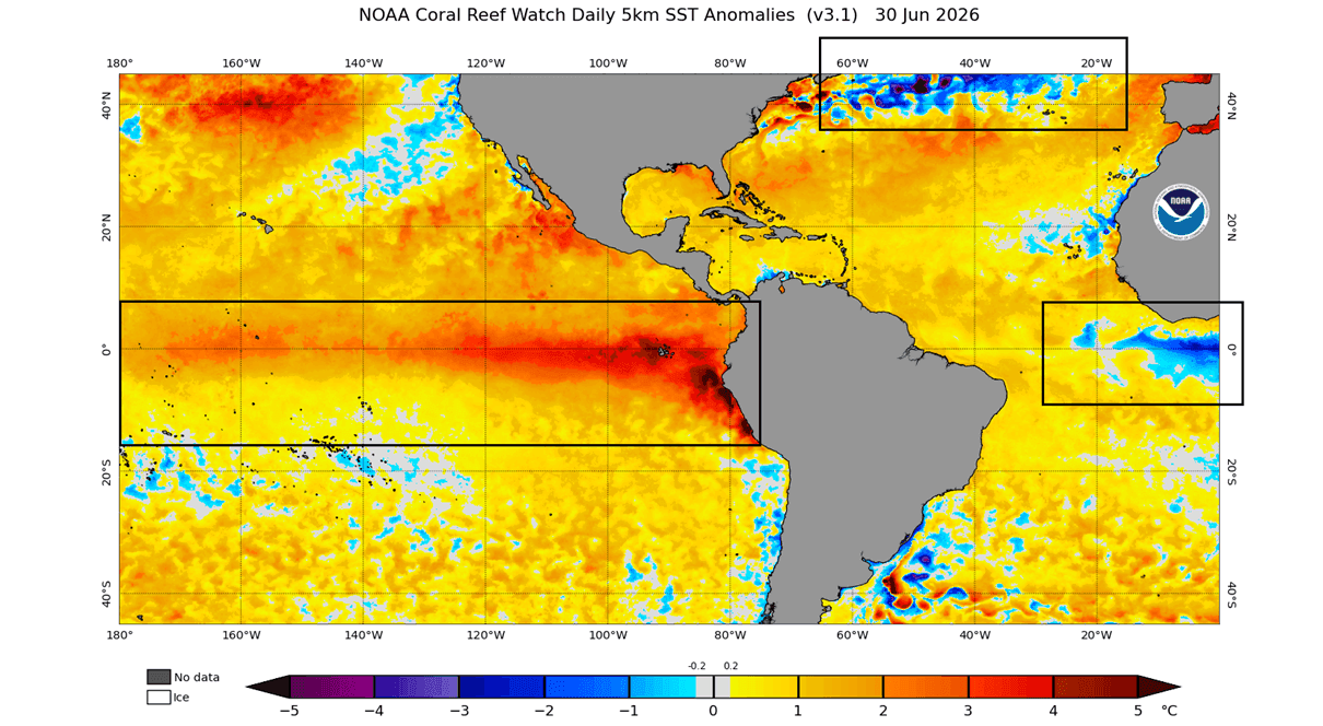
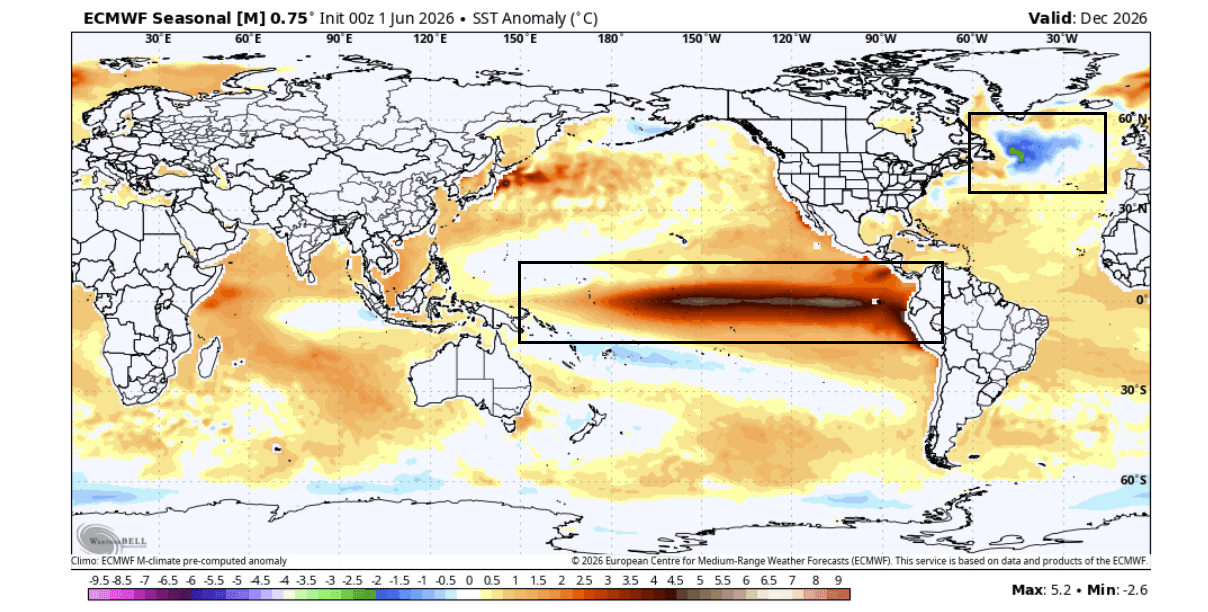
A concerning climate phenomenon is once again emerging in the far North Atlantic, signaling potential shifts in global weather patterns that could define the winter of 2026/2027. Recent oceanographic analysis has identified a resurging "cold blob"—a persistent region of abnormally low surface temperatures—that mirrors historical cooling events. As this anomaly expands, meteorologists are increasingly concerned about its potential to interact with a developing "Super El Niño" in the tropical Pacific, creating a dual-forcing mechanism that could significantly disrupt the atmospheric circulation across North America and Europe.

Main Facts: The Intersection of Ocean and Atmosphere
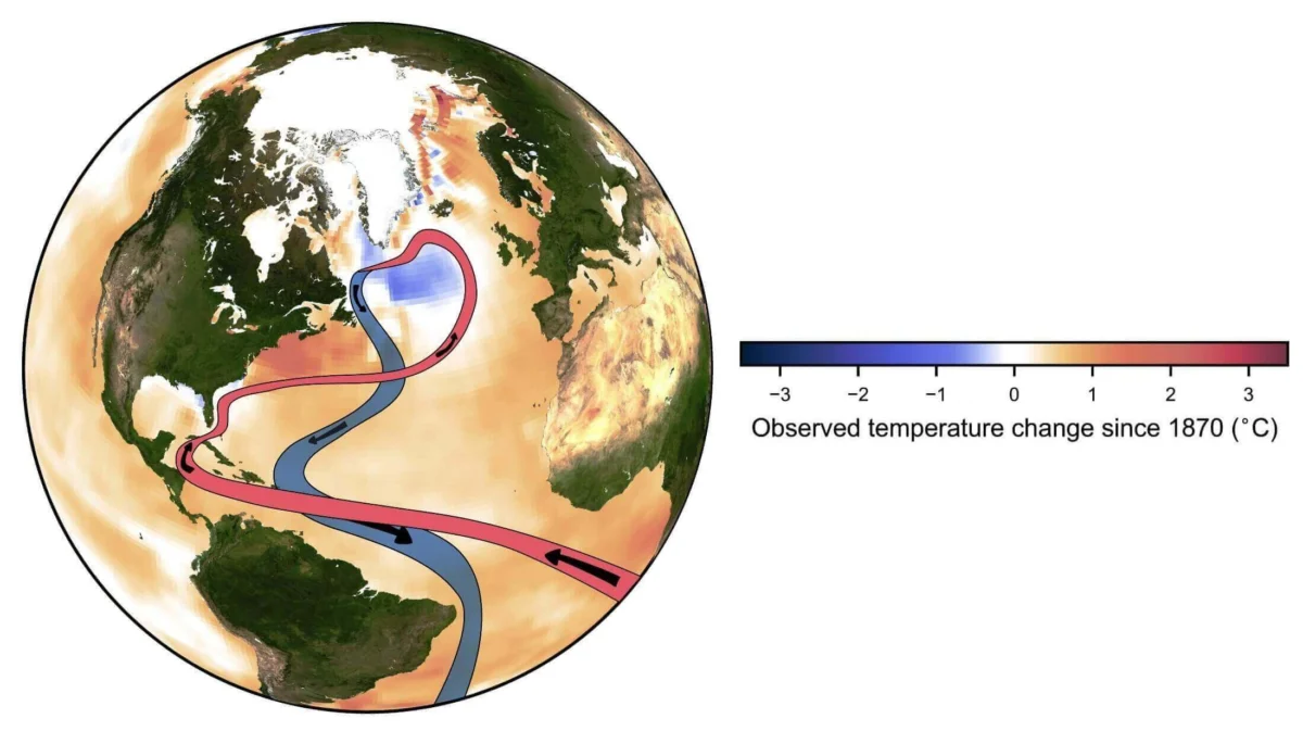
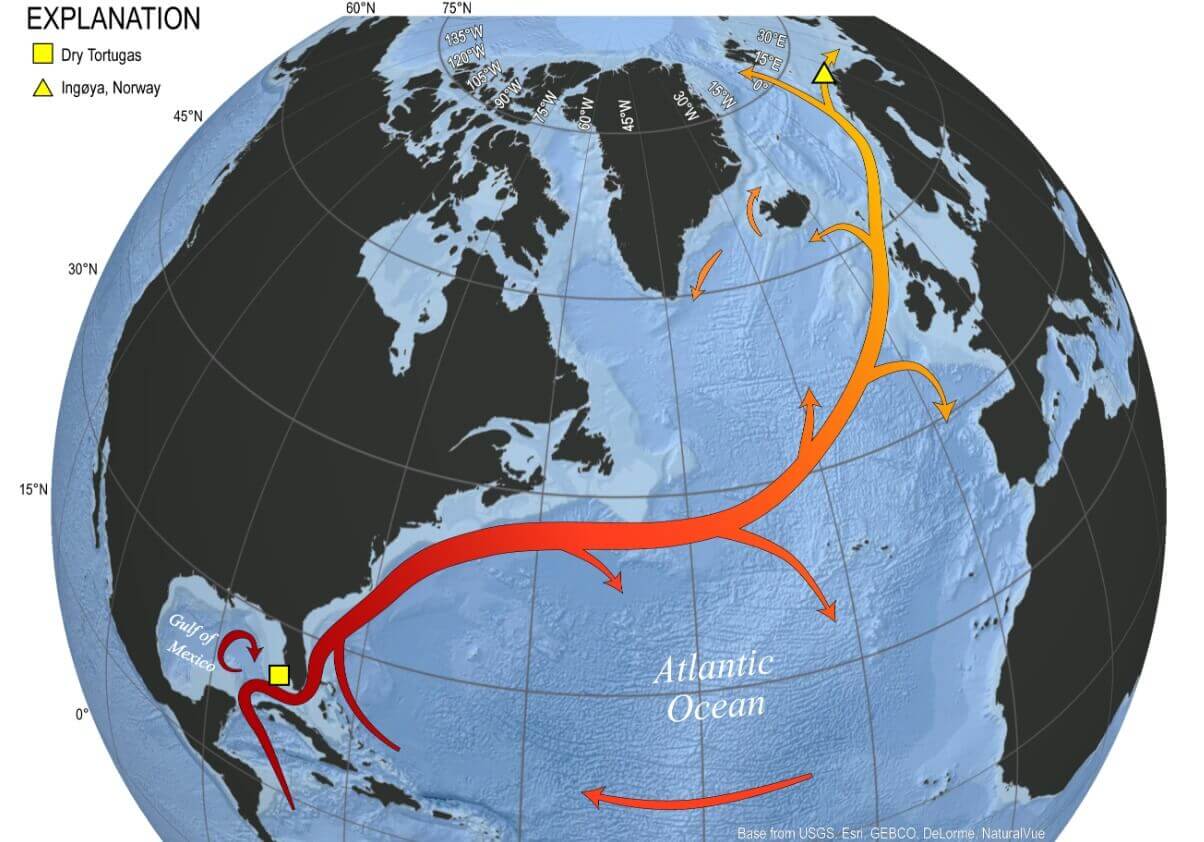
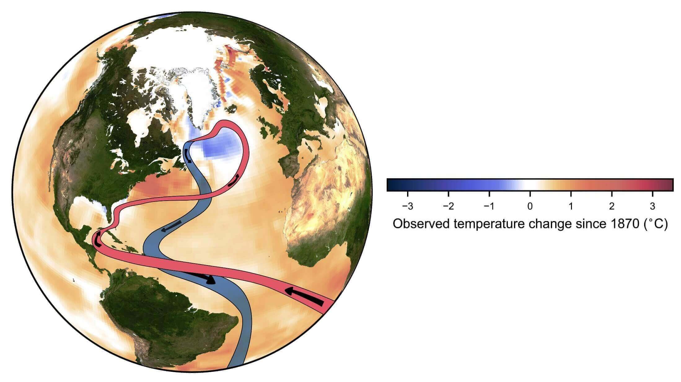
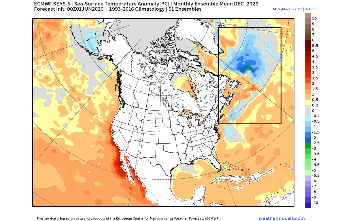
The North Atlantic "cold blob" is not merely an isolated patch of chilled water; it represents a fundamental disruption in the North Atlantic current system, frequently associated with the weakening of the Atlantic Meridional Overturning Circulation (AMOC). The AMOC acts as a conveyor belt, ferrying warm tropical waters toward the polar regions. When this system slows, heat transport diminishes, leading to the cooling of the subpolar gyre—the area east of Newfoundland.
Meteorologists view this cooling as a critical indicator of atmospheric instability. Because the ocean and atmosphere are inextricably linked, the temperature gradient created by a cold North Atlantic often forces the jet stream to shift its path. When paired with the massive thermal energy release from a Super El Niño in the Pacific, these ocean anomalies act as "control lights" on the dashboard of our climate system, offering early warnings about the pressure patterns likely to dominate the coming winter months.
Chronology: A Developing Seasonal Narrative
The progression of this current cooling trend has been documented through a series of snapshots spanning from mid-2026 into the upcoming winter forecast.
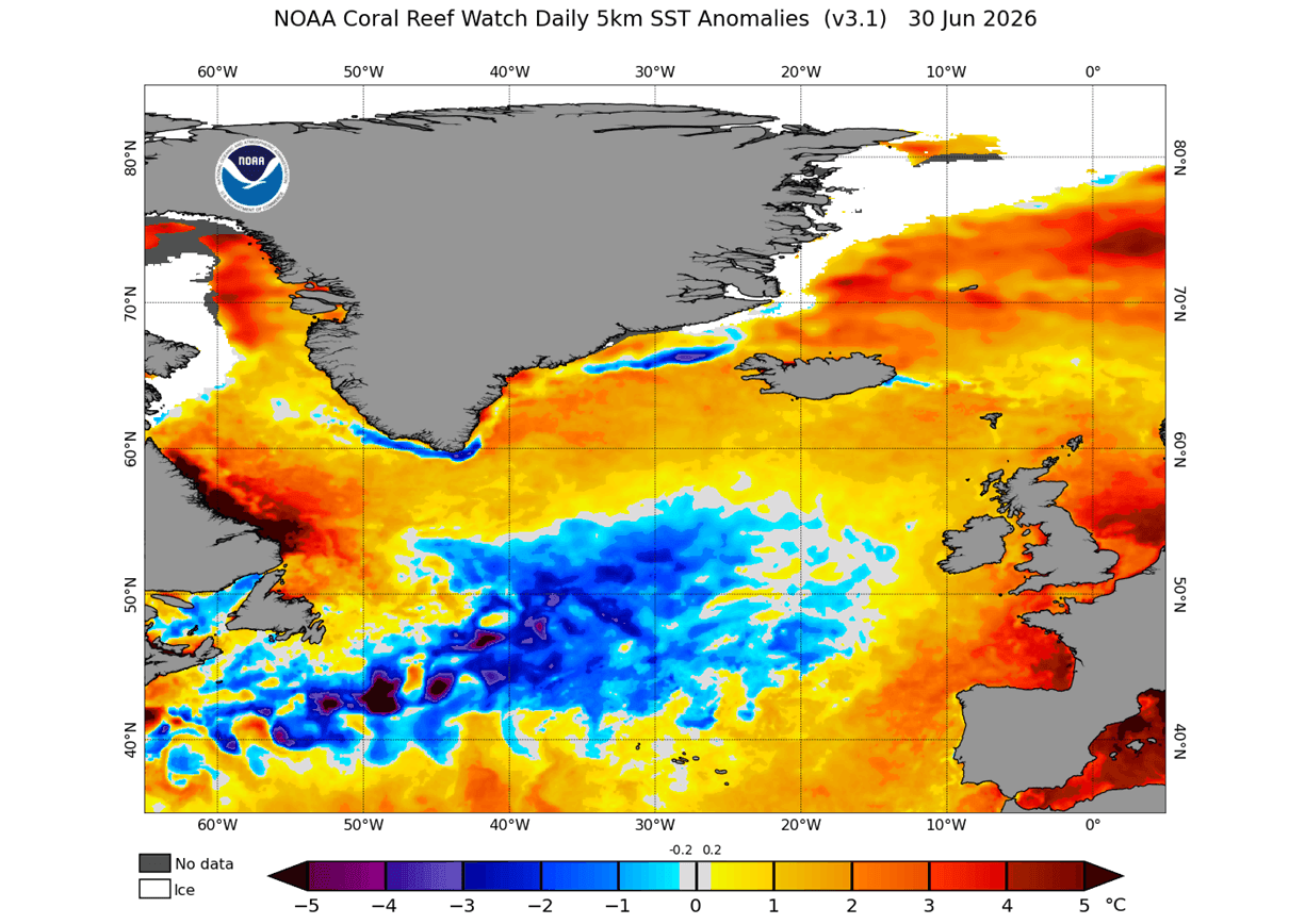
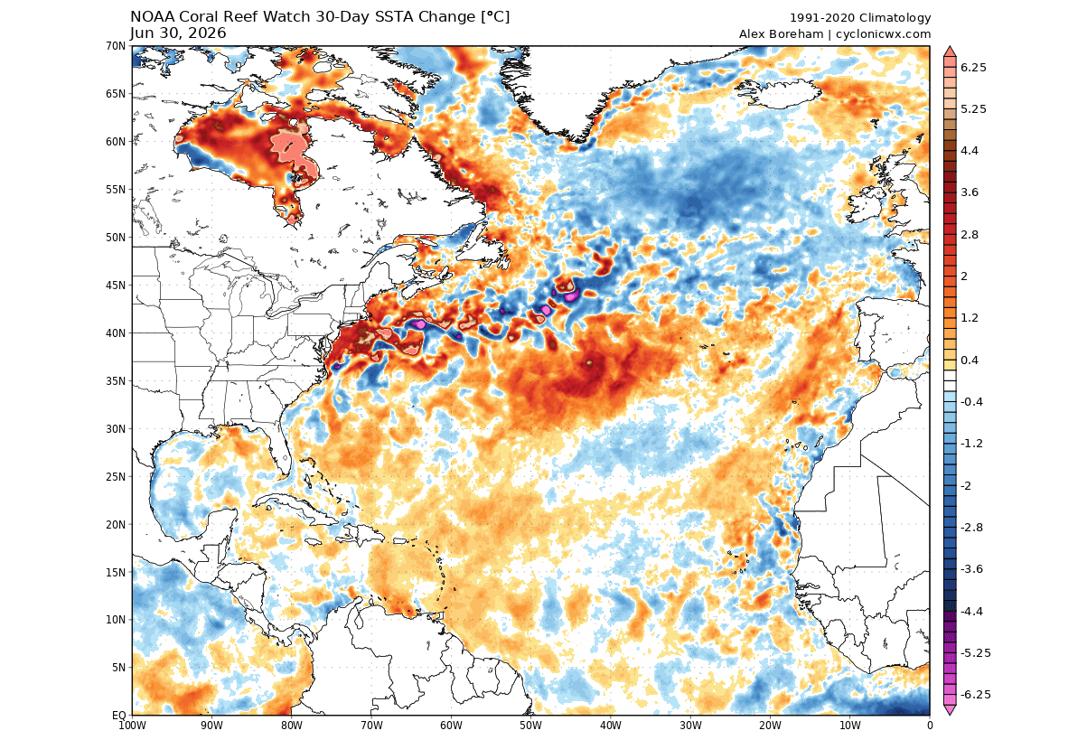
- June 2026: Analysis from the National Oceanic and Atmospheric Administration (NOAA) Coral Reef Watch (CRW) identified the initial growth of the cold anomaly, showing it expanding and encroaching upon the path of the Gulf Stream.
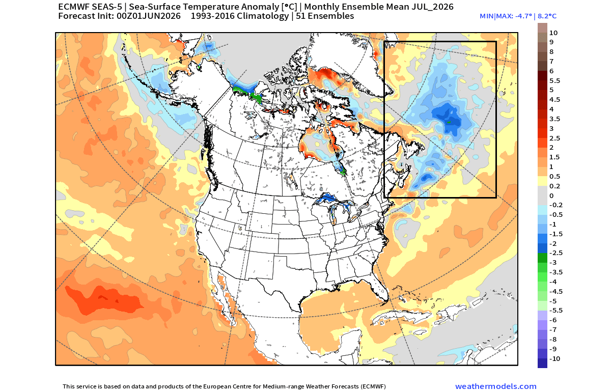
- July 2026: Mid-summer forecasts from the European Centre for Medium-Range Weather Forecasts (ECMWF) confirmed the persistence of the blob. Unlike short-lived seasonal fluctuations, the data indicated that the cold anomaly was becoming a "locked-in" feature of the North Atlantic.
- Winter 2026/2027 Outlook: Current long-range models (including the CFS and CanSIPS) show the cold signature remaining stable through December and into early 2027. The models consistently show a high-pressure "blocking" system forming over Canada, effectively creating a "cold corridor" for the eastern United States.
Supporting Data: The Science of the "Cold Blob"
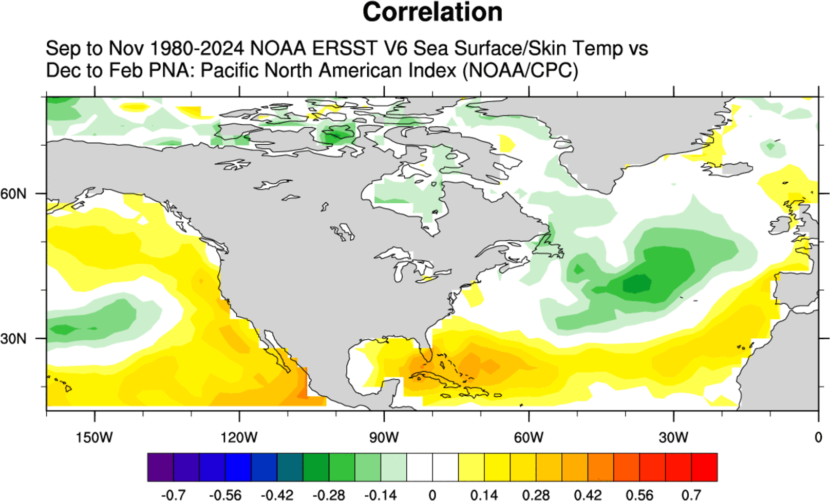
To understand why this anomaly matters, researchers rely on reanalysis tools that correlate decades of sea-surface temperature (SST) data with atmospheric pressure readings.
The AMOC Slowdown
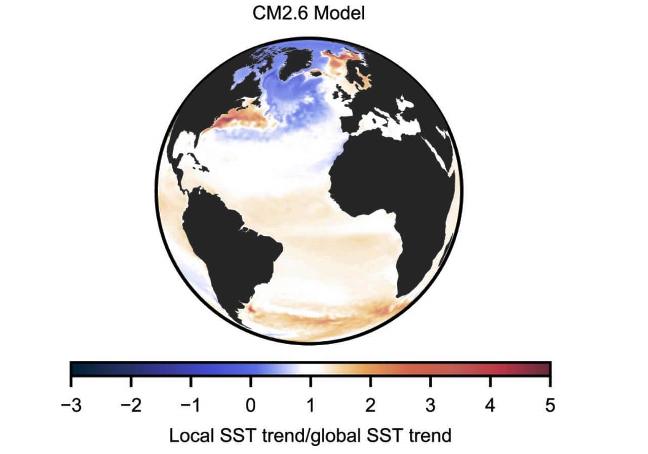
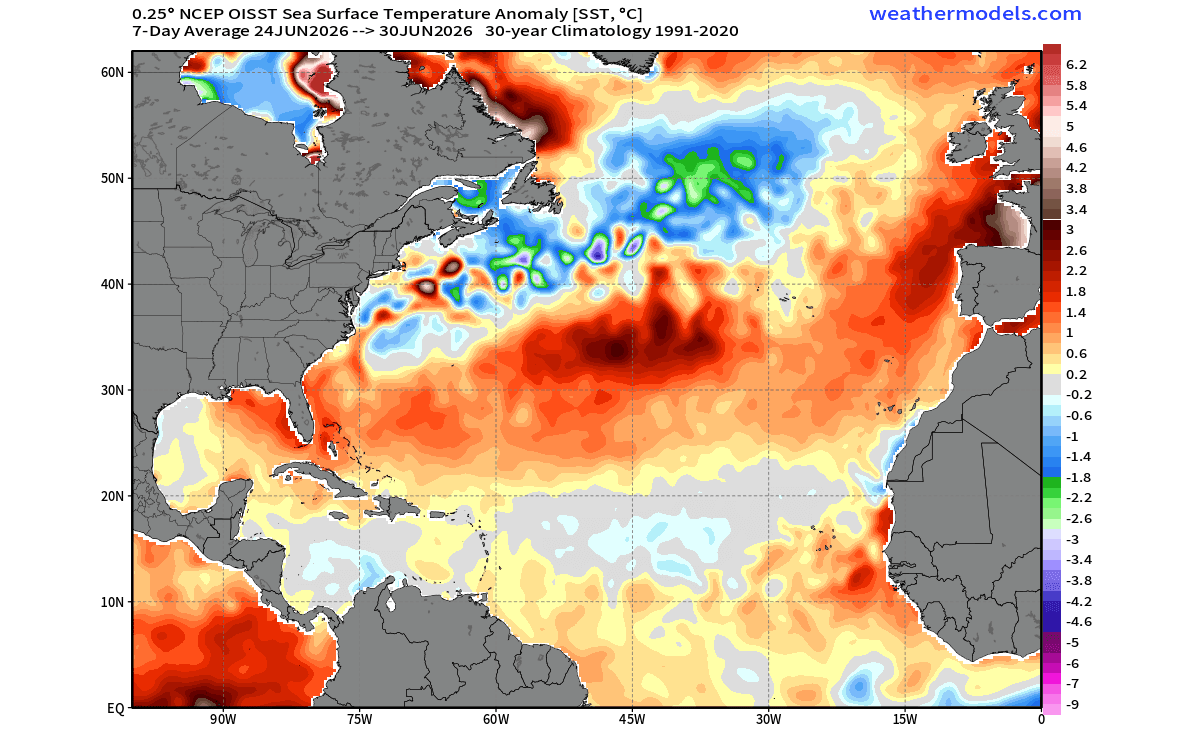
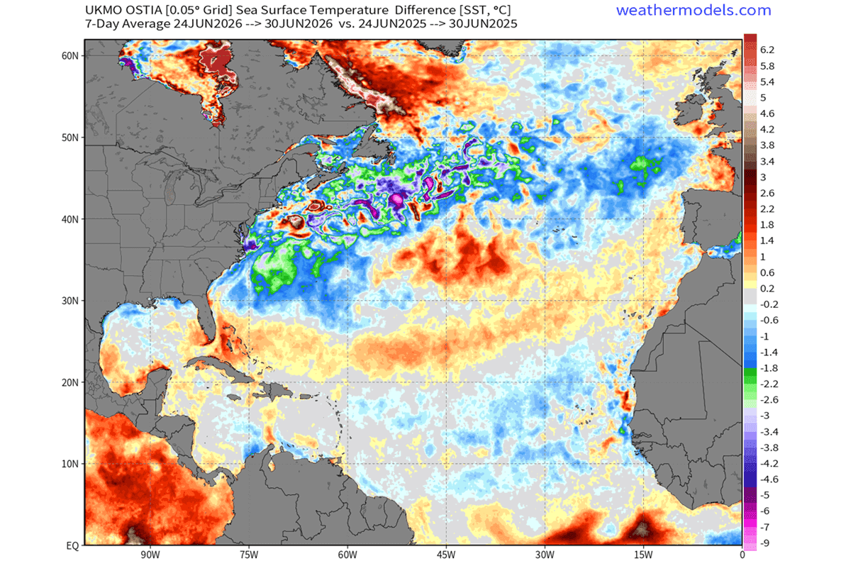
The AMOC’s role in climate regulation is profound. It sustains the temperate climate of the U.S. East Coast and Western Europe. Modern oceanographic data suggests the AMOC is weakening faster than historical models predicted. The "cold blob" is the primary visual signature of this slowdown. By comparing computer simulations of a weakening AMOC against current satellite observations, scientists have found an alarming degree of alignment. The surface temperatures in the North Atlantic are currently 0.5 to 2 degrees Celsius lower than this time last year, a statistical deviation that carries significant weight in long-range forecasting.
The PNA Connection
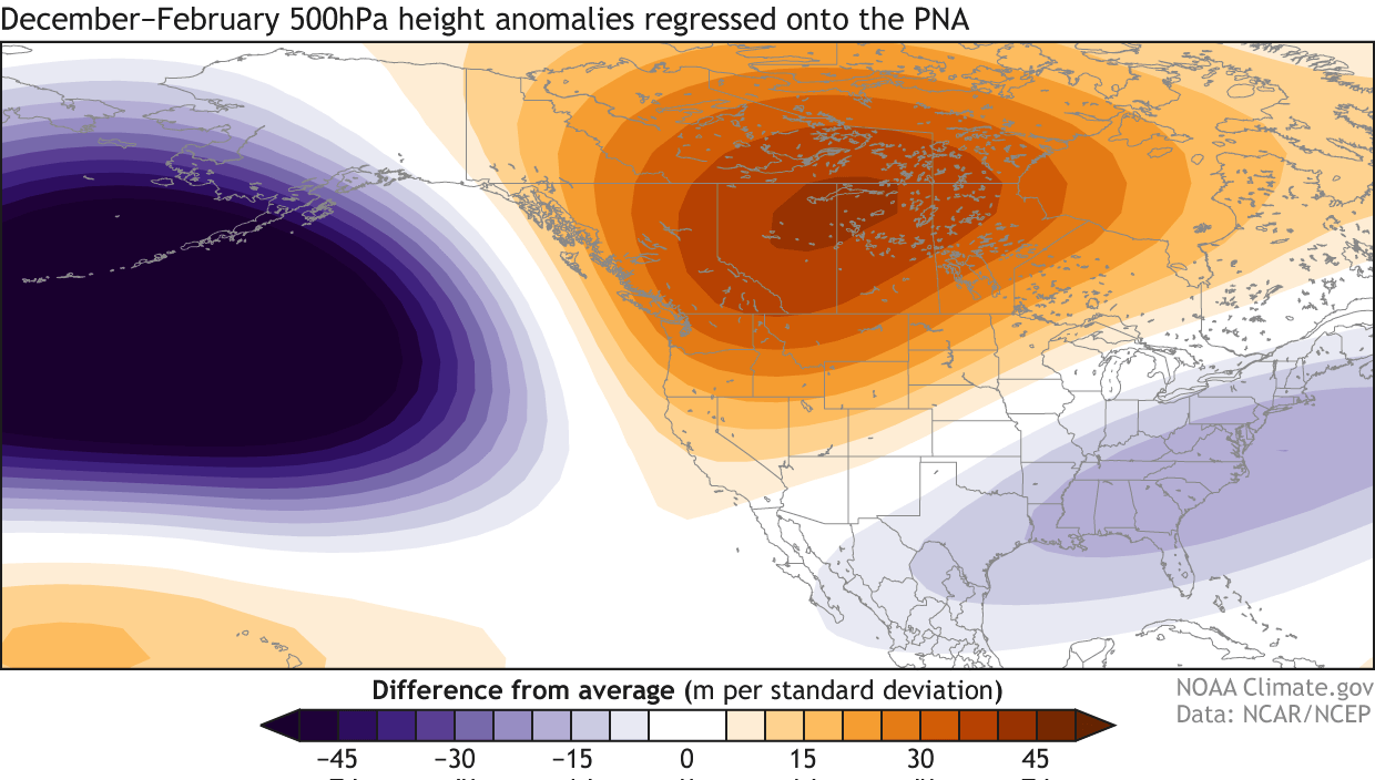
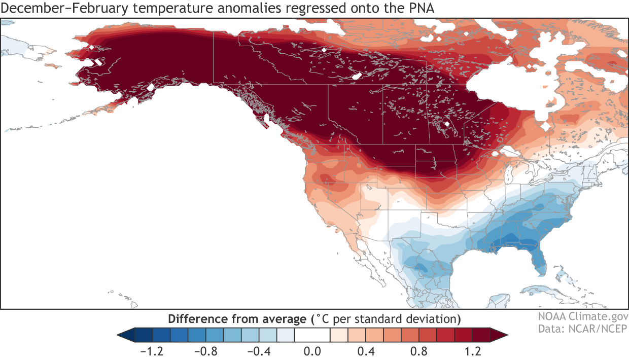
The most vital link between these ocean temperatures and terrestrial weather is the Pacific-North American (PNA) pattern. Historically, a cold Atlantic anomaly during the autumn months often precedes a "Positive PNA" phase in the following winter. A positive PNA phase is characterized by:
- High pressure over the northwestern United States and western Canada.
- Low pressure over the central, southern, and eastern United States.
- Northerly air flow, which pulls freezing Arctic air deep into the mid-latitudes.
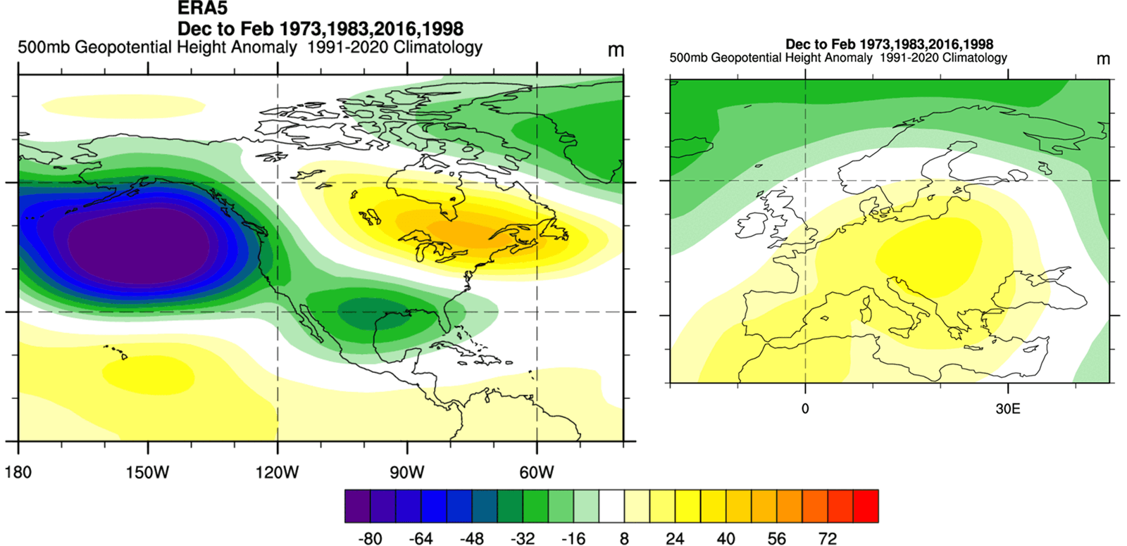
When we layer a Super El Niño on top of this, the signal becomes even more pronounced. Historical data from the last four Super El Niño events confirms that this specific configuration frequently leads to intensified winter extremes, including deep-freeze events for the eastern half of North America.
Implications for the Upcoming Winter
The combination of the Atlantic cold blob and the Pacific Super El Niño suggests a winter defined by extreme variability.
North America: The Battleground
The long-range forecast for the United States and Canada points toward a "tale of two winters." The Pacific-driven ridge is expected to bring warmer-than-average conditions to the northern United States and parts of Canada. However, the southward-dipping jet stream, fueled by the Atlantic pressure anomalies, is likely to force a cold-air corridor through the Midwest and into the Eastern Seaboard. This is a pattern that has been observed in recent years, specifically during the 2014-2015 season, which featured a similarly potent Atlantic cold blob.
Europe: The Shift in Pressure
Europe faces a different set of challenges. While North America deals with potential Arctic outbreaks, the Super El Niño pattern typically promotes the development of high-pressure ridges moving in from the south. This suggests that while Northern Europe might experience bouts of cold, central and southern Europe could see erratic temperature swings and a potential shift in precipitation patterns as the Atlantic circulation struggles to maintain its traditional rhythm.
Official Responses and Scientific Consensus
While no single weather event can be attributed solely to these anomalies, the scientific community emphasizes that these patterns serve as "global drivers." Meteorologists caution that while the models are consistent, long-range forecasts are probabilistic.
"We are essentially looking at the engine of the global climate," says one senior climate analyst. "The ocean provides the heat, and the atmosphere dictates the path. When the engine’s heat distribution is altered—as it is with the current AMOC slowdown and the Pacific forcing—we expect the atmosphere to respond with more frequent and intense blocking patterns."
Global forecasting centers, including the CPC (Climate Prediction Center) and ECMWF, continue to monitor these developments. The consistency between these disparate models—each reaching the same conclusion about the PNA pattern and the Atlantic cooling—is what makes the 2026/2027 forecast particularly noteworthy.
Conclusion: Preparing for a Dynamic Season
The return of the North Atlantic cold blob, in conjunction with the emergence of a Super El Niño, represents a complex, multi-year climatic shift. These ocean anomalies act as early indicators of the structural changes in the atmosphere that will dictate our winter experience.
For residents in the United States and Canada, the data suggests a winter where the cold is not uniform but concentrated, likely resulting in "polar vortex" style intrusions into regions that have grown accustomed to milder winters. In Europe, the influence of the southern high-pressure ridge may create a season of contrast.
As we move toward the winter months, these indicators remain critical. Much like the warning lights on a vehicle’s dashboard, these ocean anomalies are signaling that the global weather machine is undergoing a significant transition. Staying informed through real-time updates and seasonal model outputs will be essential for navigating the potential impacts of this unique climatic setup. While the full extent of the winter’s bite remains to be seen, the early signs are clear: the North Atlantic is playing a pivotal role in the global weather narrative for 2026/2027.