A powerful meteorological phenomenon is currently taking shape in the equatorial Pacific, signaling a significant shift in the global climate landscape. As we look toward the Fall and Winter of 2026/2027, the emergence of a "Super El Niño" has become the primary driver for atmospheric behavior, promising to reshape weather patterns across North America, Europe, and the tropics. Recent oceanic analysis confirms that warm anomalies are intensifying at a remarkable pace, setting the stage for a highly active, high-impact cold season.

While autumn is historically characterized as a transition period—often featuring weaker, less organized weather systems—the latest forecast trends for 2026 indicate a more synchronized global evolution. The persistent and amplifying influence of this Super El Niño suggests that the atmospheric response is accelerating, with winter-like circulation patterns establishing themselves earlier than typically observed.
The Science of ENSO: Planetary Dynamics at Play
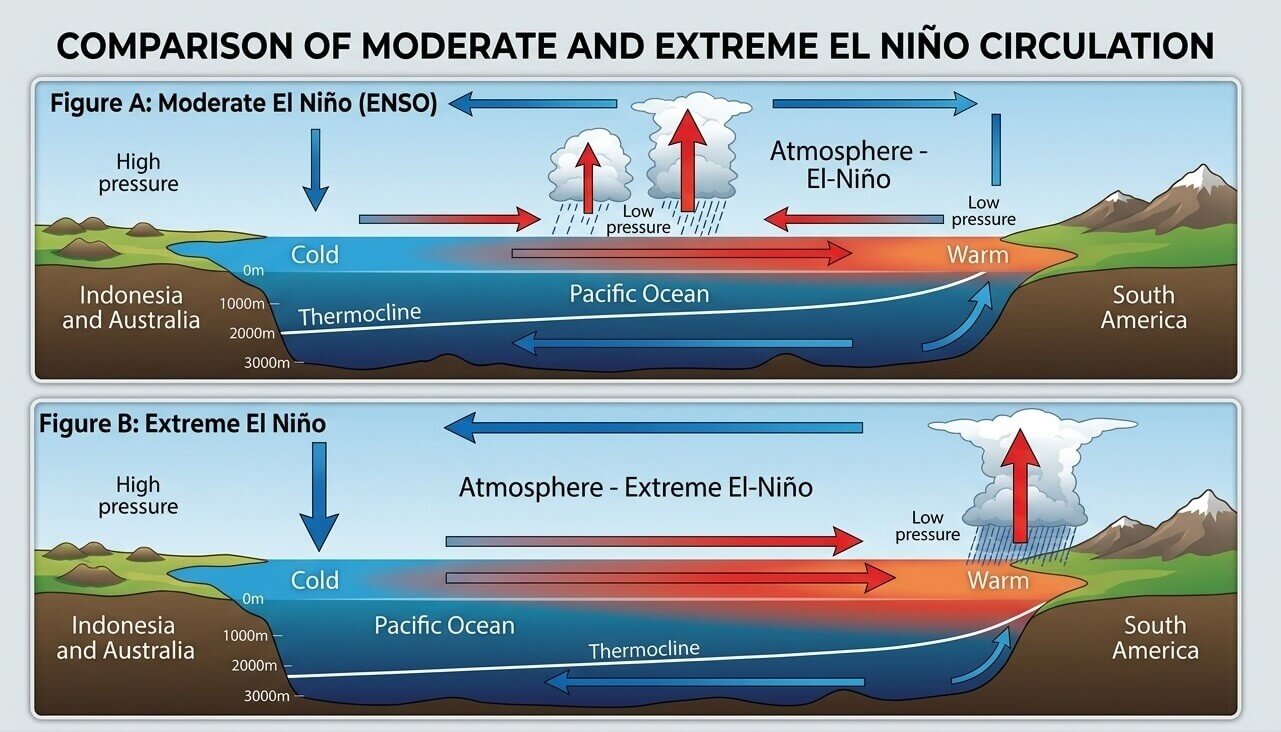
At the heart of these forecasts lies the El Niño Southern Oscillation (ENSO), a periodic fluctuation in sea surface temperatures and air pressure across the equatorial Pacific. During an El Niño event, the Pacific Ocean enters a "warm phase," fundamentally altering the Walker Cell—the complex system of atmospheric circulation that governs tropical rainfall and global pressure gradients.
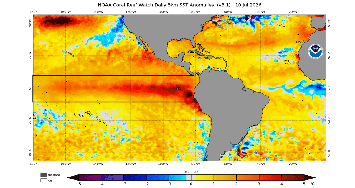
In a standard El Niño, we observe a drop in surface pressure over the central and eastern tropical Pacific, paired with a strengthening high-pressure zone over the western Pacific. This shift acts as a catalyst for global weather, as the redistribution of tropical heat energy ripples outward into the mid-latitudes.
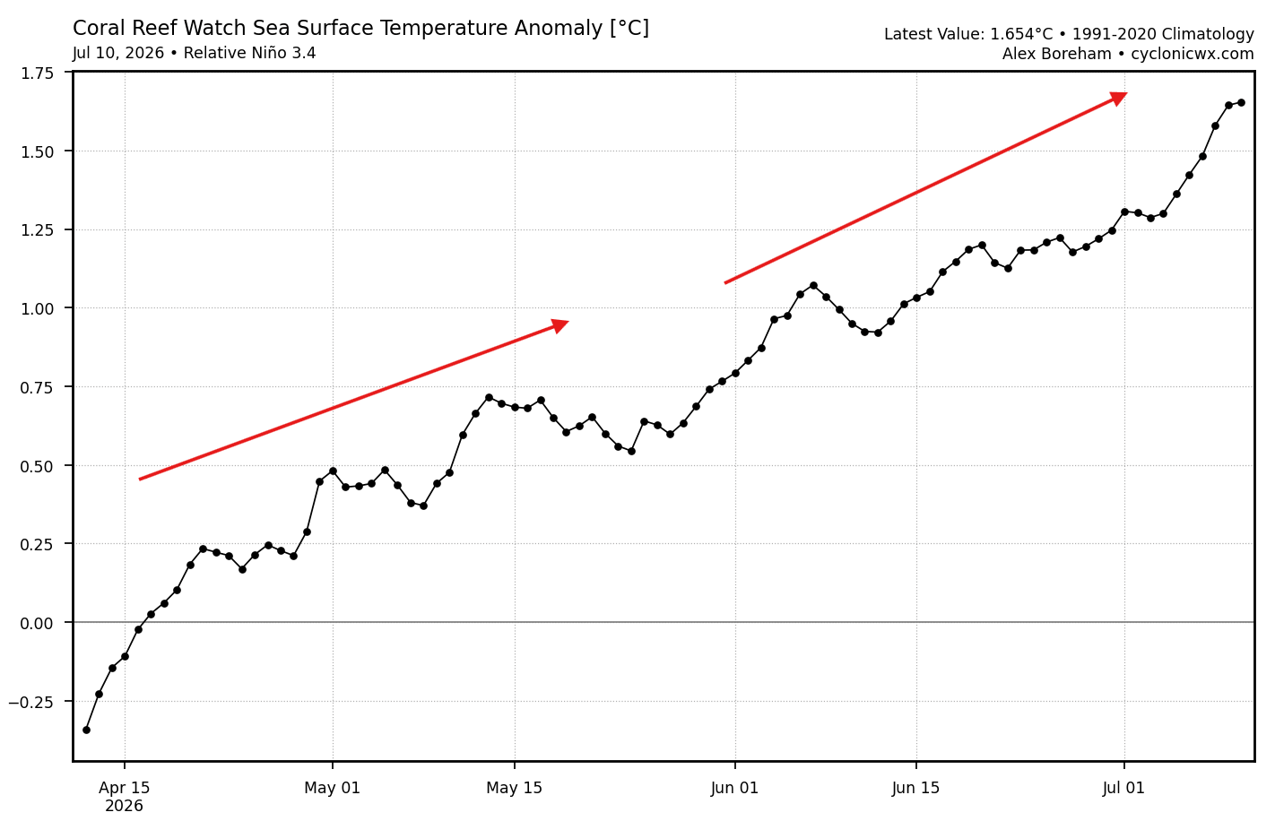
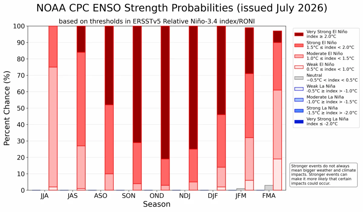
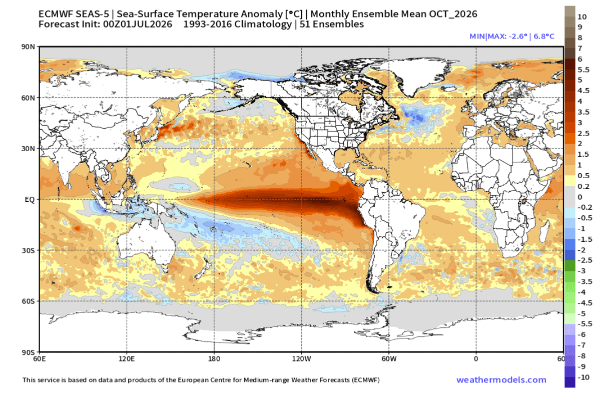
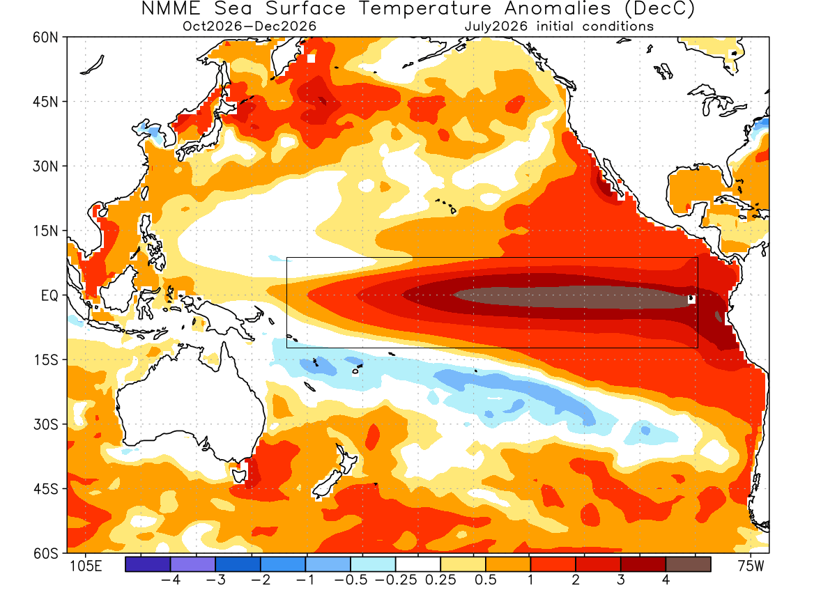
The 2026 event is not merely a typical El Niño; current data classifies it as a "very strong" event, with the potential to peak as one of the most significant occurrences in decades. The latest ocean monitoring reveals that sea surface temperature anomalies in the core ENSO regions have already surged 3–4 degrees Celsius above the long-term average. To be categorized as a "Super El Niño," seasonal values must sustain levels above +2 degrees—a threshold this current event is not only meeting but exceeding with rapid momentum.
Chronology of Development: From Early Warming to Seasonal Peak
The evolution of this climate event is tracking on a historic timeline. Since early 2026, ocean heat content has steadily climbed, with the most significant warming observed throughout the summer months.
July – August 2026: The Initial Surge
During these months, satellite imagery and buoy data confirmed the rapid emergence of warm anomalies. The eastern Pacific saw peak temperatures consistently pushing 3–4 degrees above normal, indicating that the atmospheric bridge—the link between the ocean and the atmosphere—was successfully established earlier than in many historical counterparts.
September – November 2026: The Autumn Transition
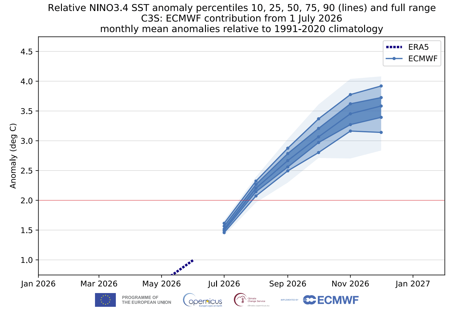
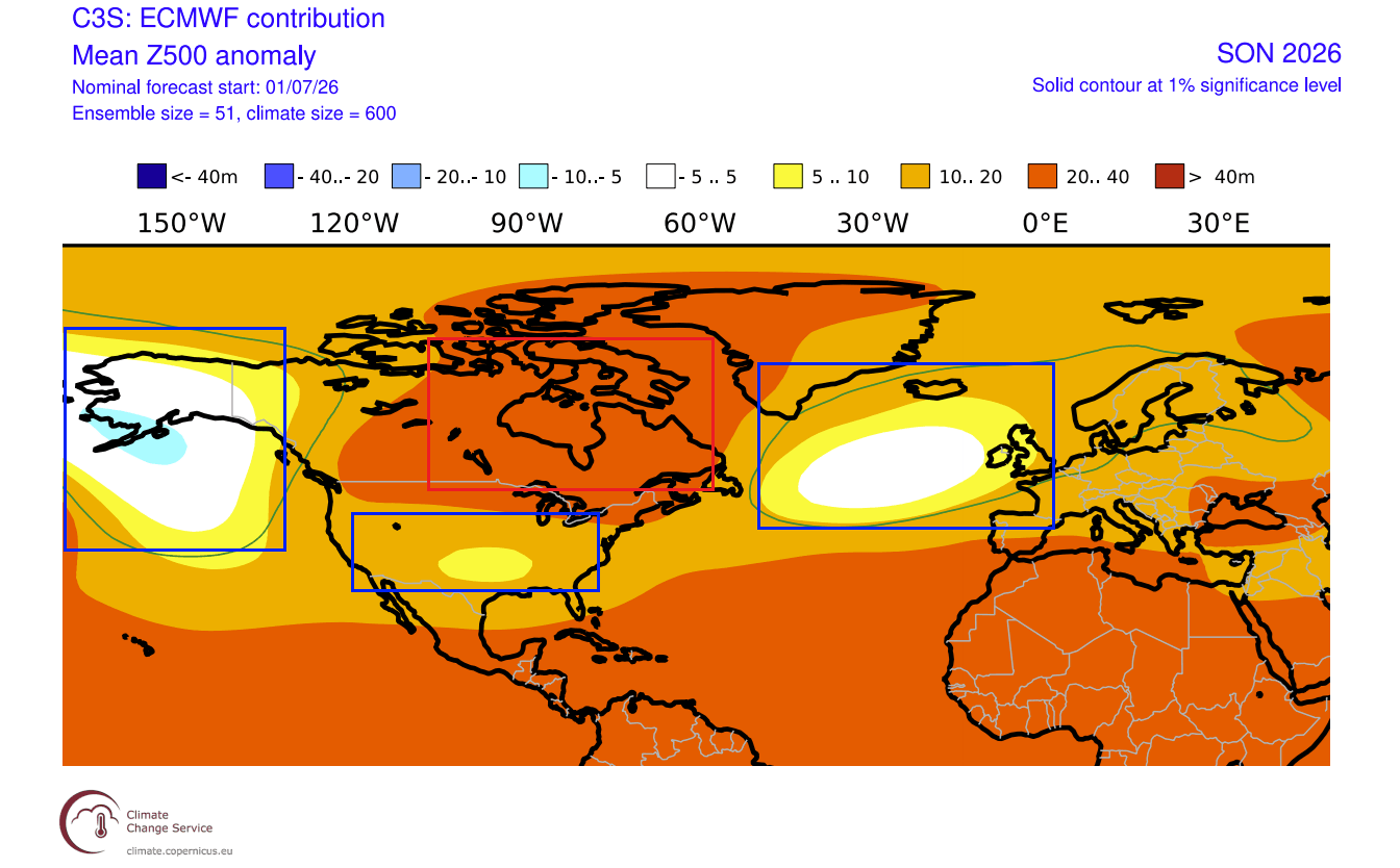
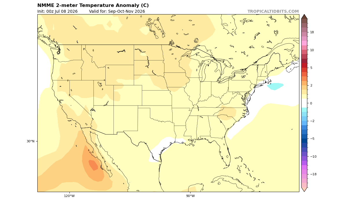
As we transition into the meteorological fall, the models show an "unusually evolved" state. Typically, El Niño signals in autumn are subtle. However, the 2026 forecast models, including the ECMWF (European Centre for Medium-Range Weather Forecasts) and the North American Multi-Model Ensemble (NMME), suggest that the atmosphere is already mimicking mid-winter configurations. This includes a distinct high-pressure ridge over Canada and a deepened, active low-pressure track across the southern United States.
December 2026 – February 2027: The Winter Peak
Long-range projections suggest that the oceanic anomaly will likely reach its peak between late fall and early winter. Current ensemble forecasts indicate that the peak sea surface temperature anomaly could surpass +6 degrees Celsius in localized eastern regions, cementing this as a historically significant event.
Supporting Data: Why Forecasters Are on High Alert
The credibility of this forecast rests on the convergence of multiple, independent climate models. The ECMWF and NMME systems, which aggregate data from major meteorological agencies in the United States and Canada, show overwhelming consensus regarding the strength of the event.
The Walker Cell and Global Circulation
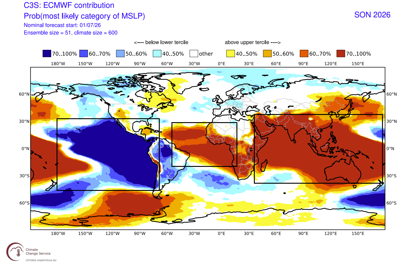
The current pressure anomalies in the tropics provide a "Hello World" signal of the El Niño influence. A broad low-pressure zone over the eastern tropical Pacific—coupled with rising air—demonstrates a textbook, albeit extreme, Walker Cell reaction. This confirms that the global circulation is now "locked in" to the El Niño influence.
Surface Pressure Patterns
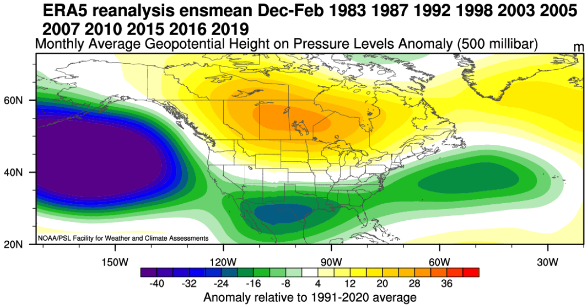
The forecast maps reveal a classic high-amplitude pattern. A high-pressure anomaly over Canada is effectively acting as a "boulder in a river," deflecting the polar jet stream. Meanwhile, a high-octane subtropical jet stream is developing across the southern U.S., which will serve as a conveyor belt for moisture-rich storm systems throughout the winter months.
Implications for North America and Europe
The geographical impacts of a Super El Niño are profound, shifting the baseline expectations for temperature and precipitation across the Northern Hemisphere.
North America: The Southern Storm Track
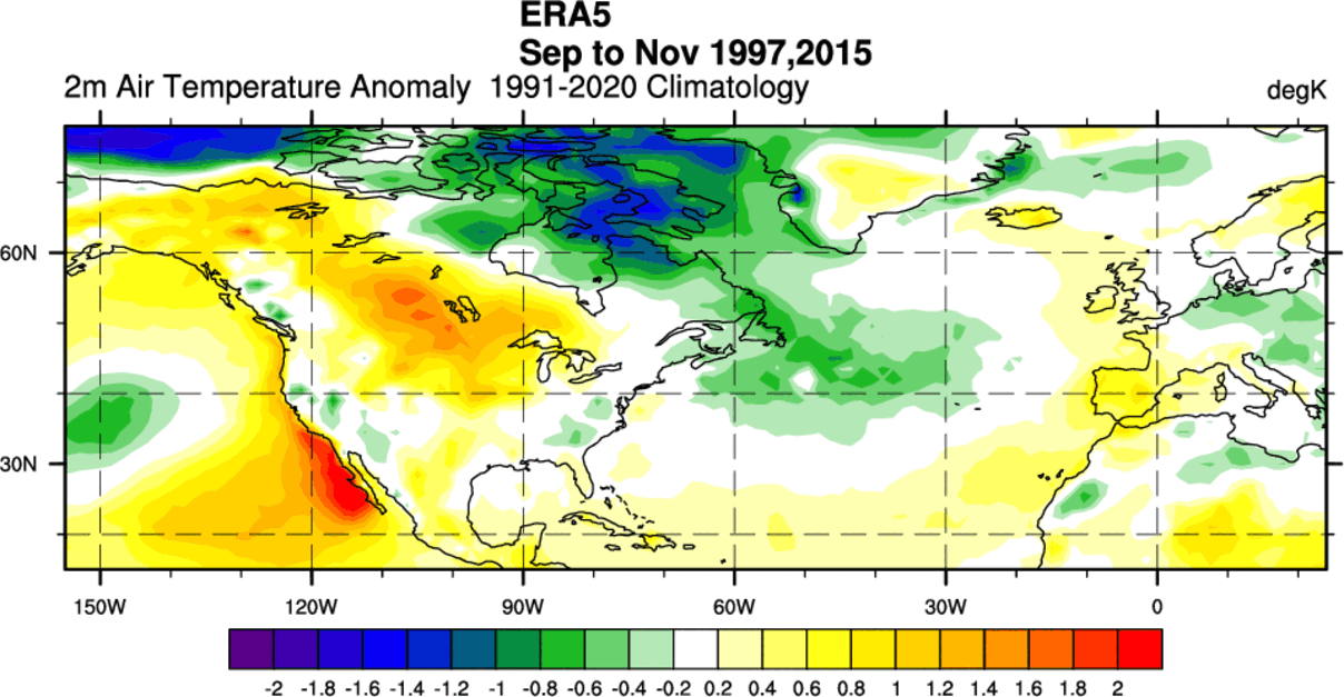
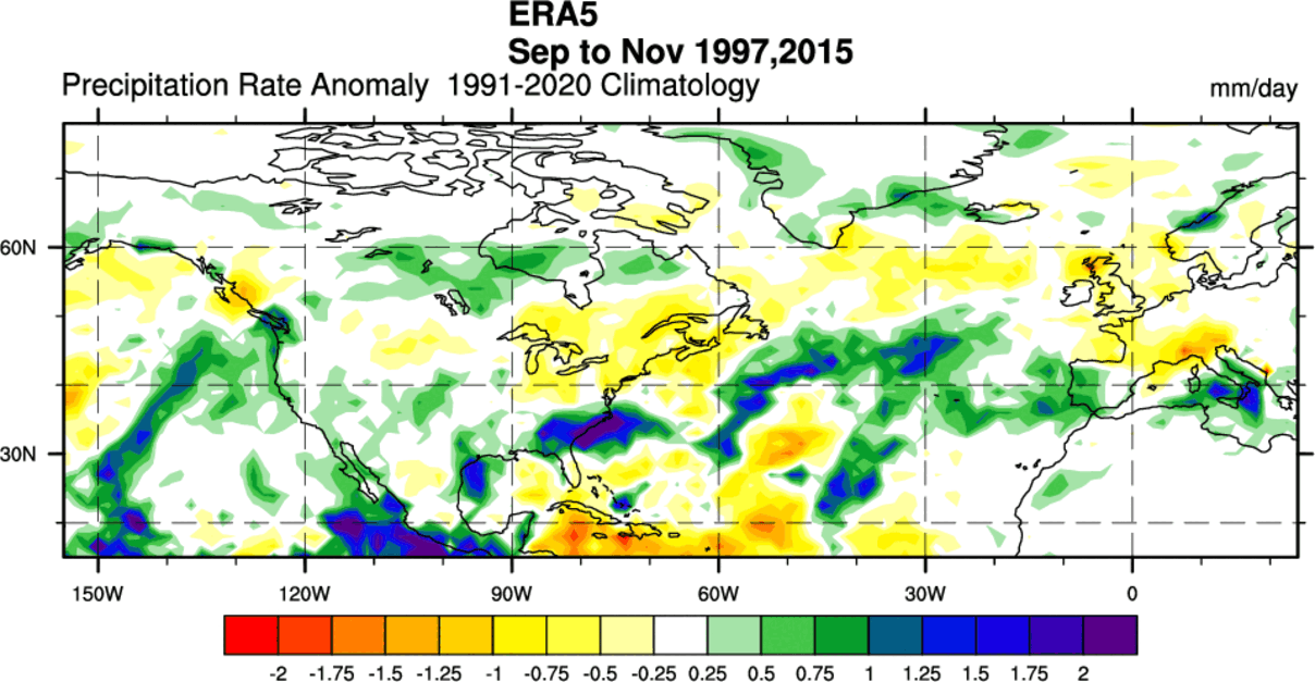
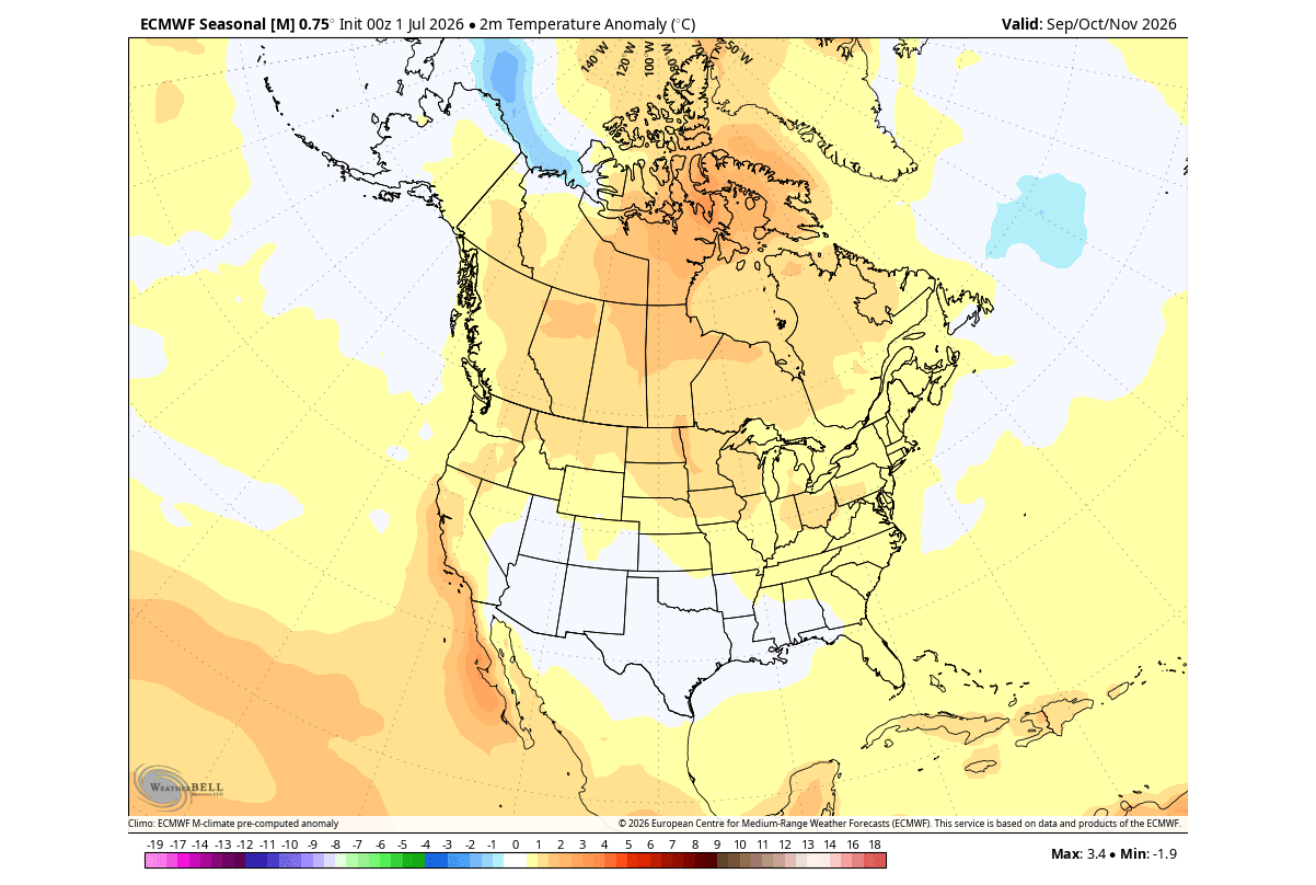
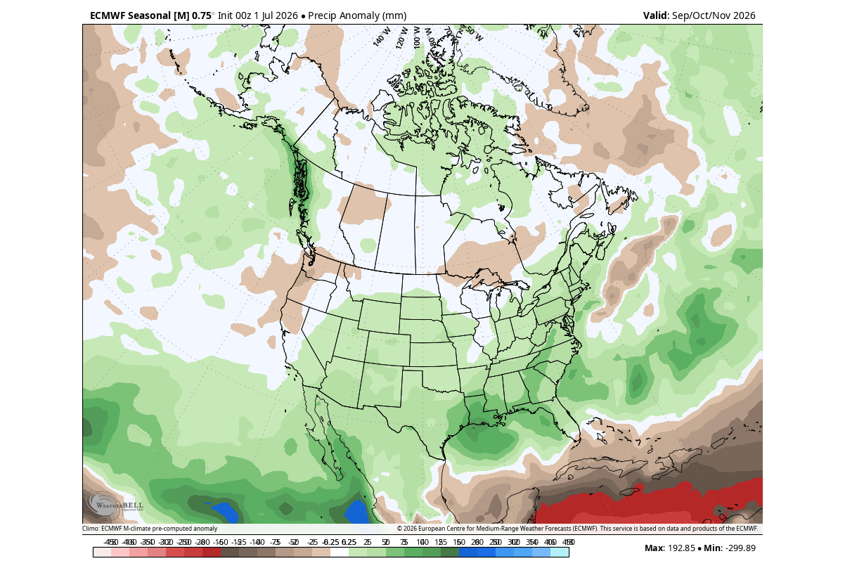
For the United States, the primary implication is an active southern storm track. As the subtropical jet stream intensifies, the southern and southeastern states should prepare for increased precipitation and potentially severe weather. Conversely, the northern United States and parts of Canada are expected to experience warmer-than-average conditions due to the persistent high-pressure ridging that effectively keeps the arctic air trapped further north.
Europe: A Mild, Wet Winter
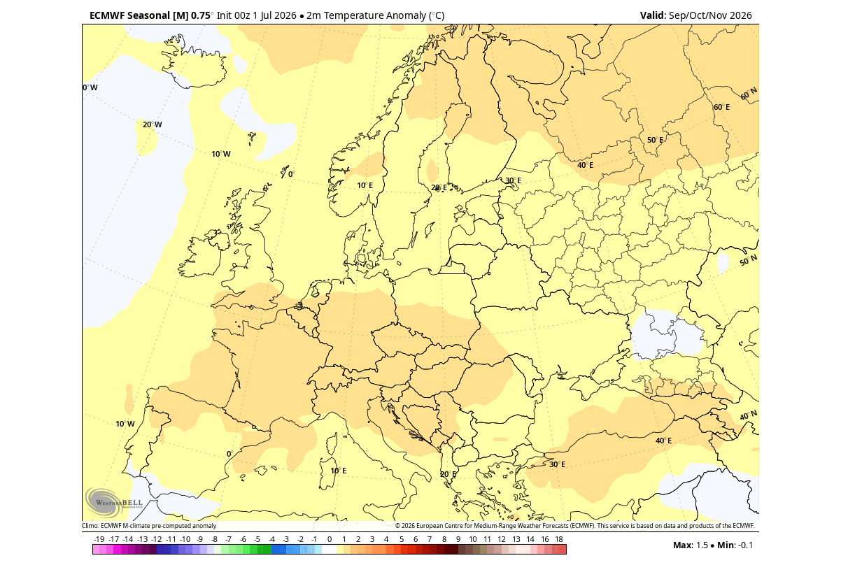
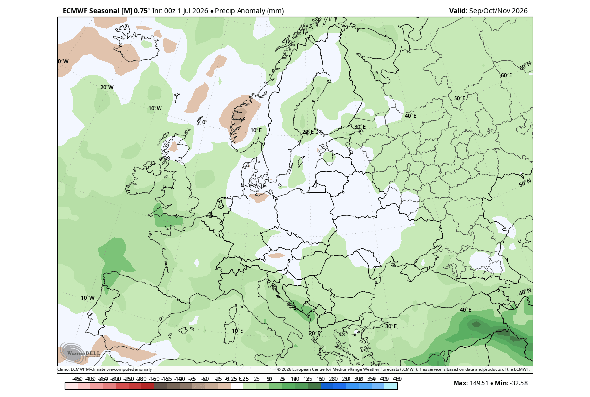
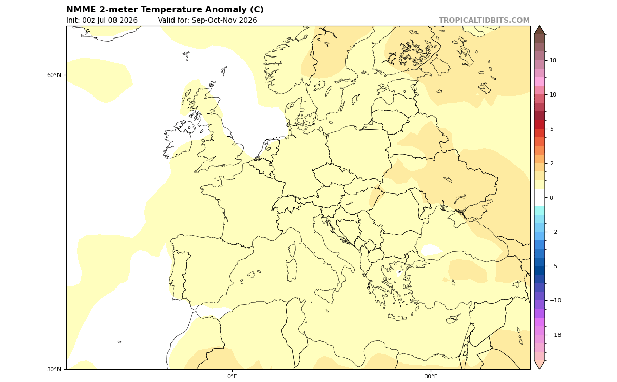
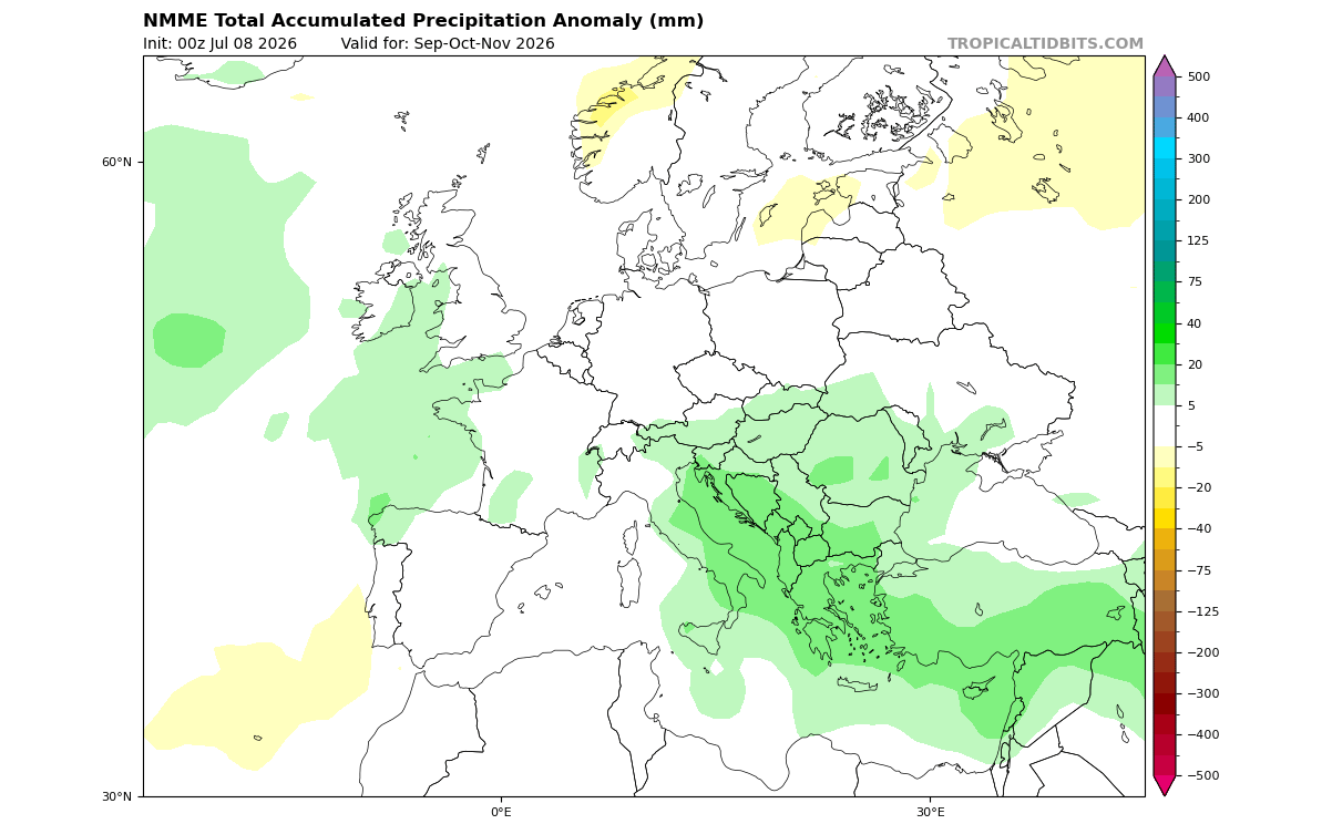
Europe, while not under the direct influence of Pacific sea temperatures, experiences the ripple effects of the shifted jet stream. Forecasts suggest a strong westerly flow from the Atlantic, driven by a persistent low-pressure zone over northwestern Europe. This configuration typically brings milder, wetter weather to the continent, with increased storm potential for the UK, Ireland, and mainland Europe, while limiting the opportunities for widespread, sustained cold outbreaks.
The Polar Vortex: The Wildcard Factor
No discussion of a winter season is complete without addressing the Polar Vortex. The stratosphere, the layer of the atmosphere where the vortex resides, is highly sensitive to the energy propagating upward from the troposphere—energy that is significantly enhanced during a Super El Niño.
Historical data suggests that an El Niño phase increases the statistical likelihood of a Sudden Stratospheric Warming (SSW) event, particularly in January. An SSW event can lead to a "collapse" or major disruption of the Polar Vortex. If the vortex weakens, it loses its ability to contain the freezing arctic air, leading to a "spill-out" of polar temperatures into the mid-latitudes.
While the baseline forecast for 2026/2027 points toward a mild winter for many, a major disruption of the Polar Vortex could override these trends, creating sudden, severe cold snaps even in regions that were forecasted to be warmer. This remains the most volatile variable in the upcoming winter forecast.
Official Outlook and Final Considerations
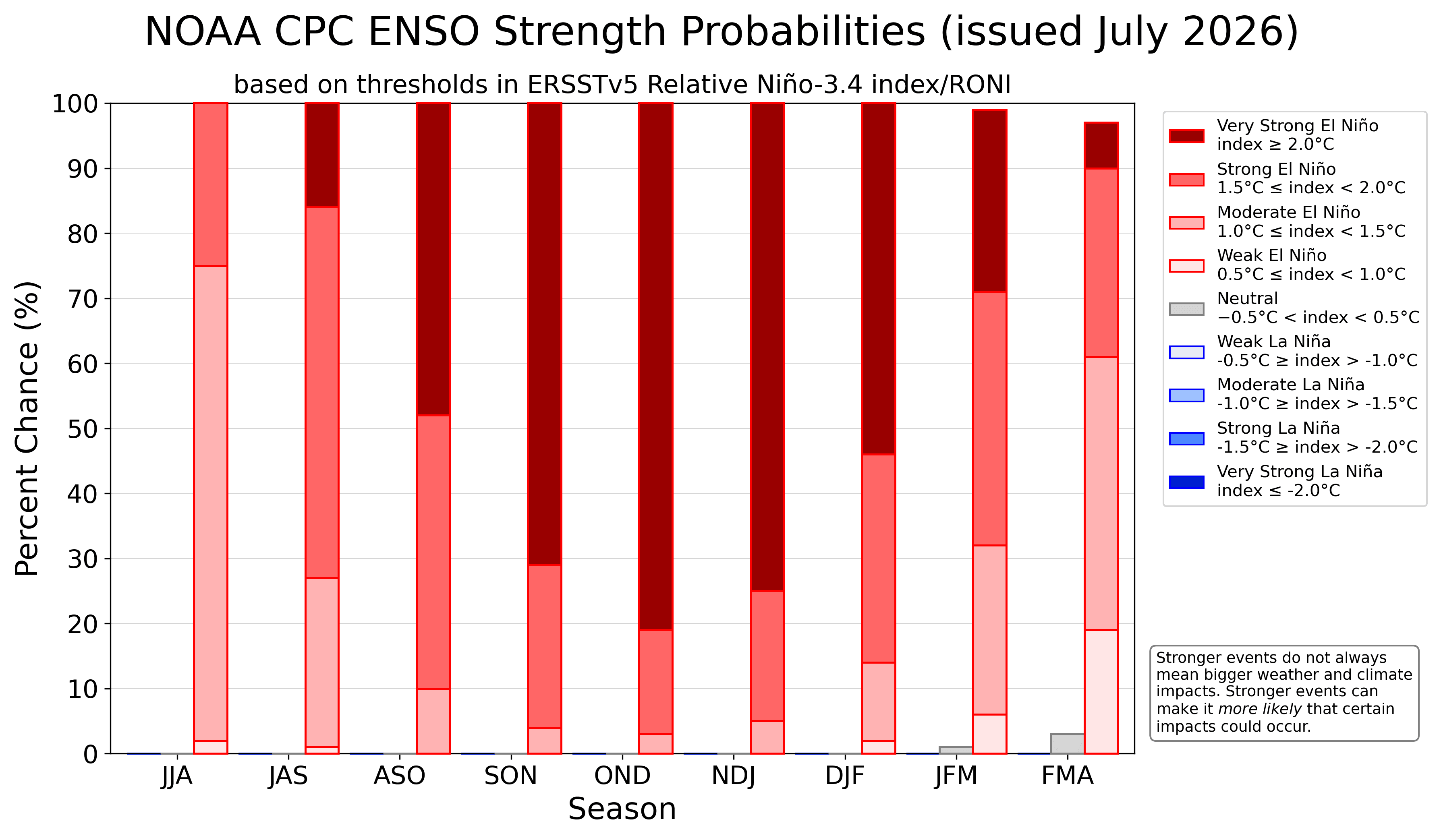
Major climate agencies, including the National Oceanic and Atmospheric Administration (NOAA) and its Climate Prediction Center (CPC), have expressed high confidence in the development of this extreme El Niño. The official probability models reflect a near-unanimous expectation that the event will remain in the "extreme" category throughout the remainder of the year.
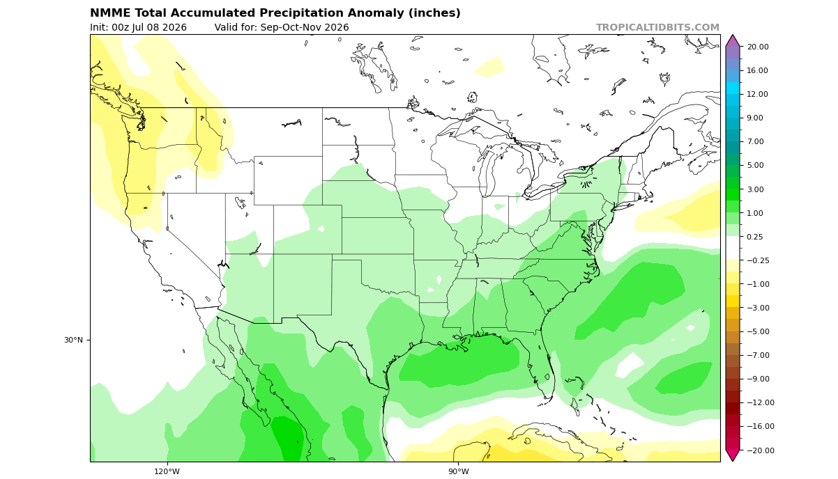
For the public, the implications are clear: while the seasonal average may suggest certain trends, the "Super" nature of this El Niño creates a high-amplitude environment. This means that weather extremes—whether they be excessive rainfall in the U.S. South, mild anomalies in the North, or the potential for sudden, intense cold if the Polar Vortex is disrupted—are more likely to occur than in a neutral year.
As the 2026/2027 season progresses, meteorological agencies will continue to monitor the interplay between the Pacific ocean temperatures and the stratospheric winds. The "locking in" of these patterns suggests that we are entering a period of significant atmospheric volatility. Stakeholders in sectors ranging from agriculture and energy to transportation should prepare for a season defined by heightened climate activity, driven by one of the most powerful natural phenomena on the planet.
For those tracking these developments, the key is to look beyond seasonal averages and focus on the short-term forecast updates, as the atmospheric "engine" of this Super El Niño continues to push global weather into uncharted territory.