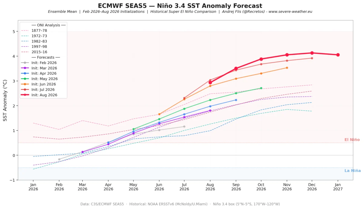
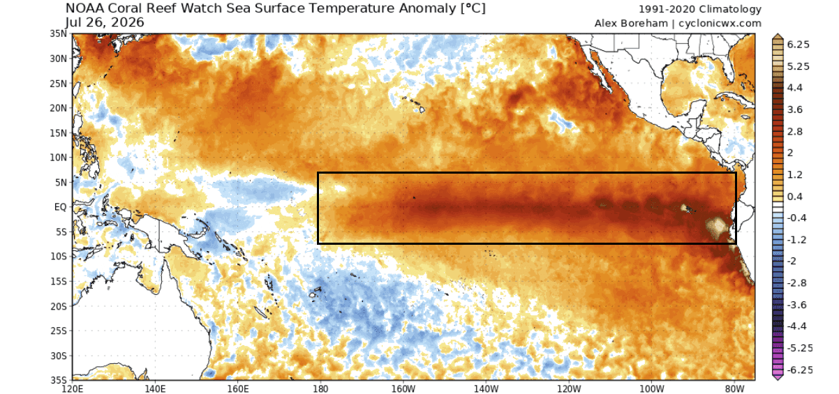
As we move into the second half of 2026, meteorologists are closely monitoring a rapidly evolving climate phenomenon in the tropical Pacific. Current ocean analysis and atmospheric modeling data suggest the formation of a "Super El Niño," a potent warming event that threatens to redefine global weather patterns throughout the upcoming fall and winter seasons. With anomalies in sea surface temperatures already reaching or exceeding +5 degrees Celsius above historical norms, this event is on a trajectory that could potentially challenge existing records for intensity.
The Mechanics of a Super El Niño
At its core, an El Niño event is defined by a significant warm temperature anomaly in the equatorial Pacific Ocean surface. This warming disrupts the "Walker Cell"—the complex system of rising and sinking air that governs tropical rainfall and wind patterns.
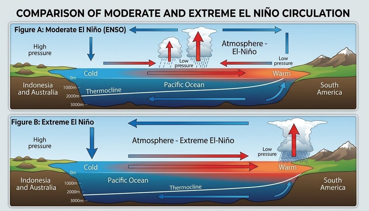
In a typical, moderate El Niño, these shifts are noticeable but localized. However, in a "Super" event, the pressure drop in the central and eastern tropical Pacific is profound, creating a high-pressure zone over the western Pacific that acts as an "atmospheric bridge." This bridge extends the reach of the Pacific’s thermal energy, effectively forcing the global jet stream into new, more extreme configurations.
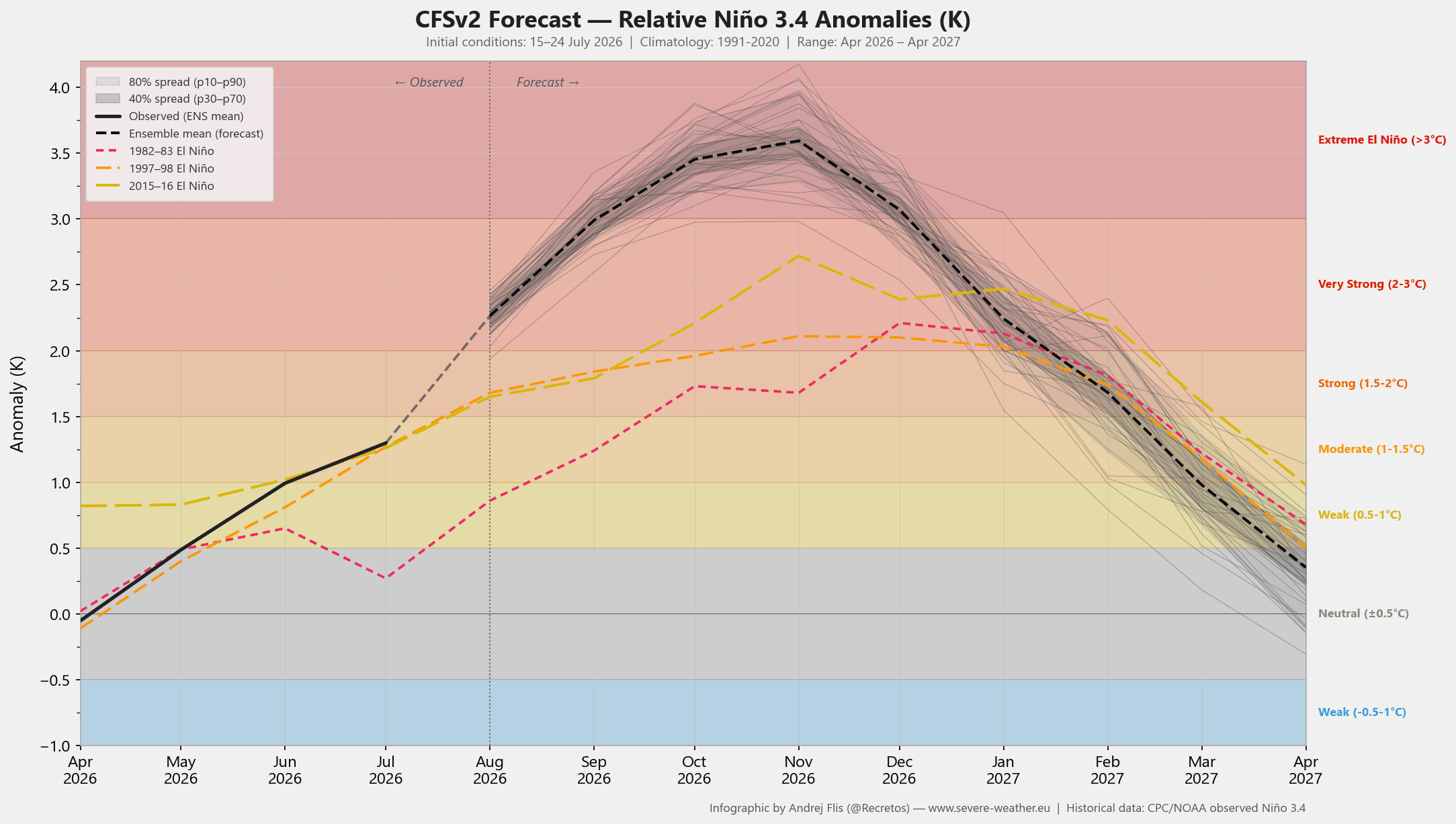
Data from the NCEP (National Centers for Environmental Prediction) CFSv2 model currently indicates that the 2026 development is moving faster than the most notorious historical El Niño events. With ensemble support suggesting peak anomalies will comfortably exceed the +3-degree threshold, the scientific community is bracing for a season of significant climatic volatility.
Chronology: From Early Signs to Global Forcing
The development of this 2026 Super El Niño was not spontaneous. It began with significant westerly wind events that triggered large subsurface warm anomalies known as "Kelvin Waves." These waves travel eastward beneath the ocean surface, eventually surfacing to manifest as the massive warm anomaly now visible across the central and eastern Pacific.
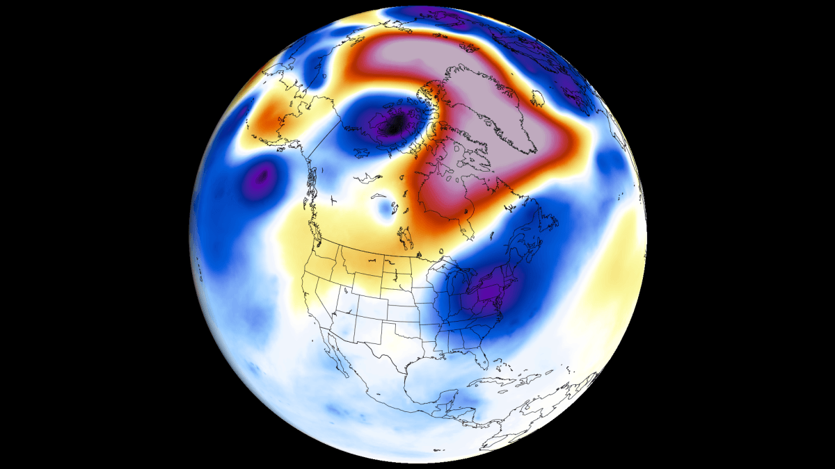
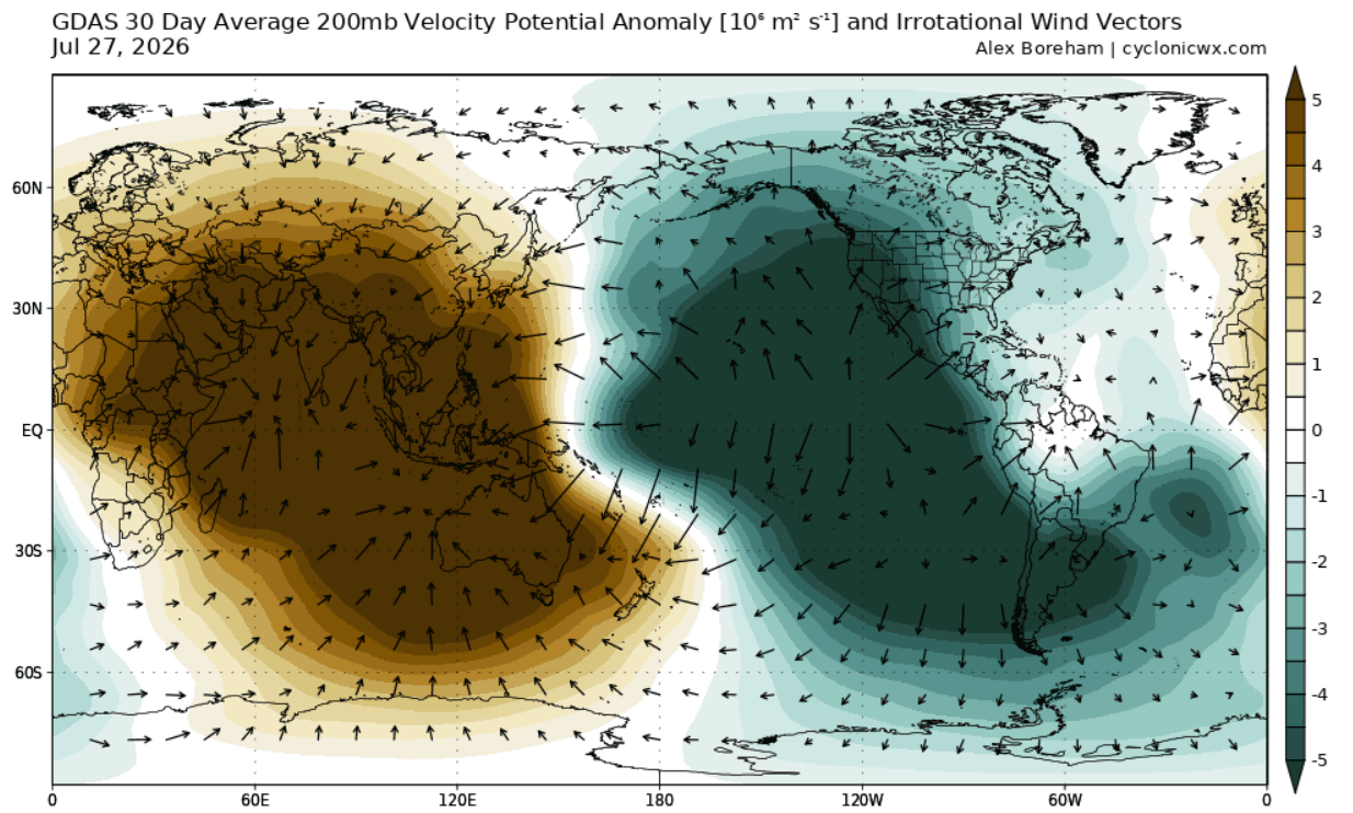
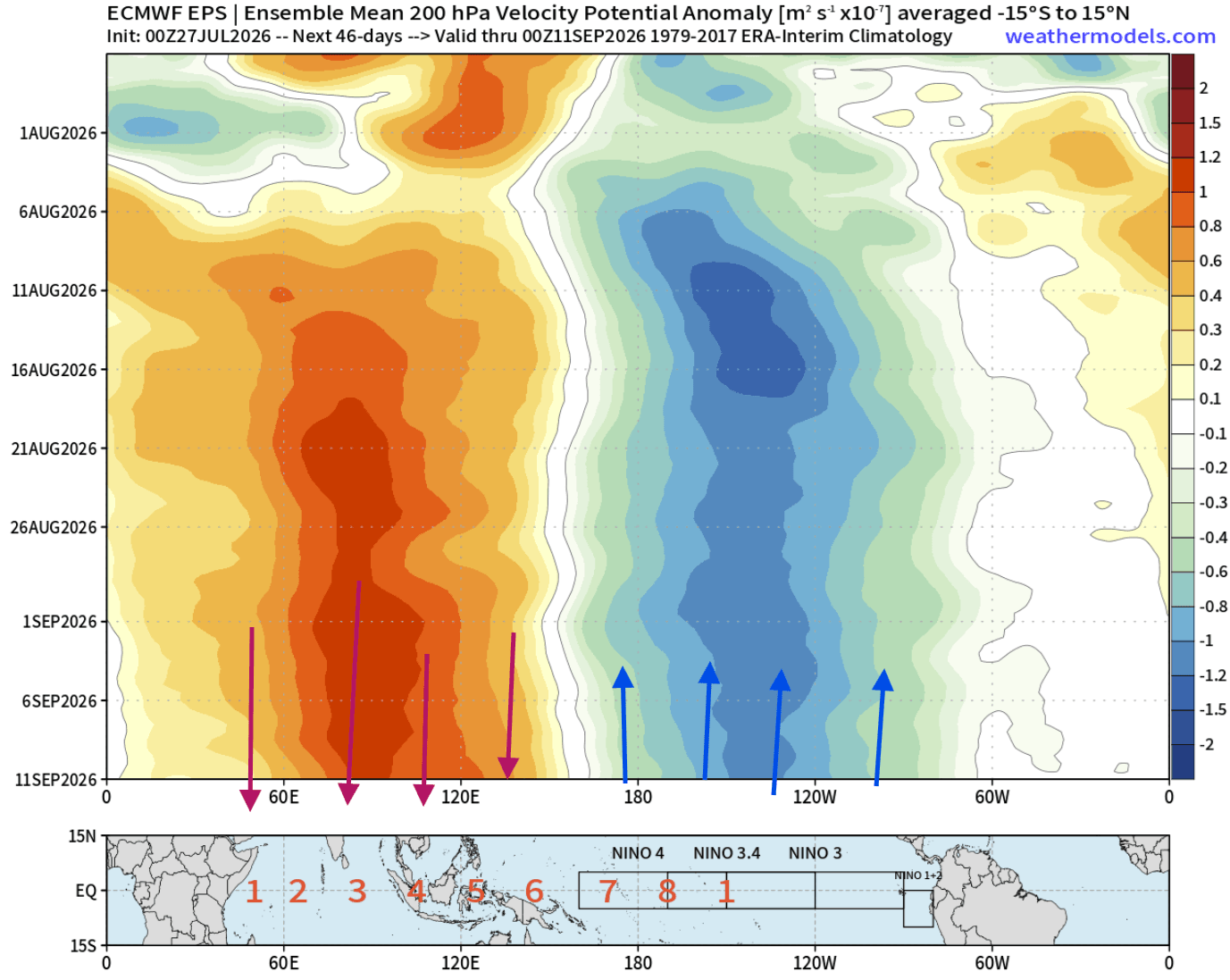
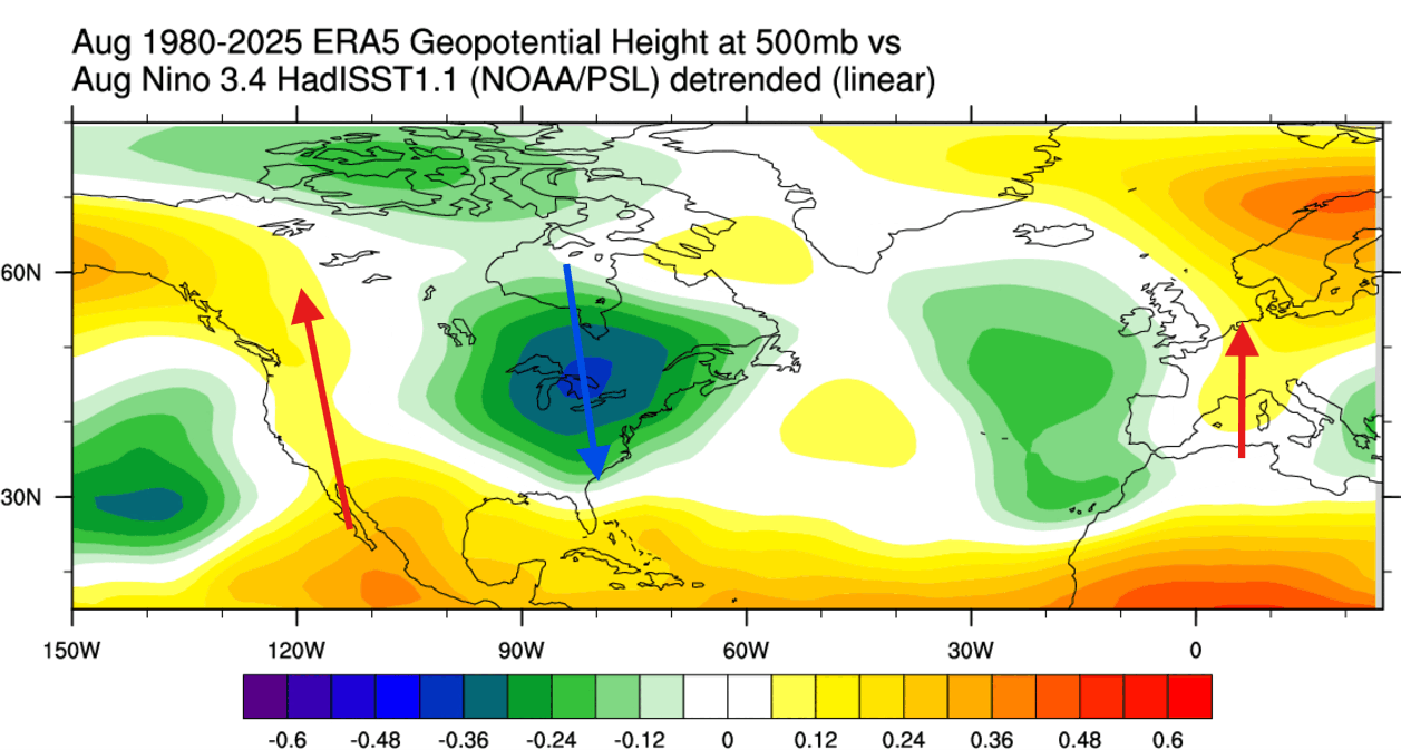
- July 2026: Initial signs were detected, with pressure and temperature patterns in North America showing a striking correlation to historical Super El Niño years. The "atmospheric bridge" began to lock into place, with clear rising air motion over the eastern Pacific and sinking motion over the Indian Ocean.
- August 2026: The current phase is defined by the locking down of an "atmospheric standing wave." The unusual strength of the Pacific anomaly is effectively forcing the global circulation to reorganize around this fixed point.
- Late Summer/Fall 2026: Forecasts indicate an amplification of the split-flow jet stream pattern, which will serve as the primary engine for North American weather during the transition into winter.
- Winter 2026/2027: The peak of the event is projected for late fall and early winter, where the extreme temperature anomalies are expected to exert maximum influence on the mid-latitudes.
Supporting Data: Analyzing the Atmospheric Response
The evidence for a major event is not limited to sea surface temperatures. Velocity Potential forecasts at the 200mb level (roughly 12 kilometers altitude) provide a clear picture of the global circulation. Recent analysis shows an immense atmospheric bridge, confirming that the Walker cell has been fundamentally modified.
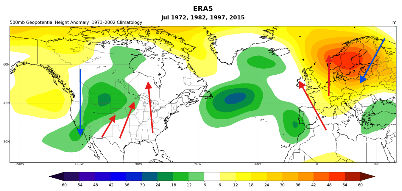
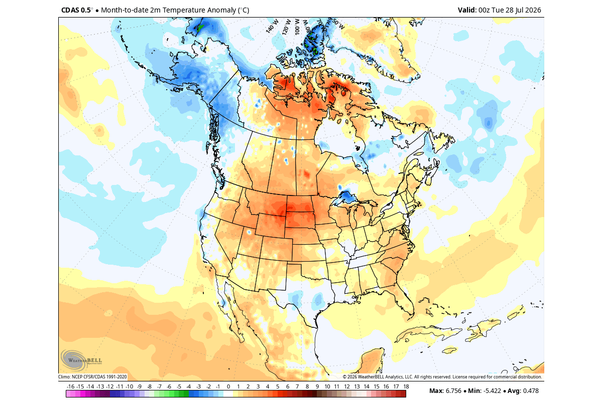
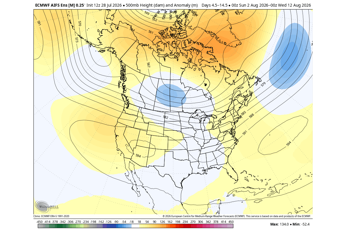
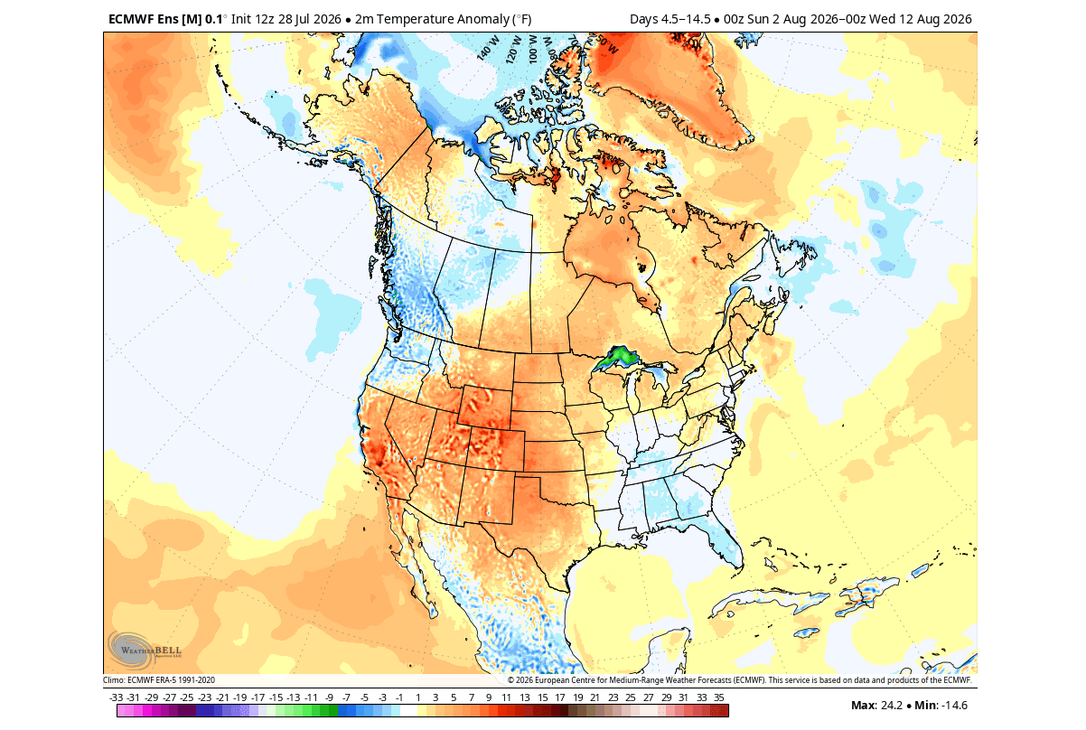
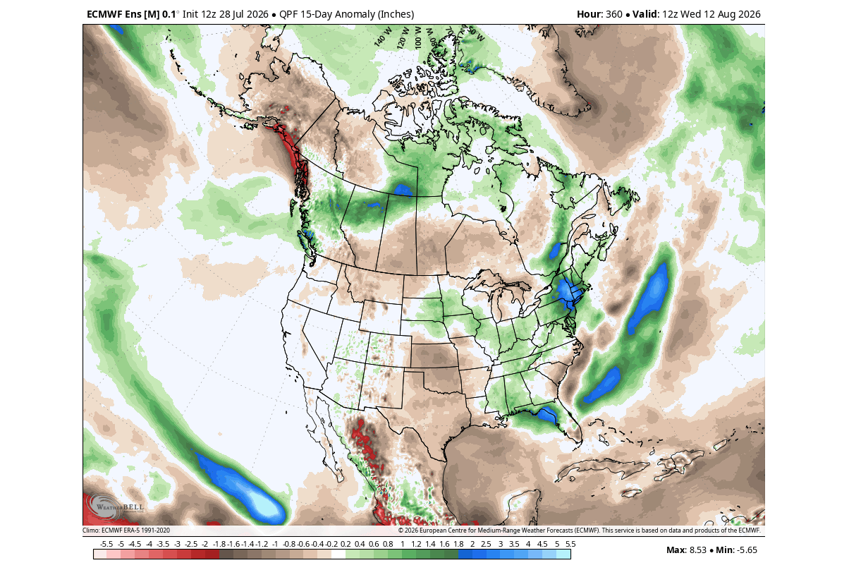
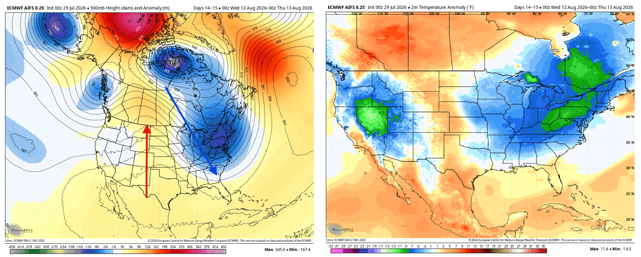
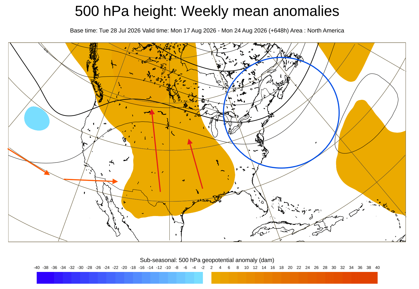
In North America, the pressure pattern for July and August has mirrored historical Super El Niño signatures. We are seeing a shift where low-pressure systems are more frequently steered toward the eastern United States, while a persistent high-pressure ridge builds over the west-central regions of the U.S. and Canada. This configuration is responsible for the divergent temperature profiles we are witnessing: cooler, unsettled weather in the east and northeast, contrasted by sustained warmth under the western ridge.
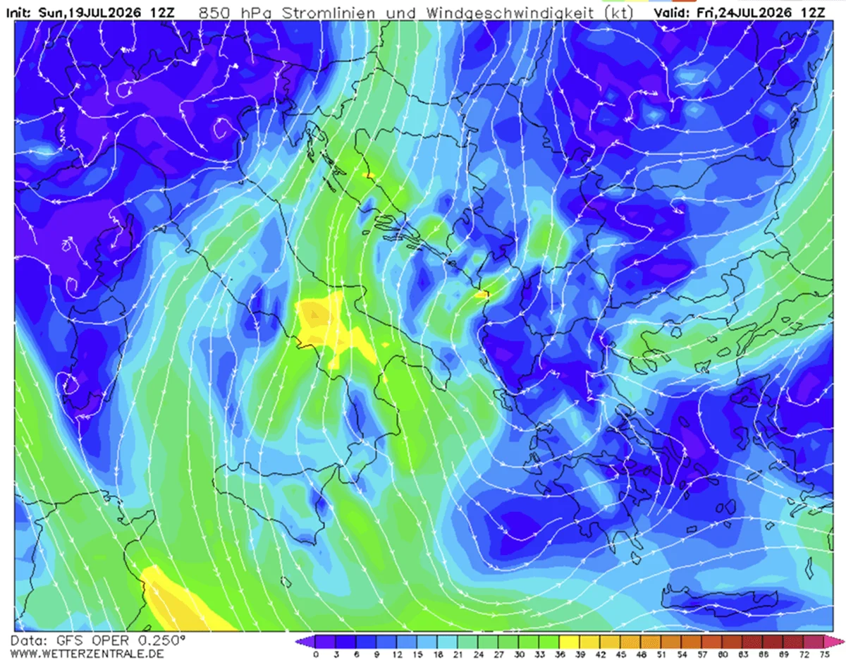
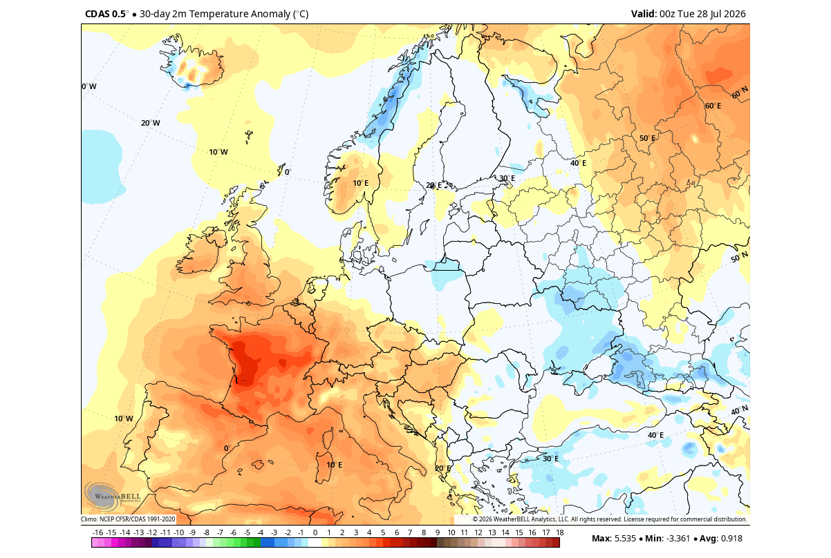
For Europe, the signal is more complex, as the continent is further removed from the direct forcing of the Pacific. However, the data suggests that as the ridge shifts eastward, the European continent will experience a period of fluctuating pressure, with high-pressure domes initially causing warmth, followed by potential instability as the atmospheric waves propagate across the Atlantic.
Implications for North America and Beyond
The "split-flow" pattern projected for the upcoming winter is perhaps the most significant implication of this Super El Niño.
The North American Outlook
By late fall, the amplified Pacific jet stream will begin to dominate. For Canada and the northern United States, the high-pressure block is expected to suppress Arctic air, potentially leading to a milder-than-average winter in these regions. Conversely, the southern United States will likely bear the brunt of an active storm track. As the subtropical jet stream is pushed southward by the Pacific forcing, we can anticipate increased precipitation and a higher frequency of winter storm events across the Central and Southern Plains, extending into the Mid-Atlantic.
The European Perspective
Europe remains on the periphery of the primary ENSO signal, but the indirect effects are non-negligible. Models suggest that the Atlantic low-pressure zones, influenced by the broader atmospheric reorganization, will likely bring moisture-laden, westerly flows to western and central Europe. This may result in a winter characterized by above-normal temperatures and increased precipitation, particularly in the regions typically reliant on stable, colder winter air.
Official Projections and Expert Consensus
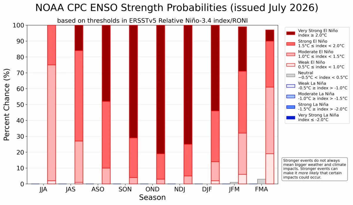
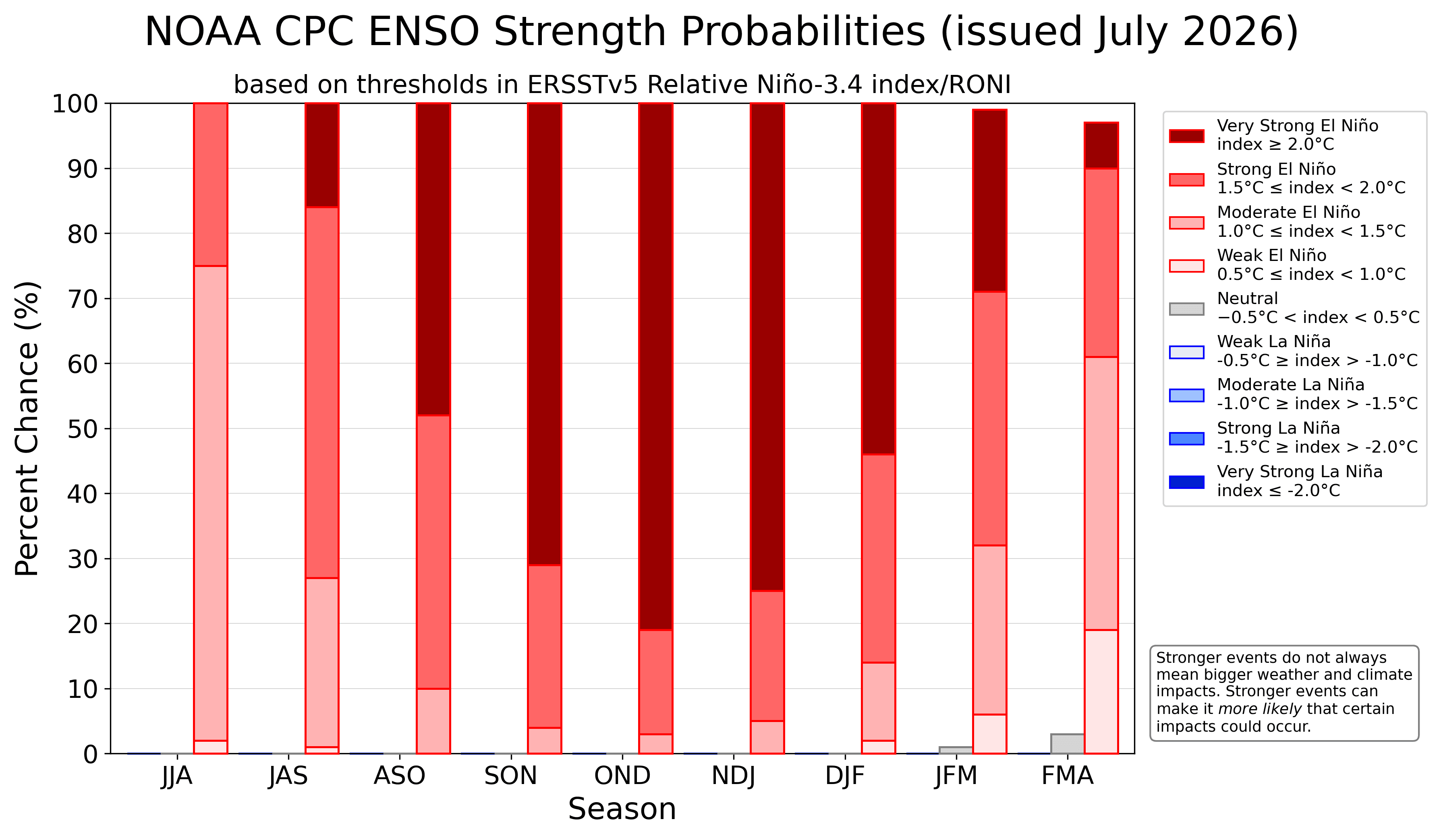
The National Oceanic and Atmospheric Administration (NOAA) Climate Prediction Center (CPC) has released probability outlooks that align with the "Super" classification. The ensemble support for this event reaching the extreme category is substantial. Scientists emphasize that the "Eastern Pacific" (EP) nature of this specific event—where the peak heat is concentrated in the eastern basin—creates a more direct, aggressive shift in the jet stream compared to "Central Pacific" events.
This intensity translates to a "highway" of storm activity. The extreme nature of the 2026 event means the standard seasonal variations will be amplified. Where a moderate El Niño might cause a mild shift, this Super El Niño is expected to lock the atmosphere into a persistent, high-energy state.
Conclusion: Preparing for an Anomalous Season
As we look toward the end of 2026 and into 2027, the primary takeaway is one of increased volatility. The global atmosphere is currently under the influence of a massive, Pacific-driven standing wave that is forcing a departure from historical seasonal norms.
For the public and policymakers, this means preparing for a winter that may deviate sharply from recent years. The combination of a strong Canadian ridge and an active southern storm track in the United States suggests that water management, energy demand, and disaster preparedness in southern regions should be prioritized.
Meteorological agencies will continue to refine these models as the event reaches its late-fall peak. Given the rapid development and record-breaking trajectory of the current 2026 anomalies, the global community should remain vigilant. The 2026/2027 winter will not merely be a standard seasonal transition; it will be a testament to the profound power of the tropical Pacific to reshape the climate of the Northern Hemisphere.
Note: For ongoing updates, stakeholders are encouraged to monitor the latest long-range seasonal forecasts from the European Centre for Medium-Range Weather Forecasts (ECMWF) and NOAA, as the interaction between this Super El Niño and other secondary climate drivers remains a focus of active research.