As the Northern Hemisphere approaches the winter season of 2026/2027, meteorologists and climatologists are observing a convergence of rare global phenomena. Early long-range diagnostic data indicates that the Polar Vortex—the massive, high-altitude circulation system that governs the containment of Arctic air—is showing signs of significant vulnerability. With a "Super El Niño" event brewing alongside specific stratospheric wind anomalies and record-low Arctic sea ice, the stage is set for a potentially volatile winter across North America and Europe.
Main Facts: A System Under Pressure
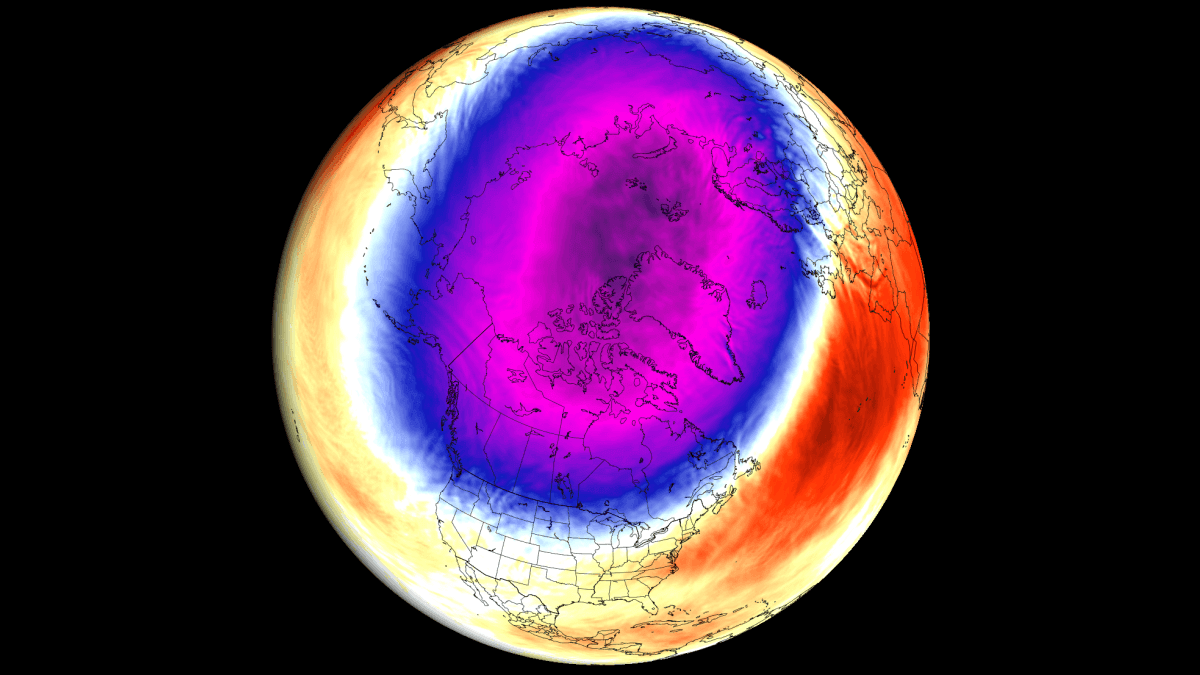
The Polar Vortex is not a singular storm, but a persistent, large-scale cyclone of cold air and low pressure situated over the North Pole. It exists in two distinct layers: the troposphere (where we experience daily weather) and the stratosphere (reaching up to 50km in altitude).
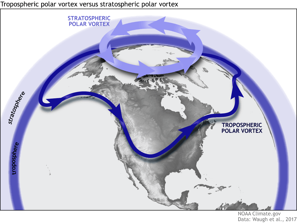
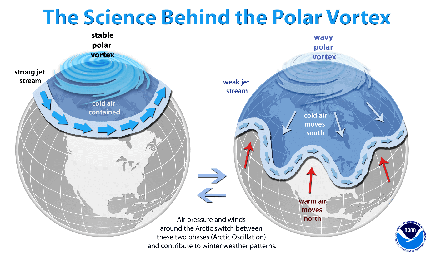
In a "normal" or stable year, the vortex acts as a rigid, spinning wall that traps frigid Arctic air within the polar circle, allowing mid-latitude regions to experience more moderate temperatures. However, when the vortex weakens, it becomes distorted—often stretching or splitting. This allows cold, dense polar air to "leak" southward, penetrating deep into the United States, Canada, and Europe. Current long-range models for January 2027 show a distinct weakening signal in the stratosphere, suggesting that this containment wall may buckle, leading to a dynamic and potentially disruptive winter season.
Chronology of Climate Drivers
The current forecast is built upon the interaction of three primary "global signals" that are currently aligning in a manner rarely seen in recent decades:
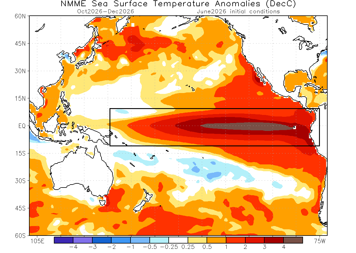
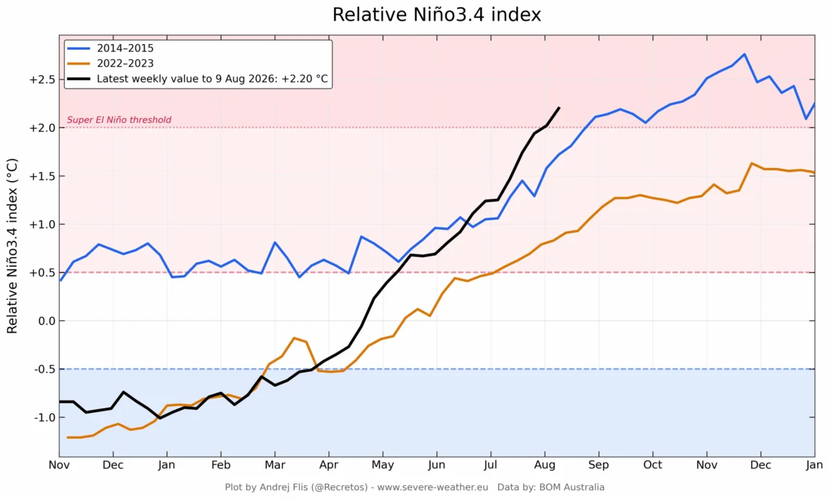
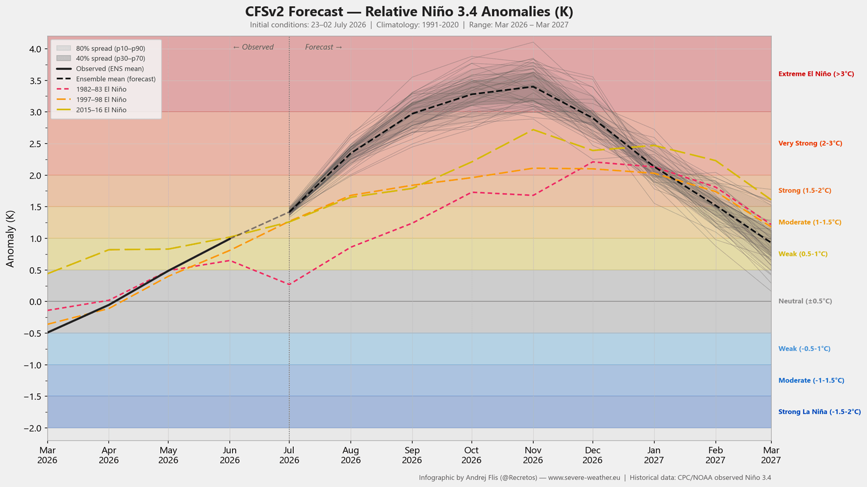
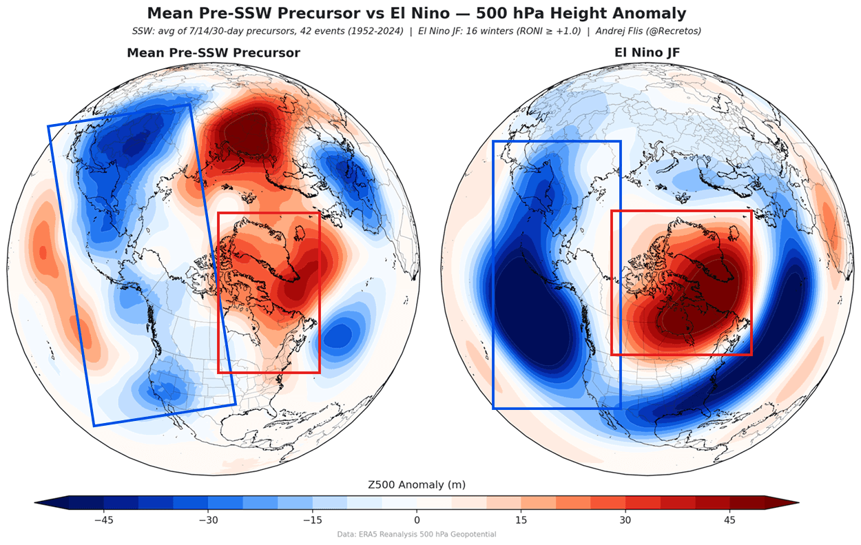
- The Super El Niño Peak (Late 2026): We are tracking the development of a massive warm-phase El Niño event in the equatorial Pacific. Forecasts from the NMME (North American Multi-Model Ensemble) suggest this event will exceed a +2°C anomaly, classifying it as a "Super El Niño." Historically, these events amplify planetary-scale waves that travel upward from the troposphere into the stratosphere, exerting immense pressure on the Polar Vortex.
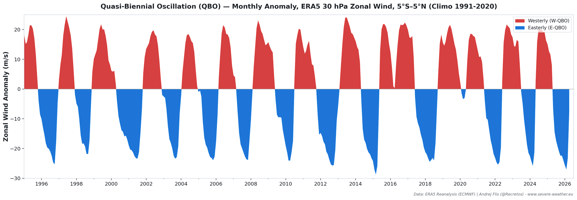
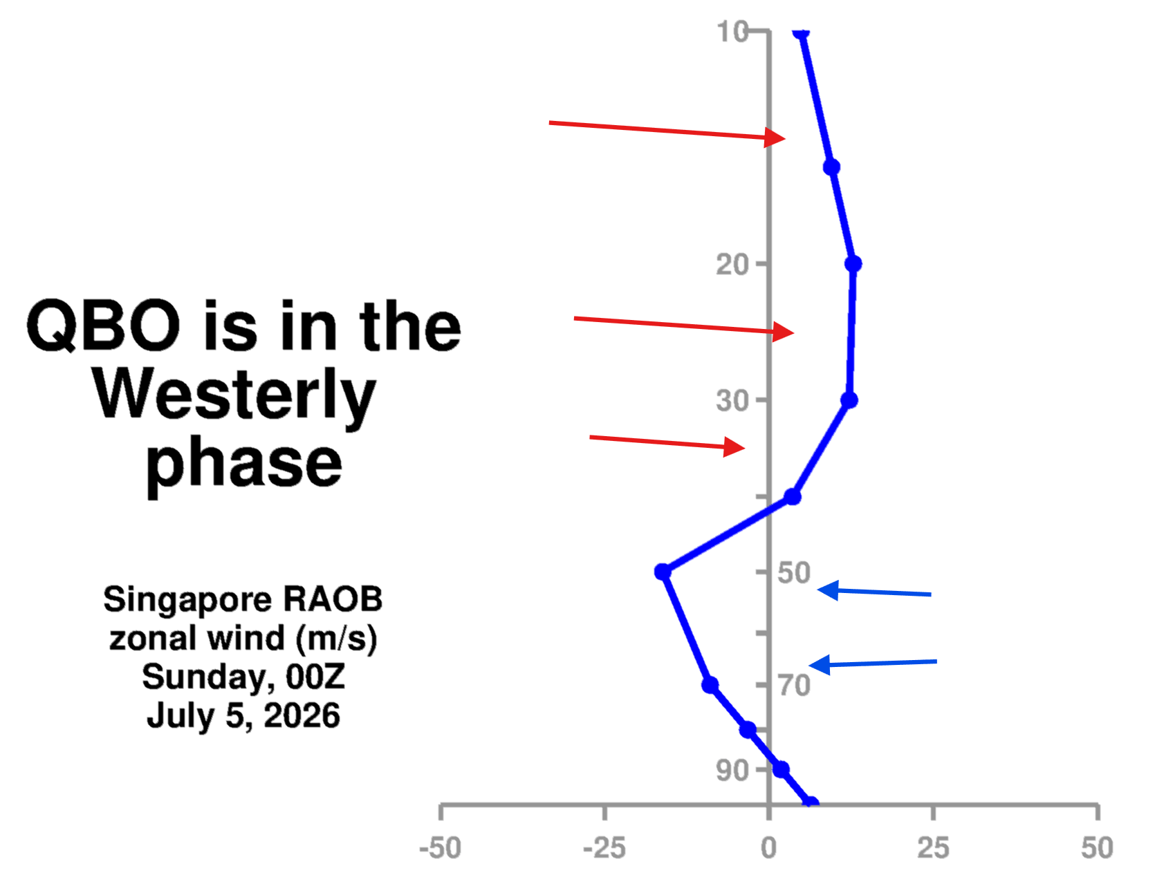
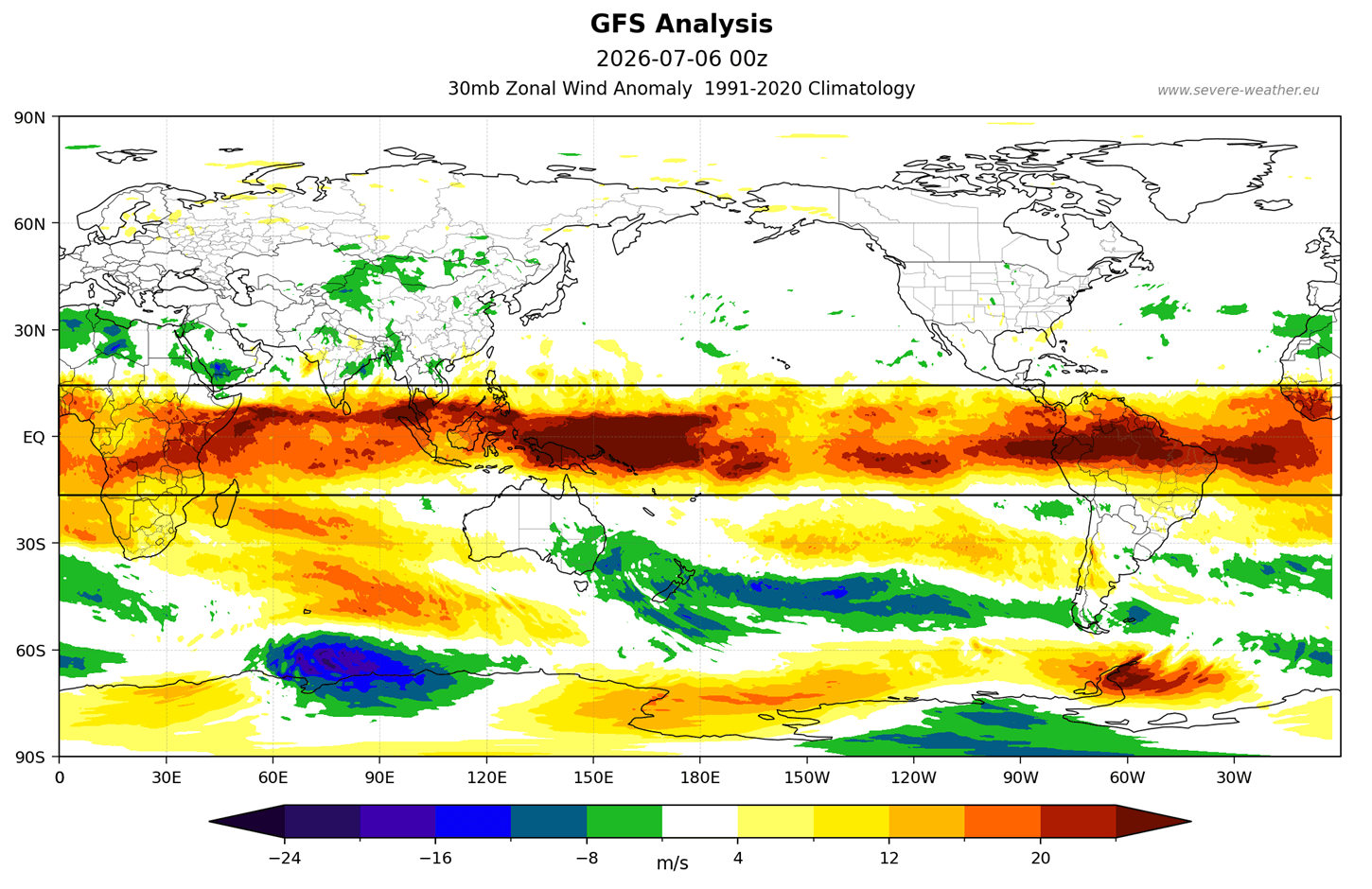
- The QBO Heartbeat (Autumn 2026): The Quasi-Biennial Oscillation (QBO) represents the wind direction in the tropical stratosphere. Currently, the atmosphere is in a westerly QBO phase. While this typically stabilizes the vortex, the presence of an extreme El Niño can override this stability, creating a complex tug-of-war that often results in mid-to-late winter collapse.
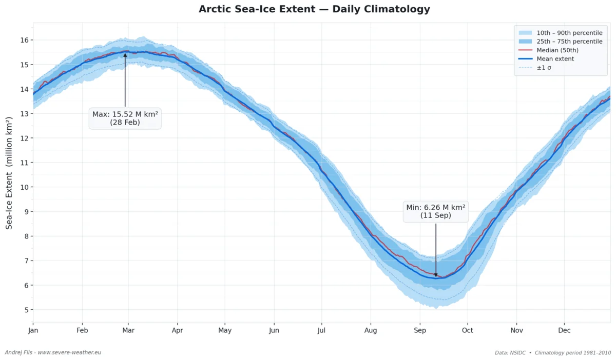
- Arctic Sea Ice Deficit (Fall 2026): Data from the Barents and Kara Seas shows record-low sea ice. This lack of ice changes the energy balance at the North Pole, forcing planetary (Rossby) waves to intensify. These waves provide the "kinetic energy" required to disrupt the stratospheric vortex, pushing it off its axis.
Supporting Data: Analyzing the Stratospheric Signals
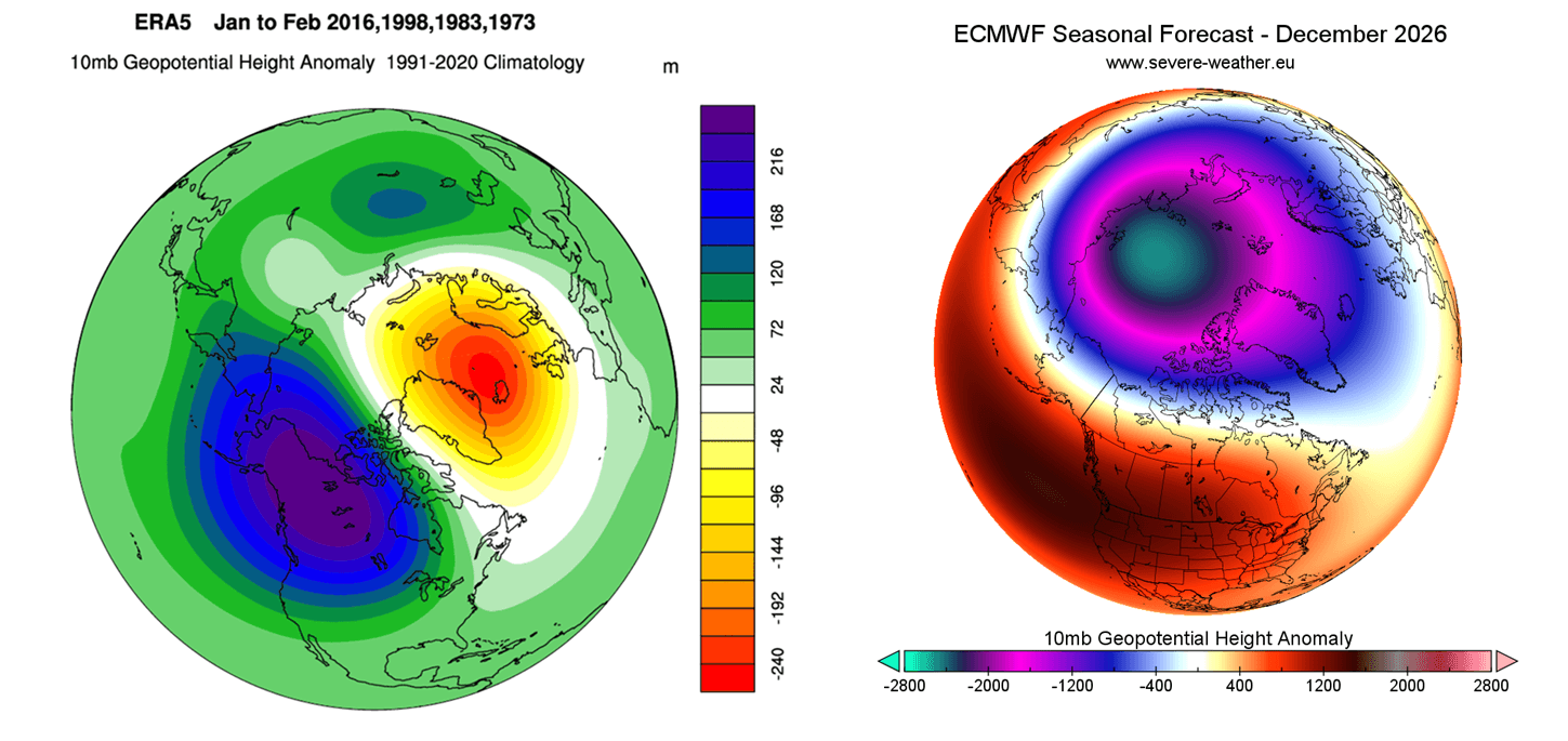
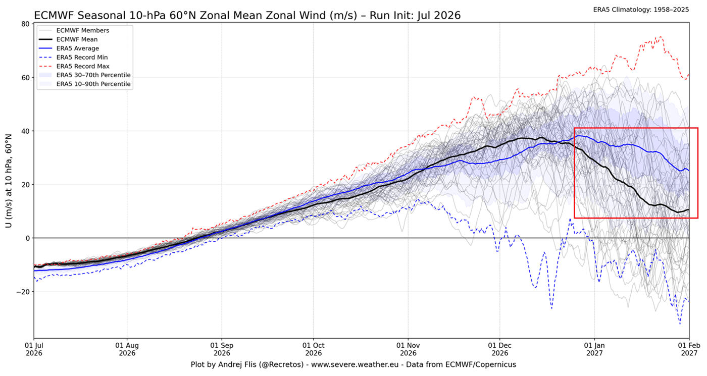
The evidence for a potential disruption is not merely speculative; it is grounded in high-resolution computational modeling. The European Centre for Medium-Range Weather Forecasts (ECMWF) seasonal ensemble has recently released data showing a sharp decline in the strength of zonal winds at the 10mb stratospheric level.
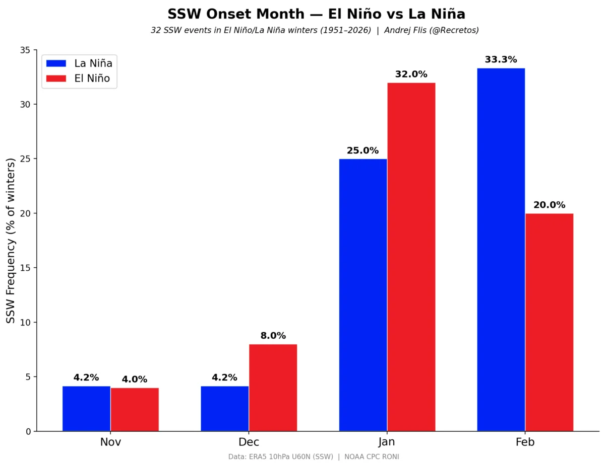
When zonal winds weaken, the vortex loses its structural integrity. The 3D imagery of the stratosphere currently shows a building high-pressure anomaly—a "warm spot"—that is beginning to press against the cold core of the vortex. If this trend continues through December, the probability of a Sudden Stratospheric Warming (SSW) event in January 2027 increases significantly.
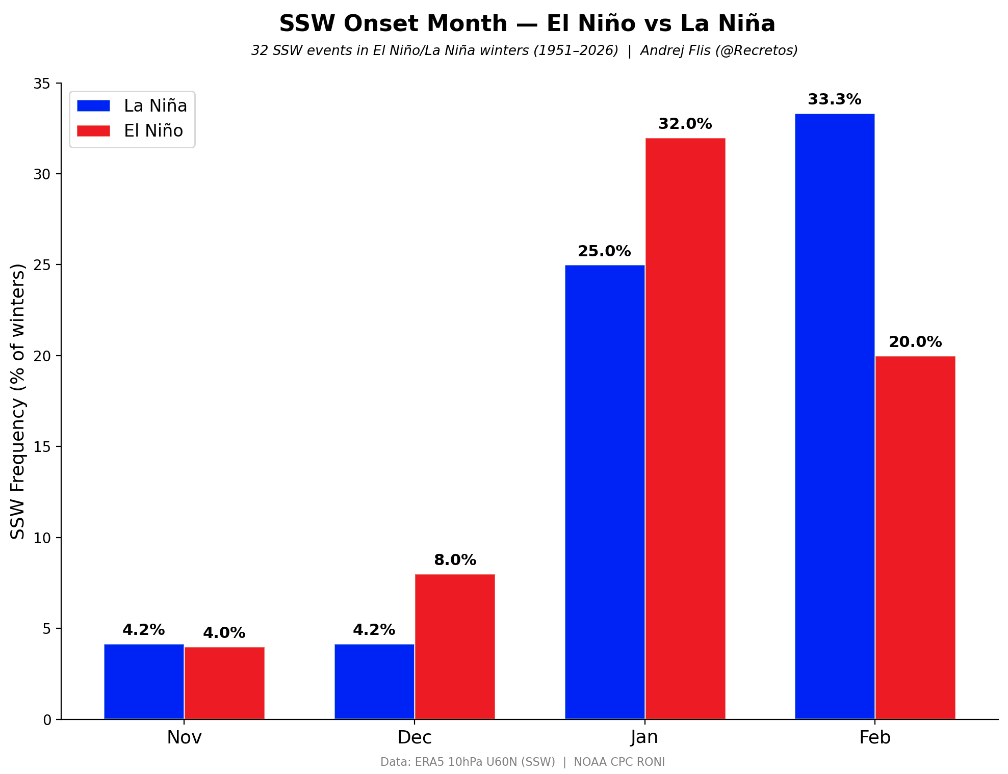
In an SSW, temperatures in the stratosphere can spike by tens of degrees in just a few days. This thermal shock causes the vortex to collapse or split. Historical precedents, such as the events of January 2026, show that when such a split occurs, the "Polar Express"—a direct pathway for Arctic air—is essentially opened, leading to sustained sub-zero temperatures across the central and eastern United States and northern Europe.
Official Perspectives and Meteorological Consensus
While no meteorological agency issues a "guarantee" of specific weather months in advance, the scientific consensus is focusing on the increased volatility of the upcoming winter. NOAA and other climate research bodies emphasize that a disrupted vortex is the single most significant factor in creating "blocking patterns."
Blocking patterns occur when the jet stream stalls, preventing typical weather systems from moving across the Atlantic or Pacific. This creates a "stuck" weather pattern, where extreme cold or heavy snow events can persist over a specific region for weeks at a time. The current atmospheric configuration—a perfect storm of Pacific ocean heat and Arctic ice loss—suggests that the baseline probability for these blocking patterns in early 2027 is currently higher than the 30-year average.
Implications for Winter 2026/2027
What does this mean for the average person in the mid-latitudes? A disrupted Polar Vortex is not synonymous with "everywhere is cold." Instead, it represents a shift in the distribution of cold air.
- For North America: A split in the vortex typically displaces the cold core toward the eastern half of the United States and Canada. Residents in these regions should prepare for potential outbreaks of intense, arctic-air-driven snowfall and temperature plunges that can occur with little warning.
- For Europe: Northern and central Europe are historically susceptible to the "easterly flow" that follows a vortex disruption. This pattern often pulls cold, dry air from the Siberian plains westward, leading to significant snowfall and prolonged freezing conditions.
- For Infrastructure: The implications for energy grids, transportation, and agriculture are substantial. A winter marked by a weak vortex is characterized by extreme temperature swings—rapid transitions from mild conditions to deep-freeze scenarios. Utility providers and emergency management services are already being advised to account for the heightened risk of extreme weather events in their seasonal planning.
Conclusion: Monitoring the Transition
As we move toward the final quarter of 2026, the focus will remain on the stratospheric wind profiles. The transition from the current "westerly" QBO phase toward the potential January disruption remains the primary variable in the long-range outlook.
While the "Super El Niño" provides the energy, and the low Arctic sea ice provides the mechanism, the actual timing of the vortex’s reaction remains fluid. Observers should monitor the 10mb wind speeds and the daily temperature anomalies over the Barents-Kara region. If these indicators continue to show the current trends, the winter of 2026/2027 will likely be remembered as one of the most dynamic and disruptive in recent memory.
As we continue to gather data from NASA’s radiosonde analysis and global climate models, we will provide ongoing updates. In the complex world of atmospheric science, the Polar Vortex remains the ultimate arbiter of winter’s intensity. By tracking these early-season signals, we gain a vital window into the potential for extreme cold, providing a necessary head start for those living in the path of the coming winter’s reach.