The Arctic ice cap, the world’s northernmost climate regulator, is currently signaling a state of extreme vulnerability. According to the latest satellite data from mid-June 2026, Arctic sea ice extent has plummeted to record-low levels for this time of year. As the region enters the peak of its annual melt season, scientists are monitoring a combination of fragile ice concentrations and an emerging meteorological phenomenon in the tropical Pacific that could fundamentally alter the trajectory of global weather for the remainder of the year and into the winter of 2026/2027.

Main Facts: A Record-Breaking Start to the Melt Season
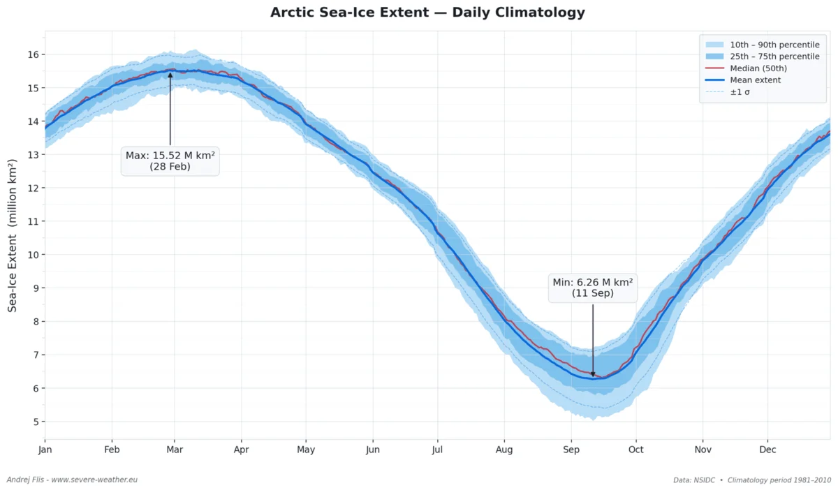
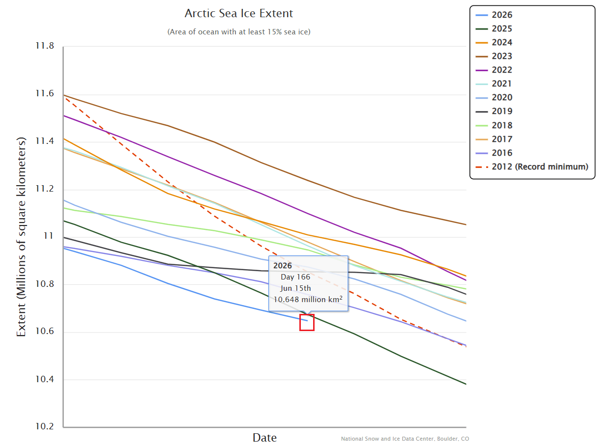
The Arctic Ocean, characterized by its vast, shallow, and frigid waters, functions as a massive heat sink and a critical driver of the Northern Hemisphere’s atmospheric circulation. Current analysis reveals that the sea ice extent is not only trailing behind the levels observed in 2025 but is also lagging behind the historic 2012 record-low mark.
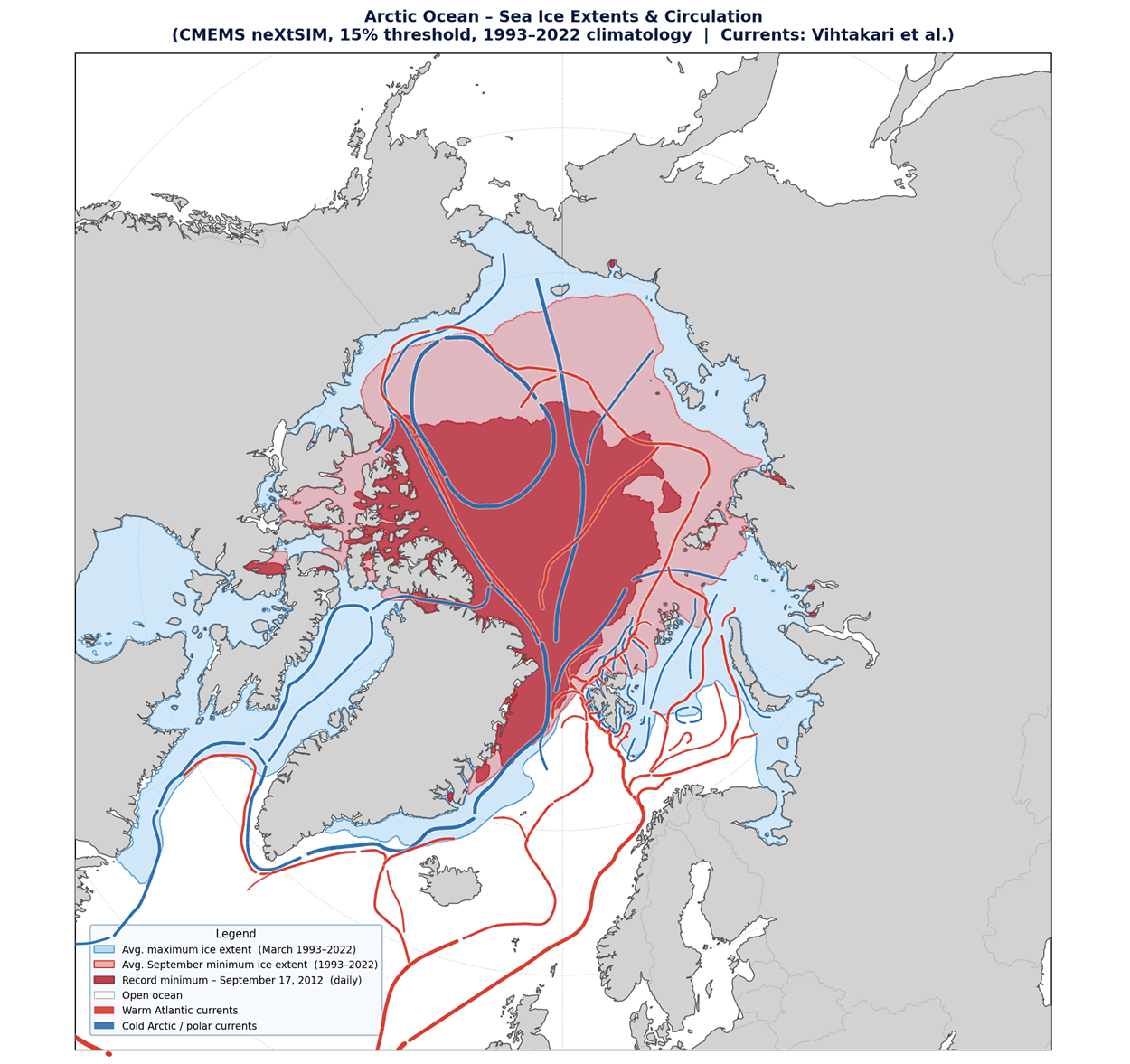
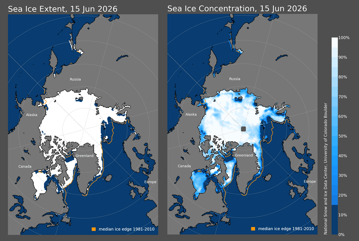
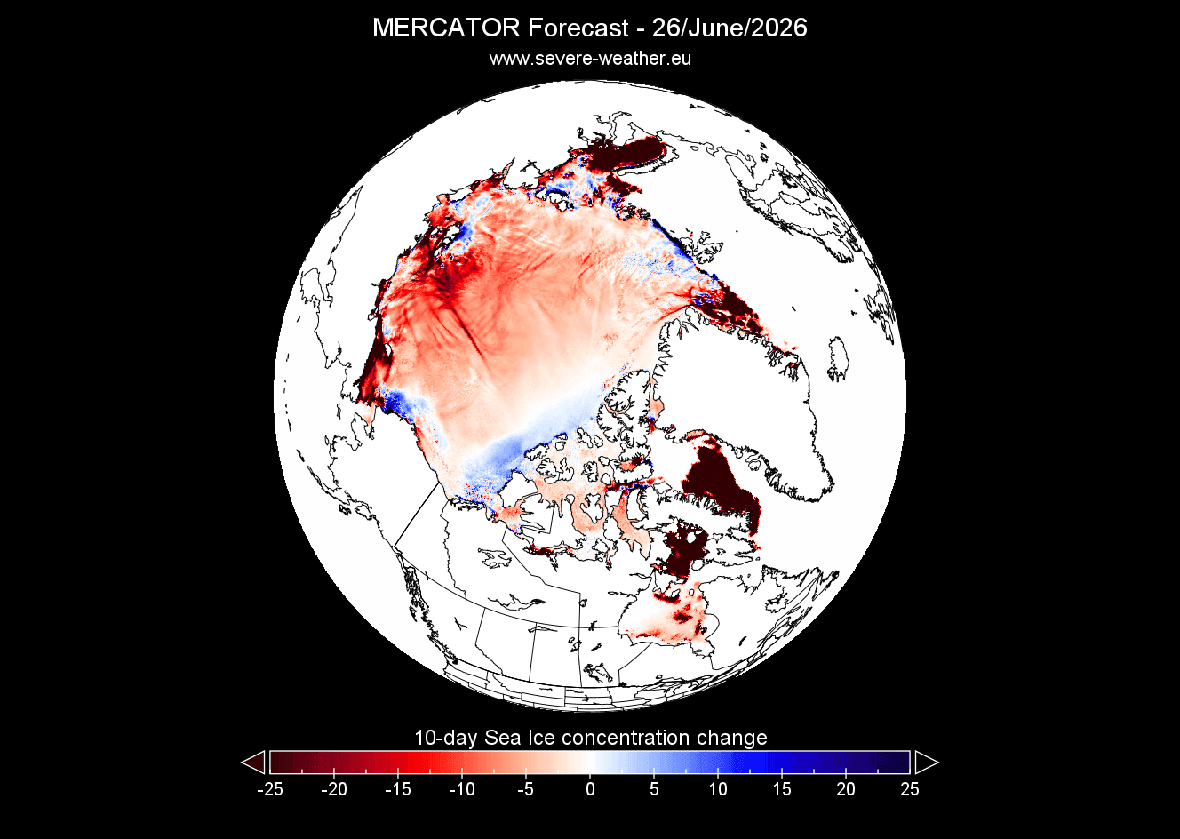
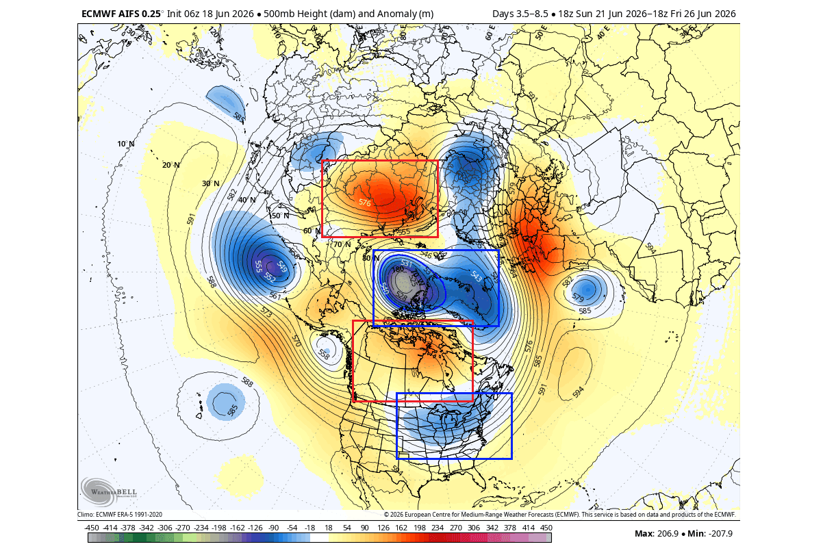
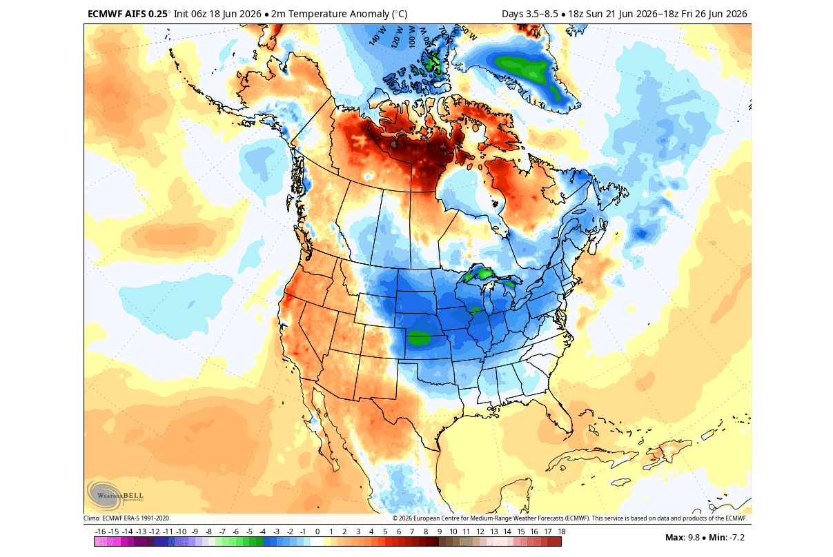
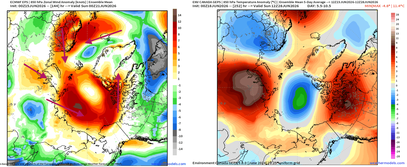
The most concerning development is the reduction in ice concentration, particularly on the Atlantic side of the Polar region. This lack of density renders the ice cap susceptible to rapid fragmentation. Meteorological forecasts indicate that an upcoming shift in pressure patterns will likely accelerate this melting process. Paradoxically, this same atmospheric configuration is expected to drive a surge of cooler air into North America, creating a stark contrast between the warming Arctic and the temporary temperature anomalies in the United States and Canada.
Chronological Progression: From Early Spring to Mid-Summer
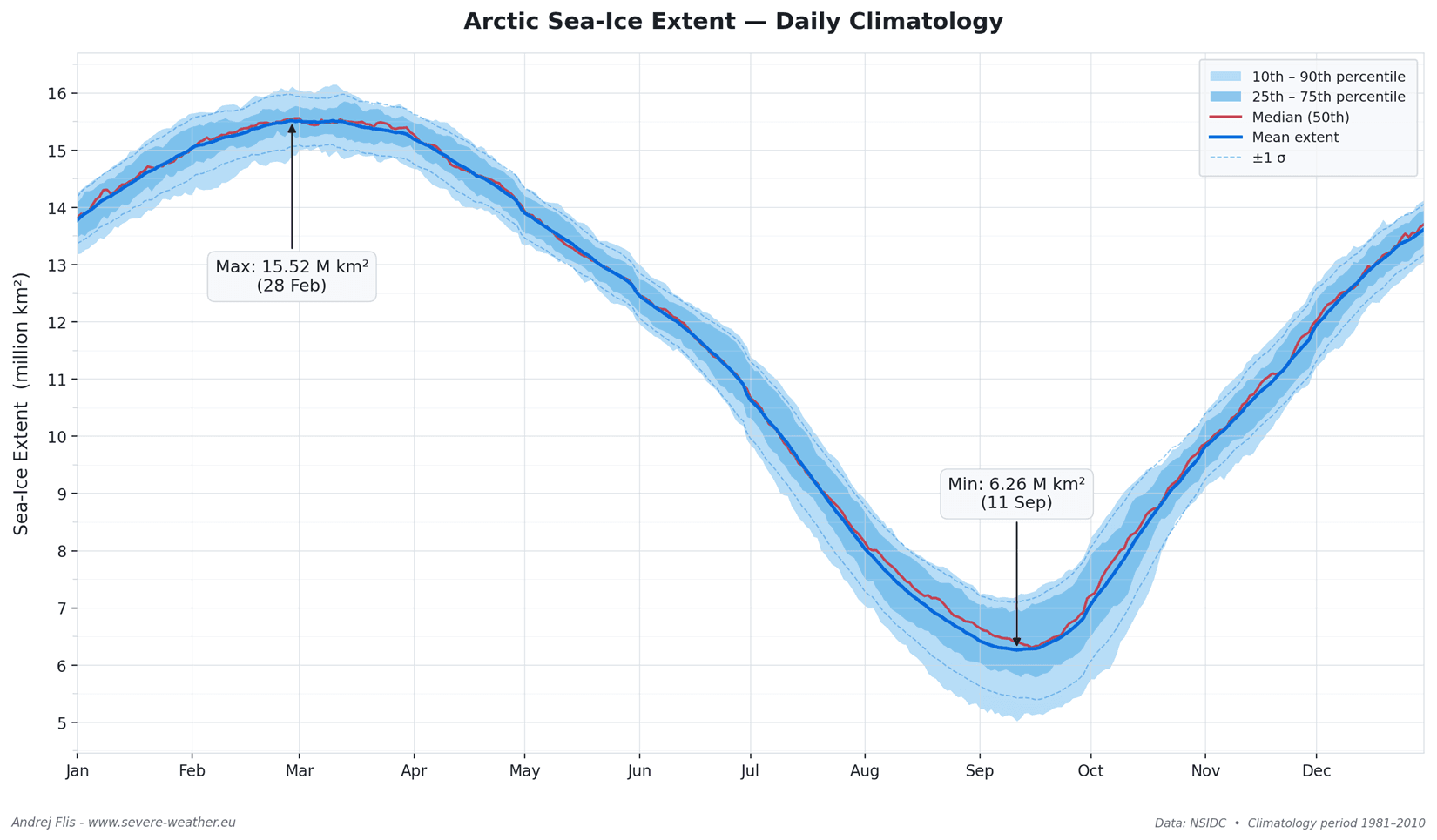
The Arctic sea ice cycle follows a predictable, albeit increasingly volatile, rhythm. The melt season typically initiates in late March, as increasing solar radiation triggers the retreat of the ice edge. This progression continues through the summer months, reaching an absolute minimum in mid-September.
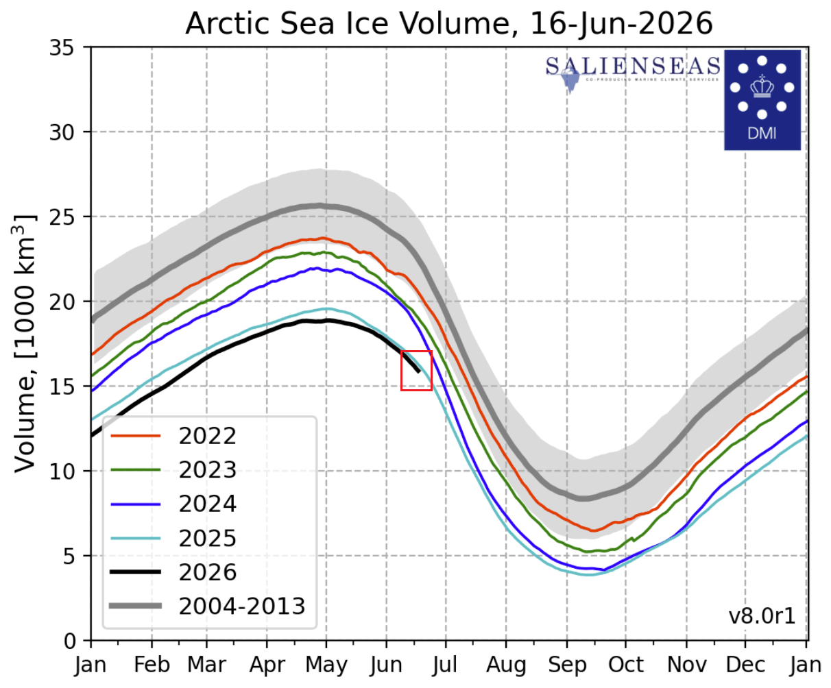
- Late Spring (May): Sea ice volume typically reaches its peak during this period as the polar regions remain cold enough to maintain structural integrity. However, 2026 data shows that the ice volume is currently lower than in previous years, signaling a premature thinning.
- Mid-June (Current Status): The region has officially entered a record-low state for this time of year. The Atlantic and Kara Sea sectors are showing signs of accelerated melting due to current circulation patterns.
- Late Summer/Fall (Projections): The integration of a developing "Super El Niño" in the Pacific is expected to sustain high-pressure ridges over the Arctic, potentially driving further melting through September.
Supporting Data: The "Super El Niño" Influence
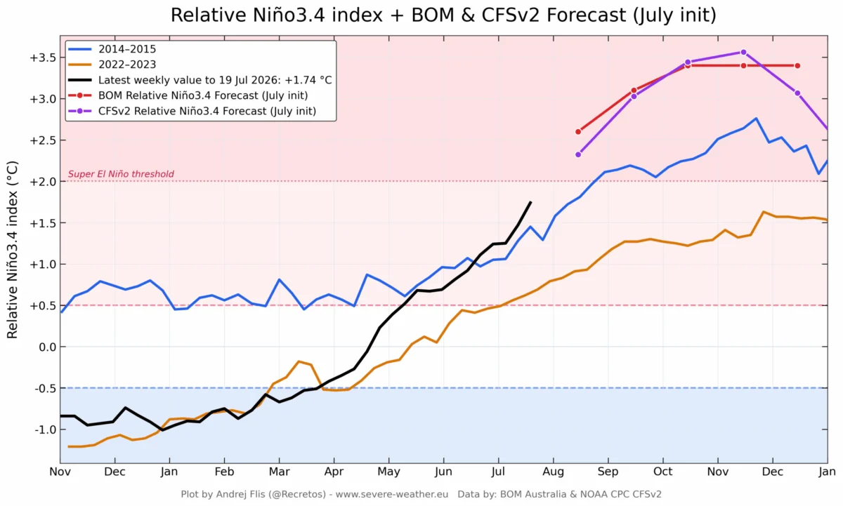
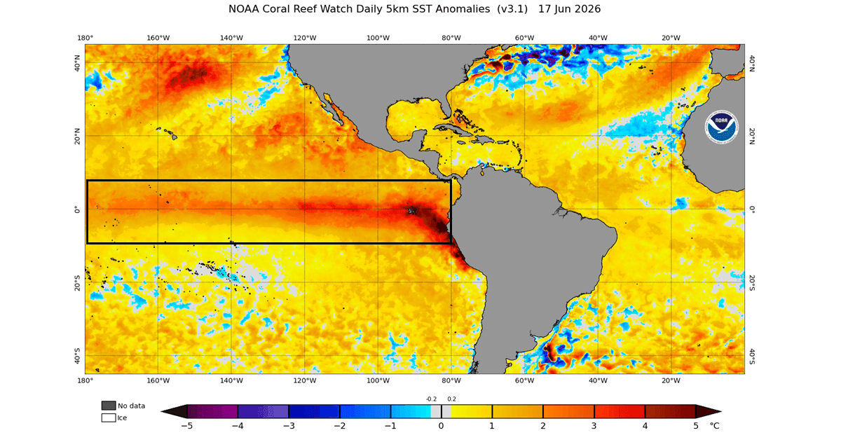
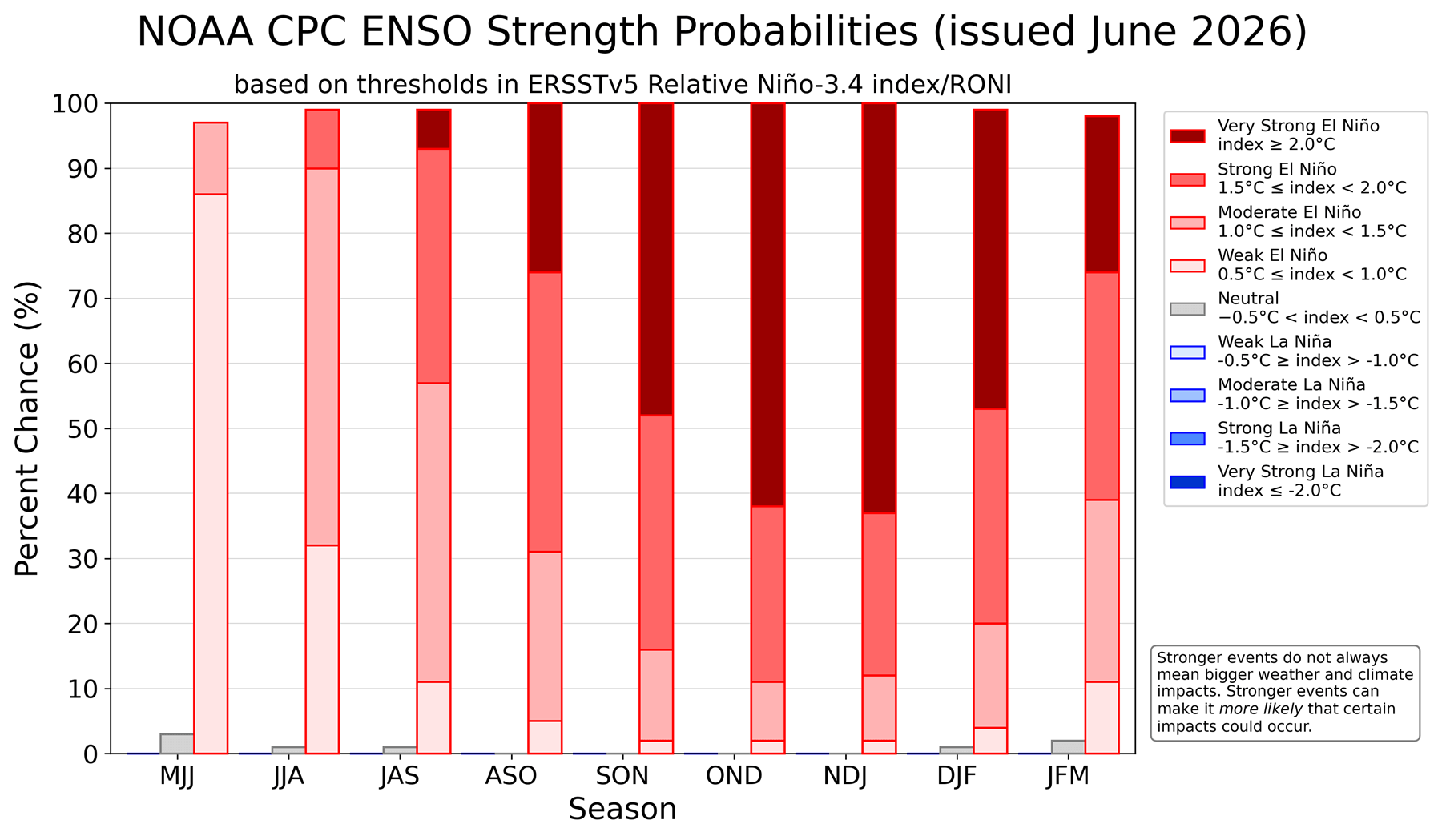
The development of a powerful Super El Niño event in the tropical Pacific is the defining variable of the 2026 climate outlook. El Niño, the warm phase of the El Niño-Southern Oscillation (ENSO), is defined by significant sea surface temperature anomalies in the equatorial Pacific.
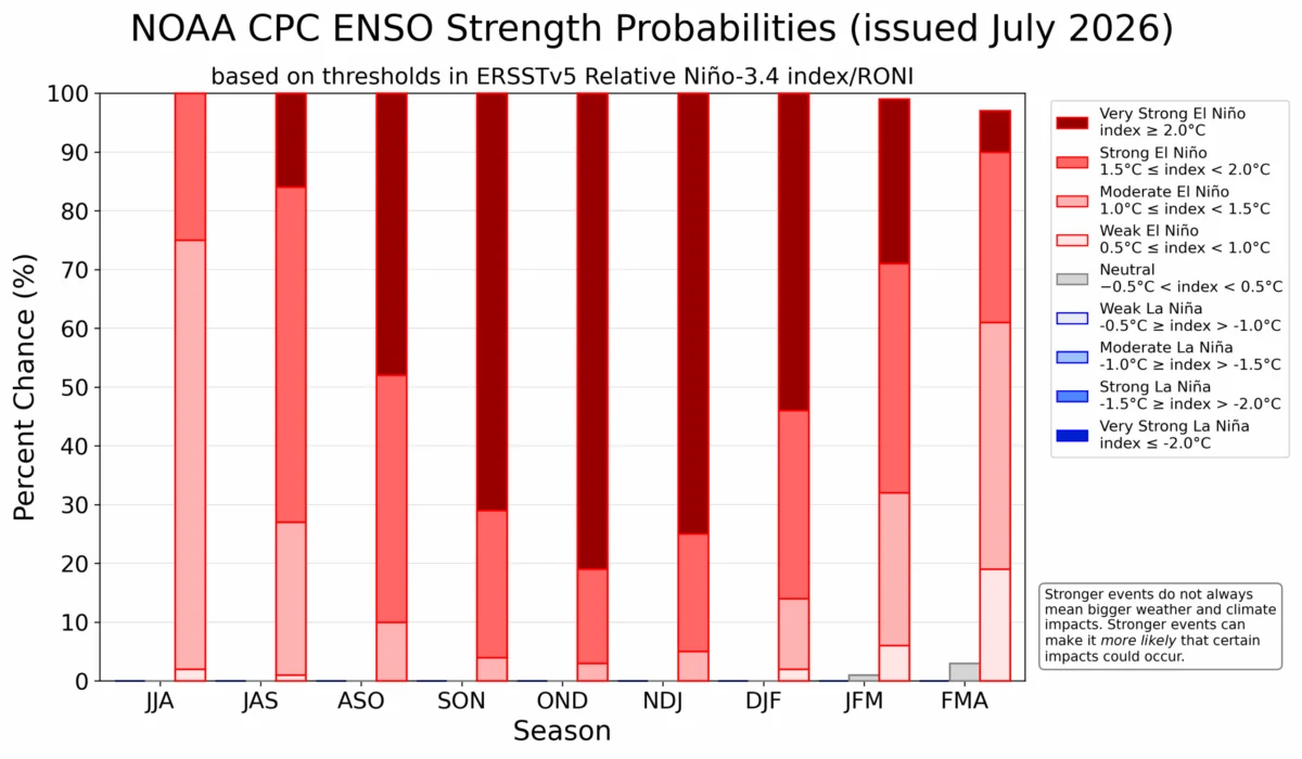
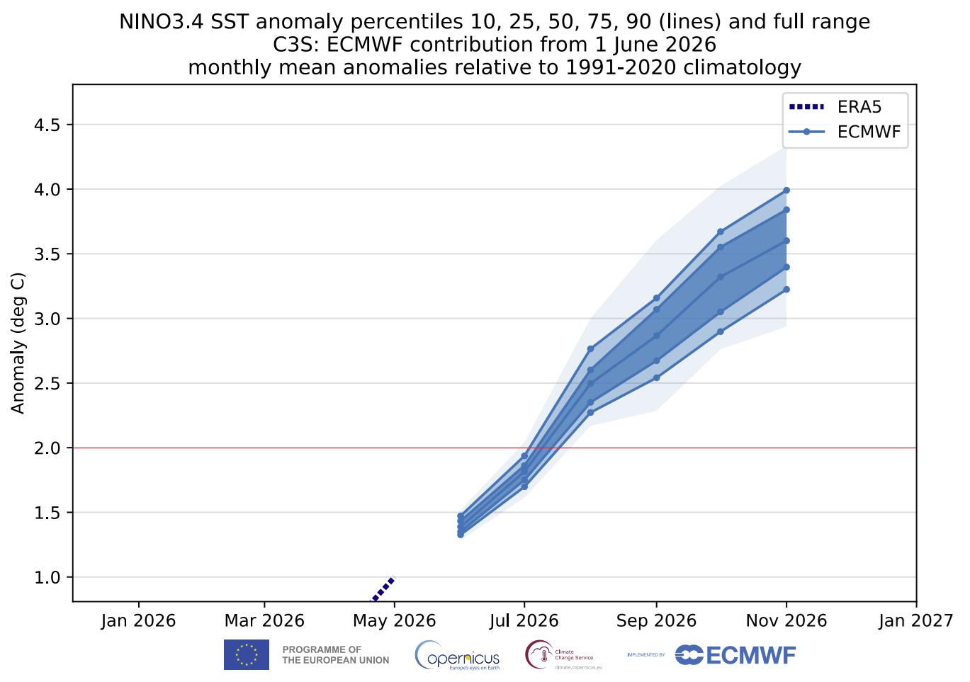
Current ECMWF (European Centre for Medium-Range Weather Forecasts) ensemble models indicate that this event is rapidly strengthening. Projections show the sea surface temperature anomaly in the Niño 3.4 region likely exceeding the +2.0°C threshold, placing it firmly in the "Super" category. This is not merely a regional Pacific event; it is an atmospheric driver capable of reconfiguring global pressure systems.
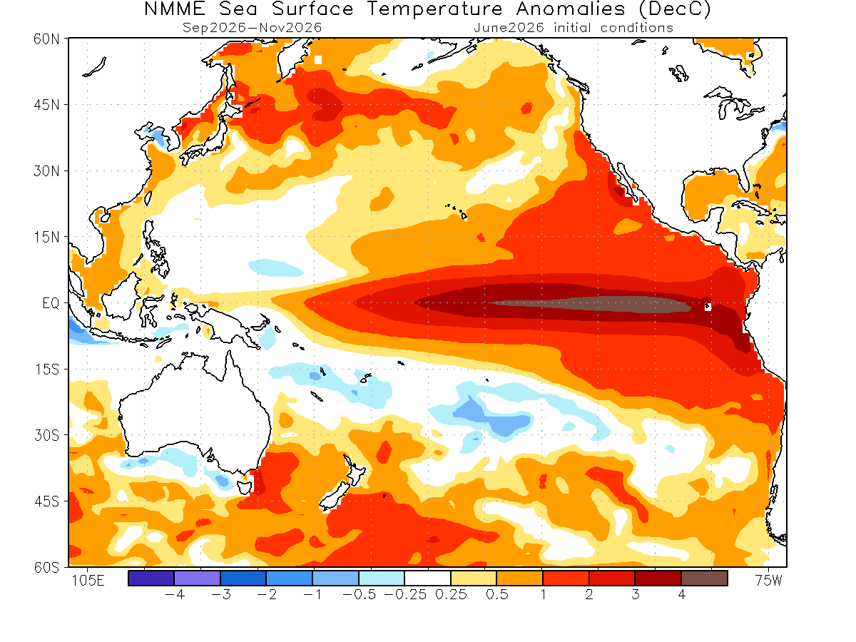
Data from the National Multi-Model Ensemble (NMME) suggests that these anomalies could climb as high as +4.0°C by the autumn months. The correlation between these Pacific temperature spikes and Arctic ice loss is established through "atmospheric bridges"—shifting pressure patterns that transport warm air from lower latitudes directly into the Polar Circle. Historical analysis confirms that during strong El Niño years, the pressure gradients typically shift, resulting in increased melt rates in the Beaufort Sea and the central Arctic Ocean.
Atmospheric Mechanics: The Polar Vortex Connection
The ultimate concern for meteorologists is the potential impact on the Polar Vortex—the massive, spinning reservoir of cold air located in the stratosphere, approximately 30 miles above the Earth’s surface.
The Role of the Vortex
In a stable state, the Polar Vortex acts as a containment vessel, locking frigid air within the Arctic. However, the interplay between reduced sea ice and a Super El Niño event acts as a destabilizing force. The reduction of sea ice creates a "warmer" Arctic surface, which can send energy waves upward into the stratosphere. These waves can disrupt the vortex, causing it to elongate, displace, or even collapse.
Winter Implications for 2026/2027
When the Polar Vortex is disrupted, the cold air that was previously trapped in the Arctic is forced to spill southward into the mid-latitudes. This phenomenon has been observed in recent years, leading to severe, unseasonable cold snaps across the United States, Canada, and Europe.
Long-term studies of previous Super El Niño events show a statistically significant correlation with a weaker, more erratic Polar Vortex. When combined with a record-low sea ice minimum in the fall, the probability of a "Stratospheric Warming" event increases. While each winter is unique, the current precursors suggest a high-impact season for the Northern Hemisphere.
Implications for Global Weather Patterns
The implications of these developments extend far beyond the Arctic circle. The immediate result of the current pressure configuration is a northerly flow that brings unseasonable cold into the central and eastern United States and southern Canada, while simultaneously promoting warmer, ice-melting conditions in the Canadian Arctic Archipelago and the Labrador Sea.
A New Climate Reality
The scientific community is closely watching how these two major factors—the rapid thinning of the Arctic ice cap and the rapid onset of a Super El Niño—will interact. If the current trends hold, the world could be facing a period of intense atmospheric volatility.
- Arctic Ecosystems: Continued record-low ice levels disrupt the food chain and accelerate the feedback loop of warming, as open ocean waters absorb more solar radiation than reflective ice (the albedo effect).
- North American Weather: Residents in the United States and Canada should prepare for a potentially bifurcated winter. The combination of El Niño and a compromised Polar Vortex could lead to extreme temperature swings and high-impact winter storms, as the "blocking" patterns in the atmosphere prevent typical weather systems from moving through normally.
- Global Connectivity: The "atmospheric bridge" between the Pacific, the Arctic, and the mid-latitudes demonstrates that climate change is not a localized issue. A warming Arctic is not just an environmental concern for the North Pole; it is a direct influence on the heating and cooling cycles of major metropolitan areas in the Northern Hemisphere.
Conclusion: Monitoring the Future
As we head into the peak of the 2026 melt season, the data is clear: the Arctic is in a fragile state, and the Pacific is shifting into a high-intensity mode. The combination of these two forces serves as a stark reminder of the complexity of our climate system. Meteorological agencies will continue to track the "Kelvin Waves" (subsurface warm water movements) in the Pacific and the structural health of the ice cap to refine forecasts for the coming autumn and winter.
For those in North America and Europe, the coming months will be defined by how effectively the atmosphere can channel these massive energy shifts. While the record-low ice levels are a primary point of concern for scientists, the downstream effects on the Polar Vortex and seasonal temperatures will be the primary concern for the public. As the global climate continues to respond to these massive signals, the importance of accurate, long-range forecasting has never been more critical.