A powerful meteorological force is gathering in the equatorial Pacific, signaling the onset of what climatologists are already describing as a "Super El Niño." As the primary global weather driver for the upcoming Fall and Winter seasons, this event is not merely a regional anomaly; it is an atmospheric catalyst that is already restructuring planetary circulation patterns at a remarkable pace.

Latest oceanic analysis confirms that warm anomalies within the El Niño Southern Oscillation (ENSO) region are expanding aggressively. While autumn is typically a transitional season characterized by weaker, less organized patterns, the 2026 forecast suggests an unusually connected evolution. The influence of this Super El Niño is amplifying, setting the stage for a highly active weather season that will likely persist well into the 2026/2027 winter.
The Mechanics of a Super El Niño: Planetary Dynamics
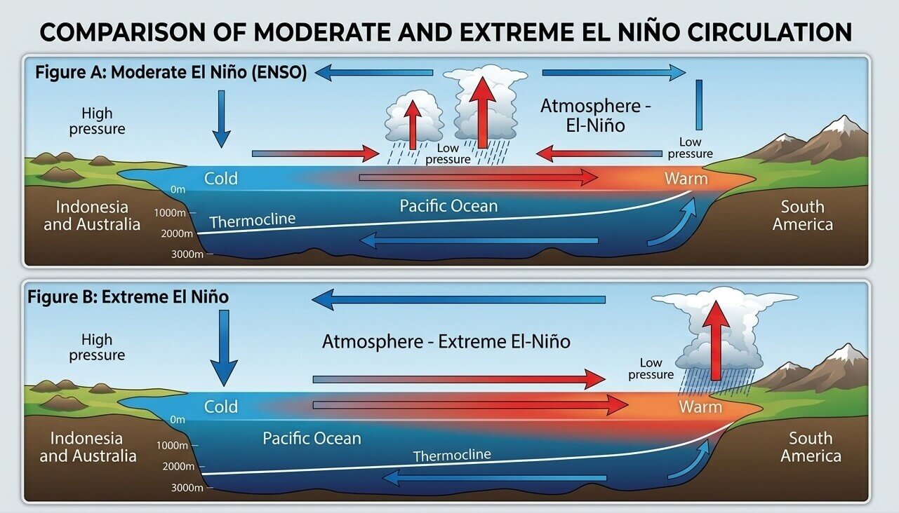
To understand the gravity of the 2026/2027 season, one must look at the Pacific "Walker Cell." The Walker Cell is a system of upward and downward atmospheric motion that dictates global rainfall and pressure distributions. Under normal conditions, trade winds blow from east to west across the Pacific, keeping the western waters warm.
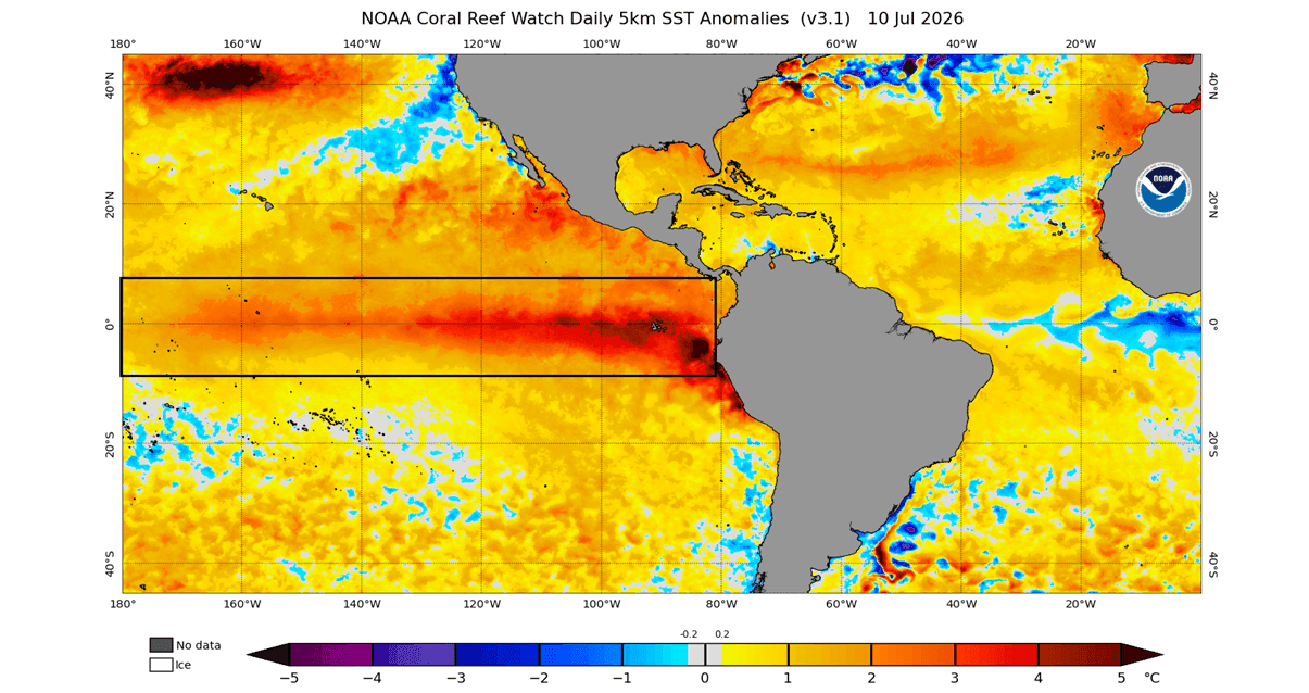
However, during a strong El Niño, these trade winds weaken. This causes a massive shift in pressure: a drop in the central and eastern tropical Pacific and a corresponding high-pressure zone over the western Pacific. This shift is not isolated; it acts as a "bridge," transmitting energy from the tropics to the mid-latitudes, ultimately altering the position of the jet streams and the tracks of global storm systems.
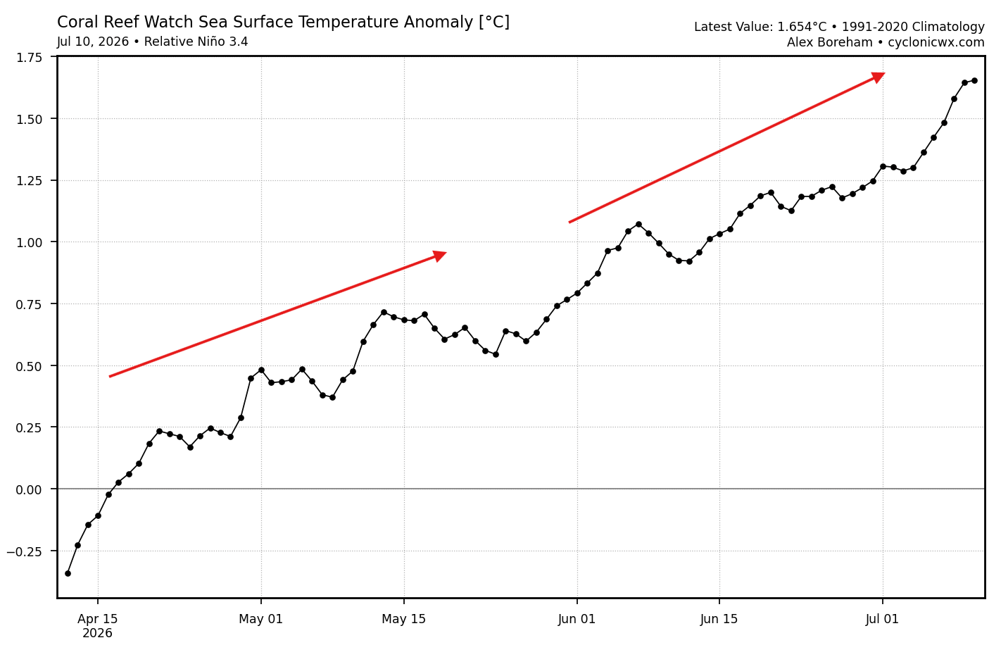
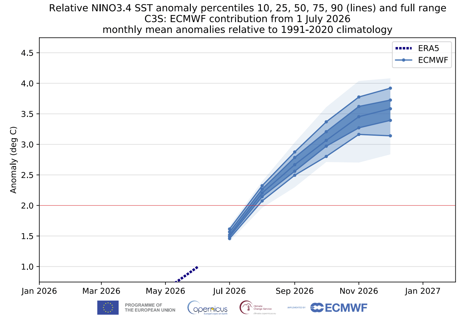
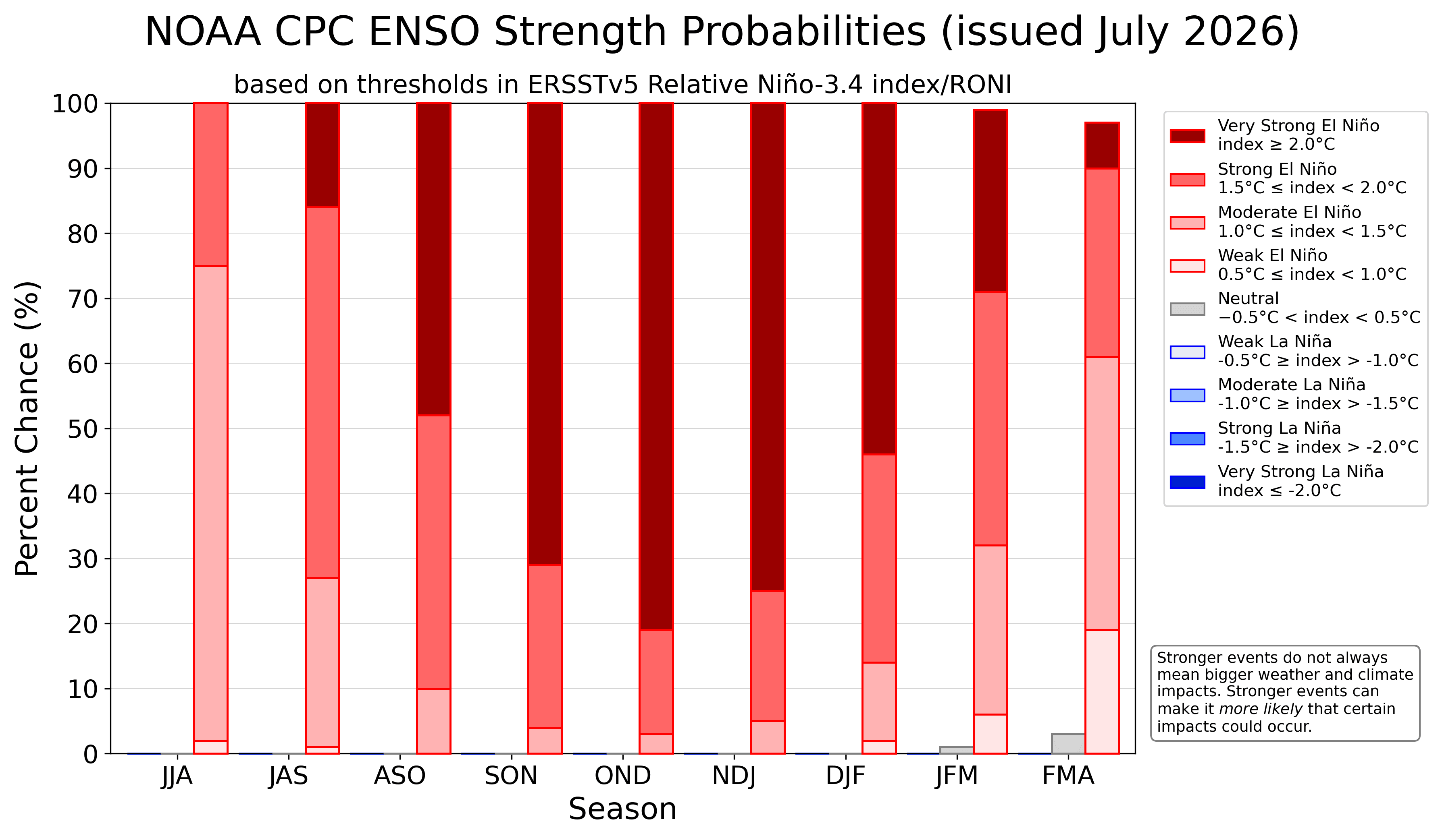
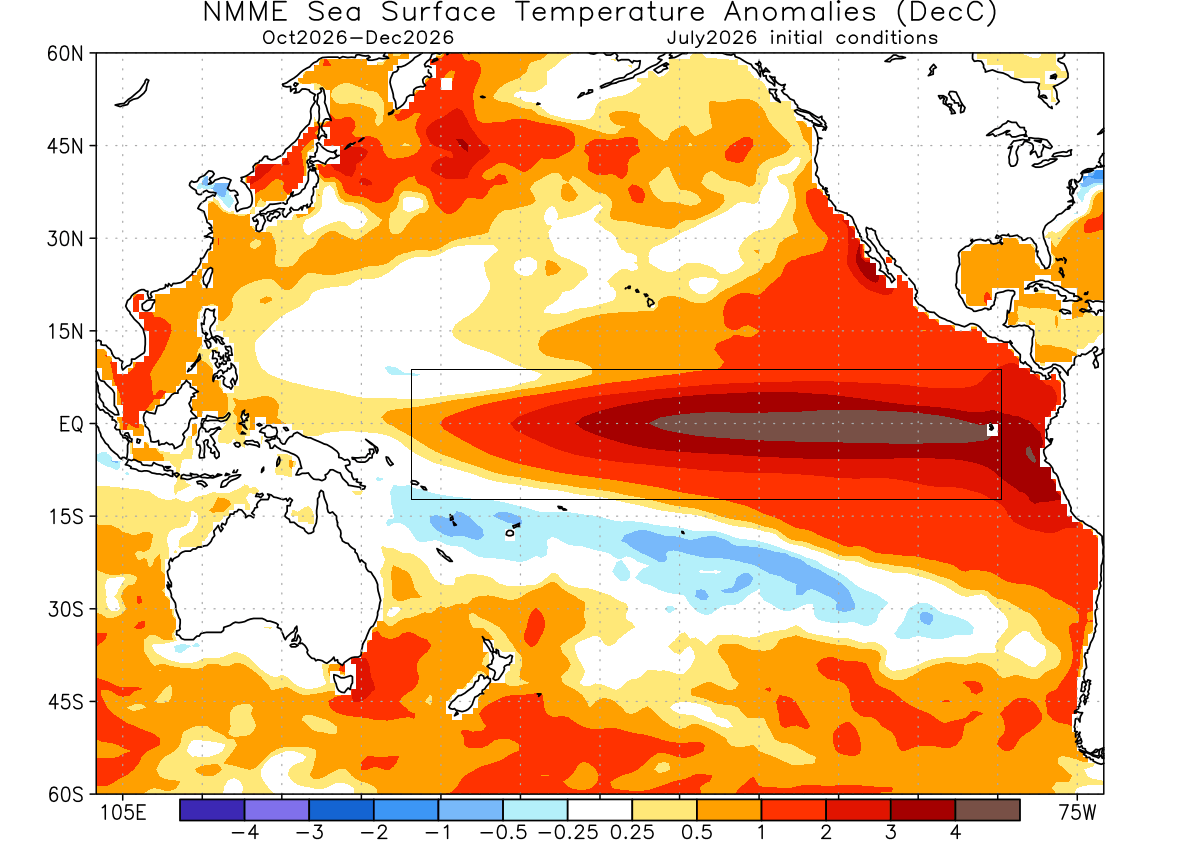
We are currently observing an event that is forecast to peak among the strongest recorded in decades. Data from the ENSO region indicates that surface temperature anomalies have already surged to 3–4 degrees Celsius above the seasonal norm. In the realm of climate science, a sustained seasonal anomaly exceeding +2 degrees Celsius is the benchmark for a "Super" event. Current models suggest we will easily surpass this threshold, moving the 2026/2027 season into a category of its own.
Chronology of the 2026 Forecast
The evolution of this event has been rapid. By mid-summer 2026, ocean heat content began to surge, showing a distinct departure from historical baselines.
- Late Summer 2026: Initial emergence of strong Pacific warming trends. Atmospheric response begins to mirror classical El Niño configurations.
- Autumn 2026 (Current Phase): Transitioning from oceanic warming to atmospheric dominance. Seasonal models (ECMWF and NMME) indicate that the "winter-like" pressure patterns—typically seen in December—are already manifesting in October.
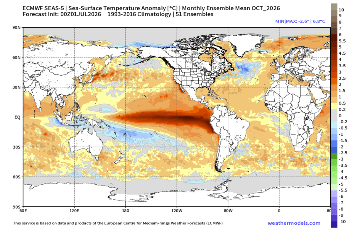
- Late Fall/Early Winter 2026: Predicted peak intensity. Projections indicate ocean temperature anomalies could reach +6 degrees in specific pockets, reinforcing the "Super" classification.
- January 2027: The anticipated climax of the pattern, where high-latitude blocking (the Canadian ridge) meets an active subtropical jet stream, creating the highest potential for extreme weather events.
Supporting Data: What the Models Reveal
The scientific consensus, drawn from the ECMWF (European Centre for Medium-Range Weather Forecasts) and the NMME (North American Multi-Model Ensemble), provides a sobering outlook.
Pressure and Circulation
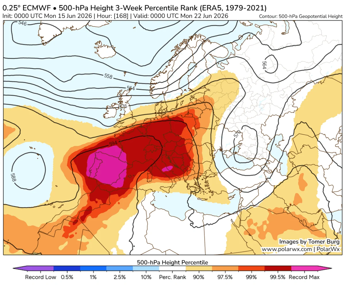
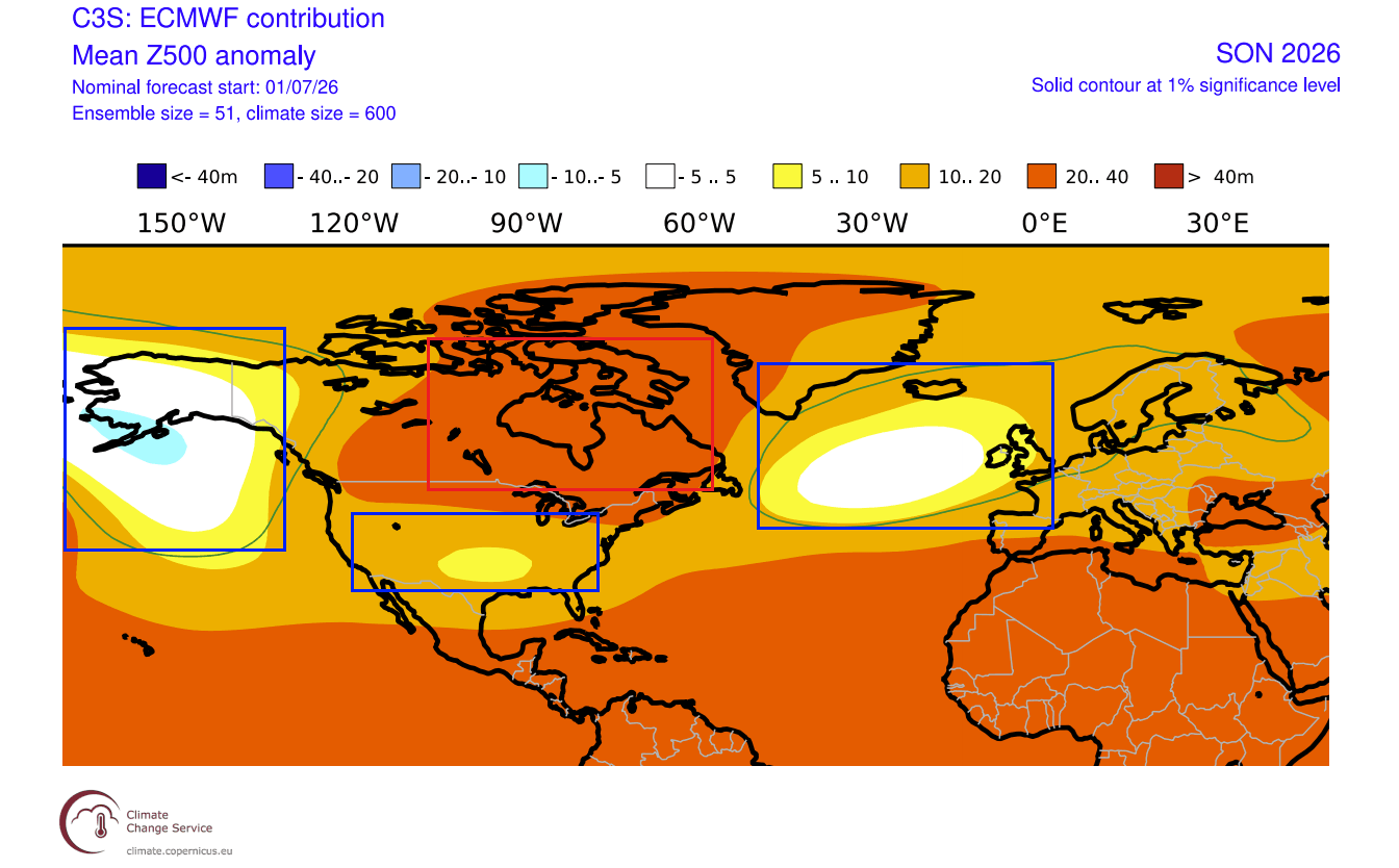
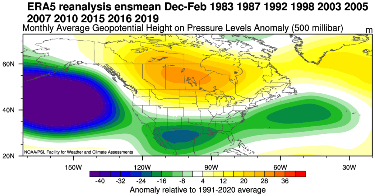
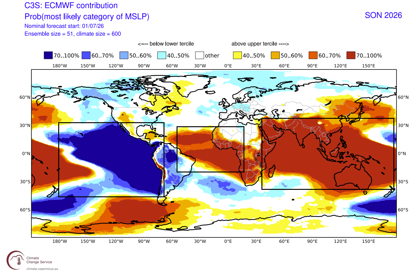
The forecast maps reveal an unusually rigid pressure structure. A robust high-pressure anomaly is centered over Canada, while a chain of low-pressure storm systems is projected to track across the southern United States. Further east, a persistent low-pressure area over the North Atlantic is expected to funnel mild, moisture-rich air into the United Kingdom, Ireland, and mainland Europe.
This configuration is essentially an "amplified" version of a standard winter response. The presence of these anomalies as early as autumn is unprecedented, suggesting that the atmospheric response to this Super El Niño is "locked in."
Temperature and Precipitation Anomalies
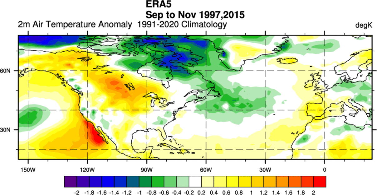
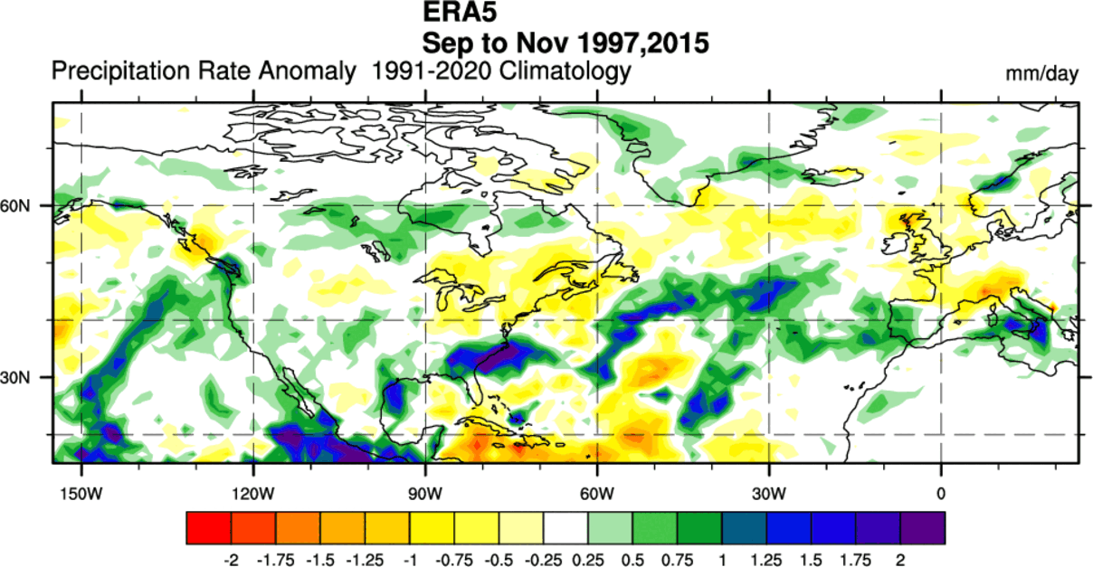
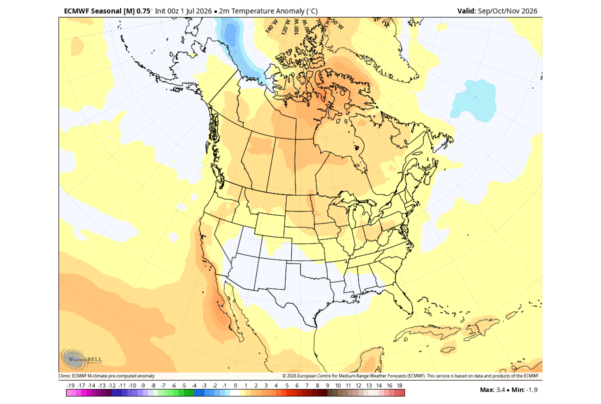
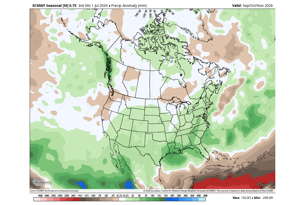
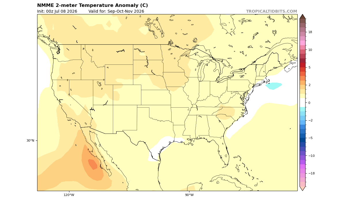
North America will experience a distinct north-south divide. The northern United States and Canada are expected to see persistent above-normal temperatures, trapped under the influence of the Canadian high-pressure ridge. Conversely, the southern U.S. will likely bear the brunt of an active subtropical jet stream, leading to increased precipitation and storm frequency.
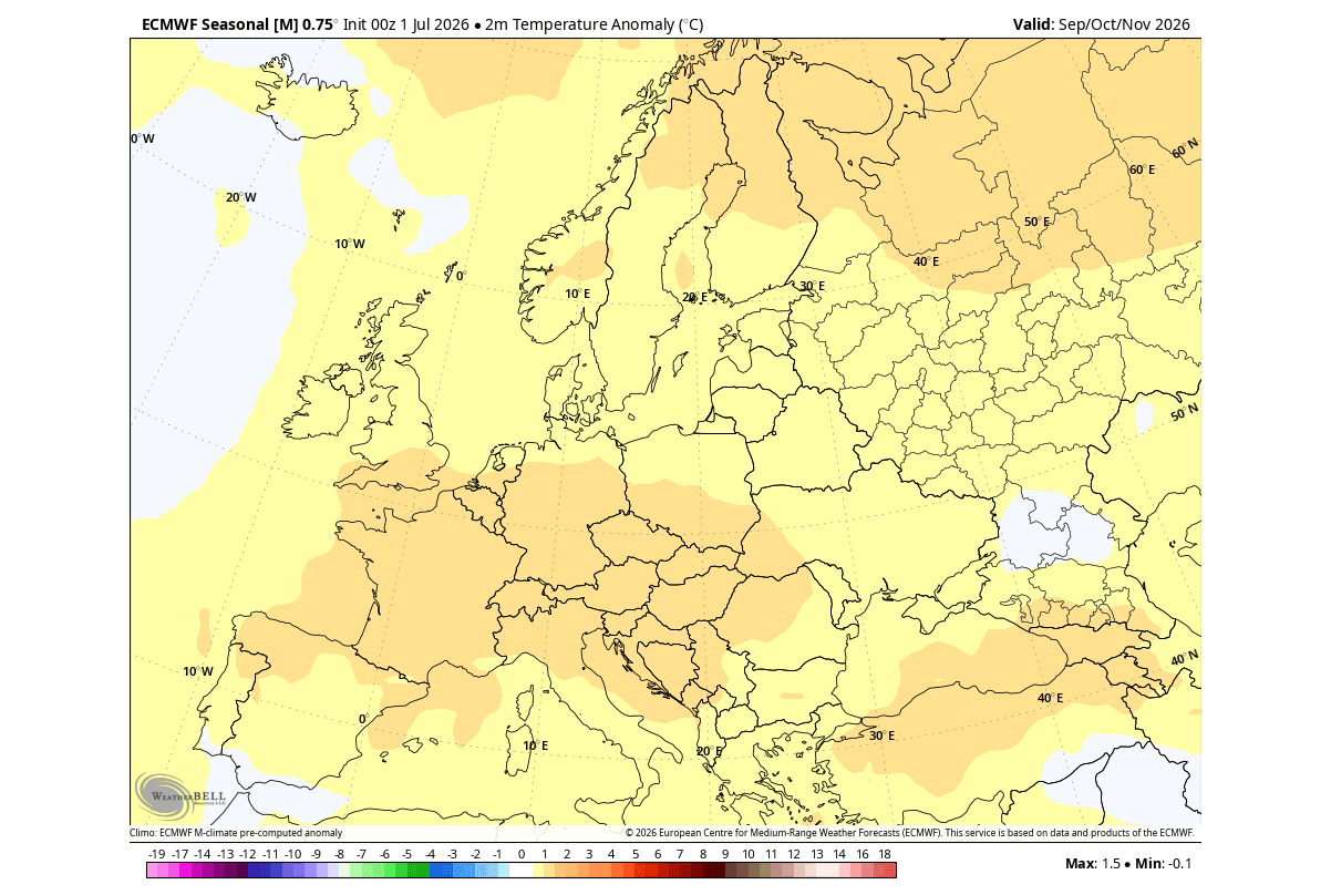
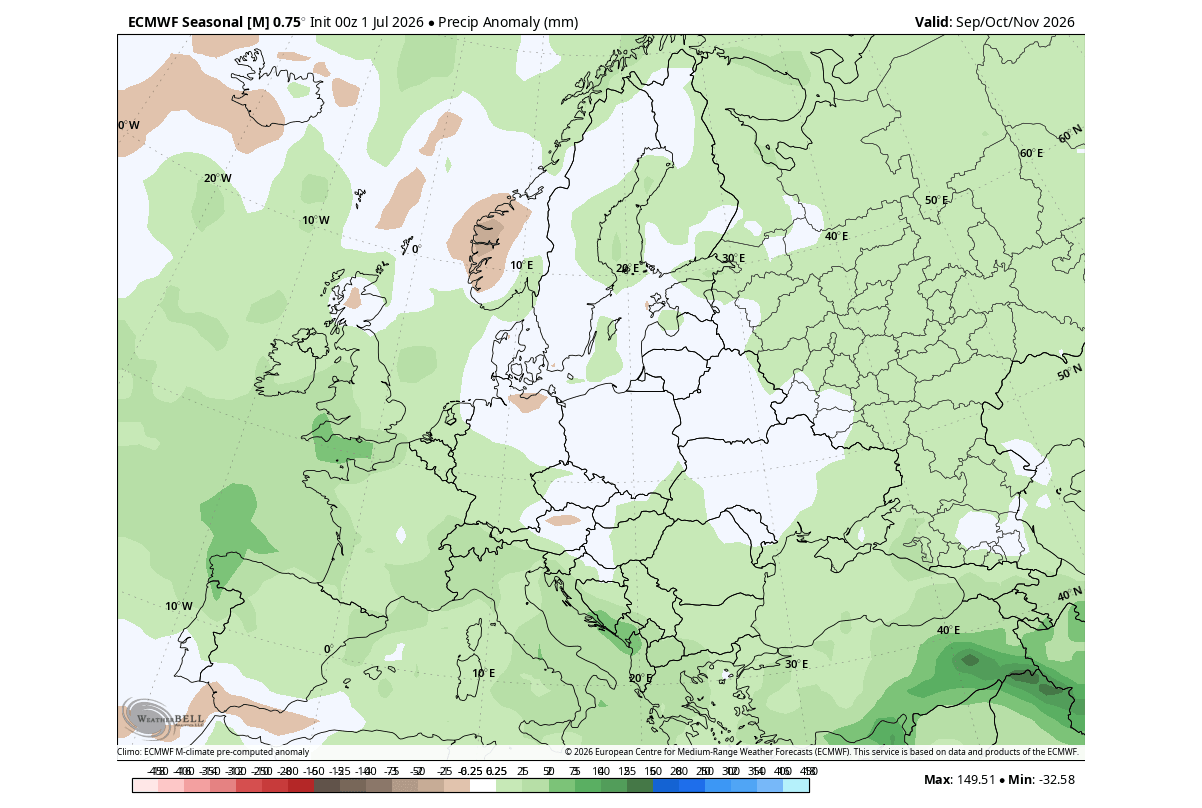
In Europe, the forecast indicates warmer-than-normal surface temperatures across the central, western, and southeastern regions. The persistent westerly flow from the Atlantic acts as a thermal buffer, limiting the severity of early-season cold snaps but increasing the risk of significant rainfall events across the continent.
Official Outlooks and Institutional Analysis
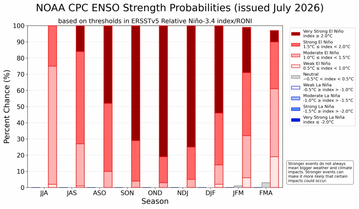
The National Oceanic and Atmospheric Administration’s Climate Prediction Center (NOAA CPC) has updated its strength probability charts to reflect the high likelihood of an extreme El Niño event. Official data underscores a near-unanimous agreement among meteorological agencies that this event will rank among the most powerful on record.
These institutions warn that the "historical" nature of this event means we are entering uncharted territory. While we have data from past Super El Niños (notably the 1997/98 and 2015/16 events), the current global climate state—marked by higher baseline ocean temperatures—may result in atmospheric responses that deviate from historical precedents.
Implications for Winter 2026/2027
The implications for the coming winter are twofold: increased storm activity and a potential disruption of the Polar Vortex.
The Polar Vortex Factor
The Polar Vortex, the massive cyclonic system spinning in the stratosphere, is the final piece of the puzzle. Historical data suggests that Super El Niño events increase the probability of Sudden Stratospheric Warming (SSW) events during mid-winter.
An SSW event essentially "breaks" the vortex, causing its circulation to collapse. When this happens, the frigid air typically contained at the pole spills southward into North America and Eurasia. Given the current trajectory of the Super El Niño, meteorologists are closely monitoring the stratosphere for signs of such a disruption. If the vortex weakens, the result would be a stark contrast: while the season might be mild on average due to the El Niño flow, it could be punctuated by brutal, short-lived cold outbreaks as polar air escapes its confinement.
Global Societal Impact
For the United States, the primary concerns are the increased risk of severe, moisture-laden winter storms in the southern and eastern states, which could lead to significant flooding and infrastructure stress. For Europe, the primary risk involves persistent storm tracks leading to wind-related damage and sustained wet conditions, which can impact agriculture and local water management systems.
Conclusion: Preparing for an Amplified Season
The 2026/2027 season is poised to be defined by the strength of the Pacific. The "Super" designation is not merely a label; it describes an atmospheric engine that is running at a higher capacity than we have seen in years. As the pressure patterns solidify and the subtropical jet stream intensifies, the global community must prepare for a winter that will likely be characterized by heightened volatility.
While these long-range forecasts provide a window into the potential reality, the complexity of the Earth’s climate system—particularly the unpredictable nature of the Polar Vortex—means that vigilance is required. As we move deeper into the autumn, the interaction between the tropical forcing of the Pacific and the high-latitude dynamics of the Arctic will dictate the final outcome. Stay tuned to official weather briefings and regional forecasts as the winter season approaches.