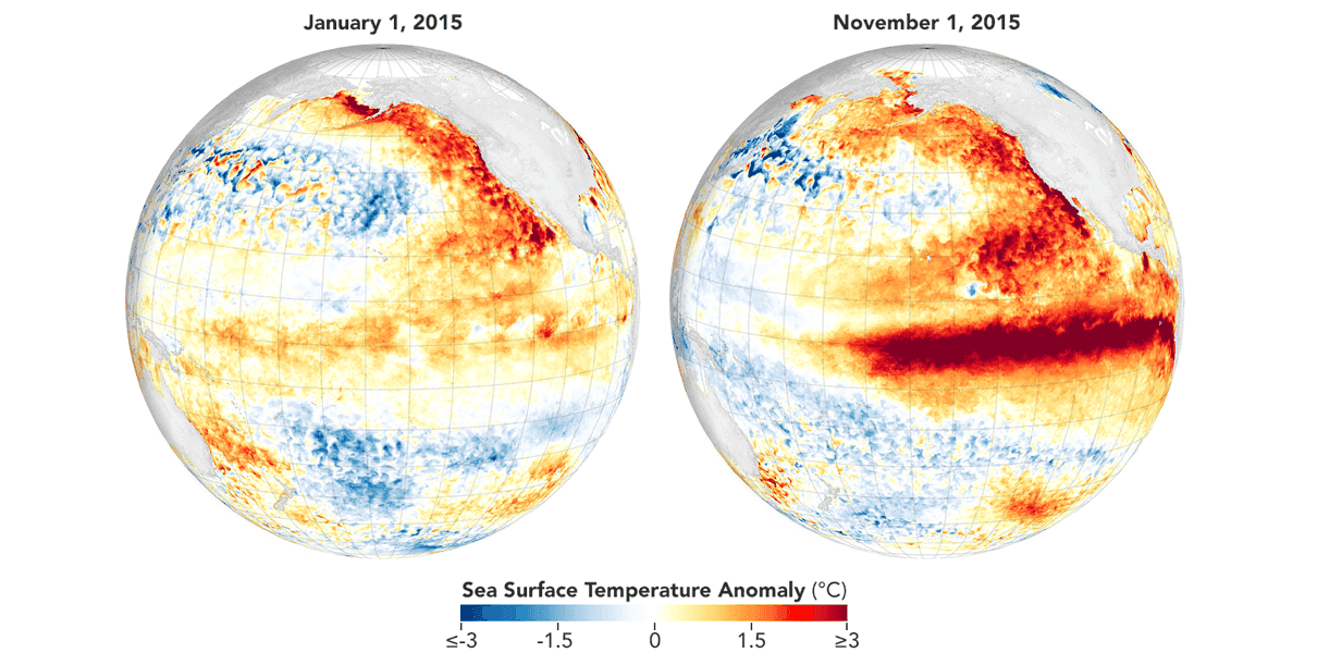
The global climate system is currently witnessing the rapid intensification of a meteorological phenomenon that promises to reshape weather patterns across the Northern Hemisphere for the next year. Latest oceanographic and atmospheric data confirm that the 2026 El Niño is not merely a standard oscillation, but a burgeoning "Super El Niño" event. With sea surface temperature (SST) anomalies in the central and eastern Pacific already exceeding historical thresholds, climate scientists are preparing for what could potentially be the strongest event on record, surpassing even the historic 2015/2016 cycle.

Main Facts: A Global Climate Catalyst
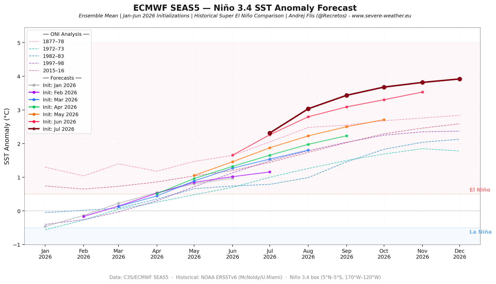
El Niño is the warm phase of the El Niño-Southern Oscillation (ENSO), a recurring climate pattern involving changes in the temperature of waters in the central and eastern tropical Pacific. When these waters warm significantly—typically by more than 2.0°C above the long-term average—it triggers a "Super El Niño."
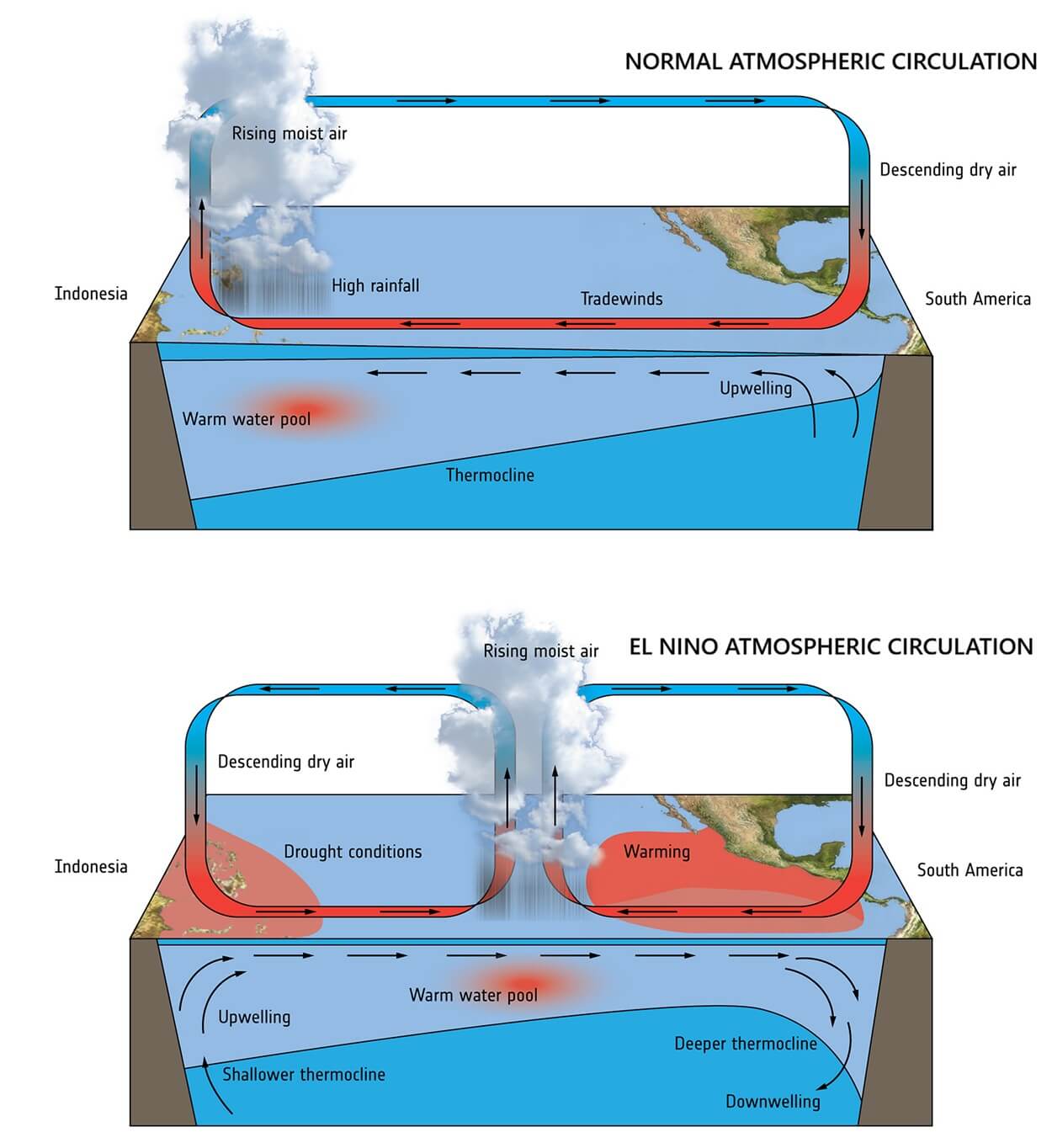
The current 2026 event is distinguished by its rapid onset and an exceptionally strong subsurface energy signature. This phenomenon acts as a massive "pressure release valve," shifting energy from the depths of the Pacific Ocean into the atmosphere. The resulting tropical forcing—the transfer of heat and moisture from the ocean to the atmosphere—is already altering global circulation, shifting jet streams, and dictating the development of seasonal pressure systems for Winter 2026/2027.
Chronology: From Subsurface Anomaly to Global Force
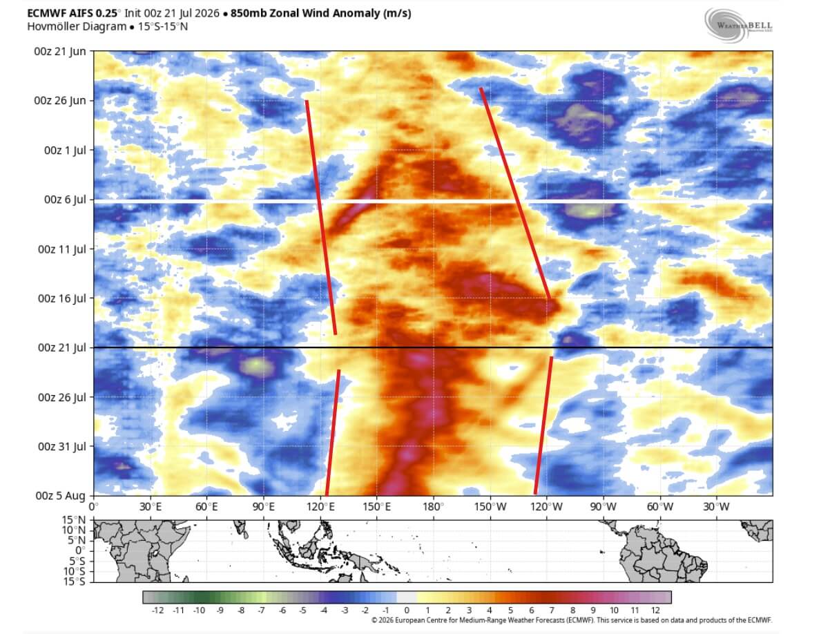
The trajectory of the 2026 event began with a massive accumulation of subsurface heat in the western Pacific, which was subsequently pushed eastward by powerful westerly wind bursts.
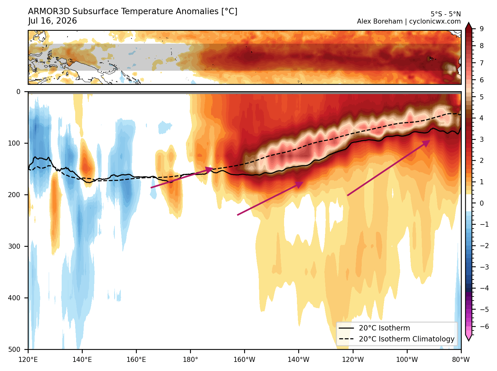
- Initial Phase: Earlier this year, ocean models identified a gathering of warm subsurface anomalies, a precursor to the Kelvin Wave—a deep-ocean surge of warm water moving toward the eastern Pacific.
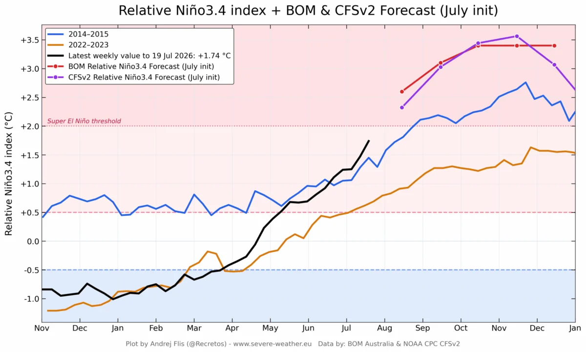
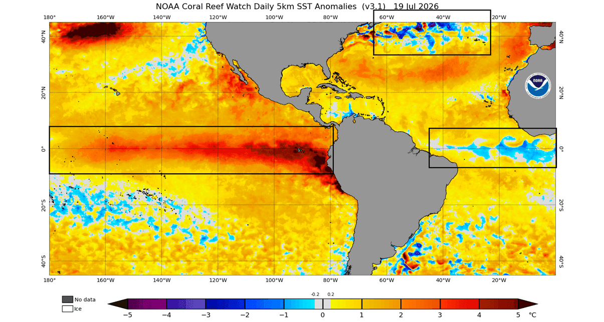
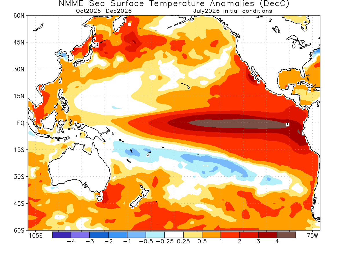
- Rapid Escalation: By mid-summer, this Kelvin Wave surfaced, causing sea surface temperatures in the eastern tropical Pacific to jump to 3–4°C above normal.
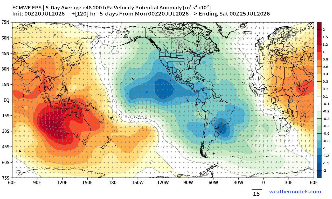
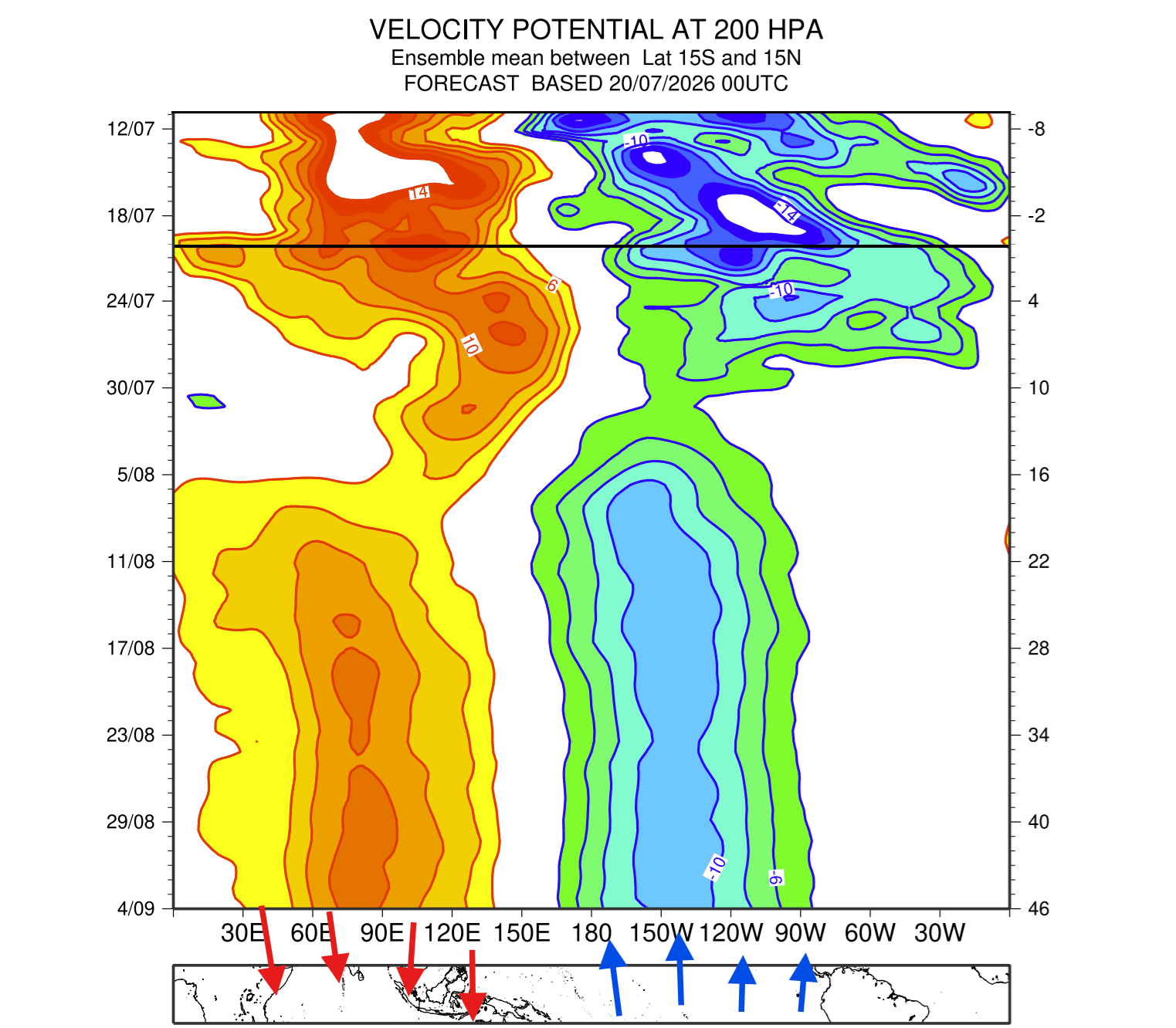
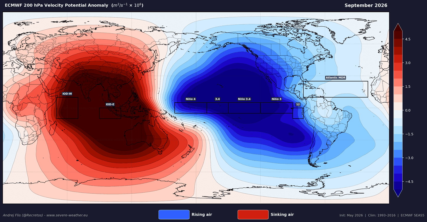
- Current Status: As of late summer 2026, the atmosphere has officially "locked" into an El Niño mode. The Walker Cell—the primary tropical atmospheric circulation system—has shifted, with persistent rising motion and low pressure established over the central and eastern Pacific, while sinking motion dominates the western Pacific and parts of the Indian Ocean.
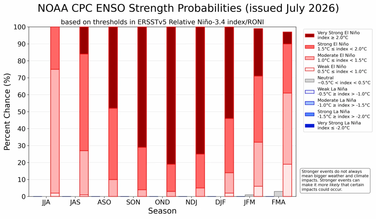
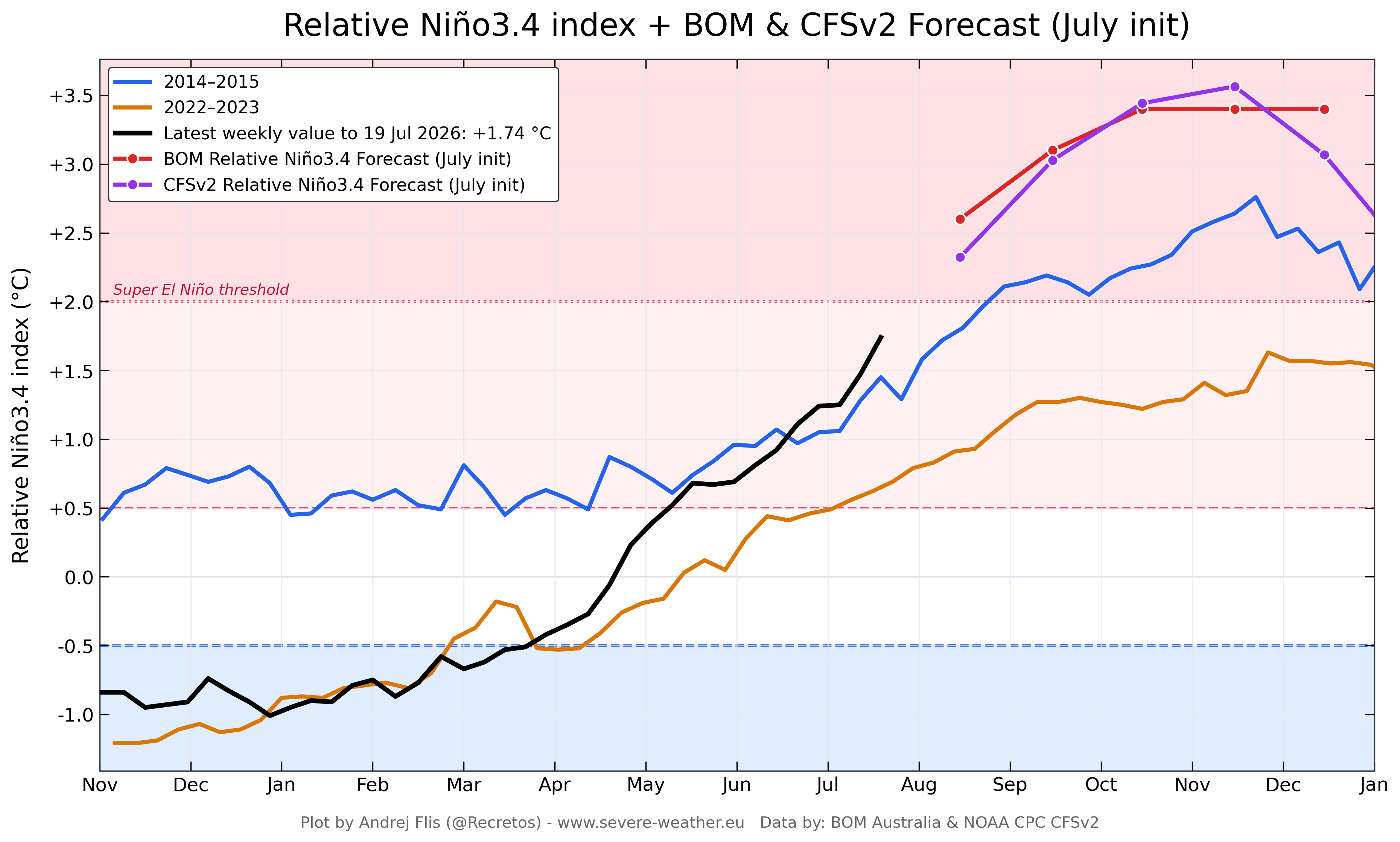
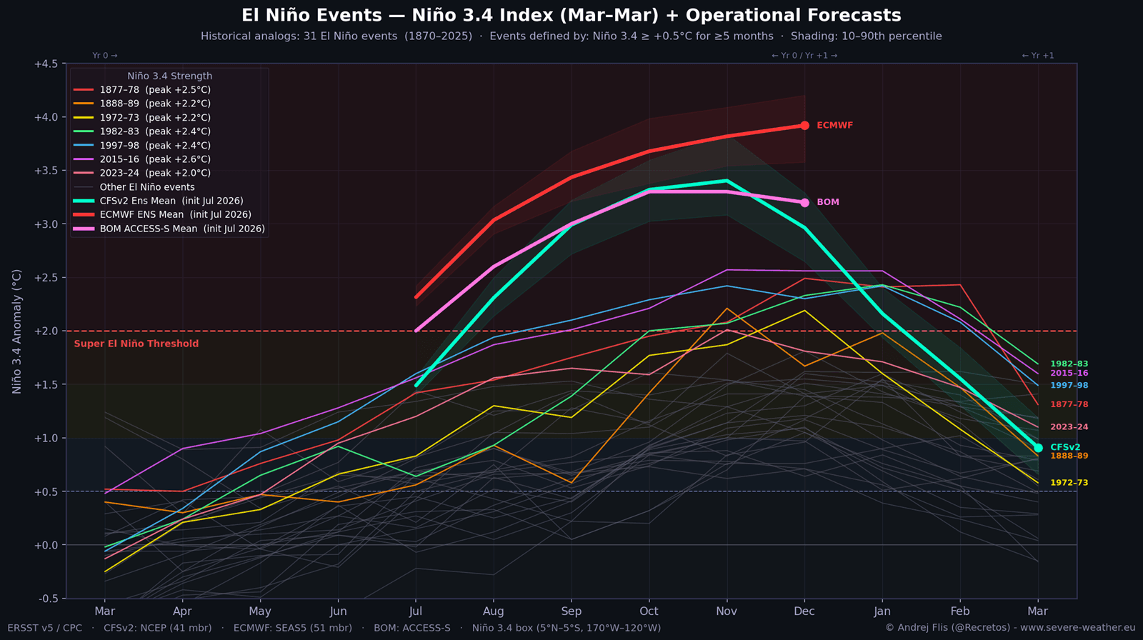
- Projection: Models from major centers, including the ECMWF (Europe), NOAA (USA), and the Australian Bureau of Meteorology (BOM), project the event will reach its peak intensity during the November–December 2026 period, potentially maintaining record-breaking anomalies well into the spring of 2027.
Supporting Data: The Engine of a Super Event
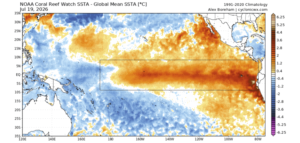
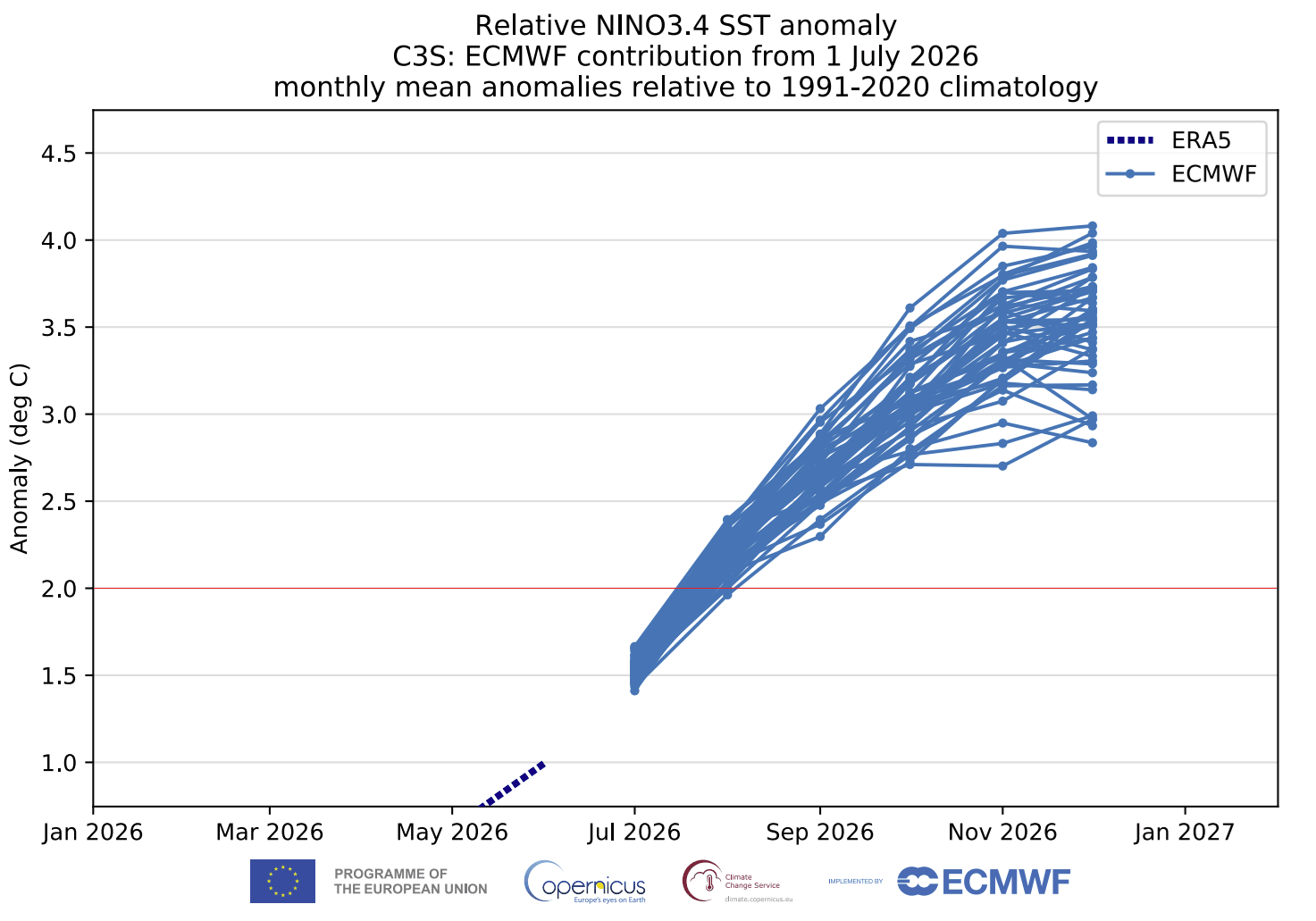
The intensity of a Super El Niño is measured by the magnitude of the Pacific temperature anomaly. Current ensemble forecasts from the NMME (North American Multi-Model Ensemble) and ECMWF suggest that the 2026 event will easily eclipse the +2.0°C threshold, with some projections peaking near +3.0°C.
The Kelvin Wave "Engine"
The true engine of this event is hidden beneath the ocean surface. Subsurface temperature analysis shows a core of warmth peaking at over 7°C above normal in the top 500 meters of the Pacific. This energy is being fueled by recurring, intense westerly wind bursts that prevent the natural cooling of the eastern Pacific, effectively sustaining the warm anomaly.
Atmospheric Standing Waves
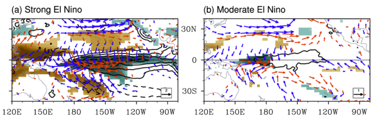
The atmosphere is not merely reacting to the ocean; it is being "captured" by it. Because the ocean warming is so vast, it creates a stationary atmospheric wave—a "standing wave" of rising air. This forces the jet stream into a rigid, non-standard configuration, which explains why meteorological models are already able to predict winter pressure patterns with high confidence months in advance.
Implications for North America and Europe
The 2026/2027 winter is poised to be heavily influenced by this Pacific driver.
North American Outlook
In the United States and Canada, the primary impact will be an amplified Pacific jet stream.
- Western & Northern Regions: A persistent high-pressure blocking anomaly over Canada is expected to deflect the polar jet stream northward, leading to significantly milder temperatures across western Canada and the northern tier of the United States.
- Southern & Eastern Regions: The energized southern jet stream will act as a conveyor belt for moisture. Frequent, low-pressure systems are expected to track across the Southern Plains, the Gulf Coast, and the Eastern United States. This will likely result in increased precipitation, potentially leading to heavy rainfall or, where cold air intrusions coincide, significant winter storm activity.
European Outlook
Europe’s response to El Niño is notoriously more complex and less direct than that of North America. Current models suggest a possible high-pressure ridge forming in the south, which could lead to milder conditions in parts of the continent. However, the exact configuration of the North Atlantic jet stream remains sensitive to the potential disruption of the Polar Vortex, leaving the European forecast with a higher degree of uncertainty.
Polar Vortex Disruption: A Critical Wildcard
One of the most consequential risks associated with a Super El Niño is its influence on the stratospheric Polar Vortex. The Polar Vortex is the high-altitude, spinning wall of air that traps cold arctic air over the pole.
Historical data shows that strong El Niño events correlate with a higher frequency of Sudden Stratospheric Warming (SSW) events. These events can trigger a "collapse" or major disruption of the Polar Vortex. If the vortex weakens or reverses:
- The "containment" of arctic air fails.
- Cold polar air is released southward, flowing into the mid-latitudes of the United States, Canada, and Europe.
- The result is often the "Polar Express" pattern—periods of extreme, bone-chilling cold that can occur regardless of the overall seasonal warming trend.
Current seasonal forecasts show a distinct weakening trend in the Polar Vortex for January and February 2027, suggesting that even in a generally "mild" winter, the risk of sudden, severe cold outbreaks remains high.
Official Responses and Scientific Consensus
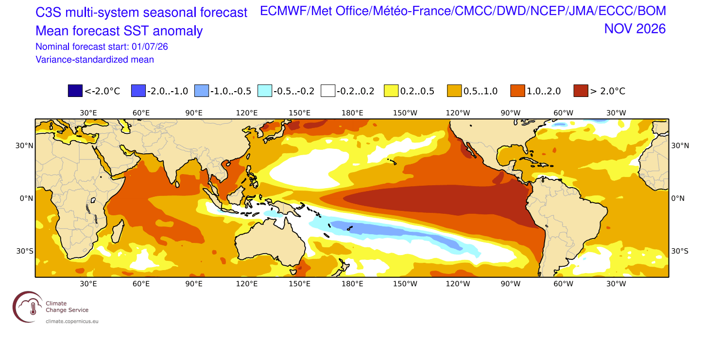
The consensus among global climate agencies is clear: the 2026 event is historic. The agreement between the NOAA CFSv2, the ECMWF, and the Australian BOM—three separate modeling authorities—provides a high level of confidence that we are entering uncharted territory.
These agencies are emphasizing that while "textbook" El Niño patterns provide a roadmap, the unprecedented strength of this event means that previous anomalies may be underestimates. The focus has now shifted from whether a Super El Niño will occur to how communities should prepare for the resulting extreme weather shifts, including potential flooding in the Southern U.S., drought conditions in other global regions, and the increased volatility of winter storms.
Conclusion: Entering Uncharted Territory
The 2026/2027 Super El Niño is more than just a weather pattern; it is a profound shift in the Earth’s energy balance. As the Pacific continues to feed energy into the atmosphere, the global weather system will experience increased amplification, higher energy availability for storms, and a higher probability of rapid, disruptive climate shifts.
For the general public, the implications are significant: winters are rarely "average" during a Super El Niño. Instead, they are defined by extremes—extreme temperature contrasts, intense storm tracks, and the constant, underlying threat of a Polar Vortex collapse. As we move toward the winter months, monitoring the development of these pressure systems will be essential for both disaster preparedness and understanding the new, high-energy climate state that 2026 has brought to the fore.
The coming months will serve as a definitive test for current climate modeling capabilities, and the data gathered during this winter will likely be used to calibrate climate science for decades to come. Residents in affected regions are encouraged to remain vigilant as the seasonal transition into winter begins, keeping a close watch on regional forecasts that will be increasingly shaped by the massive, shifting engine of the Pacific.