By Investigative Desk, Severe Weather News
After ten days of relentless combat against one of the most challenging wildfires in recent Italian history, emergency crews have finally secured the slopes of Monte Amariana. The fire, which scorched over 600 hectares of rugged limestone terrain in the Friuli-Venezia Giulia region, served as a harrowing reminder of the volatility of the Alpine landscape under the pressure of extreme, record-breaking summer heat.

The blaze, which at its peak threatened the residential tranquility of Tolmezzo and the hamlet of Pissebus, was officially brought under control following a strategic convergence of international aerial firefighting assets and a fortunate shift in atmospheric conditions.
The Genesis of a Crisis: From Lightning to Inferno
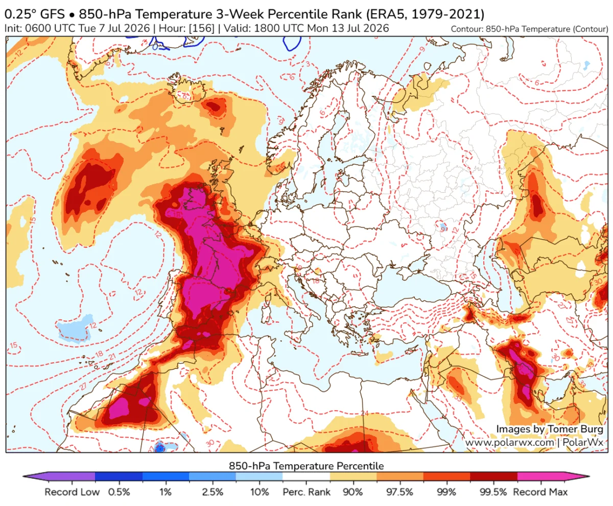
The catastrophe began in the early days of August 2026. As an intense, persistent heat dome locked over Western and Central Europe, temperatures in the Italian Alps soared, drying out the dense Pinus nigra forests that cloak the Carnia region.
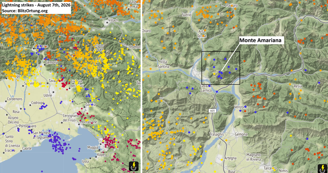
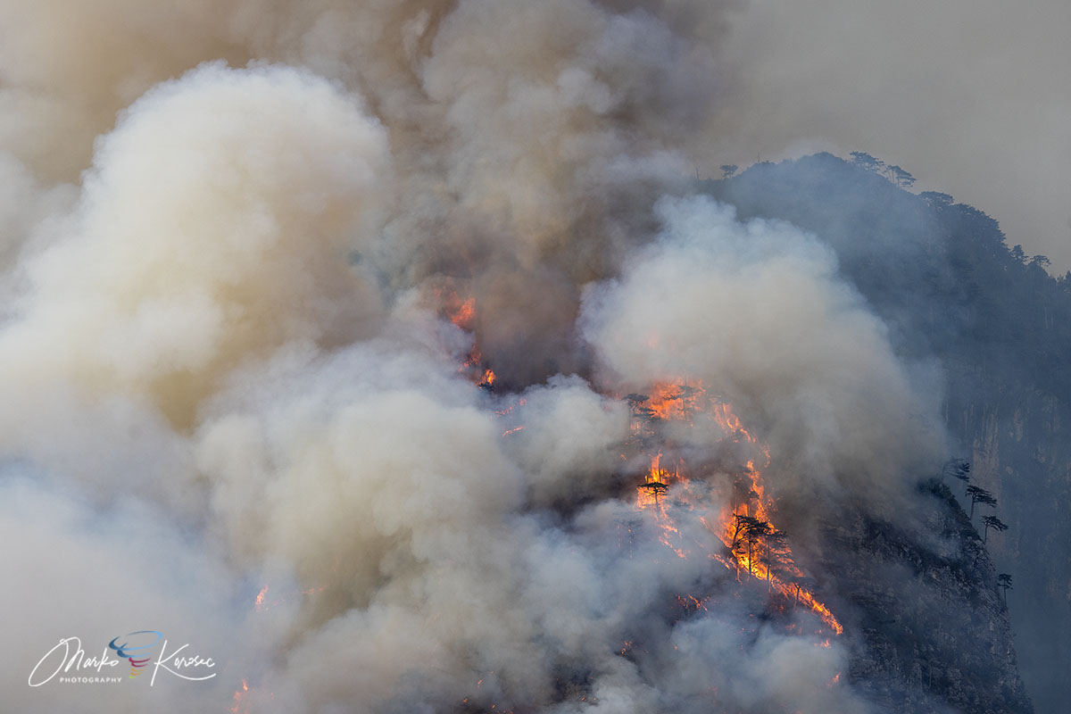
On August 7th, the simmering tension of the heatwave broke as a frontal wave swept across the mountains. While the storm brought necessary cooling for some, it delivered a lethal spark to the high-altitude forests of Cuel Feltron. Lightning strikes ignited the tinder-dry vegetation, setting off a slow-burning fire in an area where the terrain is almost entirely vertical.
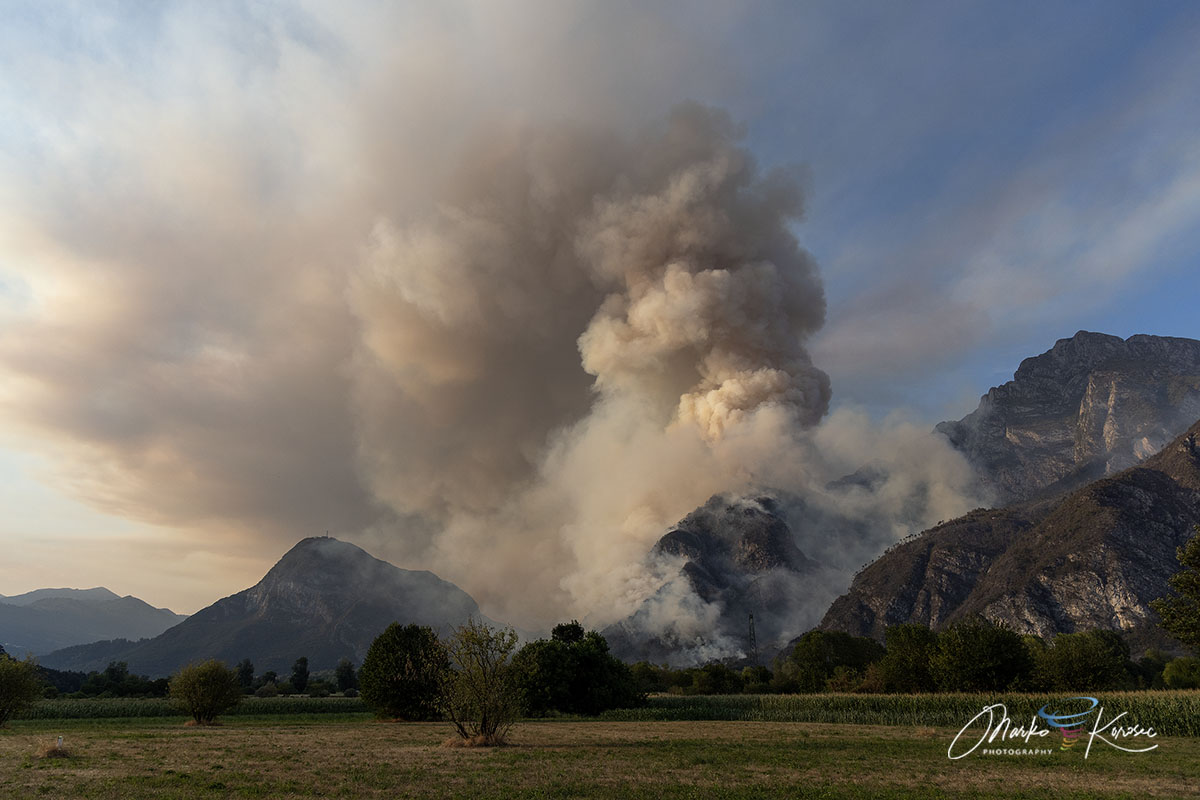
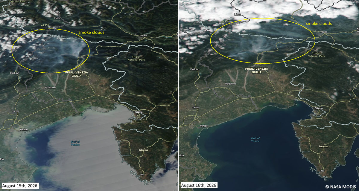
For the first week, the fire remained localized, albeit inaccessible. However, the situation deteriorated rapidly on Ferragosto (August 15th). As gusty, dry downslope winds battered the mountainside, the fire roared to life, jumping the Rio Confine ridge and racing toward the populated slopes of Monte Amarianute. At its most explosive stage, the heat intensity was so profound that it generated its own micro-climate, forming pyrocumulus clouds that loomed over the valley like a dark, volcanic omen.
Geographical Profile: The Impossible Battlefield
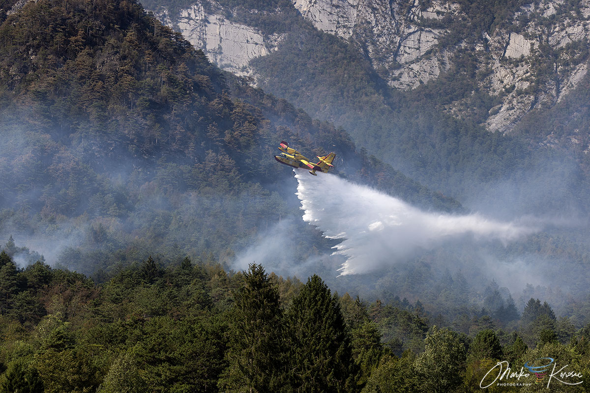
Monte Amariana (1,905 m) is a striking, pyramid-shaped peak that defines the skyline of the Eastern Tolmezzo Alps. Its geography, however, is a firefighter’s nightmare. The mountain is composed of sheer limestone cliffs, steep karst formations, and narrow ridges that make traditional ground-based firefighting virtually impossible.
The vegetation—primarily Pinus nigra and thick, brittle brushwood—acts as a high-density fuel bed. Once ignited, the steep gradients created a "chimney effect," where rising heat and oxygen accelerated the flames upward with terrifying speed. Because ground crews could not safely navigate the vertical crags, the mission became an almost exclusively aerial endeavor, testing the limits of European cross-border cooperation.
The Aerial Siege: A Multinational Task Force
As the flames moved within 50 meters of homes in Pissebus, the Italian government initiated a massive emergency mobilization. The mission to protect the districts of Tolmezzo and Amaro involved a sophisticated, multi-national aerial task force.
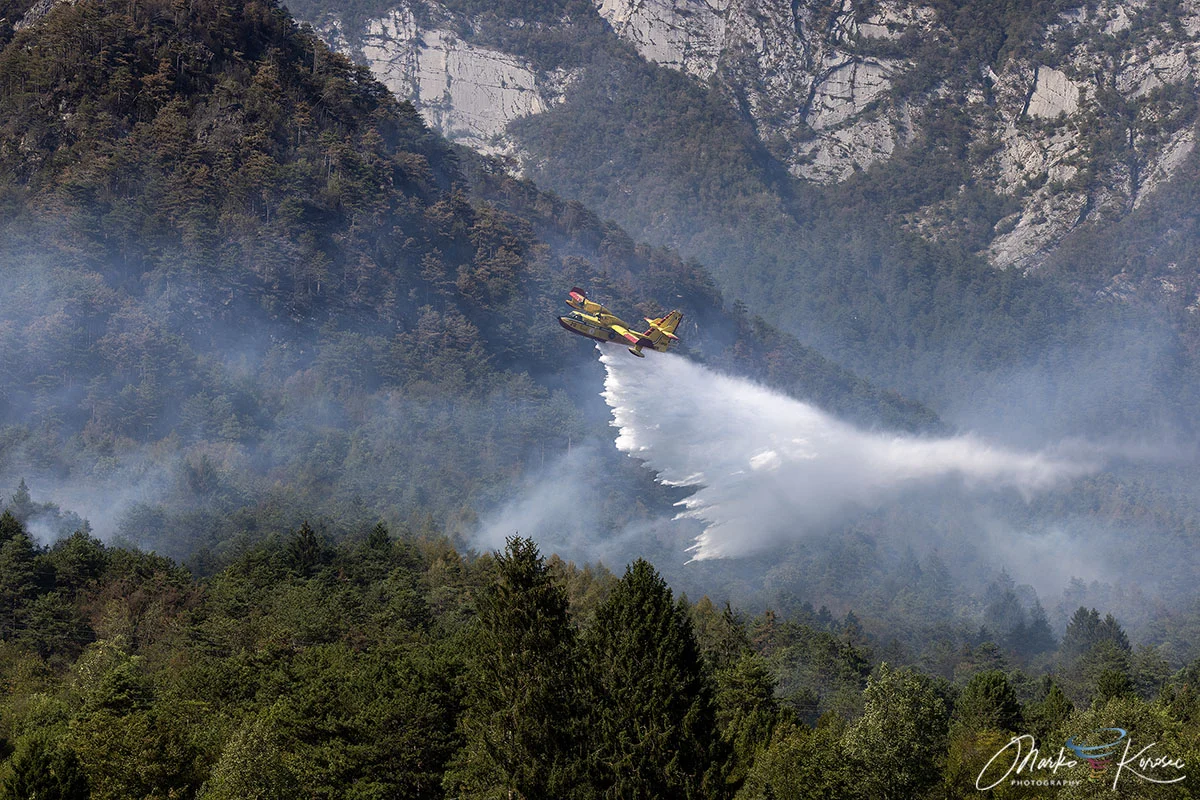
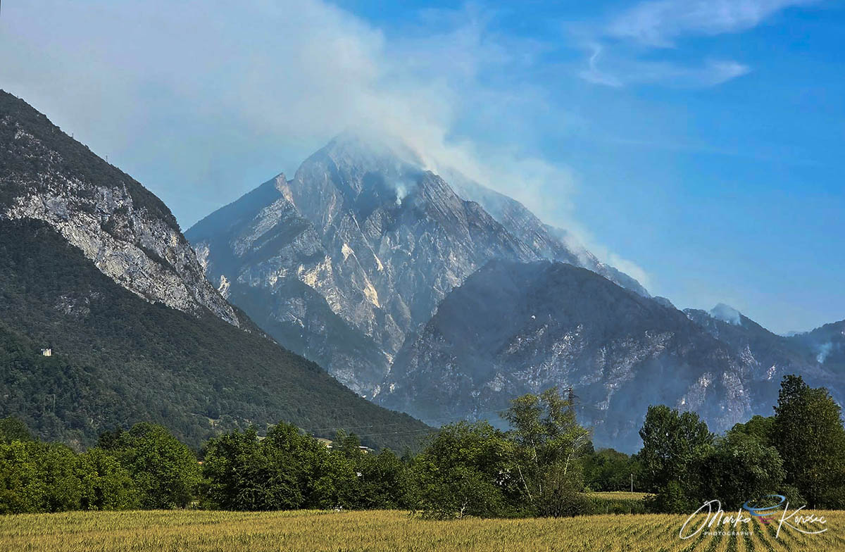
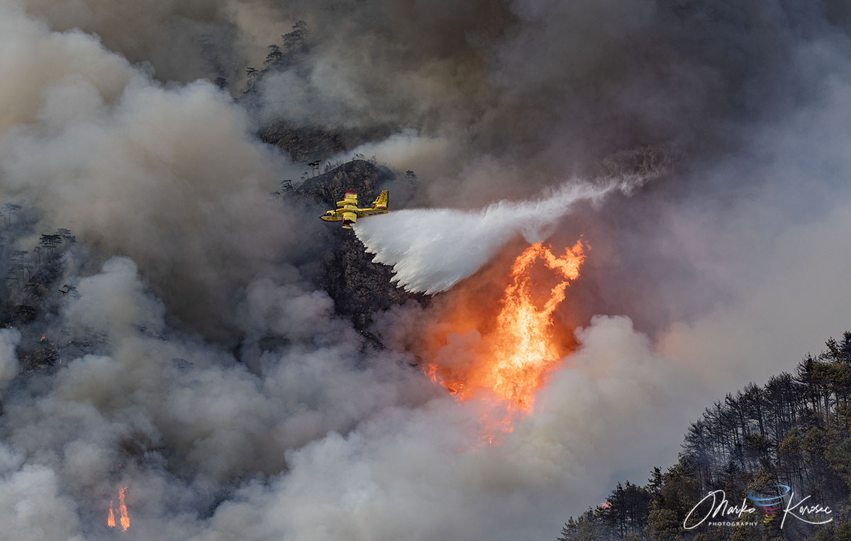
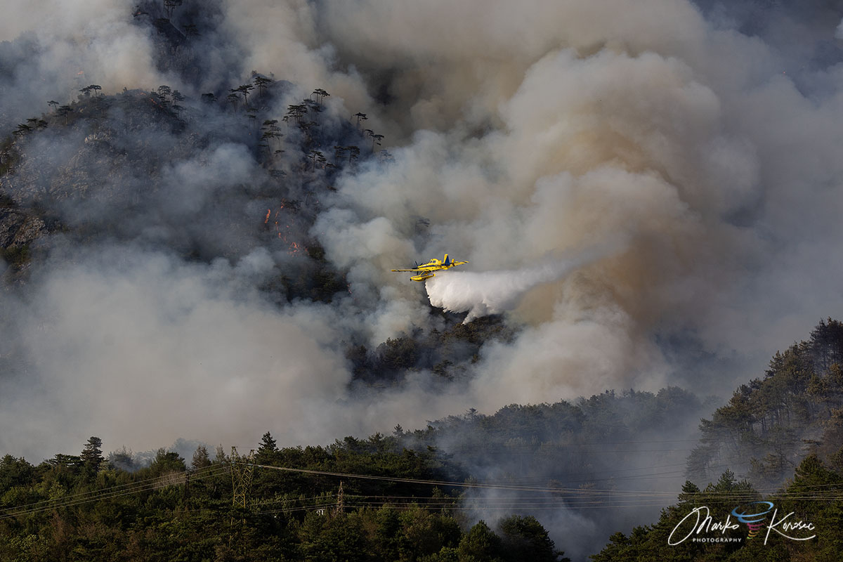
Italian Canadair CL-415 aircraft, the workhorses of European forest fire suppression, performed hundreds of precision drops, skimming the nearby water bodies to deliver thousands of liters of water to the inaccessible ridges. They were joined by Slovenian Air Tractor water bombers, which provided essential agility in the narrow canyons of the Carnia range.
Simultaneously, regional helicopters provided tactical support, shuttling equipment and personnel to safer vantage points. On the ground, the Corpo Forestale Regionale and the Vigili del Fuoco (National Fire Brigade) formed a defensive perimeter around residential sectors. Their role was critical; while the aircraft fought the fire, ground crews managed evacuations, cleared defensible space, and monitored the fire’s progress to prevent sudden flanking maneuvers toward the village centers. High-voltage power lines in the area were proactively deactivated, a necessary precaution that underscored the severity of the threat to regional infrastructure.
Chronology of the 10-Day Struggle
- August 7th: Initial ignition detected on Cuel Feltron following a series of lightning strikes.
- August 8th–14th: The fire smolders in remote, high-altitude sectors; ground monitoring established.
- August 15th (Ferragosto): Major flare-up occurs. Downslope winds push the fire over the Rio Confine, threatening the Pissebus hamlet and the municipality of Tolmezzo.
- August 16th–19th: Peak intensity. Formation of pyrocumulus clouds observed. International task force mobilized.
- August 20th–22nd: A significant frontal system arrives in the FVG region. Heavy rainfall (150–200 mm) delivers the final blow to the remaining flame fronts.
- August 23rd–Present: Transition to mop-up operations using thermal drone technology to locate and neutralize residual hotspots.
The Role of Climate and Drought
The Monte Amariana wildfire did not occur in a vacuum. It was the direct result of a summer defined by significant rainfall deficits across Friuli-Venezia Giulia. Data from regional meteorological stations indicated that the soil moisture levels in the Carnia region were among the lowest recorded in a decade.
This prolonged hydrological drought created a "fuel-primed" landscape. Even before the lightning strikes of August 7th, the forest floor was essentially a bed of kindling. The extreme heat dome, which brought temperatures exceeding 40°C across parts of Europe, acted as a catalyst, ensuring that once a fire started, it would be almost impossible to extinguish without a total change in the synoptic weather pattern.
The final suppression of the fire was not a triumph of human technology alone, but a relief granted by nature. Between August 20th and 22nd, an intense weather system delivered more than 150 mm of rain to the region. This deluge successfully extinguished the last of the smoldering embers, effectively ending the emergency phase of the operation.
Post-Event Analysis: Environmental and Social Implications
The aftermath of the fire is a sobering sight. Over 600 hectares of the famous mountain complex have been reduced to ash, altering the local landscape for years to come. The loss of forest cover on such steep, fragile limestone slopes raises significant concerns regarding soil stability. With the autumn rains approaching, the region must now brace for an increased risk of landslides and debris flows, as the root systems that once held the mountainside together have been compromised.
Furthermore, the economic impact on the local community is substantial. The mountain is a landmark for the Carnia region, and the closure of trekking routes and the disruption to local tourism during the height of the summer season have hit local businesses hard.
However, the event has also sparked a dialogue about future preparedness. Experts from the Corpo Forestale have highlighted the need for better aerial surveillance, particularly in the wake of more frequent heatwaves. The successful deployment of thermal drones in the final stages of the fire has proven to be an effective tool, and there are calls to integrate this technology more permanently into regional wildfire response strategies.
Conclusion: A Resilient Community
As the smoke clears over the Tagliamento valley, the residents of Tolmezzo and Amaro are beginning the slow process of recovery. The memory of the 10-day inferno will linger, but so too will the memory of the coordination between the Italian and Slovenian teams, and the bravery of the firefighters who stood between the homes and the advancing flames.
The Monte Amariana wildfire serves as a stark case study in the modern era of climate change—a warning that even the most rugged, high-altitude landscapes are no longer immune to the dangers of extreme weather. As the region moves into the final weeks of summer, the focus remains on monitoring the burn scars, ensuring that the mountain is safe for the long term, and reflecting on the lessons learned from this Alpine trial by fire.
Data and meteorological imagery for this report were provided by PivotalWeather and WXcharts. Further analysis of the August 2026 heat dome is available in our related coverage of European climate trends.