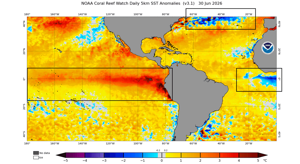
As we move into the latter half of 2026, the global climate system is flashing signals of a major transition. Meteorologists and oceanographers are closely monitoring two massive, competing phenomena that are poised to dictate the character of the upcoming winter: a rapidly developing "Super El Niño" in the tropical Pacific and the resurgence of a persistent, cooling "cold blob" in the far North Atlantic.

This rare convergence of oceanic anomalies is not merely a statistical curiosity; it represents a significant forcing mechanism that influences the jet stream, regional pressure systems, and, ultimately, the winter weather patterns across the United States, Canada, and Europe. As we approach the winter of 2026/2027, the evidence suggests we are heading toward a season of sharp contrasts and high-impact atmospheric shifts.
Main Facts: The Dual Drivers of Winter 2026/2027
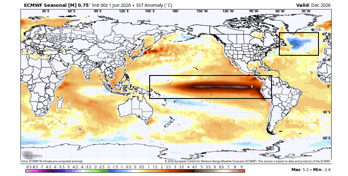
The global climate is currently being pulled in two directions by oceanic temperatures. On one side, the tropical Pacific is experiencing a powerful Super El Niño event. El Niño, characterized by the warming of surface waters in the central and eastern Pacific, is a primary driver of global weather patterns, known to rearrange the jet stream on a planetary scale.
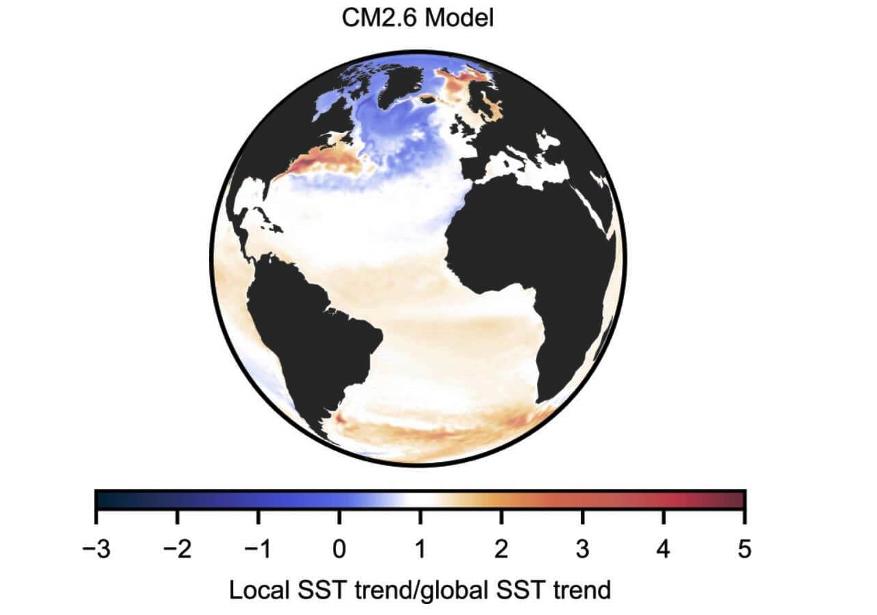
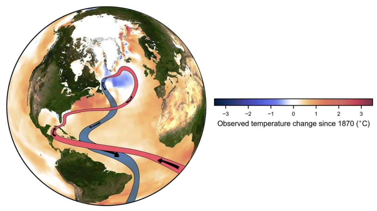
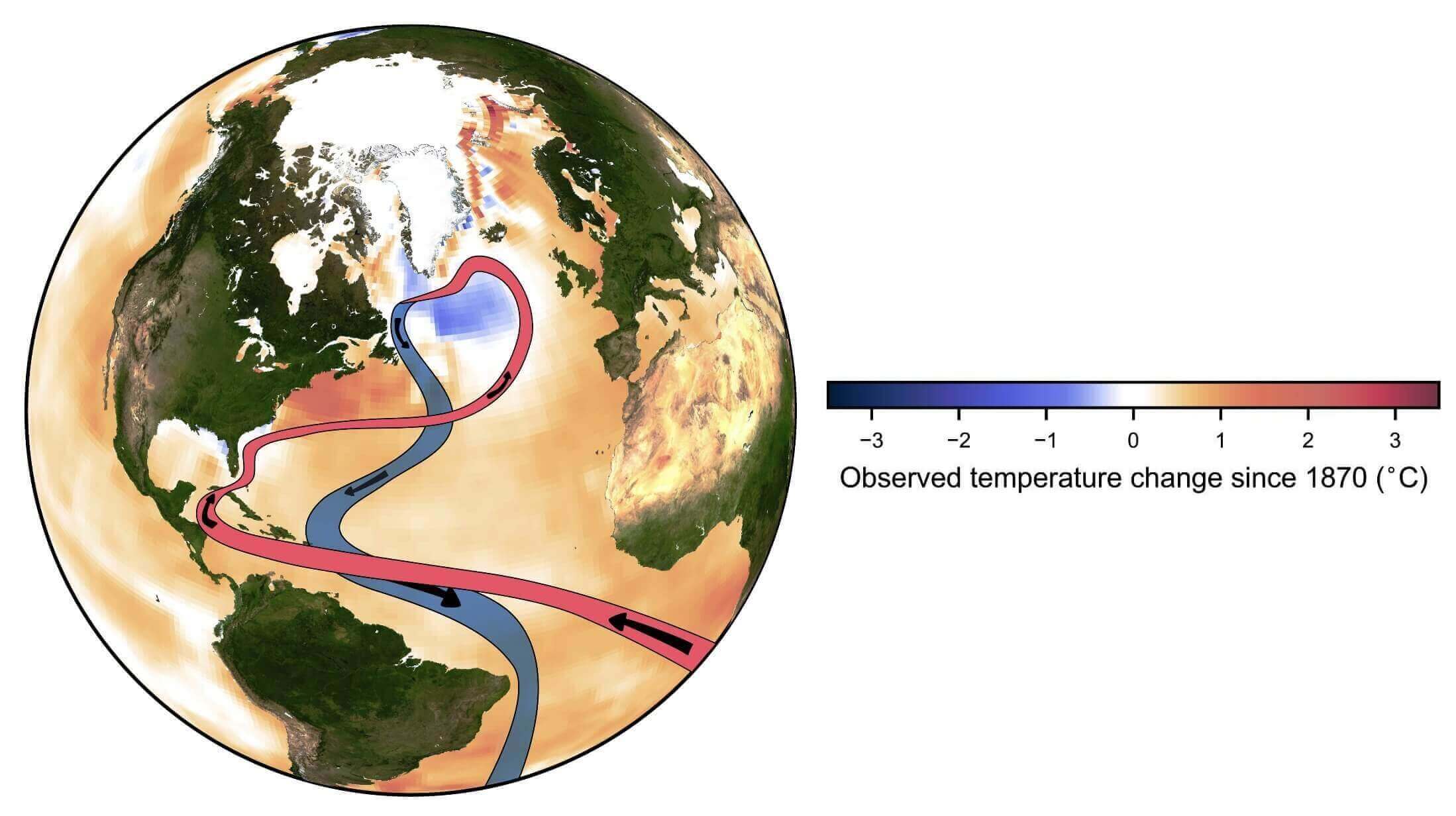
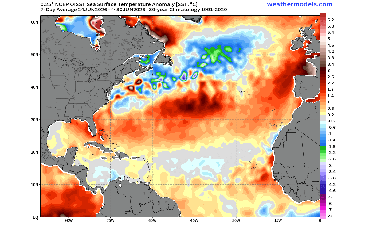
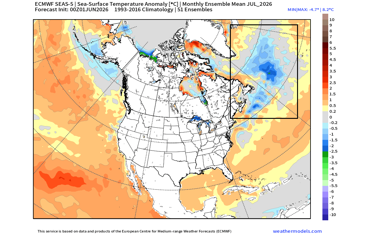
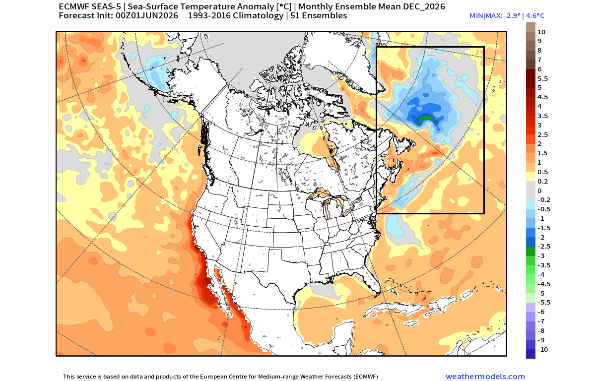
Simultaneously, the North Atlantic has begun to display a "cold blob"—a distinct, large-scale cooling anomaly in the subpolar gyre. This cold patch, situated east of Newfoundland, is a phenomenon that researchers have linked to the potential weakening of the Atlantic Meridional Overturning Circulation (AMOC). When these two massive thermal anomalies—the heat of the Pacific and the cooling of the North Atlantic—coexist, they create a "tri-headed" atmospheric tension that models suggest will define the winter season.
Chronology of the Anomaly: A Developing Trend
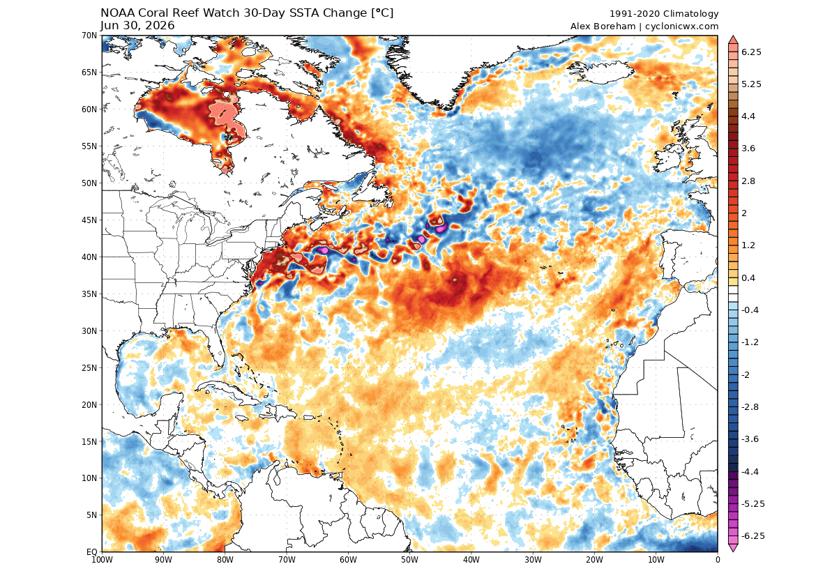
The current cooling trend in the North Atlantic is not a sudden occurrence but a progression that has been documented over several months. By late July 2026, NOAA ocean analysis confirmed that this cold anomaly is not only persisting but expanding.
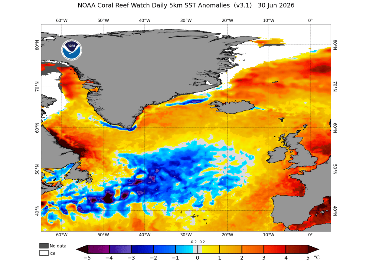
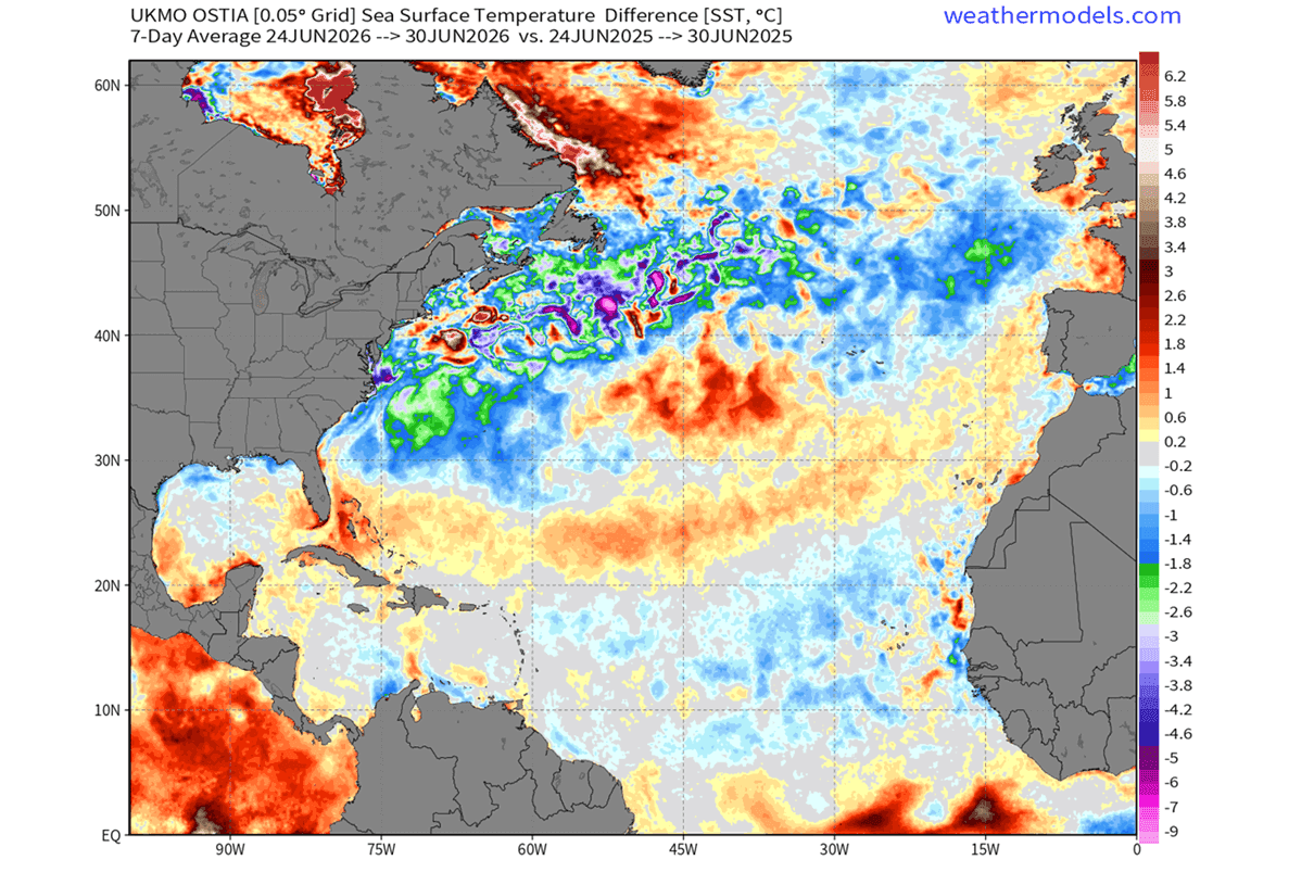
- June 2026: Initial observations revealed a cooling trend in the subpolar North Atlantic. Compared to the same period in 2025, surface temperatures in these regions have dropped by 0.5 to 2 degrees Celsius in some sectors.
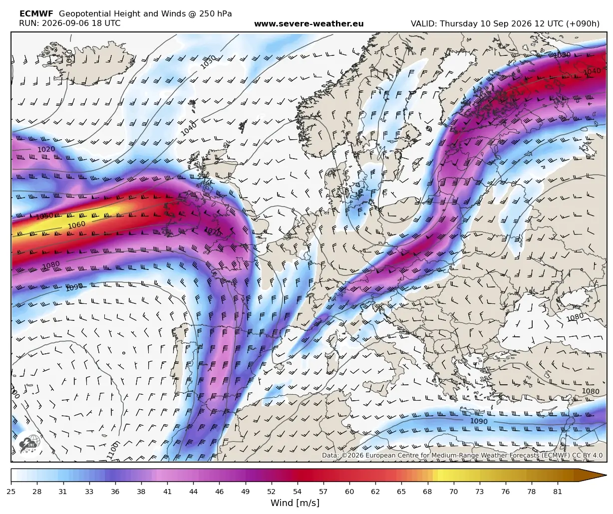
- July 2026: Long-range forecast models, including those from the ECMWF (European Centre for Medium-Range Weather Forecasts), indicated that the cold blob would remain a semi-permanent feature through the fall, extending its influence into the start of the winter season.
- Late 2026 (Forecast): As we head toward December, models show a sustained, organized structure to this cold anomaly, effectively creating a "cold tail" that influences the flow of the Gulf Stream and alters the thermal energy transport that typically keeps the North Atlantic temperate.
Supporting Data: The AMOC Connection and Atmospheric Coupling
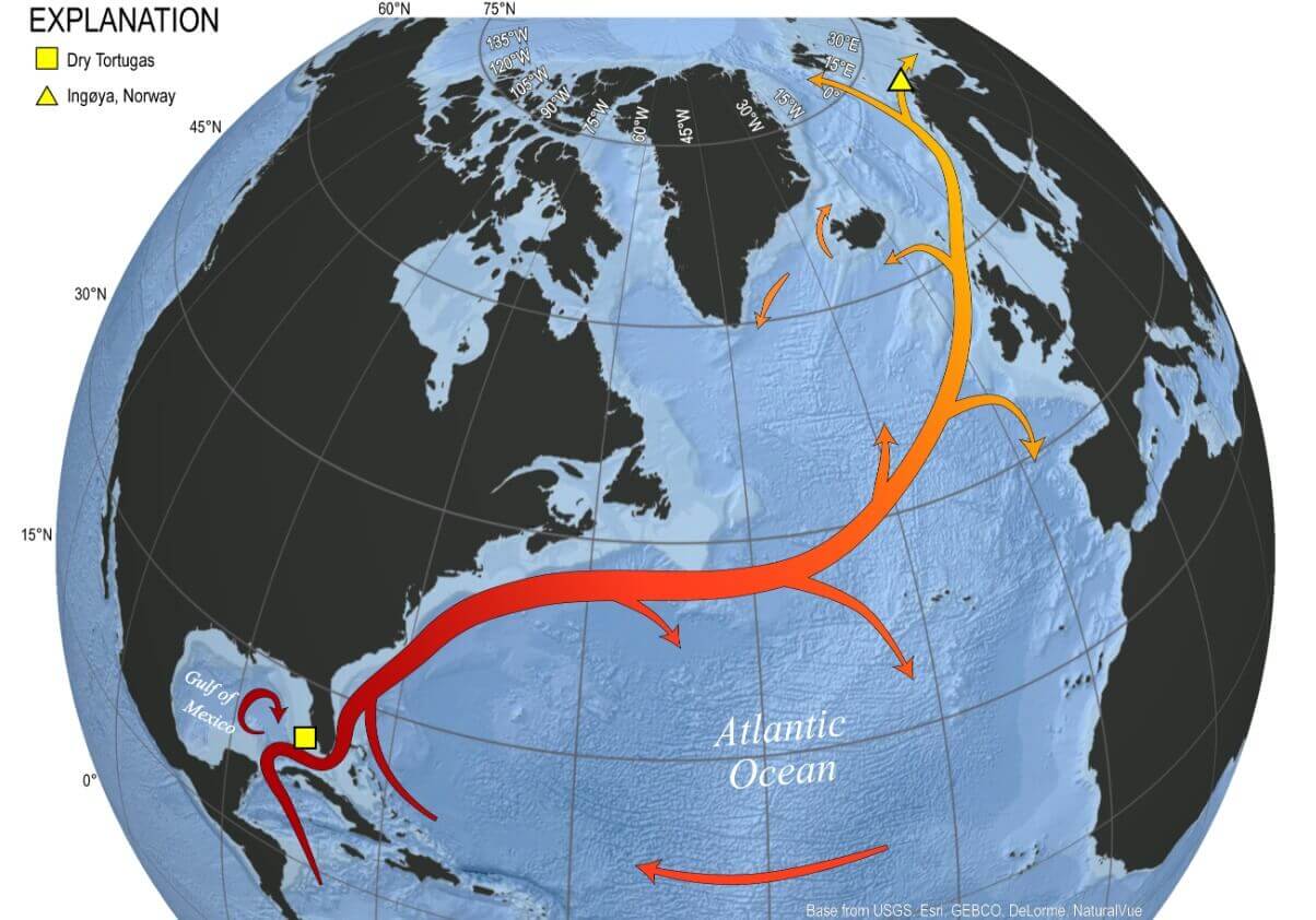
To understand why these ocean temperatures matter, one must look at the Atlantic Meridional Overturning Circulation (AMOC). This system acts as a global "conveyor belt," transporting warm water from the tropics toward the high latitudes of the North Atlantic.
The Weakening Conveyor
For years, oceanographic data has suggested that the AMOC is experiencing a slowdown. The cold blob observed today is a hallmark signature of this deceleration. As the current slows, it fails to transport enough tropical heat northward, resulting in a cooling of the surface waters in the North Atlantic even as the rest of the globe warms. Computer simulations of a weakened AMOC show a striking resemblance to the real-world temperature trends we are witnessing today.
Atmospheric Teleconnections
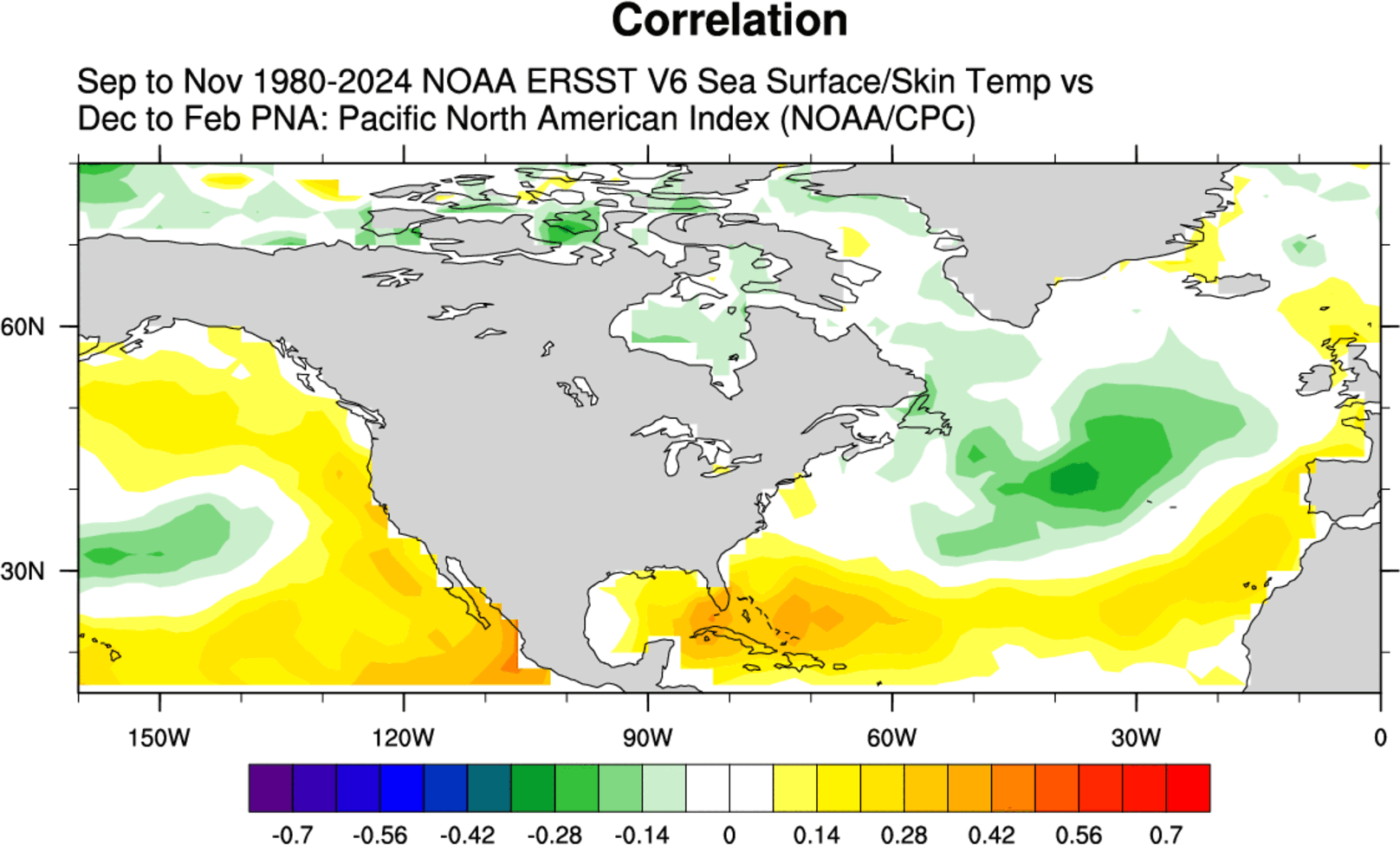
The ocean and atmosphere are inextricably linked. The presence of a cold North Atlantic anomaly often acts as a precursor to specific pressure configurations. Specifically, historical data shows a correlation between a fall "cold blob" and the development of a positive Pacific-North American (PNA) pattern in the following winter.
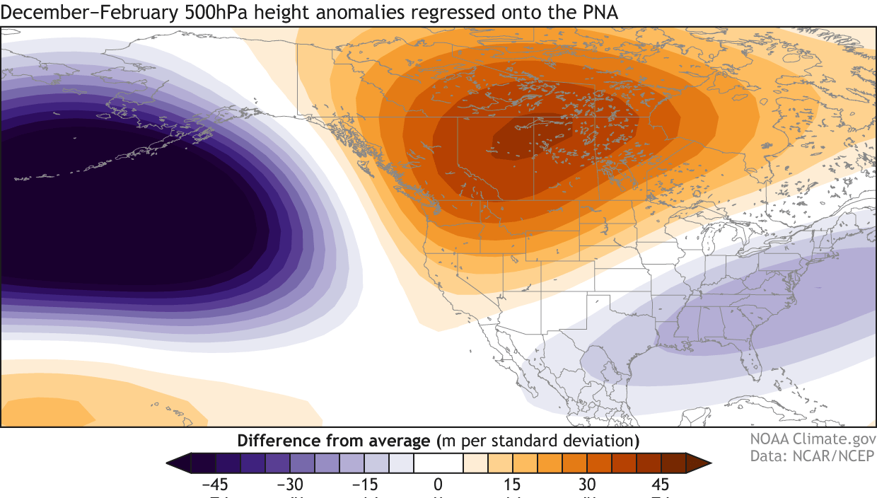
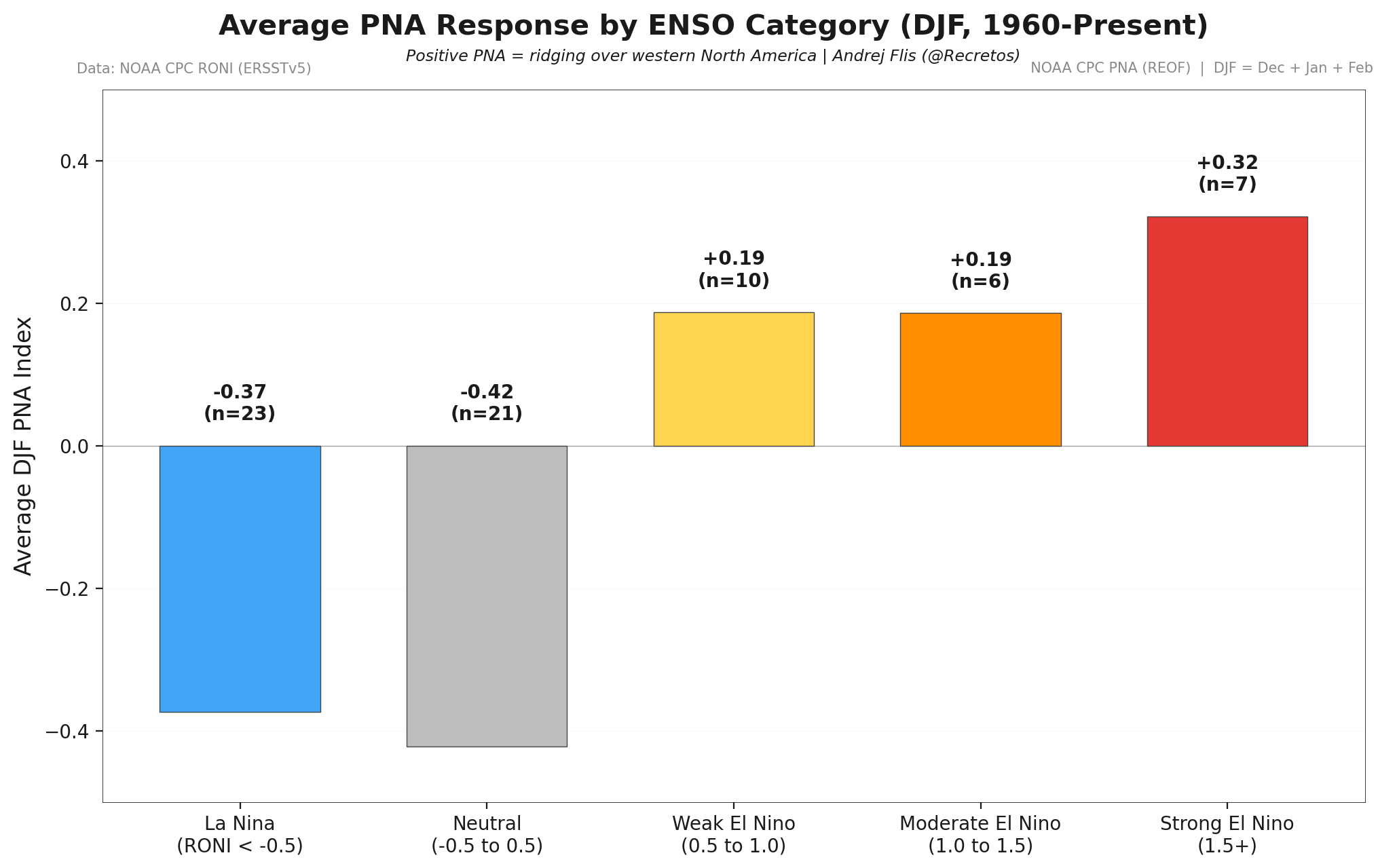
The PNA pattern is a major atmospheric circulation mode. A "positive" PNA phase is associated with a high-pressure ridge over the western United States and Canada, which often displaces the jet stream, driving colder, more unstable air into the central and eastern United States. When this is overlaid with the influence of a Super El Niño—which typically forces a strong, wavy jet stream—the potential for significant winter weather volatility increases exponentially.
Implications for North America and Europe
As global models integrate the current oceanic data, the forecast for the upcoming winter is becoming increasingly clear.
The North American Outlook
Predictions from the ECMWF, CanSIPS, and the American CFS (Climate Forecast System) are showing a high degree of consensus. All three major models point to a strong positive PNA pattern for December 2026 through February 2027.
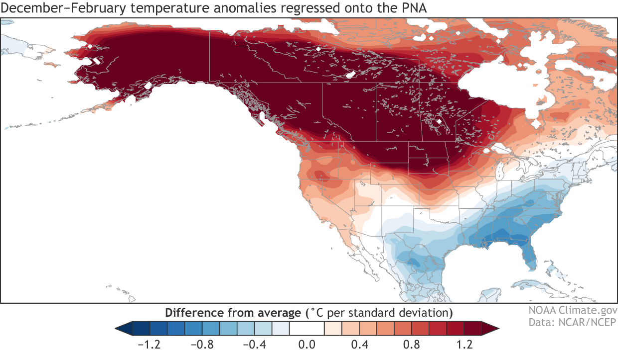
- Western/Northern Regions: The high-pressure ridge associated with the positive PNA will likely favor warmer-than-normal conditions across the western United States and western Canada.
- Central and Eastern Regions: The corresponding trough (low-pressure area) will likely open the door for arctic air incursions, potentially leading to a "cold corridor" from the Canadian prairies down into the Midwest and Eastern United States.
The historical comparison to the 2014-2015 winter, which featured a similarly strong Atlantic cold anomaly and a warming Pacific, provides a blueprint for what might occur. That season saw significant cold-air outbreaks and intense winter storm tracks across the Eastern U.S., driven by a localized Polar Vortex core.
The European Perspective
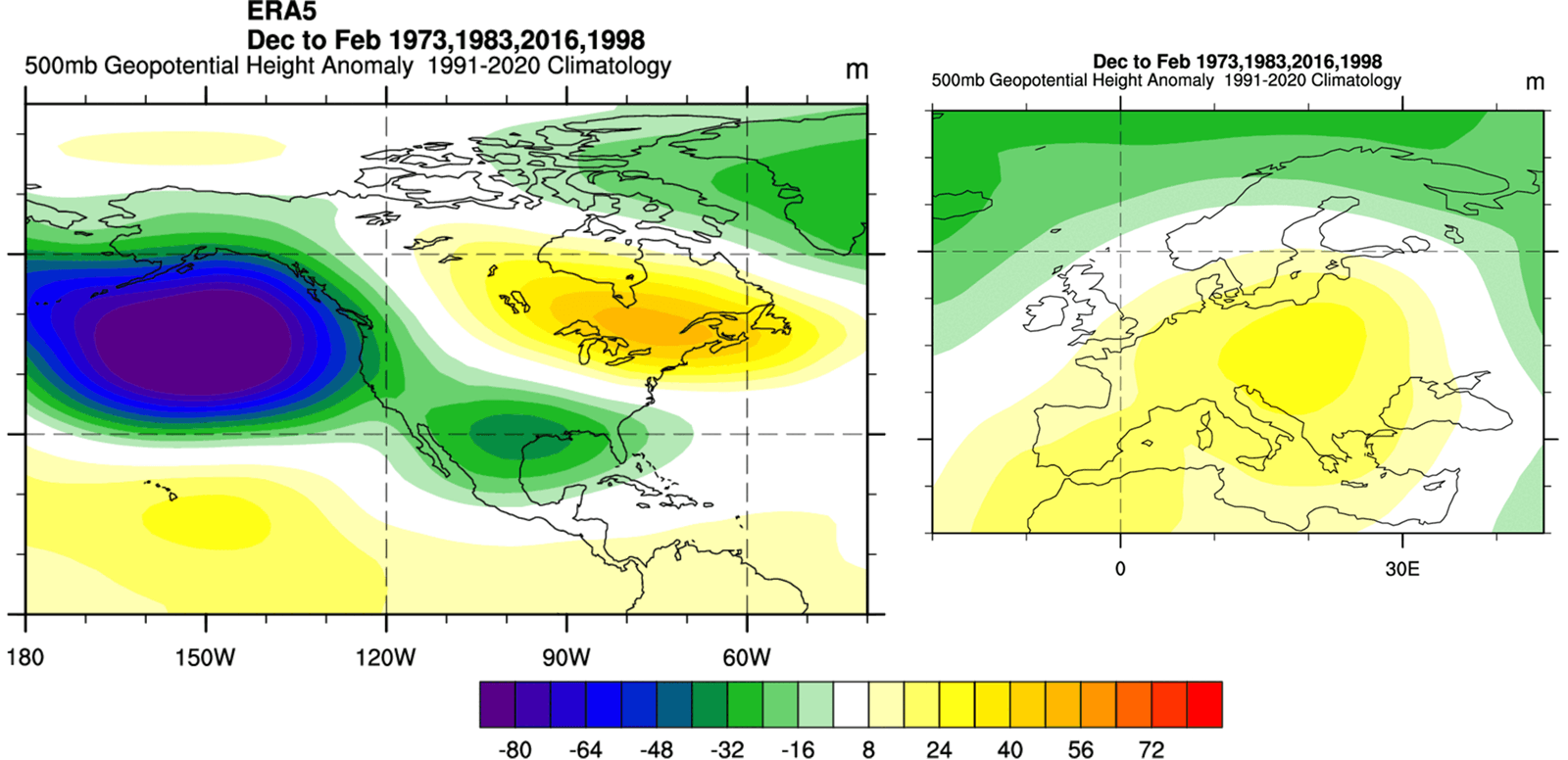
The situation for Europe presents a different narrative. While North America deals with the potential for cold-air channeling, Super El Niño winters in Europe often exhibit a different response. The rising high-pressure ridges typical of such events tend to favor warmer anomalies across central, western, and southern Europe as the winter progresses, while northern Europe may experience more variable, colder conditions.
Official Perspectives and Scientific Caution
While the correlation between these ocean anomalies and winter weather is statistically robust, meteorologists urge caution. Long-range forecasting, especially at a seasonal scale, is an exercise in probability rather than certainty.
The National Oceanic and Atmospheric Administration (NOAA) and other climate centers emphasize that while the "control lights on the dashboard"—the ocean anomalies—are flashing, the atmosphere remains chaotic. Internal atmospheric variability, such as the Sudden Stratospheric Warming (SSW) events that can disrupt the Polar Vortex, can override these oceanic signals.
However, the fact that multiple global models (ECMWF, CFS, and CanSIPS) are converging on a similar atmospheric solution suggests that the influence of the Super El Niño and the Atlantic cold blob is profound enough that it is being consistently picked up by our most sophisticated predictive tools.
Conclusion: A Winter of Extremes
The winter of 2026/2027 is shaping up to be a case study in global climate connectivity. The Pacific Ocean, through the engine of a Super El Niño, is providing a massive influx of energy into the atmosphere, while the North Atlantic, through its cooling blob and potential AMOC decline, is acting as a massive thermal anchor.
For residents across North America and Europe, these signals imply that the coming months may be defined by sharp, rapid transitions. The likelihood of a "textbook" winter is low; instead, we should prepare for a season of extremes—warmth in the west, potential bitter cold in the east, and a global climate system that is increasingly sensitive to the interplay between our cooling and warming oceans. As the season approaches, continued monitoring of these "control lights" will be essential for understanding the shifting narrative of our winter climate.