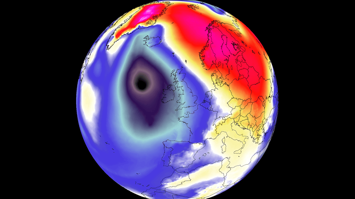
As September 2026 draws to a close, meteorologists are tracking an explosive meteorological event unfolding over the North Atlantic. A powerful, rapidly deepening low-pressure system—technically classified as a "bomb cyclone"—is currently barreling toward Western Europe, bringing with it the threat of hurricane-force wind gusts, life-threatening marine conditions, and an unseasonably warm air mass that will disrupt weather patterns from Ireland to the high latitudes of Iceland and Scandinavia.
This article provides an in-depth analysis of the storm’s rapid development, its projected trajectory, and the potential hazards for those living in the path of this intense cyclonic system.
The Meteorological Mechanics: Understanding "Bombogenesis"
The term "bomb cyclone" is not merely sensationalist media terminology; it refers to a precise atmospheric process known as bombogenesis. This phenomenon occurs when a mid-latitude cyclone experiences a rapid intensification, with its central barometric pressure dropping by at least 24 millibars (hPa) within a 24-hour period.
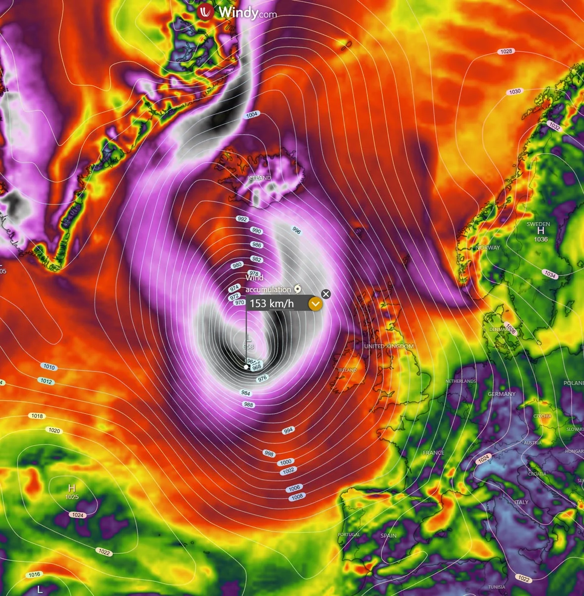
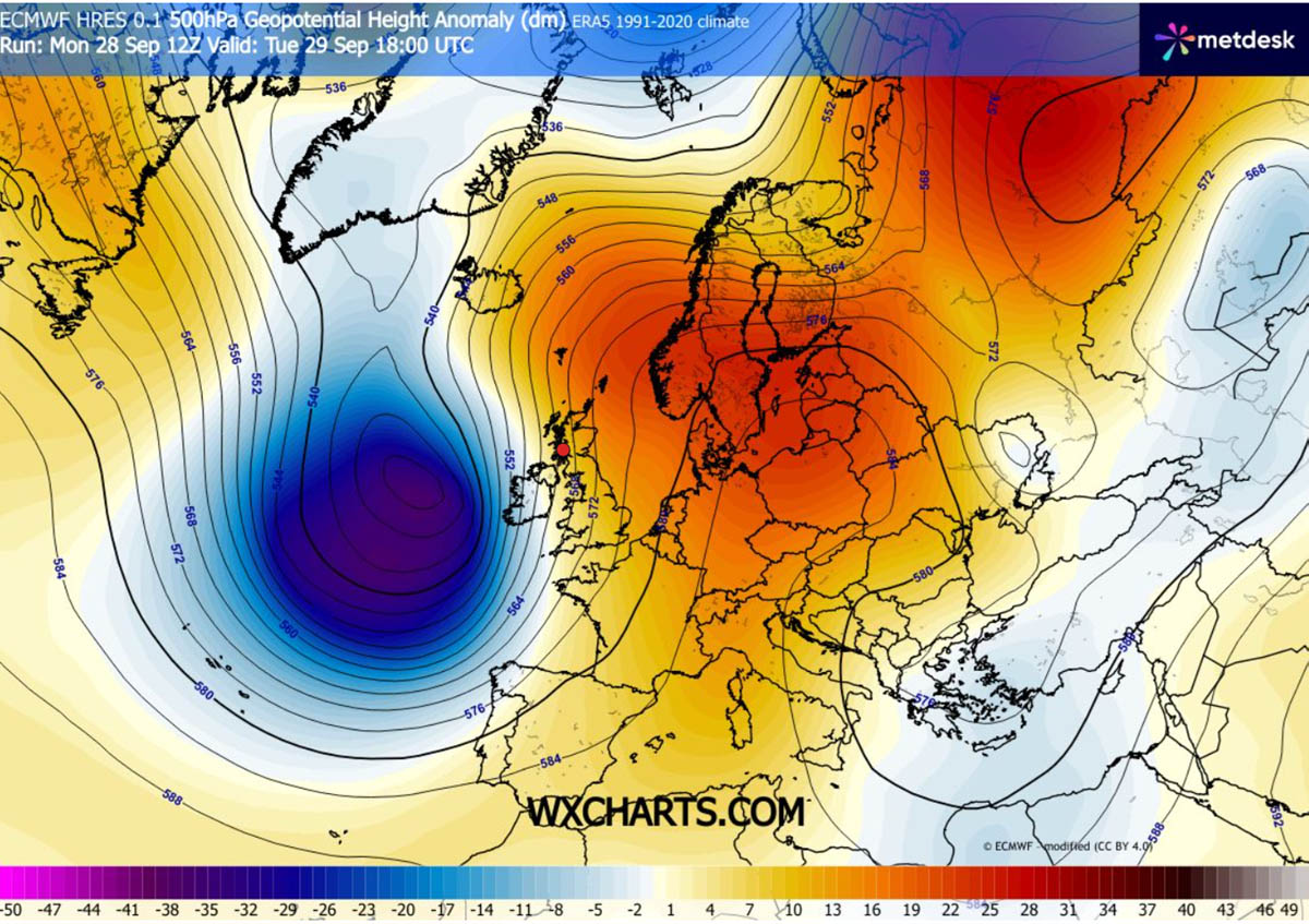
The current system, which began as a relatively modest disturbance, has undergone explosive intensification due to a high-amplitude upper-level trough swinging out of the North Atlantic. As this trough collides with a formidable 1035 hPa blocking high-pressure system anchored over Central Europe and Scandinavia, a steep baroclinic gradient is created. This gradient effectively "squeezes" the isobars (lines of equal pressure) across the UK and Ireland, creating a high-energy environment where wind speeds accelerate dramatically.
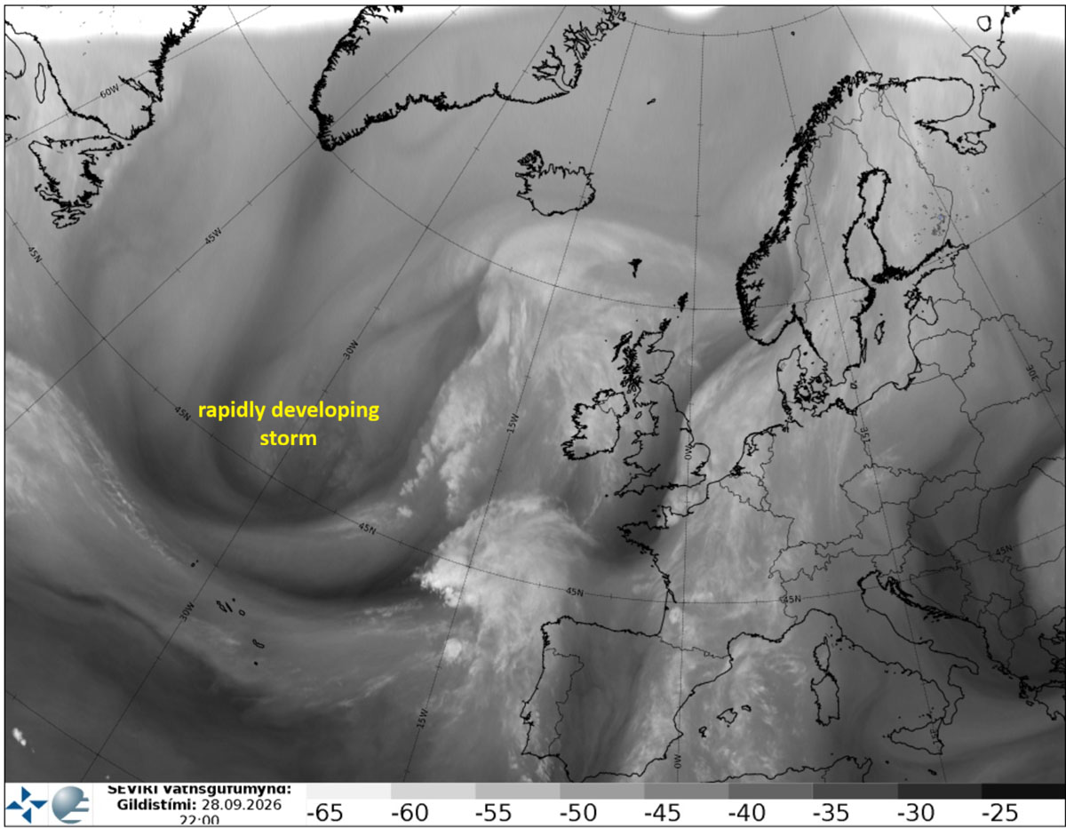
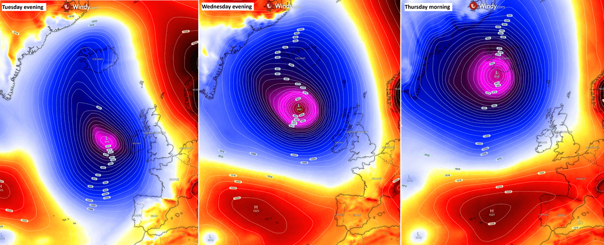
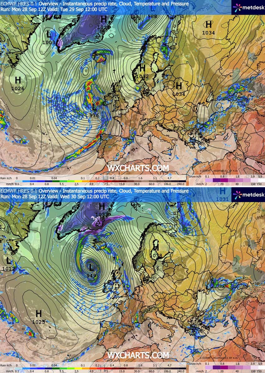
Meteorologists observing the water vapor satellite spectrum have identified a classic signature of this process: a developing jet stream that acts as an "exhaust pipe" for the storm, rapidly evacuating air from the center of the low and forcing the pressure to plummet. By Tuesday evening, the system is expected to reach a core pressure of approximately 950 mbar, with further deepening to 945 mbar as it approaches the Faroe Islands and eventually Iceland by Thursday.
Chronology of the Storm: From Genesis to Landfall
The development of this system has been swift and highly visible on global weather models.
Monday: The Seed of the Storm
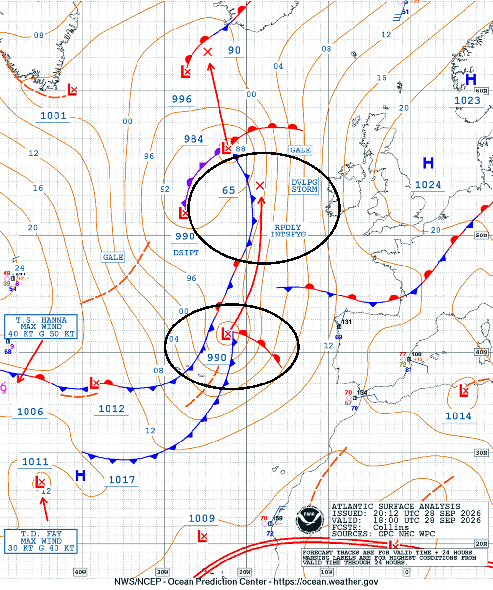
By Monday night, satellite imagery confirmed the formation of a strong baroclinic zone. Analysis from the Ocean Prediction Center (OPC) showed the system emerging west of the Iberian Peninsula. The pressure was already trending downward, signaling the start of the "bombing" phase.
Tuesday: Rapid Deepening and Initial Impacts
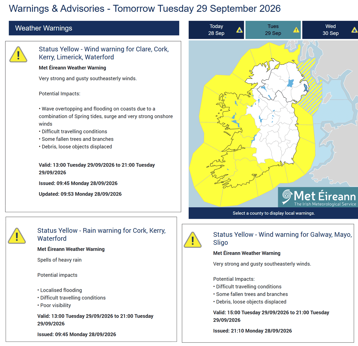
As the storm moved into Tuesday, its central pressure plummeted from 990 mbar toward 965 mbar. The circulation pattern began to widen significantly, reaching toward the western coast of Ireland. Forecasters noted a cold front beginning to move rapidly eastward, bringing the first signs of the storm: squall lines and rising wind gusts. Met Éireann, Ireland’s national meteorological service, responded by issuing yellow wind warnings, alerting residents to the risk of dangerous driving conditions and potential structural damage.
Wednesday: The Peak of Intensity
By Wednesday, the storm will reach its zenith. With a central pressure dropping below 950 mbar, the pressure gradient around the eye of the storm will be extreme. This is when the most significant impacts will be felt, including near hurricane-force winds across the North Atlantic and the immediate approach toward the Faroe Islands.
Thursday: Transition and Dissipation
By Thursday morning, the low-pressure system is expected to make its final push toward Iceland. While it will begin to lose some of its explosive energy as it interacts with the landmass of Iceland, it will leave behind a legacy of extreme precipitation and residual wind damage.
Supporting Data and Forecast Models
The severity of this event is underscored by several key meteorological indicators tracked by global forecasting centers:
- Wind Gust Projections: The strongest wind swath is expected to track north of Ireland, with gusts ranging from 100 to 130 km/h in exposed coastal areas. In the core of the storm, particularly over the open ocean, gusts are expected to exceed 150 km/h.
- Marine Hazards: Perhaps the most dangerous aspect of this storm is the sea state. With a massive fetch of wind behind it, the cyclone is generating high-amplitude swells. Models indicate wave heights reaching 10 to 12 meters (33 to 40 feet) to the west of Ireland and Scotland, posing a significant threat to maritime traffic and coastal infrastructure.
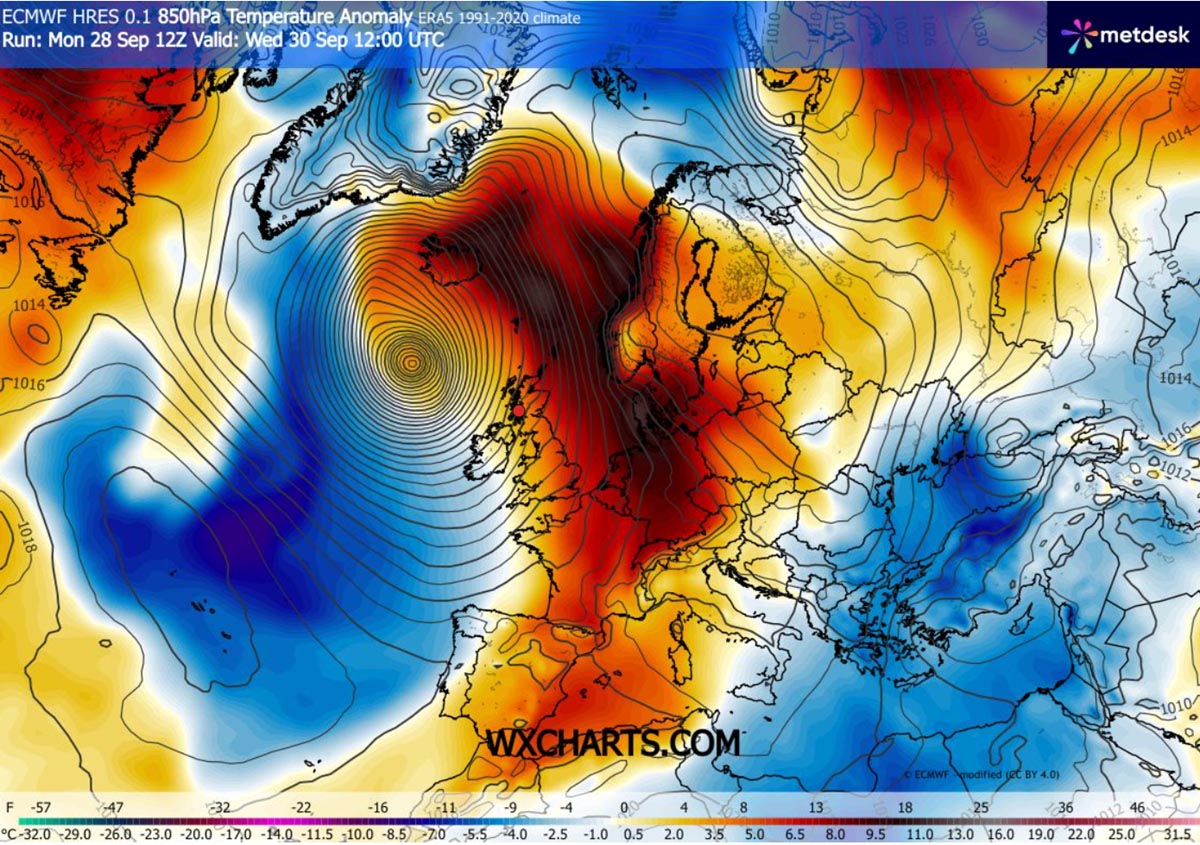
- Temperature Anomalies: Because of the storm’s vast, counter-clockwise circulation, it is pulling a massive plume of tropical moisture and heat from the south. While the UK and Ireland face wind, countries further north, including Denmark and parts of Scandinavia, will experience an anomalous spike in temperatures as the warm front advances ahead of the cold core.
- The Atmospheric River: A critical concern for Iceland is the "atmospheric river" effect. As the storm stalls near the island on Thursday, the persistent south-southeasterly jet will force moist air against the mountainous terrain, resulting in extreme orographic rainfall. Forecasters are bracing for localized totals of 250–300 mm within a 24-hour window, which could lead to severe flash flooding and landslides.
Official Responses and Public Safety
National meteorological agencies across the British Isles and the North Atlantic have been proactive in their messaging. The primary guidance for the public includes:
- Coastal Vigilance: Residents along the western coasts of Ireland, Northern Ireland, and the Scottish Outer Hebrides are being warned to stay away from shorelines. The combination of high tide and 8–10 meter waves creates a high risk of coastal inundation and dangerous spray.
- Infrastructure Preparedness: With gust speeds capable of downing trees and power lines, local utility companies have moved to high-alert status, preparing for widespread power outages. Emergency services have advised that travel should be avoided during the peak of the squall lines.
- Aviation and Maritime Disruption: Major airports and ferry operators have begun issuing schedule adjustments, anticipating that the high-velocity wind field will render operations unsafe throughout Wednesday.
Implications: A Glimpse into a Shifting Climate
While individual storm events cannot always be definitively linked to long-term climate trends, the intensity of this September 2026 system highlights the increasing volatility of the North Atlantic. The "Omega block" pattern currently in place—which is effectively steering this storm toward the north—is a testament to the complex atmospheric configurations that can exacerbate extreme weather.
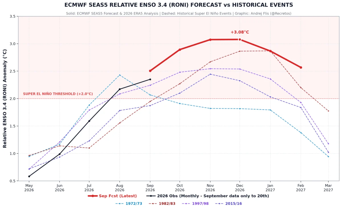
Furthermore, this event is occurring against the backdrop of a record-breaking "Super El Niño" cycle for 2026/2027. Climate scientists are closely monitoring how these oceanic anomalies influence the jet stream, often creating the very conditions required for such explosive cyclogenesis.
Long-Term Consequences
The aftermath of this storm will likely include a significant cleanup effort, particularly in Iceland, where the volume of water expected could overwhelm existing drainage and flood-defense infrastructure. In the UK and Ireland, the focus will remain on stabilizing power grids and assessing damage to property caused by the intense, short-lived squall lines that characterize these types of bomb cyclones.
As we move toward the winter months of 2026/2027, this storm serves as a stark reminder of the power of the North Atlantic. The meteorological community remains vigilant, using high-resolution models to refine the impact zone and ensure that the public has the best available data to stay safe.
Residents are urged to continue monitoring local weather updates, follow the guidance of emergency management agencies, and prioritize safety over travel until the system has fully passed.
For real-time tracking, updates on current wind speeds, and localized pressure readings, please consult the official dashboards of Met Éireann, the Icelandic Meteorological Office (Vedur IS), and satellite data providers such as Windy and Wxcharts.