Executive Summary: A Mountain System in Crisis
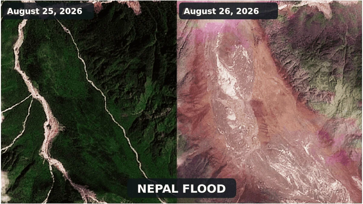
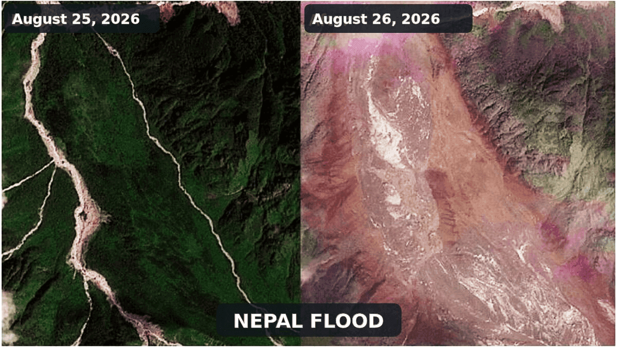
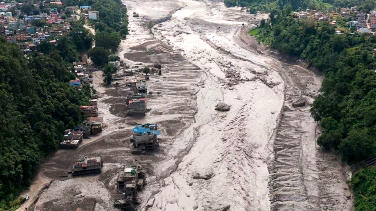
On August 26, 2026, the remote, high-altitude border region between Nepal and Tibet was struck by a catastrophic geological event that reshaped the landscape and devastated communities. A massive surge of water, mud, and boulders roared through the Bhote Koshi-Trishuli river system, obliterating critical infrastructure, including roads, bridges, and hydropower installations.
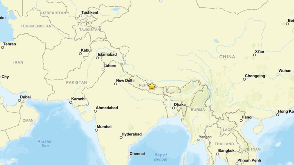
While initial reports suggested a seismic trigger, subsequent investigations by the U.S. Geological Survey (USGS) and satellite analysis from the International Center for Integrated Mountain Development (ICIMOD) have clarified the event’s nature: it was a massive ice and rock avalanche that initiated a secondary, highly destructive, landslide-dam outburst flood. As of late August 26, confirmed fatalities had reached 160, with hundreds more listed as missing. These figures are expected to rise as search and rescue teams gain access to the isolated, debris-choked valleys.
Chronology of the Disaster
The event began in the upper reaches of the Lhende Khola, a tributary of the Bhote Koshi, situated at the international border. Satellite evidence suggests that a massive, glacierized slope suffered a catastrophic failure, sending millions of cubic meters of ice, snow, and bedrock plummeting into the valley floor.
The Seismic Misinterpretation
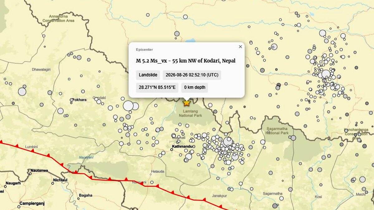
In the immediate aftermath, seismic networks detected a significant signal, initially cataloged as a magnitude 4.4 earthquake. This triggered widespread speculation that tectonic activity had destabilized the mountainside. However, a critical reassessment by the USGS (Event ID: us7000tbwb) reclassified the signal as a magnitude 5.2 landslide. This correction was pivotal: the ground-shaking was not the cause of the disaster, but rather the result of the sheer mass of material—estimated in the millions of cubic meters—colliding with the valley floor.
The Surge Downstream
The avalanche created a temporary dam within the narrow, steep-walled valley. As water accumulated behind this unstable obstruction, the pressure grew until the dam partially failed. This released a massive, debris-charged surge that traveled downstream, causing the water level of the Trishuli River to spike by approximately nine meters in under thirty minutes. This rapid, high-energy pulse is what led to the widespread destruction of downstream settlements and hydroelectric facilities.
Supporting Scientific Data and Analysis
To understand the severity of this event, one must look at the specific geophysical mechanics involved. The disaster is best described as an "ice-and-rock avalanche-induced landslide-dam outburst flood."
Distinguishing the Mechanism
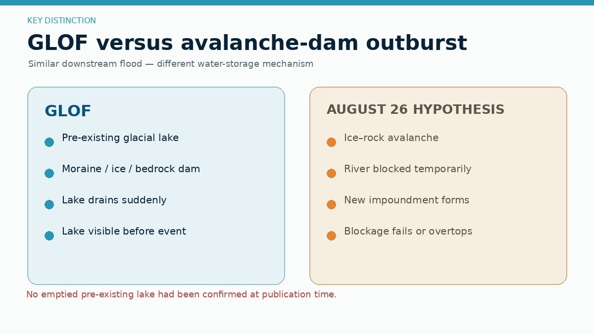
A common point of confusion in mountain hydrology is the terminology used to describe such events. This disaster is not, strictly speaking, a Glacial Lake Outburst Flood (GLOF). A GLOF requires the sudden drainage of a pre-existing glacial lake. While some minor ice-marginal water may have been present, the primary driver here was the physical obstruction of the river channel by the landslide debris itself.
Comparisons to Global Precedents
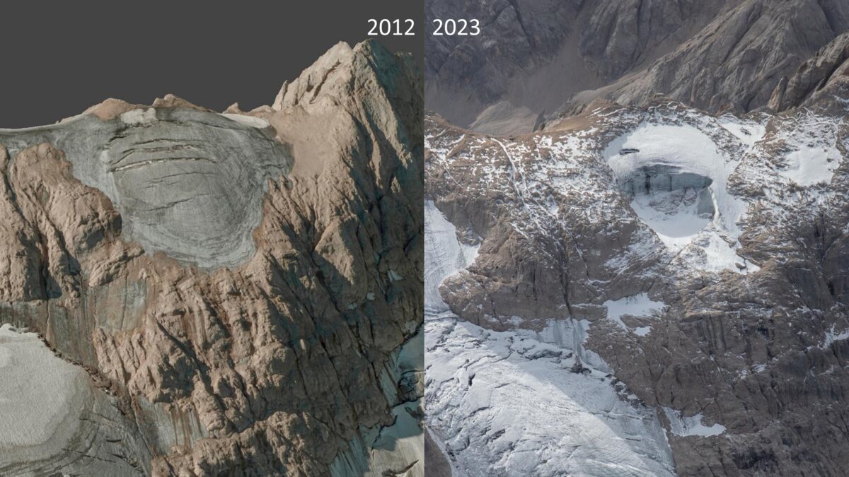
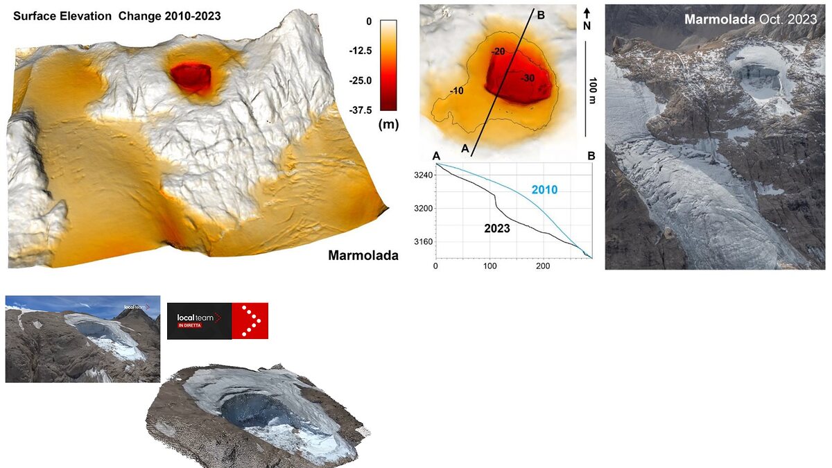
Geologists are comparing this event to the 2025 Blatten disaster in Switzerland, where a massive rock and ice avalanche from the Birch Glacier dammed the Lonza River, and the 2022 Marmolada glacier collapse in Italy. These events share a "cascading" nature:
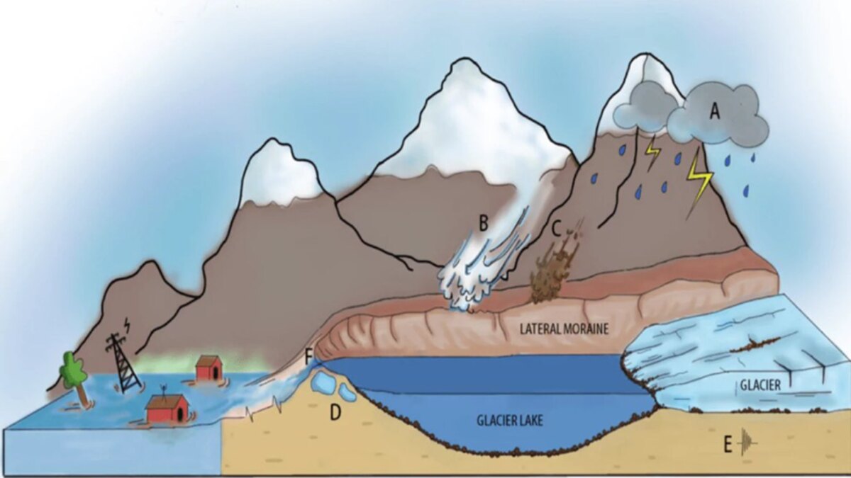
- Initial Failure: A steep, glacierized slope loses structural integrity.
- Avalanche Phase: A mixture of ice, rock, and debris accelerates downslope.
- Damming Phase: The material blocks a river channel.
- Outburst Phase: The pressure of impounded water leads to a catastrophic breach, creating a flood wave that gathers speed and volume by entraining riverbed sediment.
The 2026 event underscores that these disasters are rarely caused by a single factor, but rather by the cumulative effect of glacier thinning, permafrost degradation, and local mechanical triggers.
The Role of Climate and Environmental Change
While it is premature to definitively attribute the August 26th event to climate change, scientists emphasize that the "environmental baseline" of the Hindu Kush Himalaya is shifting.
Changing Baselines
The region has seen a consistent, long-term trend of warming. This heat leads to:
- Permafrost Degradation: The ice that acts as "glue" for rock joints in high-altitude environments is melting, making steep walls inherently more unstable.
- Glacier Thinning: As glaciers retreat, they leave behind unsupported valley walls and create new, potentially unstable landforms.
- Meltwater Circulation: Increased seasonal meltwater penetrates deeper into fractures, increasing internal water pressure and accelerating the process of mechanical failure.
Geomorphologists, such as those at the French CNRS, have noted a dramatic increase in the frequency of large-scale rockfalls in the Alps during the summer of 2026. A similar trend is observed in the Himalayas. While the specific trigger of the Lhende Khola collapse may have been a local, mechanical event, the conditions that made such a massive failure possible are increasingly prevalent due to broader climatic trends.
Official Responses and Transboundary Challenges
The scale of the disaster has prompted a massive, albeit difficult, response from authorities in both Nepal and China.
The Warning Gap
One of the most profound lessons of this disaster is the inadequacy of current transboundary warning systems. Rivers do not recognize political borders, yet meteorological and hydrological data sharing often lags behind the speed of a flash flood.
- Monitoring: Authorities are now being urged to move beyond simple inventories of glacial lakes and begin monitoring "unstable glacierized slopes" using satellite interferometry and ground-based sensors.
- Communication: The need for real-time, automated data exchange between Nepal and China is paramount. The delay in relaying warnings about the initial surge meant that many downstream communities had no time to reach higher ground.
Ongoing Risks
Experts have issued a stern warning: the hazard may not have concluded. Satellite imagery suggests that a significant portion of the avalanche debris remains in the upper Lhende Khola, potentially still impounding water. Any secondary failure, whether caused by renewed rainfall or the gradual erosion of the existing dam, could produce another surge. Consequently, evacuation orders for affected areas remain in effect, and the use of the lower river valleys remains strictly restricted.
Implications for Future Infrastructure
The destruction of hydropower and transport infrastructure in the Rasuwa district serves as a grim case study for future development in high-mountain zones.
- Risk Assessment: Future projects must incorporate "cascade modeling" into their environmental impact assessments. It is no longer sufficient to build for a standard flood; designs must account for the high-sediment, high-velocity surges characteristic of avalanche-dam outbursts.
- Resilience: The placement of critical infrastructure must be re-evaluated, with a preference for sites that are less vulnerable to valley-bottom surges.
- Global Cooperation: This disaster confirms that the Himalayan region is facing a new era of "high-mountain volatility." The international scientific community must prioritize funding for the monitoring of these high-altitude threats.
Conclusion: Lessons from the Lhende Khola
The events of August 26, 2026, stand as a sobering reminder of the power of the natural world in a warming climate. By reclassifying the seismic signature of the event, the scientific community has provided a clearer, albeit more complex, picture of what occurred. It was not an earthquake that caused the destruction, but a massive, complex mass-movement event that transformed a mountain slope into a lethal, fast-moving flood.
As rescue and recovery efforts continue, the focus must remain on the long-term reality of these hazards. The tragedy of the Bhote Koshi-Trishuli system is a clarion call for more sophisticated, transboundary monitoring and a shift in how we build and live within the world’s most dynamic mountain environments. The disaster is a testament to the fact that when it comes to the Himalayas, the landscape is not static; it is in a state of rapid, often violent, transition.