As we approach the final quarter of 2026, the global climate system is entering a period of extraordinary atmospheric synchronization. Meteorologists are closely monitoring the rapid intensification of a "Super El Niño" in the tropical Pacific, which is now being amplified by the emergence of a positive Indian Ocean Dipole (IOD). This dual-ocean phenomenon is creating a powerful, interconnected atmospheric engine that is poised to fundamentally alter weather patterns across the Northern Hemisphere for the upcoming 2026/2027 winter season.

Main Facts: A Dual-Ocean Atmospheric System
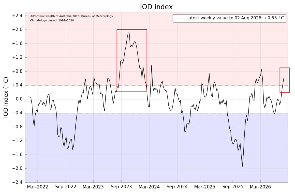
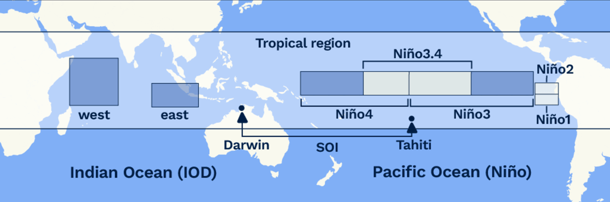
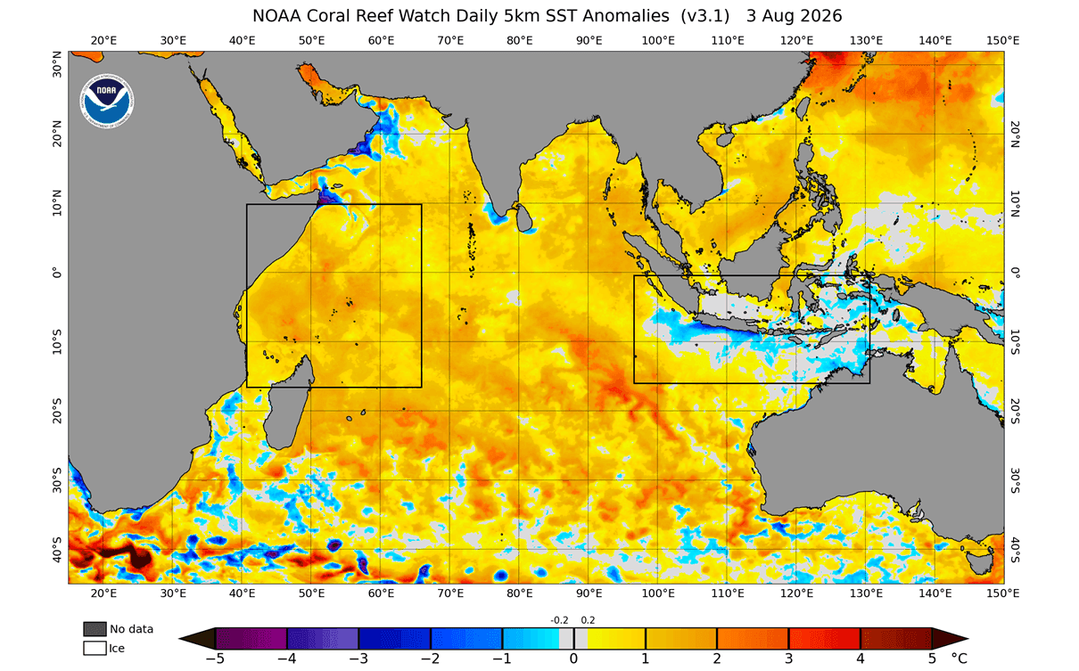
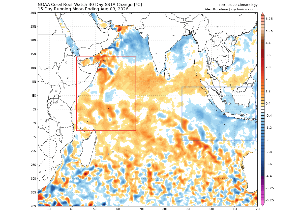
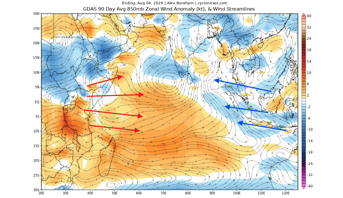
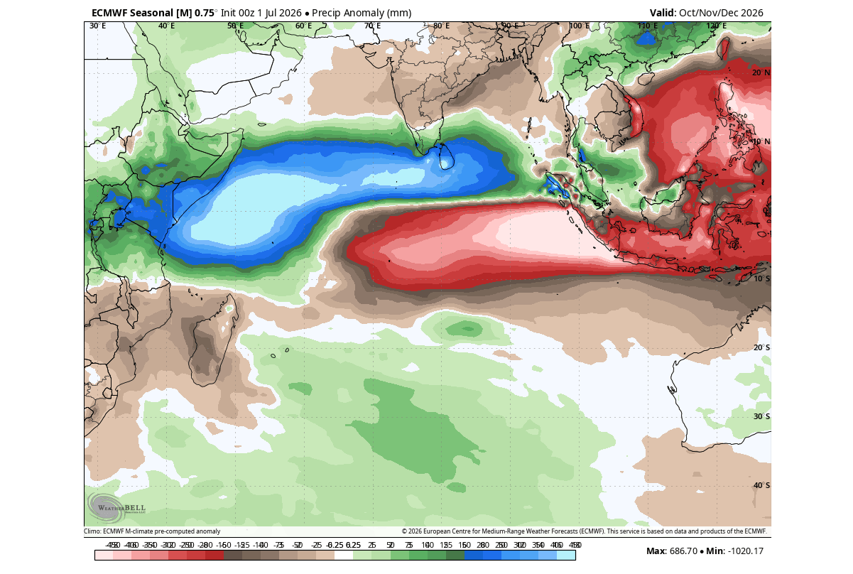
The Indian Ocean Dipole, often referred to as the "Indian Niño," is a climate pattern characterized by fluctuating sea surface temperatures. In a positive IOD phase, waters in the western Indian Ocean become significantly warmer than those in the east, triggering a shift in tropical convection. When this occurs alongside a Super El Niño—an extreme warming event in the Pacific—the result is a global-scale atmospheric response.
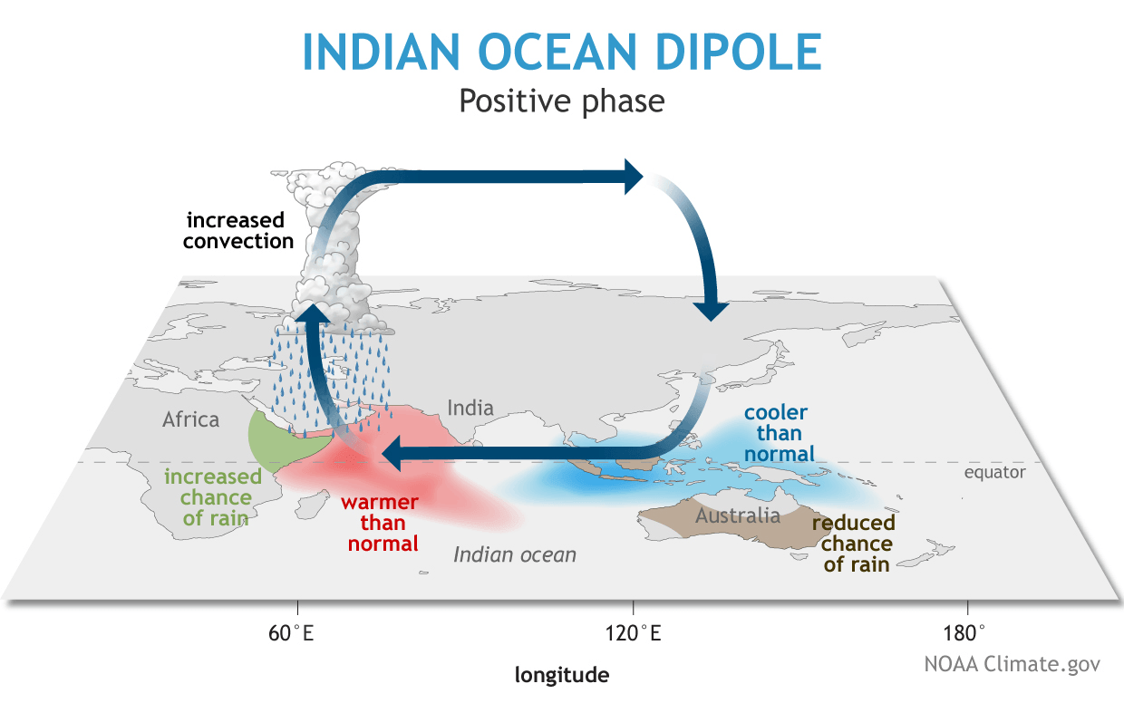
The current data indicates that these two anomalies are not acting in isolation. Instead, they are synchronized through a complex system of tropical wave forcing, pressure changes, and trade wind modifications. This "dual-ocean" system effectively reshapes the global circulation, influencing everything from the position of the jet stream to the frequency of winter storms across North America and Europe. As of August 2026, the atmospheric footprint of this interaction is already manifesting in global climate models, signaling a winter that may deviate significantly from historical averages.
Chronology of Development
The transition into this high-impact climate state began earlier this year, but the acceleration observed in late summer has caught the attention of the global meteorological community.
- Early 2026: Initial signs of Pacific warming appeared, laying the groundwork for a potential El Niño event.
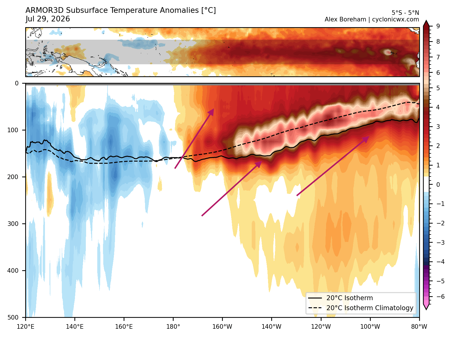
- Mid-2026: Subsurface temperatures in the tropical Pacific began to show the development of a massive Kelvin Wave—a deep, warm underwater current that serves as the engine for a Super El Niño.
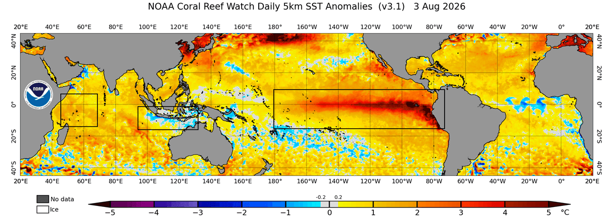
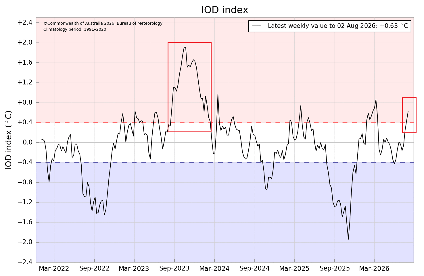
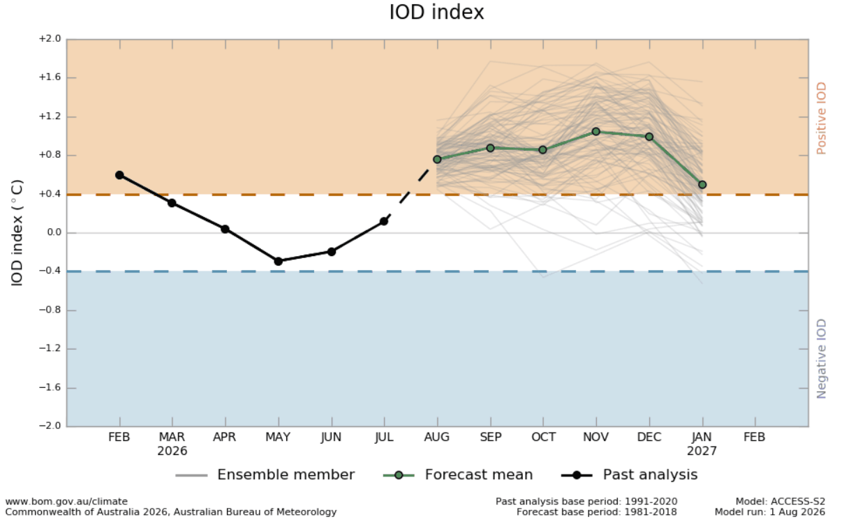
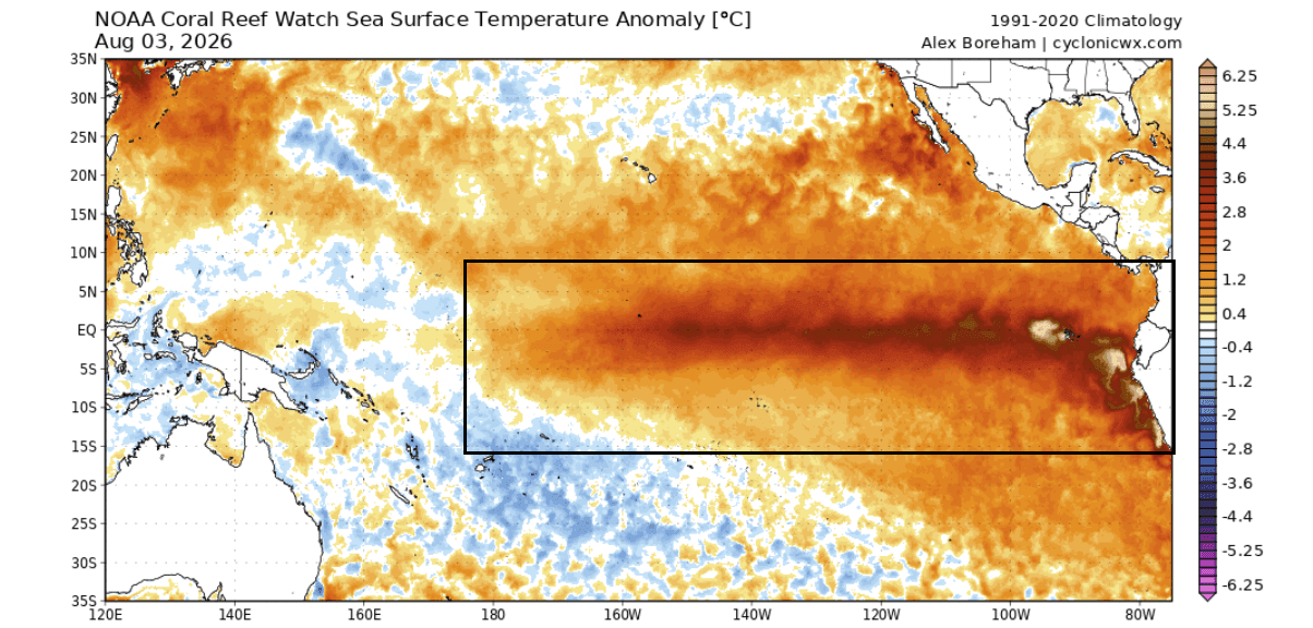
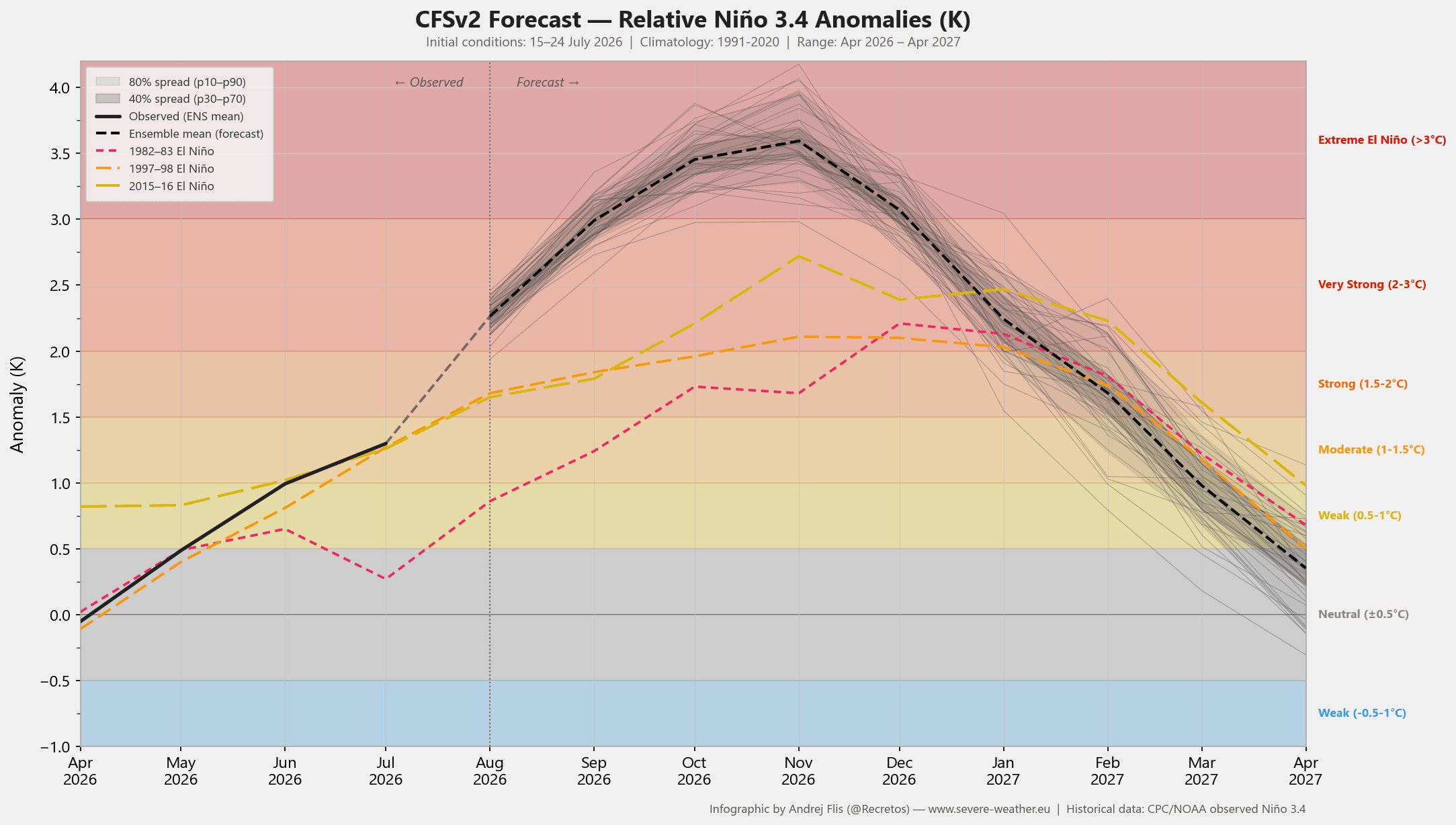
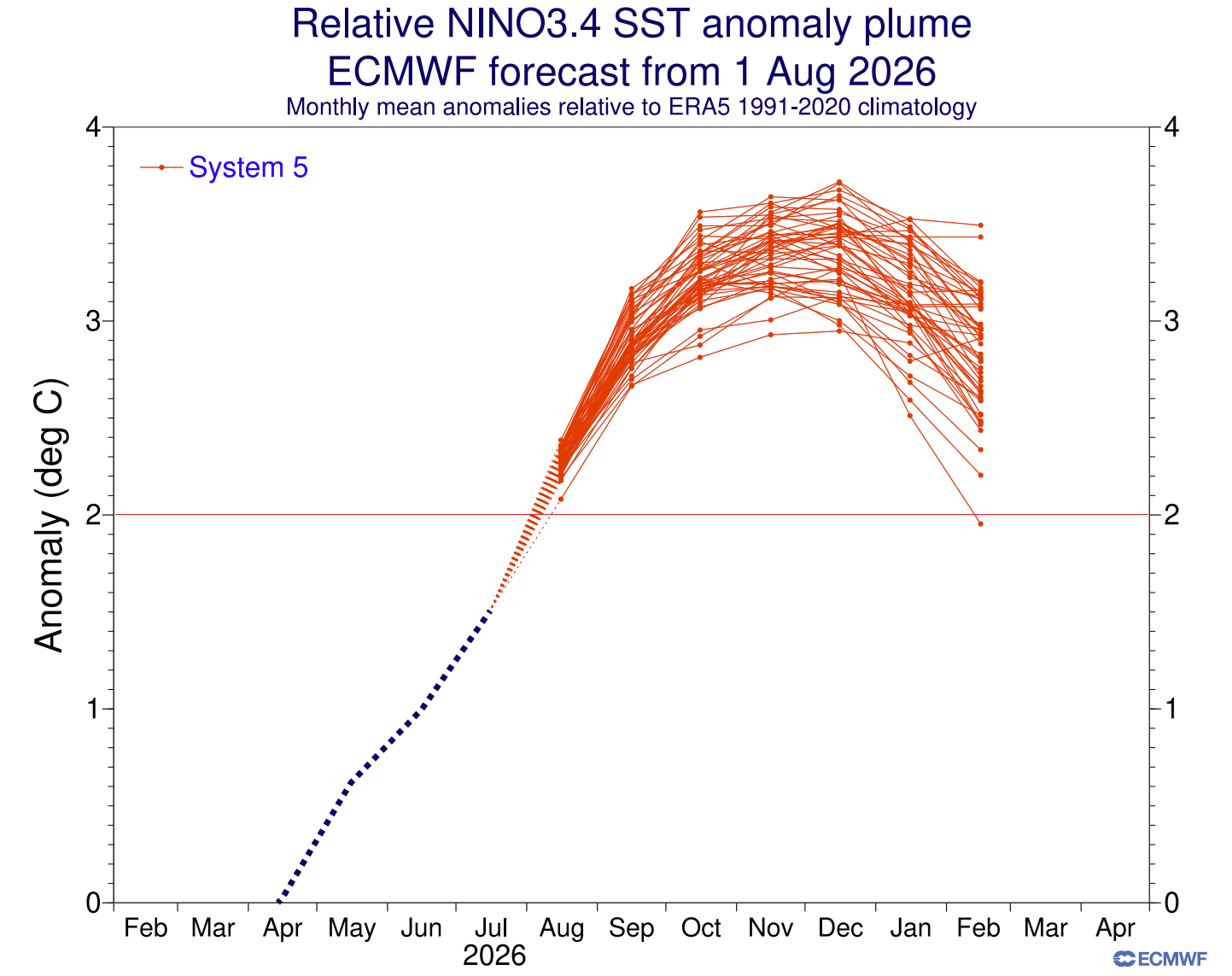
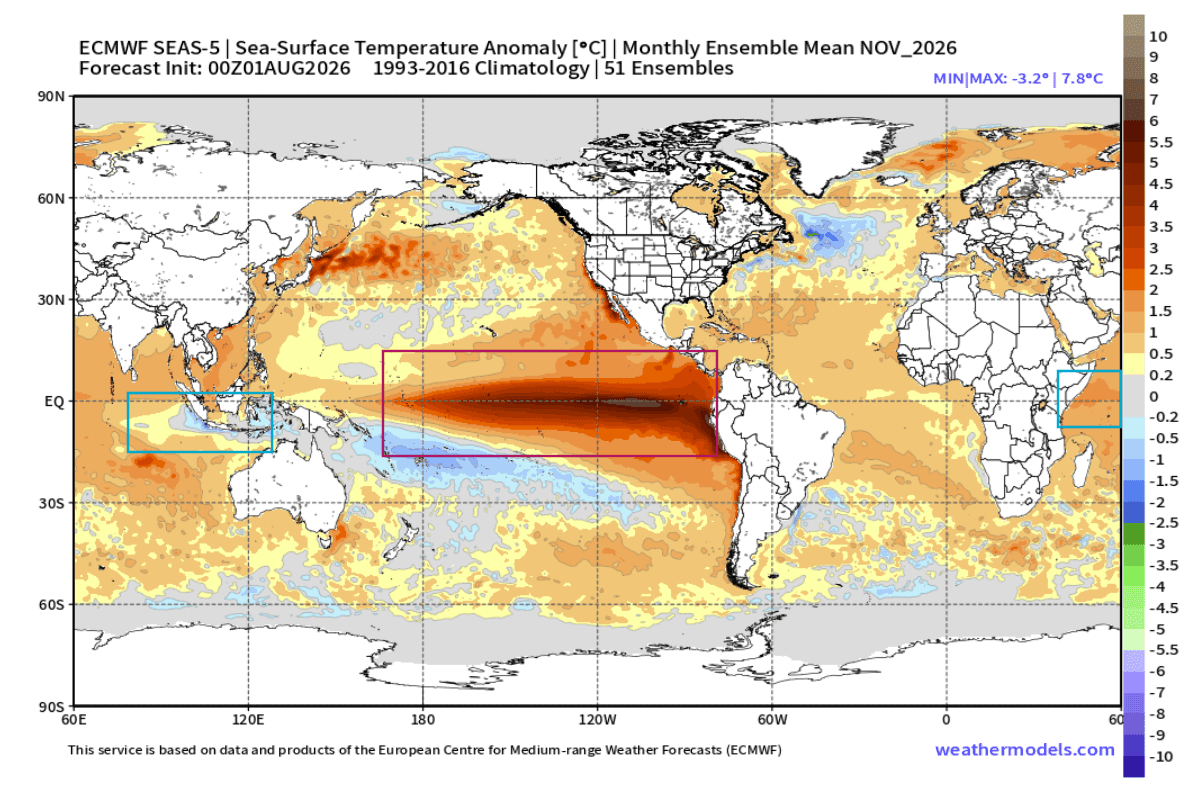
- August 2026: The IOD officially entered a sustained positive phase. Simultaneously, the Pacific warming breached the +4°C anomaly threshold in central regions, confirming the "Super" classification of the current El Niño event.
- Fall 2026: Forecasts indicate that the combined forcing will peak as the atmosphere "locks" into a pattern of persistent rising air over the Pacific and sinking air over the Indian Ocean.
- Winter 2026/2027: This configuration is expected to dictate the jet stream path throughout December, January, and February, creating a season of extremes.
Supporting Data and Meteorological Analysis
The complexity of this forecast is backed by multi-model ensembles, including the European Centre for Medium-Range Weather Forecasts (ECMWF) and the National Centers for Environmental Prediction (NCEP).
The Subsurface Engine
The heart of this event lies 500 meters beneath the surface of the Pacific. The deep-core temperature anomaly, which has peaked at over 8 degrees above normal, demonstrates the sheer scale of the energy available. This Kelvin Wave, fueled by weakened trade winds, is currently rising to the surface, where it is expected to sustain an extreme El Niño that could surpass the +3°C anomaly threshold—making it one of the most significant climate events in recorded history.
The Atmospheric Standing Wave
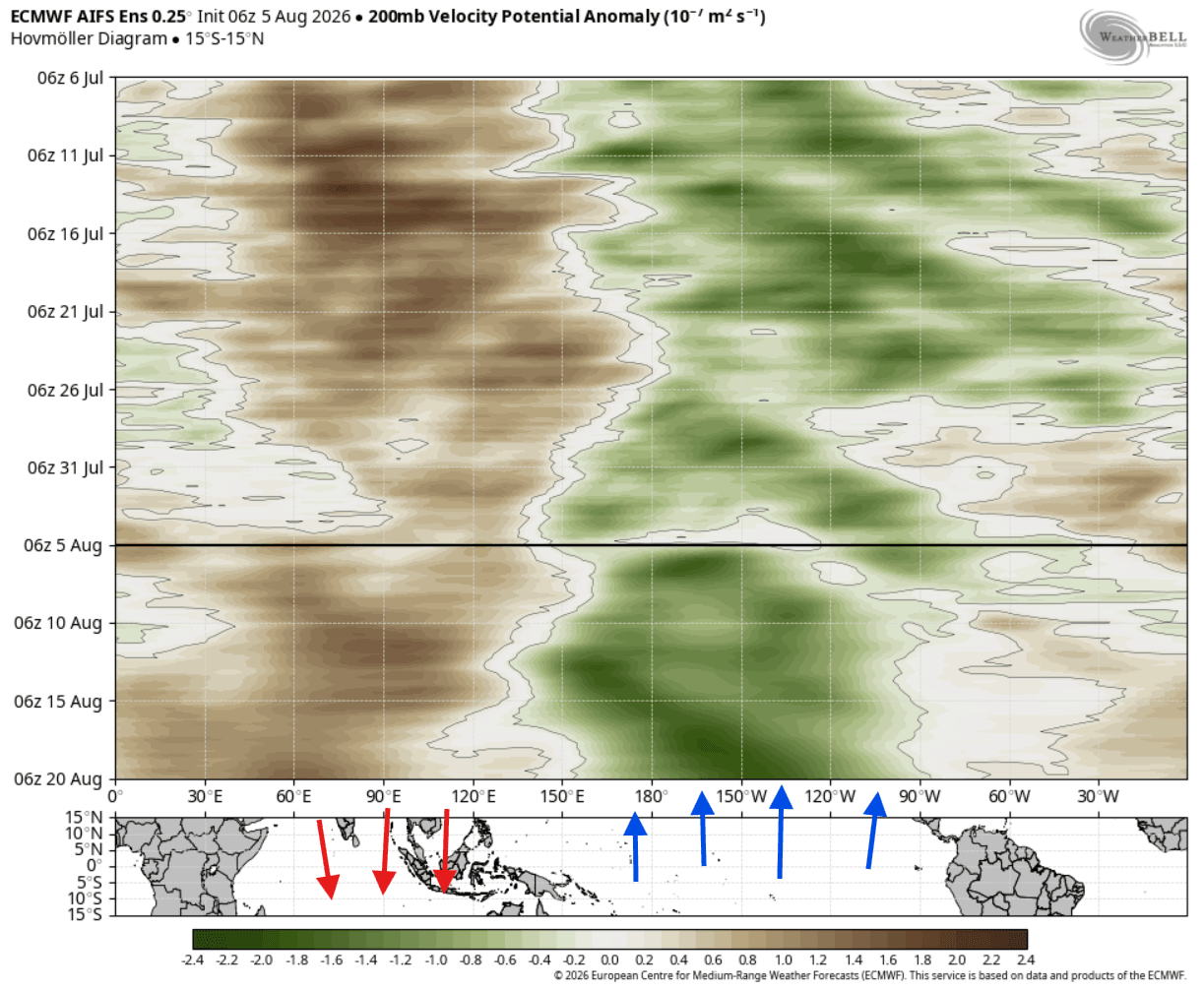
Atmospheric motion analysis reveals a "standing wave" pattern. Green-coded areas representing rising air are anchored over the tropical Pacific, while brown-coded areas of sinking air dominate the Indian Ocean. This configuration acts as a giant atmospheric pump, pushing energy into the upper levels of the atmosphere and creating a planetary wave train. This wave train travels across the globe, effectively "steering" the jet stream like a ship’s rudder.
Implications for North America and Europe
The structural impact of this dual-ocean forcing is profound, particularly for the United States, Canada, and Europe.
North America: A Tale of Two Winters
The 2026/2027 forecast suggests a "split-flow" pattern across North America. A persistent high-pressure ridge is expected to anchor itself over Canada and the northern United States, leading to milder-than-average temperatures in these regions.
Conversely, the southern United States will likely bear the brunt of a highly active southern storm track. As the Pacific jet stream steers moisture-laden, low-pressure systems into the southern tier, states from California to the Carolinas should prepare for increased precipitation. Where this moisture interacts with periodic cold air outbreaks from the north, the potential for significant winter storms, ice events, and heavy snowfall increases substantially. The Central and Eastern U.S. are currently identified as the primary corridors for these winter weather events.
Europe: A Westerly Influence
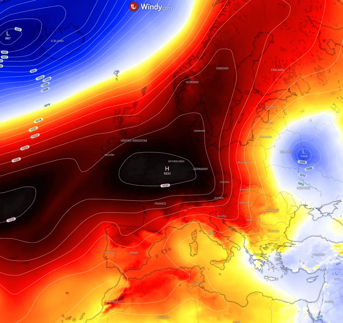
Europe’s experience will be largely defined by an amplified westerly flow. The research suggests that the atmospheric wave train crossing North America will push low-pressure anomalies into the North Atlantic. This creates a strong pressure gradient that will likely bring mild, moisture-heavy air into Europe. While this pattern typically favors warmer-than-normal winters for the continent, it does not preclude extreme weather; the increased moisture transport from the Atlantic will likely drive higher-than-average precipitation, with occasional cold snaps occurring in the UK, Ireland, and northern Europe as individual low-pressure systems drift through.
Official Perspectives and Scientific Consensus
Leading meteorological institutions have been cautious but firm in their projections. The consensus is that while standalone IOD events often produce minor fluctuations in regional weather, the combination of a Super El Niño and a positive IOD is a force multiplier.
Scientific studies on atmospheric Rossby wave trains confirm that this specific pairing creates an "atmospheric domino effect." As the tropical energy is released, it forces a readjustment of global pressure systems. The real-world data, when compared to computer models, consistently suggests that winter storms may feed on this tropical energy more aggressively than initial simulations might predict. Consequently, the atmospheric response is often faster and more volatile than in neutral years.
Conclusion: Preparing for the Climate Shift
The upcoming winter is shaping up to be an exceptional climate event. With the Super El Niño and the positive Indian Ocean Dipole acting in tandem, the global weather engine is primed for a winter of significant shifts.
For residents in the southern United States, the primary concerns will be an increase in storm frequency and potential heavy winter precipitation. For those in Canada and the northern U.S., the expectation is a milder, more stable season under a dominant high-pressure ridge. Europe, meanwhile, should brace for a wet, windy, and generally mild winter driven by an active Atlantic corridor.
As the situation evolves through the fall, the meteorological community will continue to monitor the atmospheric standing wave. These large-scale oceanic anomalies are not merely temporary weather fluctuations; they are indicators of how the modern climate system reacts to extreme thermal energy. As we move closer to December, the focus will shift from seasonal averages to the specific timing and intensity of individual storm systems. Residents are encouraged to stay updated with local forecasts, as the "Super" nature of this El Niño ensures that even minor shifts in the jet stream could have cascading impacts on local weather.
The data referenced in this report relies on the latest ensemble models from the ECMWF and NOAA. As with all long-range forecasting, these trends represent statistical probabilities based on current ocean-atmosphere coupling. Updates will be provided as the season progresses and as the atmospheric state solidifies into its winter configuration.