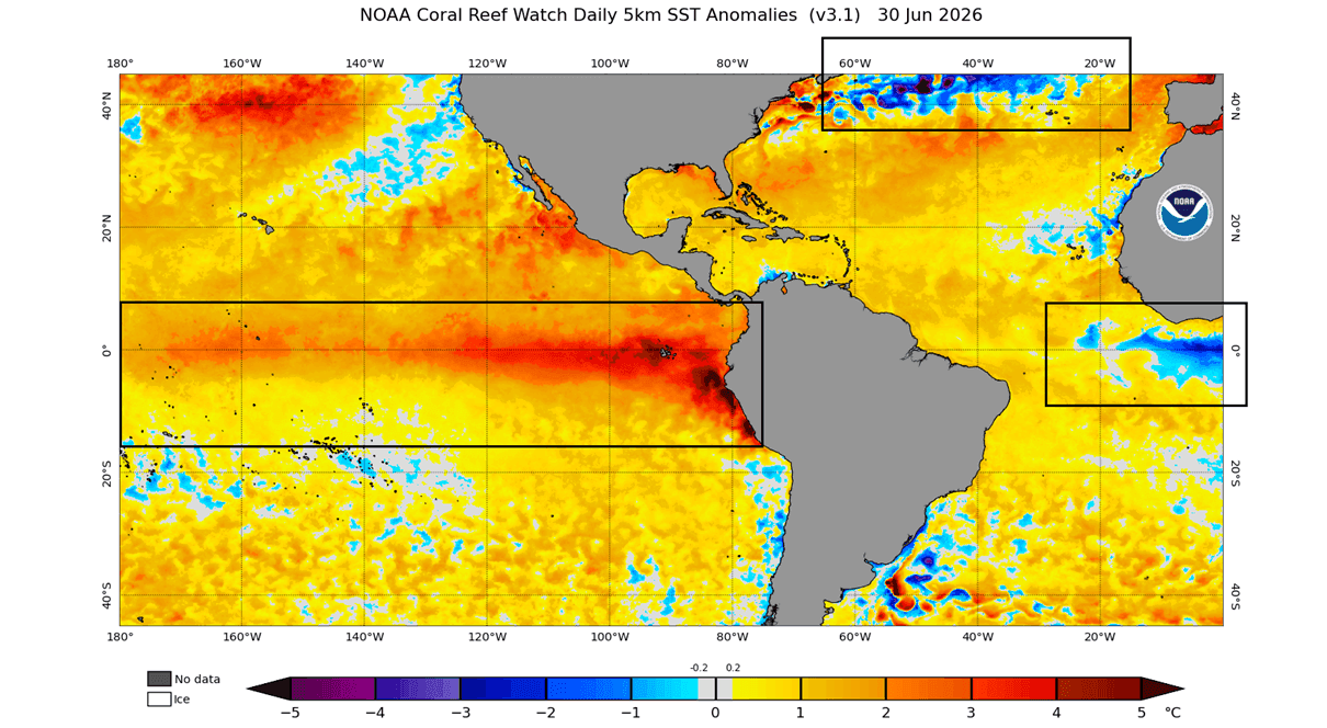
As we move into the second half of 2026, meteorologists and climate scientists are turning their attention to a rare and potentially volatile intersection of global oceanic forces. The emergence of a powerful "Super El Niño" in the tropical Pacific is coinciding with the resurgence of a massive cold-water anomaly in the North Atlantic—a phenomenon colloquially known as the "Cold Blob."

This dual-forcing scenario is creating a complex atmospheric blueprint that global climate models suggest will dictate the character of the upcoming Winter 2026/2027. For residents across the United States, Canada, and Europe, these oceanic signals are not merely academic; they are the primary indicators of potential shifts in jet stream positioning, pressure patterns, and temperature extremes for the coming season.
Main Facts: The Global Oceanic Tug-of-War
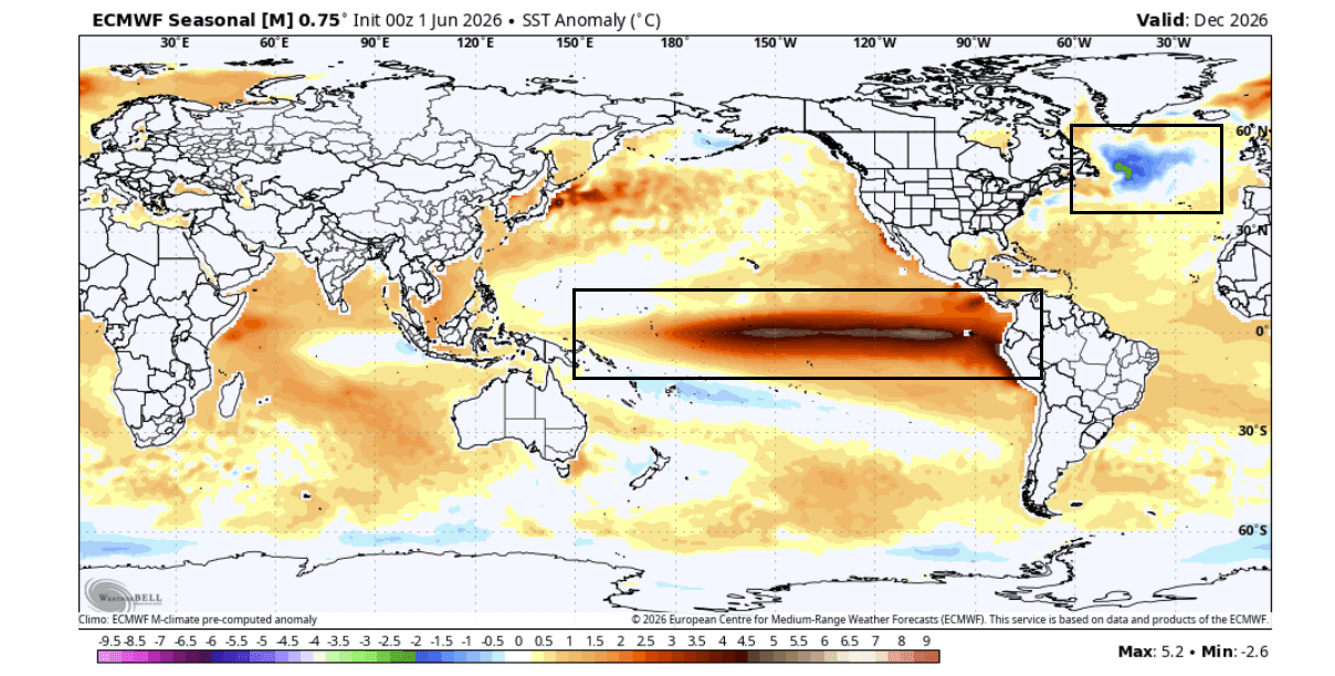
The current climatic state is defined by two primary, yet opposing, drivers. In the tropical Pacific, a Super El Niño event is rapidly gaining momentum. El Niño—the periodic warming of the central and eastern tropical Pacific—is a well-documented driver of global weather patterns. When it reaches "Super" status, its influence on the atmosphere becomes significantly more pronounced, often disrupting traditional jet stream tracks.
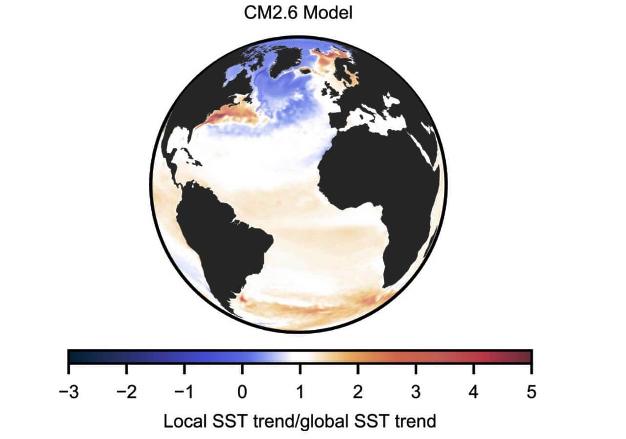
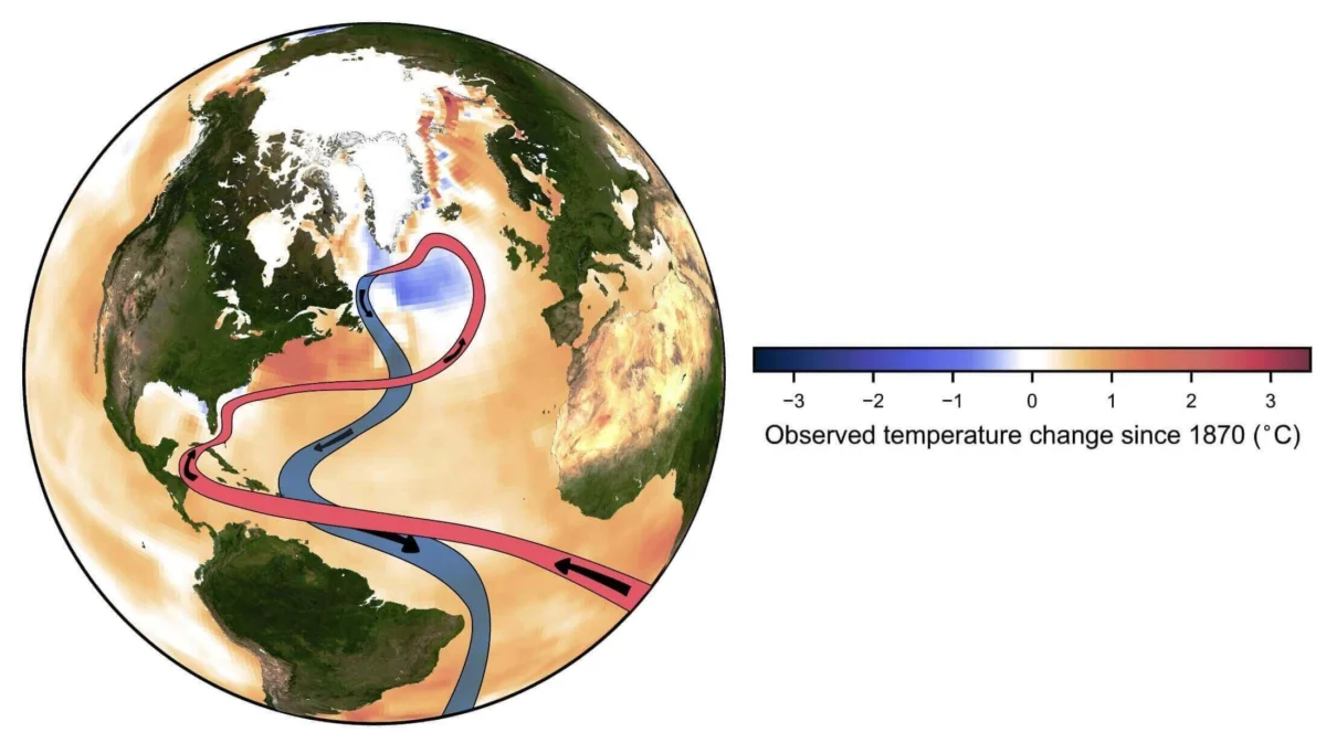
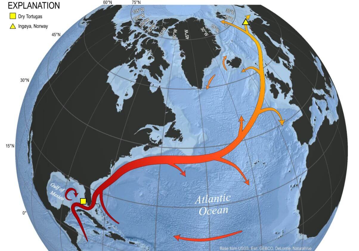
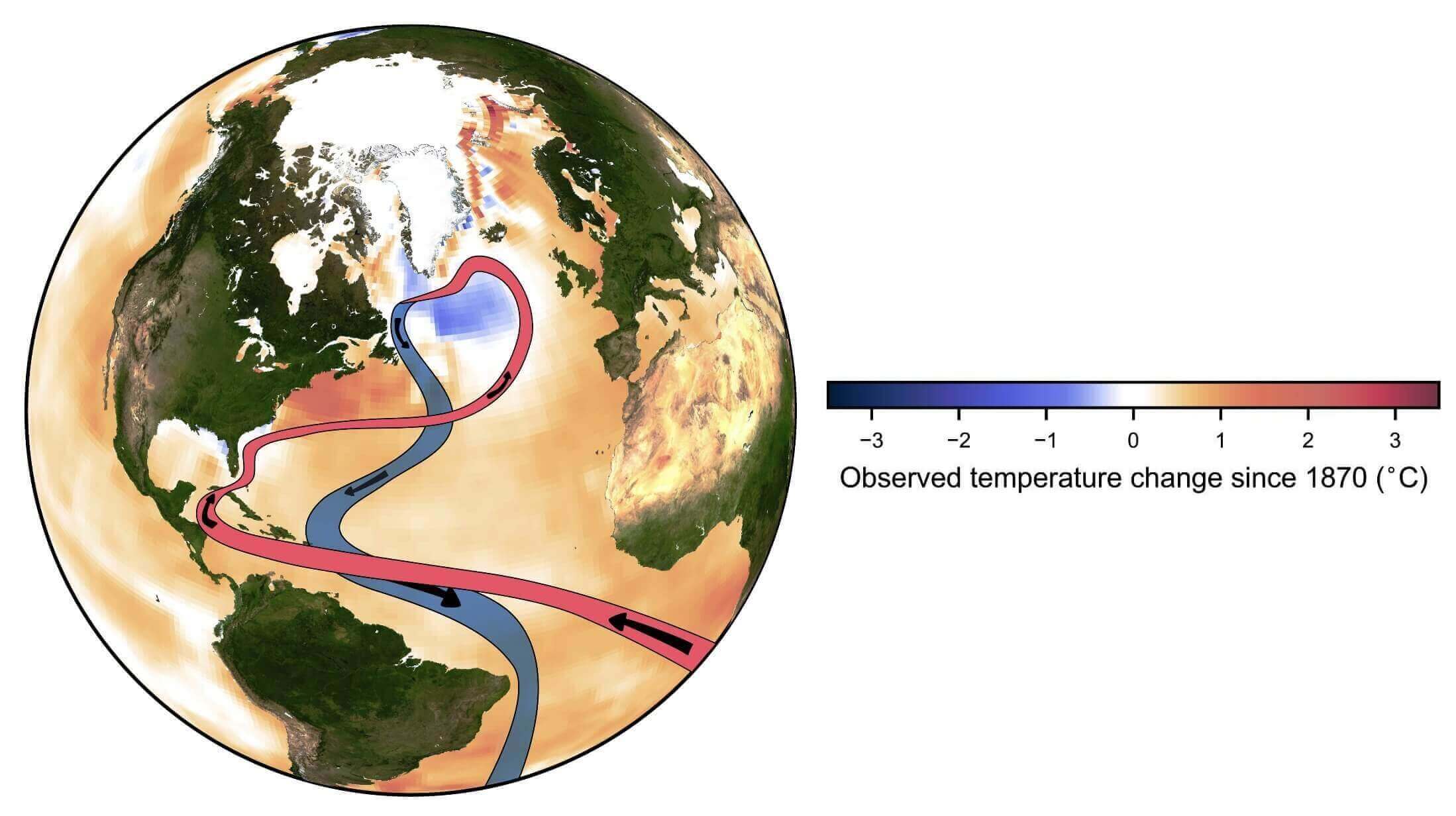
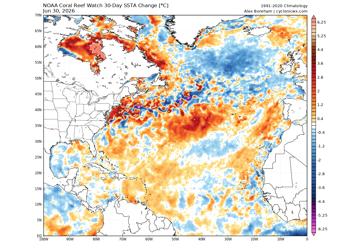
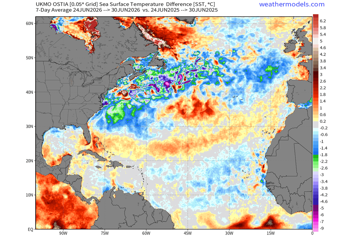
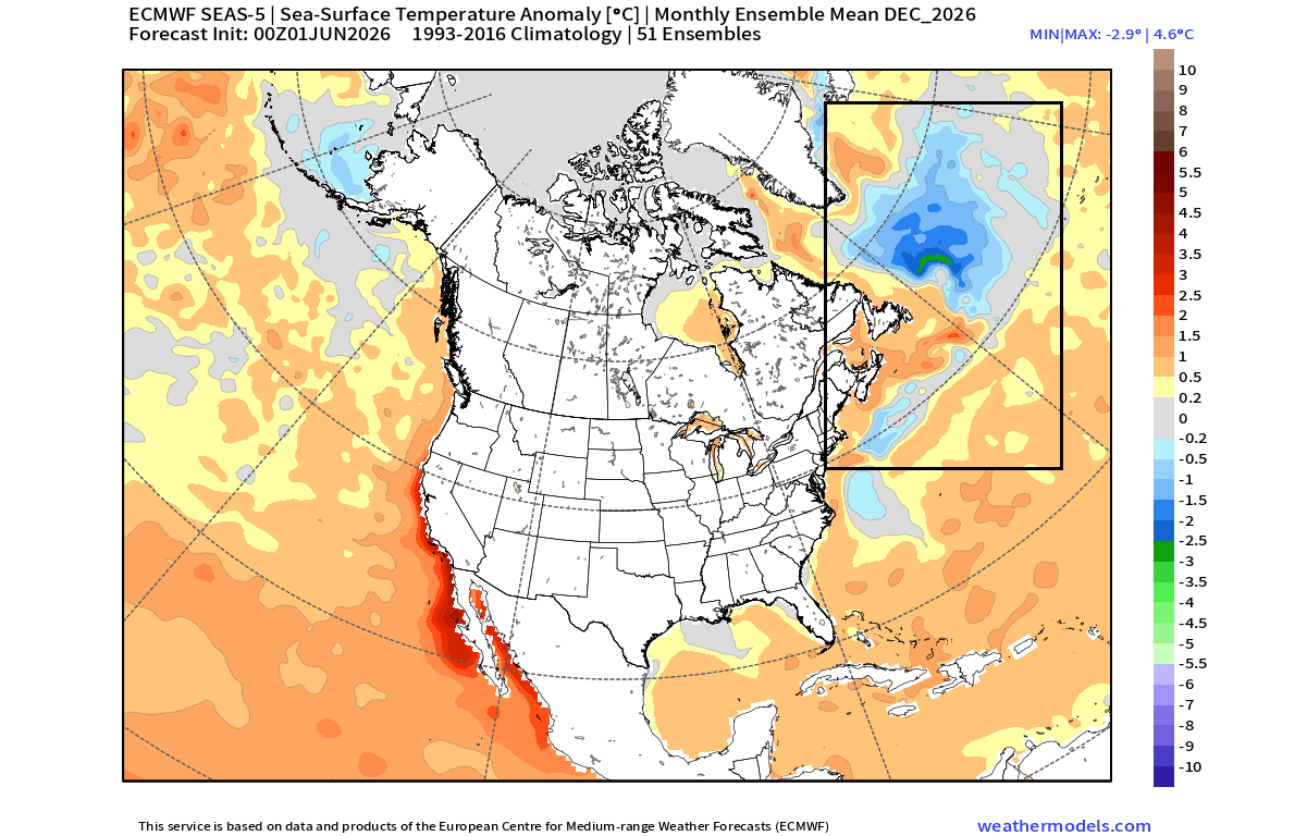
Simultaneously, the far North Atlantic is exhibiting a pronounced cooling trend. Ocean analysis reveals that a "Cold Blob"—an area of significantly below-average sea surface temperatures—is expanding in the subpolar gyre. This region is critical, as it serves as a "sink" for the Atlantic Meridional Overturning Circulation (AMOC), the conveyor belt of heat that regulates temperatures across the Northern Hemisphere. The persistence of this cold anomaly suggests that the North Atlantic is experiencing a significant, perhaps structural, cooling phase that will likely persist well into the early months of 2027.
Chronology: The Evolution of the 2026 Pattern
The shift began to manifest in early summer 2026. By July, satellite-derived sea surface temperature (SST) data from NOAA’s Coral Reef Watch (CRW) and other oceanic monitoring platforms confirmed that the North Atlantic was cooling at a rate exceeding initial projections.
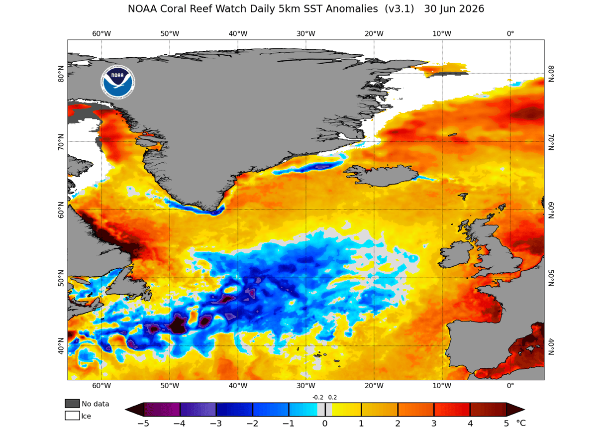
- Early June 2026: Initial signs of a developing "Cold Blob" appeared east of Newfoundland, signaling a potential slowdown or disruption in the traditional heat-transport mechanisms of the Gulf Stream.
- July 2026: The anomaly became more organized. Surface temperature maps showed a 0.5 to 2-degree Celsius drop compared to the same period in 2025.
- Late Summer 2026: The Super El Niño in the Pacific began to "break" into the atmosphere, coupling with the Pacific-North American (PNA) pattern, a key index for predicting winter weather across the continent.
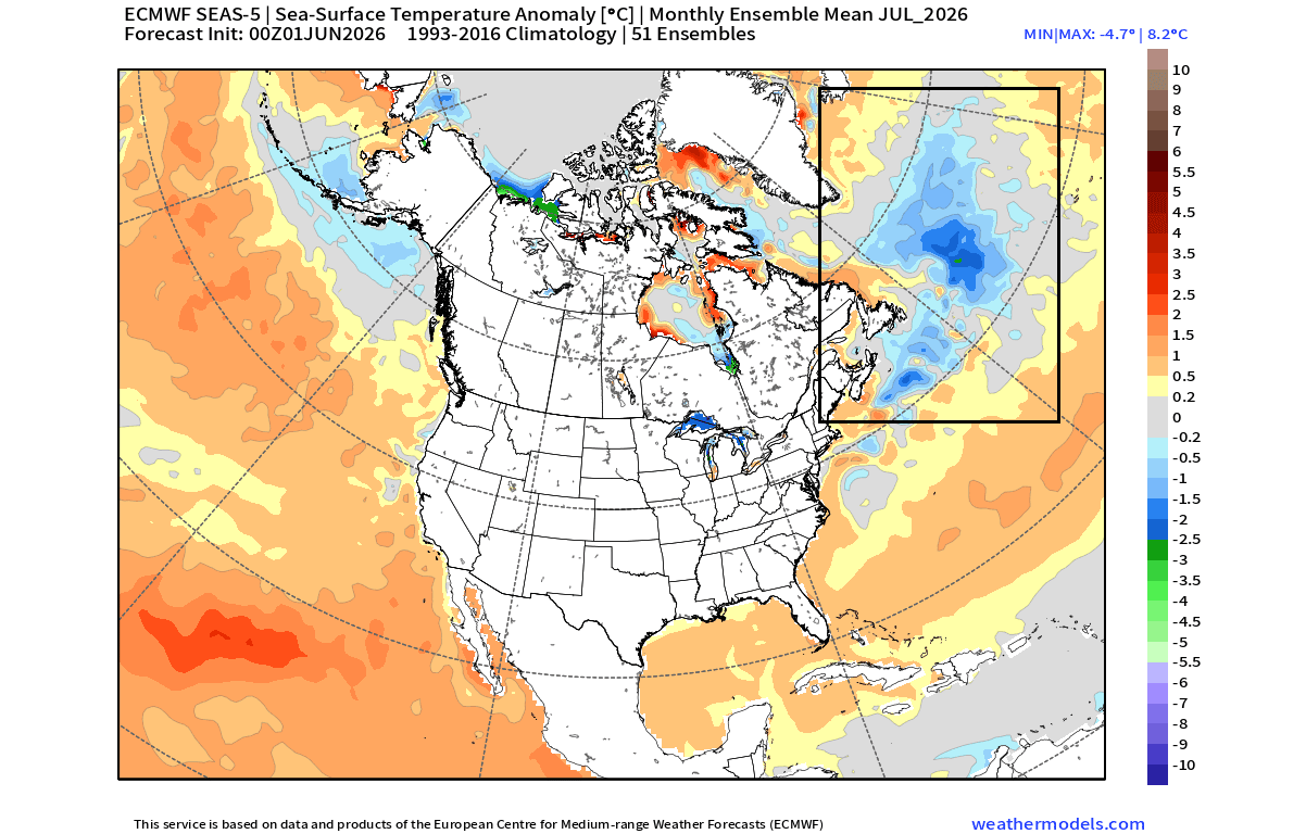
- Forecast Outlook (December 2026): Predictive models from the ECMWF (European Centre for Medium-Range Weather Forecasts) and the Canadian seasonal system (CanSIPS) indicate that both the Pacific warming and Atlantic cooling will hold their positions, setting the stage for a high-contrast winter.
Supporting Data: The AMOC and the PNA Connection
The relationship between the North Atlantic and the atmosphere is a subject of intense research. The AMOC, which includes the Gulf Stream, acts as a heat pump, bringing warm tropical waters to the North Atlantic and keeping Western Europe and the U.S. East Coast significantly warmer than they would otherwise be.
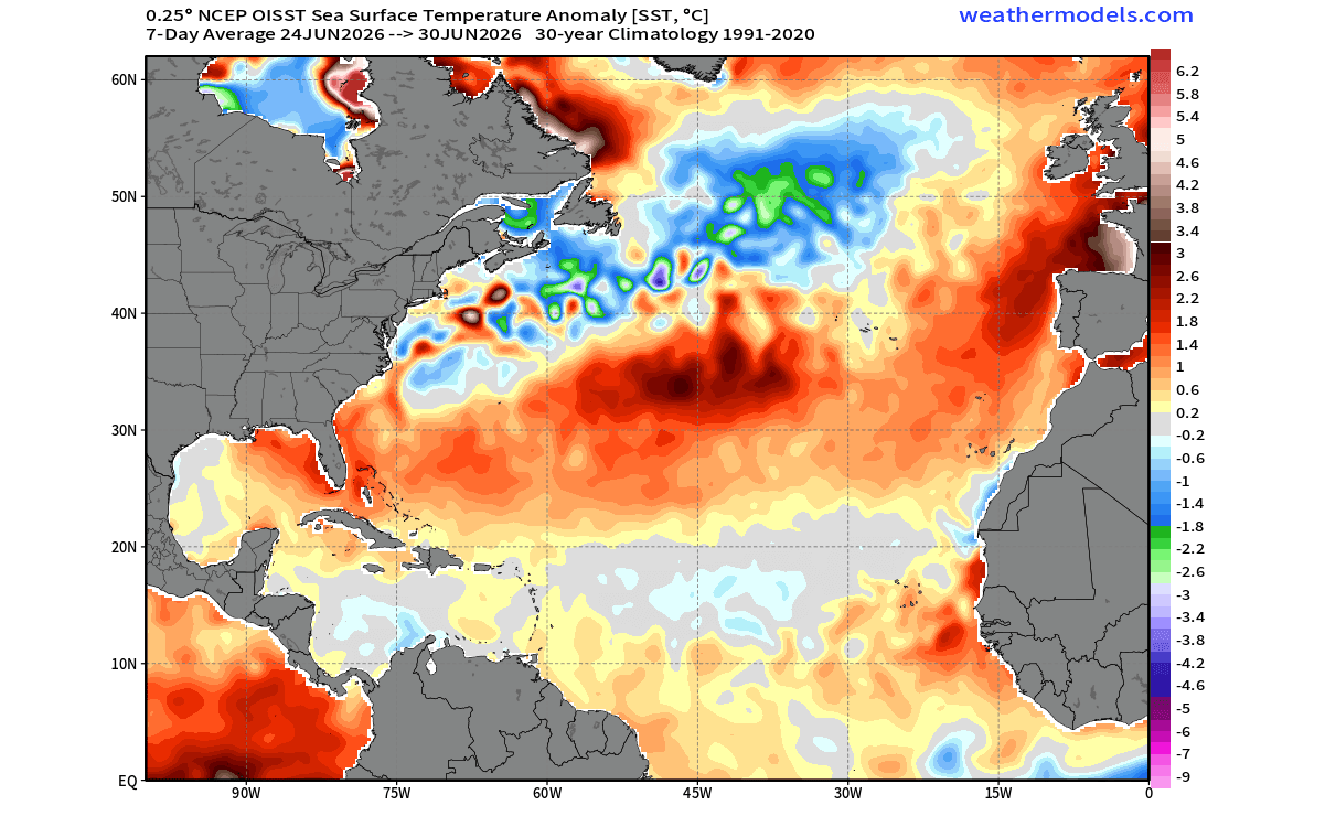
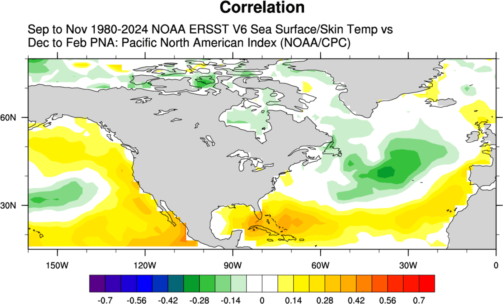
When the AMOC weakens—as indicated by the persistent cold anomaly in the subpolar North Atlantic—the atmospheric response is often immediate. Historical data from the last two decades demonstrates that a cold Atlantic anomaly frequently precedes a positive Pacific-North American (PNA) pattern.
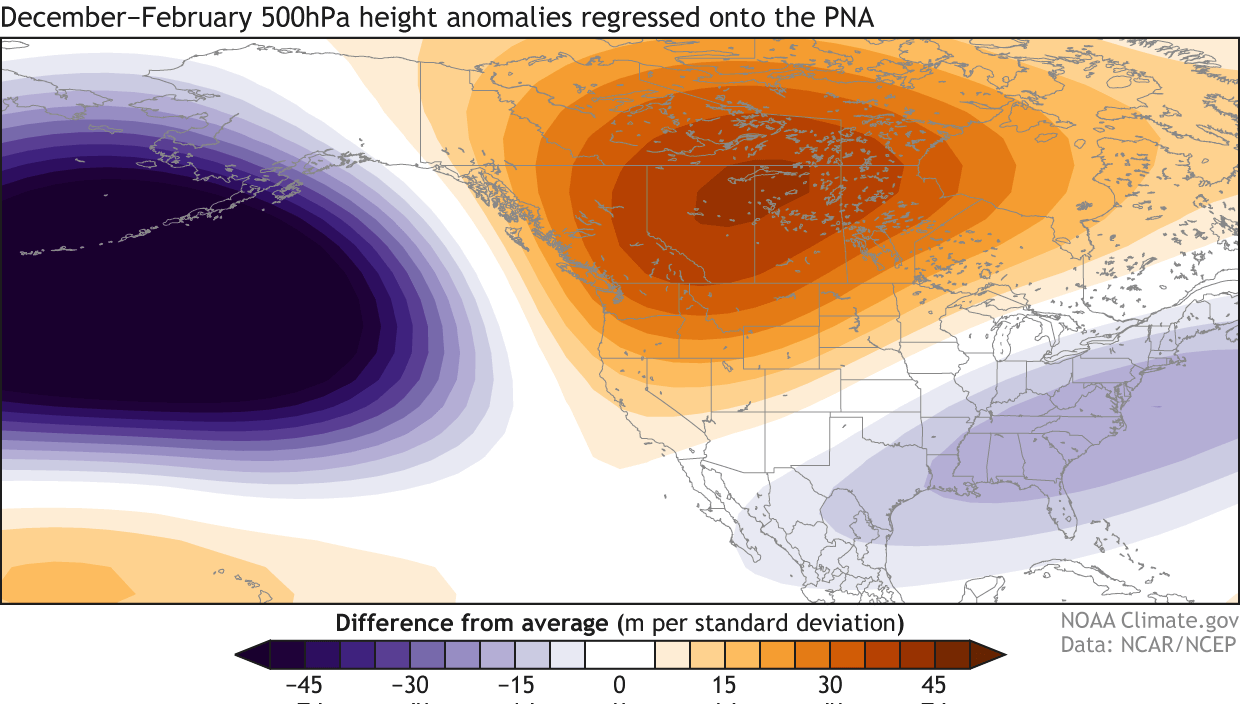
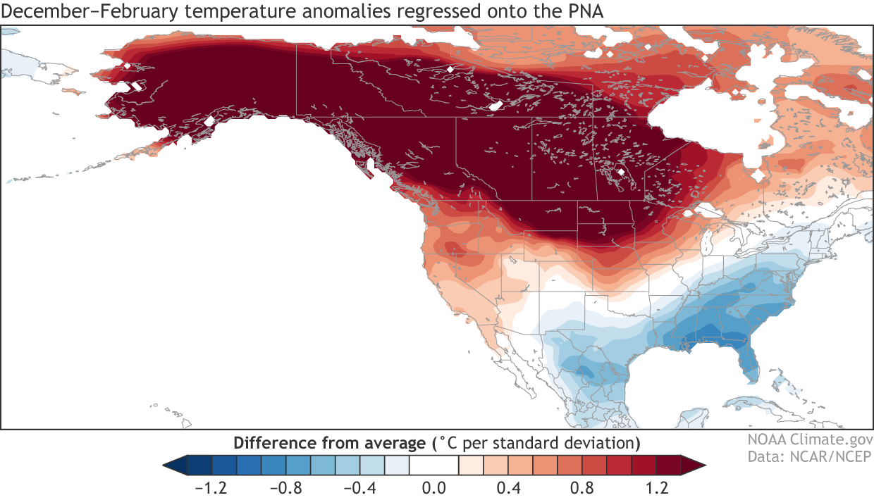
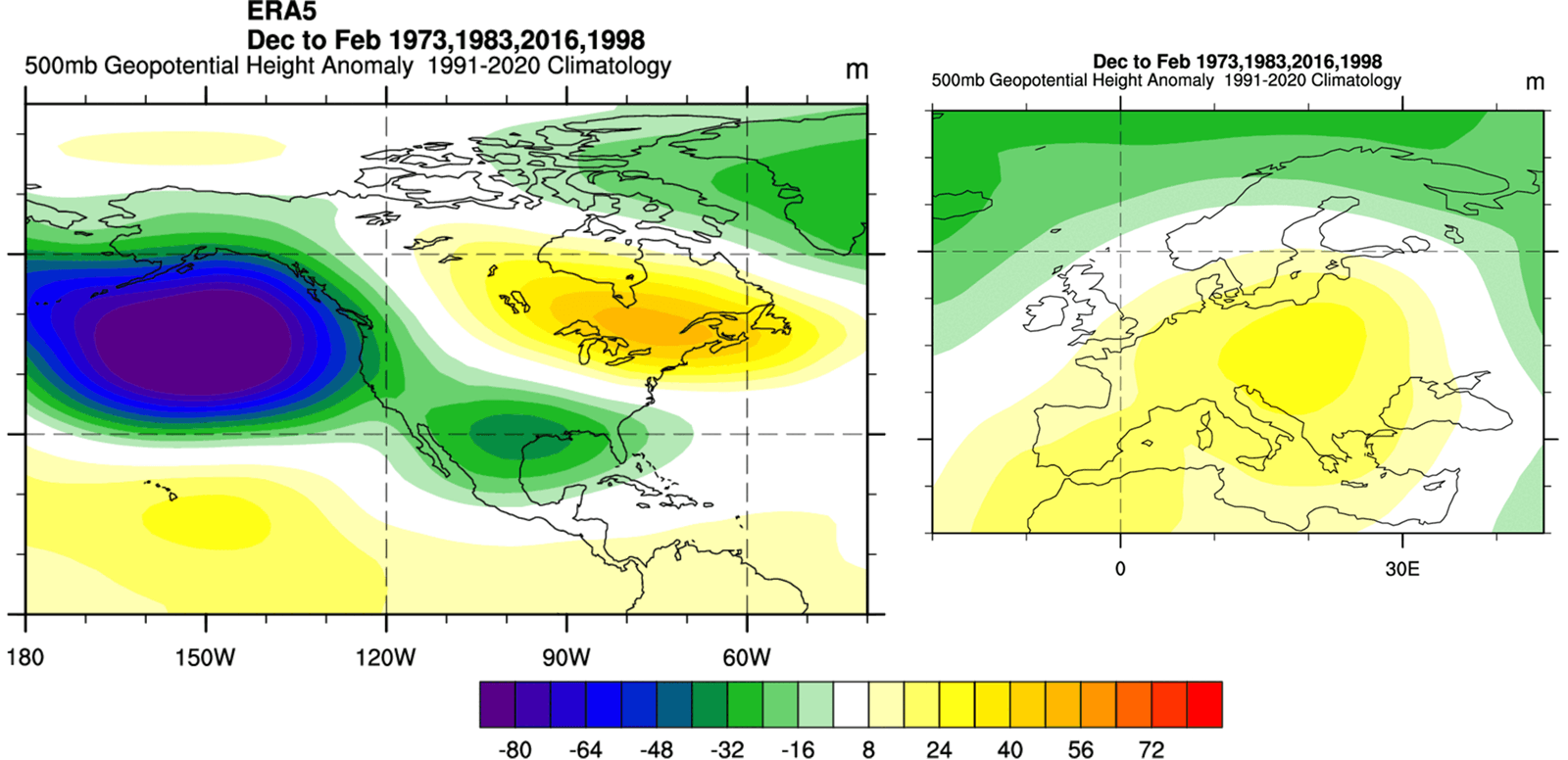
The PNA index measures the pressure anomalies between the North Pacific and North America. A positive PNA phase, which is currently favored by the developing Super El Niño, typically features:
- High-pressure ridging: Occurring over the western United States and western Canada, leading to unseasonably warm, dry conditions in those regions.
- Deep troughs: Developing over the central and eastern United States, which channel arctic air southward.
- The "Cold Corridor": A tendency for the eastern U.S. and eastern Canada to experience more frequent and intense cold-air outbreaks as the jet stream dips into these regions.
Comparison with the 2014-2015 and 2025-2026 winters, which featured similar oceanic configurations, provides a strong historical analog. In those instances, the interaction between the cold Atlantic and the warm Pacific Pacific generated a persistent "Polar Vortex" core over the East, resulting in volatile winter temperatures and significant snowfall events in regions that were otherwise expected to have mild winters.
Official Responses and Model Consensus
Major climate agencies, including the NOAA Climate Prediction Center (CPC) and the ECMWF, are currently utilizing these models to provide long-range seasonal outlooks. The consensus among the CFS (Climate Forecast System) and other global models is striking: there is a high degree of confidence in the development of a strong positive PNA pattern for the winter of 2026/2027.
The models indicate that while the northern tier of the United States and Canada may experience warmer-than-average temperatures due to the high-pressure ridge, the central and eastern U.S. are positioned for colder-than-normal periods. Conversely, Europe is expected to see a different set of consequences. As the high-pressure ridge from the south migrates, it may lead to warmer winter anomalies in parts of Western and Southern Europe, while Northern Europe may face periodic, sharp cold snaps as the atmospheric blocking patterns shift.
Implications: A Winter of Extremes
The implications for the coming winter are multifaceted, impacting energy markets, agriculture, and public safety.
Energy and Infrastructure
A winter characterized by a positive PNA pattern often leads to increased energy demand in the central and eastern United States. With the potential for the Polar Vortex to become displaced, local utilities must prepare for sudden surges in demand for heating. The "cold corridor" from Western Canada into the Eastern U.S. suggests that infrastructure will be tested by rapid temperature fluctuations.
Agriculture and Seasonal Planning
For the agricultural sector, particularly in the U.S. Midwest and Eastern Canada, the forecast poses a dual threat. The early-season warmth predicted by the El Niño influence could cause premature growth, leaving crops vulnerable to the sharp, late-season cold snaps associated with the Atlantic anomaly. Farmers are advised to prepare for a winter that may be marked by more variability than the historical average.
Global Climate Dynamics
Finally, this year serves as a critical case study in how the atmosphere manages "global forcing." Scientists are observing the "dashboard lights" of the planet—the sea surface temperatures—to understand how the climate system compensates for the rapid cooling of the North Atlantic. If the current trajectory continues, it suggests that the climate system is shifting into a new, more volatile mode of operation where regional anomalies are increasingly linked to global drivers.
Conclusion
The winter of 2026/2027 is shaping up to be a defining season for climate research. By observing the "Cold Blob" in the Atlantic and the "Super El Niño" in the Pacific, we gain a unique window into the mechanics of our planet. While long-range forecasting carries inherent uncertainties, the convergence of these two massive indicators provides a rare level of clarity for the months ahead.
As the atmosphere and the oceans continue their complex dance, the data suggests that for millions across North America and Europe, the coming winter will be a testament to the power of these global drivers, underscoring the necessity for robust, science-based preparedness in an era of shifting climatic norms. As the seasonal transition approaches, constant monitoring of these ocean-atmospheric "control lights" remains the most effective tool for navigating the winter to come.