The Iberian Peninsula is currently under the shadow of an unforgiving atmospheric furnace. A robust, stagnant "heat dome"—a high-pressure system of immense intensity—has anchored itself over southwestern Europe, setting the stage for what meteorologists characterize as one of the most significant and potentially record-shattering thermal anomalies of the early summer season. As the mercury prepares to climb toward a staggering 45 to 47°C, Spain and Portugal are bracing for a period of extreme meteorological stress that threatens both public safety and regional infrastructure.
The Anatomy of the Event: A Saharan Intrusion
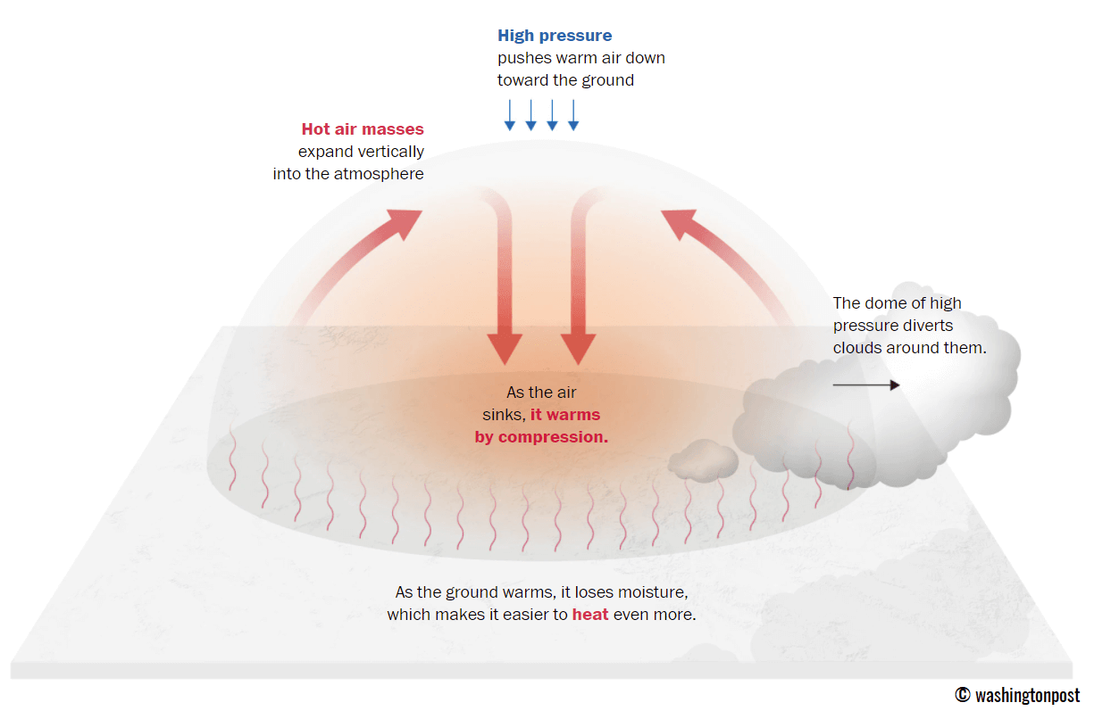
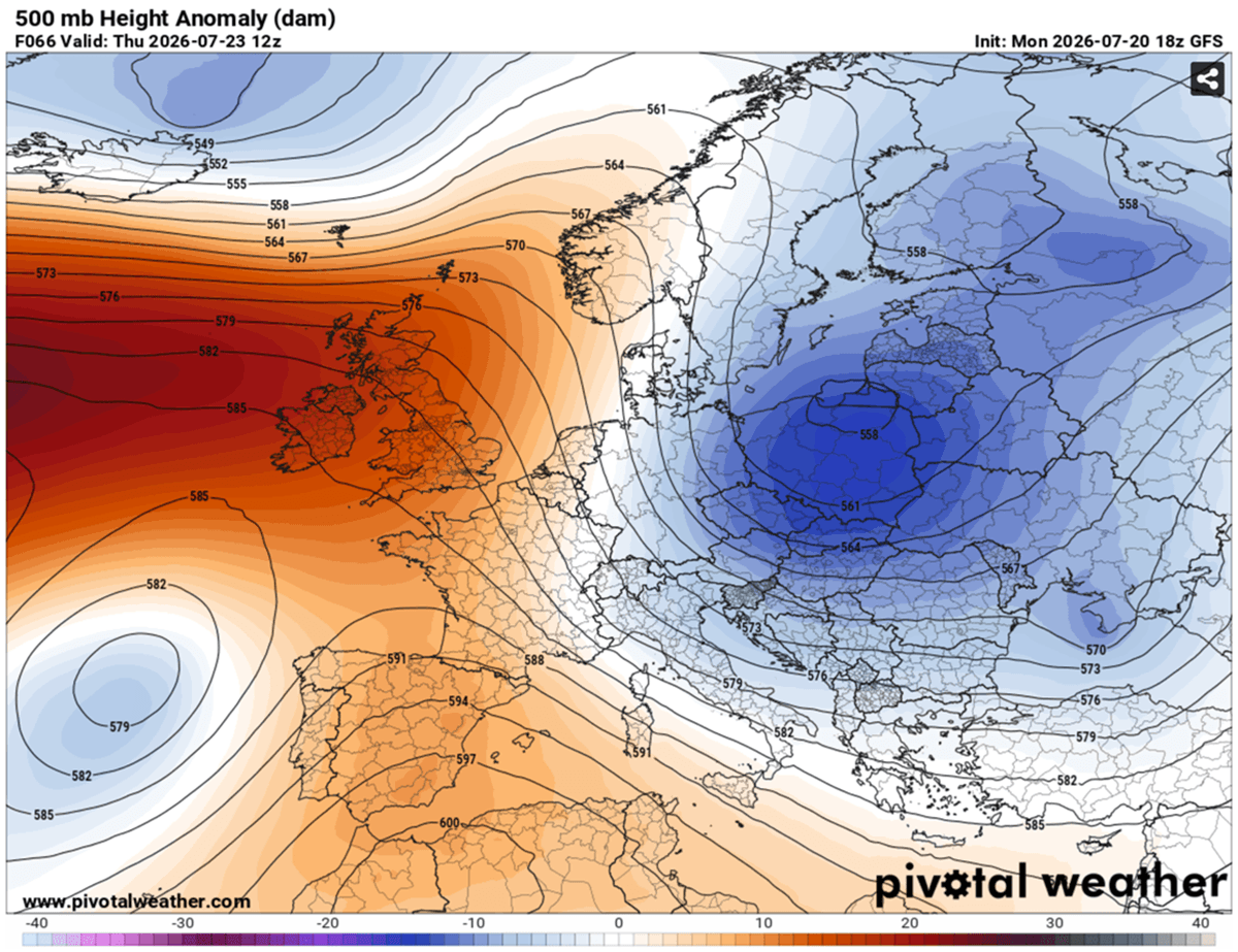
This is not merely a standard summer heatwave. The event is fueled by a massive, sustained pulse of superheated air originating directly from the heart of the Sahara Desert. As the high-pressure ridge stabilizes over Southwestern Europe, it acts as a lid on a pot, trapping and compressing hot air near the surface.

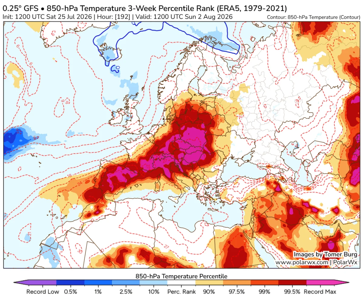
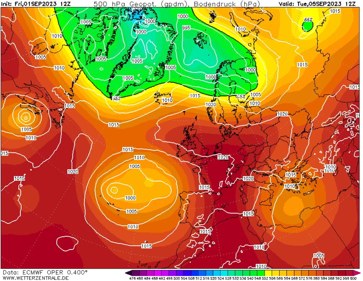
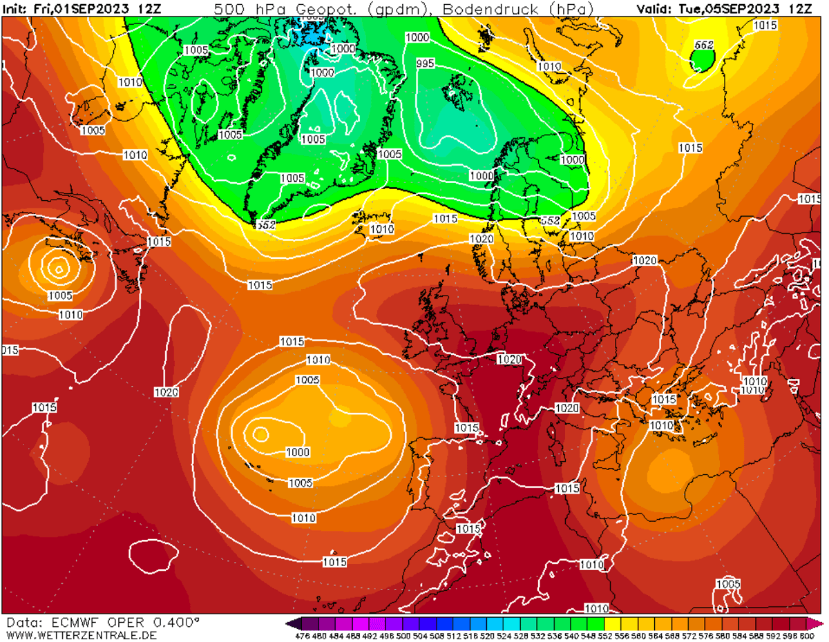
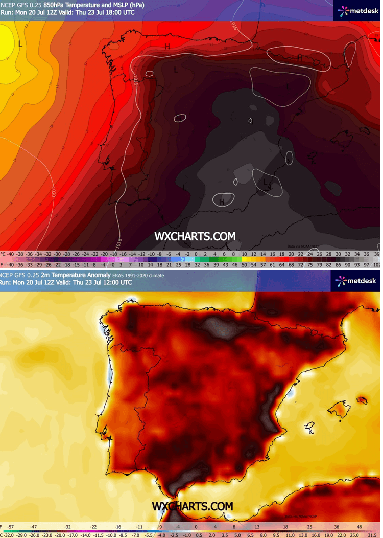
Meteorologists note that the synoptic setup is reinforced by a cut-off low-pressure system to the west, which acts as a pump, drawing the arid, scorching air mass across the Iberian landscape. At the 850 mbar level—a critical metric for atmospheric scientists—temperatures are forecast to exceed 30°C, a value rarely seen this far north. This translates to surface-level temperatures that are 10 to 15°C above the seasonal norm, a discrepancy that pushes the human body’s thermoregulatory capabilities to their absolute limit.
Chronology of the Surge
The progression of this heat event is rapid and relentless. By mid-week, the ridge will reach its maximum intensity.
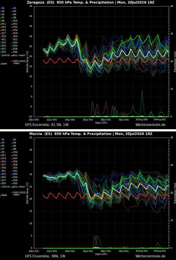
- Wednesday: Initial peak conditions will settle over central and southern Spain. Forecast models, including the global GFS and regional ARPEGE systems, indicate a consistent surge to 42–44°C across the interior plains, while coastal regions will begin to feel the pressure of the rising heat.
- Thursday: The heat reaches its zenith. As the air mass compresses against the interior plateaus, downslope "foehn" winds will strip remaining moisture from the air, causing temperatures in the Guadalquivir and Ebro valleys to skyrocket. Projections for Murcia, Alicante, and Valencia suggest that thermometers may hit the 46–47°C range, flirting with the absolute historical maximums for these provinces.
- Friday: While western regions of the peninsula may begin to experience minor relief as more humid Atlantic air filters in, the central and eastern corridors will remain trapped in the heat dome’s grip. Temperatures are expected to remain in the 45°C range, maintaining a high-stakes environment for emergency services and public health officials.
The "Heat Dome" Mechanism
To understand the severity of this event, one must grasp the physics of the "Heat Dome." When a large-scale high-pressure system parks over a continent, it creates a feedback loop. High-altitude air sinks toward the ground; as it sinks, it compresses and warms adiabatically. Because the air is trapped by the high-pressure dome, it cannot escape or circulate.
This process is exacerbated by the Iberian Peninsula’s unique topography. As winds are forced over mountain ranges and descend into the interior lowlands, they undergo further adiabatic warming. This "downslope" effect essentially supercharges the heat, explaining why the Guadalquivir and Ebro valleys—historically the hottest zones in Spain—consistently report the most extreme, near-record spikes during these synoptic events.
Comparative Data: Historical Context and Records
The stakes for this week’s heatwave are set against a backdrop of historic extremes. Spain’s official record, validated by the national meteorological agency AEMET, stands at 47.6°C, recorded in La Rambla (Córdoba). For context, this is only 1.2°C shy of the all-time European record of 48.8°C, recorded in Syracuse, Sicily, in 2021.
- La Rambla, Córdoba: 47.6°C (Record holder).
- Montoro: 47.4°C.
- Córdoba Airport: 46.9°C.
- Alcantarilla Air Base: 47.0°C (August 2021).
- Talavera de la Reina: 45.5°C.
The current forecast suggests that Murcia, in particular, is the most likely candidate to challenge its local benchmarks. Furthermore, the Ebro Valley’s record of 44.5°C (Zaragoza, 2015) is well within the projected margin of this week’s thermal spike.
Societal and Economic Implications
The consequences of this prolonged thermal peak extend far beyond physical discomfort. The impact on key regional sectors is expected to be profound:
Public Health and Vulnerable Populations
The lack of nighttime relief is a critical factor in this crisis. With overnight lows projected to remain in the mid-to-upper 20s, the human body is denied the opportunity to recover from daytime heat stress. This poses an acute risk to the elderly, the chronically ill, and children. Heat exhaustion and heat stroke are the primary medical concerns, and health systems across the peninsula are currently on high alert.
Occupational Hazards
Outdoor laborers—particularly those in agriculture and construction—face immediate danger. The combination of intense solar radiation and high ambient temperatures makes prolonged outdoor activity a life-threatening prospect. Authorities are expected to advise strict adherence to "cool-down" protocols and suggest shifts in working hours to avoid the peak heat between 12:00 PM and 6:00 PM.
Agricultural and Fire Risks
The agricultural sector is bracing for crop stress and irrigation shortages. Perhaps more ominously, the environmental conditions—characterized by low relative humidity and dry, gusty winds—create the perfect recipe for explosive wildfire behavior. Emergency management agencies have issued high-level warnings regarding fire ignition. Any spark in the current environment is likely to lead to rapid fire spread, making the coming days a period of maximum vigilance for forest fire prevention teams.
Infrastructure Strain
Power grids are under immense pressure as residential and industrial demand for air conditioning spikes. The heat can also impact transportation infrastructure, with the potential for rail buckling and road surface damage.
The Broader European Perspective
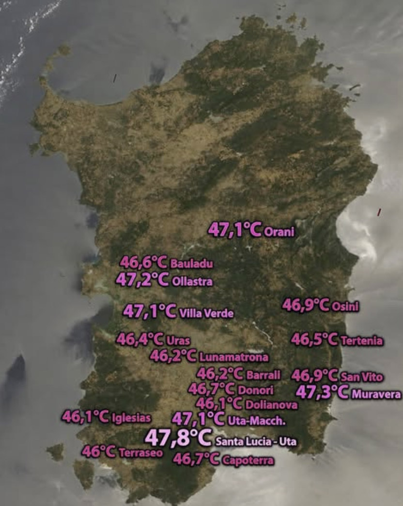
This event is not occurring in isolation. Recent weeks have seen the Mediterranean basin acting as a focal point for extreme heat. Sardinia recently reported temperatures as high as 47.8°C, while Algeria and Tunisia have seen the mercury touch 49°C.
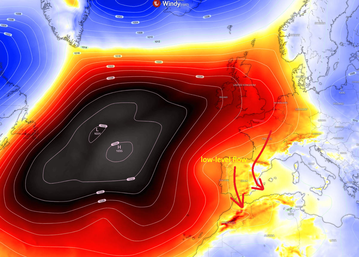
The movement of this heat dome is part of a larger, global trend of atmospheric blocking patterns. As the high-pressure system retrogrades westward into the Iberian Peninsula, it creates a stark contrast with the cooler, unsettled weather currently moving across Eastern Europe and the Balkans. This "Omega block" pattern—named for the shape the pressure contours take on a weather map—is known for its longevity and stability, meaning the heat is unlikely to dissipate rapidly once it sets in.
Conclusion: A Call for Vigilance
Meteorologists and civil protection agencies across Spain and Portugal are urging residents to take the situation seriously. With temperatures potentially reaching levels that have only been seen a handful of times in recorded history, the standard "summer precautions" are insufficient.
Citizens are advised to stay hydrated, avoid physical exertion during peak hours, and keep homes closed to trap cooler air during the day. As the heat dome remains locked over the peninsula, the focus must remain on the preservation of life and the protection of essential services. While the heatwave is expected to be relatively short-lived compared to some of the catastrophic month-long events seen in other parts of the world, its intensity is sufficient to cause lasting damage.
As the weekend approaches, the meteorological community will continue to monitor whether the dome will shift or intensify further. For now, the message remains clear: the Iberian Peninsula is entering a period of extreme danger, and caution is the only rational response.