By Editorial Staff
August 2026
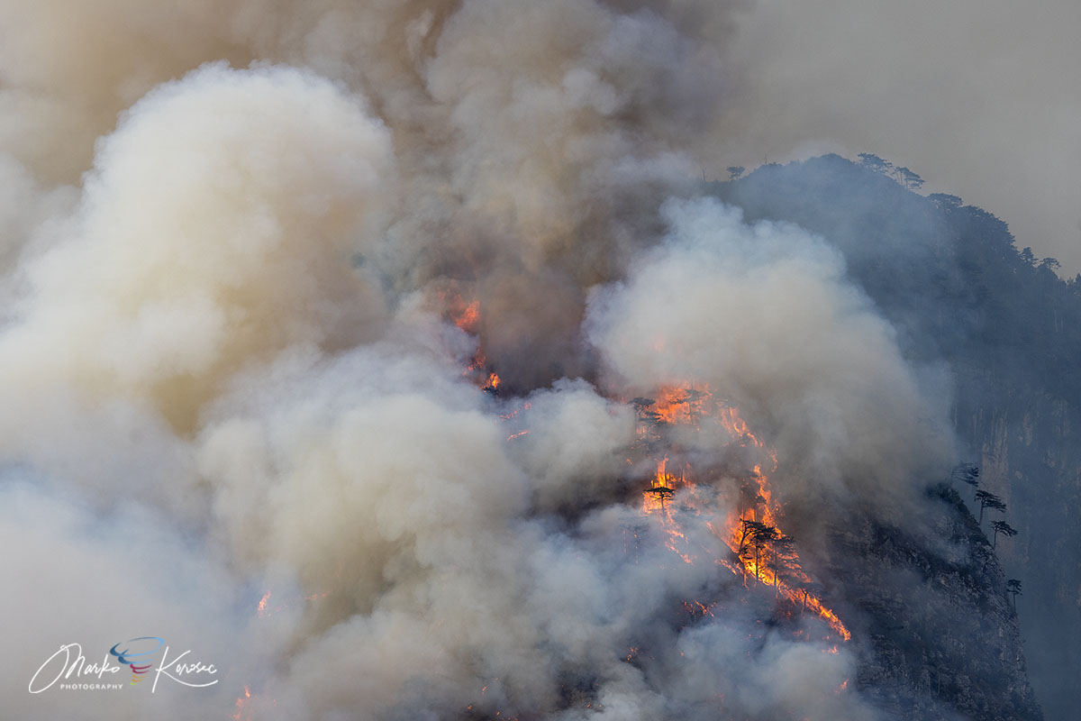
The rugged peaks of the Carnia region in Italy’s Friuli-Venezia Giulia (FVG) have long been defined by their limestone majesty and dense, ancient forests. However, for ten harrowing days this August, the silhouette of Monte Amariana was defined not by its natural beauty, but by a towering, relentless inferno. The blaze, which scorched over 600 hectares of vertical wilderness, pushed the limits of regional firefighting capabilities and brought the reality of climate-driven extreme weather to the doorstep of the municipality of Tolmezzo.

The containment of the fire, finalized by a fortuitous shift in weather patterns, marks the conclusion of one of the most severe forest fires in recent Alpine history—a disaster fueled by a lethal combination of a mid-summer heat dome, persistent drought, and the volatile topography of the Eastern Tolmezzo Alps.
The Genesis of the Blaze: A Perfect Storm
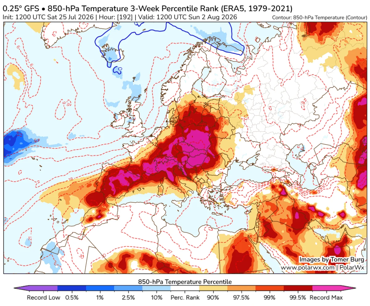
The disaster began with a meteorological "one-two punch" early in August 2026. As an intense heat dome settled over Southern and Central Europe, the mountainous landscape of the FVG region became a tinderbox. The combination of prolonged high temperatures and a severe rainfall deficit left the Pinus nigra forests—already prone to combustion—drier than they had been in decades.
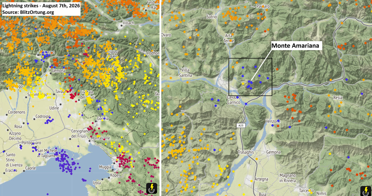
On August 7th, as a frontal wave moved through the region, the atmosphere destabilized. Lightning strikes, confirmed by regional detection networks, ignited the initial sparks on the upper slopes of Cuel Feltron, a steep, inaccessible spur of Monte Amariana overlooking the town of Amaro.
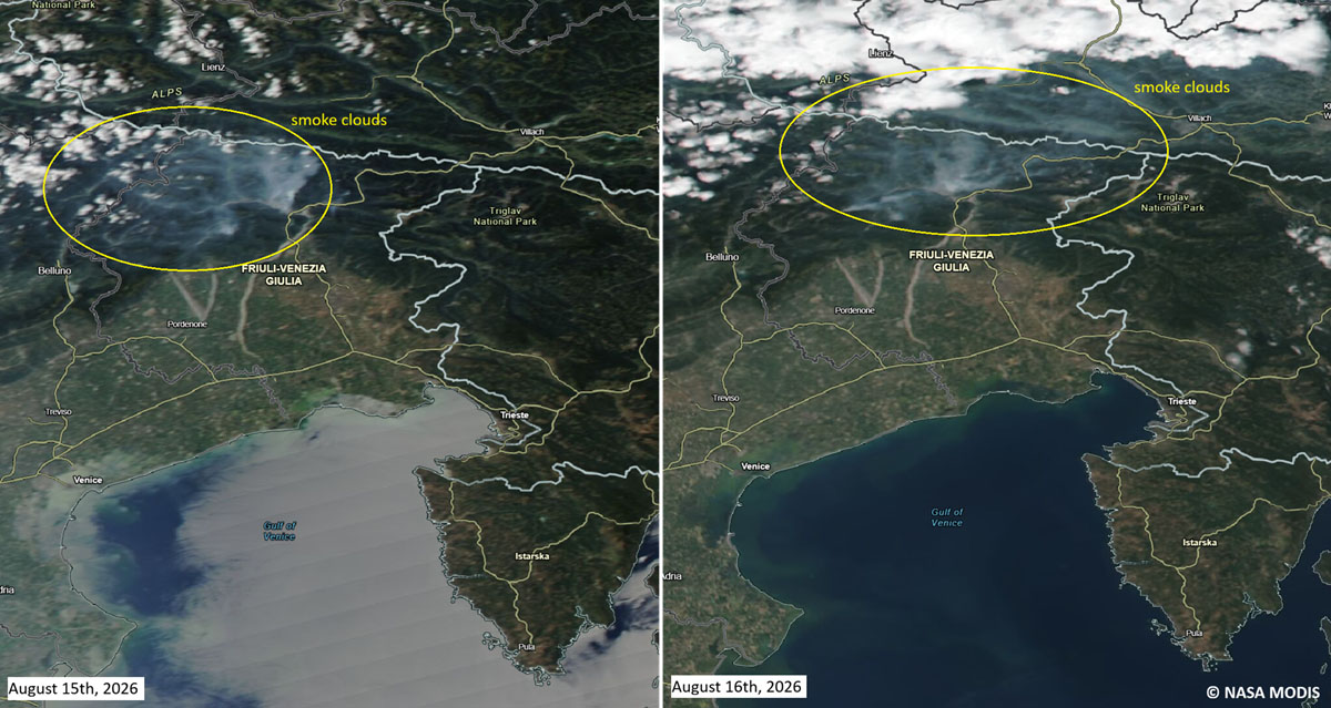
For several days, the fire remained a localized threat, confined to high-altitude ridges. However, the situation deteriorated rapidly on August 15th—Ferragosto, Italy’s major mid-summer holiday. A surge in gusty, downslope winds fanned the flames, driving them over the Rio Confine ridge and onto the slopes of Monte Amarianute. Suddenly, the fire was no longer a remote mountain event; it was a direct threat to the residential hamlets of Tolmezzo, specifically the Pissebus sector and the fringes of Illegio.
Tactical Challenges: The Vertical Battlefield
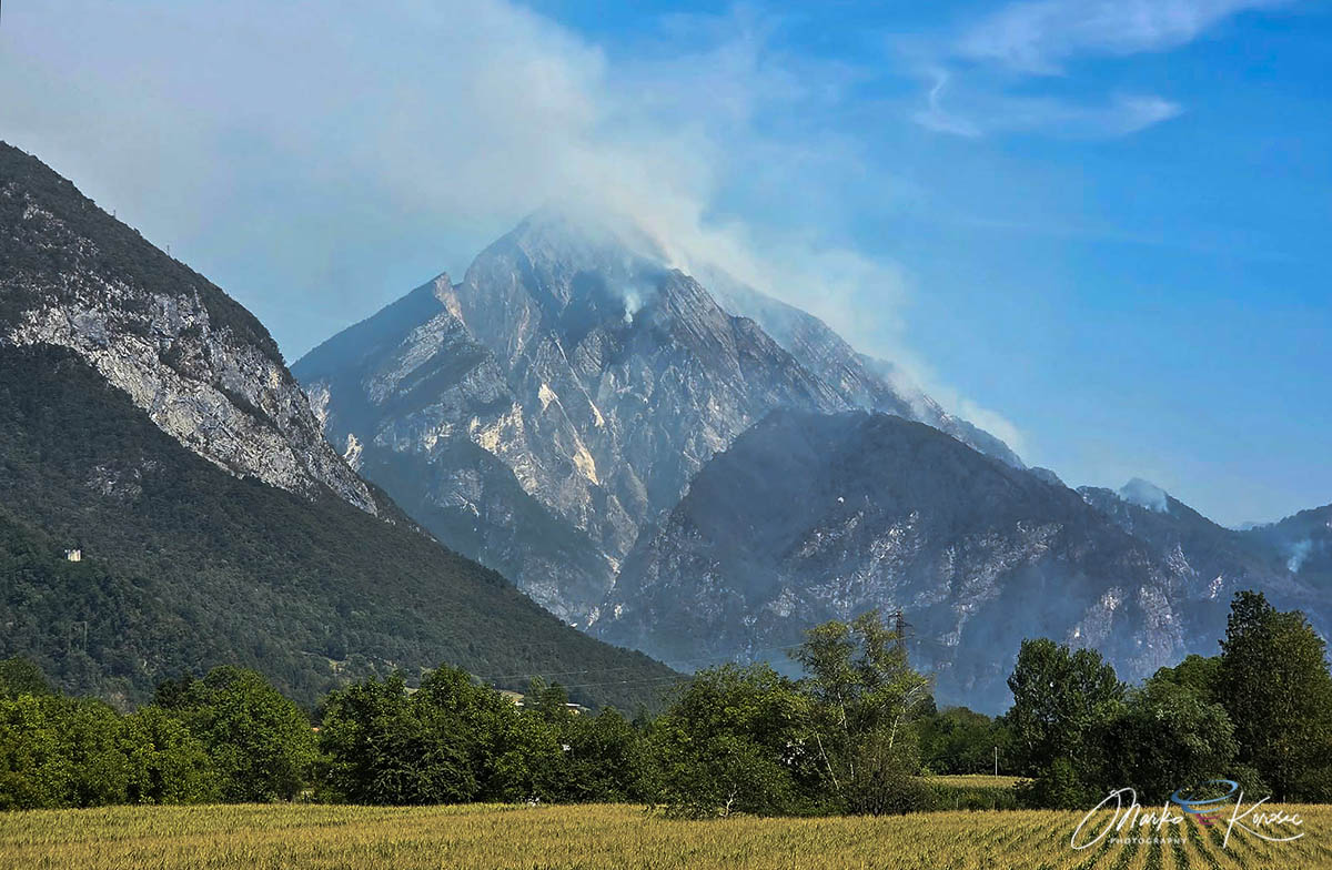
Firefighting in the Eastern Tolmezzo Alps presents a unique set of challenges that pushed responders to their limits. The mountain, rising to 1,905 meters, is characterized by sheer limestone cliffs and near-vertical gradients. This topography made traditional ground-based suppression impossible; firefighters could not physically reach the active fire lines without risking their lives in a crumbling, treacherous environment.
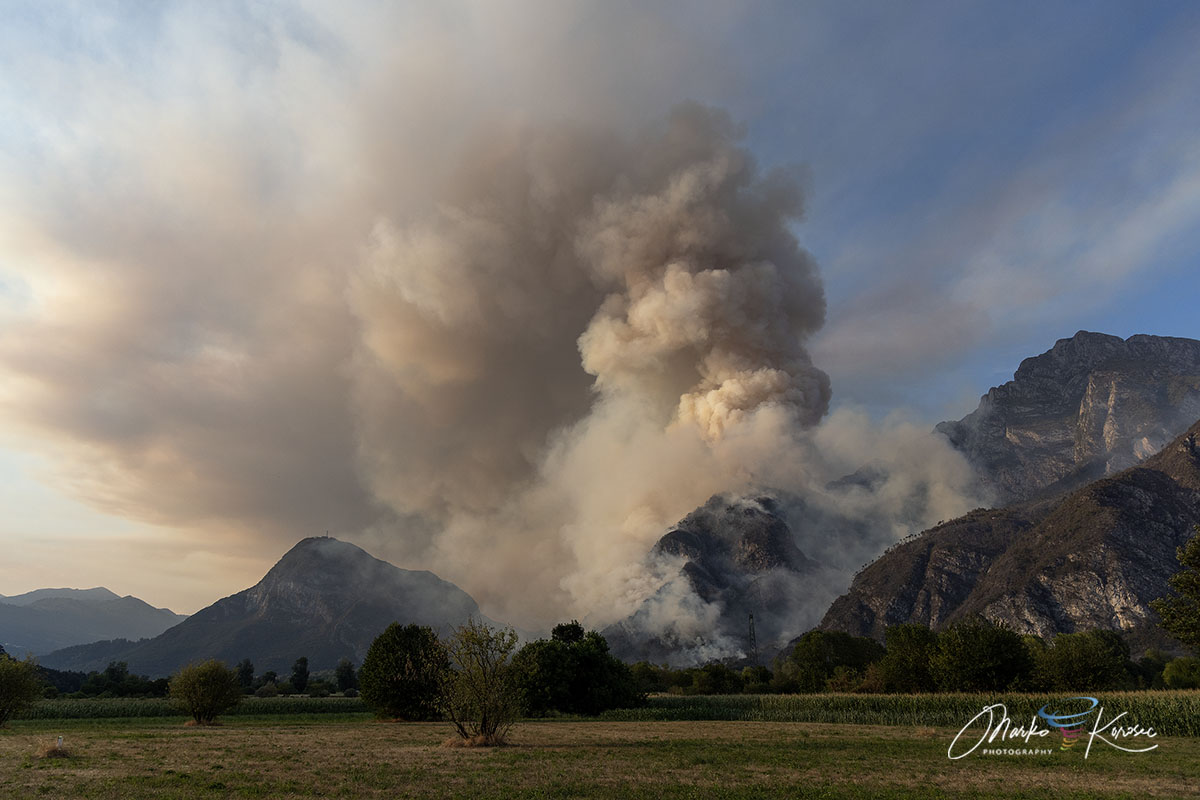
The terrain created a "chimney effect," where heat and fire were funneled upward through narrow gullies, accelerating the spread of the flames. The intensity of the heat was so great that it birthed pyrocumulus clouds—dense, fire-induced thunderstorms that can further complicate aerial operations by creating erratic, localized winds.
The Aerial Task Force
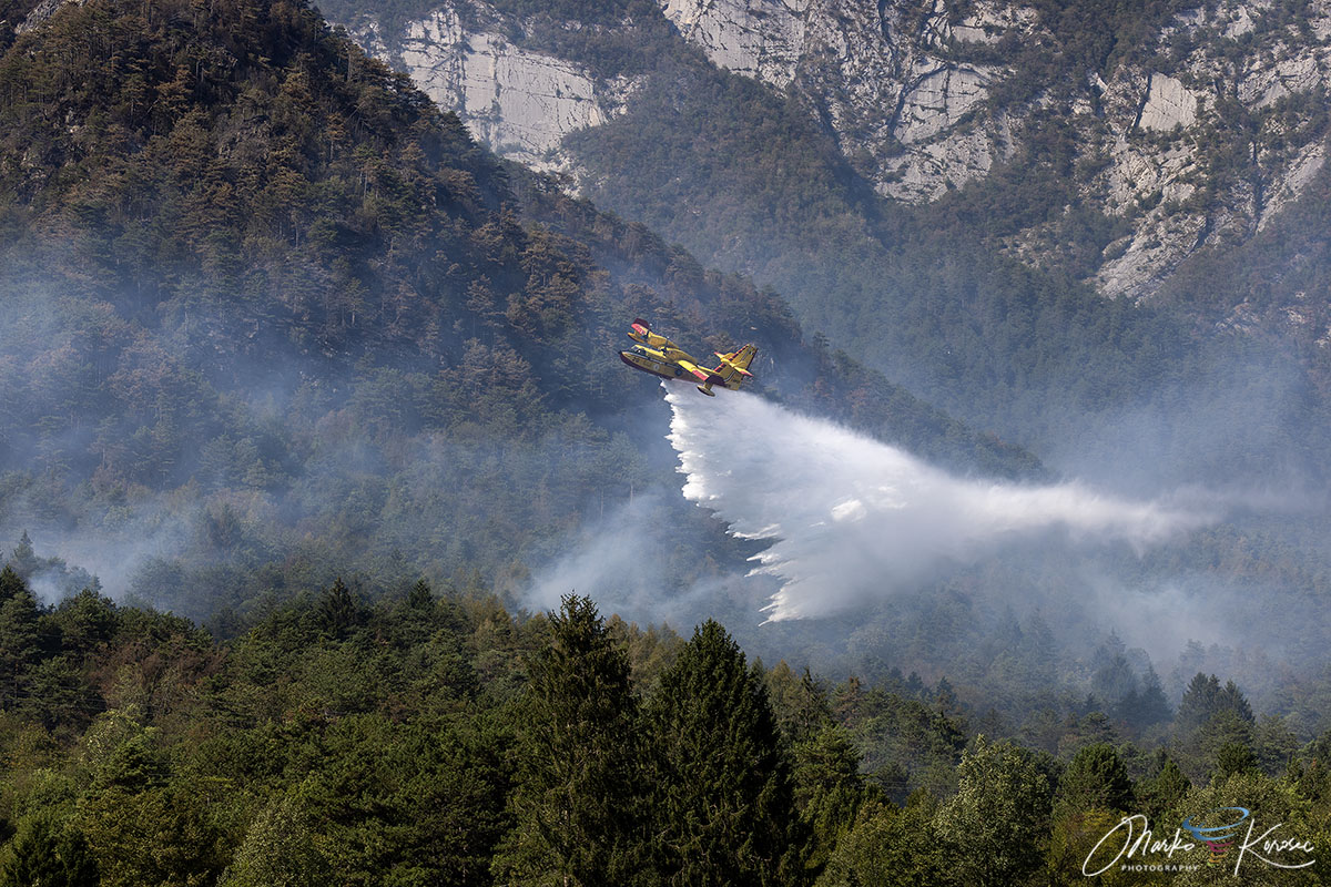
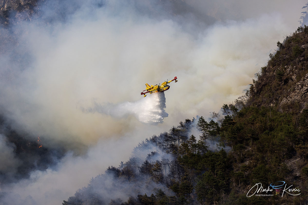
Recognizing the inability to deploy ground crews safely, authorities launched a massive, multi-national aerial operation. The response was a testament to European cooperation:
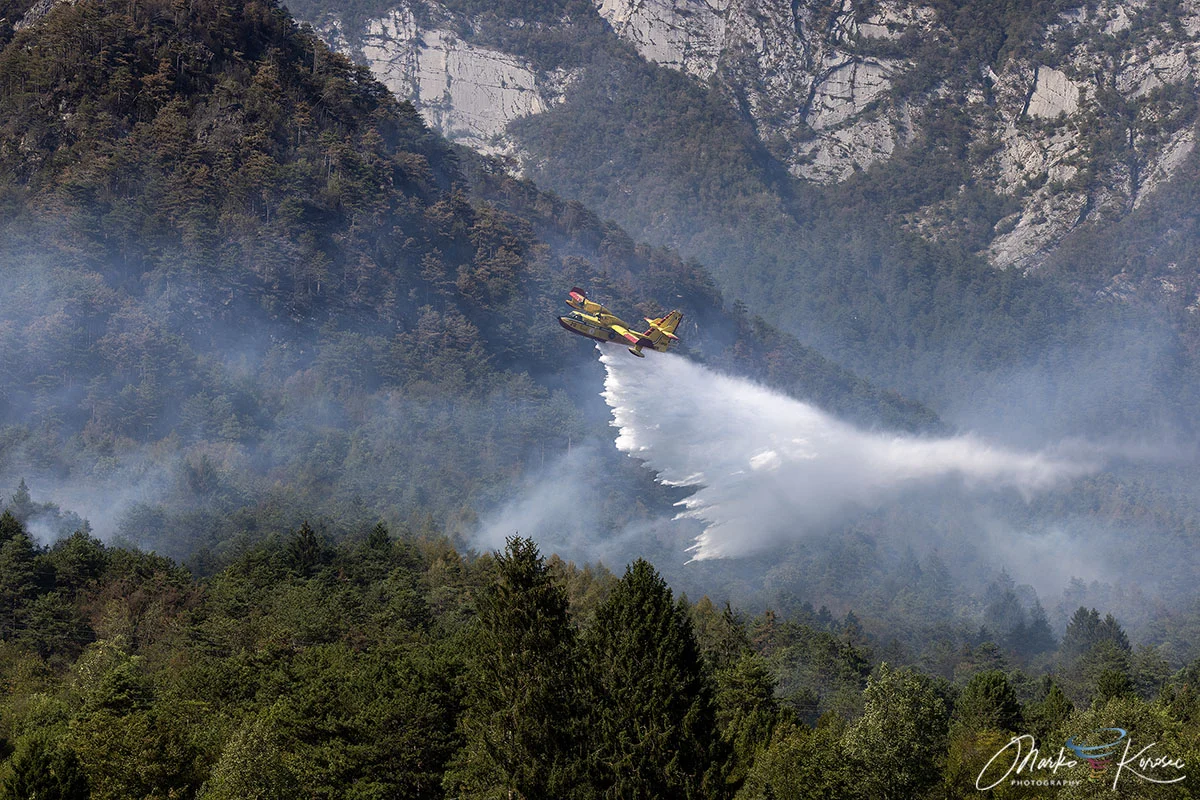
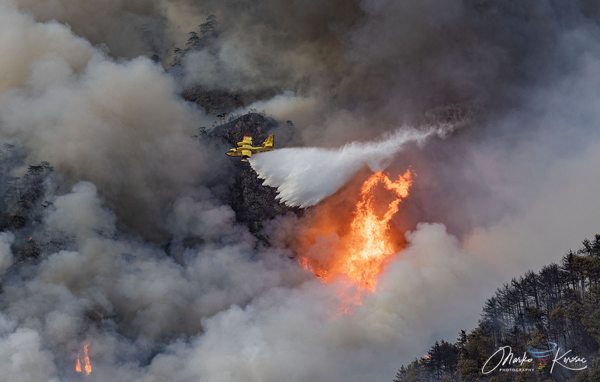
- Italian Canadairs: The backbone of the effort, executing precision water drops to soak the ridge lines.
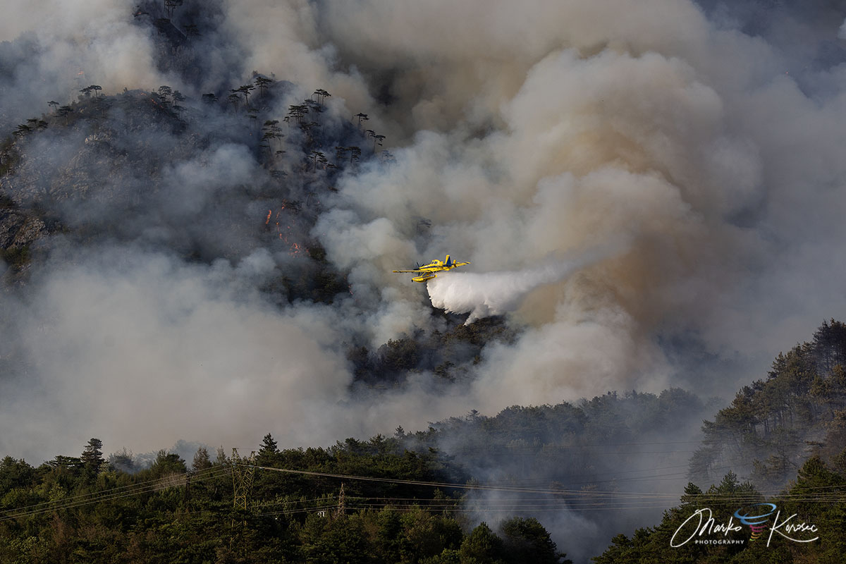
- Slovenian Air Tractors: Provided critical support, working in tandem with the Italian fleet to ensure a continuous cycle of water bombardment.
- Regional Helicopter Wings: Served a dual purpose, dropping water on precise hotspots and transporting ground crews to safer, lower-elevation positions to construct firebreaks.
Hundreds of drops were made over the ten-day period, effectively "caging" the fire and preventing it from descending further into the valley floor, where it would have posed an existential threat to the civilian population.
Chronology of the Crisis
Phase 1: Ignition (August 7th – August 14th)
Following the lightning strikes on the 7th, the fire smoldered in the high-altitude brushwood. During this period, the fire remained largely invisible to the public, though regional forest authorities (Corpo Forestale Regionale) monitored it closely.
Phase 2: The Escalation (August 15th – August 17th)
The transition of the fire from Cuel Feltron to Monte Amarianute marked the most dangerous phase of the operation. Evacuations were ordered for residents in the Pissebus area as the fire line moved to within 50 meters of private homes. The skyline of Tolmezzo was obscured by thick plumes of acrid smoke, and power lines were de-energized to prevent accidents and damage to the regional grid.
Phase 3: The Stalemate (August 18th – August 21st)
For three days, the battle was a stalemate. The fire burned through 600 hectares, consuming centuries-old forests and leaving the landscape blackened. Ground crews shifted to a defensive posture, using thermal drones to monitor hotspots and ensuring that no secondary ignitions threatened the valley.
Phase 4: Atmospheric Relief (August 22nd – August 24th)
The turning point came not from human intervention, but from a dramatic shift in the synoptic-scale weather pattern. A deep low-pressure system moved across Northern Italy, dumping between 150 mm and 200 mm of rain over the FVG region in a 72-hour window. This deluge, while potentially causing localized flooding concerns, effectively extinguished the remaining smoldering embers of the Monte Amariana fire.
Supporting Data: A Region Under Stress
The scale of the fire is symptomatic of the broader climate trends currently affecting Northeast Italy. Analysis of regional precipitation data reveals a multi-month deficit in rainfall that rendered the vegetation in the Carnia mountains exceptionally vulnerable.
When comparing the 2026 summer data to long-term historical averages, the FVG region experienced a sustained period of extreme vapor pressure deficit. This effectively "baked" the moisture out of the forest floor, creating a fuel load that was primed for high-intensity ignition. The fire served as a grim reminder that even high-altitude Alpine environments are no longer immune to the dangers of extreme, sustained drought.
Official Responses and Environmental Implications
The Italian Civil Protection Agency and the Vigili del Fuoco (Fire Brigade) have been praised for their coordination during the crisis. By effectively mobilizing cross-border resources, they prevented what could have been a catastrophic loss of property and life.
"The operation was a triumph of technology and coordination, but a tragedy for the environment," noted a spokesperson for the regional environmental agency. The loss of 600 hectares of forest cover will have long-term consequences for the mountain’s microclimate. The removal of ground-level vegetation increases the risk of soil erosion and rockfalls—a significant concern for the steep, limestone-heavy geology of the region.
As the smoke clears, the focus shifts to restoration. Thermal drone monitoring continues to ensure that the ground is fully cooled, while local geologists assess the stability of the slopes affected by the heat.
Looking Forward: Lessons for the Alpine Region
The Monte Amariana wildfire is a stark signal that the "new normal" for the Alps involves a higher frequency of fire events. Historically, the region was characterized by cool, moist summers; the 2026 season proved that the protective barrier of the mountains is eroding in the face of warming trends.
Key lessons identified by emergency management officials include:
- Investment in Aerial Assets: The reliance on the Canadair fleet underscored the need for expanded regional aerial firefighting capabilities.
- Forest Management: Increased focus on thinning out "ladder fuels"—dead, dry wood that allows ground fires to climb into the canopy—is essential in high-risk zones.
- Community Preparedness: The swift evacuation of Pissebus saved lives. Future urban planning in the Carnia region will likely incorporate stricter fire-buffer zones near residential developments.
As the residents of Tolmezzo begin the process of returning to normal, the charred slopes of Monte Amariana stand as a silent, blackened monument to a summer that changed the region forever. The fire has been extinguished, but the questions it raises about climate adaptation and the future of the Alpine landscape will resonate for years to come.