As we transition into the latter half of 2026, meteorologists and climate scientists are turning their gaze toward the tropical Pacific. Data from the latest oceanographic and atmospheric models indicate the rapid development of a "Super" El Niño event. This phenomenon, characterized by extreme sea-surface temperature anomalies in the equatorial Pacific, is already exerting a profound influence on global circulation, signaling a potential record-breaking season that will redefine weather patterns across North America and Europe throughout the coming fall and winter.
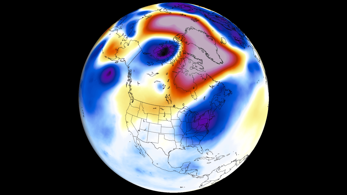
Main Facts: The Anatomy of a Super El Niño
An El Niño event occurs when warm water accumulates in the central and eastern Pacific, disrupting the standard "Walker Circulation"—the atmospheric bridge that governs trade winds and precipitation globally. When these anomalies reach the threshold of a "Super" event—typically defined as a sea-surface temperature (SST) anomaly exceeding +2.0°C—the consequences are magnified.
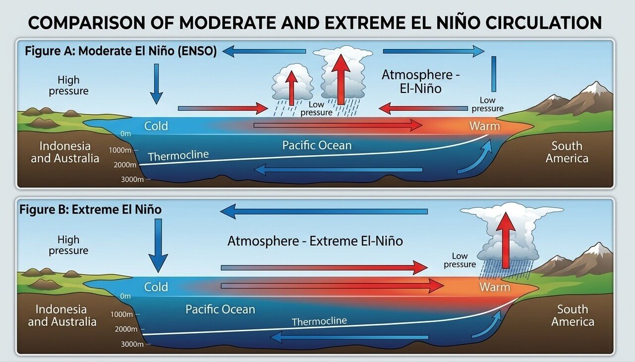
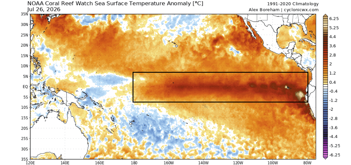
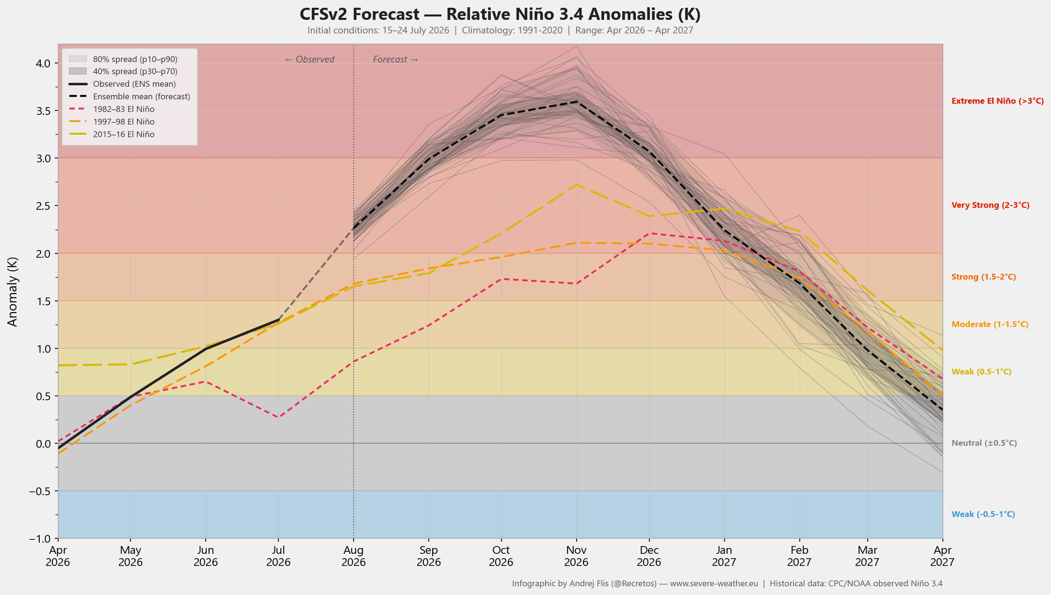
Current analysis suggests that the 2026/2027 event is tracking significantly faster than historical counterparts. Peak anomalies in the central Pacific have already begun to breach the +3.0°C mark, with some models projecting a rise toward +5.0°C. This level of thermal energy acts as a massive atmospheric engine, forcing a permanent shift in the jet stream’s position and intensity. Unlike standard events, this Super El Niño is essentially "locking" the atmosphere into a standing wave pattern, forcing a reconfiguration of pressure systems that will dominate the Northern Hemisphere’s climate through the first quarter of 2027.
Chronology of Development
The formation of this record-strength event began with a series of vigorous westerly wind bursts that triggered a powerful "Kelvin Wave." These waves are essentially pulses of warm water that travel eastward along the equator beneath the ocean surface. As these waves surfaced, they fundamentally altered the heat balance of the Pacific.
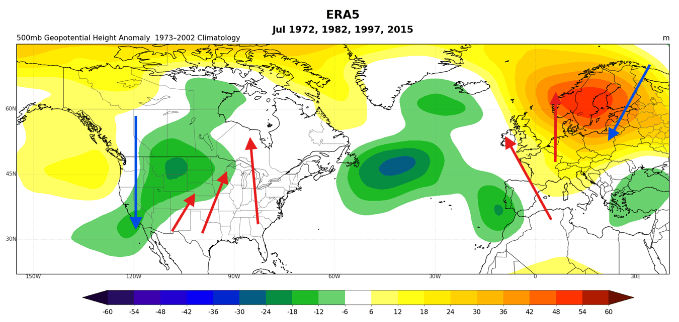
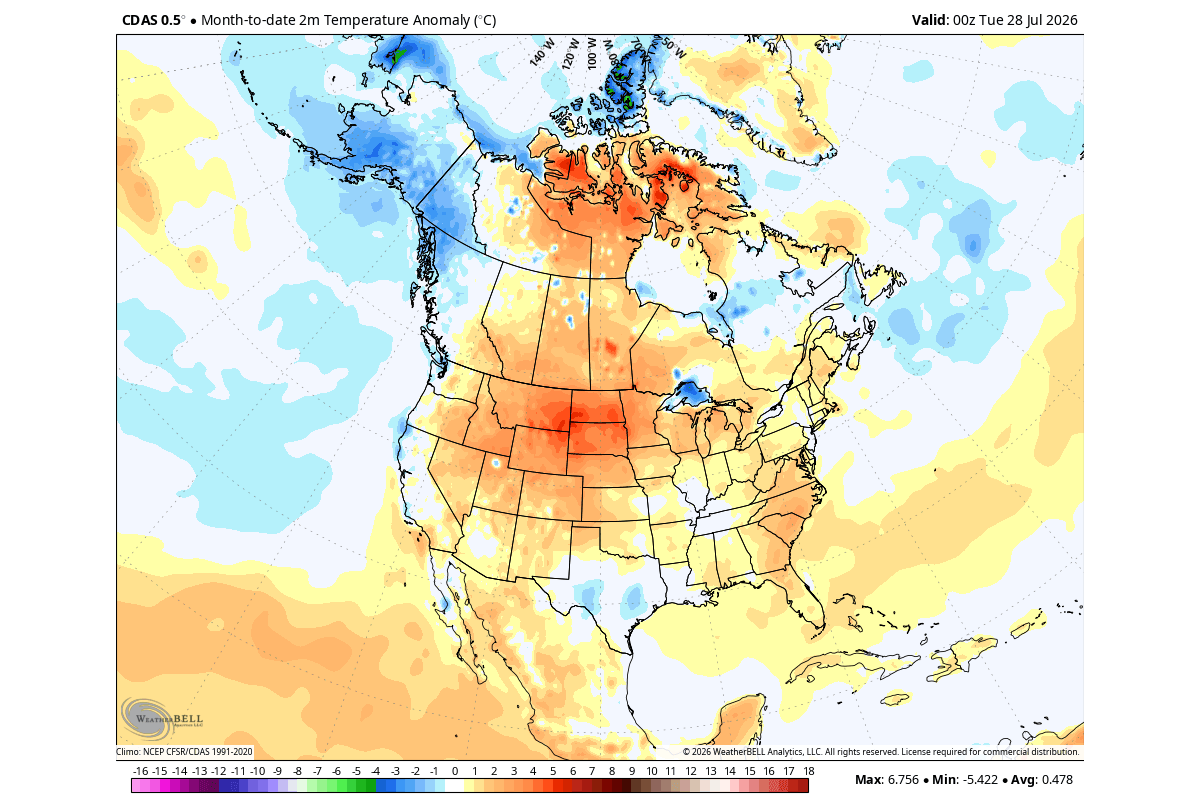
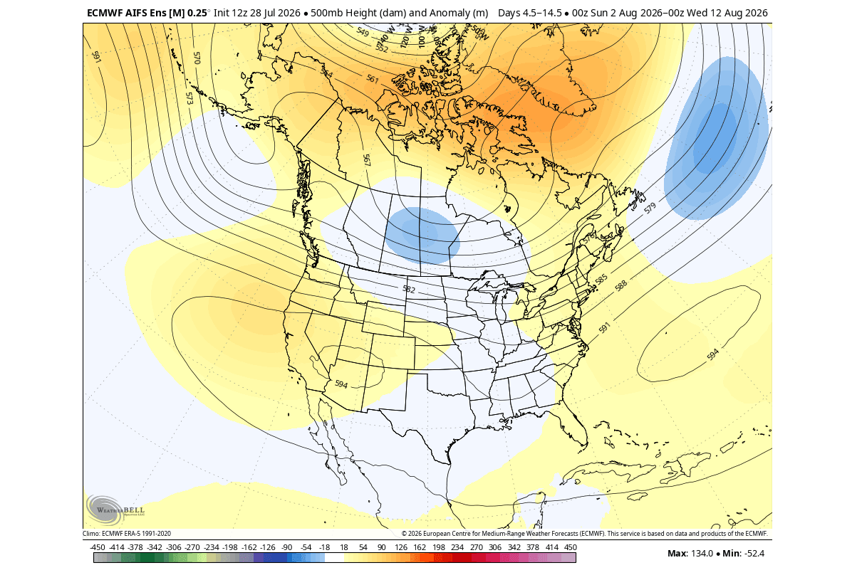
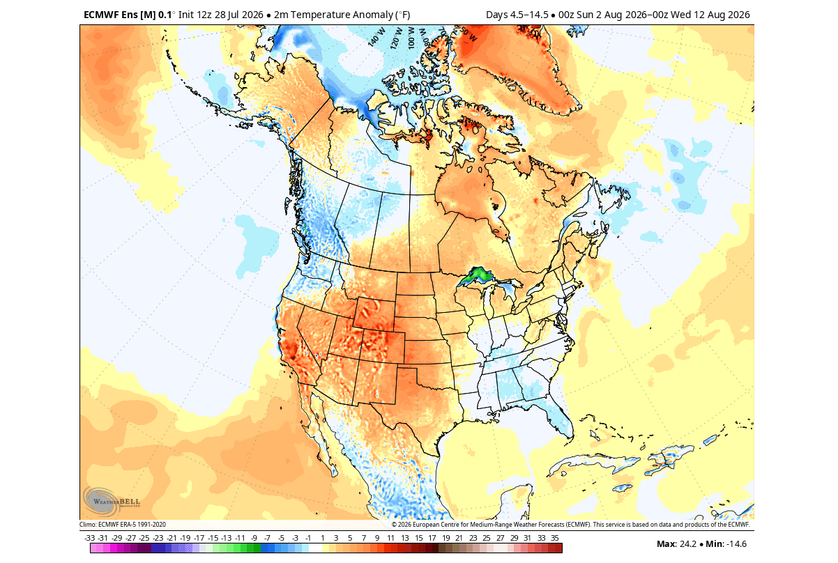
- July 2026: Initial analysis confirmed that global pressure and temperature patterns were already aligning with historical "Super El Niño" years. North America began seeing a classic pressure shift, with the primary low-pressure center moving westward, allowing for a warm southerly flow to dominate the central and eastern United States.
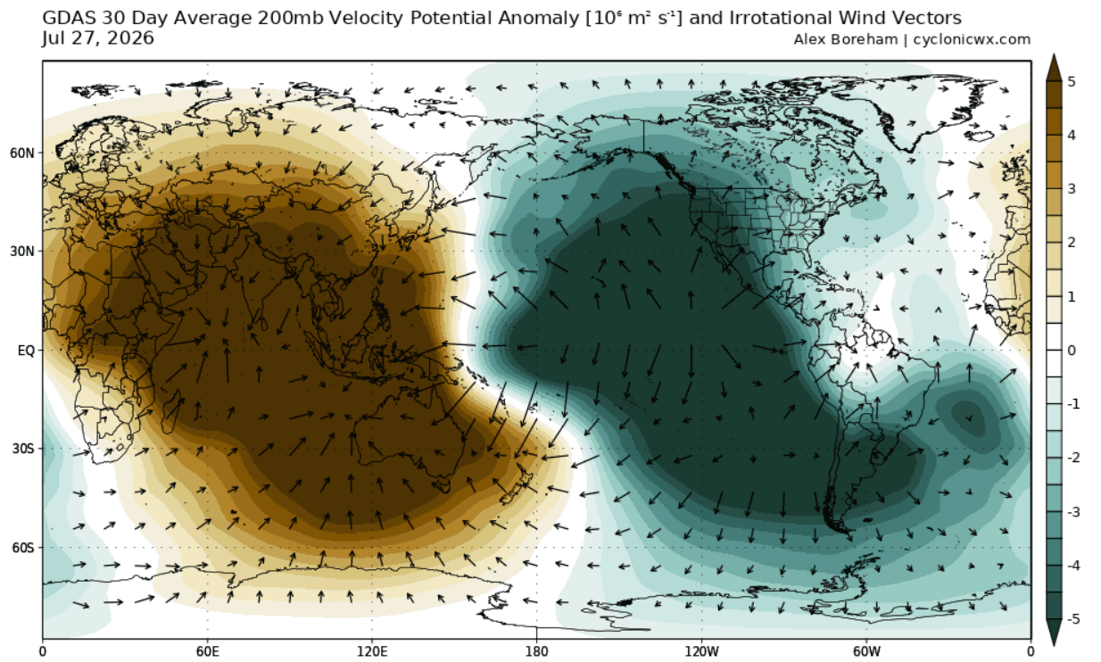
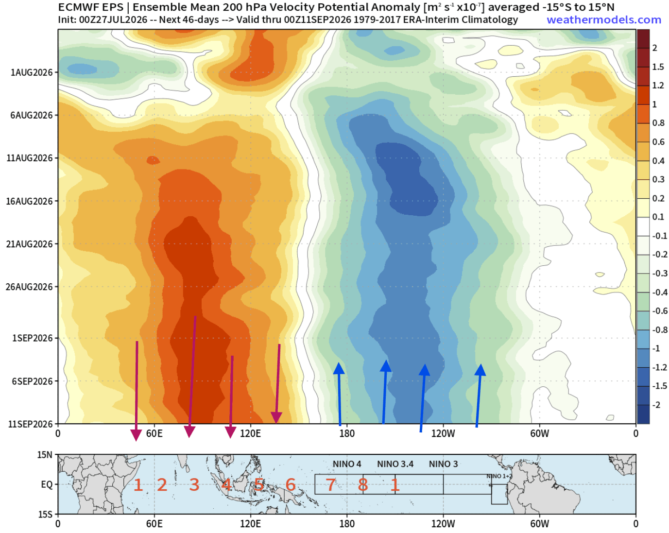
- August 2026: We are currently observing the "locking" phase. Atmospheric standing waves have established a persistent zone of rising air over the central Pacific, forcing the jet stream to bend. This is leading to a distinct split-flow pattern that is currently influencing early fall weather.
- Fall 2026 (Projected): The influence of the Pacific jet stream will continue to amplify. Meteorologists expect the development of a more persistent storm track across the southern United States, leading to increased precipitation.
- Winter 2026/2027 (Projected): The peak of the event is expected in late fall and early winter. The atmospheric response will likely reach its zenith, creating the "classic" El Niño winter characterized by a split-flow pattern that favors a warm north and a storm-active south.
Supporting Data and Model Projections
The NCEP CFSv2 model and the ECMWF (European Centre for Medium-Range Weather Forecasts) ensembles provide high-confidence evidence of this event’s trajectory. The Velocity Potential anomalies at the 200mb level (roughly 12km in altitude) reveal an immense atmospheric bridge. The "teal" color-coded rising air in the central Pacific, coupled with sinking motion in the Indian Ocean, provides a textbook signature of an ENSO-driven (El Niño-Southern Oscillation) global circulation.
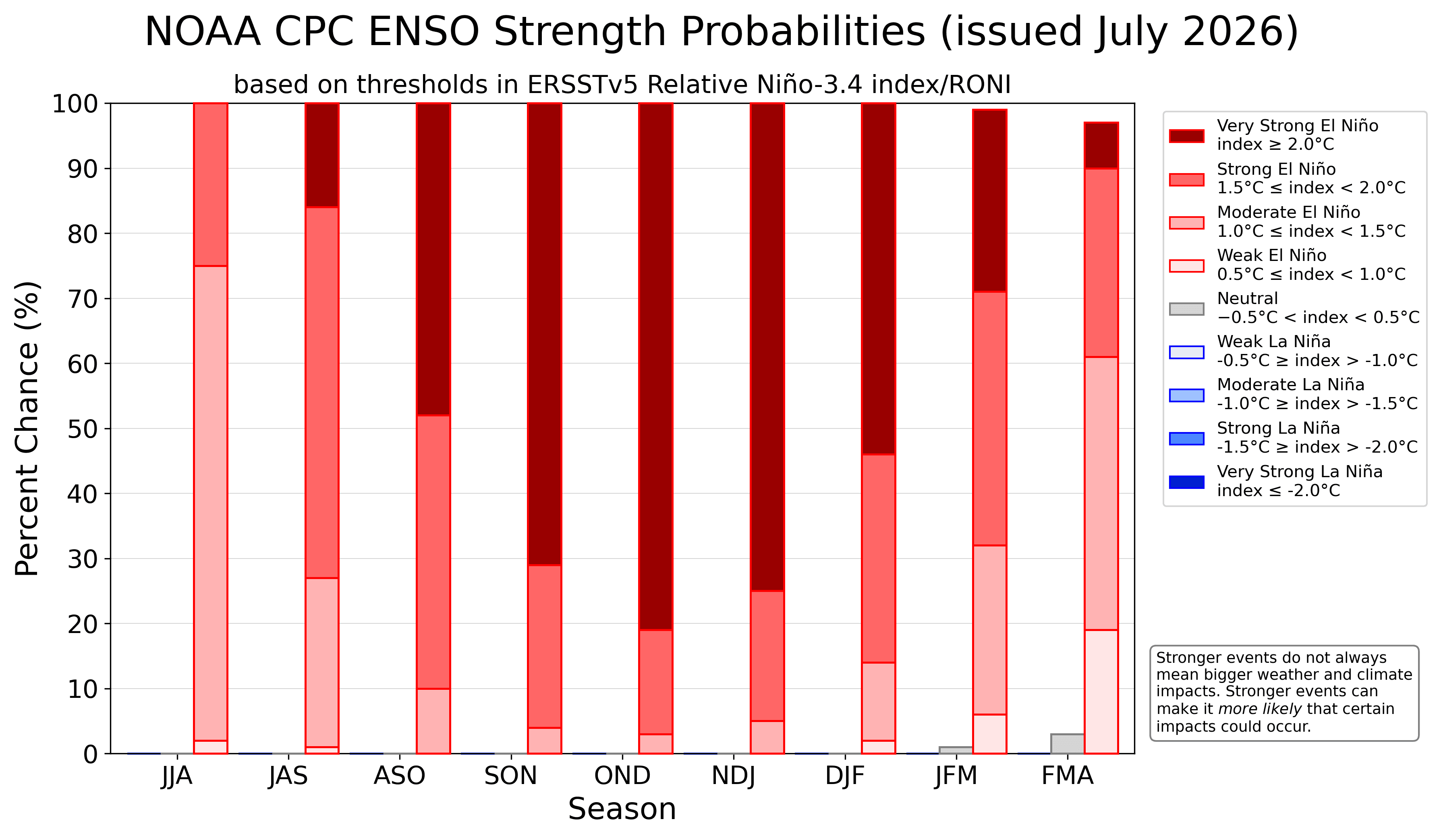
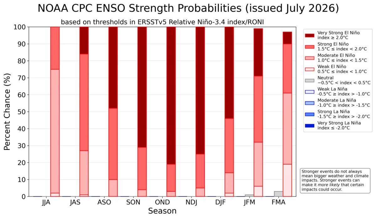
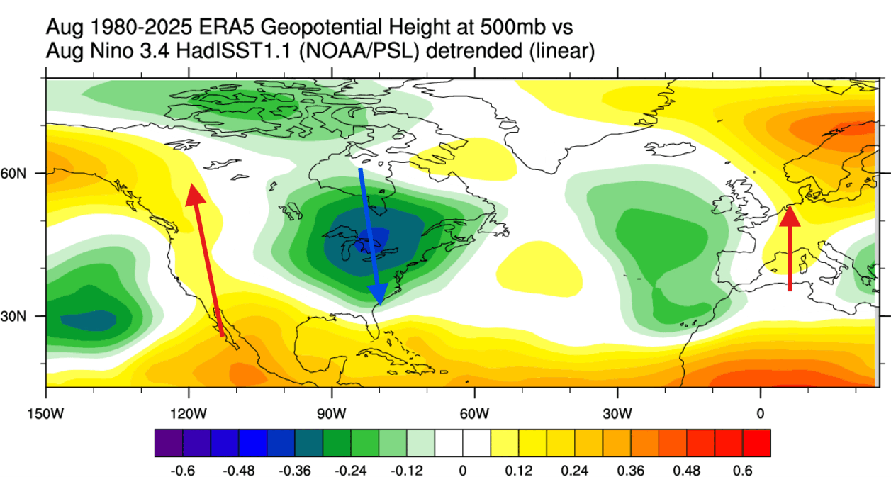
Furthermore, NOAA CPC (Climate Prediction Center) strength probability charts show significant ensemble support for this event to reach the extreme category. The consistency across multi-model forecasts (NMME) indicates that the "Eastern Pacific" (EP) nature of this event will lead to a more aggressive jet stream shift. When comparing moderate versus extreme El Niño events, historical data from ERA5 reanalysis shows that extreme events create a "highway" of energy across the southern U.S., which is markedly different from the milder, disorganized patterns seen in moderate years.
Official Responses and Scientific Consensus
While major meteorological organizations like NOAA and the NCEP have not yet issued a formal "emergency" status, their periodic outlooks confirm the high likelihood of an extreme event. Scientists emphasize that the "Super" classification is not merely a statistical label but a functional one; it implies that the atmospheric forcing is strong enough to overcome local weather variables that would otherwise create a more chaotic, less predictable season.
The scientific community is currently focusing on the "Atmospheric Bridge"—a concept where tropical heat influences the mid-latitudes through pressure adjustments. Peer-reviewed studies on past Super El Niños suggest that the location of the warm anomaly acts as a "steering wheel" for the Northern Hemisphere’s winter. Because the 2026 event is centered in the Eastern Pacific, it is predicted to "bend" the jet stream with higher precision than Central Pacific-focused events, making the forecast for the upcoming winter more reliable, albeit more severe.
Implications for North America and Europe
The implications of this climate shift are widespread and will manifest differently across geographic regions.
North America
For the United States and Canada, the primary impact is the "split-flow" pattern. The subtropical jet stream is expected to become significantly more active. This will likely result in:
- Southern and Central U.S.: An increase in winter storm frequency and total precipitation. The "active storm track" will bring frequent moisture, potentially reducing drought conditions in parts of the South but increasing flood risks.
- Northern U.S. and Canada: A persistent high-pressure ridge is projected to act as a barrier to Arctic air. This will likely result in a warmer-than-average winter for the northern tier of the continent, with lower-than-normal snowfall potential.
- Temperature Anomalies: As the winter progresses into January and February 2027, the cooling footprint of this event will likely expand. While the north remains warm, the central and eastern U.S. may experience frequent, sharp cold-air intrusions as the jet stream fluctuates.
Europe
Europe’s response to El Niño is notoriously complex, as the continent is further removed from the Pacific and subject to more chaotic Atlantic forcing. However, the current model data suggests:
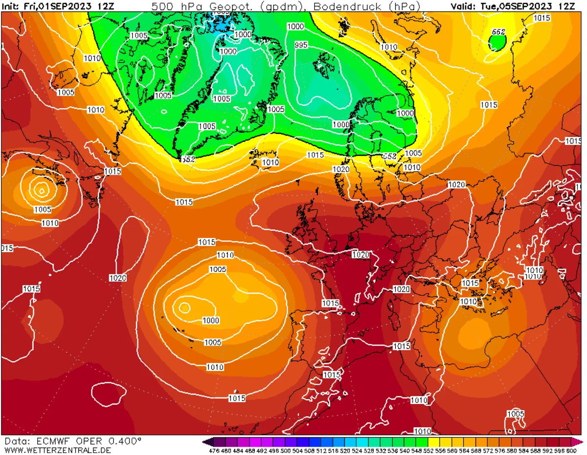
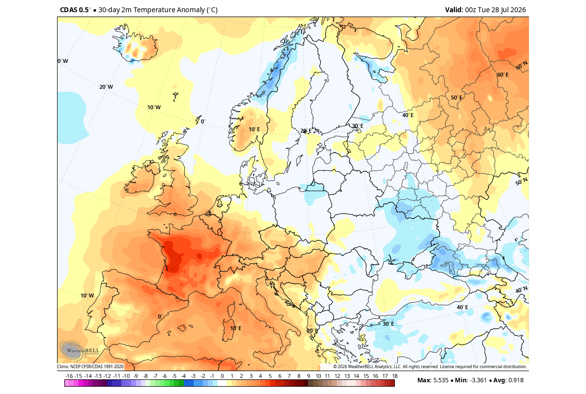
- Early Fall: A high-pressure blocking pattern is likely to favor warmer-than-normal temperatures across western and central Europe.
- Late Fall/Winter: As the El Niño signal reaches its peak, the Atlantic low-pressure zone is expected to strengthen. This will likely drive a more consistent westerly flow of moist, mild air from the Atlantic into the continent. While the north of Europe may experience more precipitation, the southern and central regions are expected to remain in a milder, albeit wetter, regime compared to historical averages.
The Path Forward
The 2026/2027 Super El Niño is a reminder of the interconnected nature of our global climate. As the tropical Pacific continues to export massive amounts of thermal energy into the upper atmosphere, the resulting "standing wave" will dictate the daily weather experiences of hundreds of millions of people.
For the agricultural sector, the southern U.S. may see a reprieve from drought, but the increased risk of severe storms will require heightened vigilance. For energy sectors, the forecast for a warm northern winter suggests lower heating demand in those regions, while the southern U.S. may see a more volatile winter season.
We will continue to monitor the development of this climate event with weekly updates. As the atmosphere transitions into the deeper phases of this Super El Niño, the accuracy of long-range modeling is expected to improve. Residents and stakeholders are encouraged to stay informed through official meteorological channels and to prepare for a winter that, while potentially warmer in the north, promises to be significantly more active in terms of moisture and storm energy across the southern latitudes. The 2026/2027 season is poised to be one of the most distinct climatic periods of the decade, serving as a critical case study in the power of ocean-atmosphere coupling.