The Western Pacific has once again been thrust into the crosshairs of a meteorological behemoth. Super Typhoon Bavi, a storm that defies conventional expectations, has rapidly evolved from a modest tropical disturbance into a formidable Category 5-equivalent atmospheric monster. In an unprecedented display of rapid intensification, Bavi vaulted from 60-mph sustained winds to a peak intensity of 180-mph in less than 48 hours. With a central pressure bottoming out at 901 mbar, the storm has cemented its place in the annals of this season’s most violent and volatile weather events.
As the storm carves a relentless path westward, meteorological agencies across the Pacific Rim are on high alert. The combination of near-perfect environmental conditions—specifically, record-warm ocean temperatures and an absence of hostile wind shear—has allowed Bavi to maintain a massive, destructive wind field that threatens to bring catastrophic consequences to the Northern Mariana Islands, southern Japan, and northern Taiwan.

Chronology: A Meteoric Rise to Super Typhoon Status
The genesis of Bavi was deceptive. Initially manifesting as a disorganized tropical system, the storm’s environment was primed for a transformation. Over the course of just two days, the storm underwent a period of explosive intensification. This phenomenon, often driven by the "heat engine" of the ocean, saw the system shed its disorganized structure to develop a classic, symmetrical "buzzsaw" rotation.
After completing a complex eyewall replacement cycle—a process where a storm replaces its inner wind core with a larger, more stable one—Bavi emerged not weakened, but significantly more expansive and dangerous. The storm’s reach, which once spanned a relatively small radius, now encompasses a destructive wind field extending over 100 miles from its center.
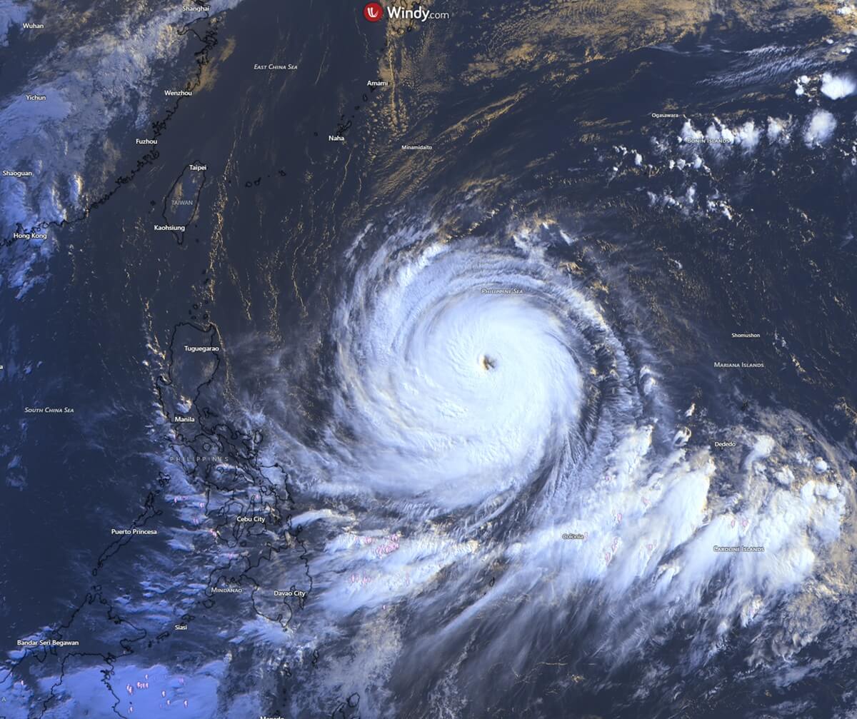
The storm’s first major landfall occurred in the Northern Mariana Islands, where the northern eyewall raked across the island of Rota. Residents endured hours of hurricane-force winds and torrential, horizontal rain. Guam, a frequent target in the region known as "Typhoon Alley," reported rainfall totals exceeding 20 inches, while wind gusts peaked at 85 mph. The island’s resilience—honed through decades of adaptation—was put to the ultimate test as the outer bands of Bavi delivered a sobering reminder of the power of the Pacific.
Supporting Data: Why Bavi is a Historic Threat
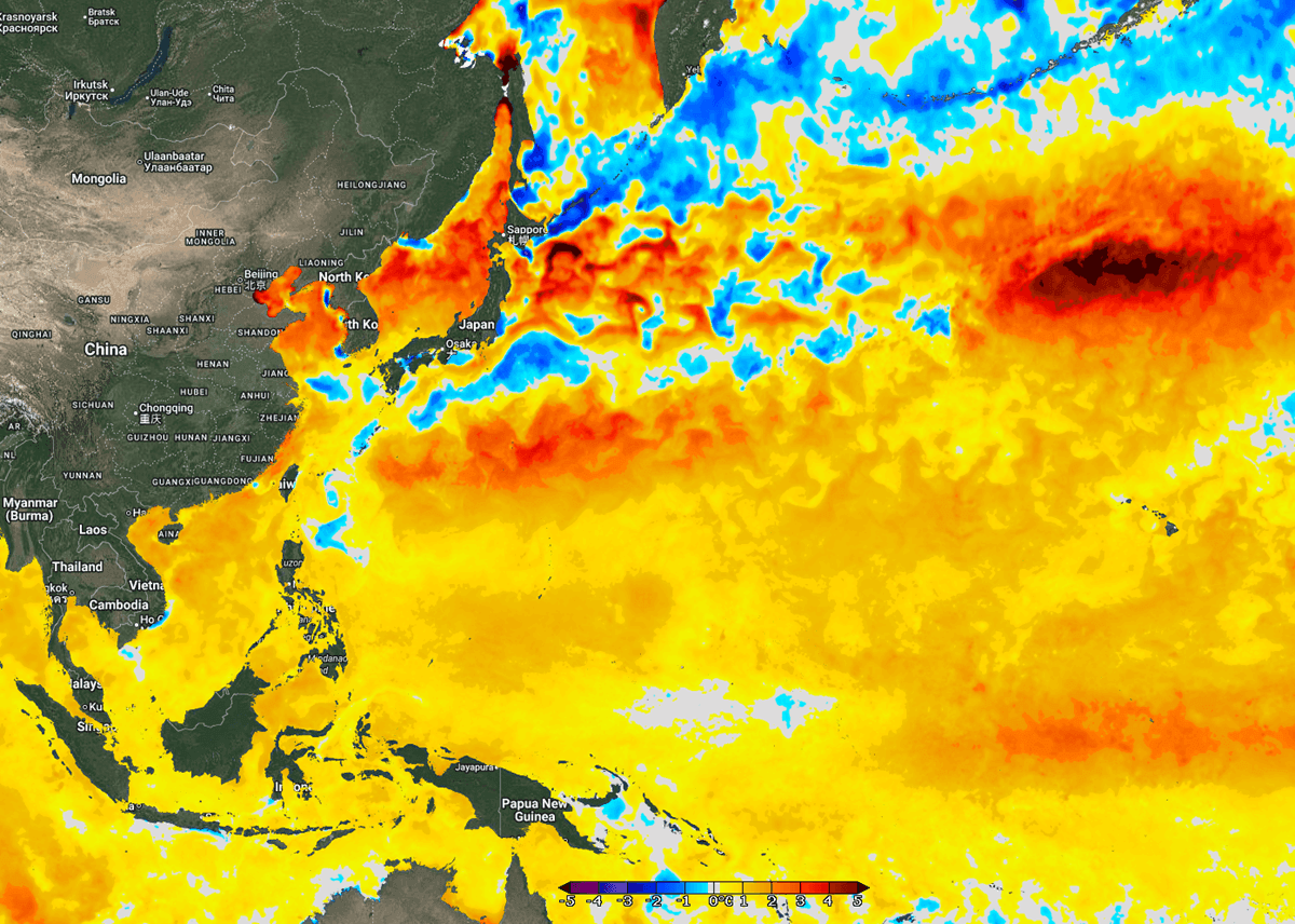
Meteorologists point to the thermal energy stored in the Philippine Sea as the primary catalyst for Bavi’s survival and strength. Current sea surface temperatures (SSTs) across the Western Pacific are hovering between 29°C and 32°C (84°F to 90°F). These temperatures are not merely high; they are 2–3°C above the long-term seasonal average, with some coastal anomalies reaching 4°C above normal.
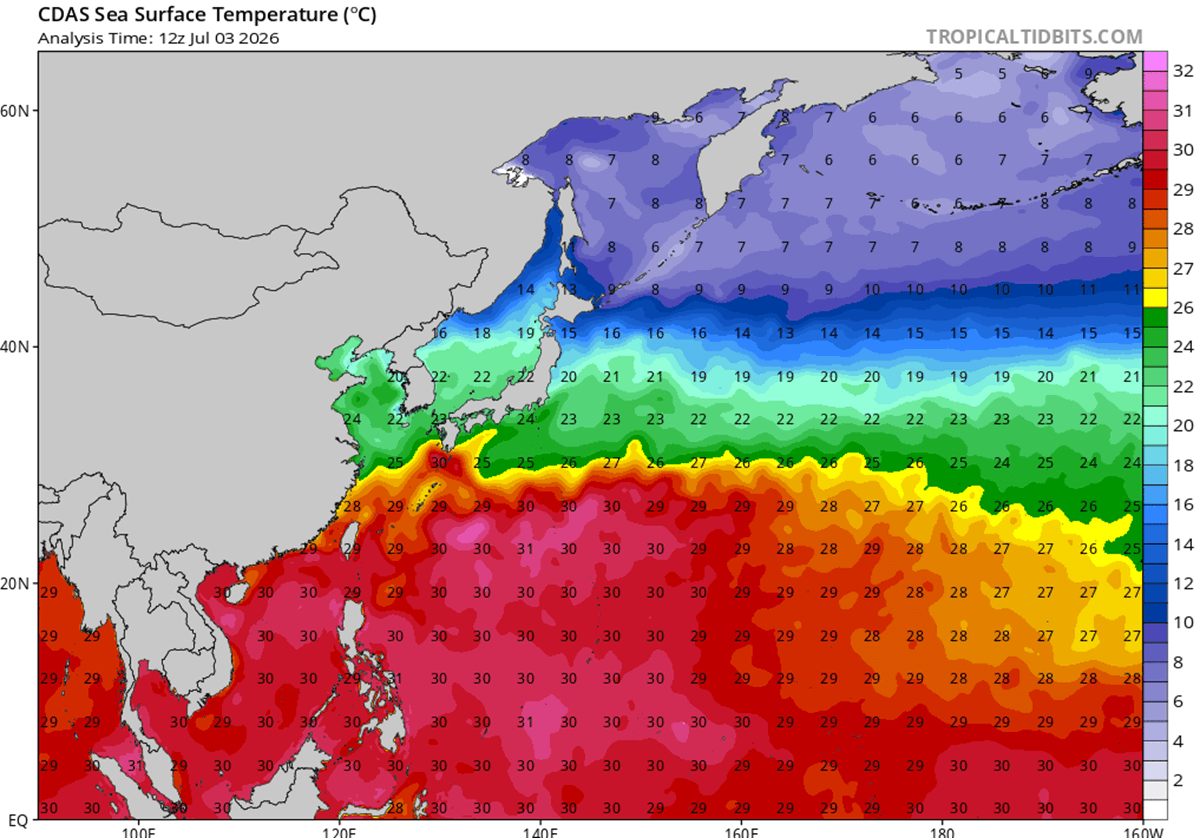
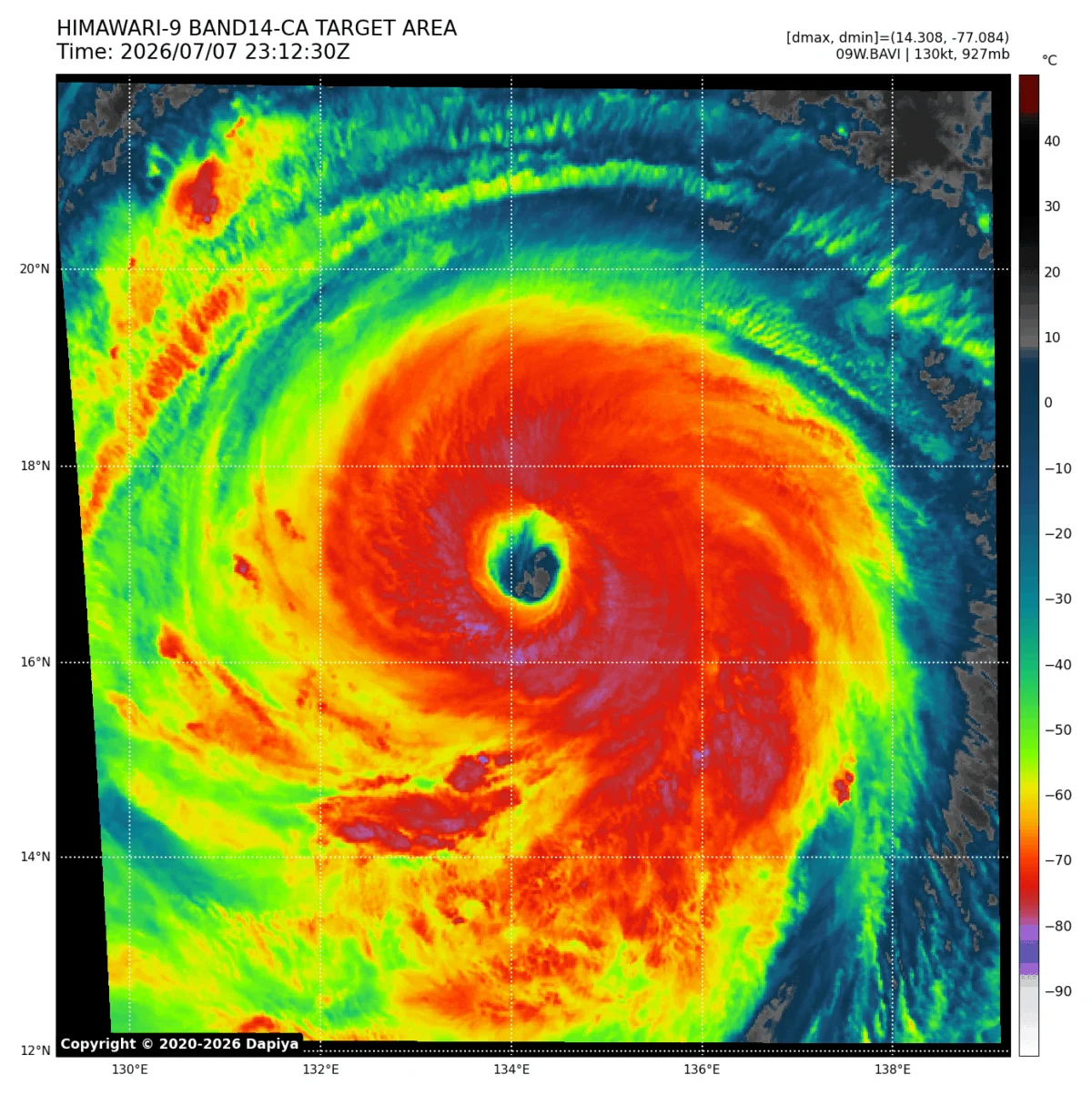
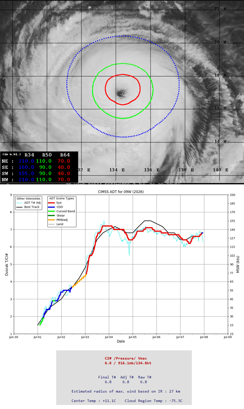
When a tropical cyclone traverses such a warm, deep water column, it undergoes a process of rapid intensification. The warm water acts as a battery, fueling the storm’s convective engine. Data from Advanced Dvorak automatic satellite analysis confirms that Bavi’s intensity, currently estimated at 135 knots (roughly 155–160 mph sustained), remains at the upper echelon of the Saffir-Simpson scale.
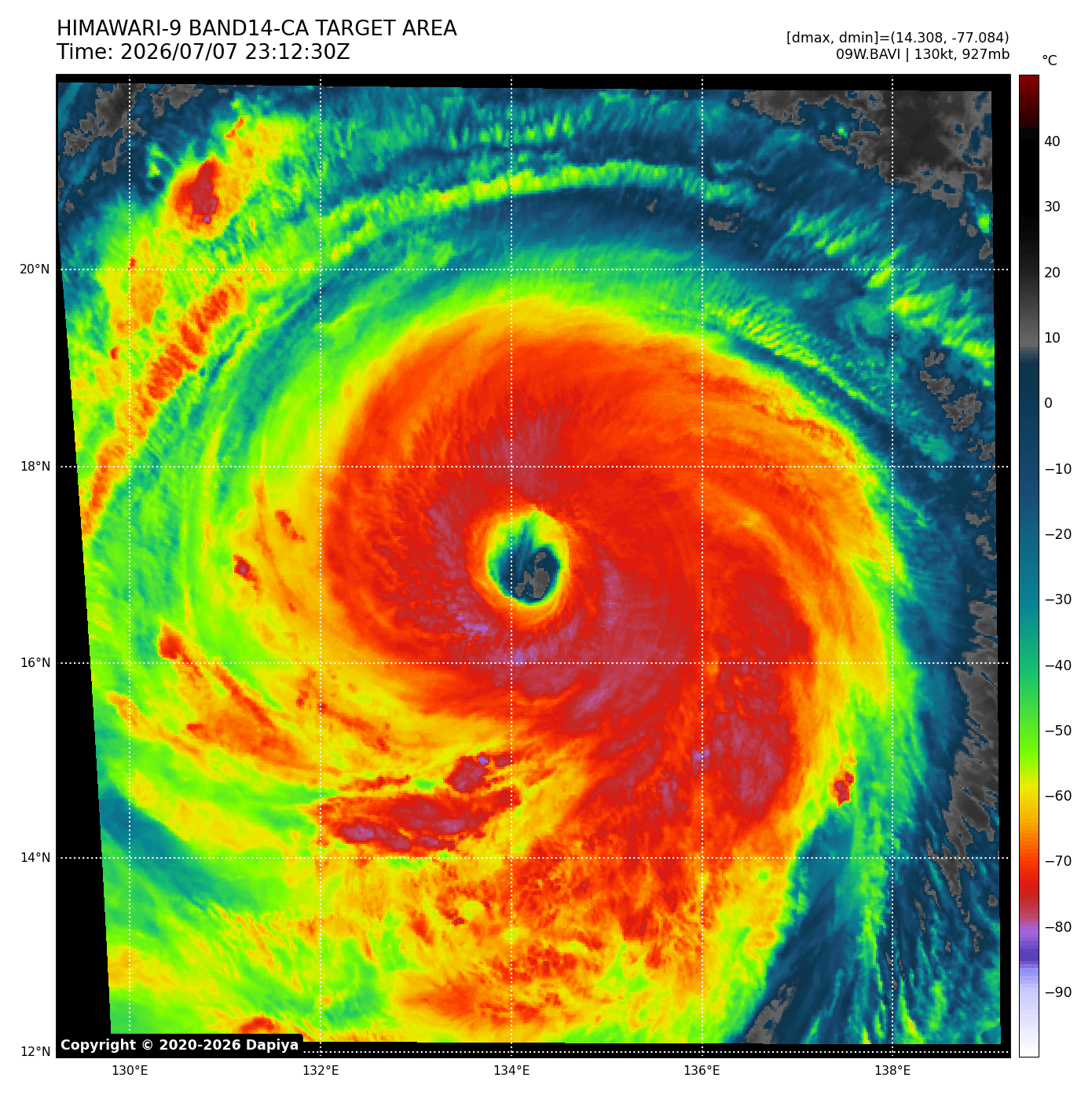
The storm’s structural integrity is equally concerning. Infrared satellite imagery reveals a massive, cloud-filled eye surrounded by a sprawling, symmetrical wind field. Unlike smaller, more concentrated typhoons that deliver localized damage, Bavi’s size ensures that the impact area is geographically vast, covering a larger swath of the ocean and coastal territory than a typical late-season storm.
Historical Context: The Evolution of "Concrete Islands"
Guam’s history is inextricably linked to the typhoons that have shaped its landscape. The island’s transition from a wooden-structure society to a "concrete island" began in earnest after the devastation of Typhoon Karen in 1962. That event acted as a societal inflection point, prompting strict building codes and infrastructure hardening that saved countless lives during subsequent disasters like Typhoons Paka and Pongsona.
Bavi, while currently moving away from the immediate vicinity of the Marianas, is being measured against these historic storms. The sheer volume of rain—already surpassing 20 inches in some locations—places it in the upper percentile of tropical precipitation events for the region. The lessons learned in the wake of previous "super" storms have undoubtedly mitigated the casualty count for Bavi, but the physical destruction to infrastructure, power grids, and local agriculture remains profound.
Forecast and Trajectory: The Impending Impact on Taiwan and Japan
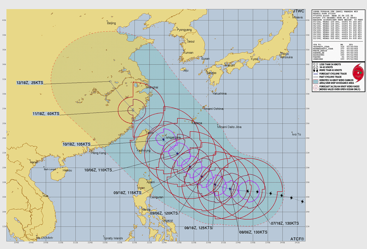
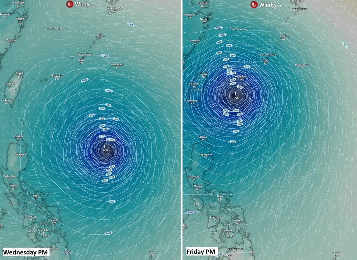
As of the latest projections, Super Typhoon Bavi is tracking west-northwest, aiming its sights toward the southern Japanese archipelago and the northern coast of Taiwan. While the storm is expected to enter a phase of gradual weakening as it interacts with cooler waters and increased vertical wind shear, it is expected to remain a high-end Category 4 or low-end Category 5 system until at least Friday.
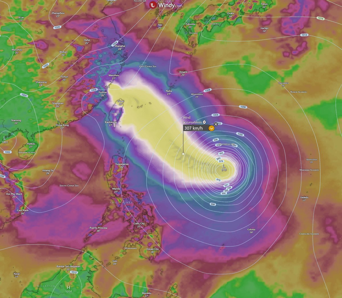
The forecast models present a grim outlook for northern Taiwan. While the core of the strongest winds may narrowly bypass the island, the peripheral bands are expected to drop staggering amounts of rain—up to 1,000 mm (approximately 40 inches) within a 48-hour period. In a mountainous region like Taiwan, such rainfall is a recipe for catastrophic flash flooding, landslides, and mudslides. The mountainous terrain will likely act as a multiplier, forcing the moisture to rise and cooling it, further intensifying the deluge.
Japanese islands such as Ishigaki and Miyakojima are also in the line of fire. These regions should brace for sustained, violent winds and significant storm surges. The interaction between the storm’s massive wind field and the complex topography of the Japanese islands will likely cause localized sea-level rises, threatening low-lying coastal communities.
Official Responses and Public Safety Directives
National weather services in Taiwan, Japan, and the Philippines have issued urgent warnings. In Taiwan, the Central Weather Bureau has mobilized emergency response teams, urging citizens in northern regions to finalize their storm preparations immediately. Public infrastructure, including ports and airports, is preparing for mandatory closures.
The consensus among emergency management agencies is clear: the danger posed by Bavi is not limited to the wind. The "hidden" threats—storm surge and inland flooding—are expected to be the primary drivers of potential loss. Authorities are emphasizing:
- Evacuation Preparedness: Residents in low-lying or landslide-prone areas are being advised to identify evacuation routes before conditions deteriorate.
- Structural Security: Despite modern building standards, the wind speeds associated with a Category 4/5 storm can compromise even well-reinforced structures. Securing loose outdoor items and reinforcing windows is mandatory.
- Water Management: With 1,000 mm of rain projected, drainage systems will likely be overwhelmed. Residents are urged to avoid low-lying roads and underpasses.
- Information Vigilance: Given the frequency of eyewall replacement cycles, the storm’s intensity can fluctuate rapidly. Residents should rely on real-time, official government updates rather than outdated forecasts.
Implications: A Climate-Altered Future?
The rapid intensification of Bavi raises uncomfortable questions about the future of typhoon behavior in a warming climate. While individual storms cannot be directly attributed to climate change, the atmospheric conditions that facilitated Bavi’s explosive growth—the anomalously high sea surface temperatures and the specific moisture availability—are consistent with current climate modeling.
The "heat engine" of the Western Pacific is clearly running hotter than in previous decades. When storms like Bavi emerge, they do not just represent a singular weather event; they represent a trend toward more frequent, more intense, and more rapidly intensifying tropical cyclones. For the island nations of the Pacific, the era of "super-typhoons" is becoming the new normal.
As Bavi approaches the China coast, the focus will shift from the open ocean to the mainland. While the storm will inevitably weaken upon hitting the coastline by Saturday, the remnants of the system will continue to bring severe weather, including flooding and high winds, deep into the weekend.
For now, the world watches the satellite loops, waiting for the eye of the storm to make its final, inevitable pivot toward land. Bavi is a reminder of nature’s raw, unbridled power, and the critical importance of science, preparedness, and collective action in the face of an increasingly volatile atmosphere. The coming 48 hours will be decisive for northern Taiwan and the surrounding islands, as they face down one of the most significant meteorological threats of the year.