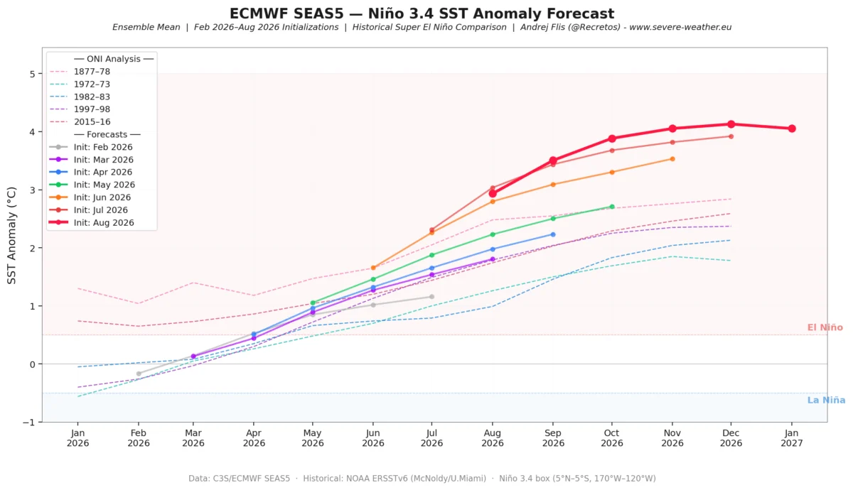
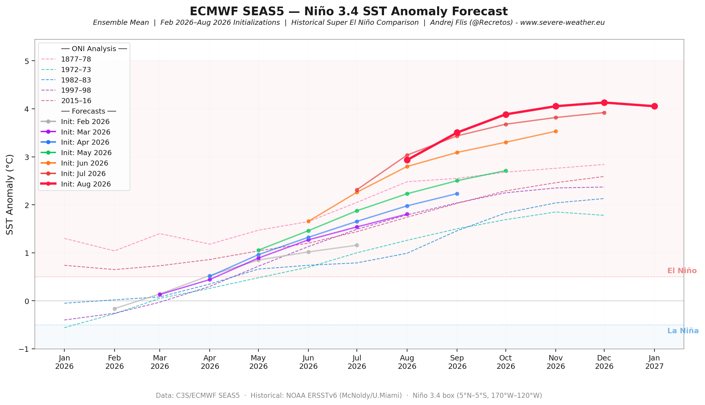
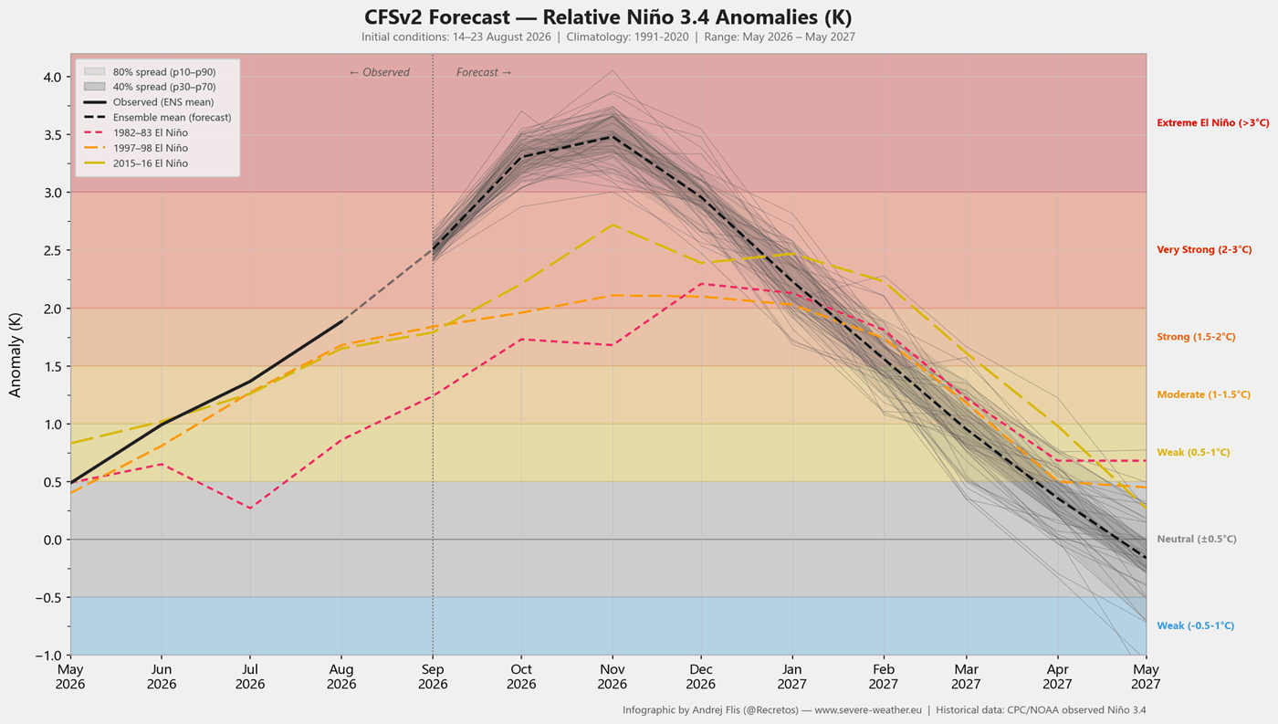
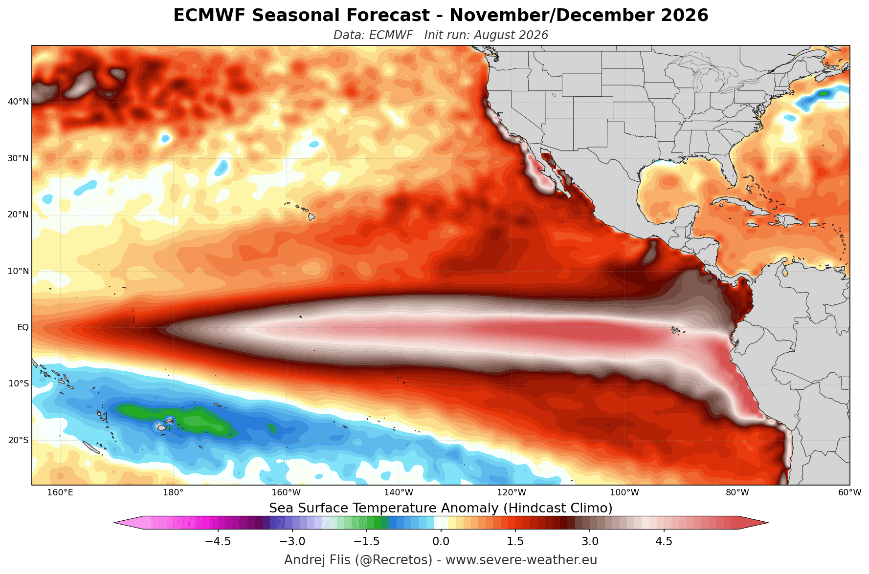
As the world transitions into the colder months of 2026, meteorologists are closely monitoring an atmospheric phenomenon of historic proportions. A rapidly developing "Super El Niño"—an extreme manifestation of the El Niño-Southern Oscillation (ENSO)—is currently exerting a profound influence on global circulation. With ocean temperatures in the tropical Pacific surging to levels that exceed the established thresholds for extreme events, major forecast systems, including the ECMWF and the NOAA NMME, are predicting an amplified, split-flow winter pattern across North America and Europe.

This forecast provides an in-depth analysis of the atmospheric drivers, the projected evolution of the season, and the potential implications for snowfall, temperature extremes, and the stability of the Polar Vortex.
Main Facts: The Engine of the 2026/2027 Winter
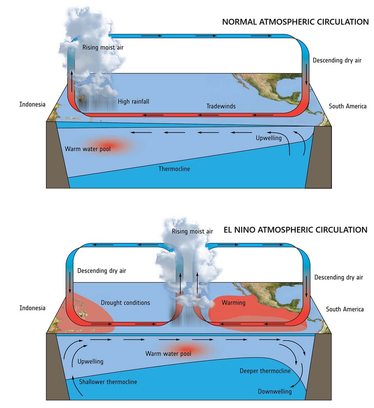
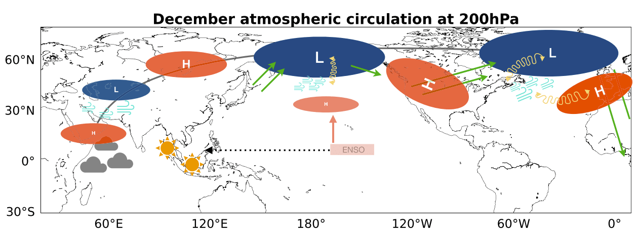
At the heart of the upcoming winter’s weather pattern lies the Pacific Ocean. The current Super El Niño is not merely a seasonal fluctuation; it is a global atmospheric disruptor. By lowering atmospheric pressure in the central and eastern tropical Pacific and intensifying high pressure over the west, the event creates a "Walker Cell" imbalance. This shift acts as an engine, launching planetary wave trains that reshape jet streams across both hemispheres.
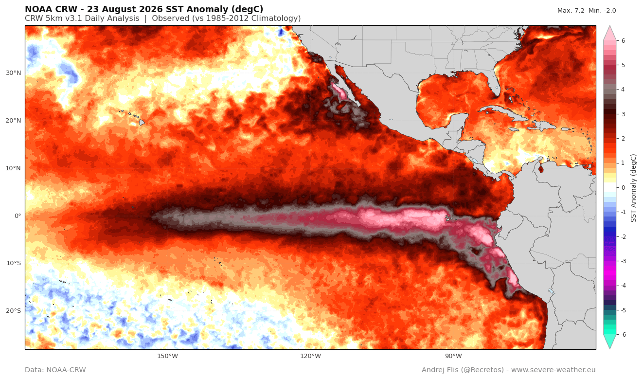
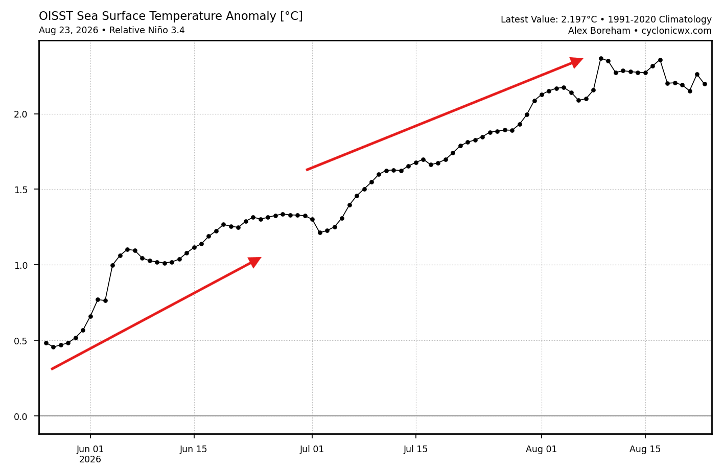
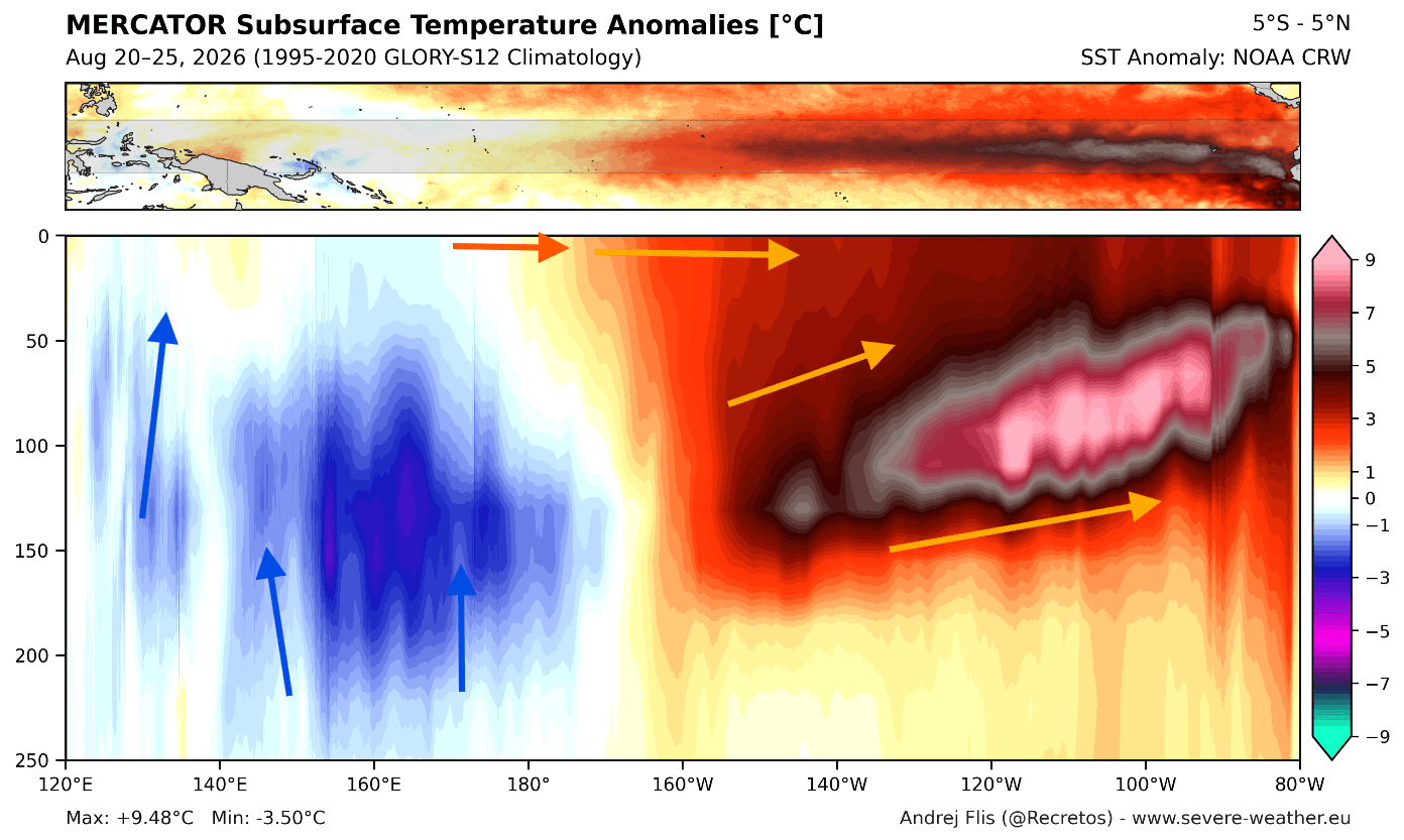
Data from the NOAA Coral Reef Watch indicates that sea surface temperature anomalies in the key ENSO regions have already surpassed 6°C (11°F) above normal. Furthermore, subsurface analysis reveals a massive, energetic "downwelling Kelvin Wave"—a core of warm water exceeding 9°C (16°F) above normal—moving eastward. This subsurface reservoir ensures that the El Niño will remain a dominant, "healthy" driver well into the winter months. Unlike moderate events, this Super El Niño possesses the energetic capacity to fundamentally alter the position of the jet stream, creating a permanent "atmospheric highway" that dictates where storms track and where cold air is blocked.
Chronology: The Evolution of a Seasonal Shift
The development of this winter’s pattern is expected to occur in three distinct phases as we transition from late autumn into the heart of 2027.
- Late Autumn (Pre-Winter): The atmosphere begins to "lock in" the El Niño signal. The Pacific jet stream strengthens, and the high-pressure ridge over Canada begins to stabilize, setting the stage for the north-south temperature divide.
- Early Winter (December): The "split-flow" pattern becomes well-defined. The Northern United States and Canada experience milder, drier conditions under the influence of the Canadian high-pressure ridge. Simultaneously, the Southern United States begins to see an increase in moisture and storm activity as the subtropical jet stream activates.
- Mid-to-Late Winter (January–February): Forecast models show a significant amplification of this pattern. As the season progresses, the pressure anomalies strengthen rather than shift. The January and February outlooks suggest that the contrast between the mild, blocked north and the stormy, cooler south will reach its peak intensity, with potential implications for mid-winter cold outbreaks in the central and eastern regions.
Supporting Data: Multi-Model Consensus
The confidence in this outlook is bolstered by the alignment of the world’s two most reliable seasonal modeling systems: the European Centre for Medium-Range Weather Forecasts (ECMWF) and the North American Multi-Model Ensemble (NMME).
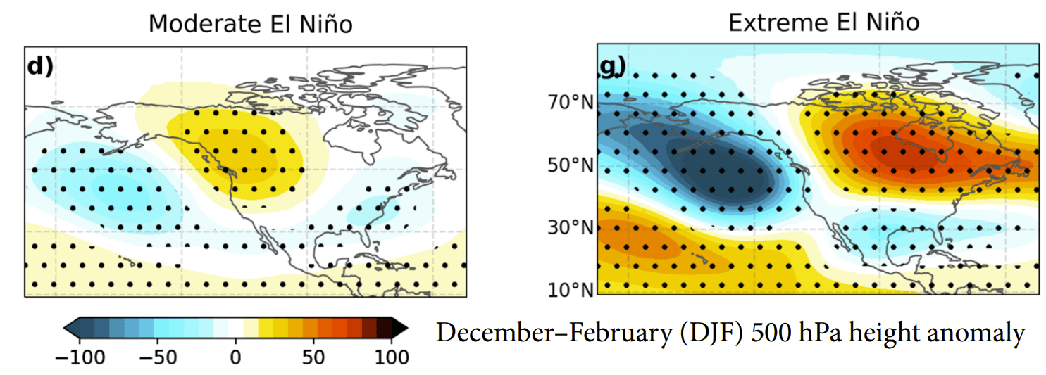
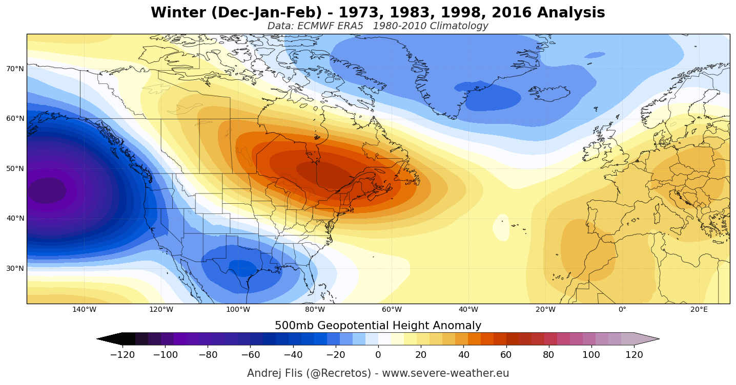
Both systems display a rare degree of consensus. They agree that the primary pressure anomaly will be a deep, persistent low-pressure zone over the North Pacific, balanced by a strong blocking ridge over Canada. The jet stream, which typically acts as a barrier, will be forced into a "split" configuration. The southern branch of this jet will become a conveyor belt for moisture-rich systems, directing them across the southern and eastern United States.
The ECMWF seasonal pressure forecast for December through February is particularly striking. It highlights a massive high-pressure area over Canada, which effectively shields the northern territories from sustained arctic blasts, while the active southern storm track keeps the southern U.S. under persistent cloud cover and cooler, wetter conditions.
The Polar Vortex: A Potential Wildcard
A critical factor in any winter forecast is the state of the stratospheric Polar Vortex—the spinning wall of cold air high above the Arctic. Recent simulations from both the ECMWF and the UKMO indicate a significant weakening of stratospheric westerly winds between late December and January.
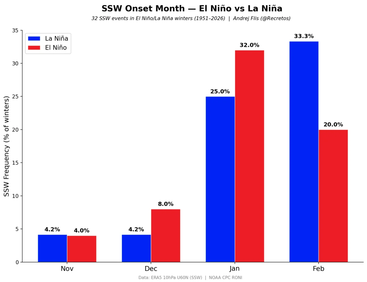
While this does not guarantee a Sudden Stratospheric Warming (SSW) event, it signals a period of instability. If the Polar Vortex becomes sufficiently disrupted, it can "leak" arctic air southward. Research indicates that strong El Niño events can sometimes facilitate this transition; while the season may start with a stable vortex, the atmospheric wave energy generated by the Super El Niño can stress the vortex as the winter progresses, potentially leading to a "Polar Express" pattern that brings rapid, volatile temperature shifts to the mid-latitudes.
Implications for Snowfall and Winter Sports
For the average citizen, the most tangible impact of this Super El Niño will be the redistribution of snowfall. The "split-flow" jet stream creates a clear winners-and-losers scenario for winter enthusiasts.
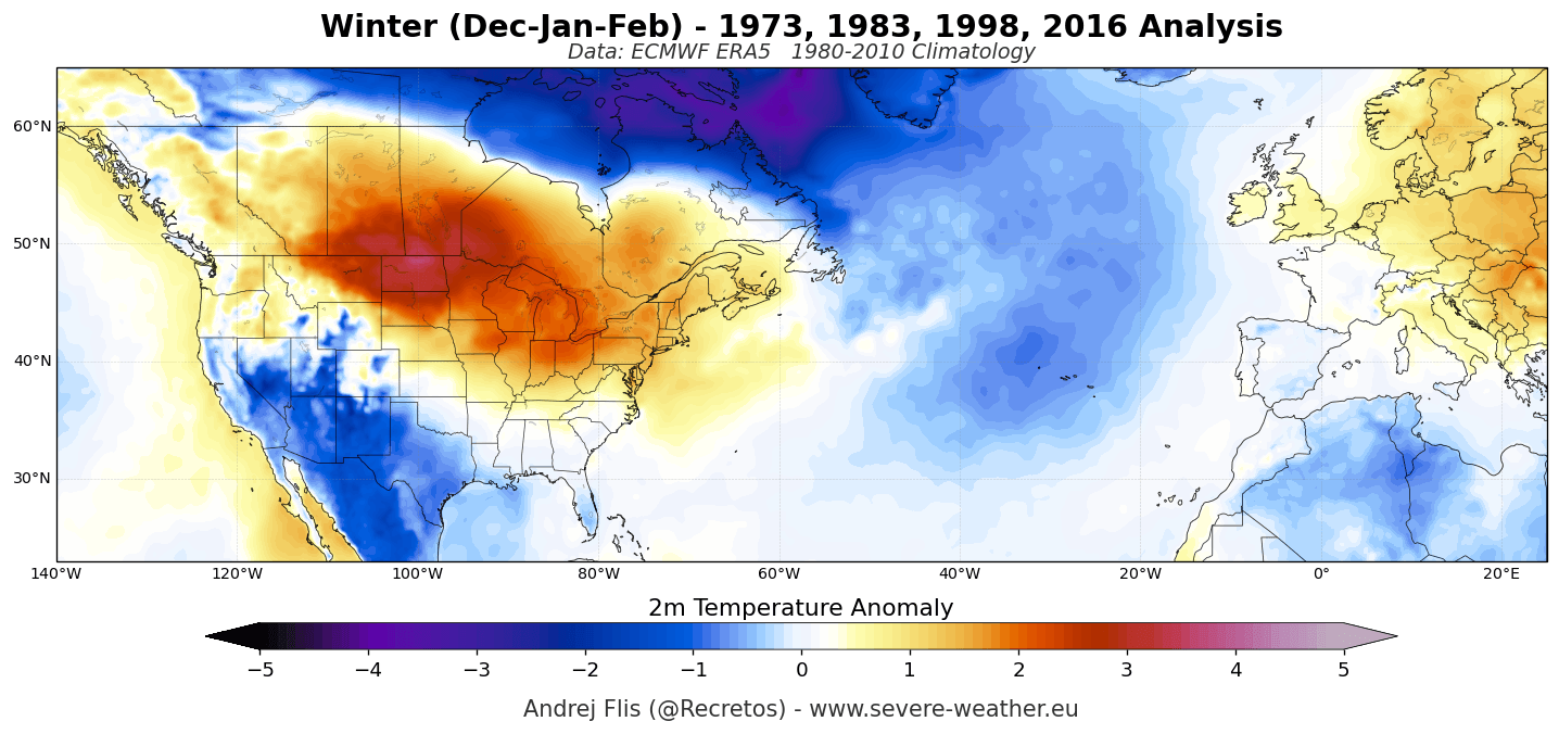
- United States: The Central and Eastern United States, along with the Southern Rockies and the Sierra Nevada, are projected to see above-normal snowfall. These regions will benefit from the moisture being pumped in by the active southern jet stream. Conversely, the Pacific Northwest, the Great Lakes, and the Northeast face a challenging season; the persistent Canadian ridge will likely deflect storm tracks away from these areas, leading to potential snowfall deficits and limited snowpack.
- Europe: The European winter is expected to be dominated by a mild, westerly flow from the Atlantic. While this will lead to warmer-than-average temperatures across most of the continent, it presents a mixed bag for snow. Low-altitude resorts in the Pyrenees and the Balkans may struggle with reduced snowpack. However, the high-altitude Alps (above 2000m) are expected to see increased snowfall, as the moisture-rich Atlantic systems clash with higher, colder elevations.
Conclusion: Preparing for an Amplified Season
Winter 2026/2027 is poised to be an outlier in the meteorological record. The combination of a historic Super El Niño and the potential for a mid-winter Polar Vortex disruption suggests a season defined by extremes. Residents in the southern United States should prepare for an active, potentially volatile storm season, while those in the northern regions may experience a milder, less snowy winter than traditional patterns would suggest.
As with all long-range forecasting, these models are subject to updates. The atmosphere is a dynamic system, and while the "Super El Niño" signal is robust, local variations will continue to play a role. Stakeholders—from municipal planners managing road safety to the ski industry and energy sector—are advised to monitor monthly forecast adjustments. The stage is set for a winter that will challenge both our infrastructure and our expectations of seasonal norms, dictated by the powerful, shifting heat of the tropical Pacific.